Jotunheimen National Park is, quite literally, the "Land of the Giants." Stretching across 1,151 square kilometers of rugged, untamed Norwegian wilderness, this high-alpine sanctuary contains the 23 highest peaks in Scandinavia. It is a landscape defined by dramatic glacial movement, crystalline lakes, and an ecology that feels ancient and indifferent to the passage of time. For the modern trekker, it represents one of the most significant pilgrimage sites in Northern Europe.
In late September 2022, I set out to traverse a 80-kilometer loop through this iconic terrain. This report serves as a detailed chronicle of that journey, providing logistical insights, historical context, and the logistical realities of navigating one of the world’s most formidable yet accessible mountain ranges.

Main Facts: The Anatomy of the Jotunheimen Loop
The Jotunheimen Loop is a moderate-to-challenging trek that requires careful planning, particularly regarding weather. The region is known for its rapidly shifting conditions; even in the late summer, snow and freezing temperatures are not uncommon.

- Total Distance: 80 km (49.7 miles)
- Duration: 3 Days
- Difficulty: Moderate
- Cumulative Elevation Gain: 3,941 meters (12,930 feet)
- Start/Finish Point: Gjendesheim Mountain Hut
- Wildlife: The park serves as a habitat for reindeer, moose, wolverines, lynx, and roe deer.
The trail is marked by the distinct red "T" symbols of the Norwegian Trekking Association (DNT), which are painted onto rocks and cairns at regular intervals. Despite the clear markings, the sheer elevation and exposed nature of the terrain necessitate high-quality navigation tools and physical conditioning.

Chronology of the Expedition
Phase 1: The Western Gateway (Gjendebu to Leirvassbu)
The journey begins with a 45-minute ferry ride across the turquoise waters of Lake Gjende. Disembarking at Gjendebu—the oldest hut in the DNT system, established in 1871—the route immediately turns northwest into the Storådalen Valley.

The initial six kilometers lead through birch forests before breaking above the treeline. The ascent is marked by the Hellerfossen waterfall, a 60-meter drop that signals the transition into the higher, more barren alpine zone. Passing the expansive Langvatnet ("Long Lake"), the trail culminates in a 20-kilometer day that ends at Leirvassbu Hut. This lodge provides a necessary sanctuary, offering traditional mountain cuisine—reindeer, elk, and wild berries—that is essential for refueling after the day’s vertical gain.

Phase 2: The U-Shaped Majesty of Visdalen (Leirvassbu to Spiterstulen)
The second day covers 16 kilometers and is perhaps the most visually stunning. Traversing north of the pyramid-shaped Kyrkja Peak, the path descends into the U-shaped Visdalen Valley. This valley is a geological textbook of glacial carving, lined with 2,000-meter-plus peaks like Store Bukkeholstinden and Styggehøe. The trek ends at Spiterstulen, a former summer farm that has evolved into a basecamp for those attempting the summit of Galdhøpiggen, Scandinavia’s highest peak (2,469 m).

Phase 3: The Skautflye Plateau and Veodalen (Spiterstulen to Glitterheim)
Leaving Spiterstulen, the terrain turns into a steep climb northeast toward the Skautflye plateau. This high-altitude section offers sweeping views of the Veobrean glacier. The trail crosses the boulder-strewn pass of Velsglupen, a harsh, lunar-like landscape that eventually drops into the verdant Veodalen Valley. This valley is a known haunt for reindeer herds, offering a rare glimpse into the park’s primary megafauna.

Phase 4: The Legend of Besseggen (Glitterheim to Gjendesheim)
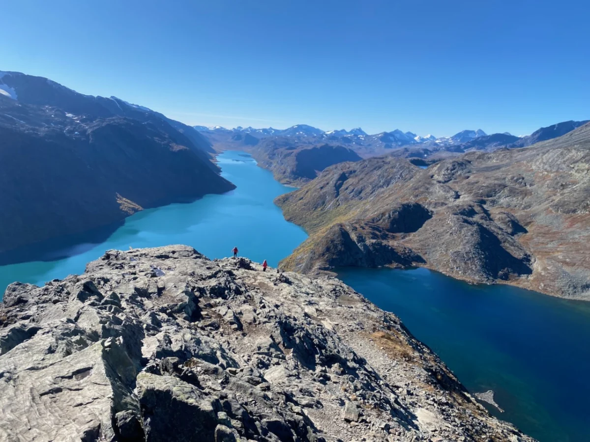
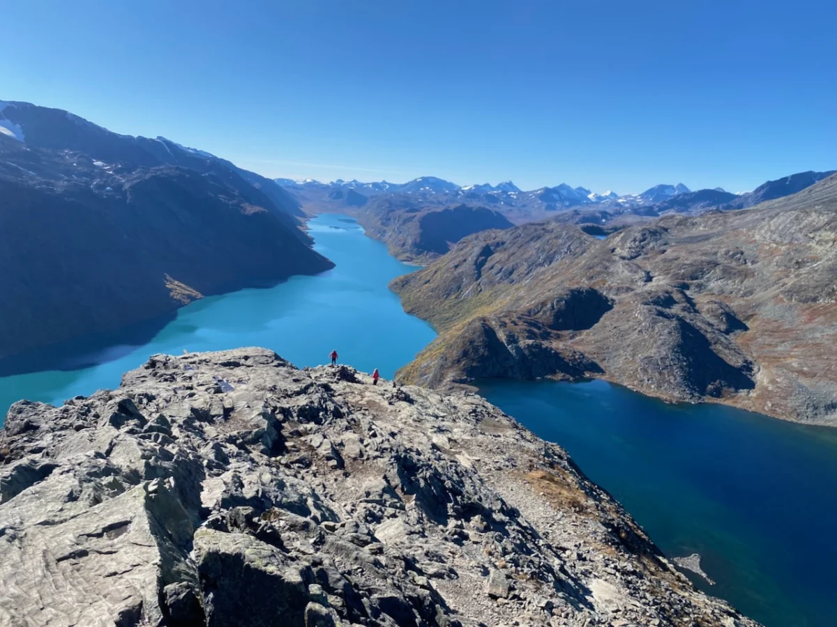
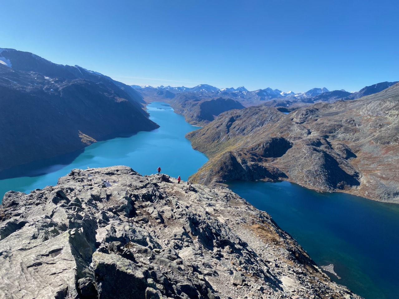
The final stage is the most storied. After passing Russvatnet and traversing the scenic ridge overlooking Lake Gjende, the route meets the legendary Besseggen Ridge. This 14-kilometer section is the crown jewel of the trek. It features a narrow, knife-edged spine that requires a technical scramble. To the left lies the deep, sapphire-blue Bessvatnet; to the right, the turquoise, glacier-fed Gjende. The contrast in water color is a geological phenomenon caused by suspended glacial silt.

Supporting Data: Infrastructure and Sustainability
The Jotunheimen region relies on a highly sophisticated hut system. These lodges are not mere shelters; they are centers of culture and logistics.

- Emergency Infrastructure: During the 2022 trip, the emergency facilities at Spiterstulen were found to be exceptionally well-equipped, featuring gas cookers and power charging stations for up to 20 hikers.
- Navigational Standards: The DNT’s marking system is considered the gold standard for European long-distance trails. However, the presence of these markers can sometimes lead to complacency among inexperienced hikers during poor visibility.
- Environmental Impact: As global interest in Nordic trekking grows, the pressure on fragile alpine flora increases. Hikers are strictly encouraged to utilize established paths and designated campsites to prevent soil erosion and damage to lichen-rich tundra.
Official Responses and Conservation Perspectives
The Norwegian Environment Agency (Miljødirektoratet) maintains a policy of "freedom to roam" (Allemannsretten), which allows for hiking and camping across most of the national park. However, park authorities have noted that the increasing popularity of the Besseggen Ridge has necessitated closer monitoring of trail maintenance and waste management.

Local mountain guides emphasize that the "Land of the Giants" is not a theme park. It is a working wilderness where weather patterns can change in minutes. The DNT advises that all hikers register their plans at local huts and consult daily weather forecasts before attempting the high-mountain crossings.

Implications: The Cultural and Personal Weight of the Trail
The Jotunheimen is more than a collection of peaks; it is a repository of Norwegian identity. The Besseggen Ridge, for example, is immortalized in Henrik Ibsen’s 1867 play Peer Gynt. In the text, the protagonist claims to have ridden a reindeer along the edge, a feat of mythic proportions that mirrors the daring nature of the hike itself.

For the modern traveler, the implication of such a journey is a shift in perspective. In the huts, one encounters a "Global Alpine Congregation"—English climbers, Dutch ultralight backpackers, and local hikers all sharing a common table. These interactions are the heartbeat of the trail. The act of sharing a meal in a remote, high-altitude lodge after a day of physical exertion strips away social artifice, leaving only the camaraderie of the road.

As I documented these trails for my book, Wanderlust Nordics, it became clear that the value of Jotunheimen lies in its ability to humble the traveler. Whether you are an elite athlete or a weekend enthusiast, the scale of the mountains, the icy bite of the wind, and the silent, roaming herds of reindeer serve as a reminder of our place in the natural order.

Preparing for Your Journey
For those looking to follow in these footsteps:

- Gear: Use the "Greenland standard." Expect wind, rain, and temperature drops. A reliable, wind-resistant shelter (such as the MLD Duomid) is essential if you plan to avoid the huts.
- Navigation: While the "T" markers are excellent, always carry a high-quality topographical map and a GPS device with offline capabilities.
- Seasonality: While the late summer offers the best conditions, the transition into early autumn brings the "fall colors" and fewer crowds, provided you are prepared for the cold.
Jotunheimen remains one of the few places on earth where you can still feel the profound, ancient power of the geography. It is a landscape that demands respect, rewards preparation, and leaves an indelible mark on all who navigate its "knife-edged" paths.