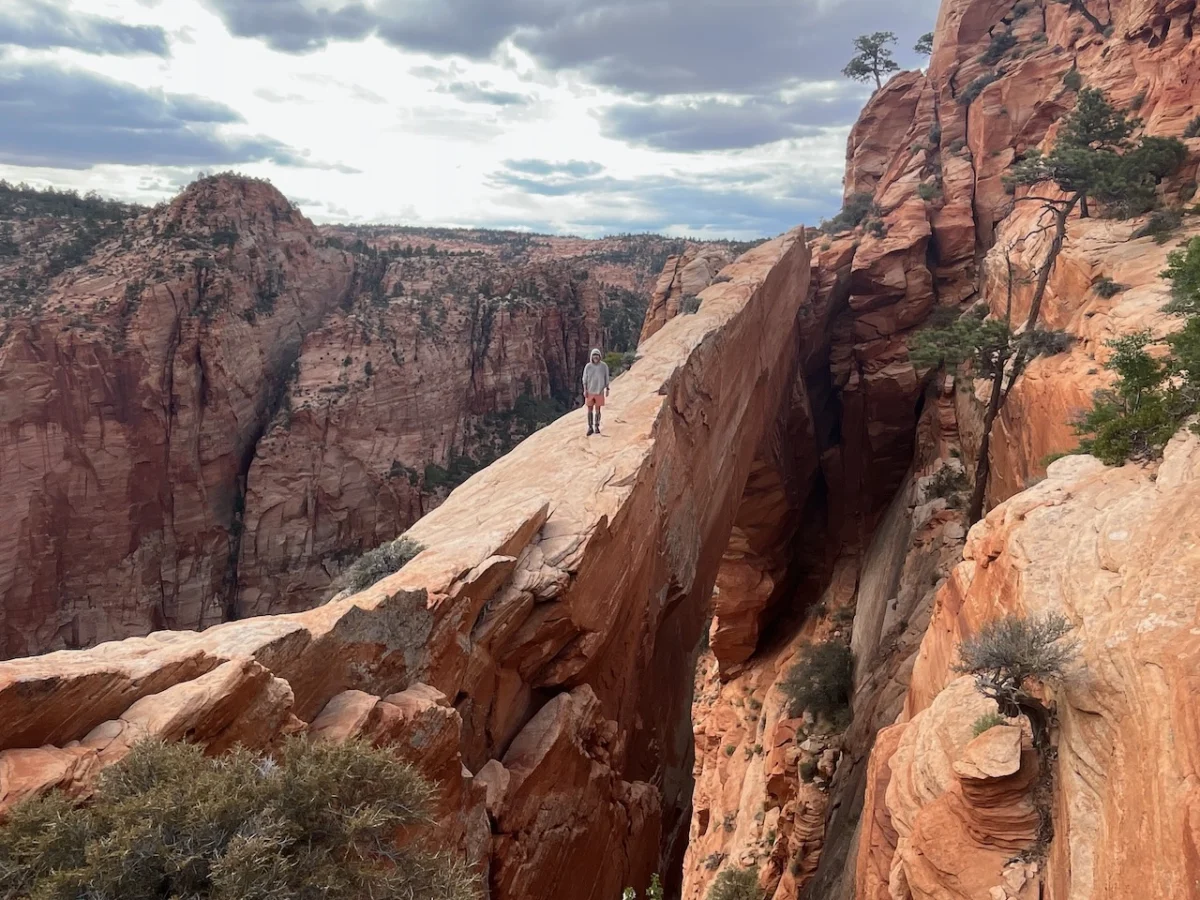
From the arid expanse of the Nevada border to the ancient, silent cliffs of Hovenweep National Monument, a monumental expedition recently concluded, shedding new light on the rugged beauty of the American Southwest. Over the course of seven weeks, from late April to early June, veteran hikers Kate “Swept Away” Pickett and her partner completed a grueling, awe-inspiring 800-mile (1,287 km) traverse across the heart of southern Utah.
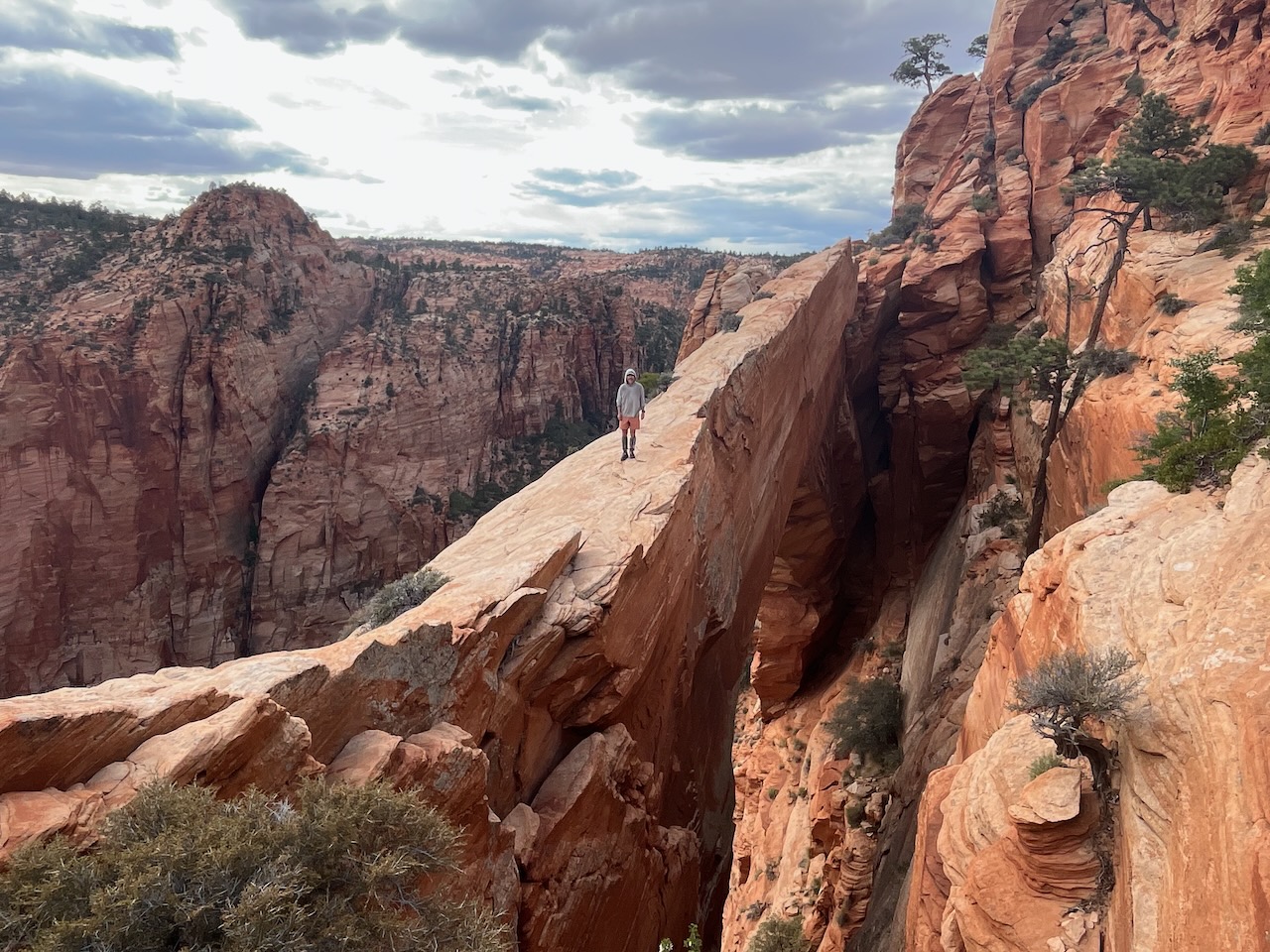
This journey was not merely a test of endurance; it was a meticulous exploration of canyons, plateaus, badlands, and mesas. By prioritizing geographical and historical curiosity over the convenience of established trails, the duo created a route that serves as a masterclass in modern long-distance navigation.

Main Facts: The Anatomy of an Epic
The Southern Utah Traverse is a testament to the sheer scale of the Colorado Plateau. Stretching nearly 800 miles, the route required a sophisticated blend of cross-country navigation, rock scrambling, river wading, and occasional stretches on dirt roads and 4WD tracks.

The primary objective for Pickett and her partner was to reach beyond their previous experiences on the well-trodden Hayduke Trail. They sought to connect the dots between the state’s most iconic landscapes and its most hidden corners. This included deep dives into the Canaan Mountain Wilderness—a rugged region between Hurricane and Kanab—and the southern, archeologically dense sectors of Bears Ears National Monument, including Grand Gulch and the historic Comb Ridge.

A Chronological Odyssey
The expedition was meticulously broken down into eight distinct stages, designed to coincide with strategic resupply points.

- The Departure: The journey commenced at the Nevada border, west-southwest of Enterprise. The initial phase focused on the transition from the Great Basin into the unique geological architecture of Utah’s red rock country.
- The Middle Miles: The route navigated the towering white domes of the Canaan Mountain Wilderness, followed by the technical challenges of the Bryce Canyon area. Here, the duo balanced permit requirements with the necessity of finding viable water sources.
- The Deep Wilderness: Crossing into the Escalante region and eventually into the Waterpocket Fold of Capitol Reef, the hikers encountered a landscape defined by dramatic elevation changes and a stark, beautiful isolation.
- The Final Stretch: The trek culminated at the Hovenweep National Monument on the Utah-Colorado border. The final milestone was marked by reaching Holly Tower, a site that provided a profound sense of closure to a seven-week odyssey.
Supporting Data: Water, Logistics, and Strategy
For any trekker in the "Four Corners" region, the primary constraint is not distance, but hydration. The logistics of this traverse were dictated by the availability of water, requiring the team to carry up to 9–10 liters of water capacity during the most arid segments.

The Science of Survival
The hikers utilized a combination of USGS mapping data and the specialized resources provided by experts like Jamal Green. However, in the absence of pre-trip beta for certain remote corridors, the duo relied on calculated caution. The journey was significantly aided by unseasonal, timely storms that filled natural potholes and streams, providing a vital, if unpredictable, lifeline.

Resupply Logistics
Resupply strategy was a hybrid of meticulous planning and community support. By utilizing mail drops at major hubs like St. George, Kanab, and Escalante—where friends and family served as the vital logistics chain—the team maintained their pace. Additionally, a strategic cache was placed at Burr Trail Road to bridge the daunting gap between Escalante and Bullfrog Marina.

Official Regulatory Framework
Navigating public lands of this stature requires strict adherence to federal and state regulations. The success of the Southern Utah Traverse relied on navigating a complex permit system:

- National Park Access: Permits were mandatory for Bryce Canyon, Grand Staircase/Escalante National Monument, and Capitol Reef.
- Bears Ears Management: Due to the sensitivity of the cultural sites within the monument, the team utilized the Recreation.gov system to ensure legal and ethical passage.
- The "America the Beautiful" Pass: This served as the foundational credential for accessing the various federal territories encountered along the 800-mile stretch.
Highlights and Cultural Significance
The sheer density of geological and archeological wonders made selecting “highlights” a difficult task. However, specific locations stood out for their historical weight and visual splendor:

- The Great Chamber: A geological marvel that underscored the sheer scale of Utah’s erosional history.
- Lower Muley Twist Canyon: The alcoves here provided shelter and a visceral connection to the geological layers of the Waterpocket Fold.
- Stevens Canyon: Described by the team as featuring "fantastical grottos" that felt entirely disconnected from the modern world.
- Bullet Canyon & Comb Ridge: The "Perfect Kiva" in Bullet Canyon and the Procession Panel at Comb Ridge served as humbling reminders of the Ancestral Puebloan history that permeates the landscape.
Implications: The Future of Long-Distance Trekking
The Southern Utah Traverse highlights a shifting trend in the hiking community: the move away from high-traffic "thru-hikes" toward bespoke, regionally focused long-distance routes.

Ethical Stewardship
The emphasis placed on the protection of archeological sites in Bears Ears and beyond carries a significant message. As these routes become more publicized, the burden of "Leave No Trace" principles becomes heavier. The team’s commitment to utilizing established routes where possible, while respecting sensitive cultural zones, sets a benchmark for future explorers.

The Value of "Slow Travel"
By choosing to prioritize historical curiosity over speed, the hikers demonstrated that the value of an expedition is measured not by the velocity of the movement, but by the depth of the engagement. This seven-week, 800-mile effort serves as an invitation to the public to look closer at the map. It suggests that there are still "blank spots" on the map of the American West—places that, while mapped, remain unexperienced by the masses.

Concluding Thoughts
As the gear is packed away and the photographs are processed, the legacy of the Southern Utah Traverse remains in the data and the imagery it produced. For the casual observer, it is a travelogue of breathtaking beauty; for the professional hiker, it is a masterclass in regional planning and endurance.

The upcoming series of posts by the hikers, detailing each stage of the journey with maps and specific route descriptions, will likely serve as an essential resource for those looking to replicate or iterate upon this incredible feat. In an era where the wilderness feels increasingly accessible, such journeys remind us that the true reward of exploration is found in the careful, respectful, and deliberate traversal of the earth’s most challenging terrains.

Disclaimer: This report is based on findings from The Hiking Life. Please note that routes of this nature carry inherent risks, and proper planning, local permitting, and expert-level navigational skills are required for anyone attempting similar journeys.