Bolivia’s Altiplano is a landscape of extremes—a high-altitude plateau defined by its thin air, vast horizons, and a geological drama that feels almost extraterrestrial. While many adventurers flock to the region for the iconic Uyuni Salt Flats or the demanding summit of Volcan Licancabur, there exists a quieter, more intimate experience hidden in the shadow of the Andes. The "Five Lakes Loop," a border-straddling expedition that serves as the perfect introduction to the high-altitude wilderness, offers a condensed masterclass in Andean beauty.

Though often overshadowed by the grander 600 km Altiplano Traverse, this overnighter provides a profound connection to the rugged, treeless expanse of the borderlands. It is a journey that bridges cultures and landscapes, requiring physical endurance and mental fortitude in equal measure.

Main Facts and Route Overview
The Five Lakes Loop is a 47-kilometer (29-mile) trek that begins and ends in the village of Sajama, Bolivia. Standing at an elevation of 4,230 meters (13,878 ft), Sajama is one of the highest permanently inhabited settlements on Earth, serving as the gateway to the Sajama National Park.

The route is characterized by its moderate technical difficulty, though it demands respect due to the extreme altitude. Approximately 40% of the journey is off-trail, requiring basic navigation skills; however, the wide-open, treeless topography of the Altiplano makes route-finding relatively straightforward for experienced hikers. The ideal window for this trek is between June and September, during the dry winter season, when skies are reliably clear and the threat of severe weather is minimized.

- Total Distance: 47 km (29 mi)
- Total Elevation Gain: 946 m (3,104 ft)
- Elevation Range: 4,230 m to 5,130 m (13,879 ft to 16,831 ft)
- Duration: 10 hours to two days
- Difficulty: Moderate (High altitude)
A Chronological Account of the Trek
Departure from Sajama
The journey begins in the quiet, dusty streets of Sajama Village. As you depart, the immediate visual anchor is the looming presence of Nevado Sajama, a dormant stratovolcano that dominates the horizon. The early stages of the hike take trekkers through high-altitude grasslands where llamas—the masters of this terrain—roam freely, their silhouettes often framed by the distant, snow-capped peaks of Volcan Pomerape (6,282 m) and Volcan Parinacota (6,348 m).

The Ascent to Paso Casiri
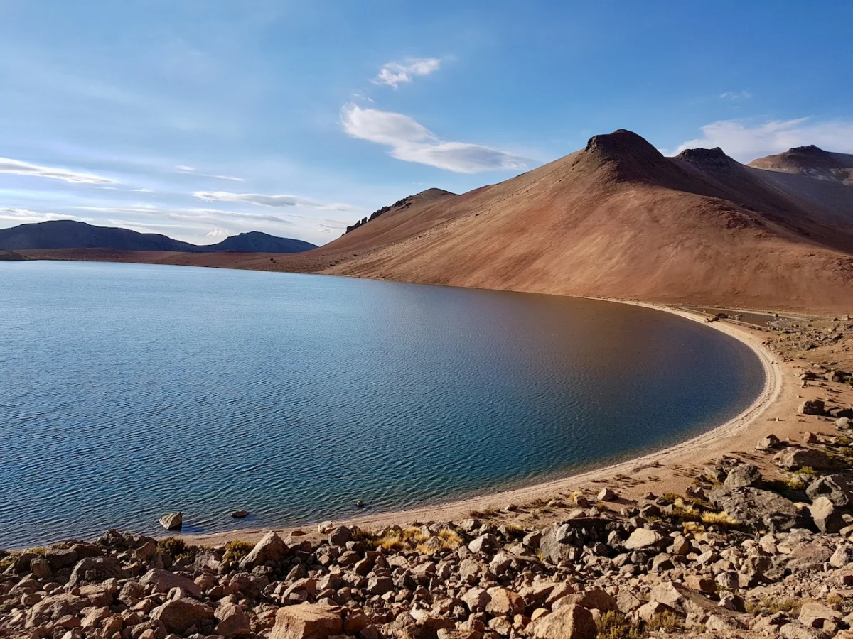
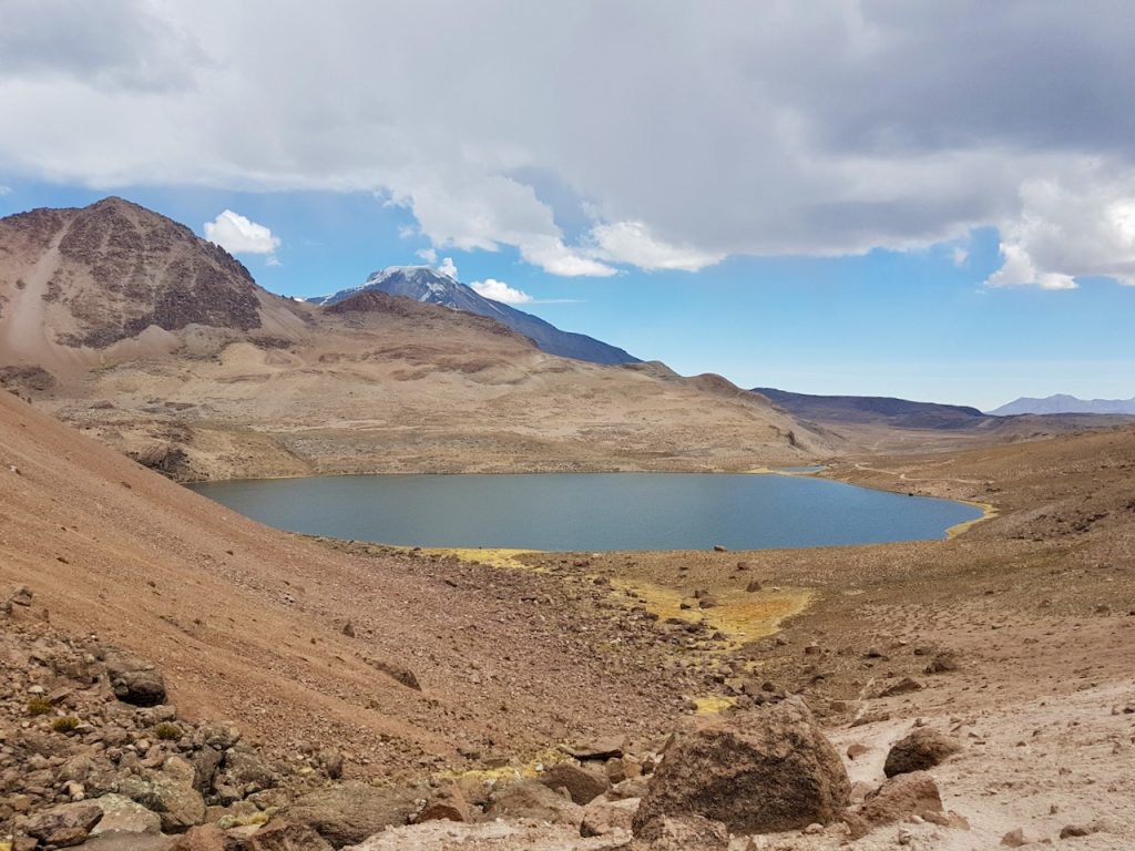
As the trail climbs toward the high passes, the scale of the landscape becomes apparent. The ascent to Paso Casiri is a highlight, offering sweeping vistas of the surrounding volcanic chain. Here, the air grows thin and cold, and the silence of the Altiplano is broken only by the crunch of boots on volcanic scree and the occasional whistle of the wind. The route leads past Laguna Casiri Macho, a pristine body of water that acts as a mirror for the cloudless, intense blue sky characteristic of the region.

The Laguna Chiar Khota Challenge
The trek continues toward the turquoise depths of Laguna Chiar Khota. This section is perhaps the most demanding, as the altitude approaches 5,000 meters. During the 2017 expedition, a planned side trip to the summit of Jisk’a Kunturini (5,475 m) had to be abandoned as a sudden, localized storm rolled in from the Chilean side. The unpredictability of weather at these heights is a constant variable; while the storm was brief, it served as a stark reminder of the volatile nature of the high Andes.

Camping Under the Starlight
The overnight stay is a defining feature of the loop. Setting up camp at nearly 5,000 meters—specifically near 4,928 meters—provides an unparalleled view of the night sky. With no light pollution for hundreds of miles, the Milky Way appears as a tangible, glowing ribbon across the heavens. However, the reward of the view comes at a price. Temperatures can plummet to -12°C (10°F), and the "bone-chilling wind" often requires a robust, four-season gear setup. A hot cup of traditional coca tea—a local remedy for altitude sickness—is not merely a luxury here; it is a necessity for internal temperature regulation.

The Final Descent
The return leg winds through the Quebrada Condoriri, a dramatic valley that leads trekkers back toward civilization. The final kilometers are a study in transition: from the raw, volcanic solitude of the high passes to the pastoral rhythm of Sajama. Upon re-entering the village, one is often greeted by the sight of locals gathering for a late-afternoon soccer match, their breath misting in the cooling air—a humbling reminder of the daily life that persists in such an inhospitable environment.

Supporting Data: Flora and Fauna
The Altiplano is not as barren as it first appears. A key botanical highlight of the Five Lakes Loop is the Azorella compacta, locally known as llareta. This peculiar plant is endemic to the Andes and thrives at elevations between 3,200 and 5,000 meters.
Looking like a moss-covered rock, the llareta is actually a slow-growing, dense shrub that can live for thousands of years. It is perfectly adapted to the harsh, high-UV radiation environment of the plateau. Encountering these "living rocks" provides a moment of biological wonder, highlighting how life finds a way to persist in one of the most extreme environments on the planet.

Logistical Implications for Prospective Trekkers
For those looking to replicate this journey, preparation is the difference between an adventure and a medical emergency.

- Acclimatization: Before attempting the Five Lakes Loop, hikers should spend at least 3–4 days in the region at altitudes exceeding 3,500 meters. Sajama Village is an excellent base for this, allowing the body to adjust to the reduced oxygen levels.
- Navigation: While the landscape is open, GPS devices are highly recommended. Snow cover or localized fog can quickly obscure landmarks, and the lack of distinct trails makes navigation tools vital.
- Water and Supplies: Water sources are available, but filtration is essential. Because the route traverses the border with Chile, hikers should ensure they are well-versed in local regulations and keep their identification documents in a waterproof bag.
- Gear: The diurnal temperature range is massive. A high-quality sleeping bag rated for at least -15°C is non-negotiable. Layering systems should focus on moisture-wicking base layers, an insulating mid-layer, and a windproof, waterproof outer shell.
The Significance of the Altiplano
The implications of trekking in the Altiplano go beyond personal achievement. These remote regions are increasingly affected by climate change, which influences the melting of glacial sources feeding these high-altitude lakes. The "Five Lakes Loop" serves as a poignant, intimate window into an ecosystem that is both resilient and fragile.

Furthermore, the region remains a bastion of traditional Aymara culture. The interaction with the residents of Sajama is a vital part of the experience. By supporting local guides, guesthouses, and services, travelers play a role in the economic sustainability of these high-altitude communities.

The Five Lakes Loop is more than just a path across the border; it is a pilgrimage into the heart of the Andes. It rewards the prepared, humbles the arrogant, and leaves every visitor with a profound sense of awe for the sheer, quiet power of the natural world. As you stand on the shores of a mountain lake at 5,000 meters, watching the shadows stretch across the volcanic plain, you realize that some of the world’s greatest wonders aren’t found in guidebooks—they are found in the silent, high-altitude corners where the earth touches the sky.