By Editorial Staff
July 22, 2026
Grand Teton National Park, the crown jewel of the Wyoming wilderness, has officially expanded its borders. In a landmark transaction finalized this July, the National Park Service (NPS) secured 35 acres of high-value, privately owned land near the park’s southwestern boundary. This acquisition marks the successful conclusion of a grueling, 25-year-long effort to integrate vital wildlife corridors into the protected federal landscape.
The deal, which saw the park pay approximately $10.99 million for the final tract—averaging a staggering $310,000 per acre—underscores the intense pressure of land development in one of the most exclusive zip codes in the United States. While the acreage may seem modest in the context of the park’s vast 310,000-acre footprint, the strategic importance of this land to the Greater Yellowstone Ecosystem cannot be overstated.
The Geography of Wealth and Wilderness
Grand Teton National Park sits adjacent to Jackson Hole, Wyoming—a region characterized by both its unparalleled natural beauty and its extreme socioeconomic profile. Teton County consistently ranks among the wealthiest in the United States, with an average per capita income often exceeding $530,000.
For the National Park Service, this creates a unique paradox. The very beauty that draws millions of visitors to the park also drives land values to astronomical heights, making public acquisition of adjacent private property a financial challenge of epic proportions. When the target property is held by long-term private owners, the negotiations require not just deep pockets, but decades of patience and community diplomacy.
The land in question was formerly part of the historic Snake River Ranch. Founded in 1929, the ranch has remained the largest privately owned property in the state, standing as a testament to the region’s agricultural heritage. However, as the shadow of luxury development loomed over the valley, the pressure to subdivide and build on these sensitive lands grew year over year.
Chronology of a Conservation Legacy
The journey to this final 35-acre acquisition did not happen overnight. It was the culmination of a deliberate, phased strategy initiated in 2001. Over the last quarter-century, the NPS, in partnership with The Conservation Fund (TCF), worked methodically with the Resor family to transition their private holdings into public hands.
The Phased Integration
- 2001–2010: The initial phase focused on identifying the most critical corridors near the Granite Canyon entrance. The first tracts were identified as essential for preventing residential sprawl that would disrupt seasonal wildlife migration.
- 2011–2020: As the partnership solidified, the NPS and TCF established a recurring funding mechanism. This period saw the acquisition of multiple smaller tracts, totaling nearly 180 acres during this window.
- 2021–2026: The final push. By the early 2020s, the remaining parcels were among the most desirable for private developers, given their proximity to both the park and the infrastructure of the Jackson Hole Mountain Resort.
- July 15, 2026: The final 35-acre parcel is officially transferred to the federal government, marking the end of a 25-year preservation mission.
This long-term commitment allowed the NPS to purchase land at a pace that matched available funding while maintaining a respectful, cooperative relationship with the Resor family, who were instrumental in the ultimate preservation of their legacy.

The Financial Engine of Preservation
The $10.99 million price tag for the final 35 acres raises questions about the feasibility of such projects. How can a public agency justify $310,000 per acre? The answer lies in the strategic use of the Land and Water Conservation Fund (LWCF).
Established in 1965, the LWCF is a federal program that redirects a small percentage of proceeds from offshore energy leases toward the protection of land, water, and outdoor recreation areas. Crucially, the program does not rely on taxpayer dollars from the general fund; instead, it uses the profits from resource extraction to fund resource preservation.
In the case of Grand Teton, the LWCF provided the necessary capital to compete with private market bidders. Without this federal support, the land would almost certainly have been developed into luxury estates, effectively walling off a vital corridor between the Teton Range and the Snake River.
Why Every Acre Matters: Ecological Implications
Beyond the headlines, the acquisition is a victory for biodiversity. The purchased tracts are located near the park’s southwestern entrance, a region that serves as a bottleneck for various species navigating the changing seasons.
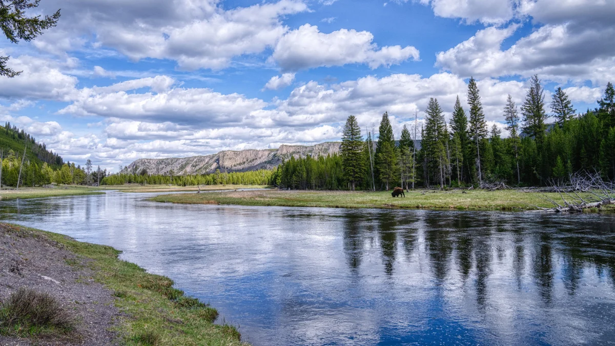
The Greater Yellowstone Ecosystem is a fragile web of life, and it serves as the home for several species currently categorized as threatened, endangered, or at-risk. The protection of this land ensures that animals can continue to migrate through the Granite Canyon area without encountering the barriers of fences, light pollution, or residential traffic.
Species that benefit from this buffer zone include:
- Canada Lynx: A elusive predator that requires large, undisturbed tracts of coniferous forest.
- Yellow-billed Cuckoo: A species sensitive to the loss of riparian habitats.
- Greater Sage-Grouse: Known for their elaborate mating rituals, these birds require vast, open sagebrush landscapes that are increasingly fragmented by development.
- Western Glacier Stonefly: An indicator species that reflects the health of high-alpine, cold-water streams flowing from the Tetons.
Official Responses and Public Sentiment
The completion of the acquisition was celebrated by stakeholders as a "final milestone."
"The landscapes that define Grand Teton National Park exist today because generations of people have made the commitment to protect them," stated Grand Teton National Park Superintendent Chip Jenkins. "This milestone represents decades of stewardship and collaboration to conserve wildlife habitat, maintain the scenic character visitors cherish, and preserve the integrity of this landscape."

The Conservation Fund, which acted as the bridge between the private sellers and the federal government, echoed this sentiment. In a press release, the organization noted, "Together, these lands help safeguard the scenic character, wildlife habitat, and recreational opportunities that define the park and the Greater Yellowstone Ecosystem."
Local residents and conservationists have largely lauded the move, recognizing that the alternative—an increase in private development—would have fundamentally altered the "wild" character that defines the Jackson Hole valley.
The Economic Context: Tourism and the Outdoor Economy
The expansion of the park is not just an environmental endeavor; it is an economic one. In 2024 alone, Grand Teton National Park hosted approximately 3.6 million visitors. These visitors collectively injected $983 million into the local economy, supporting jobs in hospitality, guide services, retail, and transportation.
According to the Wyoming Chamber of Commerce, outdoor recreation accounts for 4.5% of the state’s Gross Domestic Product. This is the fifth-highest share of any state in the nation. By expanding the park’s boundaries, the NPS ensures that the quality of the visitor experience remains high.
However, this growth brings its own set of challenges. As traffic congestion and trail density rise, the need for managed, protected land becomes even more acute. A larger park footprint allows for better dispersion of visitors and more effective management of high-traffic areas. The newly acquired land serves as a crucial piece of the puzzle in ensuring that the park can sustain this economic impact without degrading the very resources that make it a premier destination.
The Future of Public Land
The success of the Grand Teton expansion provides a blueprint for other national parks facing similar encroachment pressures. It proves that despite high real estate costs and the encroachment of urban development, private-public partnerships can succeed when there is a long-term vision.
However, the task is far from over. As we look toward the latter half of the decade, the focus of the National Park Service will likely shift from acquisition to management and restoration. The challenge now lies in ensuring these 35 acres are integrated seamlessly into the park’s trail systems and wildlife management protocols.
For the hikers, photographers, and wildlife enthusiasts who flock to the Tetons, this expansion is more than just a line on a map. It is the preservation of a horizon, the protection of a migration path, and the guarantee that the majesty of the Teton Range will remain untarnished for future generations. As the dust settles on this $10.99 million deal, it serves as a powerful reminder: while the price of land is high, the cost of losing it is far higher.