Deep in the heart of central Norway, where the earth seems to ripple into ancient, craggy ridges and emerald-hued valleys, lies the Trollheimen mountain range. Translated literally as "Home of the Trolls," the region is a place of profound mythological resonance and geological splendor. It is a transition zone where the raw, jagged character of the high alpine meets the temperate, lush serenity of maritime-influenced lowlands.

While the range is well-known to the Norwegian outdoor community, it remains a "hidden gem" on the international stage. This article serves as an immersive guide to the Trollheimen Triangle, a classic 58-kilometer circuit that captures the essence of this diverse landscape, as explored during an autumn expedition in 2022.

The Geography of Myth: Main Facts
Trollheimen is not merely a collection of peaks; it is a complex mosaic of ecosystems. The range is characterized by crystal-clear mountain lakes, expansive marshes, and historic woodlands. Human history here is etched into the very soil, with remnants of Stone Age settlements, Iron Age burial sites, and traditional, turf-roofed farmhouses that evoke a sense of living history.

The "Trollheimen Triangle" is a three-day trekking route that traverses this terrain, serving as the quintessential introduction to the region. The moniker itself was a 19th-century marketing invention, designed to entice tourists with the allure of Norse folklore. While the marketing may have had mixed results in the past, the landscape today requires no embellishment to captivate the modern hiker.

Quick Stats: The Trollheimen Triangle
- Total Distance: 58 km (36 mi)
- Recommended Duration: 2–3 days
- Difficulty: Moderate
- Total Elevation Gain: 2,720 m (8,924 ft)
- Starting/Finishing Point: Gjevilvasshytta mountain hut
Chronology of the Journey: A Three-Stage Trek
Stage 1: Gjevilvasshytta to Jøldalshytta (21 km)
The trek begins at Gjevilvasshytta, a historic mountain hut dating back to 1819, located just a 30-minute drive from the regional hub of Oppdal. The journey starts with a steady climb through the birch forests of Gjørdøldalen Valley. Within five kilometers, the canopy breaks, and the hiker is thrust into the expansive, wind-swept alpine zone.

The trail winds beneath the towering Høghøa Peak (1,308 m) before descending into the lake-dotted Høghødalen Valley. At the 11-km mark, the path crosses the Minnilla River—a key navigational milestone. The route then continues over rolling fells toward Skrikhøa Peak (1,061 m). From this vantage point, hikers are gifted with sweeping views over the Gammelsæterdalen Valley, followed by a long, gradual descent to Jøldalshytta, which sits majestically overlooking the serene Jølvatnet Lake.

Stage 2: Jøldalshytta to Trollheimshytta (16 km)
This section offers the hiker a choice of three distinct paths. For those blessed with clear weather, the high-altitude traverses over Geithøtta Top (1,316 m) or the formidable Trollhetta (1,616 m) are the preferred routes.

However, the Norwegian mountains are notoriously fickle. In the face of heavy autumnal rain, the lower-level path tracing the Svartå River becomes an atmospheric sanctuary. This route is a masterclass in Nordic beauty, featuring ancient bridges, vibrant meadows, and a series of historic, turf-roofed cottages that seem plucked from a fairy tale. Upon reaching Trollheimshytta, hikers who find the main lodge closed for the season will find the adjacent emergency shelter a welcome, dry haven.

Stage 3: The Final Ascent to Gjevilvasshytta (21 km)
The final stage is the most demanding of the trio. Departing Trollheimshytta, the trail crosses the Slettå River before embarking on a relentless, zig-zagging climb. The path gains 700 meters in elevation over just three kilometers, culminating at the rocky terrace of Skallen Peak (1,226 m).

In clear conditions, the vista extends across the entire Svartåmoen Nature Reserve. In inclement weather, it becomes a test of endurance. From Skallen, the trail traverses the tarn-peppered plateau of Mellomfjellet before descending toward Fossådalsvatnet Lake. The final push involves a steep climb to the Riarskaret Pass (1,307 m)—the highest point of the trek—followed by a descent into the Gjørdøldalen Valley and a final stretch along the Gravbekke river, leading back to the trailhead.

Supporting Data and Logistical Insights
For those planning a trip to the region, understanding the infrastructure is paramount. The Norwegian Trekking Association (DNT) maintains a network of huts that provide a blend of comfort and safety.

- Logistics: The region is best accessed via Oppdal. Hikers should be prepared for rapid weather shifts. Even in late summer or early autumn, temperatures can drop near freezing, and high winds are frequent.
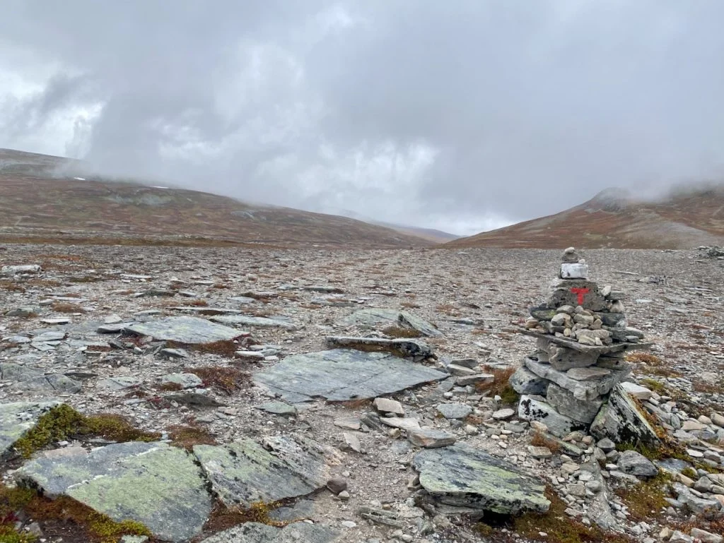
- Gear: Waterproofing is non-negotiable. A high-quality shelter or a pre-booked spot in a DNT cabin is essential. Navigation via GPS or physical topographical maps is recommended, as trail markers can be obscured by low-lying cloud cover.
- Historical Context: The presence of iron-age burial mounds suggests that this region has served as a critical transit corridor for thousands of years, linking coastal trade routes with the interior mountain pastures.
Official Perspectives and Ecological Stewardship
Regional conservation authorities emphasize that Trollheimen is a sensitive environment. The transition zone between marine and alpine climates supports specialized flora and fauna that are particularly vulnerable to foot traffic.

The National Park board of Norway consistently advocates for "leave no trace" principles. Hikers are encouraged to stay on marked trails, particularly when crossing the boggy, sensitive marshlands of the valley floors. By utilizing the established network of footbridges—such as those over the Minnilla and Slettå rivers—visitors minimize their impact on the riverbanks and riparian ecosystems.

Implications for the Modern Hiker
The Trollheimen Triangle represents more than just a physical challenge; it is a meditative experience. In an era where "bucket-list" hiking destinations are often overcrowded, Trollheimen offers a profound sense of solitude.

Why Choose Trollheimen?
- Accessibility vs. Isolation: While relatively easy to reach via public transport to Oppdal, the trails themselves offer a feeling of being completely off the grid.
- Cultural Depth: The integration of working farmsteads and historical architecture provides a narrative arc to the hike that many wilderness areas lack.
- Dynamic Scenery: The contrast between the high, rocky ridges of Skallen and the lush, verdant valleys ensures that the visual experience never becomes monotonous.
The experience of hiking in Norway is fundamentally about adaptation. Whether it is finding shelter in a storm-swept cabin or navigating the sudden transition from torrential rain to golden, crisp sunshine, the Trollheimen range demands respect and rewards the prepared traveler. It is a place where the landscape, the weather, and the history of the land all coalesce, leaving the hiker with a deeper appreciation for the raw, untamed spirit of Scandinavia.

Disclosure: This post contains affiliate links. The Hiking Life receives a small commission if you purchase an item after clicking on these links, which helps support the continued production of high-quality, independent content for the global backpacking community.