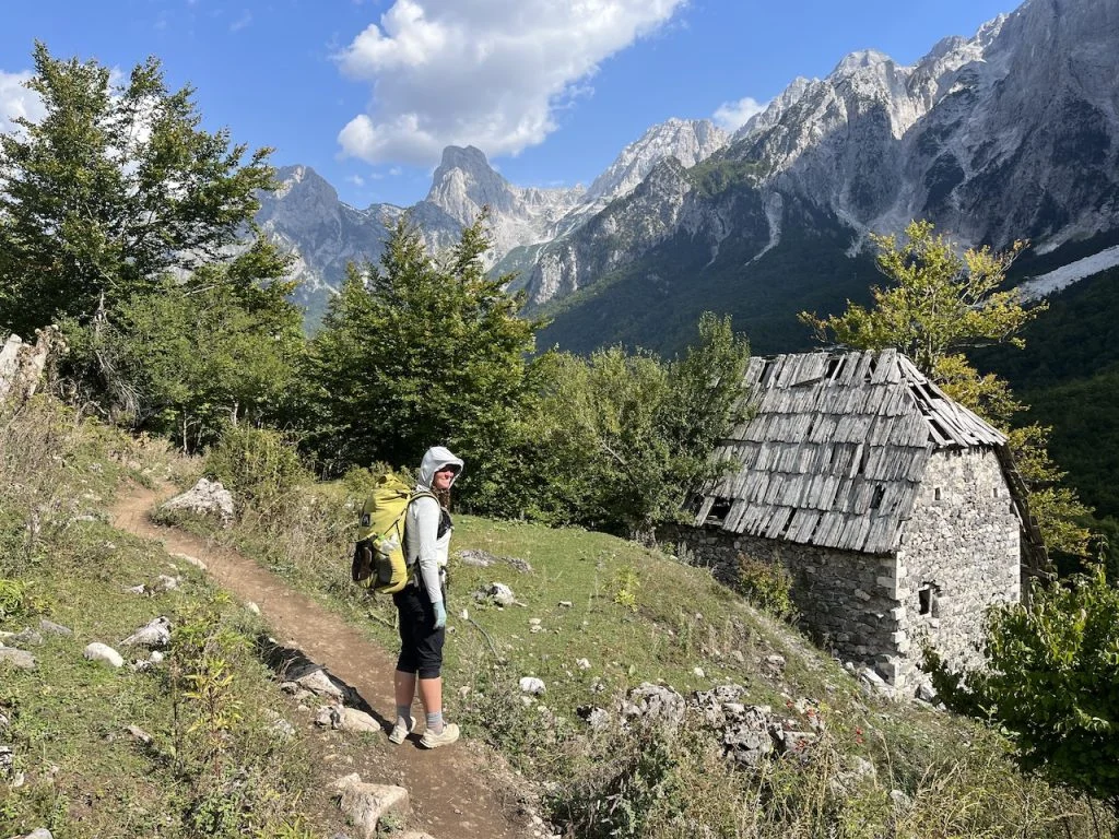
Jotunheimen National Park is arguably the most aptly named wilderness area in Scandinavia. In the local tongue, Jotunheimen translates to "Home of the Giants"—a fitting title for a landscape dominated by Norway’s 23 highest peaks, gargantuan glaciers, and a primal, rugged aesthetic that has captivated explorers for centuries. Spanning 1,151 square kilometers, this high-alpine sanctuary is not merely a park; it is the beating heart of Norwegian mountain culture.
For the seasoned hiker, Jotunheimen offers a unique proposition: a blend of high-altitude exposure, traditional mountain hospitality, and a rich, literary history. In late September 2022, I completed an 80-kilometer loop through this legendary terrain. The following report details the logistics, the challenges of the late-season environment, and the profound sense of community found within the walls of its remote mountain huts.

Main Facts: The Jotunheimen Loop at a Glance
For those looking to replicate the experience, the loop provides a concentrated dose of Norway’s most spectacular geography. The journey is physically demanding but accessible to those with moderate mountaineering experience.

- Total Distance: 80 km (49.7 miles)
- Duration: 3 Days
- Total Elevation Gain: 3,941 meters (12,930 feet)
- Start/Finish: Gjendesheim Mountain Hut
- Difficulty: Moderate to Challenging (weather-dependent)
- Key Wildlife: Reindeer, moose, wolverines, lynx, and roe deer.
The trek is defined by its dramatic transitions—from the lush, birch-forested valleys to the exposed, boulder-strewn plateaus that sit well above the treeline. The route is meticulously marked with the iconic red "T" symbol, maintained by the Norwegian Trekking Association (DNT), ensuring that even in adverse conditions, navigation remains manageable.

Chronological Expedition Log
Day 1: The Ferry and the Ascent
The journey begins at the Gjendesheim pier. Access to the trailhead is facilitated by a scenic 45-minute ferry ride across the turquoise, glacial waters of Lake Gjende. Disembarking at Gjendebu Hut—the oldest DNT cabin in the system, established in 1871—the route immediately turns toward the northwest, entering the Storådalen Valley.

The ascent is marked by the thundering 60-meter Hellerfossen waterfall. As you climb, the vegetation thins, replaced by a stark, glacial landscape. The path winds past a series of frigid, high-altitude lakes, the most prominent being Langvatnet. After approximately 20 kilometers, the day concludes at Leirvassbu, a privately run lodge where the menu reflects the landscape: locally harvested reindeer, elk, and wild berries.

Day 2: The U-Shaped Valleys
The second leg (16 km) is the most visually expansive. Departing Leirvassbu, the trail skirts the base of the pyramid-shaped Kyrkja Peak. The route leads into the Visdalen Valley, a massive U-shaped geological formation. Towering above are peaks exceeding 2,000 meters, including the imposing Store Bukkeholstinden. This section of the loop serves as a gateway to Spiterstulen, a historic mountain base that has served travelers since 1881. It is here that many adventurers prepare for the ascent of Galdhøpiggen, the highest peak in Scandinavia.

Day 3: The Skautflye Plateau and Besseggen Ridge
The final, climactic stage spans 16 km. Leaving Spiterstulen, the route climbs to the rocky Skautflye plateau. On a clear day, the views are unparalleled, offering a 360-degree vista of the Veobrean glacier and surrounding massifs. The trail eventually descends into the Veodalen Valley—a favorite haunt for the region’s reindeer herds—before culminating in the legendary Besseggen Ridge.

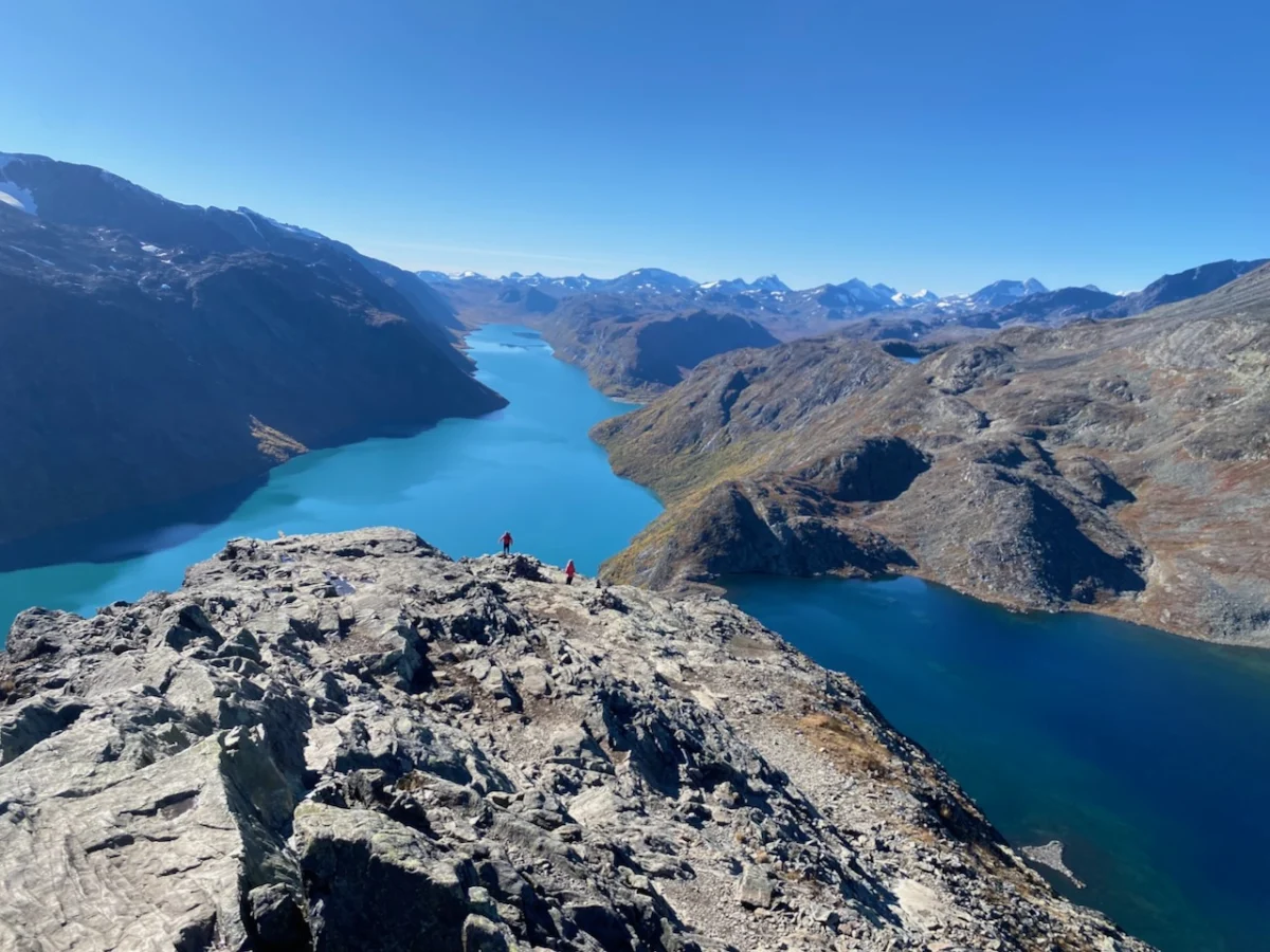
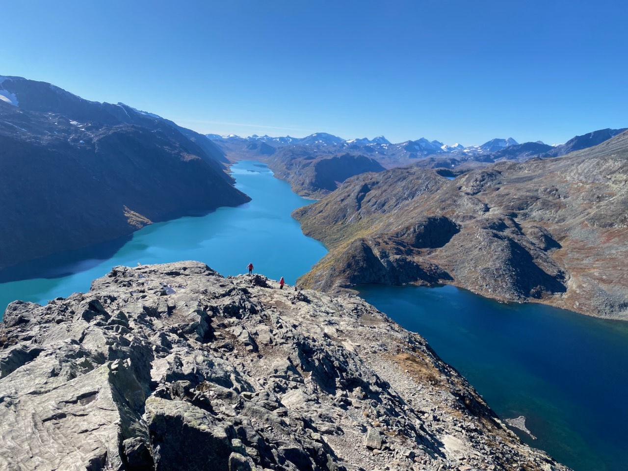
Besseggen is more than a trail; it is a rite of passage. The ridge forces a heart-pumping scramble along a narrow, knife-edged spine. To one side lies the turquoise Gjende; to the other, the deep blue of Bessvatnet. The contrast in color is a result of glacial silt in the former and pristine mountain water in the latter. It is an exposed, high-stakes finale that perfectly encapsulates the "Land of the Giants."

Supporting Data: Infrastructure and Sustainability
The Jotunheimen loop is supported by a sophisticated network of DNT huts and private lodges. These structures are not merely shelters; they are essential infrastructure that allows for a lightweight, multi-day trekking experience without the need to carry excessive rations or heavy tenting equipment.

The emergency huts, such as those at Spiterstulen, provide vital safety features: gas cookers, emergency communication, and solar-powered charging stations. This infrastructure minimizes human impact on the fragile alpine tundra by concentrating traffic and waste management in designated zones. However, as climate change alters the glacial retreat patterns in the region, the DNT continues to monitor trail stability, particularly on the steeper sections of the Besseggen Ridge.

Official Responses and Ecological Implications
The Norwegian Environment Agency (Miljødirektoratet) maintains a strict "Leave No Trace" policy within the park. In recent years, there has been an increased focus on the protection of the wild reindeer herds. Reindeer are highly sensitive to human presence, especially during calving season. Hikers are officially requested to stay on marked trails to avoid fragmenting the herd’s migratory paths.

Furthermore, the surge in popularity of the Besseggen Ridge has prompted local authorities to invest in trail reinforcement to prevent soil erosion. For the ethical hiker, this means respecting the roped-off sections and resisting the urge to wander off-trail for a "better photo." The longevity of these trails depends entirely on the collective restraint of the thousands who visit annually.

The Cultural Significance: The Peer Gynt Legacy
One cannot discuss the Jotunheimen without acknowledging its role in the Norwegian national identity. The Besseggen Ridge is immortalized in Henrik Ibsen’s 1867 drama, Peer Gynt. The protagonist’s tall tale of riding a reindeer across the "Gendin-Edge" has become a cornerstone of the Scandinavian literary canon.

“Have you ever chanced to see the Gendin-Edge? Nigh on four miles long it stretches sharp before you like a scythe,” Ibsen wrote. While modern hikers are discouraged from attempting to cross the ridge on the back of a reindeer, the visceral experience of the climb remains unchanged since Ibsen’s time. The ridge retains a mythical quality that draws thousands of pilgrims who wish to walk the same "knife-edge" that inspired the play.

Implications: The Social Fabric of the Trail
Perhaps the most enduring takeaway from the Jotunheimen Loop is not the physical endurance required, but the social congregation found at the end of each day. In an era of increasing digital isolation, the mountain hut serves as a rare, secular cathedral.

During my 2022 visit, I shared a table at the Spiterstulen emergency hut with a diverse cohort: English peak-baggers, a Dutch ultralight enthusiast, a German trio on their first wilderness foray, and a seasoned Chilean trekker. We exchanged tips on gear, discussed the ethics of mountain travel, and shared local food. This international community is a hallmark of high-alpine trekking. It reminds us that despite the vast differences in our origins, the mountains provide a universal language of respect, endurance, and awe.

Final Reflections for the Aspiring Hiker
Whether you are a seasoned veteran or an aspiring adventurer, the Jotunheimen Loop demands preparation. The weather in the Norwegian highlands can turn from pleasant to arctic within the span of an hour. Carrying appropriate layers, a high-quality shelter (such as the MLD Duomid), and a reliable GPS device is not optional—it is a necessity.

The "Land of the Giants" offers more than just a hike; it offers a perspective. Standing on the narrow spine of Besseggen, looking down at the deep, ancient lakes, one feels small—not in a way that diminishes, but in a way that grounds. It is a reminder that the natural world is vast, indifferent, and infinitely beautiful.

Note: The Jotunheimen Loop is one of 26 featured trails in my latest book, Wanderlust Nordics: Exploring Trails in Scandinavia (Gestalten Publishing). For a complete gear list, including the specific clothing and equipment used during this trek, please refer to my documentation of the Arctic Circle Trail in Greenland.

Disclosure: This article contains affiliate links. If you make a purchase through these links, ‘The Hiking Life’ may receive a small commission at no additional cost to you. This support is vital for maintaining the site and ensuring the continued production of high-quality, independent content for the global hiking community.