Jotunheimen is, quite arguably, the most aptly named region in the Nordic wilderness. Translated from the local language, it means "Land of the Giants"—a moniker that feels less like hyperbole and more like a warning once you stand in the shadow of its formidable peaks. Encompassing 1,151 square kilometers, this Norwegian National Park is a cathedral of stone and ice, home to the country’s 23 highest mountains and a vast, untamed expanse of glaciers, alpine lakes, and rugged plateaus.
For the modern adventurer, Jotunheimen represents the pinnacle of Scandinavian trekking. My most recent expedition in late September 2022 took me through an 80-kilometer (49.7-mile) loop, a journey that serves as both a physical test and a masterclass in the raw beauty of the North.

Main Facts: The Anatomy of the Loop
The Jotunheimen Loop is a moderate-to-challenging trek that requires careful planning, physical endurance, and a respect for the volatile mountain weather of the region.

- Total Distance: 80 km (49.7 mi)
- Duration: 3 Days
- Total Elevation Gain: 3,941 m (12,930 ft)
- Start/Finish Point: Gjendesheim Mountain Hut
- Difficulty Level: Moderate/Hard (dependent on weather conditions)
- Primary Terrain: Glacial valleys, high mountain plateaus, and exposed ridgelines.
The park is a vital sanctuary for wildlife, hosting populations of reindeer, moose, wolverines, lynxes, and roe deer. As a hiker, moving through these lands requires a "leave no trace" ethos, particularly when traversing the fragile ecosystems above the treeline.

Chronology of the Expedition
The journey began with the iconic boat ride across Lake Gjende. Departing from the pier near the Gjendesheim Mountain Hut, the ferry carves a path through the deep, turquoise water, cutting the commute to the western shore and depositing hikers at the historic Gjendebu Hut.

Day 1: The Storådalen Ascent
From the Gjendebu pier, the route heads west before turning northwest into the Storådalen Valley. The path is marked by the traditional red "T" symbols and well-placed cairns. The initial leg winds through a dense, enchanting birch forest before ascending steeply beside the 60-meter-high Hellerfossen waterfall. The transition from woodland to high-alpine tundra is abrupt. Passing a series of frigid lakes—the most notable being the expansive Langvatnet ("Long Lake")—the trail eventually leads to Leirvassbu Hut, a private lodge famous for its traditional Norwegian cuisine. Here, the local diet of reindeer, elk, and wild berries offers a profound connection to the landscape.

Day 2: Through the Heart of the Giants
The second stage, spanning 16 kilometers to Spiterstulen Hut, is perhaps the most visually stunning. After bypassing the pyramid-shaped Kyrkja Peak, the trail descends into the U-shaped Visdalen Valley. This valley is a geological showcase, surrounded by titans like Store Bukkeholstinden and Store Hellstugutinden. Arriving at Spiterstulen, a base for climbers since 1881, one feels the weight of history. This location is the primary gateway for those attempting to summit Galdhøpiggen, the highest peak in Scandinavia at 2,469 meters.

Day 3: The Skautflye Plateau and the Besseggen Ridge
The final leg is a marathon of alpine vistas. Leaving Spiterstulen, the route climbs toward the Skautflye Plateau. From this elevated vantage point, one can see the massive Veobrean glacier and the peak of Glittertinden. The path then descends into the Veodalen Valley, a frequent grazing ground for reindeer herds, before the climactic finale: the Besseggen Ridge.

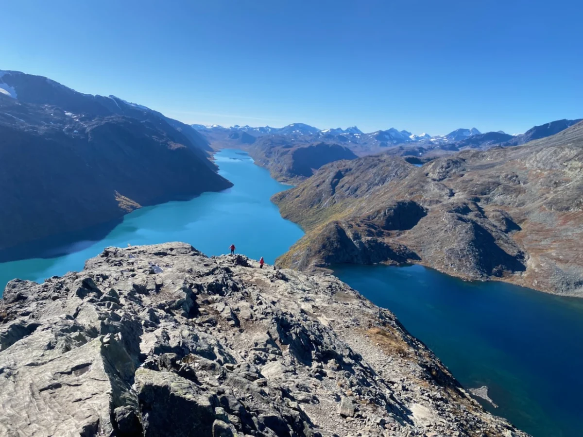
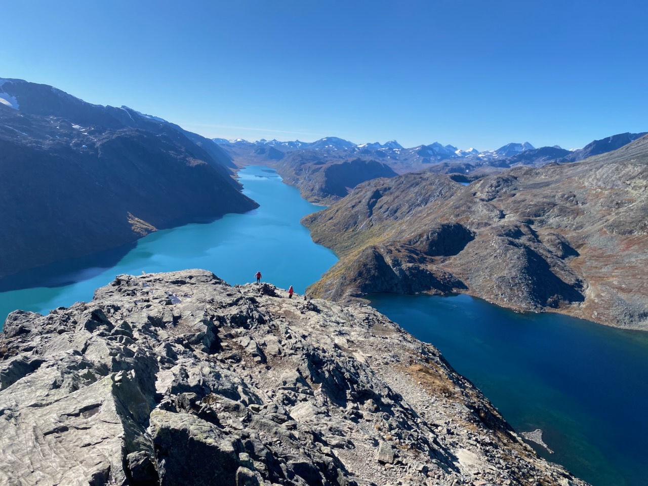
The Besseggen Ridge is not merely a trail; it is a rite of passage. Halfway along its 14-kilometer course, the path narrows to a knife-edge spine. On one side, the turquoise waters of Lake Gjende; on the other, the dark, sapphire depths of Lake Bessvatnet. It is a heart-pumping scramble that serves as the perfect, dramatic conclusion to the loop before the final descent to Gjendesheim.

Supporting Data and Logistics
Essential Trail Variations
Experienced trekkers may wish to customize the standard loop with these high-intensity alternatives:

- Galdhøpiggen Summit: An out-and-back trek from Spiterstulen to Scandinavia’s highest peak.
- Memurubu Shoreline: Following the northern shore of Lake Gjende for a lower-altitude, water-side perspective.
- Glittertinden Alternative: A high-route bypass via the second-highest peak in Norway, which adds significant elevation gain but offers unparalleled panoramas.
Accommodation and Infrastructure
The Norwegian Trekking Association (DNT) maintains a robust network of huts. While I chose to camp, utilizing my MLD Duomid for shelter, the huts provide an essential social infrastructure. Whether it is the emergency hut at Spiterstulen—equipped with gas cookers and charging points—or the historic Gjendebu Hut (established in 1871), these structures are the heartbeat of the Nordic hiking community.

Cultural Implications and Literary Heritage
The fame of the Jotunheimen region is inextricably linked to the Norwegian literary canon, most notably Henrik Ibsen’s 1867 masterpiece, Peer Gynt. The protagonist’s legendary ride on the back of a reindeer along "Gendin-Edge" (Besseggen Ridge) immortalized the landscape. Ibsen’s description of the ridge as a "scythe" stretching "nigh on four miles long" still resonates with every hiker who stands on that precipice today.

Beyond literature, the huts serve as a melting pot of human experience. During my 2022 trip, the emergency hut at Spiterstulen hosted a microcosm of the global hiking community: English climbers, a Dutch ultralight enthusiast, a German trio on their maiden voyage, and a Chilean veteran of the Andes. These interactions are the soul of the trail. They remind us that while the landscape is grand and intimidating, the act of walking across it is a deeply human, communal experience.

Expert Recommendations for Future Trekkers
- Preparation is Paramount: The weather in Jotunheimen can shift from sun to snow in a matter of minutes, regardless of the season. Ensure your gear is rated for arctic-alpine conditions.
- Respect the Wildlife: Reindeer are sensitive to human presence. Observe them from a distance and avoid encroaching on their path, especially during the fall migration.
- Digital and Analog Tools: While GPS details are invaluable for navigation, always carry a physical topographic map. Electronic batteries fail in the cold; paper does not.
- Engage with the Community: Don’t be afraid to share a meal or a story in the mountain huts. The advice you receive from other hikers regarding current trail conditions is often more accurate than any guidebook.
Conclusion: Why the Giants Call
The Jotunheimen Loop is more than a trail; it is a profound encounter with the primeval. It forces you to reconcile your own scale against the towering granite and the creeping ice. Whether you are scrambling up the Besseggen Ridge or sharing a quiet moment of reflection in the Visdalen Valley, the "Land of the Giants" demands presence.

For those looking to document their own journey, my book Wanderlust Nordics offers a comprehensive look at this route and 25 others across the Scandinavian wilderness. As I look back on my time in Jotunheimen, the lasting impression is not of the physical exertion, but of the silence—a silence that only exists where the giants dwell, and where the air is thin, crisp, and eternally fresh.