Updated June 26, 2026 – The tropical Pacific Ocean is currently undergoing a dramatic transformation that meteorologists and climatologists are watching with intense scrutiny. Latest satellite observations and deep-ocean temperature sensors confirm that a powerful "Super El Niño" is rapidly breaking into the atmosphere. This climate phenomenon, characterized by extreme sea-surface temperature anomalies and a massive reorganization of atmospheric circulation, is expected to be a dominant driver of global weather patterns throughout the remainder of 2026 and well into 2027.
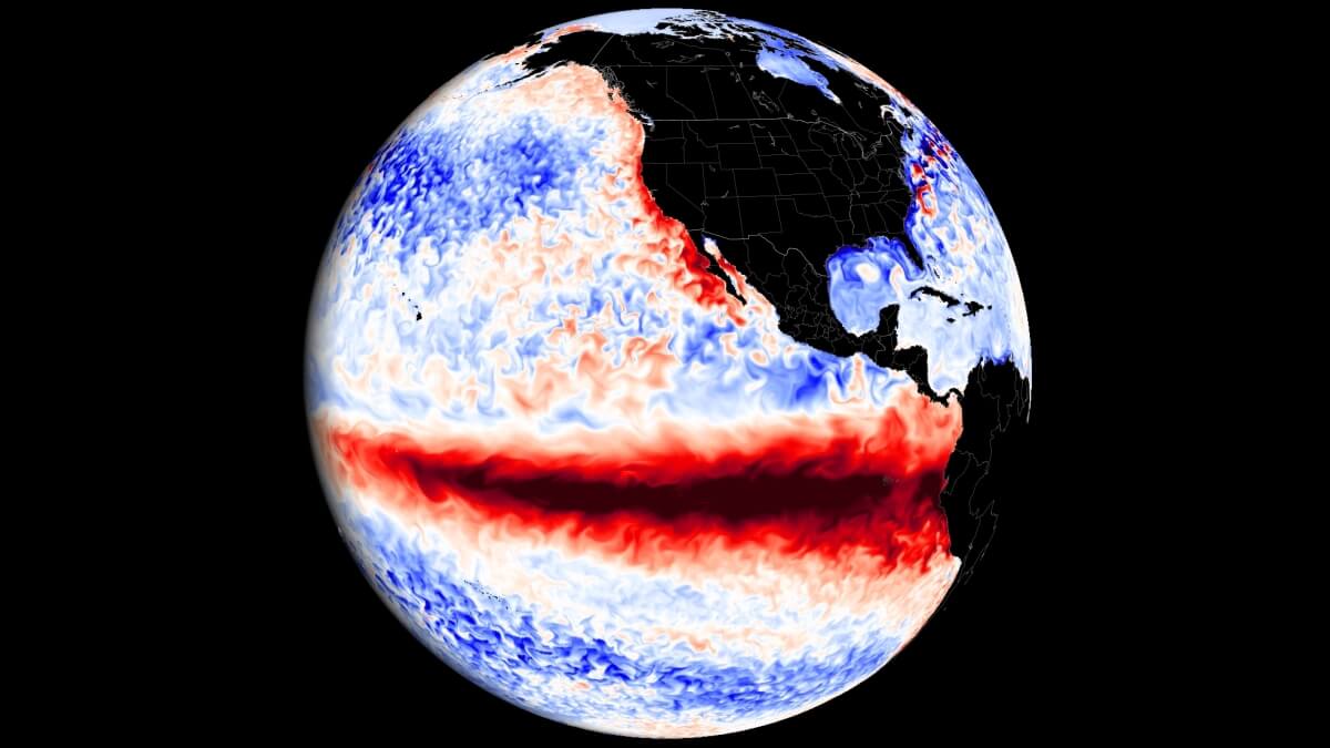
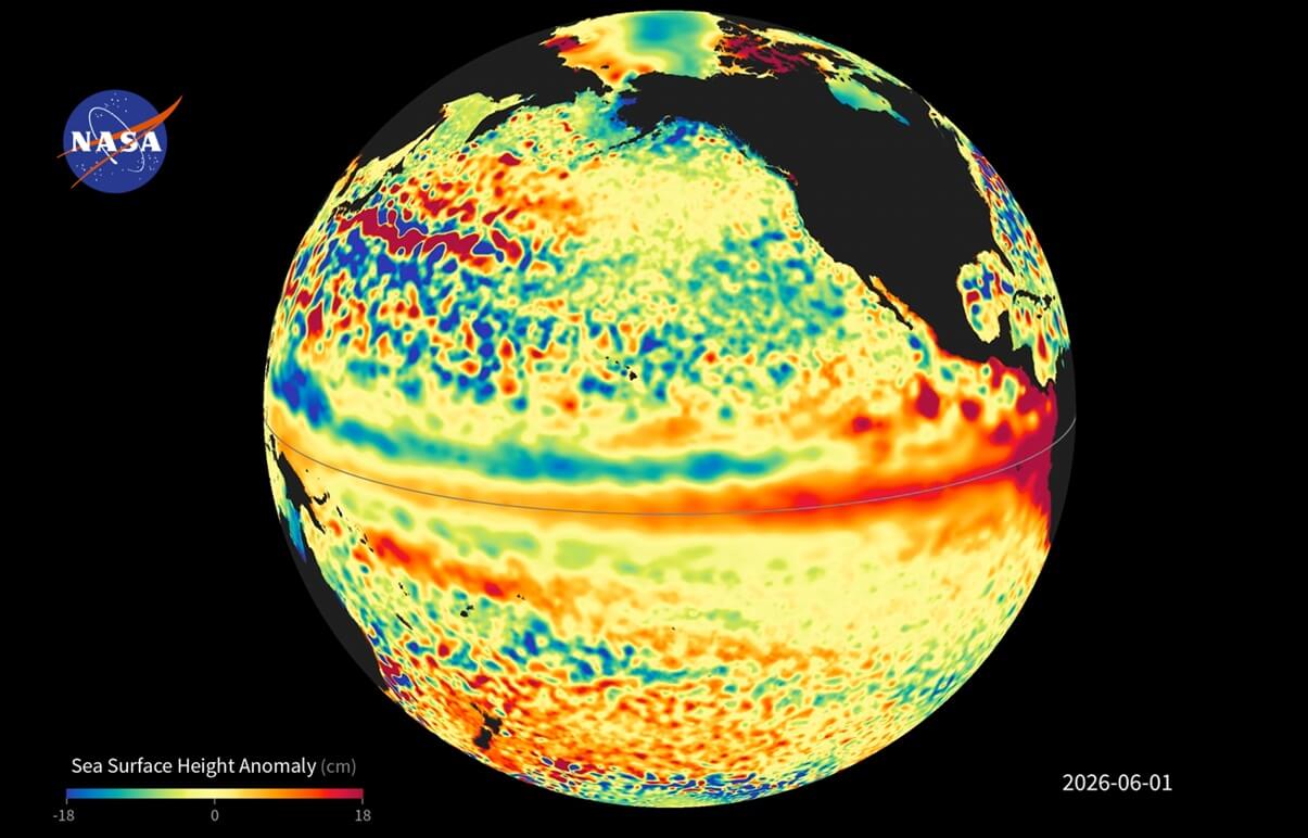
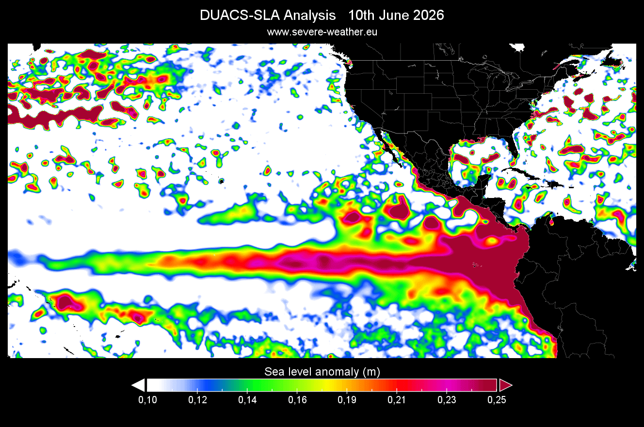
As NASA satellite analysis detects significant sea-level height anomalies across the equatorial Pacific, the scientific community is bracing for the widespread, often volatile weather shifts that accompany such rare, high-intensity events.
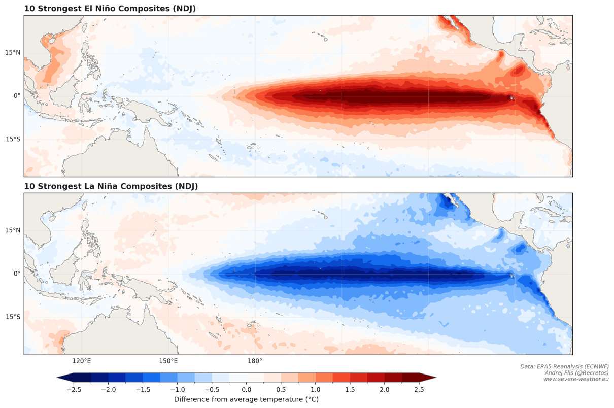
The Mechanics of a Super El Niño
Understanding the Pacific Trigger
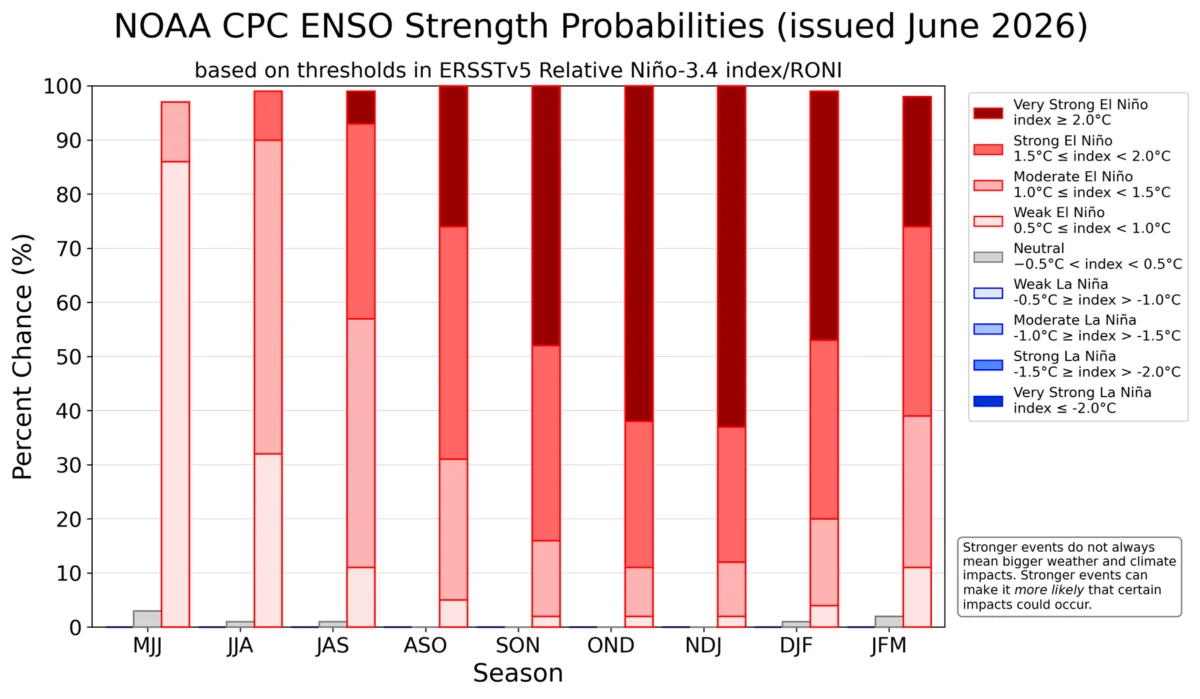
El Niño-Southern Oscillation (ENSO) is a periodic fluctuation in sea surface temperatures and air pressure across the equatorial Pacific. While El Niño events occur every few years, "Super El Niño" events—where sea surface temperatures in the central and eastern Pacific soar to 2°C or more above the long-term average—are rare, typically occurring only once per decade or less.
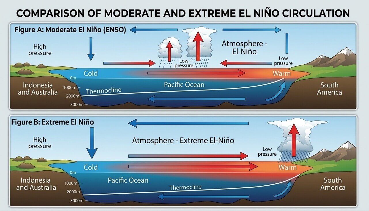
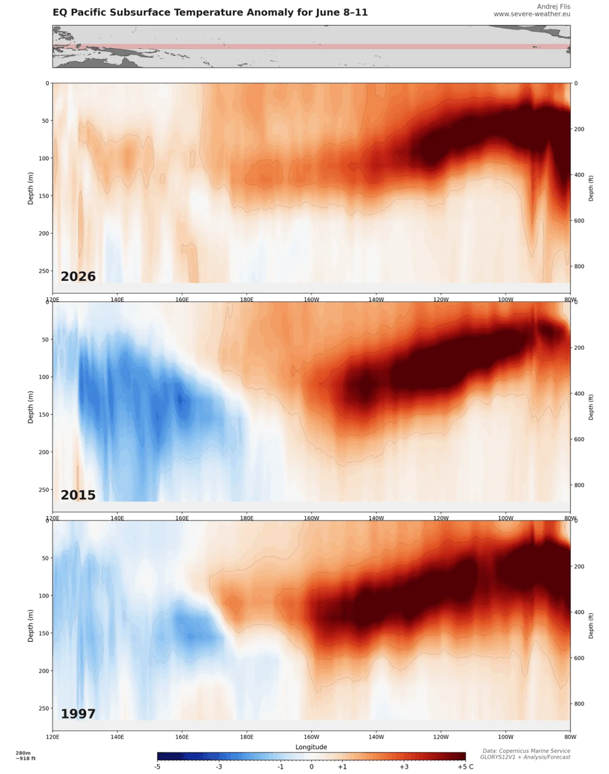
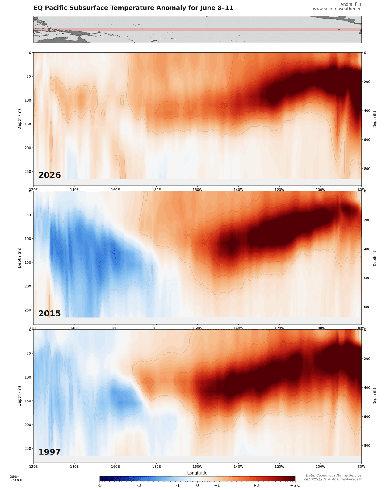
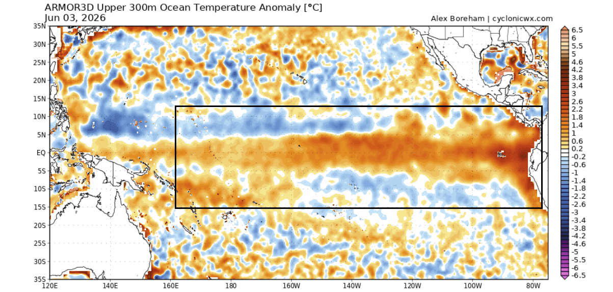
The current event is driven by a massive "Kelvin Wave"—a vast pulse of warm subsurface water traveling from the western Pacific toward the South American coast. As these warm waters rise, they alter the Walker Circulation, the atmospheric system that governs tropical rainfall and wind patterns. This creates a "pressure release valve" effect, where accumulated heat in the deep ocean is rapidly discharged into the atmosphere, fundamentally changing the jet stream’s path across the globe.
Chronology of the 2026 Development
The emergence of this event has been swift. Following a relatively weak La Niña phase during the winter of 2025/2026, the Pacific began a rapid transition in March 2026.
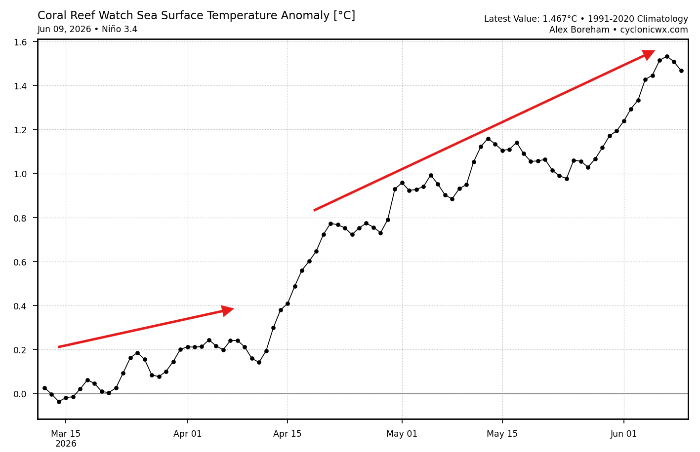
- Mid-April: Data indicated a significant acceleration in temperature anomalies, surpassing the official +0.5°C threshold required to designate an El Niño.
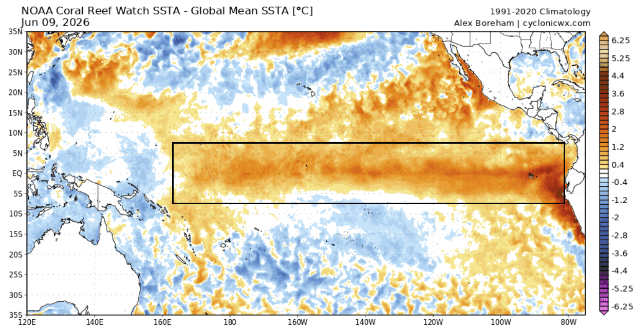
- May–June: Subsurface sensors confirmed the arrival of a massive Kelvin Wave. Satellite imagery from NASA’s Sentinel-6 mission revealed sea levels in the central and eastern Pacific rising by more than 25 centimeters (10 inches), a physical manifestation of the expanding, warming water mass.
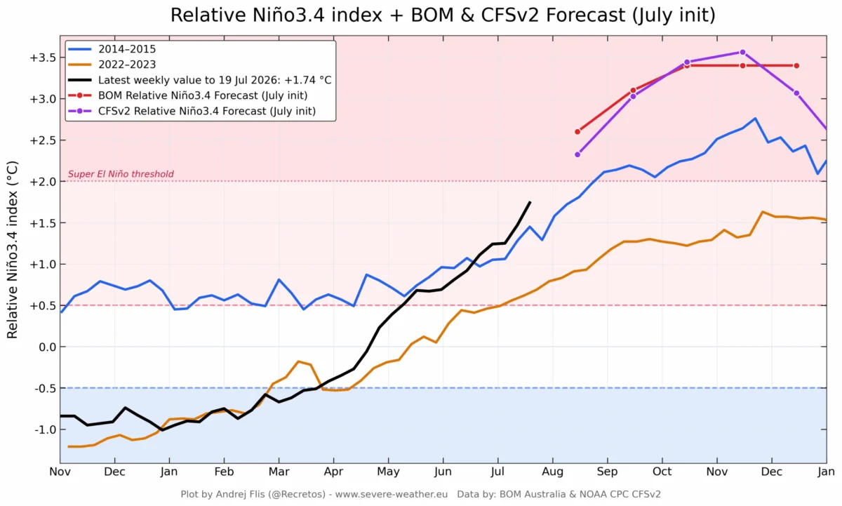
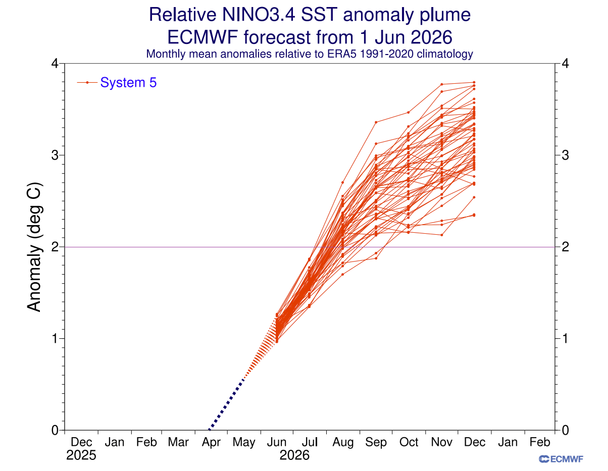
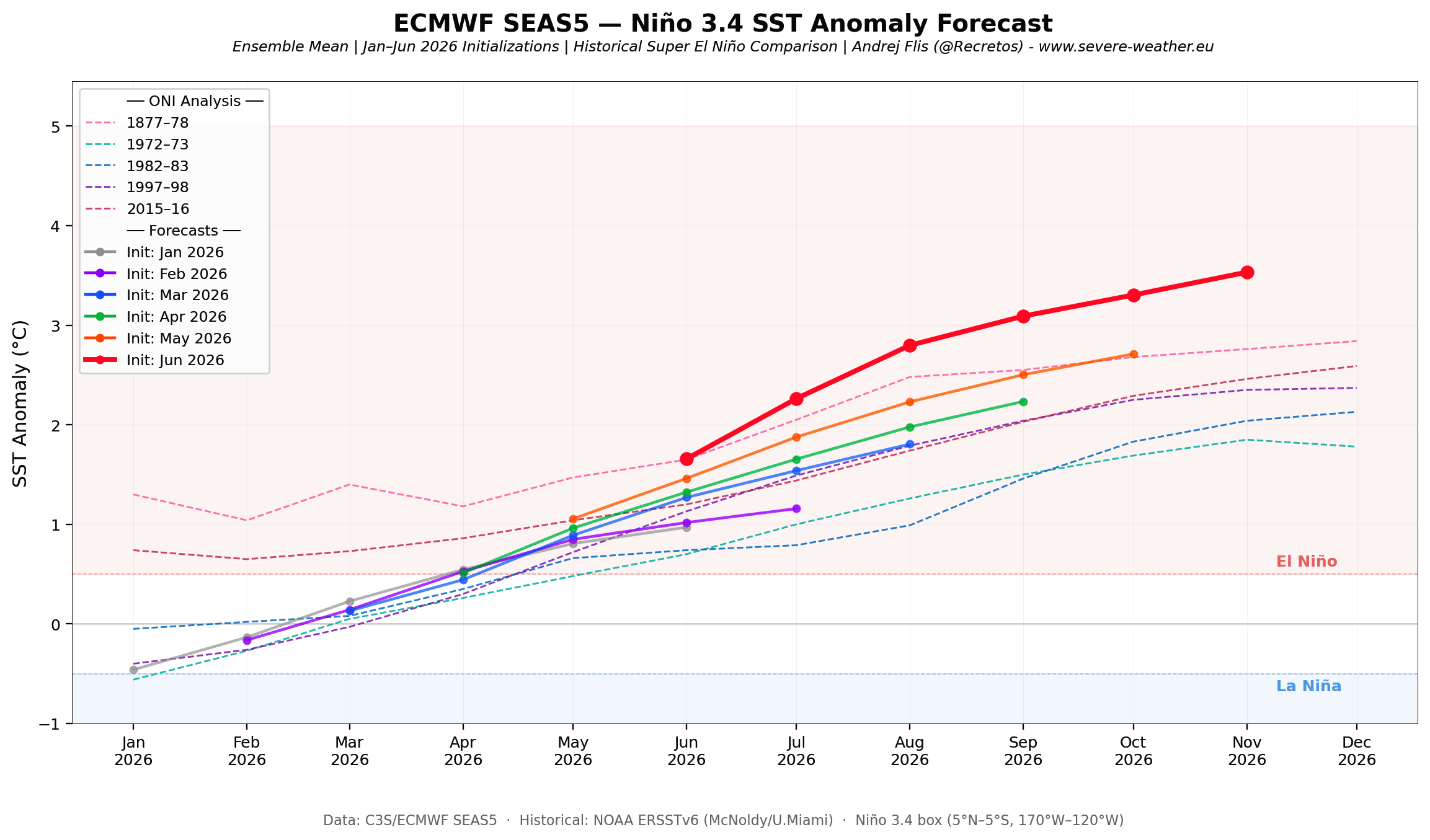
- Late June: Long-range forecast models, including those from the European Centre for Medium-Range Weather Forecasts (ECMWF), shifted their projections to show this event reaching "Super" status by the fourth quarter of 2026.
Data-Driven Forecasts: A Historic Trajectory
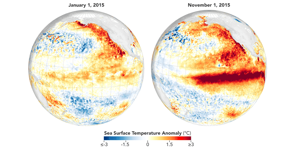
The intensity of this event is best understood through comparative data analysis. Current subsurface temperature anomalies in the top 270 meters (885 feet) of the ocean are not only tracking with the historic 2015/2016 Super El Niño but are, in some western regions, displaying even warmer signatures.
The ECMWF Outlook
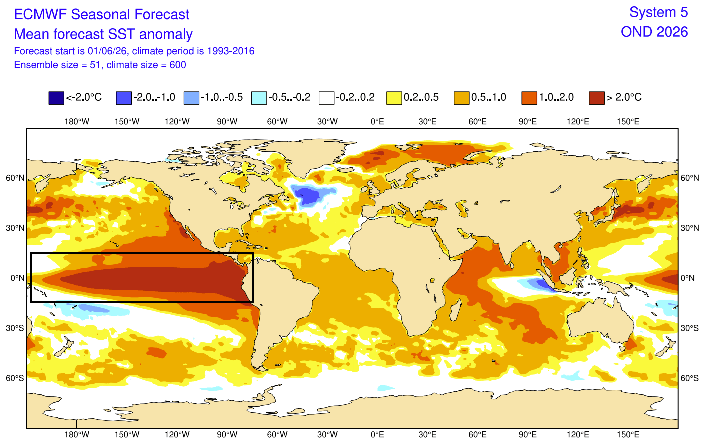
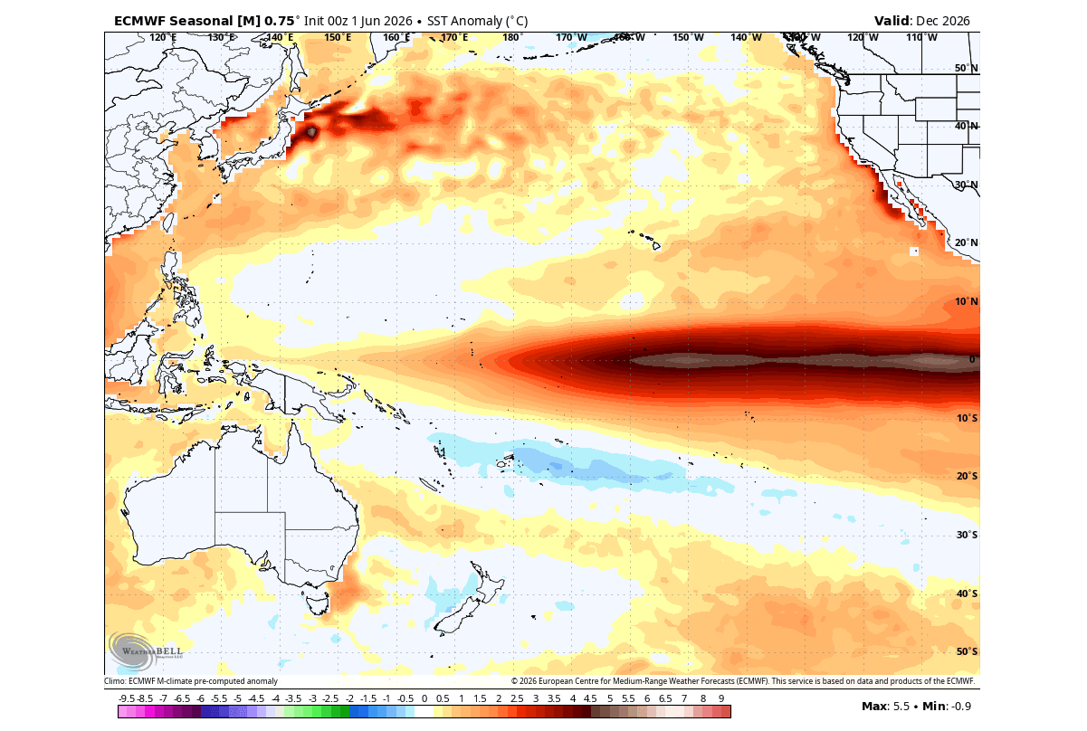
Current long-range ensembles are unprecedented. Recent model runs suggest that sea surface temperatures in the Niño 3.4 region could peak at +3°C to +5°C above average by December 2026. Should these forecasts verify, the 2026/2027 event could rival the legendary 1877/1878 El Niño, which remains one of the most powerful and disruptive climatic events in recorded history.
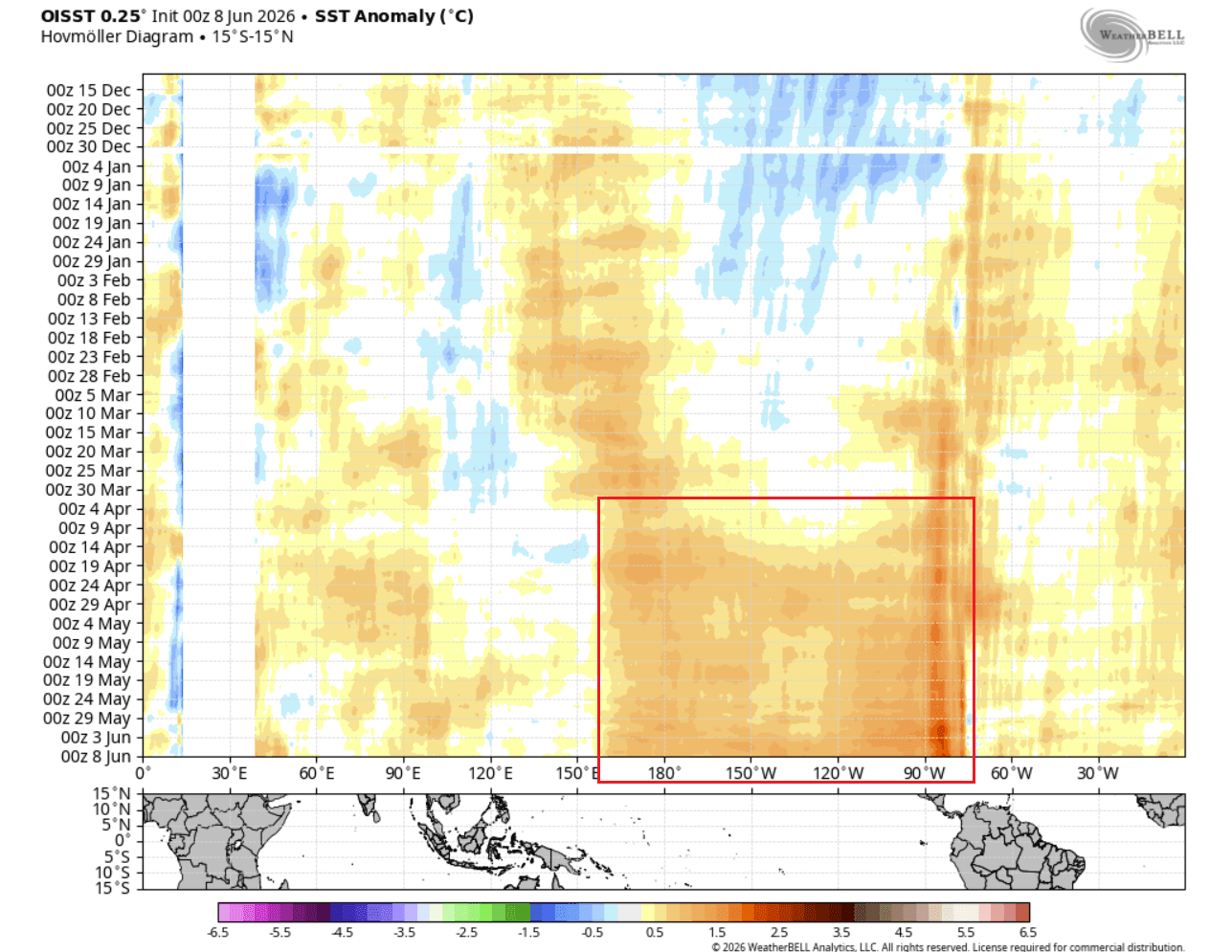
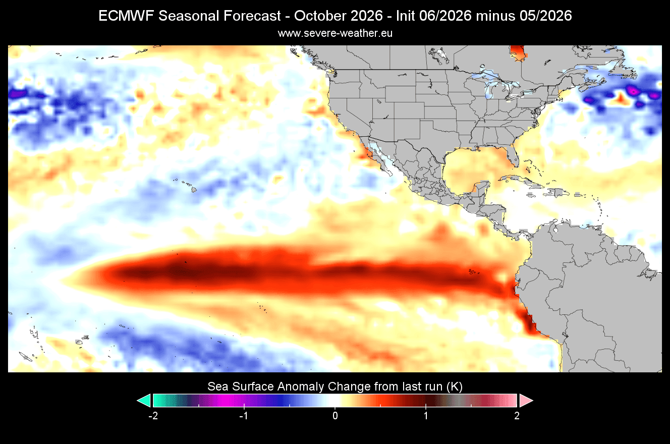
This is not a uniform warming; it is a concentrated, high-energy anomaly. By comparing the latest forecast to previous months, researchers have observed that each successive model run has increased the expected intensity, indicating that the ocean-atmosphere coupling is strengthening faster than initially predicted.
Global Implications: Impacts on North America and Europe
The atmospheric response to a Super El Niño is rarely localized; it triggers a cascade of weather anomalies globally.
North American Weather Shifts
For North America, the primary driver is the displacement of the jet stream.
- The Northern Tier: During a strong El Niño, the polar jet stream is typically pushed further north. This often results in milder, drier winters for Western Canada and the Northern United States, potentially reducing snowfall totals in those regions.
- The Southern Tier: Conversely, the subtropical jet stream intensifies and shifts southward. This usually brings increased storm activity, higher precipitation, and cooler-than-average temperatures to the Southern United States and Northern Mexico.
- Summer/Fall 2026: We are already seeing the early stages of this pattern. Current 30-day pressure forecasts show a distinct low-pressure zone over Eastern Canada, which is influencing weather patterns across the American Midwest and Northeast.
The European Perspective
The impact on Europe is more complex and often subject to influence by the North Atlantic Oscillation (NAO). However, the emerging patterns suggest that the shift in the global jet stream will favor a ridge of high pressure over Western Europe, likely leading to warmer-than-average conditions in the near term, while areas further east may experience more variable, moisture-heavy weather as they sit at the interface of differing pressure systems.
Scientific and Official Vigilance
The scientific community, including agencies like NASA’s Jet Propulsion Laboratory (JPL) and the Copernicus Climate Change Service, is utilizing this data to provide early warnings.
The primary concern for global policy makers is the potential for extreme weather events. History suggests that Super El Niño years are frequently associated with:
- Agricultural Volatility: Altered rainfall patterns can lead to drought in Australia and parts of Southeast Asia, while potentially causing flooding in the southern United States and parts of South America.
- Ecosystem Stress: Coral bleaching is a high risk during such events due to sustained elevated ocean temperatures.
- Infrastructure Risks: Coastal regions in the eastern Pacific must prepare for higher-than-normal sea levels and increased storm surge potential during the winter months.
Conclusion: Preparing for a Shift
As we move into the latter half of 2026, the data remains clear: the Pacific Ocean is priming for a major, potentially historic, climate event. The transition from a neutral state to a Super El Niño is not merely a scientific curiosity but a herald of significant shifts in the agricultural, economic, and environmental landscapes.
While long-range forecasting carries inherent uncertainties, the convergence of satellite altimetry, subsurface ocean temperatures, and atmospheric pressure anomalies provides a high-confidence signal. Communities in vulnerable regions should monitor local forecasts closely as the "Super" signature continues to lock into place over the coming months.
The global climate system is entering a period of heightened volatility. As the atmosphere adjusts to the massive heat release from the Pacific, the world can expect a season defined by record-challenging temperatures, shifted storm tracks, and a significant deviation from the climatic norms of the past decade.
Data sources for this report include analysis from cyclonicwx.com, Copernicus EU, and WeatherBell. For continued updates on the 2026/2027 climate evolution, please bookmark our portal and remain alert to the latest meteorological bulletins.