Deep in the heart of central Norway lies a landscape so rugged and steeped in folklore that its name alone commands respect: Trollheimen—the "Home of the Trolls." This mountain range, a majestic transition zone where the raw energy of the marine coast meets the stark, silent majesty of the alpine interior, remains one of Scandinavia’s most evocative wilderness secrets. While the region is well-known to the local Norwegian hiking community, it remains an "under-the-radar" gem for the international trekking crowd, offering a masterclass in glacial geology, ancient human history, and Nordic resilience.

In the fall of 2022, I embarked on a journey through these peaks, capturing the essence of the Trollheimen Triangle. The resulting exploration, which features prominently in my book Wanderlust Nordics: Exploring Trails in Scandinavia (2023), serves as a testament to a region where Stone Age echoes and modern outdoor ethics converge.

Main Facts: The Anatomy of the Trollheimen Triangle
The Trollheimen Triangle is not merely a trail; it is a cultural and environmental odyssey. Spanning approximately 58 kilometers (36 miles) and demanding a cumulative elevation gain of 2,720 meters (8,924 feet), this route is classified as "moderate" for those accustomed to mountain terrain. However, the true difficulty of the region is dictated by its mercurial climate.

- Distance: 58 km (36 mi)
- Duration: 2–3 days
- Starting/Ending Point: Gjevilvasshytta mountain hut
- Elevation Gain: 2,720 m (8,924 ft)
- Terrain: A blend of dense birch woodlands, marshy valley floors, jagged rocky ridgelines, and glacial tarns.
The moniker "Trollheimen" was officially adopted in the late 19th century. Far from being an ancient term, it was a marketing strategy employed by tourism advocates to lure travelers into the mountains. Today, that name feels entirely appropriate as you navigate the mist-draped valleys that look as though they were hewn by the very creatures of legend.

Chronological Expedition: A Three-Day Traverse
Day 1: The Ascent to Jøldalshytta
The journey begins at the historic Gjevilvasshytta mountain hut, established in 1819 and situated just a 30-minute drive from the regional hub of Oppdal. Moving in a counter-clockwise direction, the first stage stretches 21 kilometers (13 miles) toward the Jøldalshytta Hut.

The initial five kilometers pull you through the verdant birch forests of Gjerdåldalen Valley. As the tree line recedes, the world opens up into a wide saddle passing beneath the shadow of Høghøa Peak (1,308 m). The trail feels expansive here, characterized by the marshy, lake-dotted expanse of the Høghødalen Valley. A pivotal moment occurs at the 11-kilometer mark, where the path crosses the Minnilla River. From here, the route crests over rolling fells near Skrikhøa Peak (1,061 m), offering sweeping, panoramic views of the Gammelsæterdalen Valley before descending toward the inviting sight of Jøldalshytta, nestled against the shimmering waters of Jølvatnet Lake.

Day 2: The Choice of Routes to Trollheimshytta
The second stage presents a tactical choice for the hiker. One can choose the high-altitude, strenuous traverses over Geithøtta Top (1,316 m) or the formidable Trollhetta (1,616 m). However, in the face of the unforgiving autumn weather I encountered—heavy rain and low visibility—I opted for the lower-level 16-kilometer (9.9-mile) route along the Svartå River.

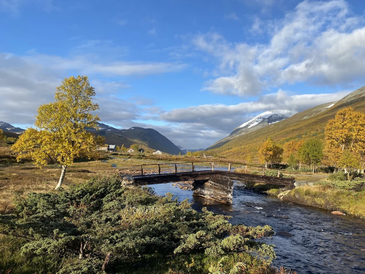
This path, often overlooked by those chasing summits, revealed a quieter beauty: ancient stone bridges, lush meadows, and traditional turf-roofed cottages that appear as if they grew directly from the earth. The day concluded at the Trollheimshytta Hut. Though the main structure was closed for the season, the adjacent emergency shelter provided a crucial sanctuary, offering a dry space to process the day’s journey while listening to the relentless rain against the roof.

Day 3: The Challenge of the High Plateau
The final stage is the most demanding of the trio. Departing Trollheimshytta, you cross the Slettå River before facing a brutal, steep climb. Over the next three kilometers, the trail gains 700 meters, zig-zagging through rocky terraces to reach the summit of Skallen Peak (1,226 m).

From Skallen, the landscape transforms. You move across the Mellomfjellet, a rocky, tarn-peppered plateau that feels entirely isolated from the world below. After skirting the eastern shore of Fossådalsvatnet Lake, the trail pushes up to the Riarskaret Pass (1,307 m)—the highest point of the stage. The final descent carries you past the tranquil Kamtjønnin Lake and back into the expansive Gjerdåldalen Valley. A final morning under clear, crisp blue skies allowed for a peaceful walk along the Gravbekke River, eventually leading back to the trailhead at Gjevilvasshytta.

Supporting Data: Environmental and Logistics
The Trollheimen region is a protected wilderness, managed by the Norwegian Mountain Touring Association (DNT). The infrastructure is meticulously maintained, with a network of huts that provide safety and community for travelers.

- Sustainability: The use of established huts is encouraged to reduce human impact on the fragile tundra ecosystems.
- Hydrology: The region is heavily defined by its water systems, including the Svartå and Minnilla rivers, which are critical to the local biodiversity.
- Historical Footprint: The trail is dotted with evidence of millennia of human occupation, ranging from Iron Age burial sites to the remnants of medieval summer mountain farms (seter).
Official Perspectives and Conservation
The Norwegian National Park authorities emphasize that while Trollheimen is a playground for outdoor enthusiasts, it is primarily a critical habitat. Conservation efforts are focused on protecting the pristine state of the alpine meadows and ensuring that the indigenous fauna—including wild reindeer—remains undisturbed by the growing interest in "slow tourism."

The DNT maintains a strictly enforced "leave no trace" policy, which is essential given the slow recovery rate of arctic vegetation. Hikers are reminded that the weather in Trollheimen is the final authority; the transition from sunshine to dangerous storm conditions can occur in minutes.

Implications: The Future of Remote Trekking
The "under-the-radar" status of the Trollheimen Triangle is likely to shift as global interest in Nordic trekking continues to rise. The implication for future hikers is clear: while the region offers an unparalleled experience of solitude and history, that experience depends on the preservation of its quietude.

For those who wish to walk these paths, the challenge is twofold. First, one must possess the physical and navigational competence to manage a landscape that does not cater to the unprepared. Second, one must embrace the ethical responsibility of preserving a fragile, ancient ecosystem.

Trollheimen is not merely a destination for a checklist; it is a living history book. From the turf-roofed cabins that guard the secrets of the past to the icy, wind-swept ridges that offer a glimpse of the geological future, the Trollheimen Triangle is a reminder of the raw, unfiltered connection between human history and the natural world. Whether you face the rain-lashed valley or the sun-drenched plateau, the "Home of the Trolls" demands your humility, your preparation, and your respect.

Disclosure: This article contains affiliate links. The Hiking Life may receive a small commission for purchases made through these links, which supports the ongoing documentation of these wilderness trails.