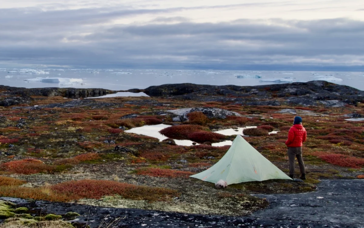
While Ilulissat rightfully claims its title as Greenland’s tourism crown jewel—boasting the majestic, UNESCO-protected Icefjord—the true essence of Arctic solitude lies just beyond the town’s bustling harbor. For those willing to trade the well-trodden boardwalks of the Sermeq Kujalleq glacier viewpoints for the raw, windswept coastline of the north, the trail to the isolated settlement of Oqaatsut offers a profound journey into the heart of Greenlandic maritime heritage.

This 41-kilometer (25.5-mile) out-and-back trek is more than a mere physical challenge; it is an expedition through a landscape defined by silence, shifting light, and the enduring resilience of remote coastal communities.

Main Facts: The Arctic Wilderness Route
The trail from Ilulissat to Oqaatsut serves as a rare bridge between the modern infrastructure of Greenland’s third-largest town and the traditional, slow-paced lifestyle of its smaller settlements.

- Location: West Greenland, 250 km (155 mi) north of the Arctic Circle.
- Distance: 41 km (25.5 mi) total (out-and-back).
- Difficulty: Rated as "Easy" to "Moderate," primarily due to navigation over rocky, undulating tundra rather than steep, technical mountain passes.
- Total Elevation Gain: 946 meters (3,104 ft).
- Optimal Season: Late June through September, when the tundra is accessible and the midnight sun provides near-endless daylight for navigation.
- Starting Point: The trailhead is conveniently located near the Hotel Arctic, the world’s northernmost four-star hotel.
A Chronology of the Journey: From Runway to Remote Outpost
The trek begins with a stark transition. As hikers depart from the outskirts of Ilulissat, the first few kilometers parallel the local airport. While the presence of construction machinery—currently engaged in a massive infrastructure expansion set for completion in 2026—may feel intrusive, it is a fleeting reminder of the modern world.

Phase 1: The Departure (0–7 km)
After roughly 40 minutes of walking, the industrial hum of the airport fades, replaced entirely by the sound of the wind and the rhythmic lapping of the Arctic Ocean. The trail here hugs the rugged coastline, winding past traditional fishing cottages. These structures, painted in vibrant shades of red, blue, and yellow, serve as visual anchors against the monochromatic backdrop of grey basalt rock and deep, leaden-hued waters.

Phase 2: The Heartland of the Tundra (7–16 km)
Approximately 7.5 kilometers in, the trail funnels hikers through a dramatic narrow gorge before opening into a landscape defined by freshwater lakes. This section is a highlight for those seeking respite; the shores of the Kangerluarsup Tasia Qalleq lakes provide an ideal location for a midday meal. For backpackers planning an overnight stay, the grassy, sheltered terrain on the southern bank of the outlet stream represents the most reliable and comfortable campsite between the two settlements.

Phase 3: The Approach to Oqaatsut (16–20.5 km)
The final leg of the journey offers the most spectacular vistas. The route ascends gradually, contouring around the serene Qarajaq Cove. From this vantage point, hikers are rewarded with sweeping views of the bay, frequently dotted with massive, grounded icebergs calved from the nearby glacier. Crossing a final rocky saddle and passing a small, cascading waterfall, the trail eventually descends into the quiet, historic enclave of Oqaatsut.

Supporting Data: The Logistics of Arctic Trekking
Planning for an excursion into the Greenlandic wilderness requires a calculated approach to safety and logistics. Unlike alpine environments with high-frequency trail maintenance, this route relies on cairns and orange blazes.

| Metric | Detail |
|---|---|
| Duration | 10 hours to 2 full days |
| Navigation | Well-marked with rock cairns; GPS recommended |
| Water | Abundant freshwater sources from glacial melt and streams |
| Weather | Highly unpredictable; rapid temperature drops are common |
| Wildlife | Occasional sightings of Arctic fox, hares, and marine life |
The "Wanderlust" Perspective
This route has gained recognition as one of the premier long-distance walks in the Arctic region. It is featured as a key itinerary in Wanderlust Nordics (Gestalten), which highlights the trail’s unique ability to showcase the "other side" of Greenland—the side that is not found in brochures focused solely on the icebergs of the UNESCO zone.

Official Responses and Environmental Implications
The preservation of this trail is a matter of both cultural and environmental significance. Local authorities in Ilulissat emphasize that while the Icefjord attracts thousands of visitors annually, the trail to Oqaatsut remains a "low-impact" zone.

"The integrity of the tundra is fragile," noted a representative from the local tourism board. "We encourage hikers to practice ‘Leave No Trace’ principles strictly. This is a working landscape; the fishing cottages are private property, and the silence of the route is part of its charm. We ask visitors to respect the sanctity of the cemetery areas and the quiet nature of the settlement’s inhabitants."

Environmental experts also point to the climate-driven shifts in the region. As the permafrost becomes less stable, trail sections near watercourses are subject to erosion. Hikers are advised to remain on marked paths to prevent scarring the lichen-rich soil, which can take decades to recover.

Implications for the Future: A Changing North
The planned expansion of the Ilulissat Airport, expected to be fully operational by 2026, holds significant implications for the region. While it will undoubtedly increase the flow of international travelers to the area, it also raises questions regarding the sustainability of local trails.

For the village of Oqaatsut, the influx of visitors via organized boat tours is already a primary economic driver. However, the hikers who choose to walk the 20-kilometer distance represent a different demographic: one that is slower, more observant, and more deeply engaged with the landscape.

A Journey Back in Time
Arriving in Oqaatsut feels like stepping through a portal. The settlement, which maintains a population of roughly 40-50 people, offers a glimpse into a way of life that has persisted for centuries. The primary activity remains small-scale fishing, and the architecture reflects the necessity of survival in a harsh climate.

For the modern traveler, this route offers a rare opportunity to disconnect from the digital age. Without cellular service for the vast majority of the trek, the hiker is forced into a state of mindfulness. Every cairn becomes a landmark, every change in the wind becomes a weather report, and every iceberg drifting in the bay becomes a reminder of the colossal, shifting power of the natural world.

Final Reflections for the Aspiring Hiker
If you are considering this trek, prepare for the sensory shift. The beauty of the Ilulissat-to-Oqaatsut trail is not found in grand summits or extreme vertical gain, but in the subtle gradients of the arctic light, the silence of the tundra, and the profound contrast between the ancient, frozen landscape and the warm, human element found in the isolated coastal cottages of the north.

Whether you complete it in a long, sun-drenched day or choose to linger overnight by the glacial streams, the trail offers a humbling, essential experience of the Arctic that is disappearing elsewhere in the world. It is, quite simply, a walk back in time—a reminder of the scale of the world and our quiet, fleeting place within it.