Deep in the heart of central Norway lies a landscape that feels pulled from the pages of a Norse saga. The Trollheimen Mountains—literally "Home of the Trolls"—serve as a dramatic transition zone between the jagged, maritime-influenced peaks of the west and the rolling, alpine expanses of the east. While iconic hikes like the Besseggen Ridge often dominate international headlines, the Trollheimen region remains a well-kept secret, offering a pristine, multi-dimensional wilderness experience that blends geological grandeur with a profound sense of human history.

Main Facts: The Geography of Myth
Trollheimen is defined by its topographical diversity. Over the course of a single trek, a hiker might traverse ancient, moss-covered woodlands, navigate lush river valleys carved by glacial melt, and climb onto rugged, windswept plateaus. This is a region where the timeline of human inhabitation is etched into the landscape: Stone Age settlements, Iron Age burial mounds, and traditional, turf-roofed mountain farmhouses provide a historical backdrop to every mile of the trail.

The crown jewel of this region for the modern backpacker is the "Trollheimen Triangle." This circuit, which was featured in the 2023 book Wanderlust Nordics: Exploring Trails in Scandinavia, is a 58-kilometer (36-mile) loop that offers an accessible yet challenging introduction to the Norwegian mountain culture.

Quick Stats:
- Total Distance: 58 km (36 mi)
- Duration: 2–3 days
- Difficulty: Moderate
- Total Elevation Gain: 2,720 m (8,924 ft)
- Start/Finish: Gjevilvasshytta mountain hut
Chronology of the Trail: A Step-by-Step Guide
The Trollheimen Triangle is best navigated in a counter-clockwise direction, starting and ending at the historic Gjevilvasshytta hut, which dates back to 1819.

Stage 1: The Ascent to Jøldalshytta
The journey begins with a 21-kilometer (13-mile) trek toward Jøldalshytta. Hikers depart from Gjevilvasshytta, quickly climbing through the fragrant birch forests of Gjerdøldalen Valley. After five kilometers, the canopy breaks, and the trail enters the expansive, open fell. The route continues through the marshy, lake-speckled Høghødalen Valley, crossing the glacial-fed Minnilla River at the 11-kilometer mark. The final push involves a long, gradual descent toward Jøldalshytta, which sits in a picturesque position overlooking the serene Jølvatnet Lake.

Stage 2: Navigating the Heart of the Range
The second stage, connecting Jøldalshytta to the iconic Trollheimshytta, offers a choice of paths based on weather conditions. In fair weather, the high traverses over Geithøtta (1,316 m) or the formidable Trollhetta (1,616 m) provide panoramic views that stretch for miles. However, the region is notorious for rapidly shifting weather. During periods of heavy rain or high winds, the low-level route along the Svartåa River is the prudent choice. This alternative is a masterclass in Norwegian beauty, featuring dense, vibrant meadows, ancient wooden bridges, and the charming, sod-roofed structures that define the region’s agricultural heritage.

Stage 3: The Final Ascent and Return
The final leg is the most demanding, requiring a 21-kilometer push back to the trailhead. After crossing the Slettåa River, the trail immediately tilts upward, gaining roughly 700 meters in elevation over just three kilometers. The summit of Skallen Peak (1,226 m) serves as a dramatic vantage point, looking out over the Svartåmoen Nature Reserve. The trek concludes by crossing the rocky, tarn-peppered Mellomfjellet plateau and skirting the eastern shore of Fossådalsvatnet Lake, eventually descending back into the Gjerdøldalen Valley to return to the trailhead.

Supporting Data and Logistics
For those planning a trip to Trollheimen, preparation is the difference between a transformative experience and an endurance test. The infrastructure in this region is managed by the Norwegian Trekking Association (DNT), ensuring that even in remote areas, hikers are never truly isolated.

- Mountain Huts: The DNT hut system is world-class. Gjevilvasshytta, Jøldalshytta, and Trollheimshytta provide essential shelter, often equipped with kitchens, drying rooms, and bunk-style sleeping arrangements.
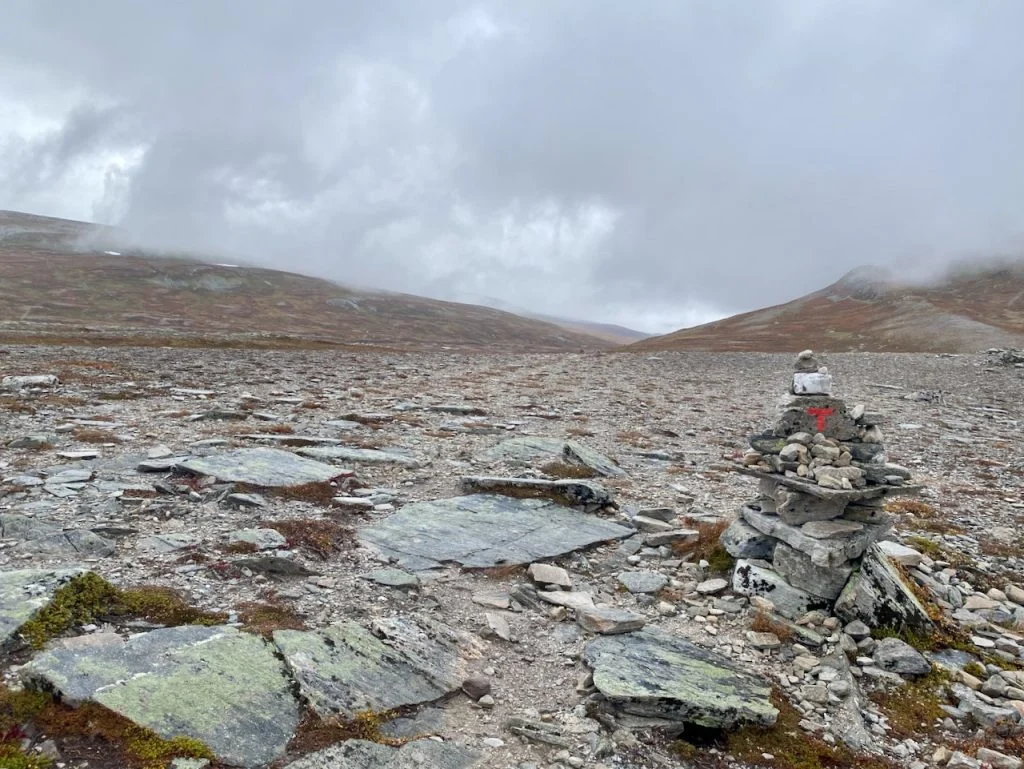
- Navigation: While trails are marked with the signature red "T" symbol, high-quality GPS files and physical topographic maps are essential, as visibility can drop to near-zero during mountain storms.
- Equipment: The "three-layer" rule is not a suggestion here; it is a necessity. Even in late summer, the temperature can fluctuate between 20°C (68°F) and near freezing, often within the span of an hour.
Official Perspectives: The Role of the DNT
The Norwegian Trekking Association (DNT) emphasizes that the Trollheimen range is a protected area, designed to balance tourism with the preservation of fragile alpine ecosystems. Officials note that the "Trollheimen Triangle" is specifically maintained to promote sustainable trekking.

"The region is a living museum," says a spokesperson for the local mountain board. "Our goal is to ensure that the infrastructure—the bridges, the trail markers, and the huts—supports the visitor without infringing on the silence and the sanctity of the wilderness. We encourage all hikers to practice ‘Leave No Trace’ principles, especially given the sensitivity of the marshlands in the valley floors."

Implications for the Modern Hiker
Why choose the Trollheimen Triangle over more famous routes? The answer lies in the authenticity of the experience. Unlike some of Europe’s more commercialized long-distance trails, Trollheimen retains a quiet, contemplative atmosphere. It is a place where you can find yourself completely alone in a landscape of jagged peaks and crystalline water, only to find the warmth of a fire and a community of like-minded hikers at the end of the day.

However, the "Home of the Trolls" demands respect. The weather is the ultimate authority in the mountains. Hikers must be prepared to adjust their plans—switching from a high mountain traverse to a valley floor trek—without hesitation. The rewards for this flexibility are immense: a deeper understanding of the Scandinavian wilderness and the unique, rugged soul of Norway.

Final Takeaway
As the author discovered in the fall of 2022, there is a singular joy in arriving at a mountain hut, damp from the rain, and finding the comfort of a hot meal and a warm bed. Whether you are traversing the high ridges or walking the valley floor, the Trollheimen Triangle offers a perfect microcosm of what makes Nordic hiking so special. It is a reminder that nature, when approached with humility and the right gear, provides the ultimate sanctuary from the complexities of modern life.

For those interested in detailed GPS tracks and further logistical insights, consider referencing "Wanderlust Nordics: Exploring Trails in Scandinavia."