In an extraordinary display of cross-border cooperation and sheer human resilience, emergency services have successfully contained one of the most volatile and destructive wildfires in the recent history of Italy’s Friuli-Venezia Giulia region. For ten grueling days in August 2026, the iconic pyramid-shaped slopes of Monte Amariana—a landmark of the Eastern Tolmezzo Alps—were engulfed in a ferocious blaze that consumed over 600 hectares of pristine Alpine forest.
The crisis, which reached a terrifying crescendo near the Ferragosto holiday, pushed the limits of regional firefighting capabilities and forced emergency evacuations as flames encroached to within 50 meters of residential dwellings in the hamlet of Pissebus. Only a combination of relentless international aerial intervention and a dramatic shift in atmospheric conditions finally quelled the inferno.

The Spark and the Escalation: A Timeline of Destruction
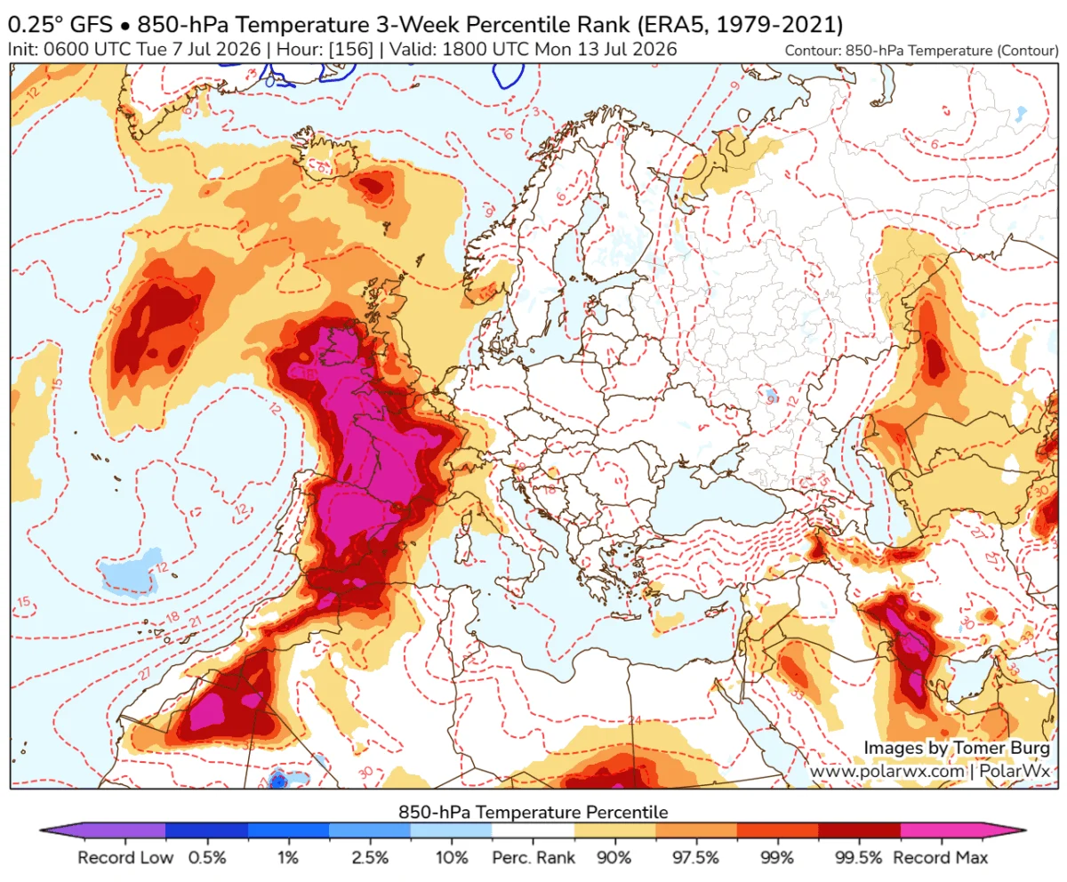
The disaster began in the first week of August 2026, a period defined by a punishing "heat dome" that had settled over much of Western and Central Europe, drying out the region’s vegetation to tinder-like consistency.
Early Ignition (August 7th)
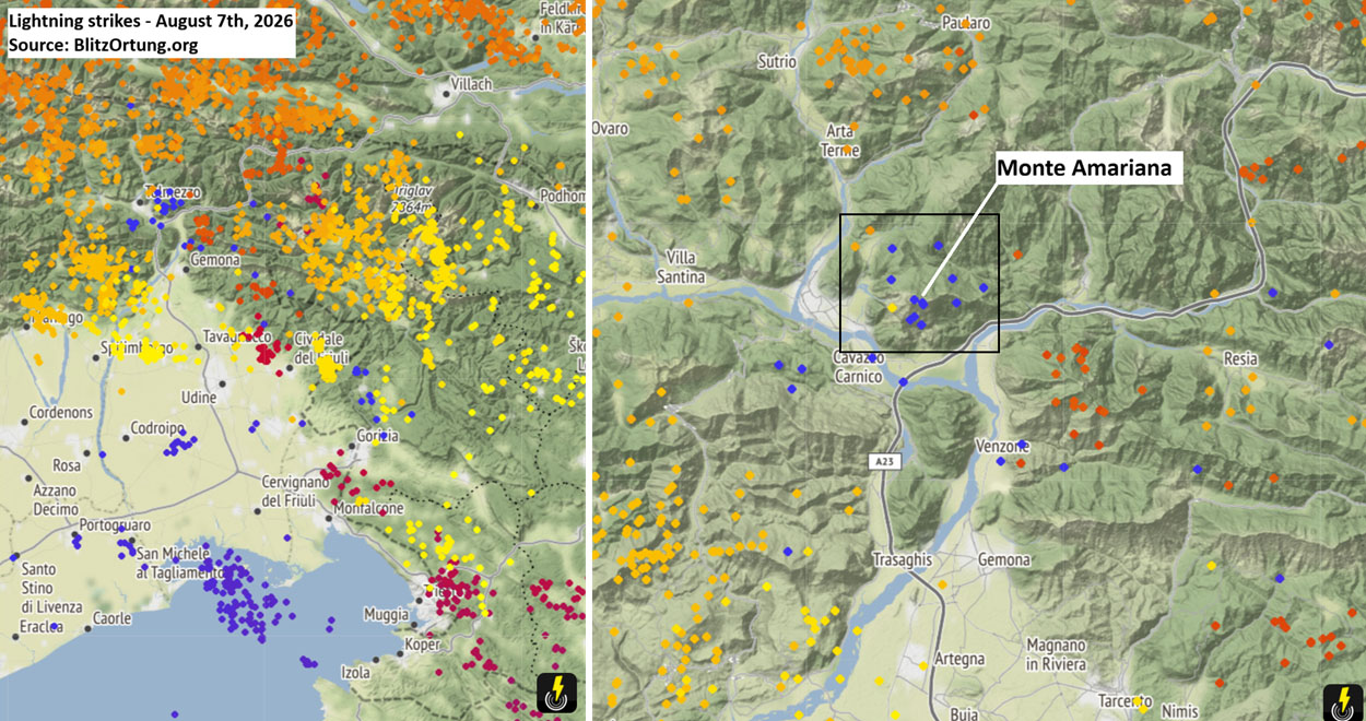
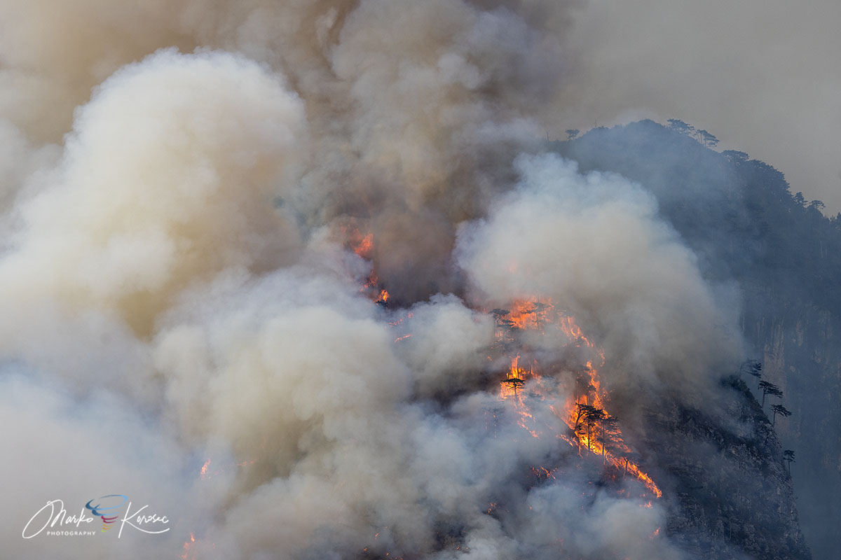
The catalyst was a series of lightning strikes during a passing frontal wave that swept through the Carnia region. Initial ignitions were detected on the upper Cuel Feltron, a steep, rugged spur of the mountain overlooking the municipality of Amaro. Due to the extreme verticality of the limestone terrain and the dense, parched Pinus nigra (Black Pine) forests, the fire quickly found fuel to sustain itself despite the difficult access.
The Ferragosto Flare-Up (August 15th)
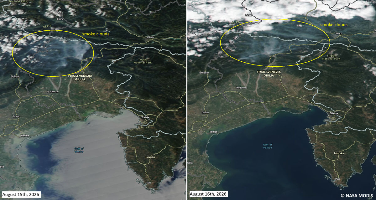
The situation deteriorated rapidly on August 15th. A shift in wind patterns—characterized by gusty, downslope flows—fanned the smoldering embers into an explosive event. The flames breached the Rio Confine ridge, jumping across to Monte Amarianute. This surge pushed the fire front dangerously close to the populated outer sectors of Tolmezzo, specifically threatening the Pissebus hamlet and the outskirts of Illegio.
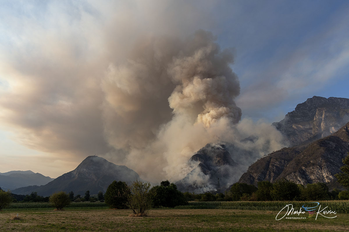
As the fire grew in intensity, it created its own weather system. Observers reported the development of pyrocumulus clouds—dense, fire-induced clouds that signaled the extreme heat release and the potential for erratic fire behavior.
Geographical and Topographical Challenges
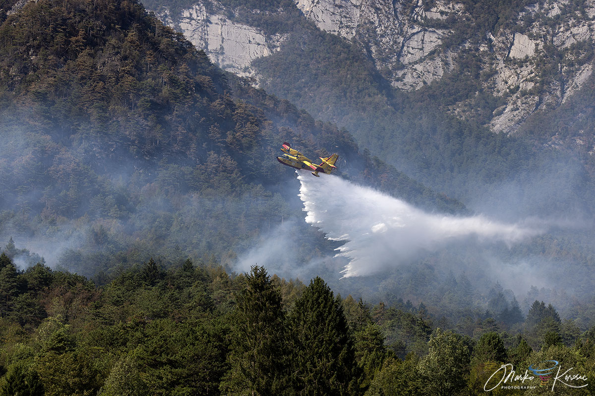
Monte Amariana (1,905 meters) presents a unique set of challenges for fire management. The peak is defined by sheer vertical limestone cliffs and a complex karst landscape. These geographical features essentially created a "chimney effect," where heat and fire were funneled rapidly upward through narrow gullies and heavily wooded slopes.
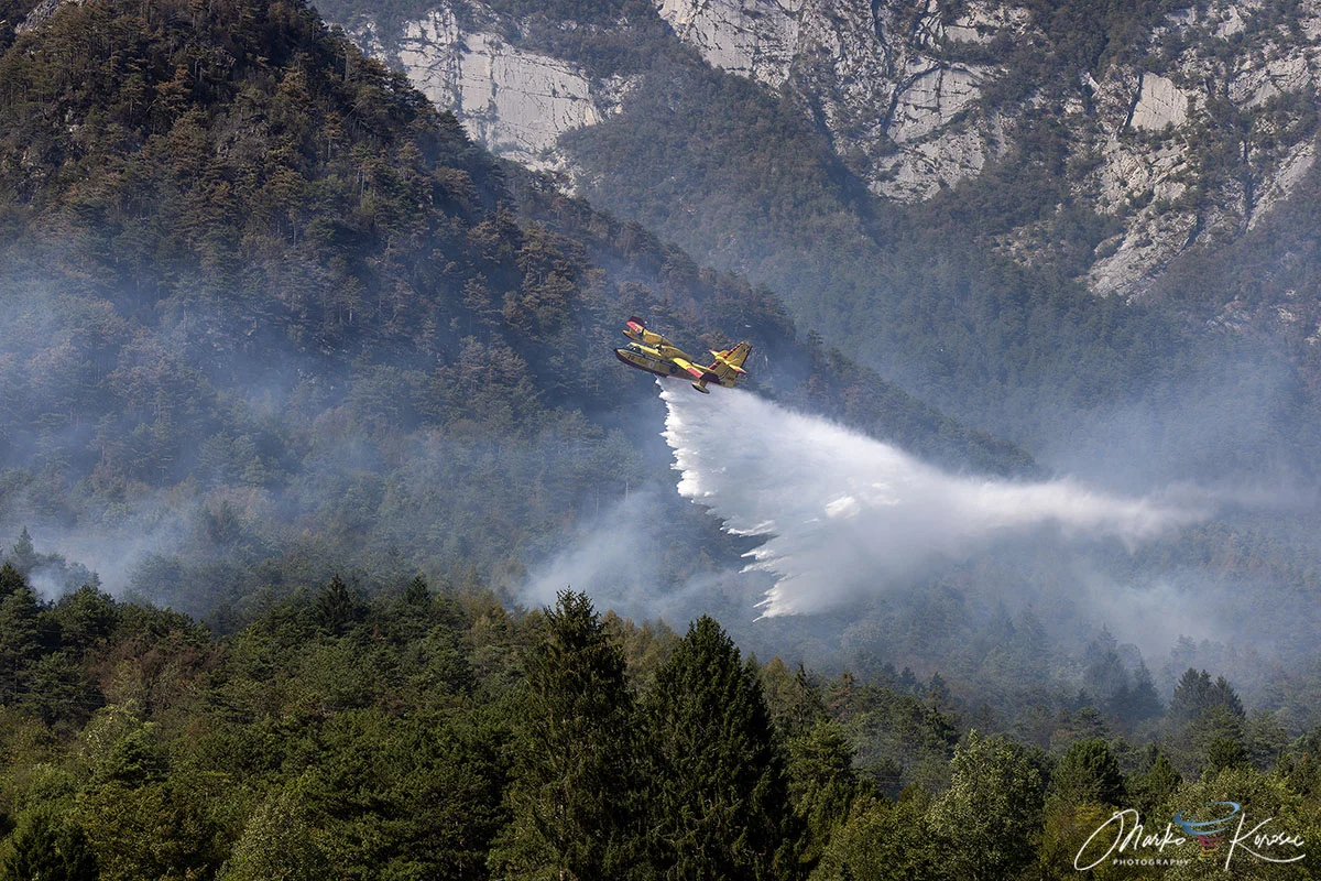
The terrain meant that ground-based firefighters, including teams from the Corpo Forestale Regionale and the Vigili del Fuoco, were often unable to reach the primary active fronts. The forest floor, carpeted in dry pine needles and brushwood, acted as a high-octane accelerant, allowing the fire to spread with a speed that startled even seasoned regional responders. Consequently, the strategy shifted to a reliance on massive aerial bombardment, targeting the ridges to create firebreaks that could starve the blaze of fuel.
An International Aerial Task Force
The scale of the threat necessitated an unprecedented mobilization of resources. Italian authorities coordinated a multi-national aerial task force to protect the vulnerable districts of Tolmezzo and Amaro.
The Aerial Arsenal
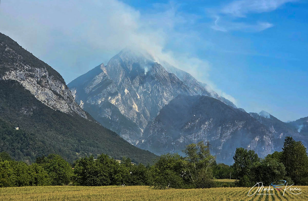
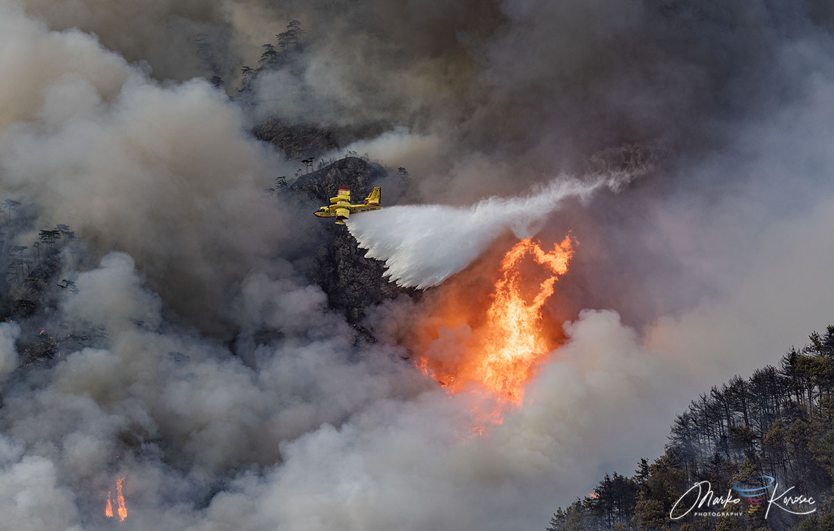
- Canadair Fleet: Italy’s iconic yellow firefighting aircraft conducted hundreds of precision drops, skimming the nearby reservoirs and the Adriatic Sea to replenish water supplies.
- Slovenian Support: Demonstrating the importance of regional solidarity, Slovenian Air Tractor water bombers were deployed to support the Italian fleet. These smaller, highly maneuverable aircraft were essential for navigating the tight gaps in the mountainous terrain.
- Regional Helicopters: Multiple helicopters were utilized for tactical water drops and for transporting ground crews to strategic positions that were otherwise inaccessible by foot.
While the aircraft battled from above, ground crews performed the essential work of "mopping up" the perimeters, cutting fire lines, and ensuring that no secondary ignitions threatened the homes below. Power lines serving the area were deactivated as a precautionary measure to prevent further ignitions or hazards to the aerial teams.
The Role of Drought and Climate Context
The severity of the Monte Amariana fire cannot be viewed in isolation. It was the culmination of a summer marked by significant rainfall deficits across the Friuli-Venezia Giulia region.
Data from the preceding months indicated that the soil moisture levels in the Carnia region had dropped to critical lows. When the heat dome arrived in mid-August, it exacerbated these conditions, ensuring that the forest was primed for a high-intensity fire event. The lack of precipitation meant that the natural humidity that usually protects Alpine ecosystems was absent, allowing the fire to burn through the night and sustain itself across days of high temperatures.
The Turning Point: Atmospheric Relief
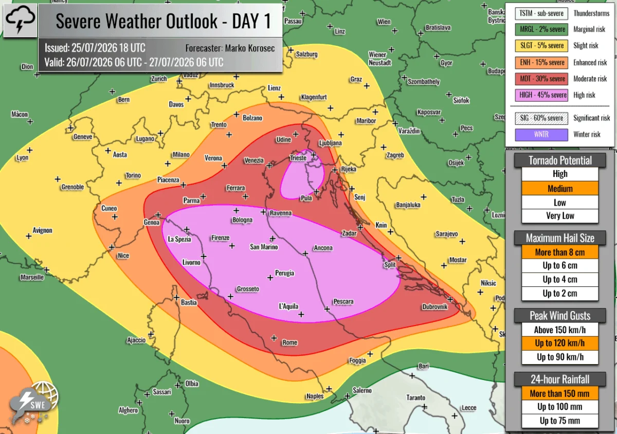
The final containment of the wildfire was as much a victory for meteorology as it was for the firefighting crews. After ten days of near-constant battle, the forecast finally shifted. Between August 20th and 22nd, a robust frontal system moved over northeastern Italy.
The change was dramatic. Over 150 to 200 mm of rain fell within a 72-hour window. This deluge acted as the final blow to the remaining hotspots, soaking the scorched forest floor and effectively extinguishing the fire’s potential to reignite. As the smoke cleared, the regional authorities transitioned from emergency response to recovery and monitoring. Thermal-imaging drones have been deployed to scan the mountain for any residual hotspots that might be lurking beneath the surface of the charred debris.
Implications for Future Forest Management
The events on Monte Amariana have prompted a wider discussion regarding fire preparedness in the Southern Alps. Experts note that as weather patterns become more extreme, the traditional Alpine forests—long considered less vulnerable to wildfire than Mediterranean scrubland—may face increased risks.
Lessons Learned:
- Technological Integration: The success of thermal drone monitoring post-fire highlights the shift toward high-tech surveillance as a standard component of wildfire management.
- Cross-Border Cooperation: The deployment of Slovenian aircraft alongside Italian forces underscores the necessity of international agreements in tackling large-scale environmental disasters that ignore political boundaries.
- Infrastructure Resilience: The threat to the Pissebus hamlet serves as a stark reminder of the need for "defensible space" planning in residential areas located near high-risk forest zones.
While the mountain is now silent and the air quality across the Tagliamento valley is recovering, the scars on the landscape of Monte Amariana remain a poignant reminder of the fragility of the Alpine environment. The 2026 fire season in Friuli-Venezia Giulia will be remembered as a summer where a community stood on the precipice of disaster and, through coordination and the eventual mercy of the weather, managed to pull back.
Data and imagery for this report were provided by the specialized monitoring services of PivotalWeather and WXcharts, with technical support from regional meteorological stations.