As the Northern Hemisphere transitions toward the colder months, meteorologists and climate scientists are turning their attention to the stratosphere—specifically, the state of the Polar Vortex. Emerging long-range data for Winter 2026/2027 indicates a high probability of a significant weakening of this critical atmospheric circulation. With a "Super El Niño" event brewing alongside peculiar Arctic sea-ice anomalies, the stage is set for a highly dynamic winter season across the United States, Canada, and Europe.
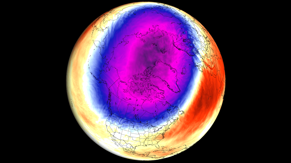
The Mechanics of the Polar Vortex: A Global Gatekeeper
To understand the stakes, one must first understand the structure of the Polar Vortex. It is not a single storm system, but rather a massive, persistent, and large-scale cyclone that encircles the North Pole. Existing in both the troposphere (where our weather happens) and the stratosphere (the layer above), it acts as a "polar wall."
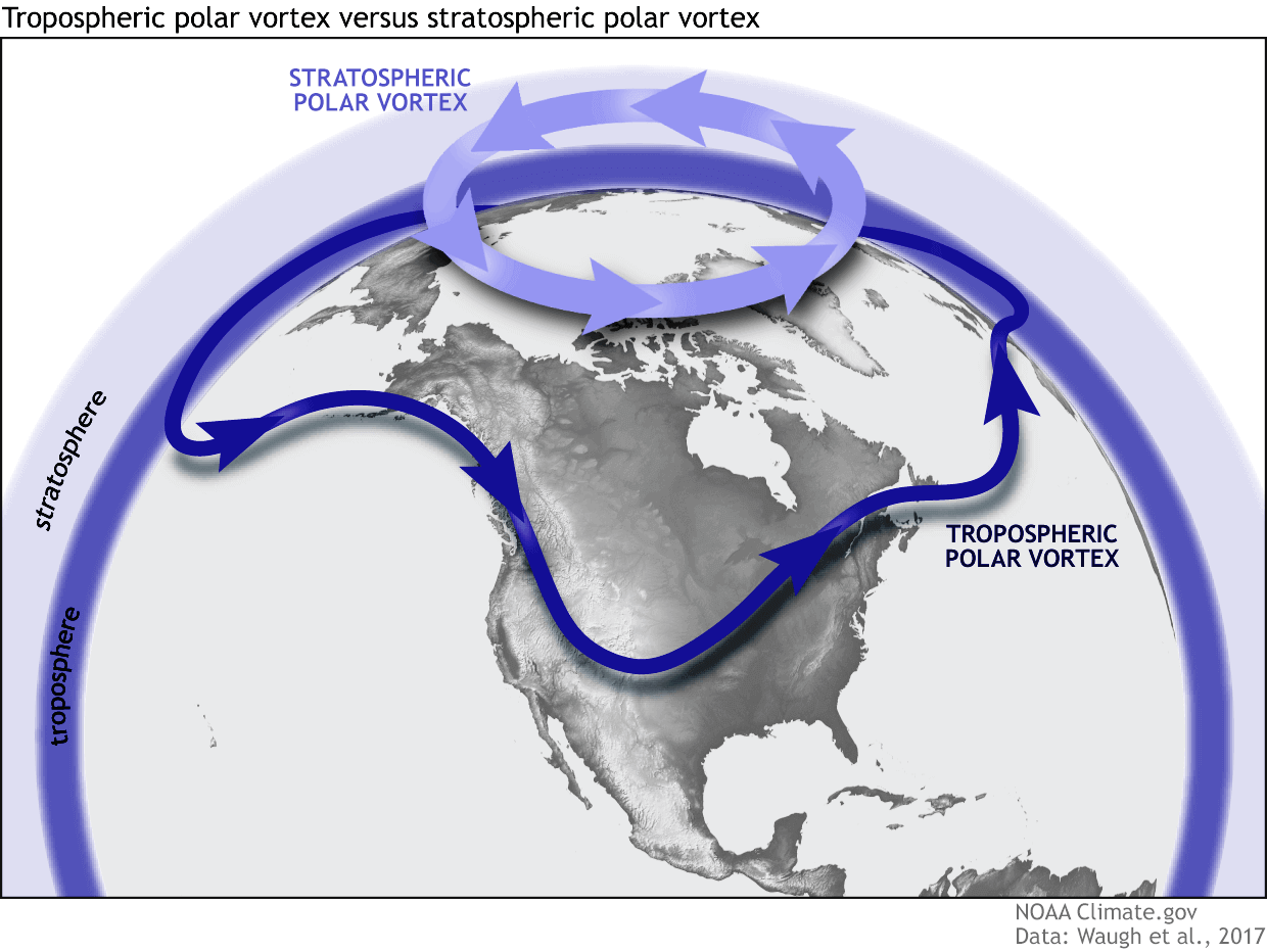
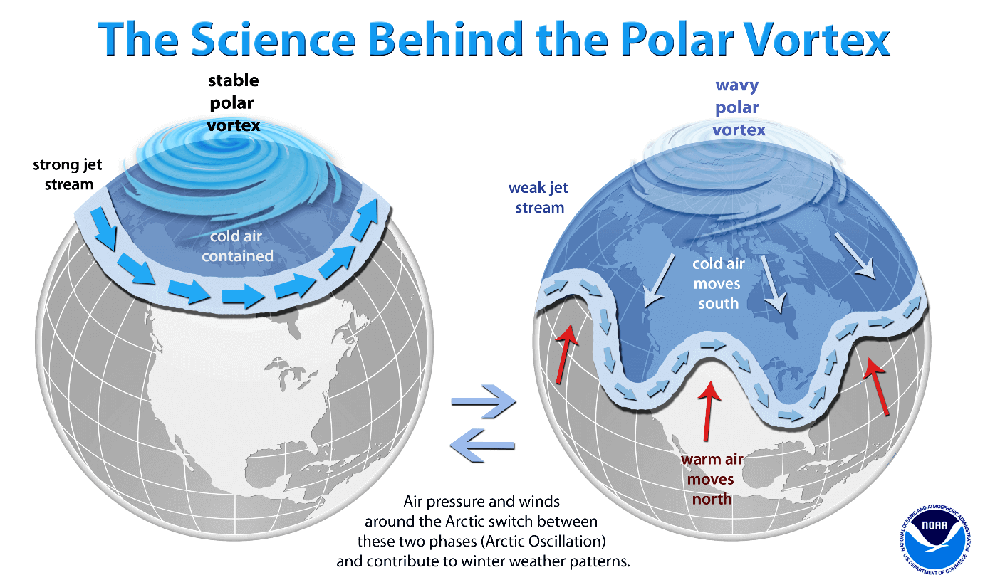
When the vortex is stable, it functions as a containment vessel, locking frigid, Arctic air within the polar circle. During these times, the mid-latitudes—including the densely populated regions of North America and Eurasia—experience relatively milder winter conditions. However, when the vortex is disrupted or collapses, that "wall" breaks down. The result is a chaotic release of extreme cold, known as an Arctic outbreak, which cascades southward into the mid-latitudes, bringing sudden freezes, intense snowstorms, and deep-winter volatility.
Chronology of Emerging Signals: Why 2026/2027 is Unique
The current meteorological outlook is defined by a "trinity" of global climate drivers that are converging to exert pressure on the vortex:
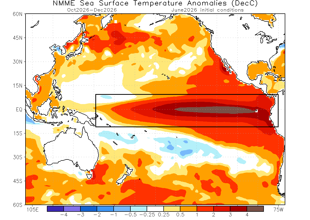
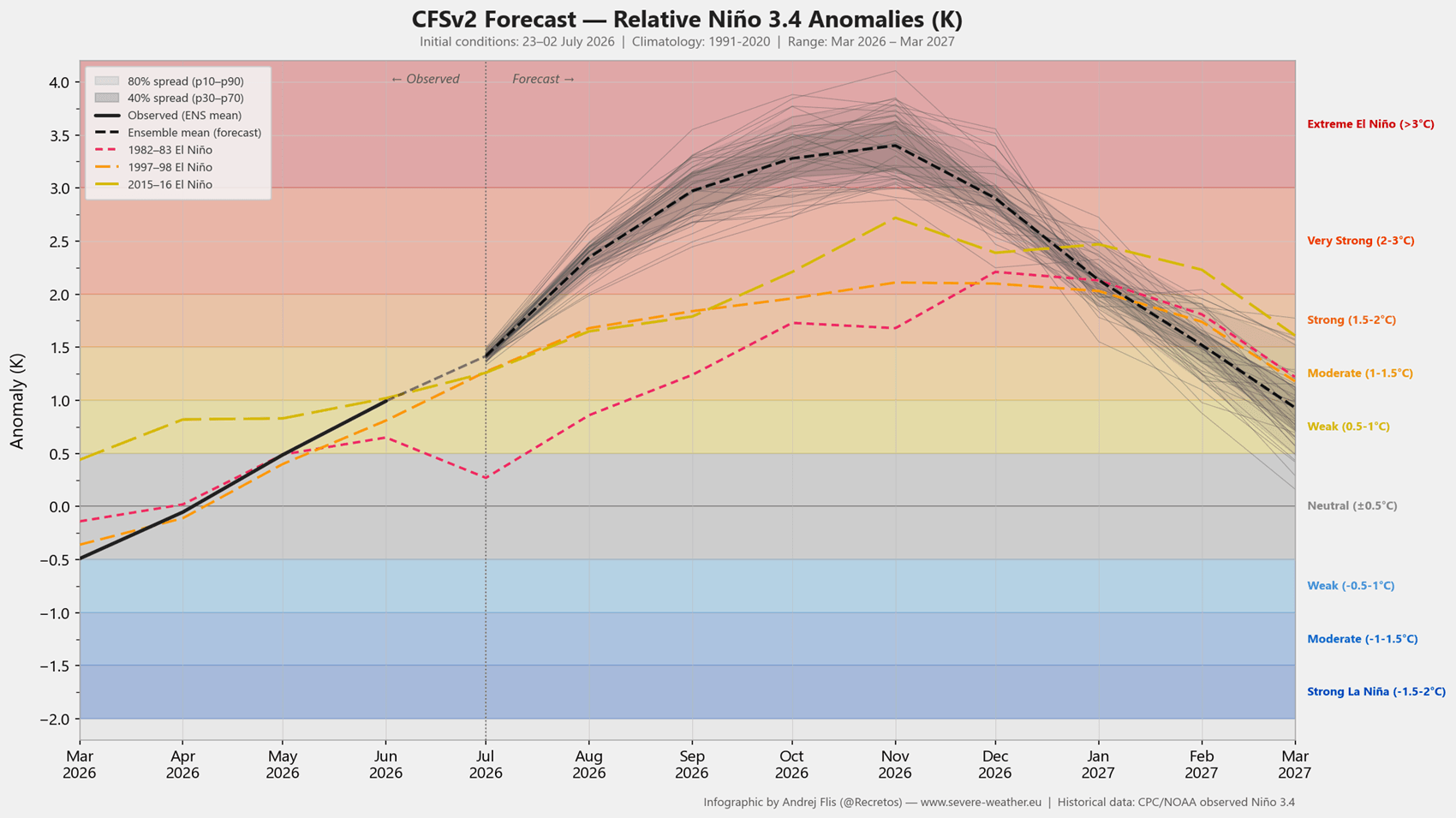
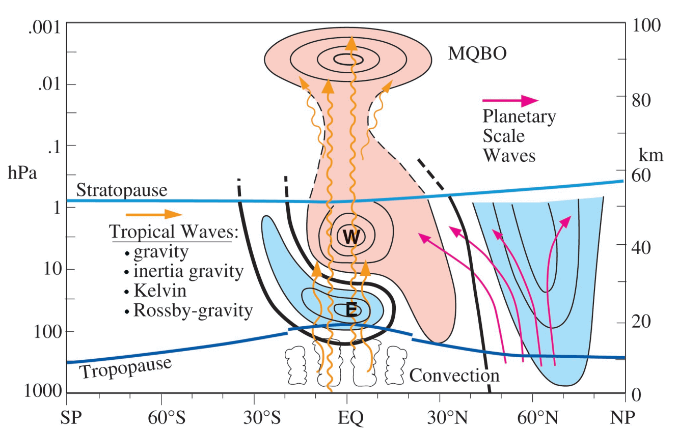
- The Super El Niño: The Pacific Ocean is currently undergoing one of the most significant El Niño phases in decades. Forecast models, including the NMME and NCEP CFSv2, suggest that equatorial sea-surface temperatures could exceed 4°C above normal. This creates planetary-scale pressure waves that propagate upward into the stratosphere, effectively "poking" the vortex and destabilizing its rotation.
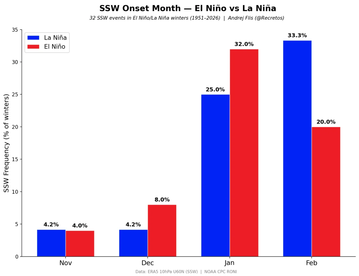
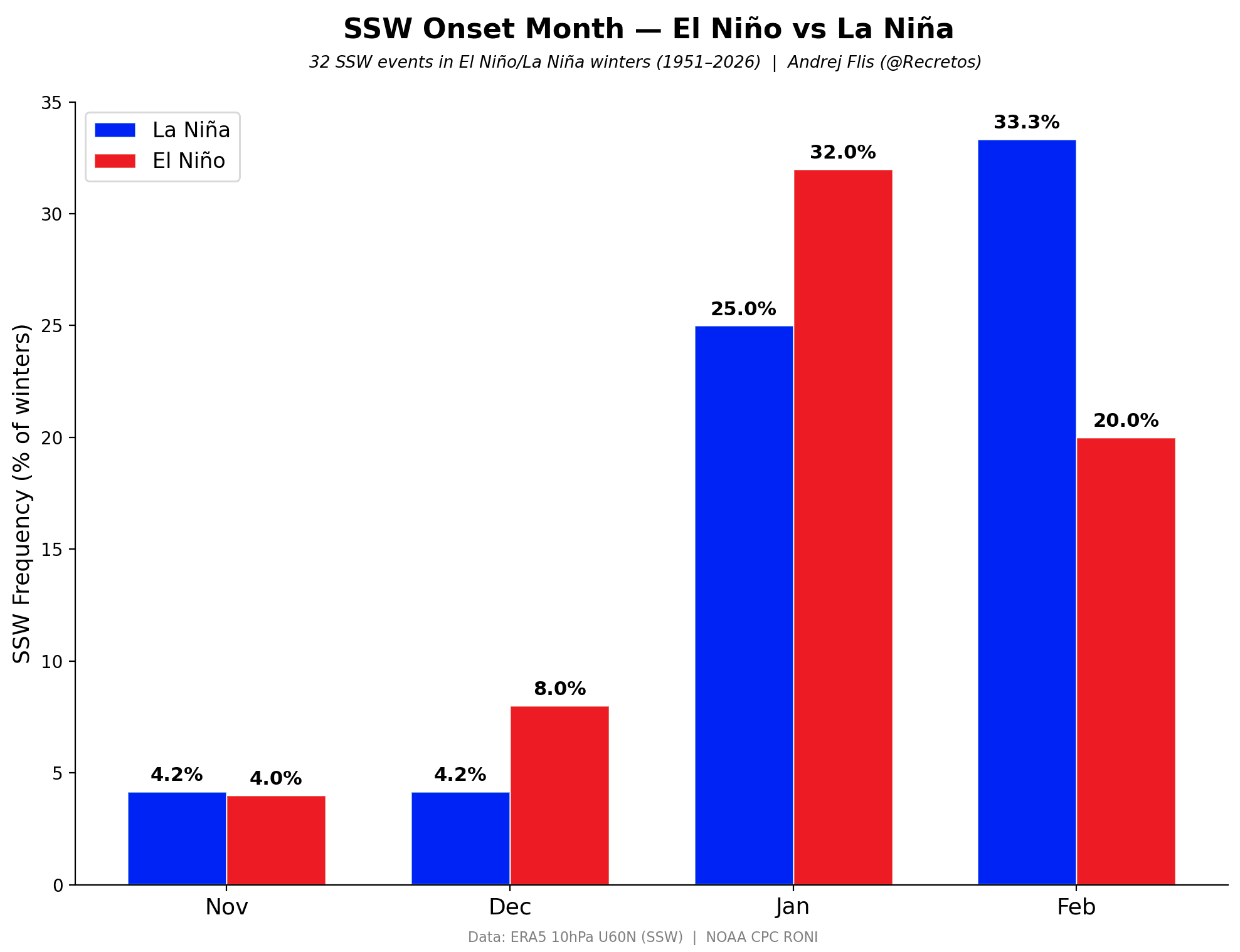
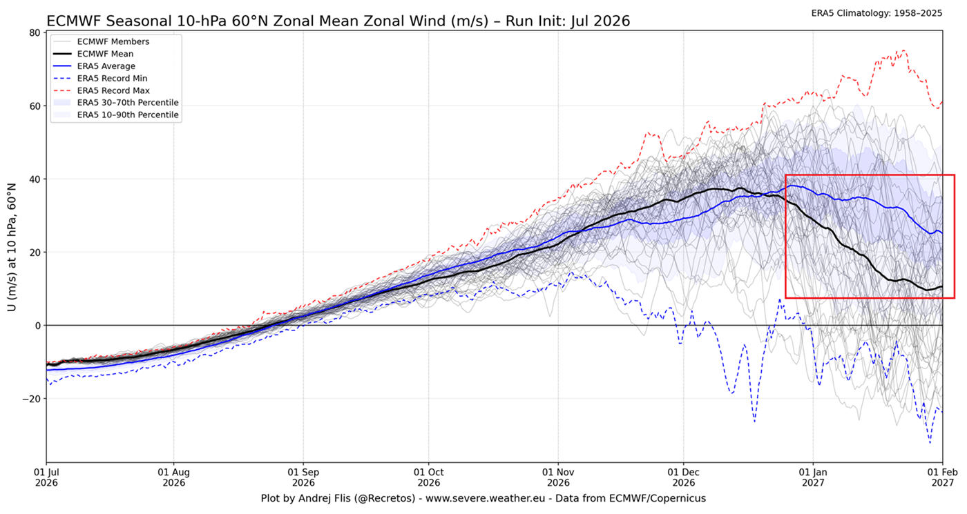
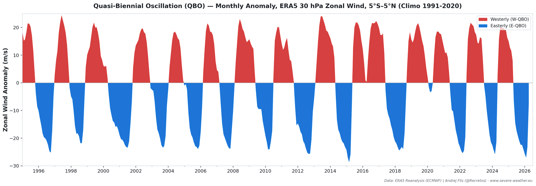
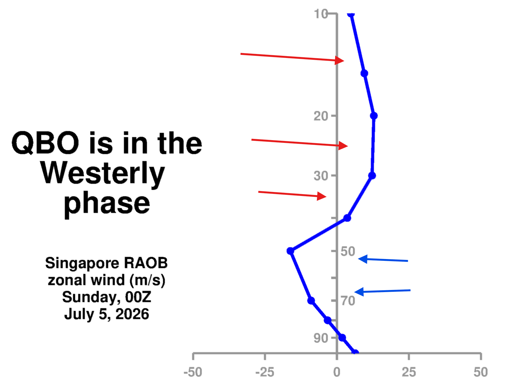
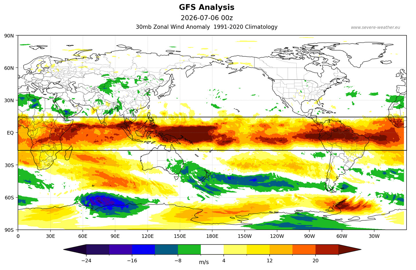
- The Quasi-Biennial Oscillation (QBO): The "heartbeat of the atmosphere," or the QBO, is currently in a westerly phase. While a westerly QBO can sometimes stabilize the vortex, the interaction with a Super El Niño creates a complex interference pattern. Historical data suggests that the combination of these two factors often leads to mid-winter structural fatigue in the vortex, particularly during the January window.
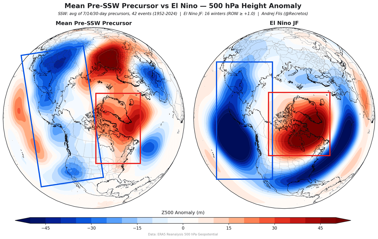
- Arctic Sea-Ice Deficits: The Barents and Kara Seas are currently showing record-low ice levels. This loss of ice is not merely a symptom of a warming climate but a causal driver of weather. Reduced ice cover alters the energy balance at the surface, which triggers Rossby waves—large-scale meanders in the jet stream—that transport heat into the stratosphere, further weakening the vortex.
Supporting Data and Model Analysis
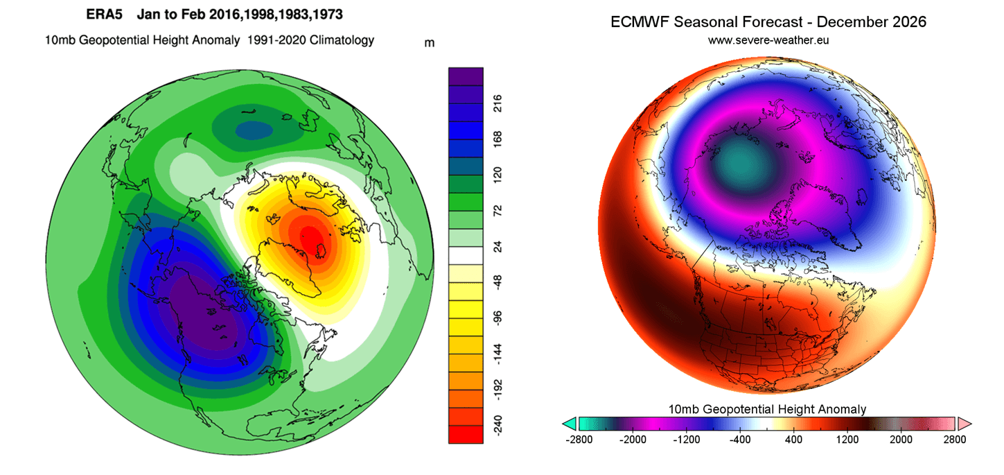
The latest seasonal forecast from the European Centre for Medium-Range Weather Forecasts (ECMWF) provides the most compelling evidence for a January disruption. Ensemble runs show a sharp downward trend in the zonal wind speed at the 10mb level (the stratospheric "belt" that measures vortex strength). When this wind speed drops, it is a clear proxy for a weakened circulation.
Data analysis of past "Super El Niño" winters confirms that these events have a statistically higher frequency of Sudden Stratospheric Warming (SSW). An SSW event occurs when the stratosphere rapidly warms, causing the Polar Vortex to deform, displace, or even split into "daughter" vortices. The current modeling for December 2026 shows a building high-pressure anomaly around the core of the vortex, a precursor to a potential structural split similar to the events seen in early 2026.
Implications for Global Weather Patterns
If the anticipated disruption occurs, the implications for the public and infrastructure are profound. A collapsed vortex does not mean the entire Northern Hemisphere freezes simultaneously; rather, it creates "winners and losers" in the lottery of winter weather.
The "Polar Express" Effect
Following a disruption, the jet stream often becomes erratic. We typically observe:
- North America: The central and eastern United States, along with southern Canada, become prime candidates for extreme cold outbreaks. As the vortex core shifts southward, it can park itself over the continent, turning the "Polar Express" on and delivering sustained sub-zero temperatures.
- Europe: Northern and central Europe often face similar risks. When the "polar wall" fails, the typical Atlantic westerlies that keep Europe mild are replaced by biting easterly winds pulling directly from the Russian Arctic.
- Snowfall Anomalies: Research into post-SSW events shows a statistically significant increase in snow depth across the Midwest and Eastern Seaboard of the U.S., as well as across large swaths of Europe. The moisture-rich air colliding with the sudden influx of polar air creates the perfect recipe for heavy, disruptive snowfall.
Official Perspectives and Scientific Consensus
While private and governmental weather agencies are cautious about labeling a "guaranteed" event, the consensus among climate researchers is that the background state of the planet is currently biased toward a "leaky" vortex. Organizations like NOAA and NASA have noted that the coupling between the troposphere and stratosphere is more sensitive during Super El Niño years.
The primary challenge remains the lead time. While the "ingredients" for a collapse are clearly present in the long-range climate models, the exact timing of a "Sudden Stratospheric Warming" event remains notoriously difficult to predict beyond a 14-to-21-day window. Consequently, meteorological agencies are keeping a close watch on the "wave energy" levels rising from the troposphere, as these waves act as the primary trigger for the vortex to destabilize.
Preparing for a Dynamic Winter
For the general public, the primary takeaway is the transition from a "predictable" winter to a "dynamic" one. A disrupted vortex often results in high-amplitude weather patterns—meaning that while we may see periods of unusual warmth, they are likely to be followed by violent, short-notice shifts to extreme cold.
Infrastructure managers, energy companies, and local governments are advised to monitor the progression of the QBO and the Barents-Kara sea ice extent as we approach the late autumn months. These indicators will provide the final "green light" for the probability of a major mid-winter collapse.
As we look toward January and February 2027, the data suggests that the Polar Vortex is under more stress than it has been in several years. Whether this results in a full-scale collapse or a prolonged period of instability, the outcome is clear: the winter of 2026/2027 is unlikely to be a quiet one. Residents across North America and Europe should be prepared for the possibility of volatile, high-impact weather as the atmosphere works to recalibrate itself against the backdrop of these significant global drivers.
Disclaimer: Long-range weather forecasting involves high levels of complexity and uncertainty. The trends discussed in this article are based on current ensemble models and historical climate correlations. Please continue to monitor local weather alerts and official meteorological services for localized, short-term updates as the winter season progresses.