June 26, 2026 — As the northern hemisphere settles into the heart of the summer season, meteorologists are monitoring a profound transition in global atmospheric circulation. Data emerging from the tropical Pacific confirms that a “Super El Niño” event is no longer a distant theoretical model; it is actively breaking into the atmosphere, signaling a significant shift in weather patterns that will likely define the remainder of 2026 and persist well into 2027.

This climatic phenomenon, characterized by an anomalous warming of equatorial Pacific waters, is currently manifesting through detectable changes in pressure and temperature across the United States and Canada. By comparing current anomalies against historical data from previous record-breaking Super El Niño events, experts are projecting a season defined by high-impact weather, from altered jet stream tracks to extreme regional temperature fluctuations.
The Pacific Wakes Up: Decoding the 2026 El Niño
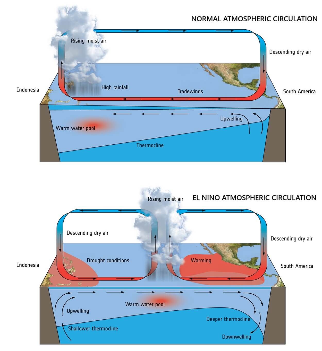
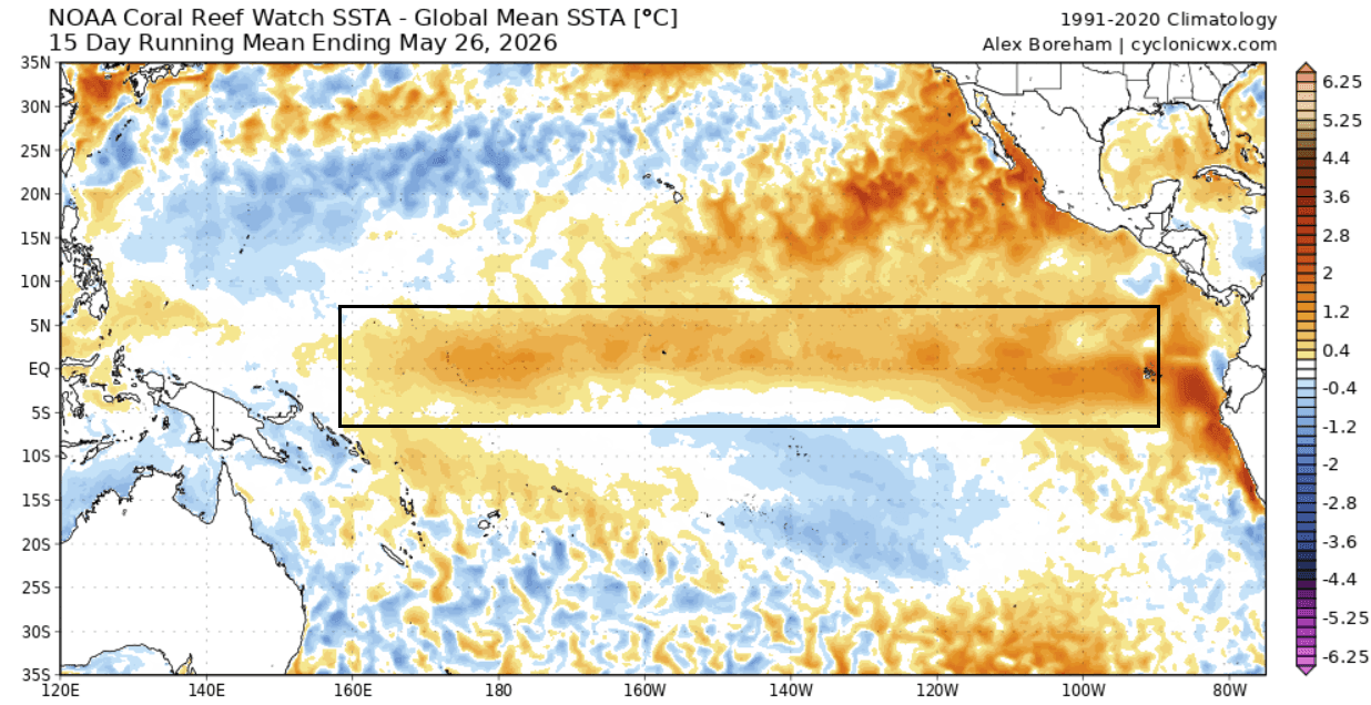
The El Niño-Southern Oscillation (ENSO) is a periodic fluctuation in sea surface temperatures and air pressure across the equatorial Pacific. In 2026, we have transitioned into a robust warm phase, which is acting as a primary driver for global weather systems.
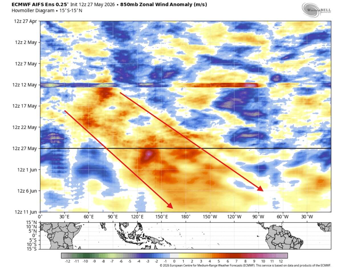
At the core of this transition is the "Walker Cell"—the complex system of atmospheric circulation in the tropics. During an El Niño, the Walker Cell is disrupted, creating an “atmospheric bridge” that transmits Pacific-based energy into the mid-latitudes. This bridge is currently being strengthened by westerly wind bursts. These bursts push warmer subsurface ocean waters—historically known as Kelvin Waves—toward the surface. As these waves rise, they alter the sea surface temperature (SST) profile, creating a massive, self-reinforcing loop that intensifies the warming signal.
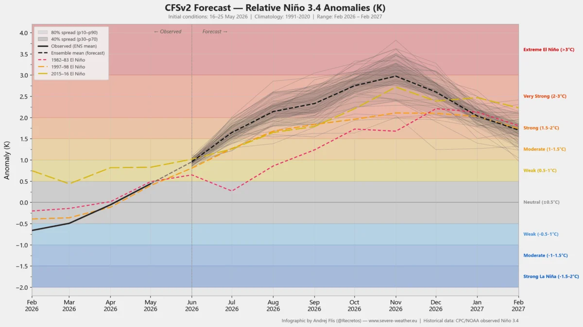
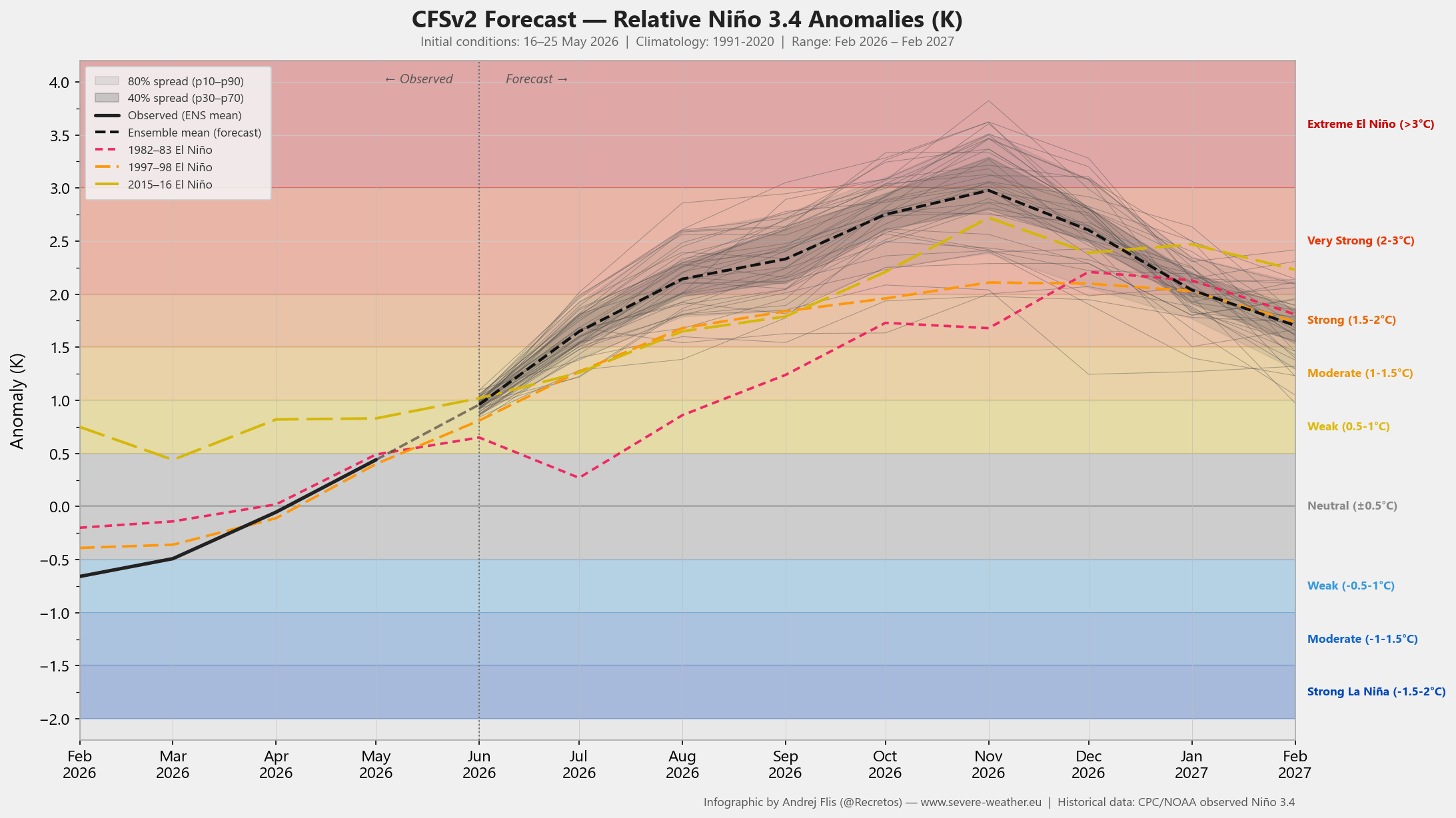
Recent analysis from the NCEP CFSv2 model suggests that this event is tracking toward a “Super” classification, with anomalies potentially exceeding +2.0°C. Long-range forecasts extending through November 2026 suggest that the intensity of this warming could rival, or even surpass, the most significant events on record, potentially reaching anomalies as high as +4.5°C in the eastern Pacific.
Chronology of the 2026 Development
The evolution of this event has been rapid and follows a distinct, predictable progression:
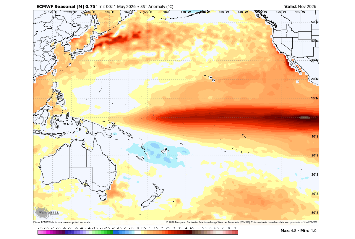
- Spring 2026: Initial signs of a weakening trade wind regime were detected, coupled with the slow but steady migration of warm water from the subsurface to the surface of the central Pacific.
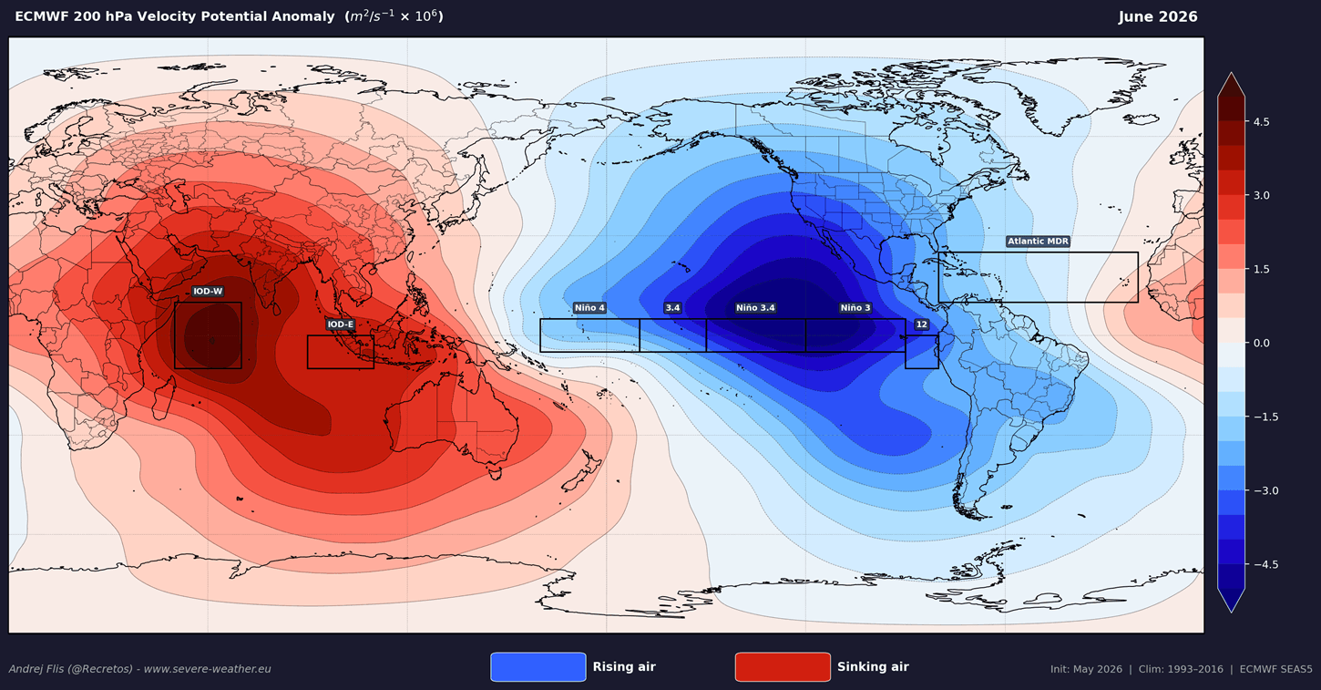
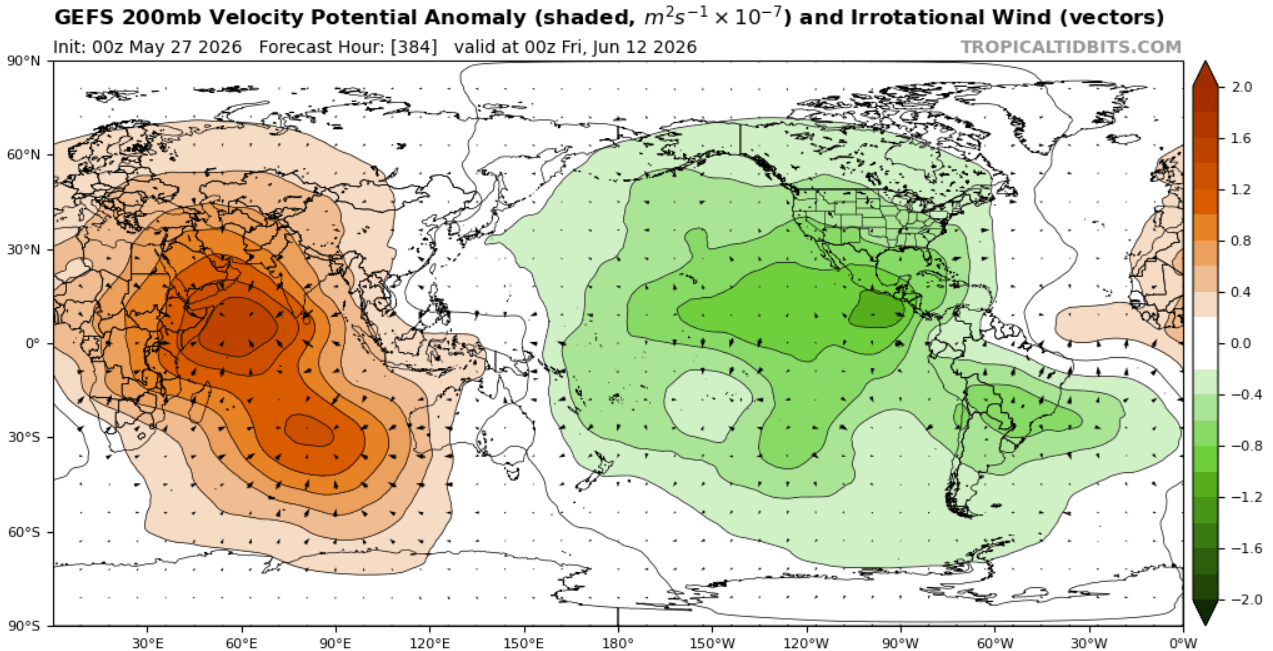
- Early June 2026: Atmospheric “velocity potential” data began to show a clear divergence: rising air over the central and eastern Pacific and sinking air over the Indian Ocean. This “smoking gun” confirmed that the oceanic warming had successfully coupled with the atmosphere.
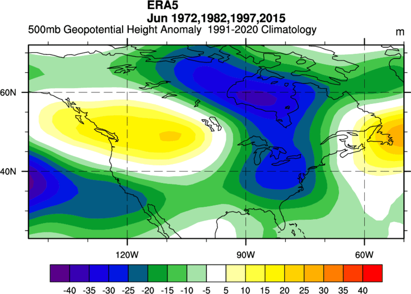
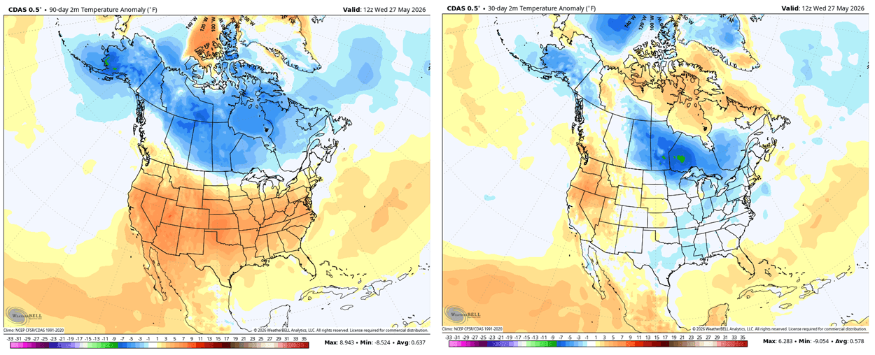
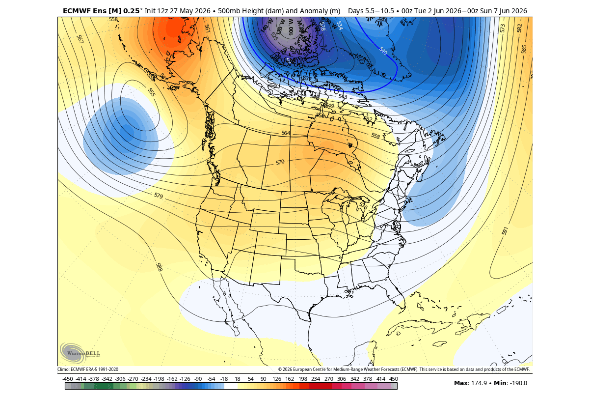
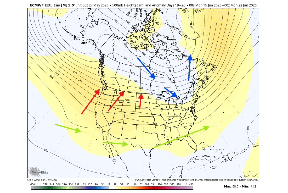
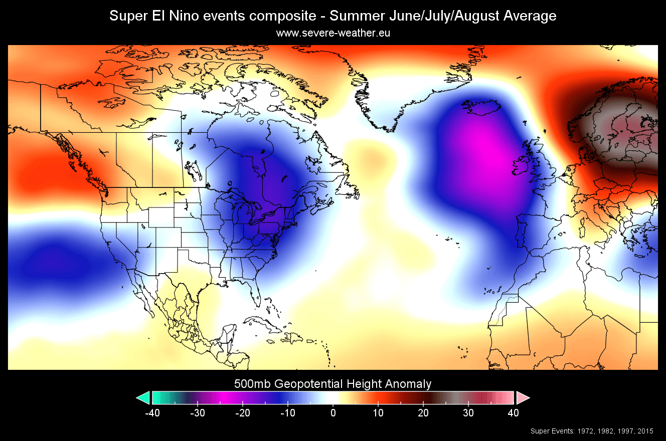
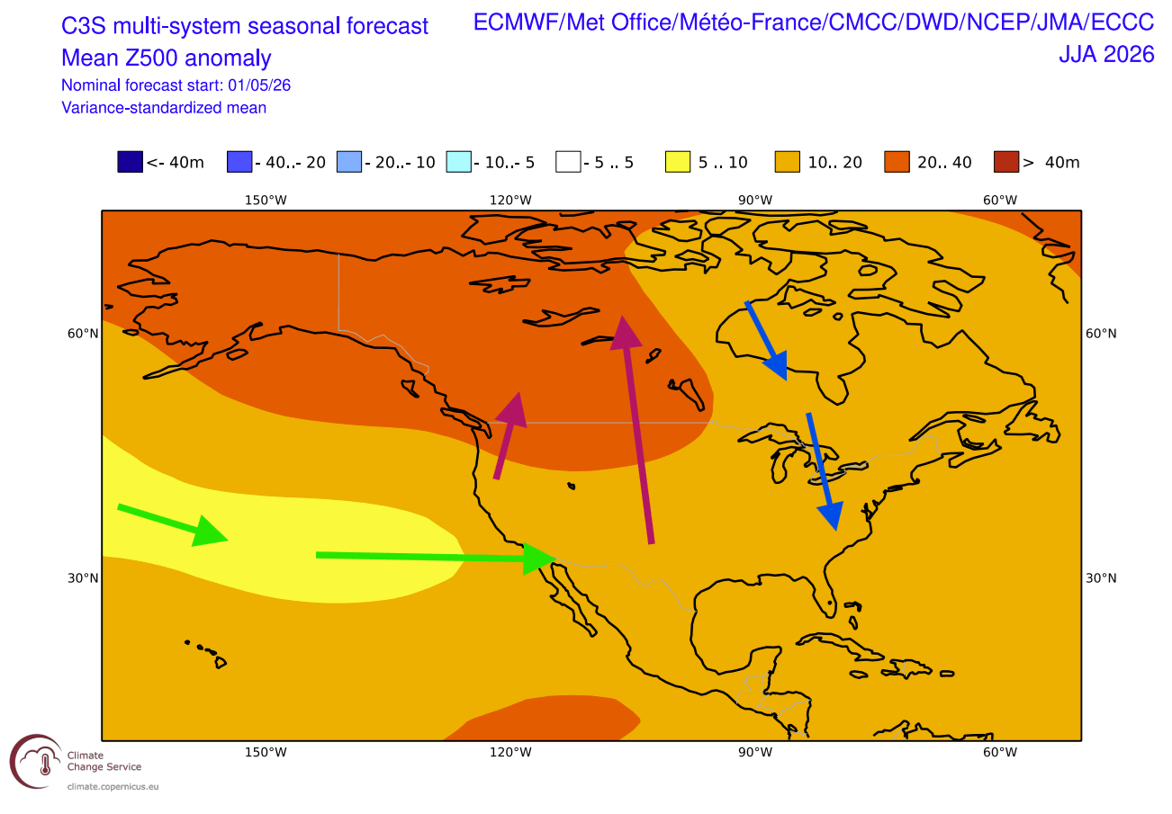
- Late June 2026: We are currently observing the formation of a high-pressure “heat dome” over the Pacific Northwest and northern United States, contrasting with a low-pressure anomaly over eastern Canada and the U.S. East Coast. This specific pressure configuration is the signature of a maturing Super El Niño.
Supporting Data and Meteorological Analysis
The scientific consensus on this event is built upon a synthesis of historical reanalysis and real-time ensemble forecasting. By mapping the current June weather patterns against the last four major Super El Niño events, meteorologists have identified a recurring atmospheric blueprint.
The Pressure and Temperature Signature
Historical reanalysis consistently shows that during the initial stages of a Super El Niño, North America experiences a specific pressure dichotomy. A persistent high-pressure region tends to establish itself over the northwestern U.S. and western Canada, while a low-pressure trough develops over the eastern seaboard and eastern Canada.
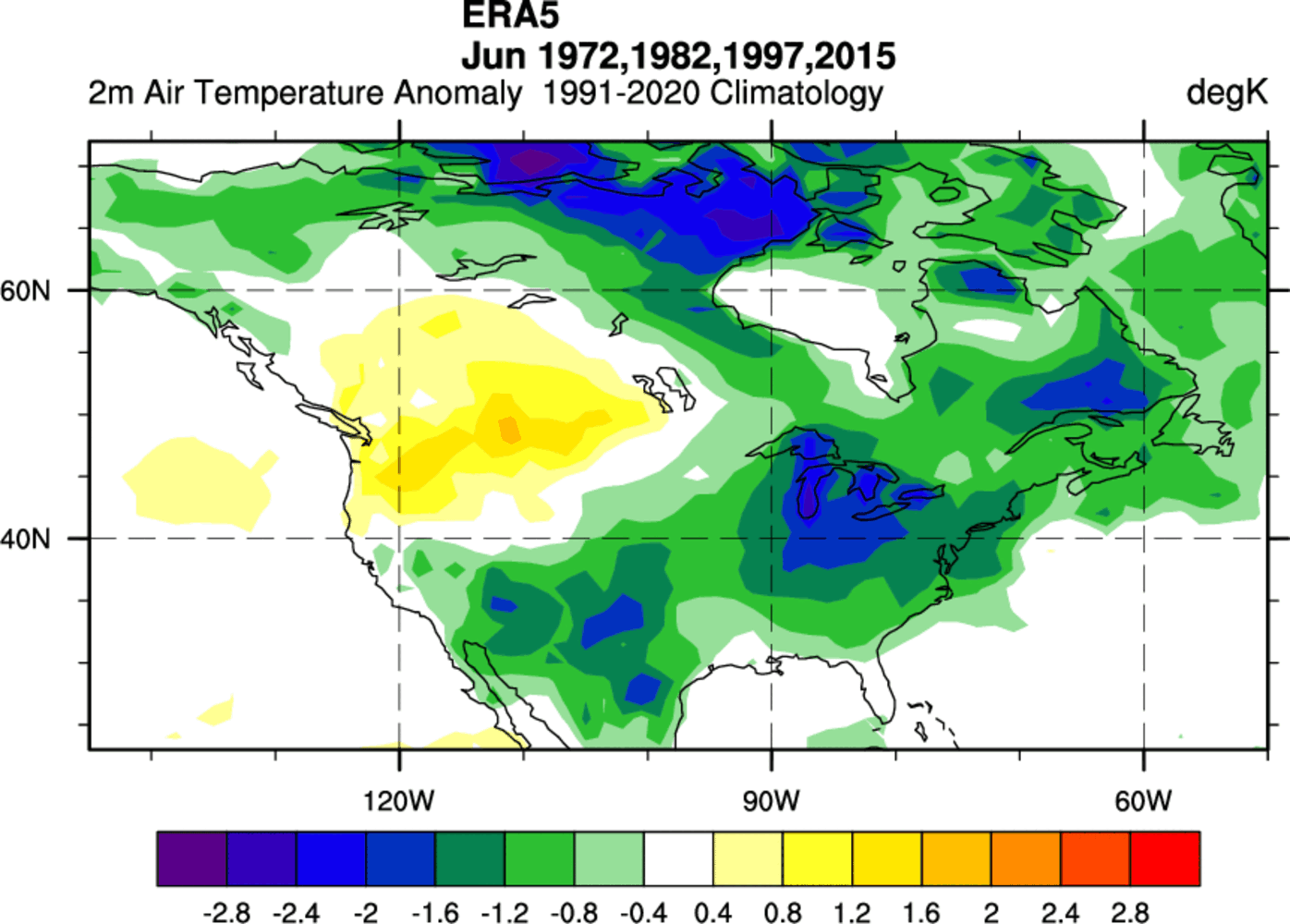
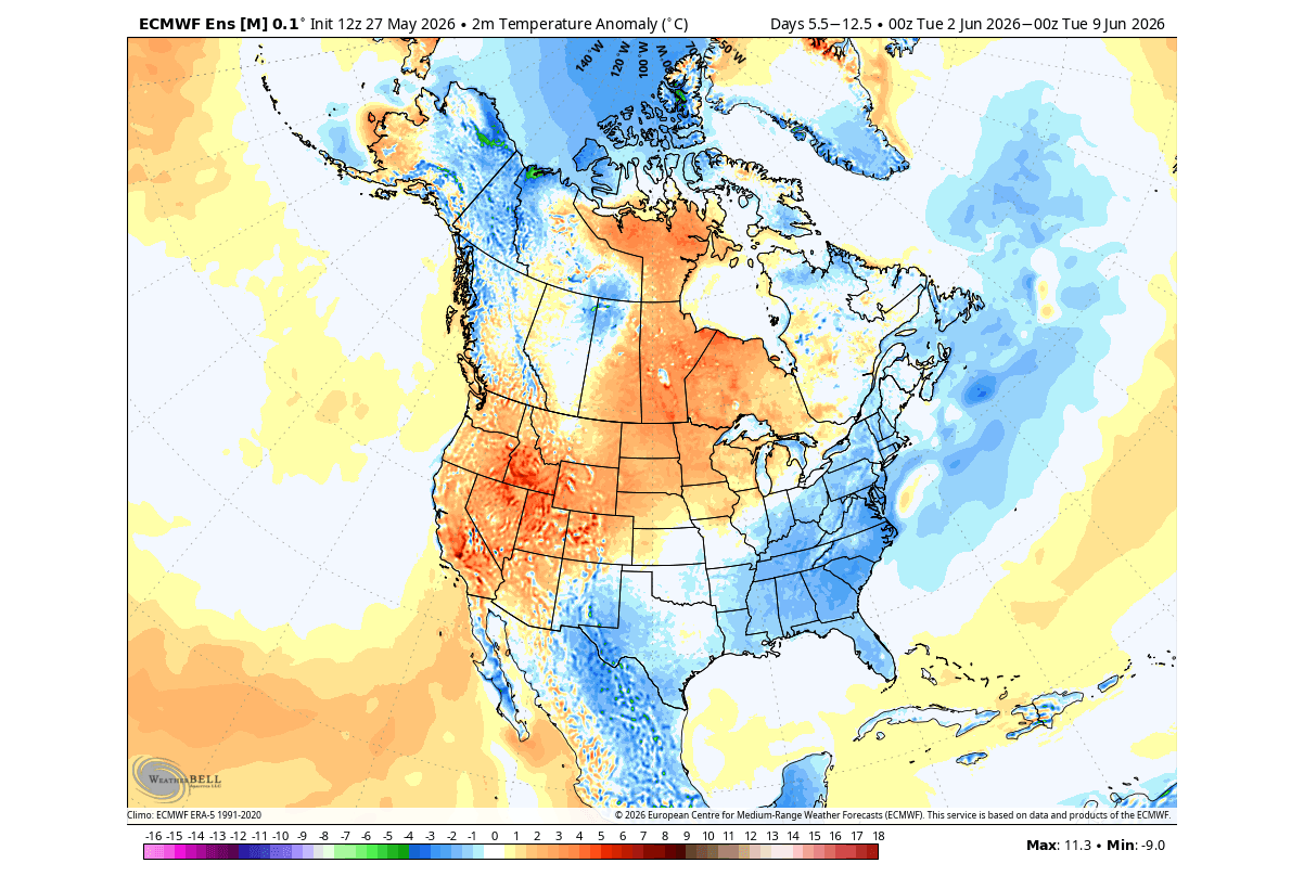
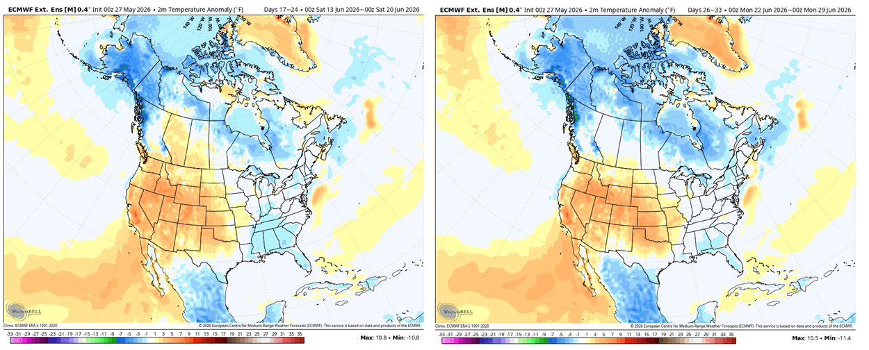
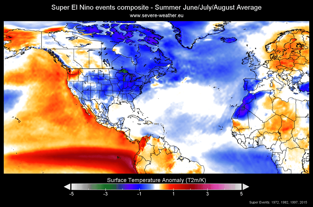
This pressure gradient forces a more northwesterly flow across the eastern half of the continent. Consequently, while the western and central U.S. face early-season heatwaves and drought-like conditions due to stagnant high pressure, the East Coast and parts of the Midwest are likely to experience more temperate conditions, or at least a mitigation of extreme heat, due to the low-pressure influence.
The Precipitation Variable
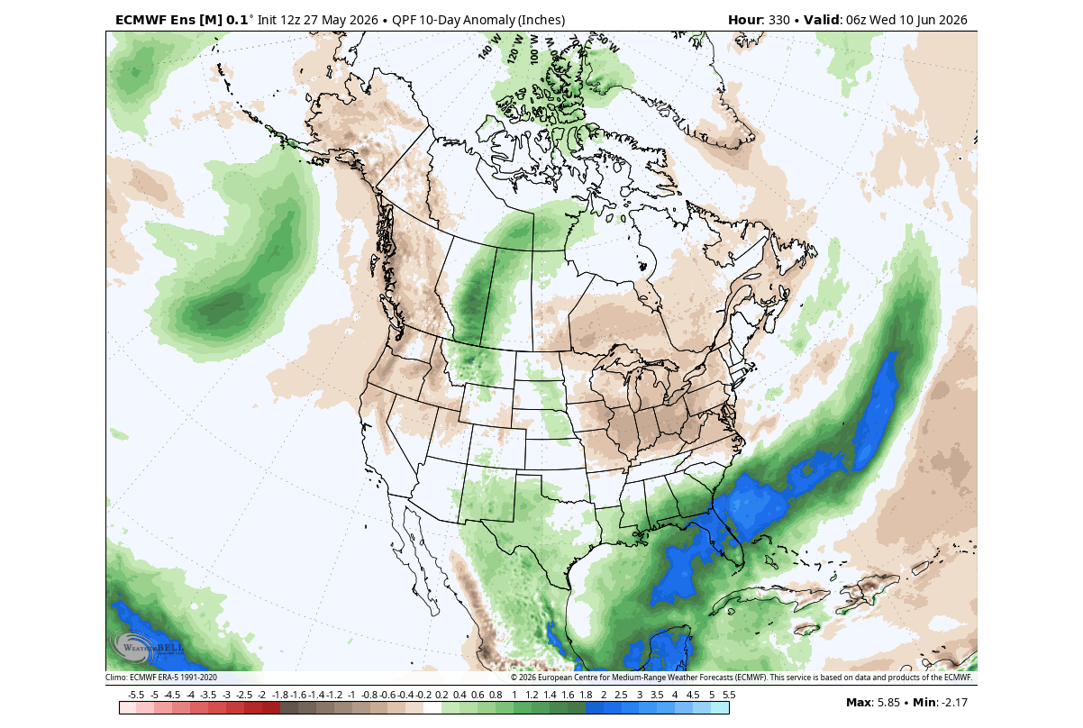
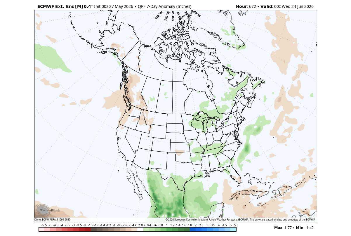
The Pacific jet stream, which typically carries moisture across the continent, is expected to become significantly more active and extended. This shift usually results in increased precipitation for the southern United States, particularly Florida and the Gulf Coast. Conversely, the high-pressure ridge dominating the western and central regions will likely act as a barrier to moisture, potentially leading to precipitation deficits in the corn belt and the Great Plains as the summer progresses.
Official Responses and Scientific Outlook
While official government agencies like the National Oceanic and Atmospheric Administration (NOAA) continue to synthesize data, the global meteorological community is increasingly aligned on the potential severity of the 2026 season.
Climate scientists warn that the “Super” designation is not merely a statistical benchmark; it is a forecast for volatility. Historical data indicates that the peak of such events often occurs in late autumn, meaning the atmospheric influence will intensify as we move toward the winter months. This implies that the current summer weather is only the prelude to a much broader reconfiguration of global climate zones.
The integration of Copernicus EU, ECMWF (European Centre for Medium-Range Weather Forecasts), and WeatherBell data suggests that the atmospheric coupling is now too strong to be reversed, ensuring that the 2026/2027 climate cycle will be dominated by this Pacific-driven energy.
Implications for North America
The implications of a Super El Niño are far-reaching and touch upon several critical sectors:
1. Agriculture and Resource Management
The expected rainfall anomalies are a double-edged sword. While the southern states may benefit from increased moisture, the drying trends predicted for the central U.S. pose a risk to mid-summer crop development. Farmers and water management agencies are being advised to prepare for potential irrigation challenges in the central and western regions, while the Southeast must remain vigilant against heavy rainfall and subsequent flooding.
2. The 2026 Hurricane Season
One of the most concerning implications of an El Niño is its impact on Atlantic hurricane activity. Typically, El Niño increases vertical wind shear across the tropical Atlantic, which acts as a deterrent to hurricane formation. However, a "Super" event introduces complex variables. While shear may be high, the unusually warm global ocean temperatures could provide enough latent heat to override these inhibitory factors, leading to an unpredictable and potentially volatile hurricane season.
3. Energy Consumption
The temperature trends—marked by severe heat in the West and more moderate, though unstable, conditions in the East—will have direct impacts on the power grid. A summer defined by persistent heat domes in the West will drive record-breaking demand for cooling energy, placing significant strain on utility infrastructure.
4. Long-Range Winter Outlook
Though it is early, the persistence of a Super El Niño often dictates the winter forecast. Historically, these events favor a split jet stream that keeps the northern tier of the U.S. and Canada milder, while the southern tier often experiences cooler, wetter winters. Should this pattern hold, it would represent a significant departure from the cold-driven winters seen in recent years, which were often dominated by the Polar Vortex.
Conclusion: Preparing for the New Normal
The 2026 summer season serves as a window into the power of the Pacific. As the El Niño signal continues to solidify, the atmospheric patterns currently being observed will become the baseline for the months to follow.
For the public and stakeholders alike, the message is one of vigilance. The historical alignment between current forecasts and past Super El Niño events suggests that we are entering a period of heightened weather activity. Whether it is the expansion of the Pacific jet stream, the shift in precipitation tracks, or the development of intense regional heat, the 2026 climate landscape is being rewritten by the warming of the Pacific.
As we move deeper into the summer, the "atmospheric bridge" will only strengthen, further cementing the influence of the Pacific on the North American continent. Staying informed through updated meteorological data and long-range seasonal outlooks will be essential for navigating the complexities of this record-breaking weather event.