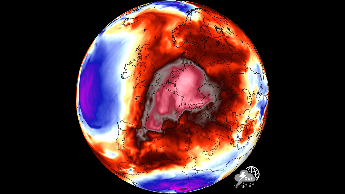
As September draws to a close, a powerful and anomalous weather phenomenon is set to redefine the transition into autumn across the European continent. A massive “Heat Dome”—a high-pressure system characterized by its ability to trap and compress hot air—is making a dramatic return. This meteorological event is poised to deliver unseasonably high temperatures, with anomalies stretching deep into early October, creating a sharp contrast between the sweltering heat of continental Europe and the stormy, cool conditions prevailing over the North Atlantic.
Main Facts: A Continental Thermal Surge
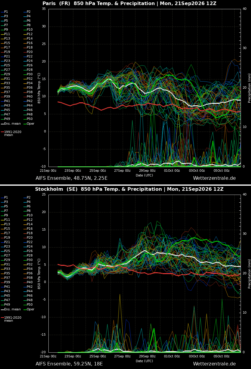
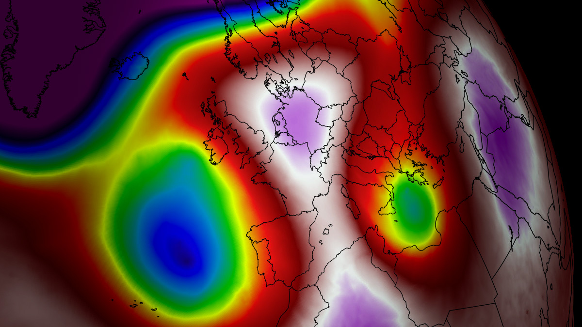
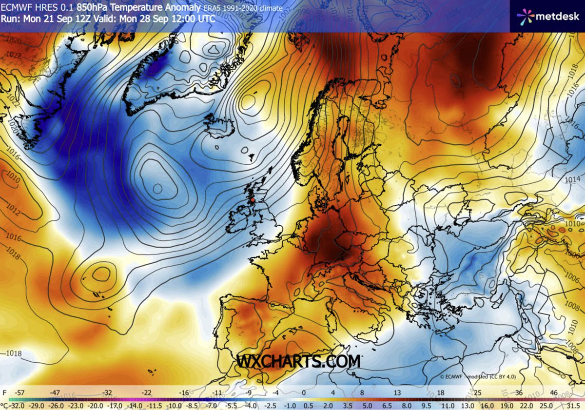
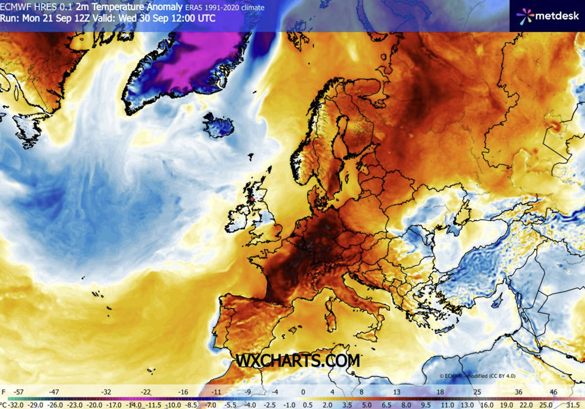
The current weather setup is driven by a powerful upper-level ridge building north from the Mediterranean and North Africa. This atmospheric engine is pushing a plume of tropical air deep into the heart of the continent. Meteorological data indicates that 850 hPa temperature anomalies—a standard metric for tracking heatwaves—will climb between 8°C and 12°C above long-term seasonal averages.
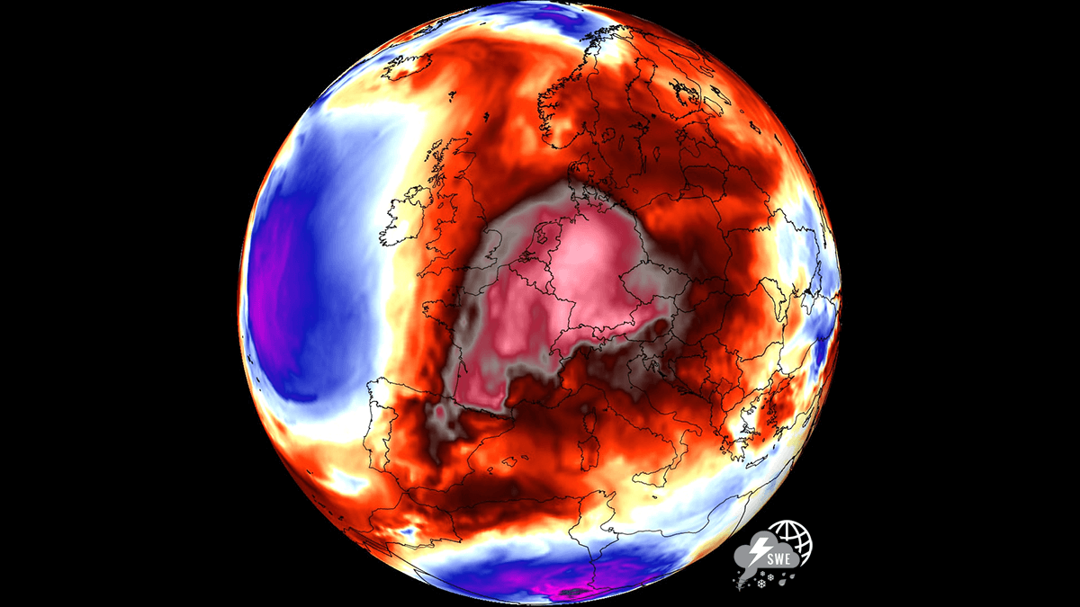
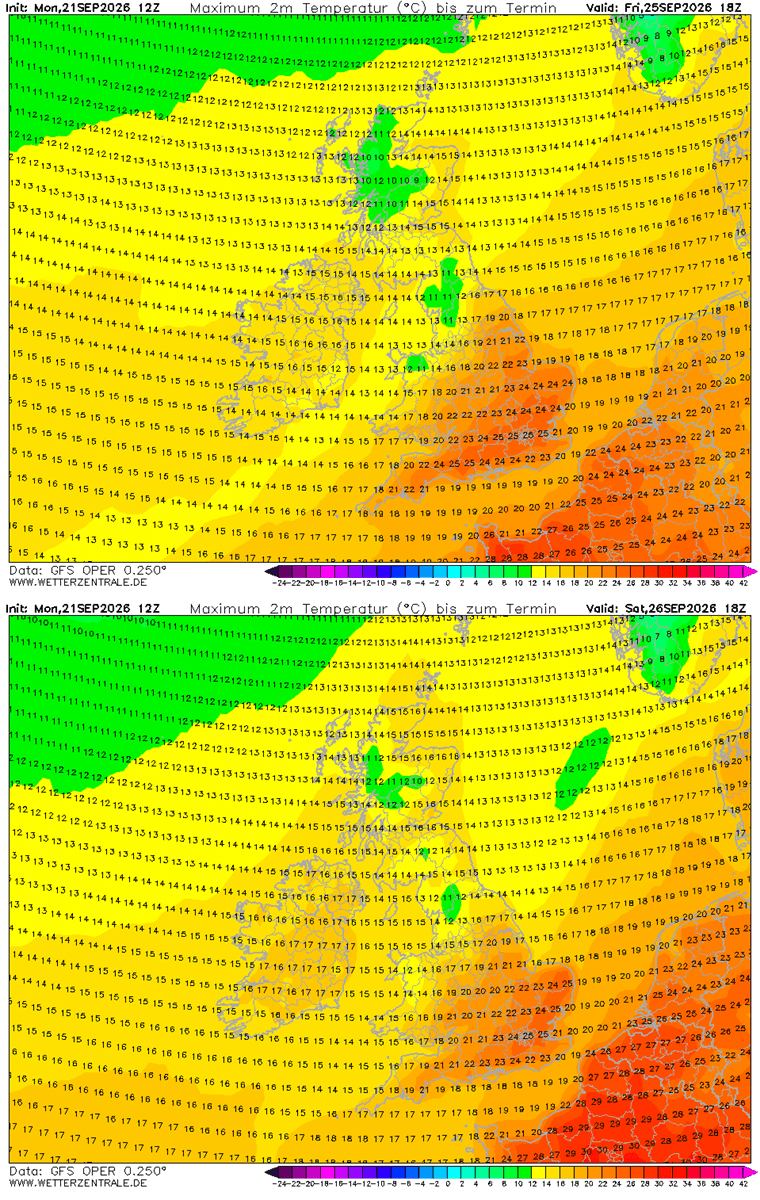
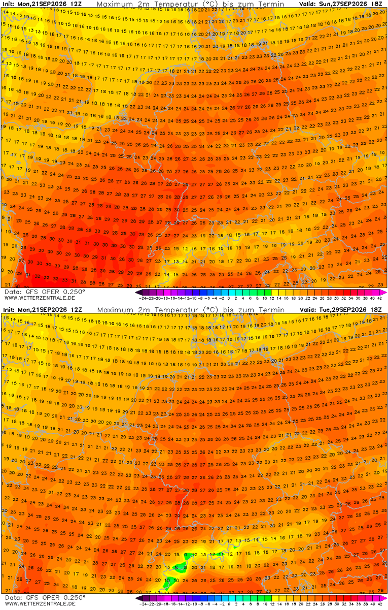
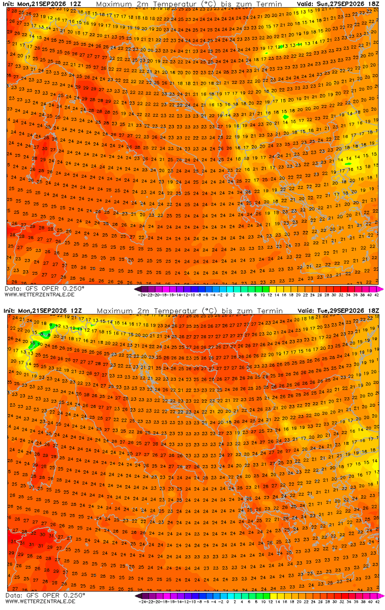
This is not a localized event; the heat will overspread vast portions of Western, Central, and Northern Europe. At the surface, this translates to afternoon temperatures pushing well into the upper 20s (°C), with several regions in the southwest expected to peak in the low 30s. For the final days of September and the opening week of October, these figures represent a significant departure from historical norms, challenging long-standing temperature records for the season.
Chronology of the Heat Event
The Setup (Late September)
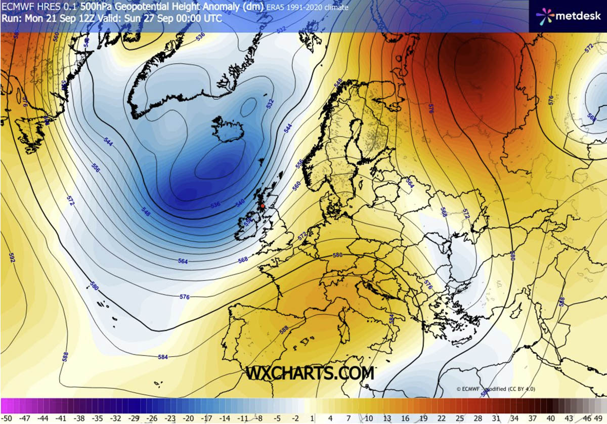
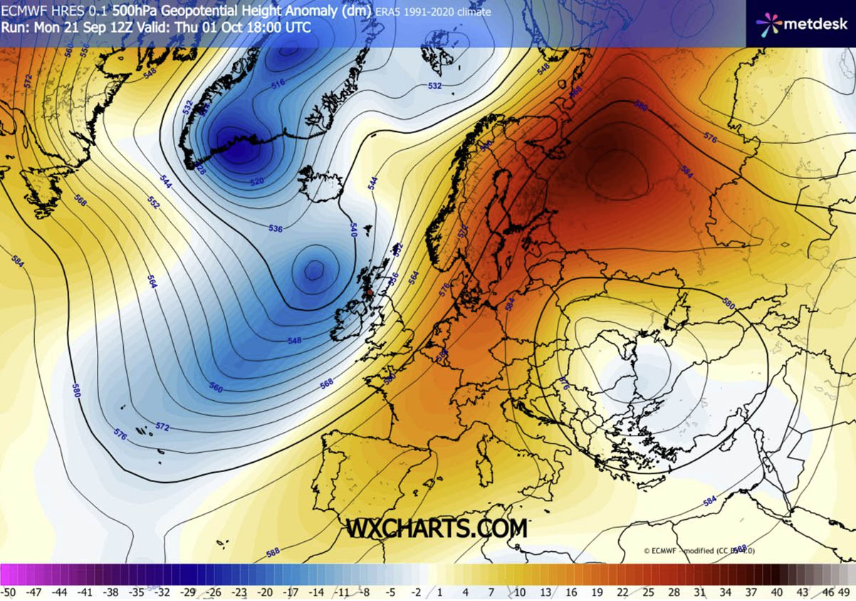
The primary driver of this event is a classic atmospheric dipole. A deep, high-amplitude trough has established itself over the North Atlantic, acting as a forcing mechanism that directs an intense southerly jet stream plume. This plume serves as a conveyor belt, transporting warm, tropical air from the Sahara and the Mediterranean toward the European interior. By late week, the heat dome will be firmly entrenched, with its core initially centered over the Iberian Peninsula and Southern France.
The Expansion (Weekend to Early October)
As the calendar turns to October, the blocking ridge will maintain its dominance. While Atlantic weather systems are typically expected to move eastward across the continent at this time of year, this persistent high-pressure block will force those systems to remain confined to the far western edges of the Atlantic. This stability will allow the warm air mass to consolidate and expand, pushing northeastward toward Germany, Scandinavia, and the Baltic states. By early next week, the most significant thermal anomalies are expected to shift from the Mediterranean basin toward Northern Europe, bringing unseasonably warm weather to Sweden and Finland.
Atmospheric Dynamics: How the Heat Dome Functions
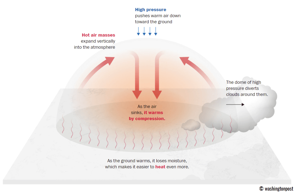
To understand the severity of this event, one must look at the mechanics of the heat dome itself. Much like a lid placed over a boiling pot, the heat dome operates by trapping warm air at all levels of the atmosphere.
The Compression Effect
The upper-level ridge creates a vast area of high pressure that effectively "parks" itself over the continent. Within this zone, atmospheric subsidence occurs—the downward movement of air. As this air sinks, it undergoes adiabatic warming, a process where air is compressed and heated as it moves to lower elevations. This suppresses cloud cover, allowing for maximum solar radiation to reach the surface, further fueling the temperature rise. Because the system is slow-moving and stable, it can persist for days or even weeks, preventing cooler air masses from encroaching on the affected region.
The Role of the "Tropical Night"
One of the most dangerous aspects of this specific heat event is the anticipated prevalence of "tropical nights." A tropical night occurs when temperatures fail to drop below 24°C, even in the absence of sunlight. This lack of nocturnal cooling is a critical factor in heat-related morbidity, as it denies the human body a necessary window for recovery. Without the ability to cool down at night, the cumulative physical stress on vulnerable populations—particularly the elderly and those with pre-existing respiratory or cardiovascular conditions—increases significantly.
Regional Breakdown of Impacts
The geographical reach of this heatwave is extensive, with varying intensities across the continent:
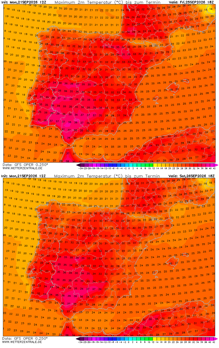
- Iberia (Spain and Portugal): This region will bear the brunt of the initial surge. From Thursday through Saturday, peak daytime highs are expected to reach 34°C to 38°C, with isolated areas potentially flirting with the 40°C mark. This is an exceptionally dry and punishing air mass.
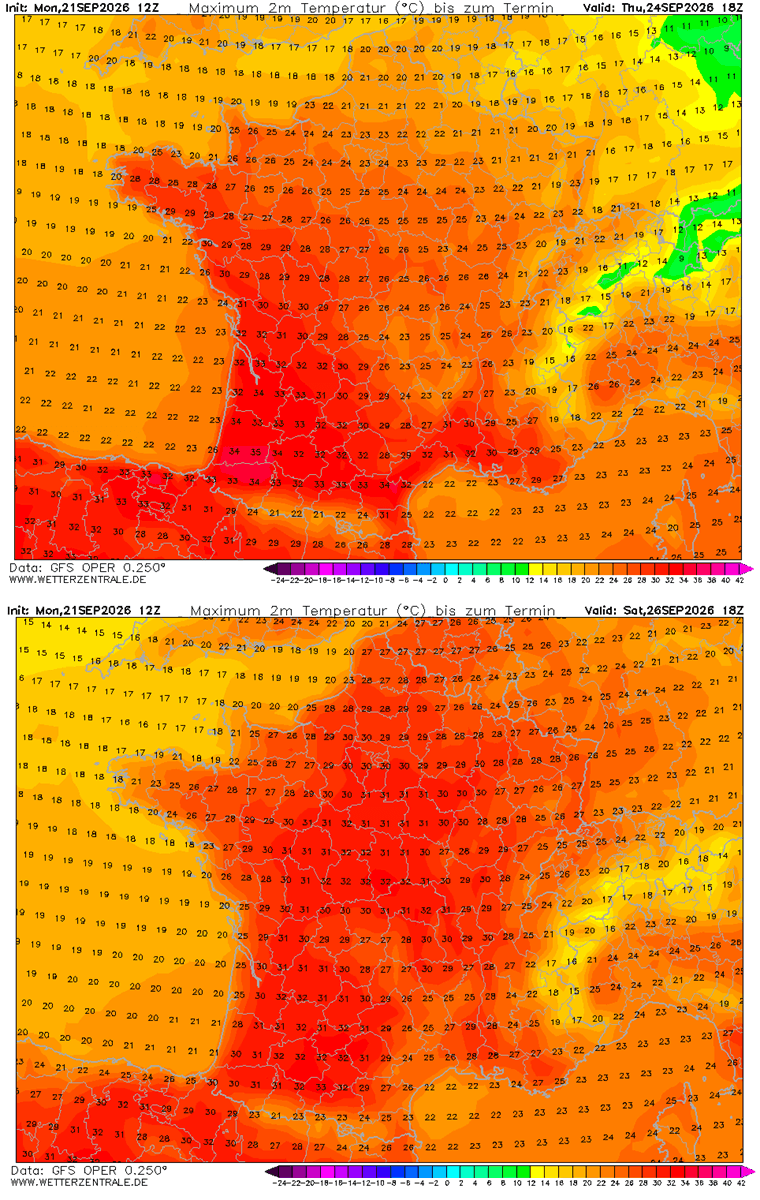
- Western Europe (France): Southern and central France will experience highs in the mid-to-high 30s. The heat will be sustained through the weekend before the ridge begins its shift toward the northeast.
- The United Kingdom: While not seeing the extremes of the south, the UK will experience a brief, unseasonable warming trend. Mid-20s are expected in south-central England through Sunday, though the far west and north will see more influence from the Atlantic moisture, resulting in higher rainfall rather than heat.
- Central Europe (Germany and Benelux): Starting Saturday, the heat will push into Germany and the Benelux countries. Residents can expect temperatures reaching the upper 20s, with some urban centers approaching 30°C.
- Southern Europe (Italy and the Balkans): The Po Valley and Tuscany will see highs of 28°C to 30°C. These temperatures are historically high for early October and may set new records in several Italian municipalities.
- Northern Europe (Scandinavia): As the event matures into next week, Sweden and Finland will see some of the most anomalous temperatures relative to their local climate, with residents experiencing weather far warmer than typical for the onset of October.
Implications for Public Health and Infrastructure
Managing Heat Stress
Public health authorities are urging residents to take precautions. Heat exhaustion, which presents with symptoms such as dizziness, dehydration, and fatigue, is a high risk for those performing outdoor activities. In more severe cases, heat stroke—a life-threatening condition—can occur.
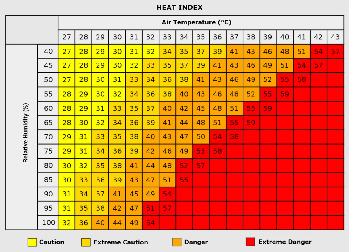
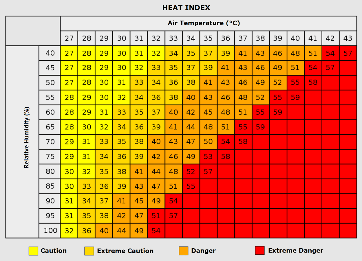
The "Heat Index" is a vital tool during this period. It is important for the public to understand that at temperatures near 35°C, high humidity levels can make the air feel like it is 50°C. Even at lower temperature readings, high humidity prevents sweat from evaporating, severely hindering the body’s natural cooling mechanism.
Agricultural and Economic Impacts
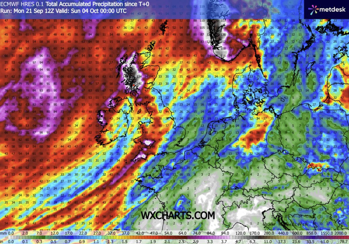
The persistence of this dry, high-pressure system will also have agricultural implications. While the immediate warmth may extend the growing season, the lack of precipitation in the affected regions could exacerbate soil moisture deficits. Conversely, the western British Isles, Ireland, and southwestern Norway face the opposite threat: as the heat dome pushes moisture-laden air into these regions, orographic rainfall could lead to significant accumulation, with some forecasts suggesting over 150 mm of rain in localized areas through early October.
Official Meteorological Perspective and Future Trends
Meteorological models, including the Global Forecast System (GFS) and the European Centre for Medium-Range Weather Forecasts (ECMWF) ensembles, show a high degree of confidence in the development of this blocking pattern. The consensus is that the ridge will remain the dominant feature of European weather until at least the first week of October.
A Signal of Changing Patterns?
While individual heatwaves cannot be attributed solely to climate change without extensive attribution studies, the frequency and intensity of these "blocking" events are consistent with broader atmospheric trends observed in recent years. The persistence of these systems suggests a shift in the standard behavior of the jet stream, which is becoming increasingly "wavy" and prone to stagnation.
The Outlook
Looking beyond the first week of October, long-range trends suggest that the atmosphere may become more dynamic as the mid-autumn period approaches. The current stable, dry air mass is likely to eventually break down, though the timing of this transition remains under close observation.
For the time being, authorities recommend that citizens in the affected zones monitor local weather advisories. With the combination of "tropical nights," elevated daytime peaks, and an extended duration, this heat event requires serious attention to personal health and energy management. As the continent transitions into the final quarter of 2026, this late-season thermal spike serves as a stark reminder of the volatility inherent in our modern climate patterns.
For real-time updates and detailed meteorological mapping, citizens are encouraged to consult their national meteorological services and monitor ongoing developments as the high-pressure system continues its evolution across the European landscape.