As the calendar turns to September, Europe is preparing for a significant meteorological anomaly. A powerful, high-pressure "heat dome" is currently expanding across the continent, promising to deliver an intense, late-season heatwave that threatens to shatter temperature records. With surface temperatures forecast to climb into the upper 30s and locally surge beyond 40°C, the Mediterranean Basin and Southern Europe find themselves in the crosshairs of a dangerous thermal event.
Driven by a vast, hot air mass surging northward from North Africa, this pattern is characterized by upper-air thermal anomalies that significantly exceed seasonal averages. From the sun-scorched plains of Spain to the historic valleys of Italy and the rugged terrain of the Balkan Peninsula, the region is bracing for a sustained period of extreme, unseasonable heat.
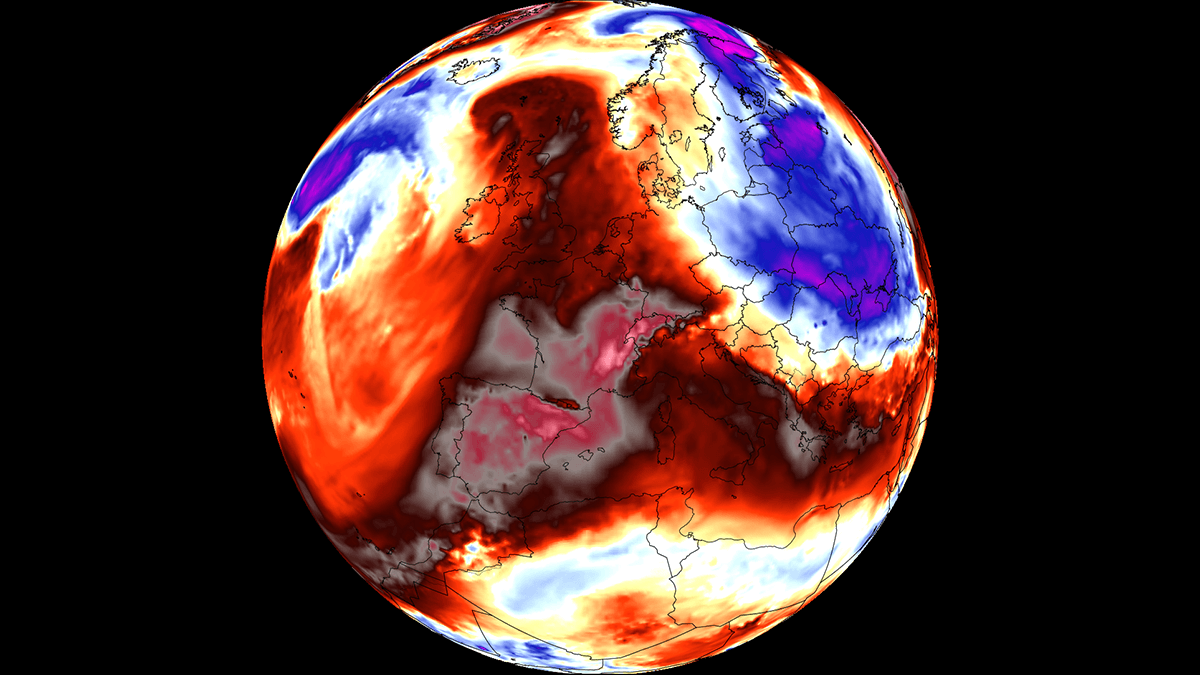
Main Facts: The Anatomy of a September Heat Dome
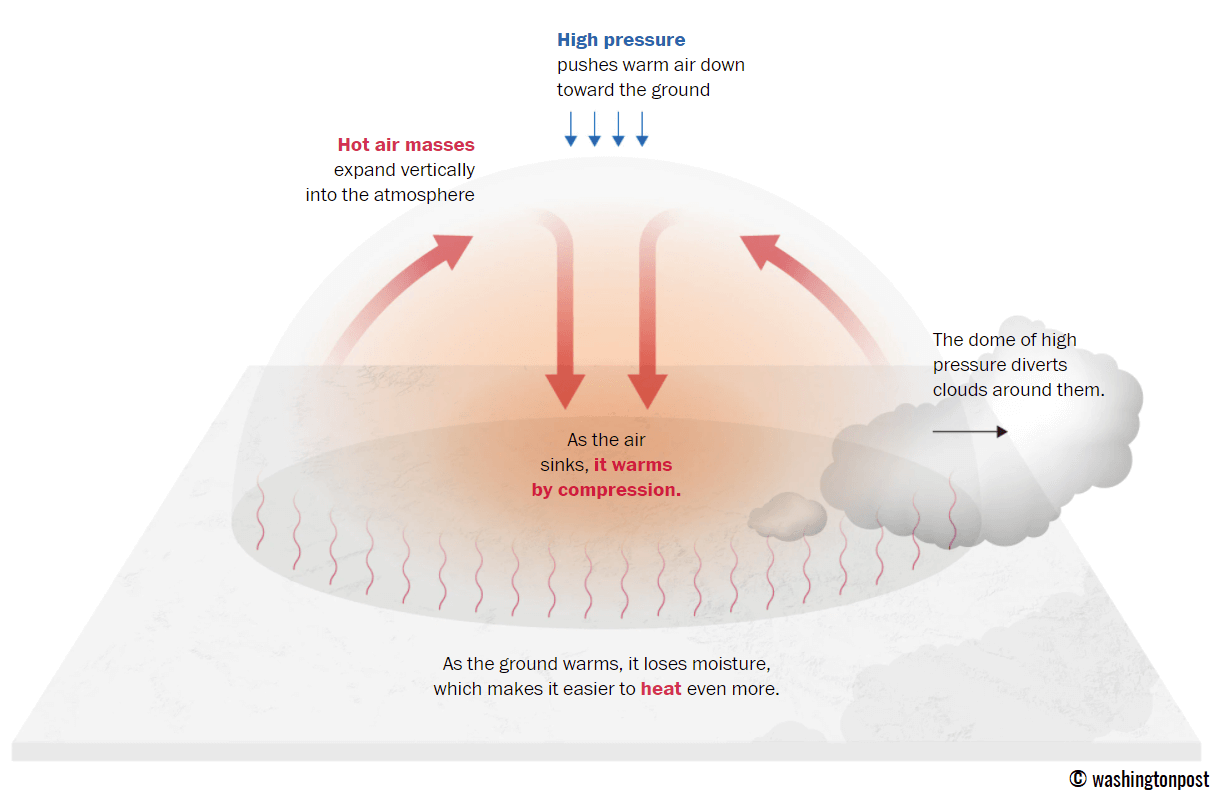
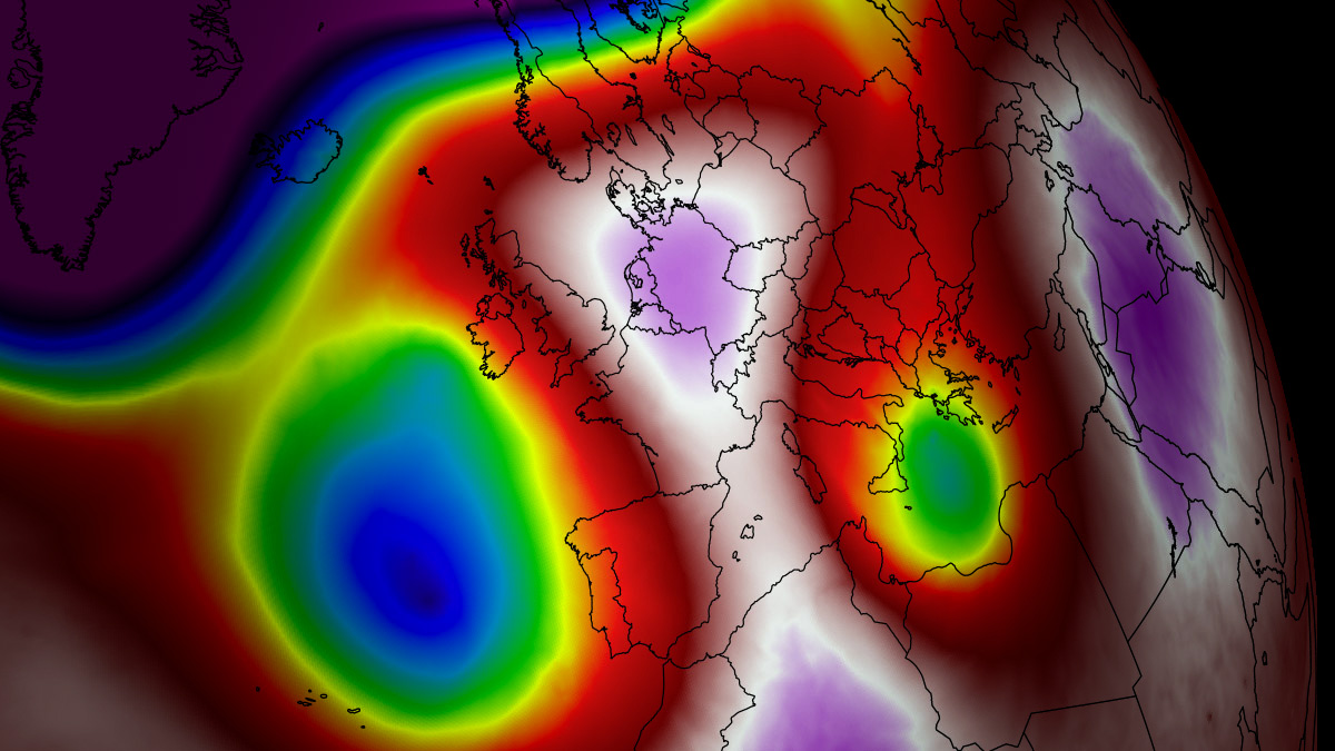
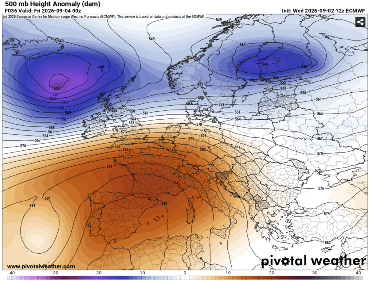
At the heart of this weather event is a persistent, expansive blocking high-pressure system anchored over the Mediterranean. In meteorological terms, this "heat dome" functions like a lid on a pot, trapping stagnant, warm air at all atmospheric levels. As the air sinks, it undergoes adiabatic compression—a process where the pressure increases and the temperature rises significantly. This creates a feedback loop: the sinking air dries out the soil, which in turn prevents evaporative cooling, leading to further surface heating.
The severity of this event is amplified by its timing. Early September typically marks the transition into cooler autumn weather, making these extreme temperatures particularly hazardous for populations accustomed to a seasonal decline in heat. Forecast models indicate that the peak of this thermal ridge will persist for several days, creating a prolonged period of physiological and environmental stress.
Chronological Progression: From Iberia to the Balkans
The progression of this heatwave is structured and predictable, as the upper-level ridge slowly migrates and strengthens across the continent.
Phase 1: The Iberian Surge (Thursday – Friday)
The Iberian Peninsula is the first to bear the brunt of the North African plume. Central and southern regions of Spain and Portugal are forecast to see daytime highs ranging between 40°C and 44°C. The dry, continental winds associated with this high-pressure system are expected to rapidly deplete soil moisture, exacerbating the risk of wildfires in already parched mountain regions.
Phase 2: Expansion into France and the Mediterranean (Friday – Monday)
As the ridge expands, the heat will push into southern and central France, with temperatures in the interior reaching the mid-30s. Simultaneously, the core of the heat dome will settle over Italy and the central Balkans. In these regions, temperatures are expected to climb to 38°C–41°C, potentially challenging long-standing records for early September.
Phase 3: The Peak and Stagnation
Throughout the weekend and into the early part of next week, the ridge will dominate continental Europe. While Western Europe, including the UK, will experience more moderate "warm" weather (mid-to-upper 20s), the heart of the continent will remain under a blanket of stagnant, extreme heat. The lack of movement in the atmosphere means this heatwave will be remarkably long-lived, denying the land and its inhabitants any meaningful reprieve.
Supporting Data: Thermal Anomalies and Meteograms
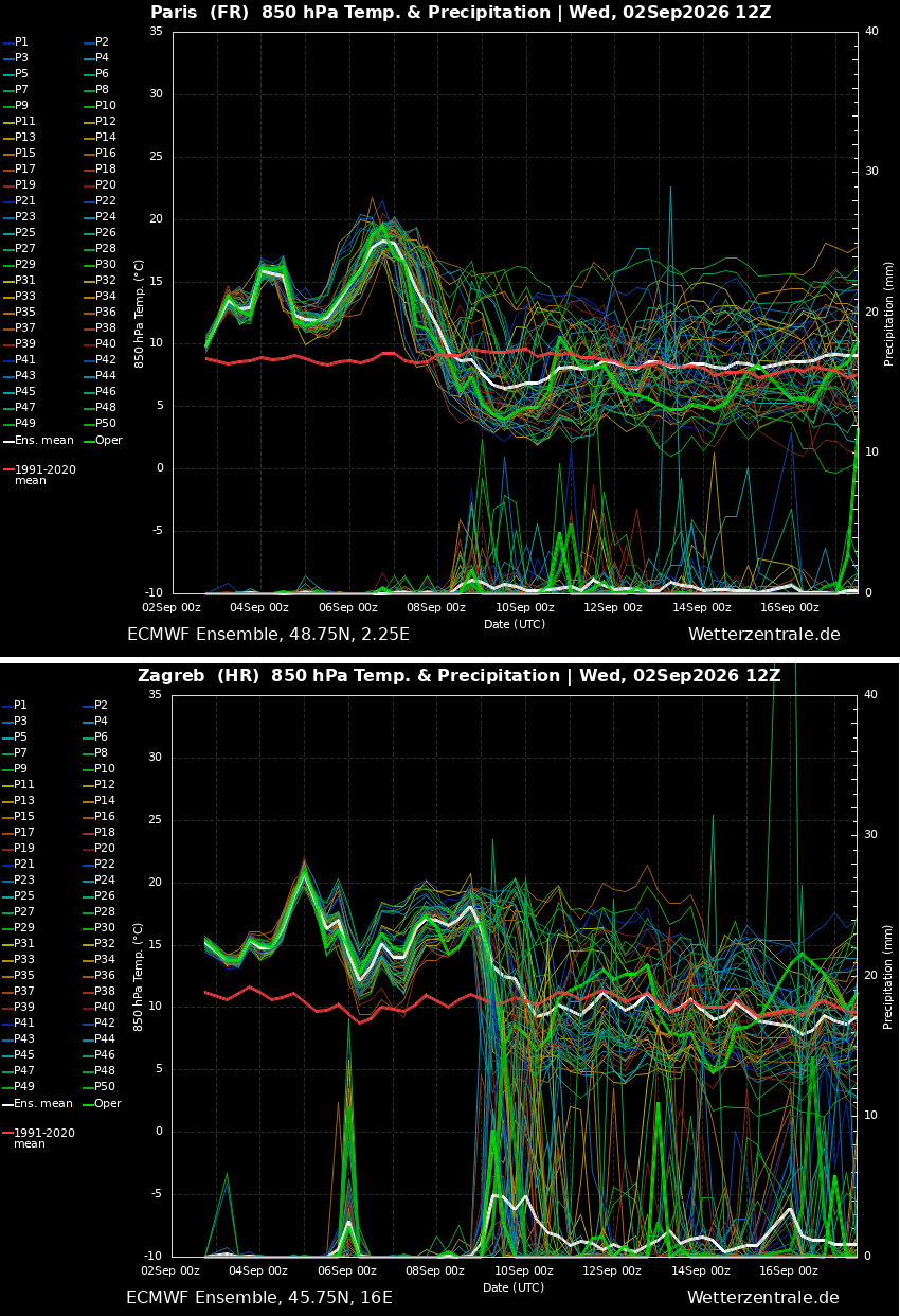
Meteorological data from standard models, such as the European Centre for Medium-Range Weather Forecasts (ECMWF) and GFS, confirm the severity of the upcoming event. The mid-range forecasts for major cities like Paris and Zagreb clearly illustrate a stark departure from long-term averages.
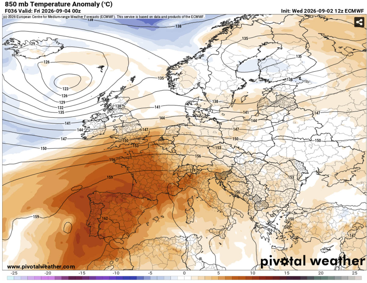
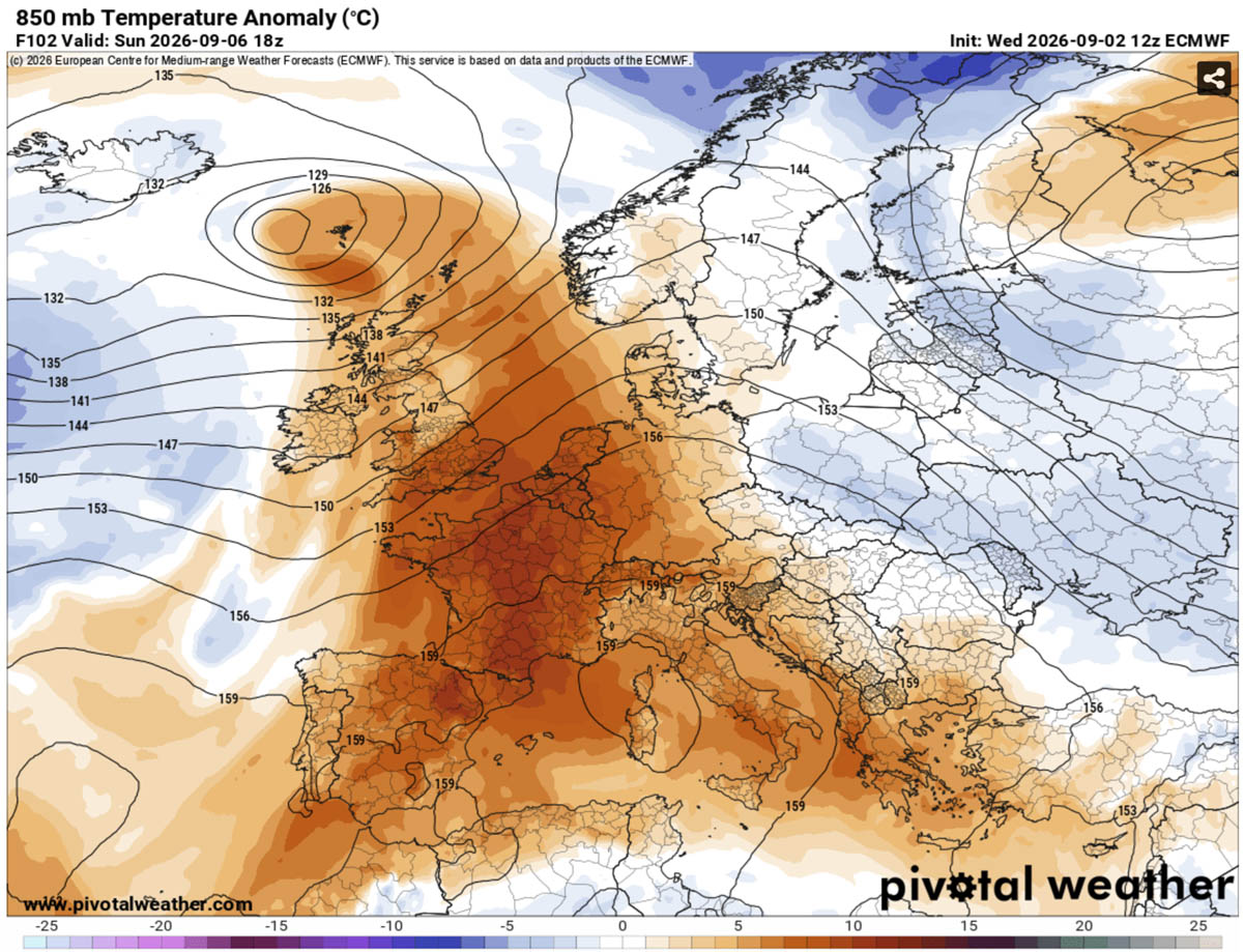
In many areas, the 2-meter temperature anomalies are predicted to be 10°C to 14°C above the seasonal norm for early September. Furthermore, the 850 hPa temperature maps—which track the temperature at an altitude of roughly 1,500 meters—show a massive, deep-red plume of anomalous heat covering the Mediterranean and extending deep into Central Europe. This is not merely a transient spike; it is a profound atmospheric displacement that indicates a robust and entrenched high-pressure system.
Implications: Public Health, Energy Grids, and Ecosystems
The physical reality of a heat dome extends far beyond the numbers on a thermometer. The most concerning implication of this specific event is the phenomenon of "tropical nights," where overnight temperatures fail to drop below 22°C to 25°C.
The Physiological Burden
Human health is highly dependent on nighttime recovery. When temperatures remain high after sunset, the human body is unable to effectively shed the heat accumulated during the day. This constant thermal stress significantly increases the risk of heat exhaustion and heat stroke, particularly among the elderly, young children, and those with pre-existing cardiovascular or respiratory conditions.
Energy Grid Strain
The prolonged heat wave will inevitably drive energy demand to near-peak levels. As cooling systems run continuously, electrical grids across Southern and Central Europe will face significant pressure. This poses a secondary risk: if the grid fails due to excessive demand, the most vulnerable populations will be left without the mechanical cooling necessary to survive the heat, potentially leading to a surge in heat-related morbidity.
Environmental Consequences
The combination of high heat and low humidity is a catalyst for wildfire activity. In regions like Spain, Italy, and the Balkans, the dry vegetation serves as kindling. With the soil already depleted of moisture, the risk of explosive fire growth is high. Emergency services are being placed on high alert as they anticipate a challenging few days of monitoring both human health and fire risk.
Addressing the "Heat Index" Reality
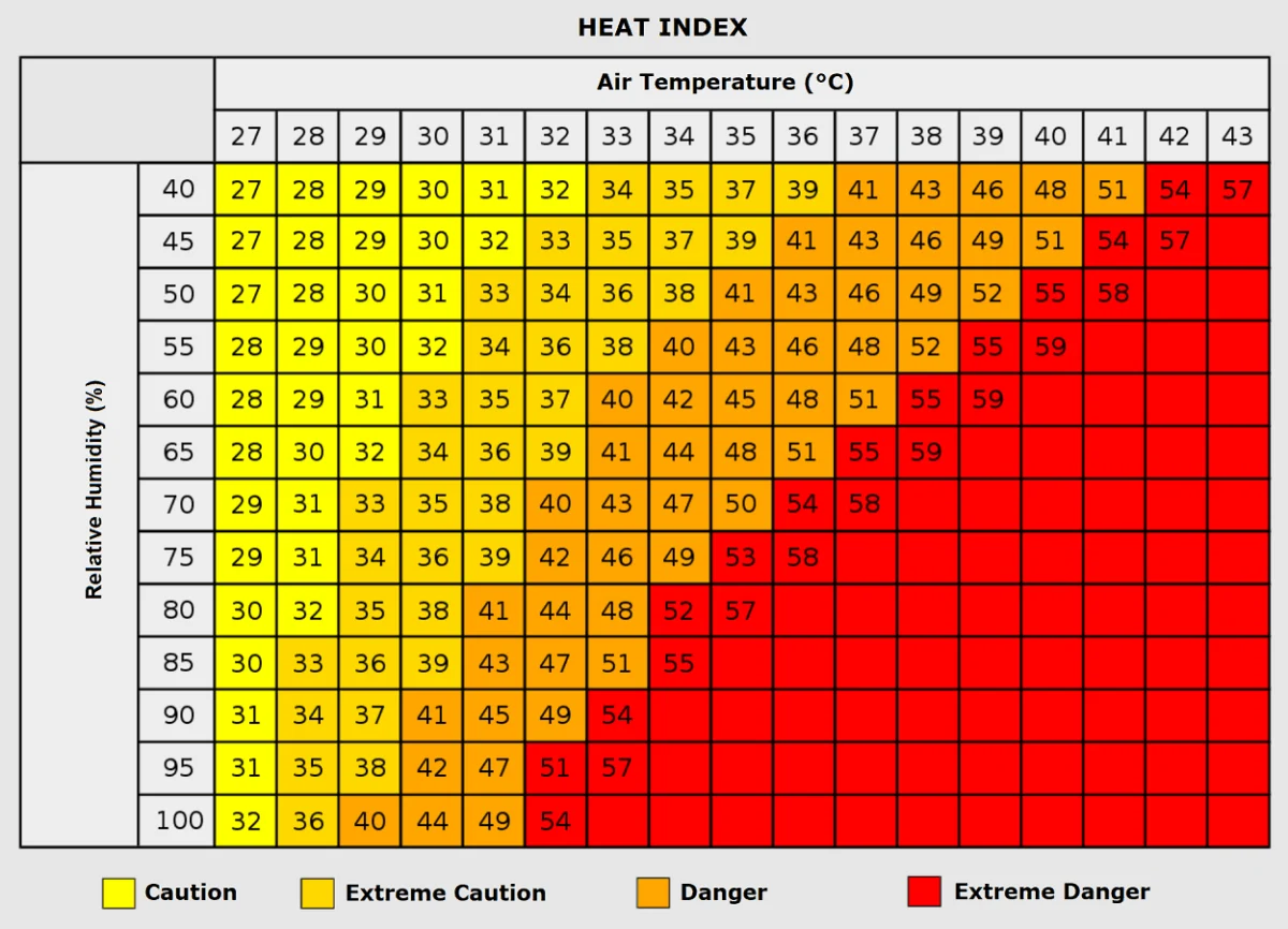
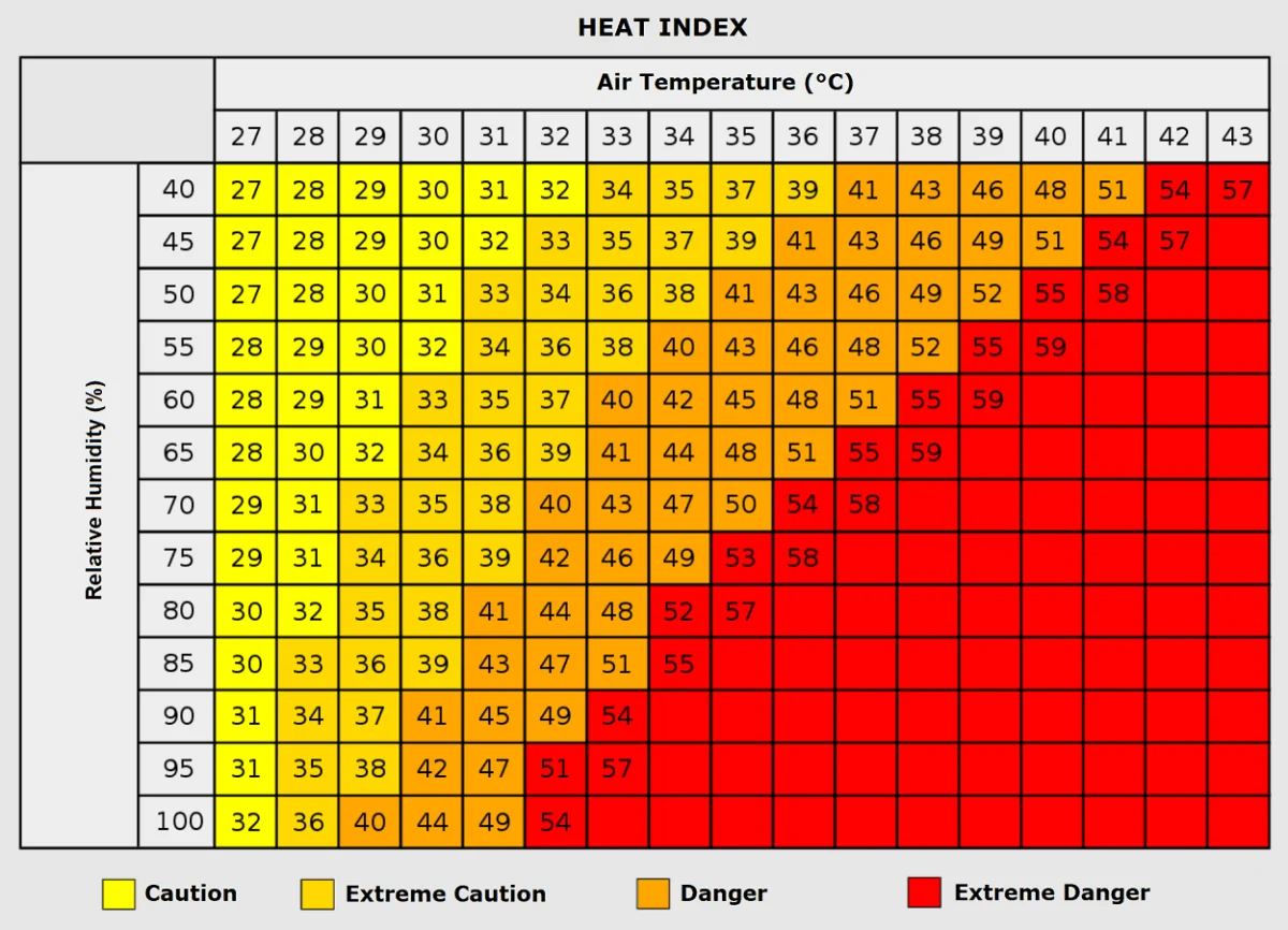
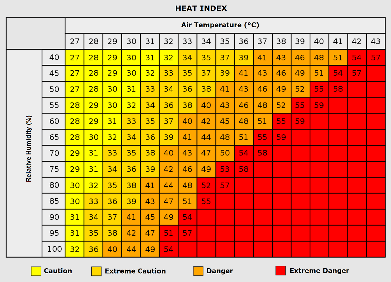
While the raw temperature is alarming, the "Heat Index"—the perceived temperature based on humidity—is equally important. In areas where moisture remains trapped, a 35°C day can feel like 50°C. Health authorities across Europe are emphasizing that even for healthy individuals, outdoor activity should be strictly limited during the peak hours of 11:00 AM to 6:00 PM. The consensus among public health officials is that this event should be treated as a severe weather emergency, comparable in danger to major winter storms or flooding events.
Official Outlook: A Potential Pattern Flip
There is light on the horizon, though it remains several days away. Forecast models are beginning to signal a "pattern flip" occurring mid-to-late next week. An upper-level ridge is expected to build in the North Atlantic, allowing a deep, cold-air mass intrusion to penetrate Western Europe.
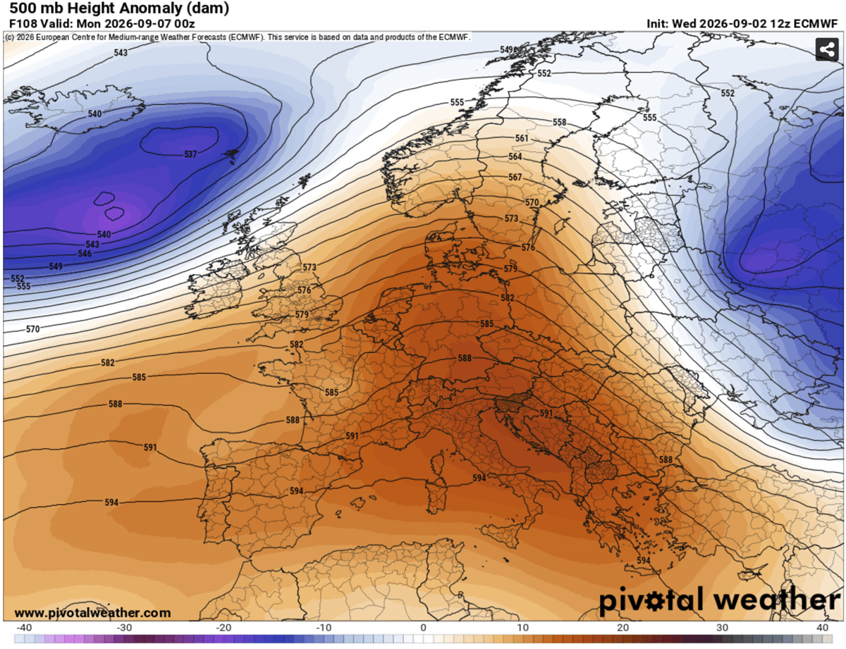
This transition is expected to be dynamic, potentially bringing not just a much-needed drop in temperatures, but also the possibility of severe thunderstorms as the cold, moist maritime air collides with the lingering hot, continental air. While this weather change will likely provide relief from the heat, it also introduces the risk of localized flooding and wind damage.
For now, however, the focus remains on the current dome. As the continent enters this grueling period of record-breaking heat, meteorologists and emergency responders alike urge the public to remain vigilant. The stability of this high-pressure system is its most dangerous trait, and until the atmosphere shifts, the priority must be safety, hydration, and the protection of those most at risk.
Stay updated with local meteorological services, as they will provide granular, city-specific warnings as the heat reaches its zenith over the coming days. The transition to autumn may be delayed, but it is coming; in the meantime, Europe must navigate this final, intense test of summer.