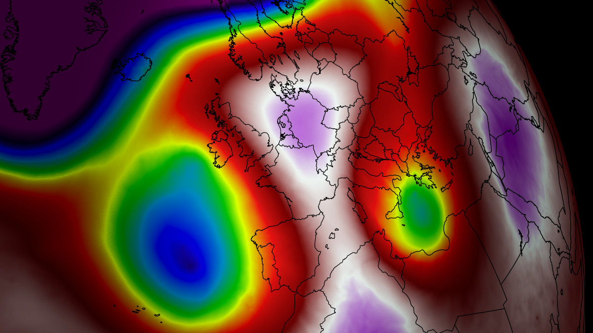
As the calendar turns to mid-August 2026, the European continent is bracing for the fifth—and potentially most punishing—major heat dome of the season. A powerful, high-amplitude upper-level ridge has locked over Western and Central Europe, setting the stage for a meteorological siege that is pushing temperatures well beyond the 40°C threshold. With thermal anomalies climbing into the 99th percentile, nations from the United Kingdom to the Balkan Peninsula are facing a prolonged period of extreme heat that threatens public health, energy infrastructure, and environmental stability.
The Atmospheric Engine: Anatomy of a Heat Dome
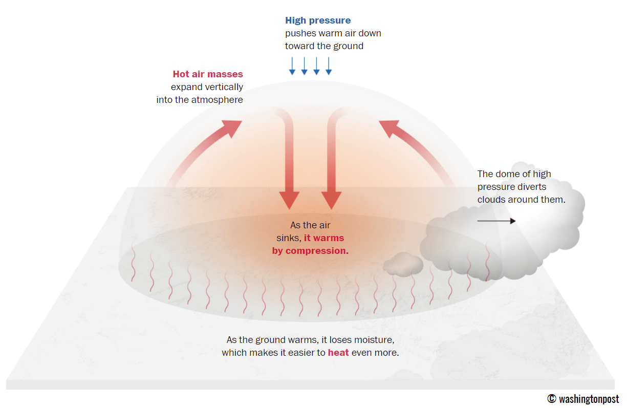
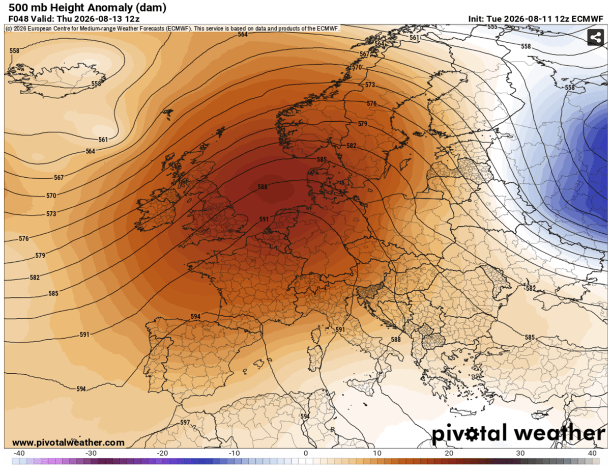
To understand the severity of the current crisis, one must first understand the "Heat Dome" phenomenon. Meteorologically, this occurs when a broad area of high-pressure air parks itself over a large portion of the continent. Acting as a thermodynamic lid on a pot, this high-pressure ridge traps warm air at all levels of the atmosphere.

As the air sinks, it undergoes adiabatic compression—a process where the pressure increases as the air descends, causing the air mass to heat up significantly. This creates a feedback loop: the trapped air continues to compress and warm, leading to soaring surface temperatures. Because these systems are often remarkably stable, they can remain anchored over a region for days or even weeks, preventing the influx of cooler, maritime air and effectively baking the terrain beneath.
A Chronology of the Thermal Surge
The progression of this heatwave is characterized by a west-to-east migration, with the core of the intensity shifting as the blocking high-pressure system evolves.
Mid-Week: The Western Front
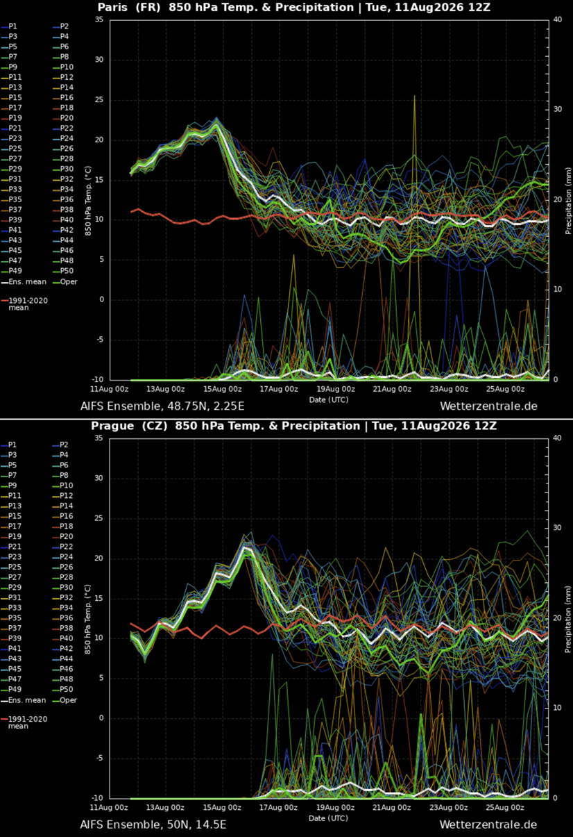
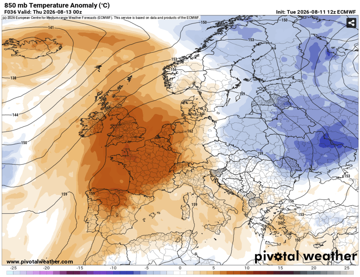
By mid-week, the primary focus of the thermal surge centers on the Iberian Peninsula, France, and the United Kingdom. In Spain and Portugal, heat-prone valleys are witnessing temperatures between 42°C and 44°C. By Thursday, the heat dome’s influence expands northward, impacting the UK, where forecasters anticipate peak temperatures in southern and central England reaching 38°C to 39°C. France, meanwhile, is bearing the brunt of the intensity, with widespread reports of 40°C to 43°C as the heat-trapping air mass consolidates over the hexagon.
The Weekend Shift: Central and Eastern Expansion
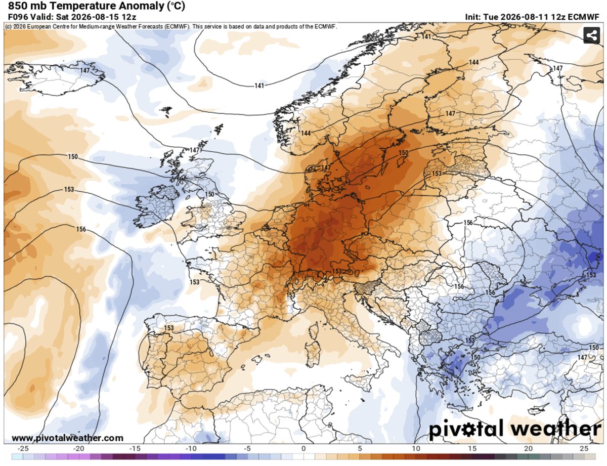
As the work week concludes, the atmospheric ridge begins to elongate and shift eastward. While western regions may see a slight, albeit brief, moderation due to Atlantic air incursions, the heat will intensify significantly across Germany, the Benelux region, and eventually the Alpine nations. By Saturday and Sunday, the focus shifts toward the Pannonian plains, with Hungary, northern Serbia, and the Po Valley in Italy bracing for temperatures nearing the 40°C mark. This eastward transition ensures that the thermal stress is not merely contained but redistributed across a wider demographic footprint.
Supporting Data: Meteorological Anomalies and "Tropical Nights"
The severity of this event is best measured not just by daytime highs, but by the absence of nocturnal relief. The meteorology of this heatwave is marked by "tropical nights," where temperatures refuse to dip below 22°C to 26°C.
This lack of cooling is a critical factor in the physiological toll on the human body. During a normal diurnal cycle, the body relies on cooler nighttime temperatures to recover from the heat accumulated during the day. When the mercury stays high overnight, the human body enters a state of perpetual heat stress, significantly increasing the risk of heat exhaustion, heat stroke, and cardiovascular distress.
Furthermore, the 850 hPa temperature anomalies—a standard metric for measuring the heat of an air mass at approximately 1.5 kilometers above sea level—are currently tracking 12°C to 16°C above the long-term averages for mid-August. This delta underscores the historic nature of the heat, pushing the boundaries of what is considered "normal" for this time of year.
Implications for Society and Infrastructure
The implications of such prolonged, extreme heat are profound and multifaceted.
Public Health Risks
The most immediate danger is to public health. Vulnerable populations—the elderly, children, and those with pre-existing respiratory or cardiovascular conditions—are at the highest risk. However, the scope of the danger has expanded to include outdoor workers in agriculture and construction.
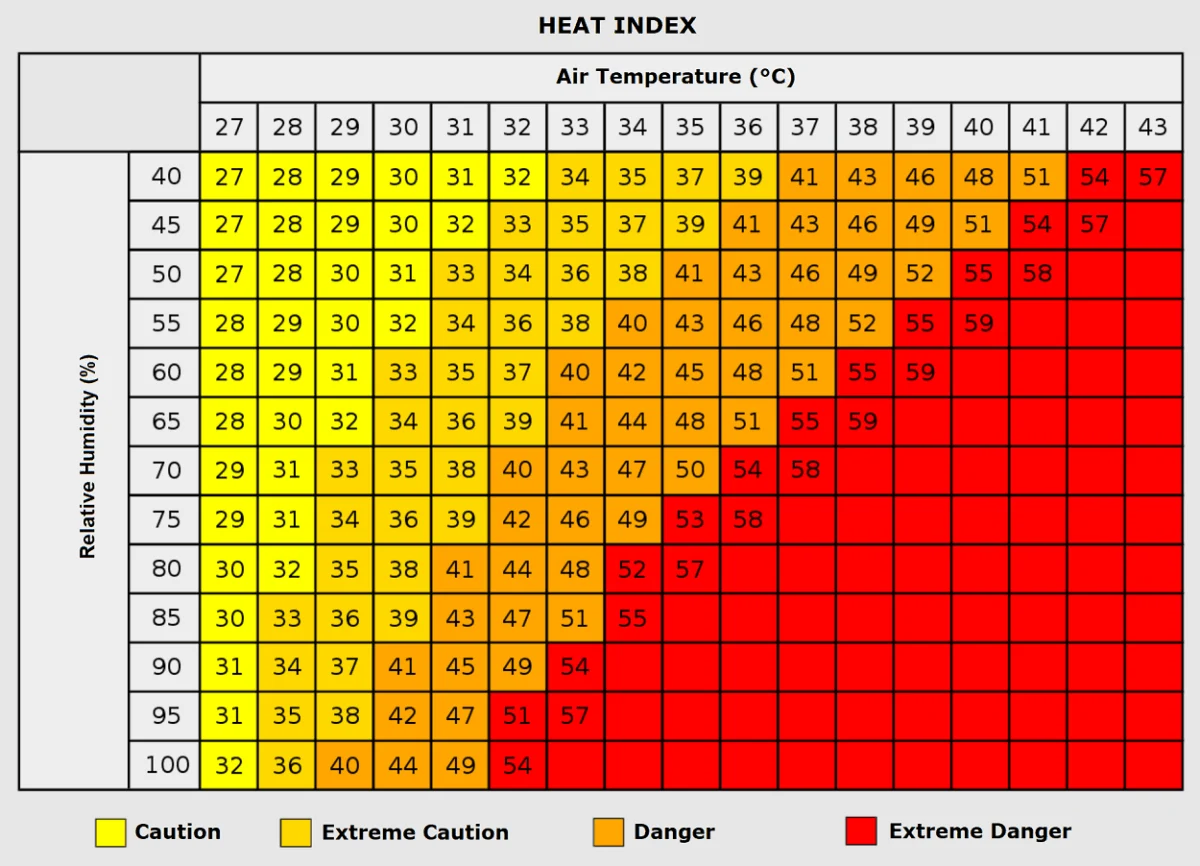
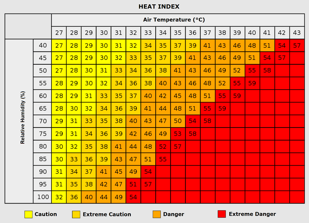
The "Heat Index," which calculates the perceived temperature based on both heat and humidity, is reaching hazardous levels. Even in areas where the ambient air temperature might be 35°C, high humidity levels can make the "real feel" exceed 50°C. This combination is a known catalyst for increased hospital admissions and mortality rates during summer months.
Energy Grid and Urban Environment
Urban corridors, characterized by "heat island" effects where concrete and asphalt absorb and re-radiate heat, are currently under extreme pressure. The surging demand for air conditioning is testing the resilience of energy grids across Europe. As households and businesses crank up cooling systems, the load on electrical infrastructure nears capacity, increasing the risk of rolling blackouts or localized grid failures.
Furthermore, the persistent dryness associated with this high-pressure system is rapidly depleting soil moisture. This creates a two-fold environmental risk: it lowers crop yields for the agricultural sector and creates tinderbox conditions for wildfires, particularly in southwestern and central Europe, where vegetation has been dried out by successive waves of heat.
Official Responses and Adaptive Strategies
While specific government responses vary by country, the general consensus among health and meteorological authorities across Europe is the implementation of "Red Level" heat alerts.
- Hydration and Cooling Centers: Municipalities in France, Italy, and Spain have opened "cool rooms" and public cooling centers, particularly for those living in high-density housing where thermal regulation is difficult.
- Labor Protections: Several governments have issued mandates for outdoor employers to shift working hours to the early morning or late evening, avoiding the peak intensity hours between 12:00 PM and 6:00 PM.
- Grid Management: Energy providers are coordinating across borders to balance supply, encouraging citizens to avoid peak energy consumption during the hottest hours of the day to prevent system strain.
- Public Awareness Campaigns: Health ministries are aggressively pushing information regarding the signs of heat stroke, emphasizing that thirst is a late indicator of dehydration and that residents must drink water proactively.
Looking Ahead: The Potential for a Pattern Flip
As the current heat dome reaches its zenith over Central and Eastern Europe this weekend, meteorologists are closely monitoring signs of a "pattern flip." Long-range forecast models suggest that by early next week, the stubborn high-pressure ridge may finally break down, allowing for a more dynamic, active weather pattern to move in from the North Atlantic.
While this transition promises cooler, maritime air and a much-needed respite for the continent, it also carries the potential for severe weather. When a period of intense, sustained heat meets a cooling front, the resulting atmospheric instability can trigger violent thunderstorms, hail, and localized flooding.
For now, however, the focus remains on endurance. With the fifth major heat dome of 2026 currently in full force, the continent is once again reminded of the increasing frequency and intensity of these extreme weather events. As mid-August temperatures continue to shatter records, the resilience of Europe’s infrastructure and the adaptability of its citizens will remain under the microscope until the final vestiges of this heatwave dissipate in the coming days.