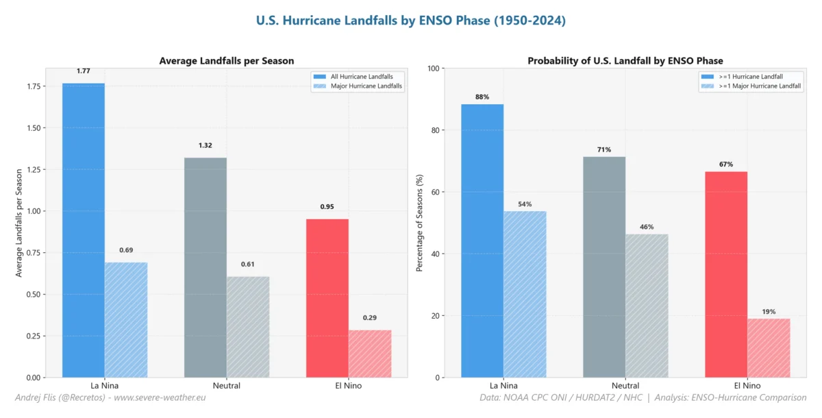
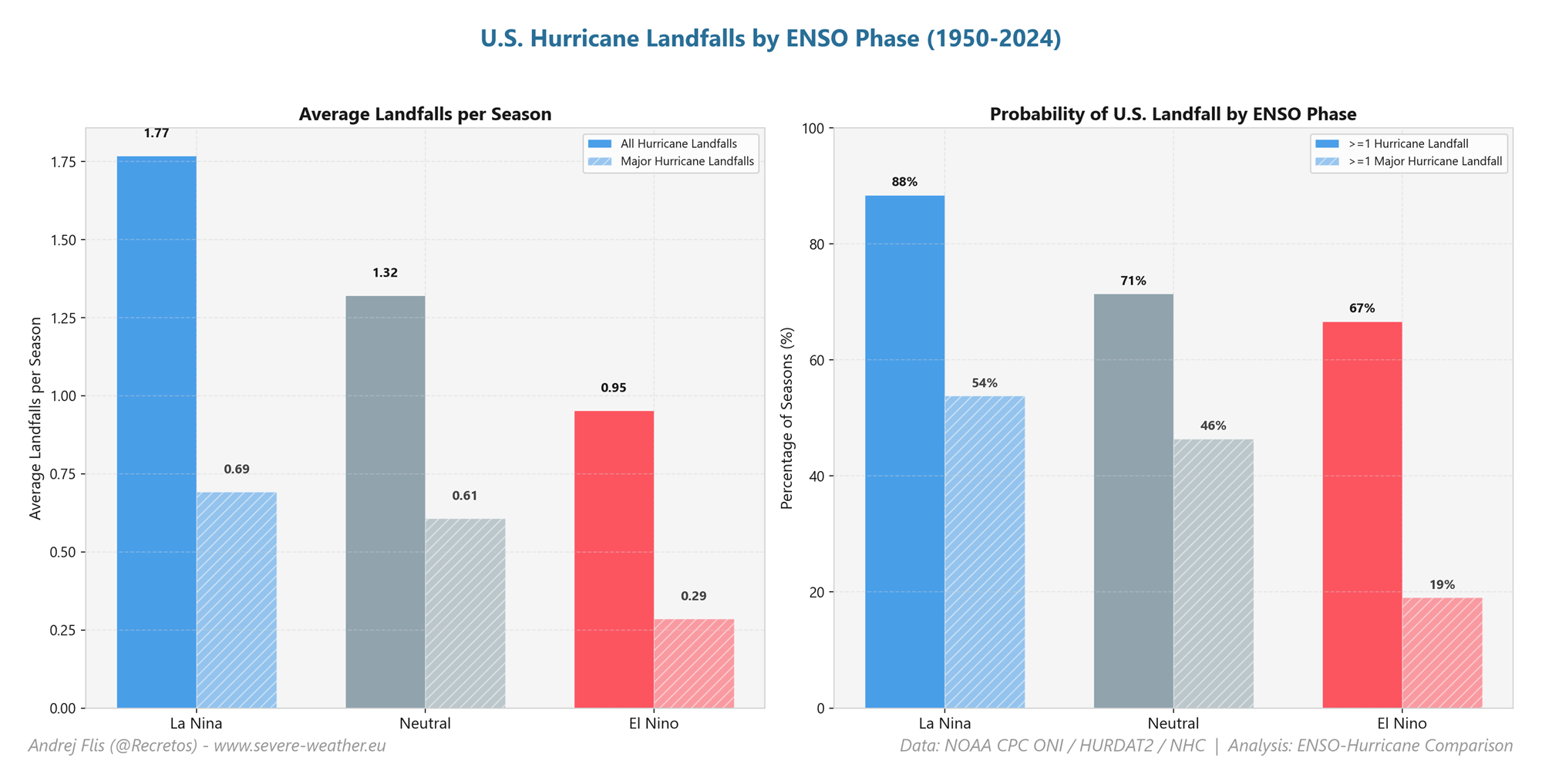
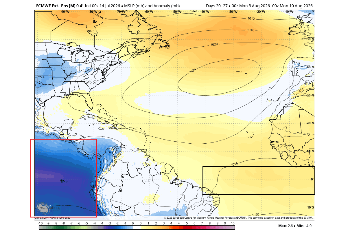
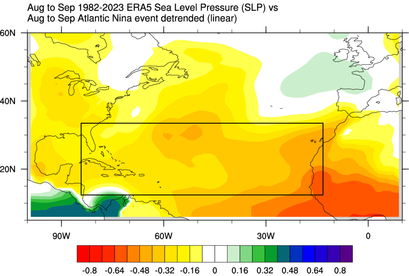
In a rare meteorological convergence, the tropical oceans are currently hosting two of the most significant climate anomalies in recent memory. A powerful "Super" El Niño is rapidly intensifying in the Pacific, while a rare Atlantic Niña has taken hold in the tropical Atlantic. While these two phenomena occupy different oceans and appear to be opposing forces, they are currently acting in concert to create a formidable "atmospheric shield" over the United States, effectively dampening the conditions required for hurricane development.
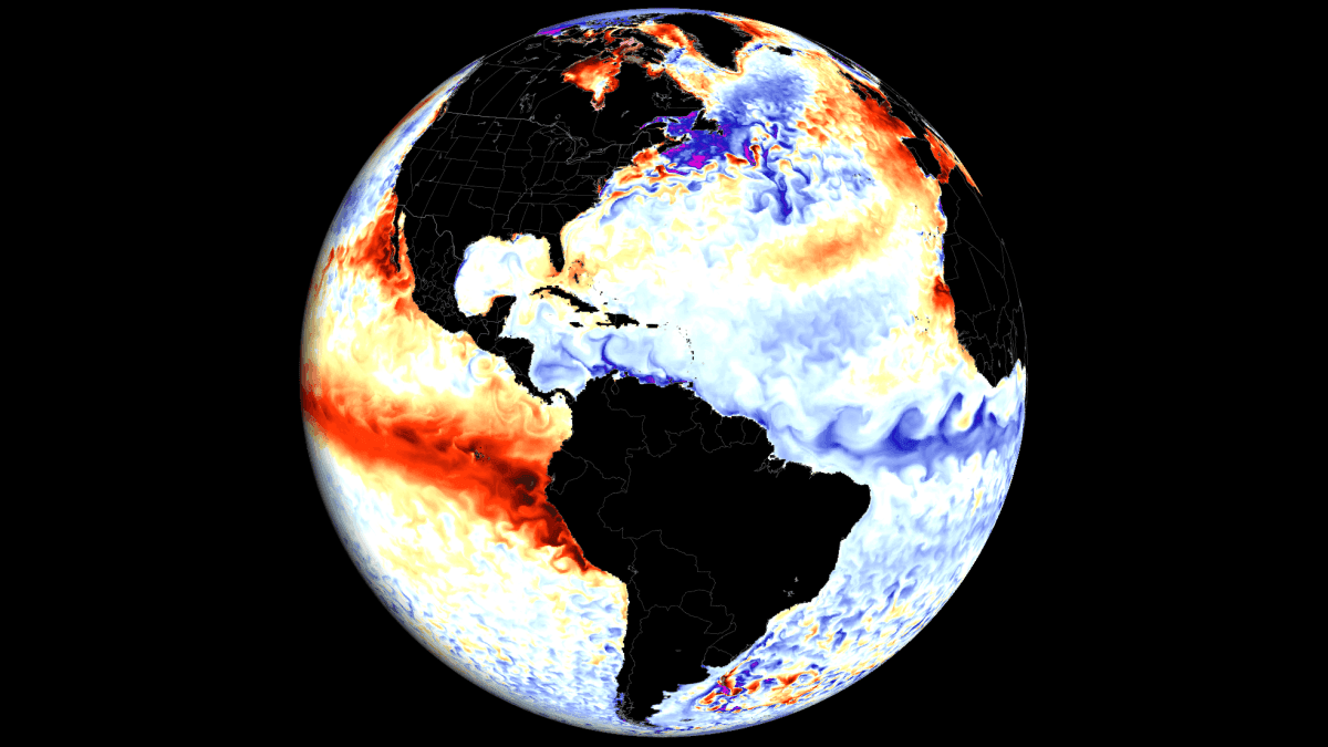
As we progress through the peak of the 2026 hurricane season, meteorological analysis suggests that this hostile environment—characterized by elevated air pressure, increased vertical wind shear, and suppressed moisture—is significantly lowering the probability of major landfalls. This article explores the mechanics of these ocean-atmosphere interactions, the current state of our climate models, and what these signals suggest for the upcoming winter season of 2026/2027.
The Mechanics of the Global Atmosphere
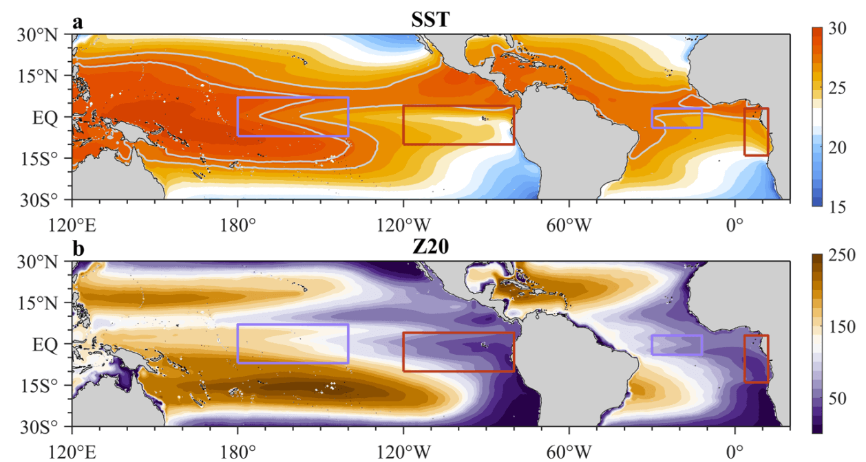
Ocean anomalies do not exist in isolation; they are the primary drivers of global circulation patterns. The interplay between the Pacific and Atlantic oceans determines the location and intensity of the jet stream, which in turn dictates the paths of tropical storms and continental weather systems.
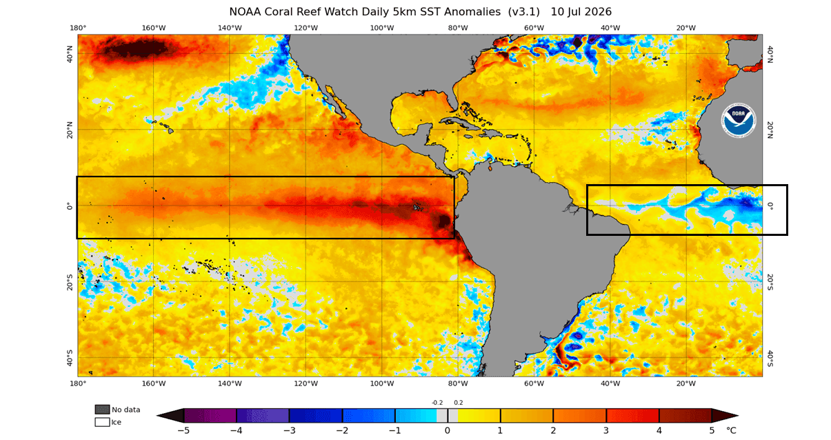
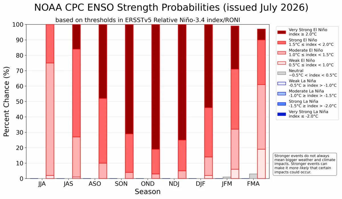
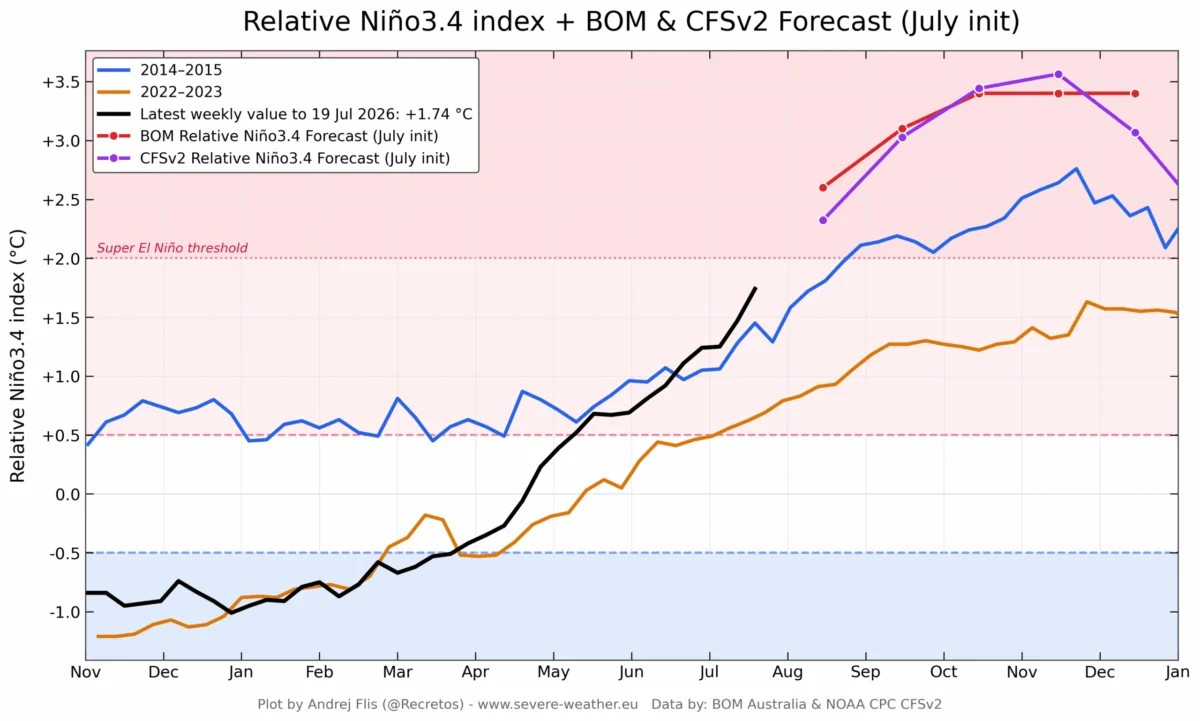
In the Pacific, the ENSO (El Niño-Southern Oscillation) cycle is currently dominated by a strong El Niño event. Recent data from NOAA’s Coral Reef Watch (CRW) indicates that sea surface temperatures in the eastern Pacific are trending 3 to 4 degrees Celsius above normal—a rapid onset that classifies this as a "Super" event. Simultaneously, the tropical Atlantic is witnessing a rare Atlantic Niña, a cold-water anomaly that acts as a mirror to the Pacific’s warmth.
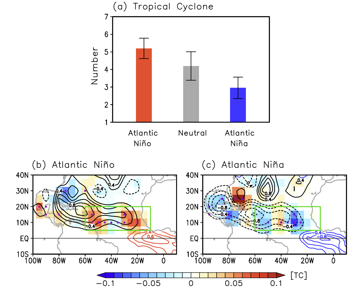
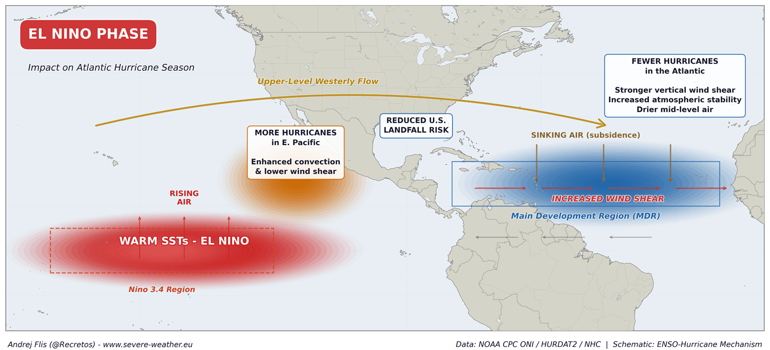
These anomalies are governed by the trade winds—the easterly currents that circle the globe near the equator. Strong trade winds drive "upwelling," where deep, colder water rises to the surface, cooling the ocean. Conversely, weak trade winds allow warm water to accumulate. Currently, the strength of the trade winds is fueling the Atlantic Niña, while the Pacific’s weakened winds have allowed the Super El Niño to flourish. Together, they create a global teleconnection that discourages the development of tropical cyclones in the Atlantic basin.
A Chronology of the 2026 Anomalies
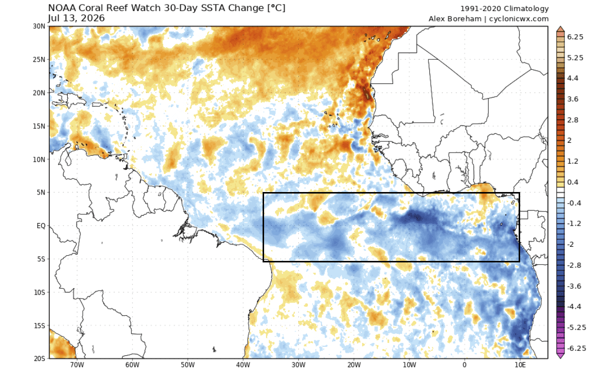
The formation of this year’s Atlantic Niña is historically significant. While Atlantic Niña events occur periodically, strong, sustained events during the peak summer months are relatively rare. If current cooling trends persist—with seasonal anomalies remaining below the -0.5-degree Celsius threshold—the 2026 event will mark only the sixth such occurrence in over four decades of reliable satellite record-keeping.
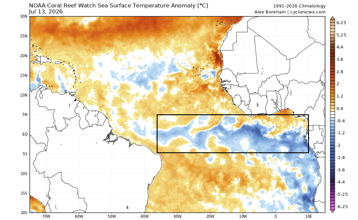
- Early Summer 2026: Initial signs of equatorial Atlantic cooling emerged in late spring, consistent with intensified trade wind activity.
- July 2026: The Atlantic Niña became clearly defined, with temperatures in the central tropical region dropping 1–3 degrees Celsius below the historical norm.
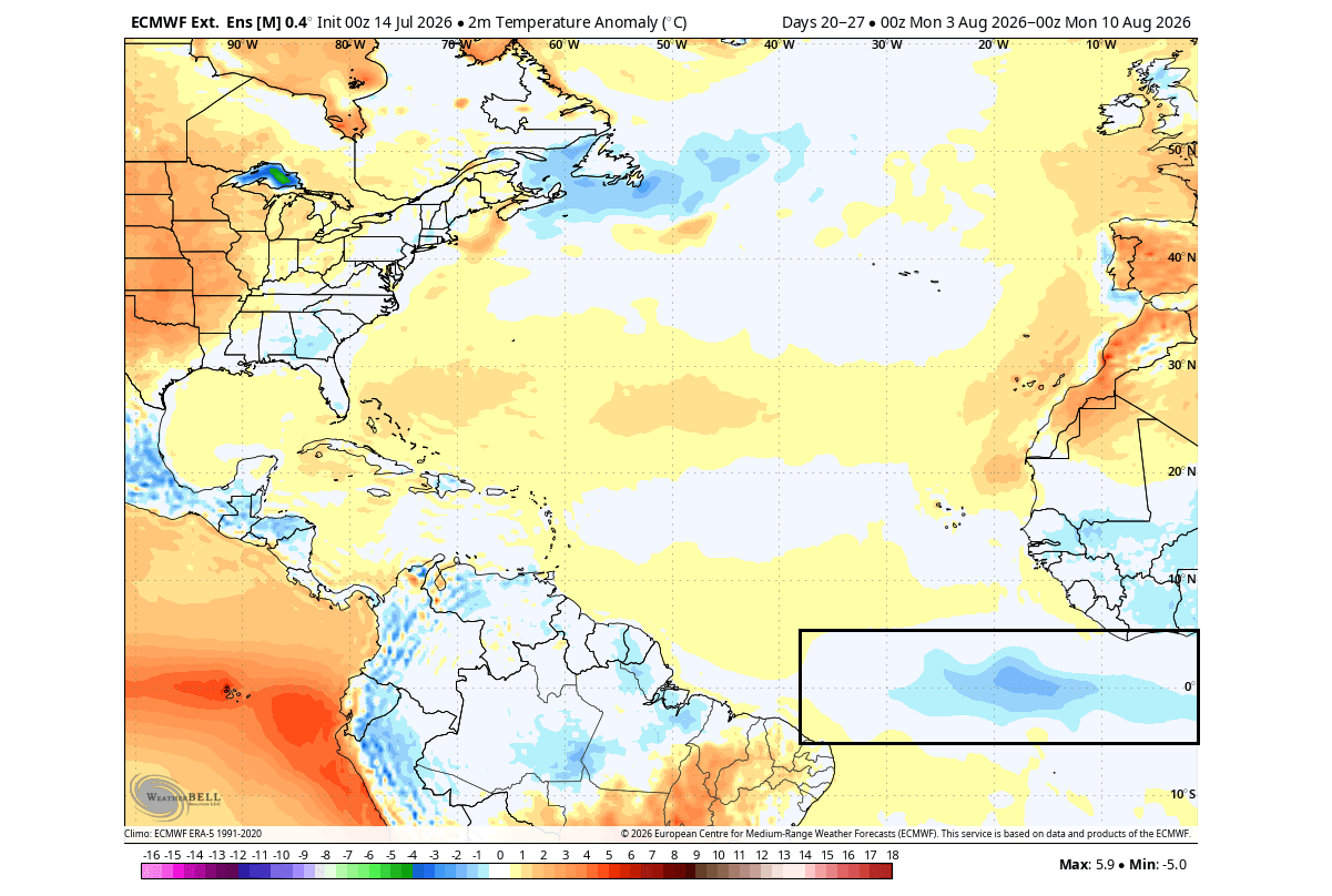
- August 2026: Forecast models from the European Centre for Medium-Range Weather Forecasts (ECMWF) confirmed that the cold anomaly was expanding, setting the stage for a suppressive environment during the most critical weeks of the hurricane season.
- Late Summer/Fall Outlook: Current modeling predicts this "atmospheric shield" will persist through the remainder of the active season, providing a continued buffer for the United States coastline.
Supporting Data and Predictive Modeling
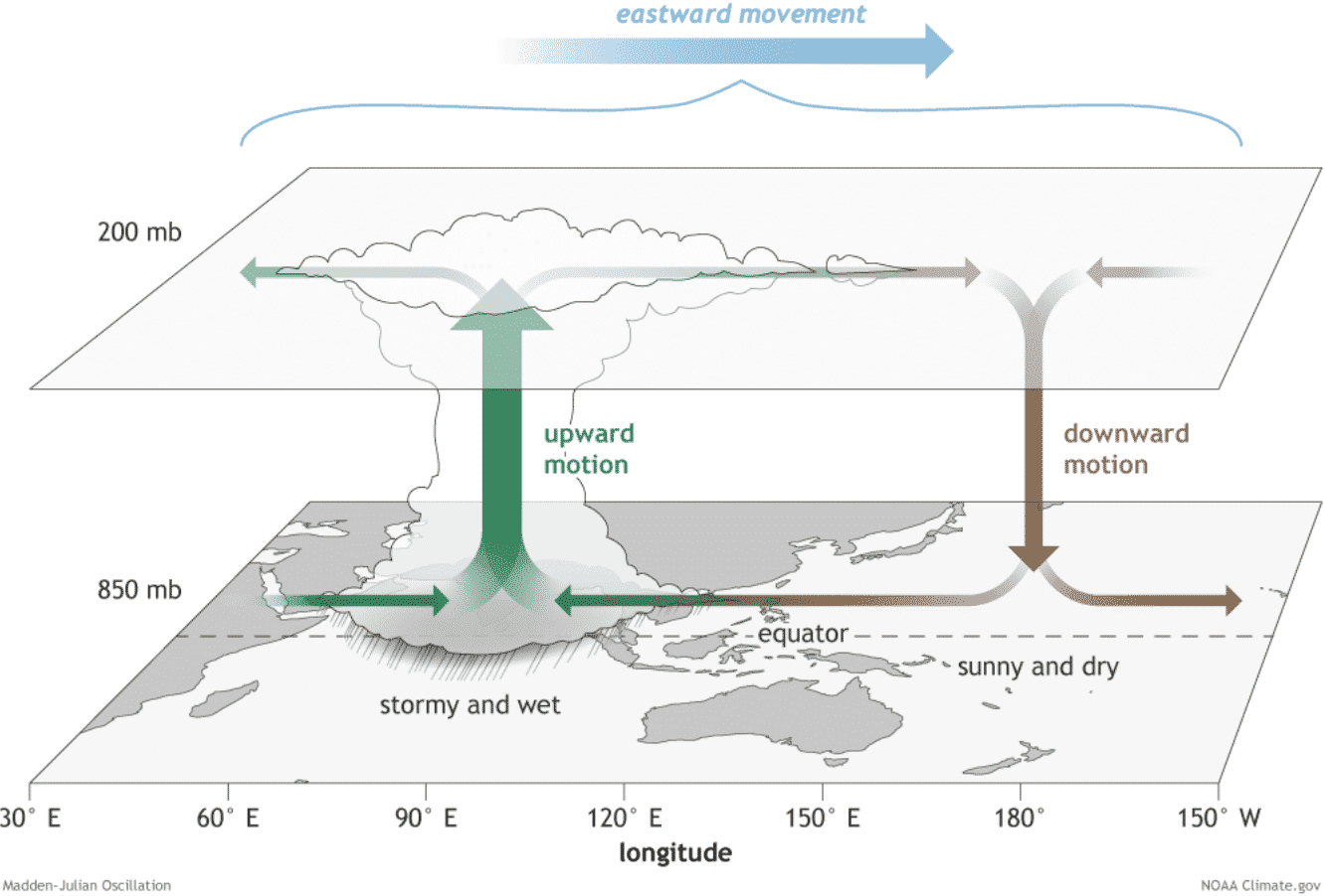
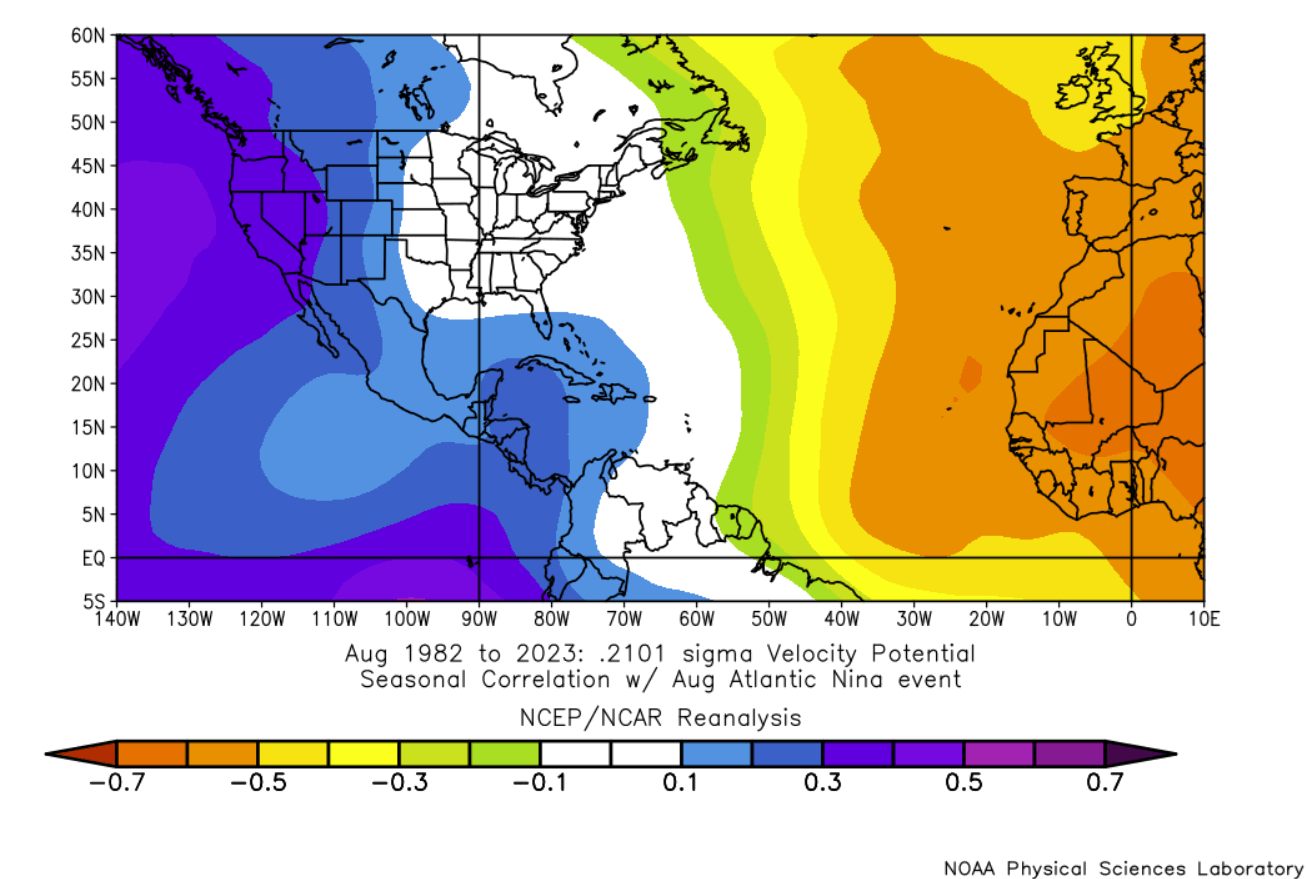
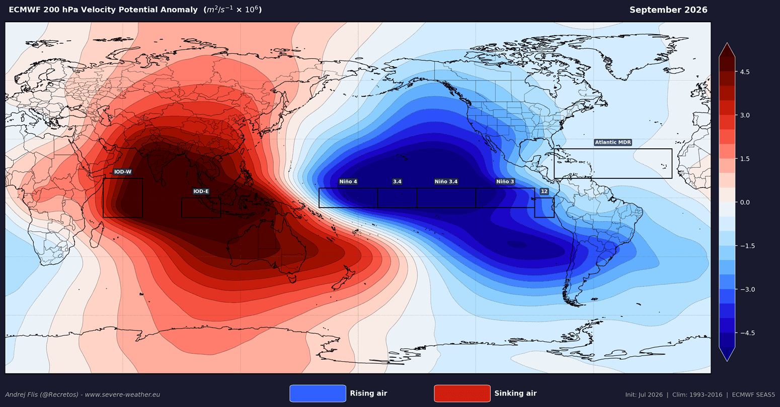
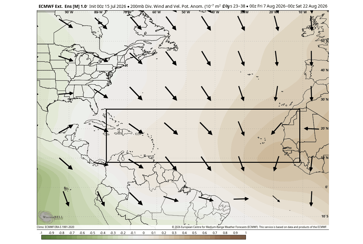
To understand why this environment is so hostile to hurricane formation, meteorologists rely on the "Velocity Potential"—a metric that tracks whether air is rising (which supports storm growth) or sinking (which suppresses it).
During a standard active hurricane season, the "Main Development Region" (MDR)—the "nursery" for Atlantic storms stretching from the coast of Africa to the Caribbean—experiences rising air, which fuels convection and low pressure. In the current 2026 configuration, the velocity potential maps show significant sinking air over the Atlantic. This is a direct consequence of the dual-ocean anomaly: the Super El Niño in the Pacific forces a global circulation pattern that results in descending, stable air over the Atlantic, effectively "capping" potential storms.
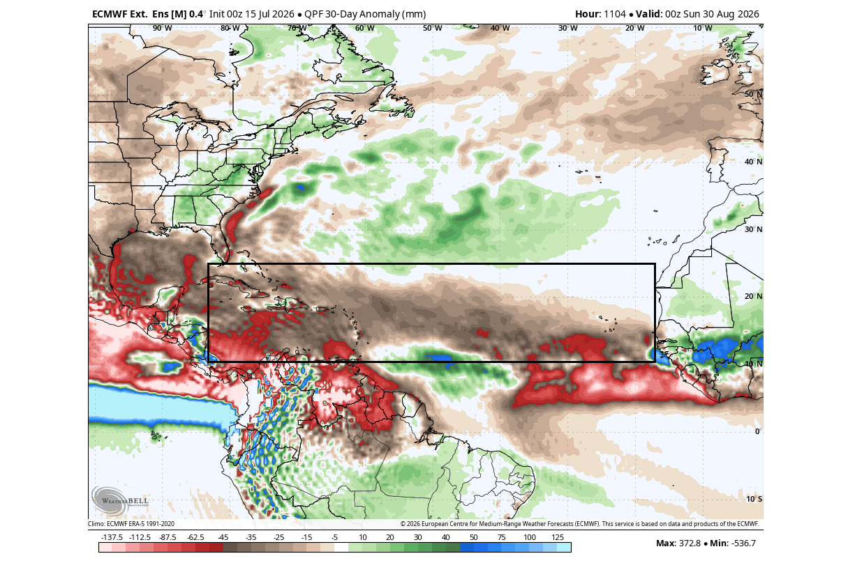
Furthermore, the ECMWF precipitation forecasts for August and September show broad regions of below-normal rainfall across the Caribbean and the U.S. East Coast. This lack of moisture is a primary indicator of suppressed tropical activity. When combined with increased vertical wind shear—the change in wind speed and direction with height, which "tears apart" developing storms—the environment is arguably the most unfavorable it has been in years.
Official Responses and Risk Assessment
The National Hurricane Center (NHC) and academic institutions like Colorado State University (CSU) have adjusted their outlooks to reflect this unique climate setup. Dr. Philip Klotzbach’s team at CSU, widely regarded as the gold standard for seasonal Atlantic forecasting, has highlighted that while the risk of landfalls is significantly reduced, it never reaches zero.
The latest CSU anomaly maps indicate that every coastal county from the Rio Grande in Texas to the shores of Newfoundland faces a lower-than-average hurricane threat for 2026. However, history provides a cautionary tale: the 1992 season was similarly "quiet" due to El Niño conditions, yet it produced Hurricane Andrew, a devastating Category 5 storm. Meteorologists emphasize that it only takes one major event to define a season, and coastal residents should remain vigilant regardless of the broad-scale climate signals.
Implications for Winter 2026/2027
The significance of a quiet hurricane season extends far beyond the autumn months. Meteorologists often look at the Accumulated Cyclone Energy (ACE) index—a measure of the total strength and duration of all tropical storms—as a diagnostic tool for the health of the global atmosphere.
A low ACE index for 2026 is projected, which suggests that the atmospheric conditions driving the current "shield" may also influence the upcoming winter. Research into atmospheric teleconnections suggests that seasons with suppressed tropical activity often correlate with specific stratospheric patterns, including a potential weakening of the Polar Vortex.
The Polar Vortex Connection
The Polar Vortex is a massive area of low pressure and cold air surrounding the Earth’s poles. When it is "strong" and stable, it keeps cold air locked in the Arctic. When it is "weak" or disrupted, the jet stream becomes wavy and unstable, allowing frigid polar air to spill into the mid-latitudes, including the United States, Canada, and parts of Europe.
Evidence suggests that the same global factors contributing to the 2026 Atlantic Niña and Pacific Super El Niño may lead to a warmer-than-average winter stratosphere. A warmer stratosphere is often a precursor to a disrupted Polar Vortex. If this occurs, we could see a winter characterized by volatile weather patterns:
- Increased Cold Outbreaks: A weakened vortex may allow Arctic air to reach deep into the United States and Canada, potentially leading to more frequent and intense winter storms.
- Jet Stream Shifts: A wavy, meandering jet stream will likely replace the typical, stable winter flow, bringing unpredictable temperature swings across the continent.
- Snowfall Variability: While a weak vortex does not guarantee snow, it creates the atmospheric instability necessary for large-scale winter precipitation events.
Conclusion: Monitoring a Changing Climate
The 2026 hurricane season serves as a masterclass in global climate connectivity. The existence of a rare Atlantic Niña alongside a Super El Niño demonstrates how ocean temperatures thousands of miles apart can coordinate to dictate the weather on our doorstep.
While the "atmospheric shield" currently protecting the United States is a welcome relief for hurricane-prone regions, the broader implications suggest that the atmospheric circulation is undergoing a significant shift. As we transition from the summer into the fall and winter, the persistence of these anomalies will be the primary focus of long-range forecasters.
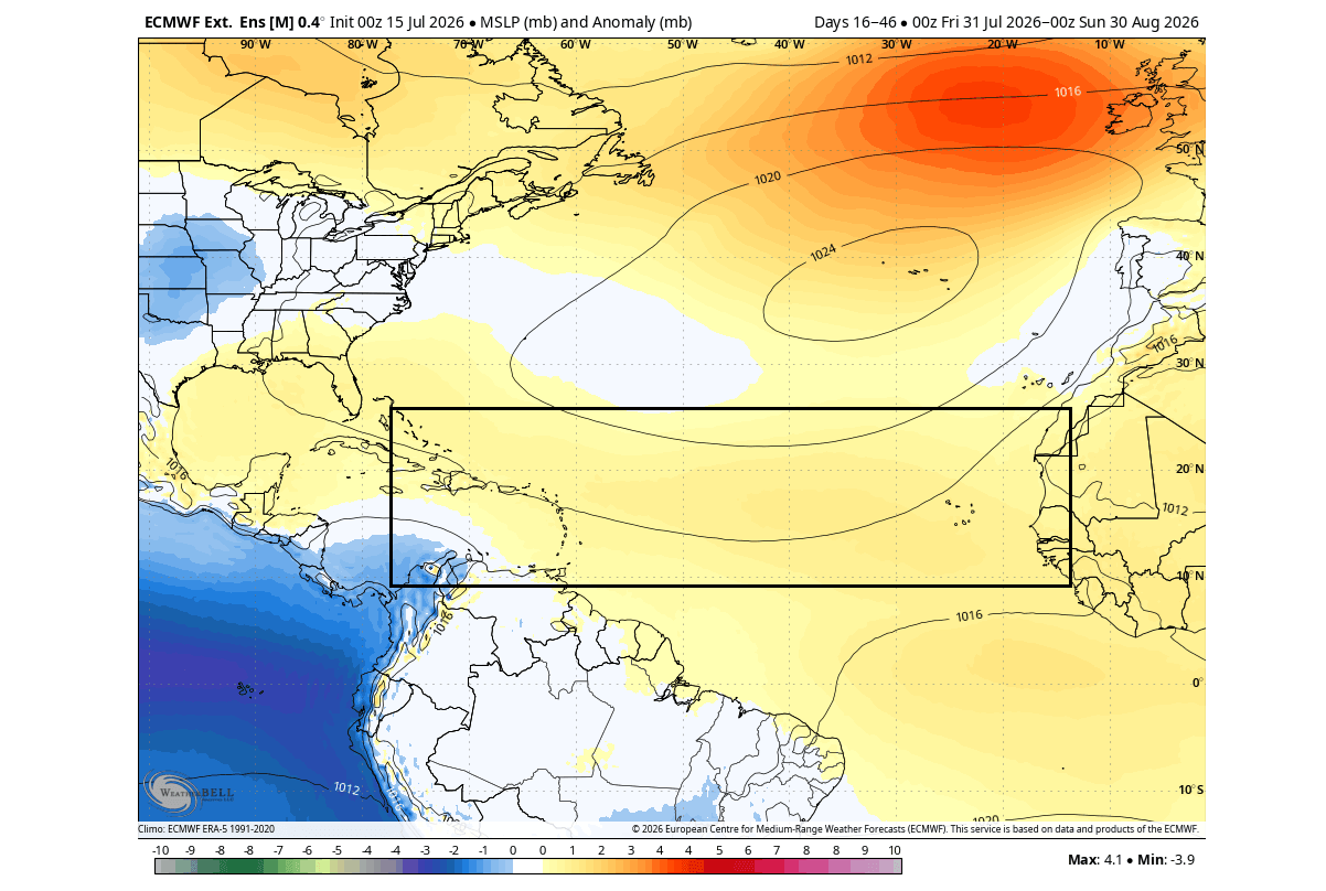
For now, the data is clear: the environment is hostile to hurricane development, offering a rare reprieve for the U.S. coastline. However, the energy saved in the tropics may well manifest in the atmosphere later this year, potentially setting the stage for a high-impact, volatile winter season in 2026/2027. As always, the global weather system remains a complex, interconnected machine, and staying informed is the best defense against the volatility of our changing climate.