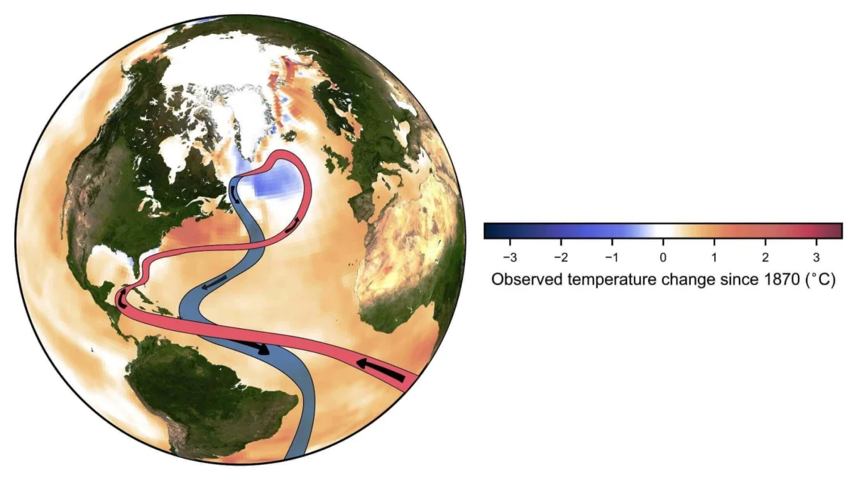
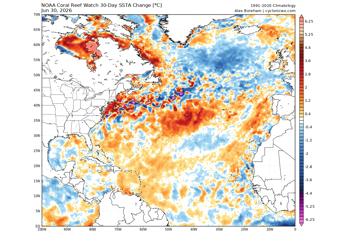
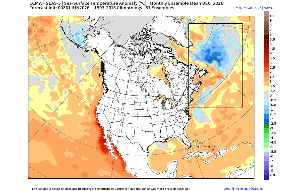
A peculiar and potentially disruptive phenomenon is re-emerging in the far North Atlantic. Oceanographers and meteorologists are tracking the resurgence of the “cold blob”—a massive, persistent region of sub-polar water significantly cooler than historical averages. As this cooling anomaly expands, climate models are increasingly signaling that its influence will stretch well into the winter of 2026/2027.

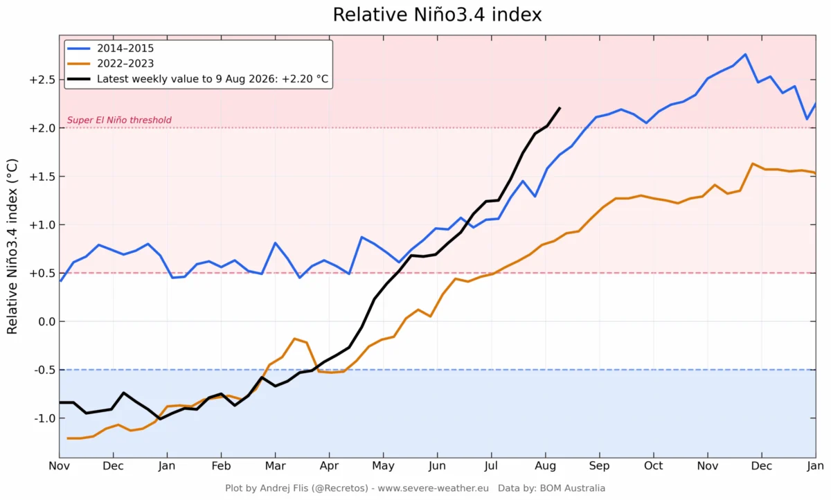
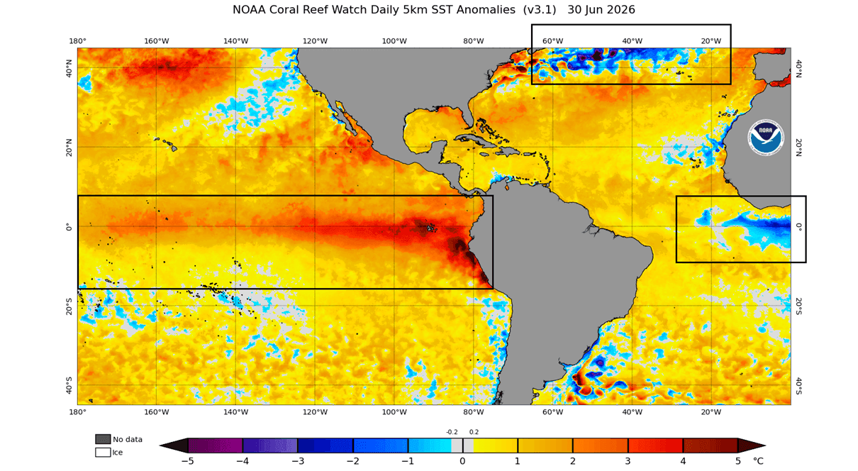
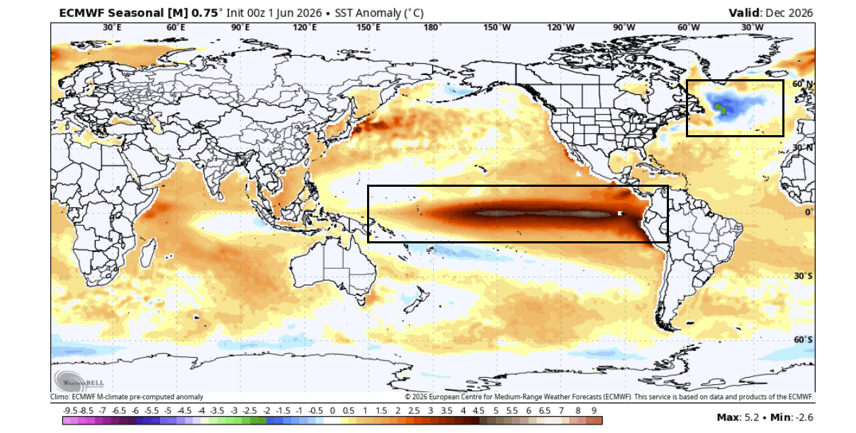
When analyzed in tandem with a rapidly developing “Super El Niño” in the tropical Pacific, this Atlantic anomaly acts as a critical piece of a global climate puzzle. Together, these two forces are already providing early, high-confidence indicators of the pressure systems, jet stream trajectories, and temperature regimes that will likely define the upcoming winter across North America and Europe.
The Mechanics of the Atlantic System: Understanding the AMOC
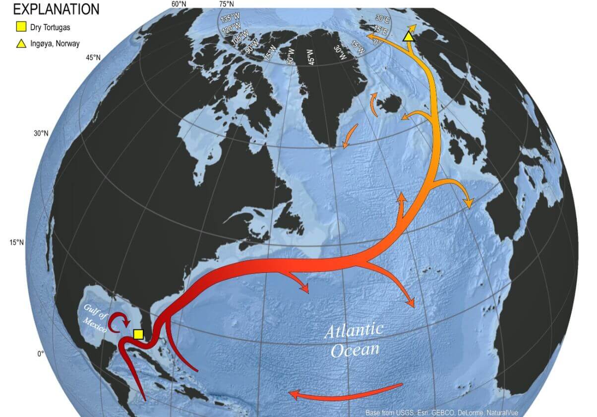
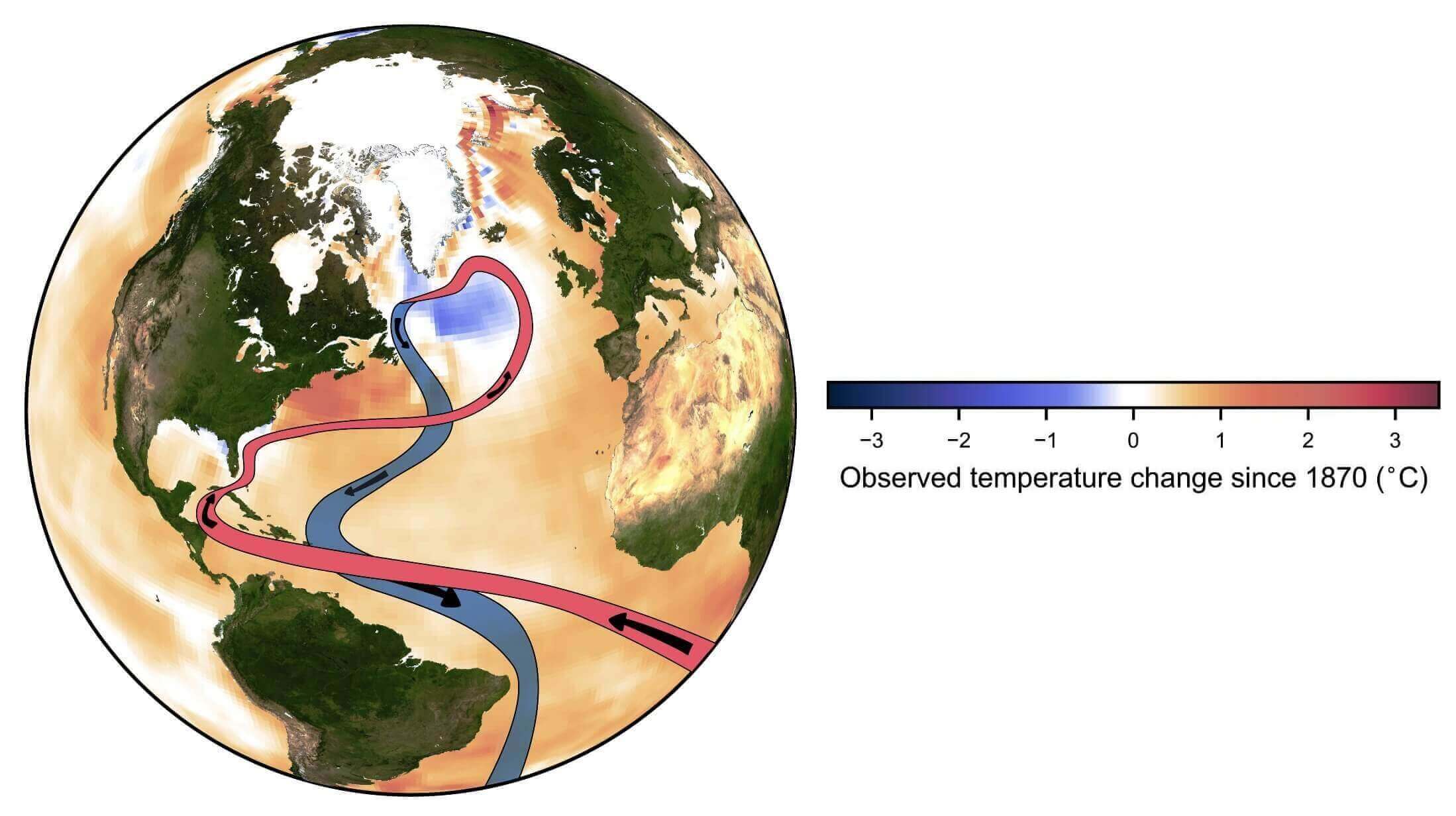
The North Atlantic is not a stagnant body of water; it is a primary driver of the Northern Hemisphere’s climate, governed by the Atlantic Meridional Overturning Circulation (AMOC). Often simplified as the “conveyor belt” of the ocean, this system carries warm, saline water from the tropics toward the Arctic. The Gulf Stream, which flows along the eastern seaboard of the United States, represents the most recognizable component of this system.
As this warm water reaches the far North Atlantic—specifically the subpolar gyre east of Newfoundland—it releases massive amounts of heat into the atmosphere, cools, becomes denser, and sinks. This sinking action drives the entire global circulation. However, recent observational data, corroborated by long-term reanalysis, suggests this "conveyor belt" is faltering.
The Slowdown of the Circulation
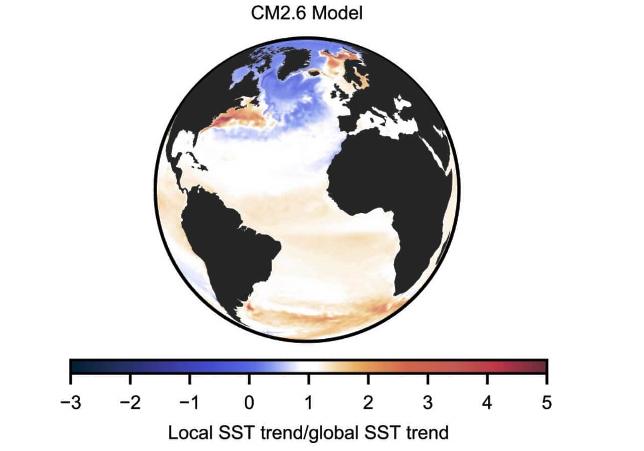
The current "cold blob" is a physical manifestation of this weakening circulation. When the AMOC slows, it fails to transport enough warm tropical water to the north, leaving the subpolar Atlantic in a state of thermal deficit. Computer simulations of an AMOC collapse show a striking parallel to current sea-surface temperature (SST) maps: they depict a warming trend along the U.S. East Coast—caused by water "piling up" as it fails to move northward—and a stark, deepening cold zone in the North Atlantic. Recent instrumental observations confirm that this decline is not merely a theoretical risk, but an ongoing reality, occurring perhaps even faster than previous climate models had anticipated.
Chronology: The Growth of the Cold Anomaly
The formation of the current cold blob is not an isolated incident but a continuation of a decadal trend.
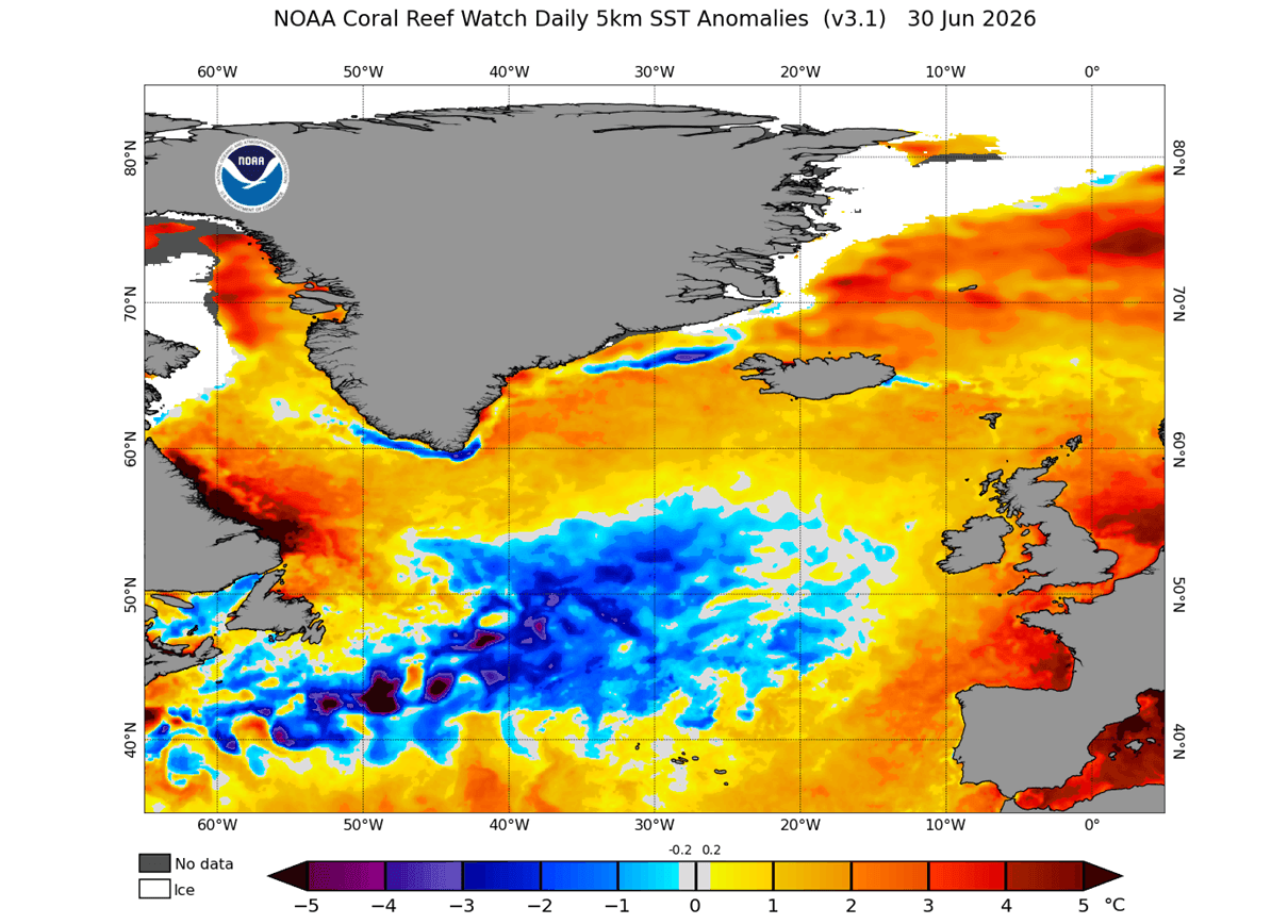
- Mid-2026: NOAA’s Coral Reef Watch (CRW) and other oceanic monitoring platforms began detecting a clear cooling anomaly in the far North Atlantic. Unlike the transient cooling events of previous years, this formation has shown remarkable structural stability.
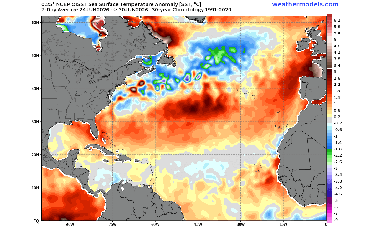
- Late June 2026: A seven-day average analysis revealed that the cold area is not only persistent but is actively linked to the Gulf Stream flow. This indicates that the thermal disruption is becoming "organized" and increasingly deep-seated.
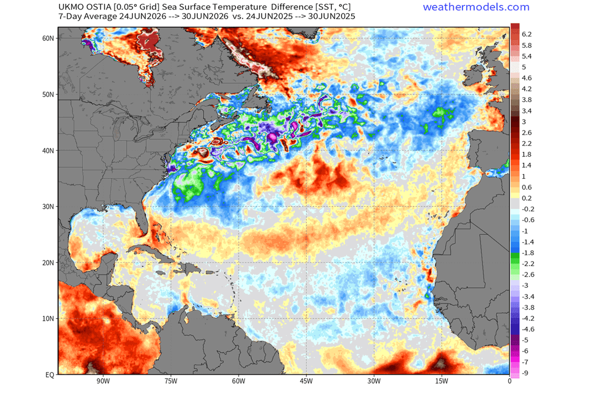
- The One-Year Delta: Comparisons between June 2025 and June 2026 surface temperatures reveal that large swaths of the North Atlantic are between 0.5°C and 2.0°C cooler than they were just twelve months ago.
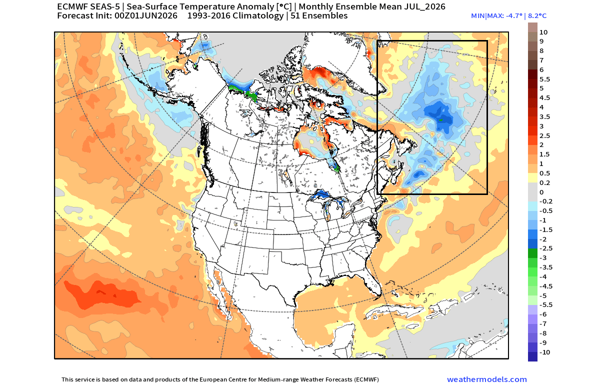
- The Forecast Trajectory: Long-range predictive models, including the ECMWF (European Centre for Medium-Range Weather Forecasts), indicate that this anomaly will remain a dominant feature through December 2026 and into the early months of 2027.
Supporting Data: The Global "Tri-Headed" Pattern
To understand the significance of the cold blob, one must look at the global "dashboard." We are currently observing a tri-headed atmospheric driver: the North Atlantic cold anomaly, the developing Super El Niño in the Pacific, and the subsequent response of the polar jet stream.
The PNA Connection
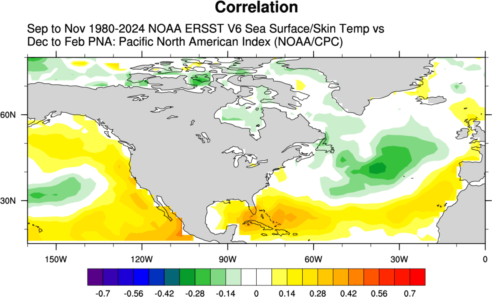
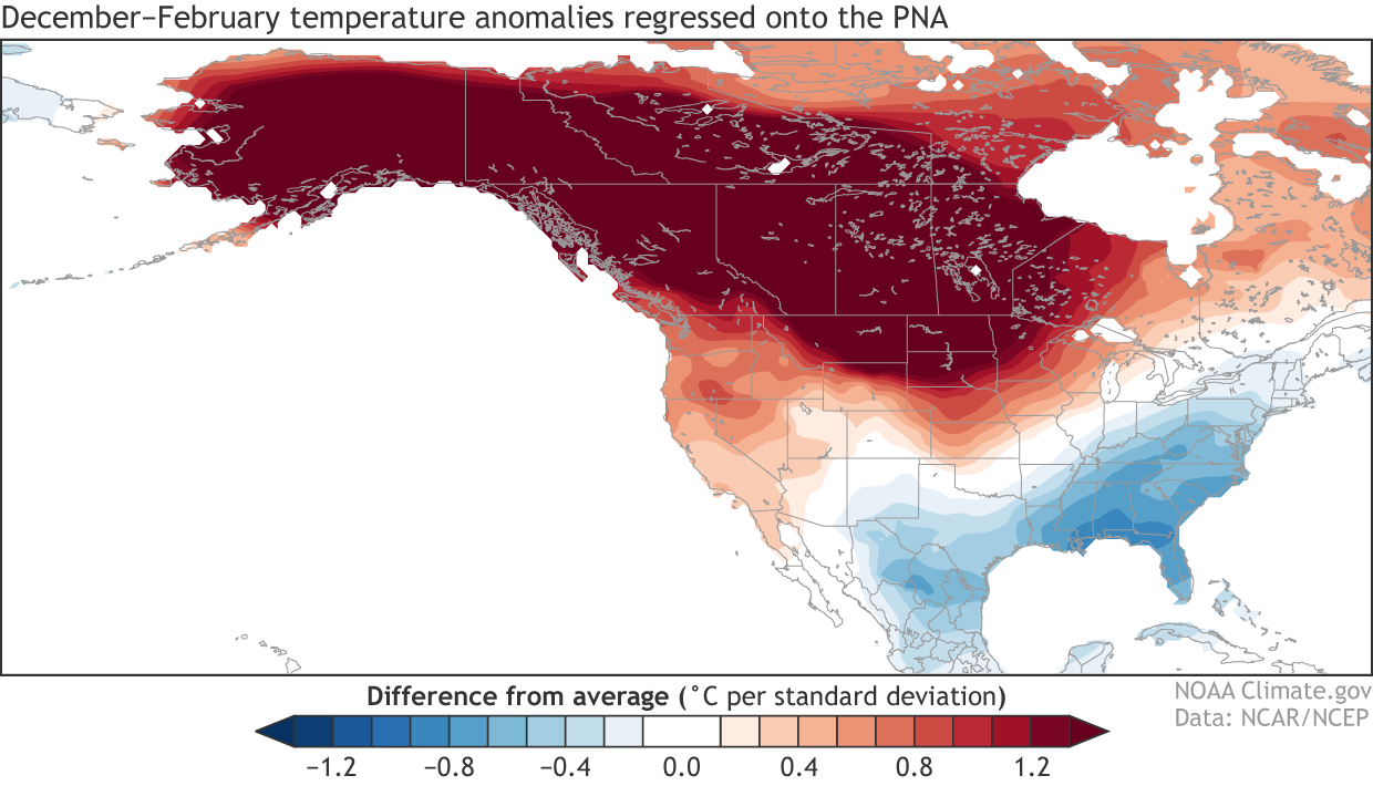
Meteorologists rely on the Pacific-North American (PNA) pattern to correlate oceanic anomalies with atmospheric outcomes. Historical data shows a robust correlation between a cold Atlantic blob in the fall and a positive PNA phase during the following winter.
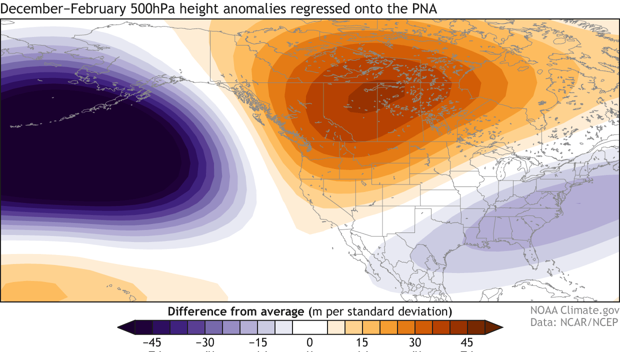
A positive PNA phase is characterized by:
- High Pressure: A persistent ridge of high pressure over the northwestern United States and western Canada.
- Low Pressure: A trough of low pressure (often associated with cold air) over the central, southern, and eastern United States.
- The Result: This configuration forces the polar jet stream to dip southward, funneling frigid arctic air into the eastern half of the North American continent.
The Super El Niño Factor
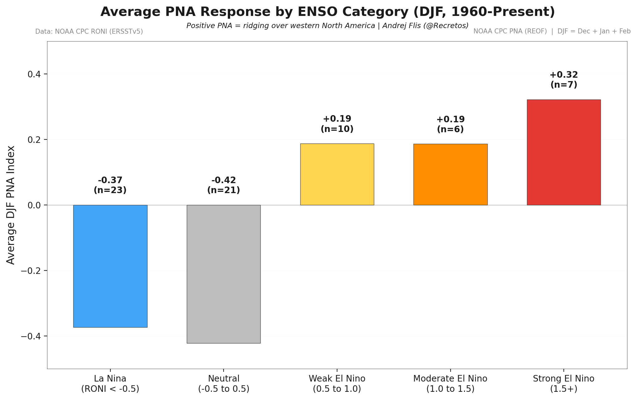
While the Atlantic blob sets the stage, the Super El Niño in the tropical Pacific is the primary engine of the 2026/2027 winter. Data from the last four Super El Niño events show a consistent, high-impact pattern: a deep low-pressure system in the North Pacific, a strong blocking high over Canada, and a resulting "cold corridor" that forms over the central and eastern U.S.
The coincidence of these two phenomena—a cold Atlantic and a warm Pacific—creates a "perfect storm" for long-range forecasting. The models are converging on a scenario where the Pacific drives the macro-scale atmospheric pressure, while the Atlantic anomaly anchors the cold-air distribution in the Eastern Hemisphere and North America.
Implications for Winter 2026/2027
What does this mean for the average citizen in North America or Europe? The predictive modeling provides a glimpse into a winter of extremes.
North America: A Tale of Two Regions
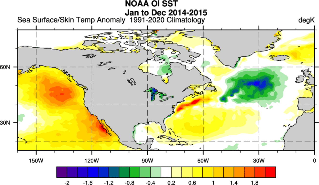
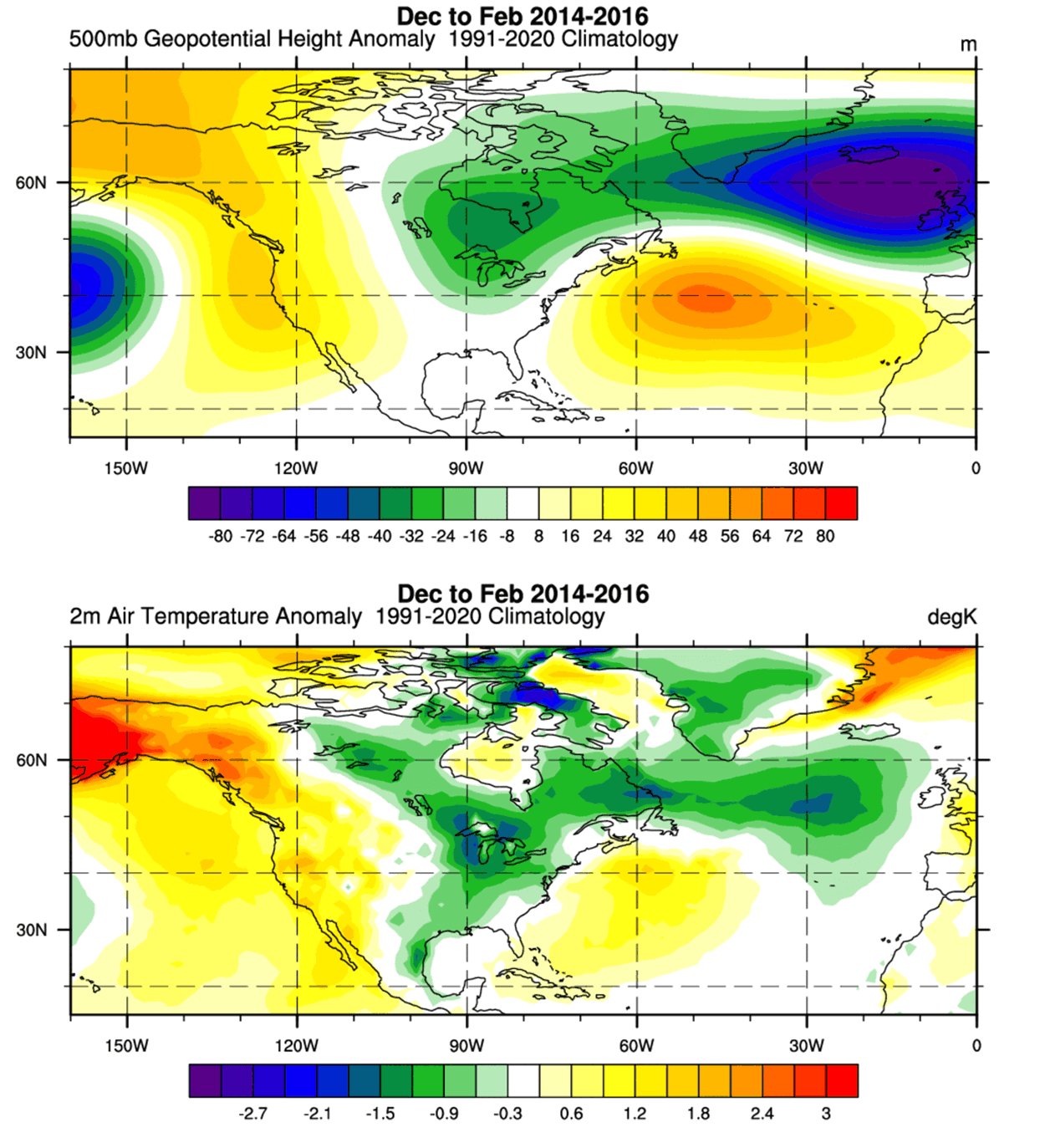
The CFS (Climate Forecast System) and other global models point toward a distinct temperature split. Under the influence of the Super El Niño, the northern United States and western Canada may experience warmer-than-average temperatures due to the high-pressure ridge. However, the "cold corridor" created by the positive PNA phase suggests that the Midwest, the South, and the entire Eastern Seaboard should prepare for intermittent, intense cold snaps. This is consistent with the winter of 2014-2015, which featured a similarly strong cold blob and resulted in significant, long-lasting cold anomalies across the eastern U.S.
Europe: The Shift in Pressure
For Europe, the implications are somewhat different. As the winter progresses, the high-pressure ridge from the south is expected to exert a stronger influence, potentially leading to warmer anomalies in central, western, and southern Europe. However, this high pressure can also act as a "block," occasionally redirecting northern cold air masses toward Scandinavia or the British Isles, depending on the specific alignment of the jet stream.
Expert Analysis and Official Outlooks
The convergence of these signals is rare. Meteorological centers globally are treating this as a high-confidence forecast due to the alignment of multiple, historically validated indicators.
The "Dashboard" Analogy
In modern meteorology, ocean anomalies serve as the "dashboard lights" of our planetary climate system. Just as a warning light on a car dashboard alerts a driver to a change in engine performance, the cold blob in the North Atlantic signals a fundamental shift in the heat-exchange capacity of our oceans.
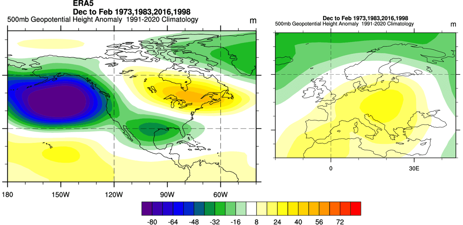
When researchers compare the 2026 data to the 2014-2016 period, the similarity is startling. The pressure maps, the geopotential heights, and the surface temperature anomalies all mirror the conditions that led to the severe, cold-driven winter patterns of that decade.
Conclusion: A Season of High Volatility
The scientific consensus remains that while the Atlantic cold blob is a secondary driver compared to the monumental force of a Super El Niño, it acts as a critical modulator. It defines the "shape" of the winter—where the cold will settle and how long it will stay.
As we move toward the final months of 2026, the data suggests that the atmospheric response to these oceanic conditions is already locked in. While seasonal forecasts are inherently probabilistic, the current alignment of the Pacific and Atlantic signals provides one of the clearest early-look scenarios in recent years. Residents across the United States, Canada, and Europe should remain vigilant, as the interplay between these two massive oceanic systems is setting the stage for a winter defined by significant atmospheric volatility and potentially sharp, localized temperature shifts.
The "cold blob" is no longer just a scientific curiosity; it is a key variable in the seasonal outlook, marking a winter that will test the resilience of infrastructure and the preparedness of the regions lying in the path of the shifting jet stream.