While Ilulissat—Greenland’s undisputed tourism capital—draws thousands of global visitors to its UNESCO World Heritage-listed Icefjord, a more intimate and solitary experience awaits those willing to venture just 20 kilometers to the north. The coastal trail to the historic fishing settlement of Oqaatsut offers a rare glimpse into a vanishing way of life, where the silence of the Arctic is interrupted only by the rhythmic lapping of the sea against weather-beaten wooden cottages.

Main Facts: The Arctic Trail Experience
The trek to Oqaatsut is not merely a walk; it is a transition from the hub of modern Greenlandic tourism into a quiet, traditional world. The journey begins near the iconic Hotel Arctic in Ilulissat and winds along the rugged western coastline.

The route is defined by its accessibility, categorized as an "easy" trek that nonetheless demands respect for the unpredictable Arctic environment. Spanning approximately 41 kilometers (25.5 miles) as an out-and-back journey, the trail is marked by traditional rock cairns and orange blazes. While the path doubles as a snowmobile and dog-sledding track during the long winter months, the window for summer hiking is narrow, typically extending from late June through September.

With a total elevation gain of 946 meters (3,104 feet), the trail provides sufficient challenge to be engaging without requiring specialized mountaineering skills. Most hikers complete the trek in anywhere from 10 hours to two days, depending on their pace and desire to soak in the desolate, monochromatic beauty of the coastline.

Chronology of the Route
The journey can be broken down into distinct stages, each offering a different perspective on the Greenlandic landscape:

The Departure (0–3 km): Starting at the Hotel Arctic, the initial leg of the hike runs parallel to the Ilulissat airport. Currently undergoing a significant expansion project—slated for completion in 2026—this section is the most industrial part of the journey. Once past the construction zone, the sensory experience shifts rapidly from the mechanical hum of airport operations to the absolute stillness of the tundra.

The Coastal Stretch (3–7.5 km): As hikers move further north, the trail hugs the shoreline. This is a region defined by contrast: the vibrant, primary-colored exteriors of traditional fishing huts stand in stark defiance against the muted, leaden tones of the rocky shore and the dark, icy waters of the bay.

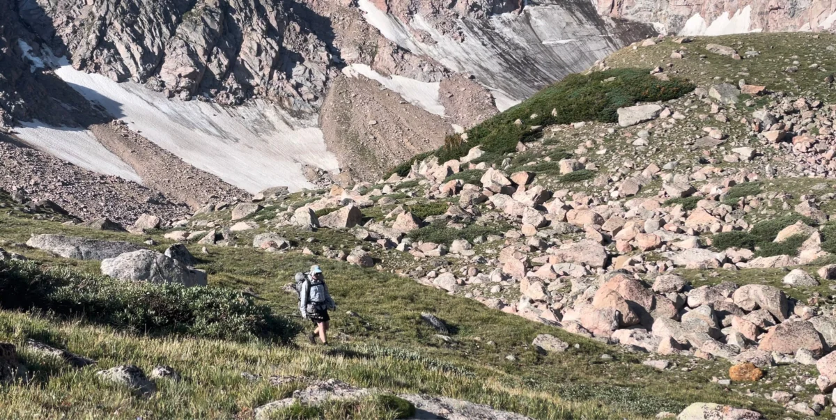
The Hinterland and Lakes (7.5–15 km): Passing through a narrow gorge, the trail opens into a landscape dotted with small, tranquil lakes. The area near the outlet stream of the Kangerluarsup Tasia Qalleq Lakes serves as the premier camping spot for those turning the trek into an overnight adventure. The terrain here is grassy and partially sheltered, providing a rare reprieve from the coastal winds.

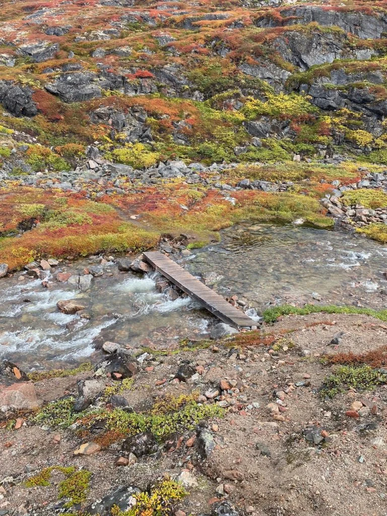
The Final Approach (15–20.5 km): The route ascends, contouring around the serene Qarajaq Cove. This elevated section is widely considered the highlight of the trip, offering panoramic views over the iceberg-choked Kangerluarsuk Bay. A final climb over a rocky saddle and past a small waterfall leads travelers into the village of Oqaatsut.

Supporting Data and Logistics
For those planning this excursion, preparation is paramount. The following data points are essential for a safe and successful trip:

- Distance: 41 km (25.5 miles) total (out-and-back).
- Total Elevation: 946 m (3,104 ft).
- Difficulty: Easy/Moderate (depending on weather conditions).
- Accessibility: Accessible via foot from Ilulissat; no vehicle access to Oqaatsut.
- Infrastructure: The trail is well-maintained with cairns and markers, but there are no emergency services along the route.
Travelers should note that while Oqaatsut is a functioning settlement with a small population, it is not a tourist resort. It is a place of residence. Visitors are expected to practice "leave no trace" principles, particularly when camping near the Kangerluarsup Tasia Qalleq Lakes, to protect the fragile permafrost and local ecosystem.

Official Perspectives and Local Significance
Local authorities in Ilulissat have long emphasized the importance of balancing the growing demand for tourism with the preservation of traditional settlements like Oqaatsut. While the Icefjord remains the primary economic engine for the region, the trail to Oqaatsut represents a "sustainable alternative" that disperses foot traffic away from the most heavily visited UNESCO areas.

"The goal is not to industrialize the hiking experience, but to provide a corridor for visitors to witness the authentic rhythm of life in a fishing village," says a local tourism representative. By encouraging hikers to explore on foot, the town hopes to foster a deeper appreciation for the maritime history that defines the Greenlandic identity. The village of Oqaatsut itself—which has a population of fewer than 50 people—remains a testament to the endurance of indigenous fishing practices. It is a place where the passage of time is measured by the migration of whales and the movement of sea ice rather than the clock.

Implications for the Future of Arctic Tourism
The trek to Oqaatsut serves as a microcosm of the challenges facing Arctic travel. As global interest in Greenland grows, the infrastructure must adapt. The expansion of the Ilulissat airport, while controversial to some locals due to the noise and environmental impact, is intended to make the region more accessible for year-round tourism.

However, the "wild" aspect of the trail to Oqaatsut remains a priority for conservationists. Unlike other parts of the world where trails are paved or heavily modified, the Oqaatsut route remains largely natural. The implication is clear: the future of this region depends on the behavior of the individual hiker. The trail is an experience in solitude, and keeping it that way requires a conscious effort from the tourism board and the visitors alike to avoid overcrowding or environmental degradation.

For the modern traveler, the walk to Oqaatsut is more than just a physical challenge; it is a mental reset. In a world of hyper-connectivity, the path offers a rare chance to unplug. It is a journey back in time, where the only thing on the agenda is to reach the next cairn, and the only soundtrack is the whisper of the wind over the ice.

Whether you are a seasoned trekker or an amateur looking for a unique adventure, the route to Oqaatsut stands as one of the most rewarding experiences in the Nordic region. As highlighted in Wanderlust Nordics, this trail remains a quintessential example of how the rugged, unforgiving, and breathtakingly beautiful landscapes of Greenland can be experienced with minimal impact and maximum reward.
Quick Tips for Your Trek:
- Footwear: Sturdy, waterproof hiking boots are non-negotiable. The terrain is rocky and can be boggy in the summer months.
- Layers: Even in July, temperatures can drop rapidly. Pack high-quality base layers and a reliable windproof jacket.
- Navigation: While the route is marked, downloading offline maps (such as Gaia or AllTrails) is highly recommended for safety.
- Respect the Wildlife: You are walking through the habitat of Arctic foxes, hares, and various bird species. Keep a respectful distance.
- Water: Fresh water is generally abundant from glacial streams, but always carry a purification method just in case.