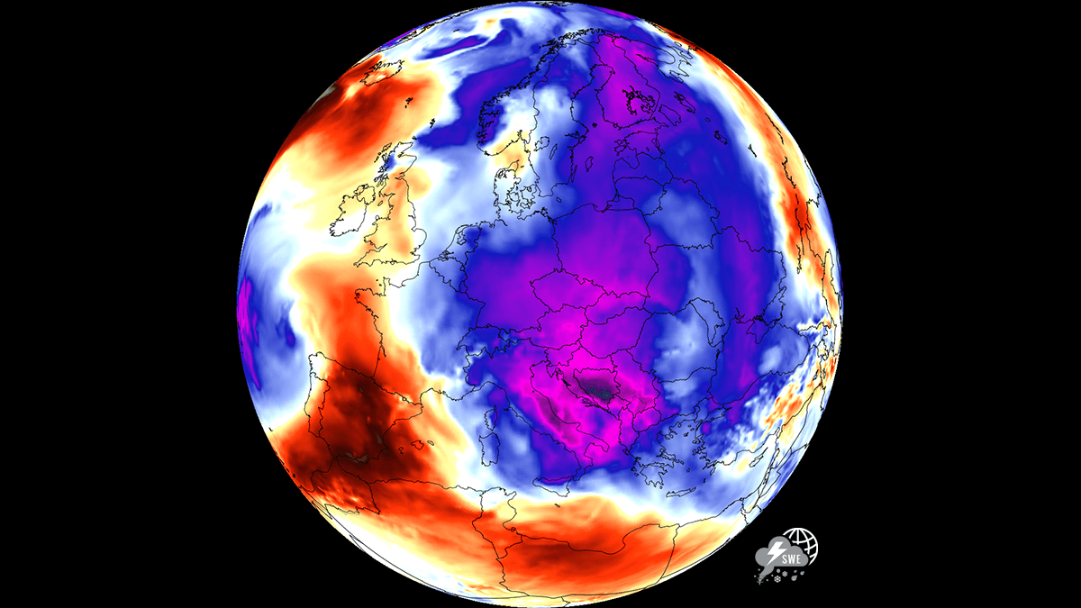
After enduring a grueling, record-breaking stretch of intense thermal stress that has gripped the European continent for weeks, a significant atmospheric transformation is underway. A massive, high-amplitude weather pattern shift is currently sweeping across the eastern half of the continent, offering a much-needed reprieve from the relentless heat. Central Europe and the Balkan Peninsula, regions that have been battered by urban heat islands, soaring nighttime temperatures, and persistent heat stress, are finally witnessing a dramatic, welcomed downturn in mercury levels.
This transition marks a pivotal moment for millions of residents, providing a vital opportunity for infrastructure to cool down and for human health to recover from the accumulated strain of a prolonged summer heatwave. While the relief is palpable, meteorologists warn that the arrival of this colder air mass brings its own set of environmental complexities, including severe thunderstorm potential and continued high-risk wildfire conditions.
Main Facts: The Anatomy of a Weather Pivot
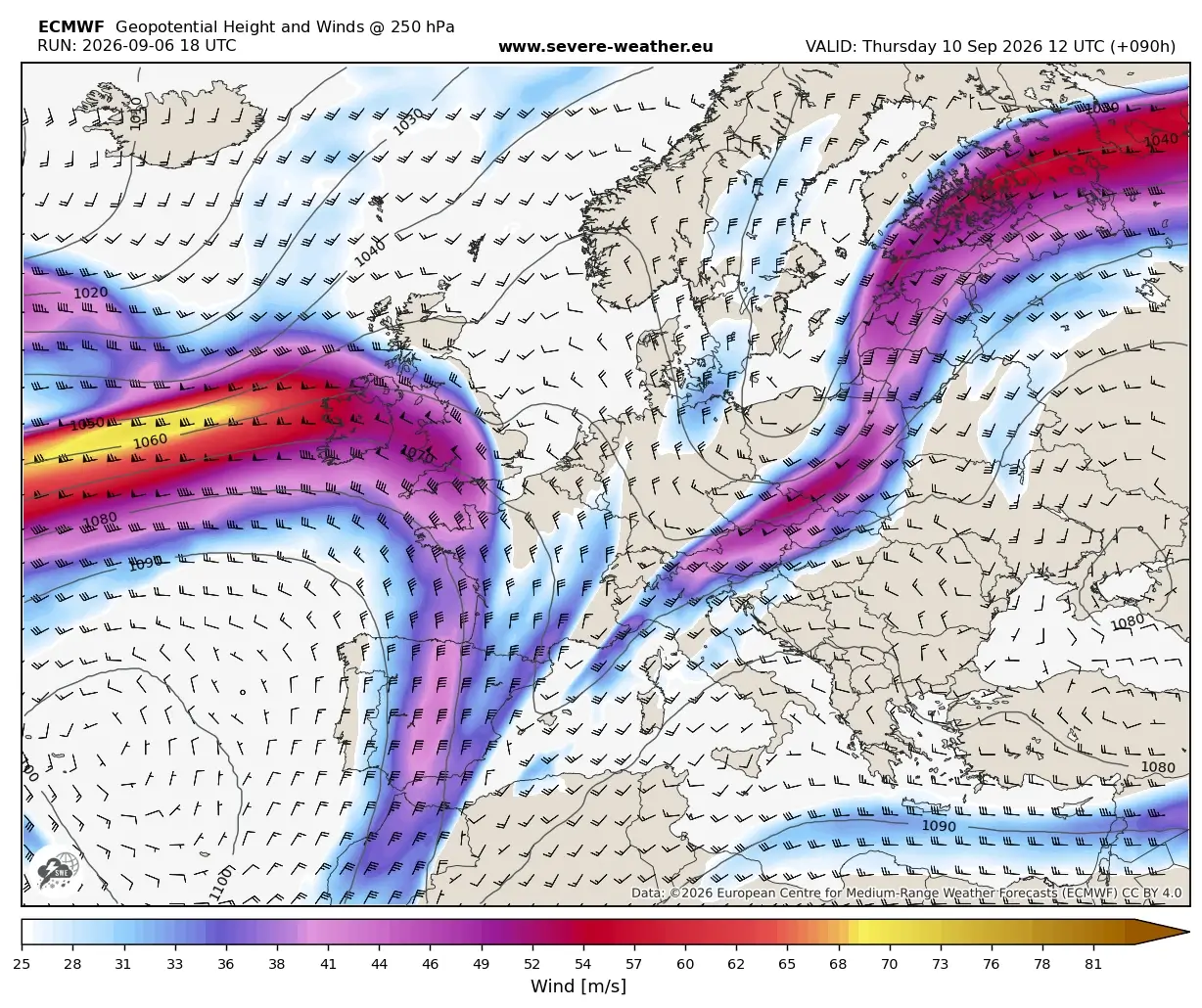
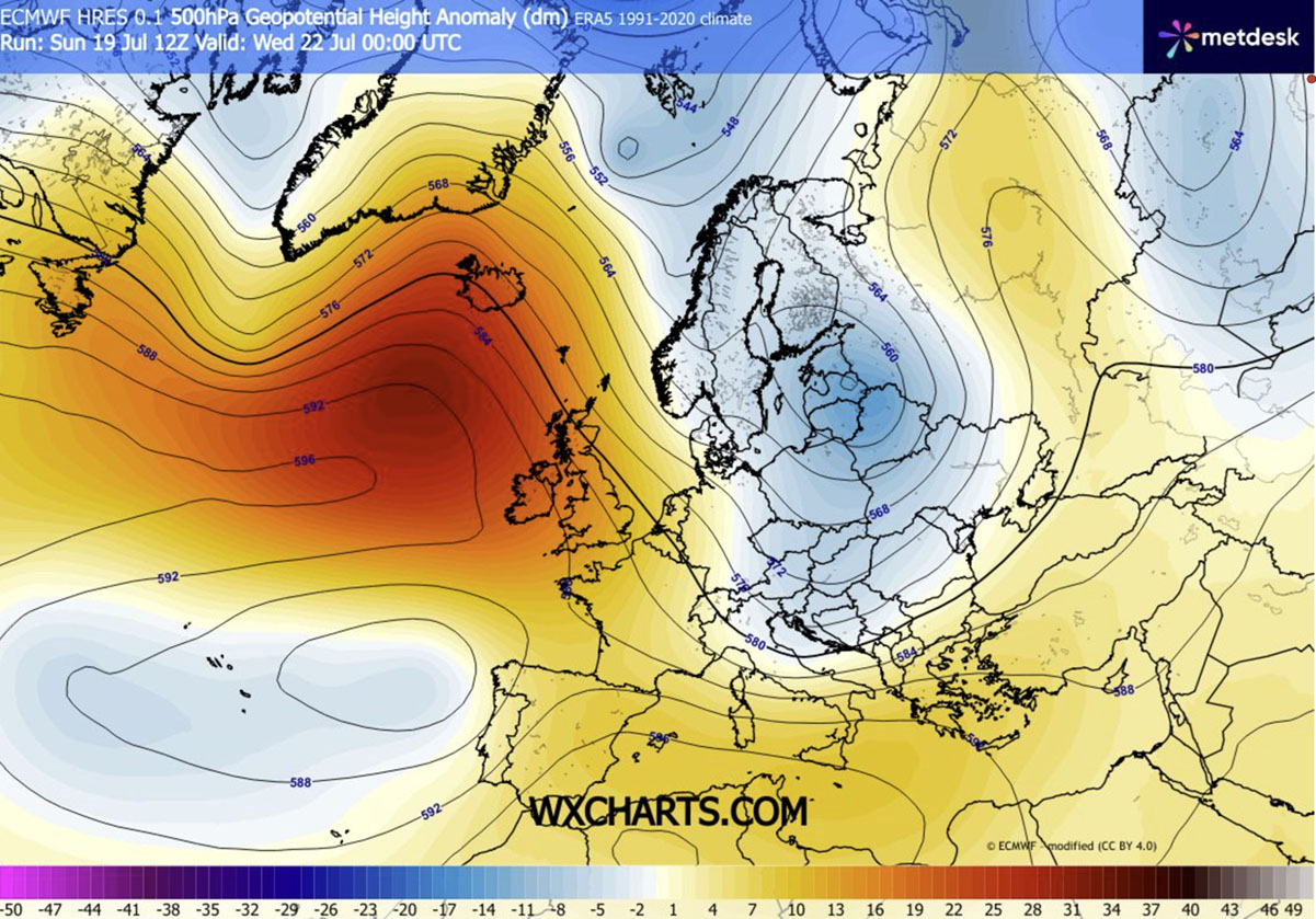
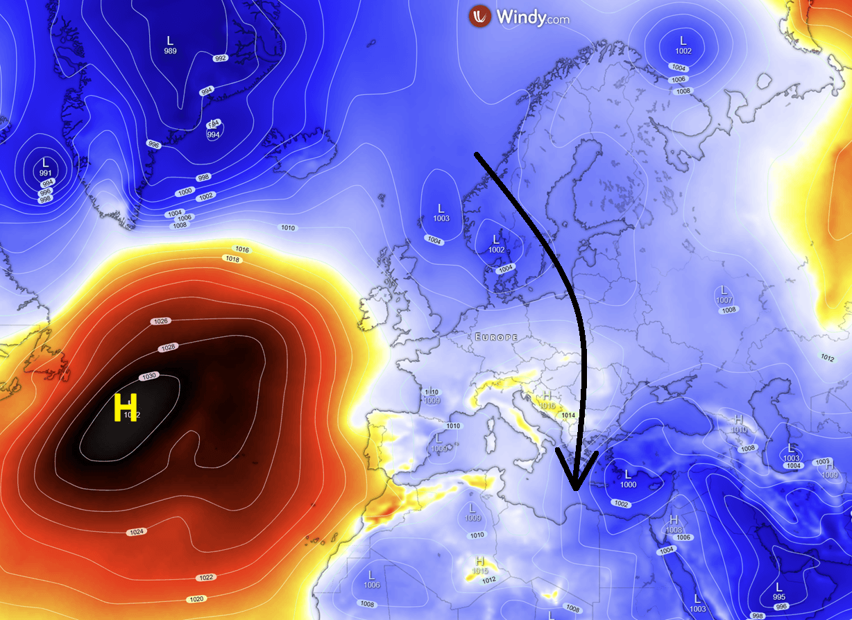
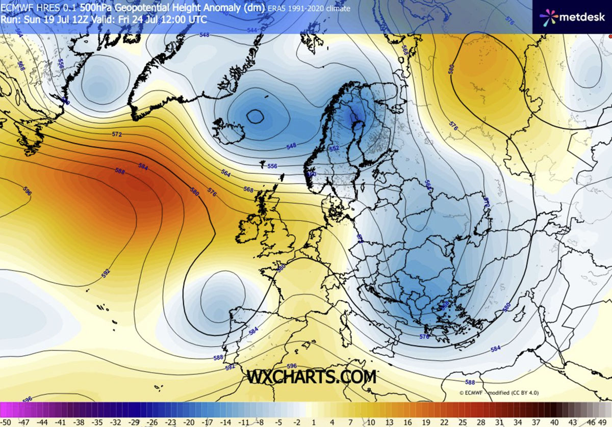
The current weather shift is driven by a dynamic, large-scale upper-level flow. An strengthening high-pressure ridge over the Atlantic has created a "blocking" effect, which in turn has allowed a deep, cold-core low-pressure system to dig southward from the Arctic circle. This reconfiguration of the jet stream is pulling cooler, more unstable air masses into the heart of Europe.
Key Highlights:
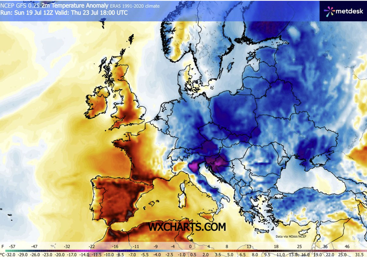
- Temperature Reversal: Daytime highs, which were consistently hovering in the mid-to-high 30s (°C), are dropping significantly. In many central and eastern regions, temperatures are falling to, or even below, seasonal averages, staying comfortably under the 30°C threshold.
- The "Cold Wave" Reach: By late this week, the cooling effect will extend from the Baltic states down to the southern Balkans and the Eastern Mediterranean, with temperature anomalies ranging from 4°C to 8°C below the long-term norm.
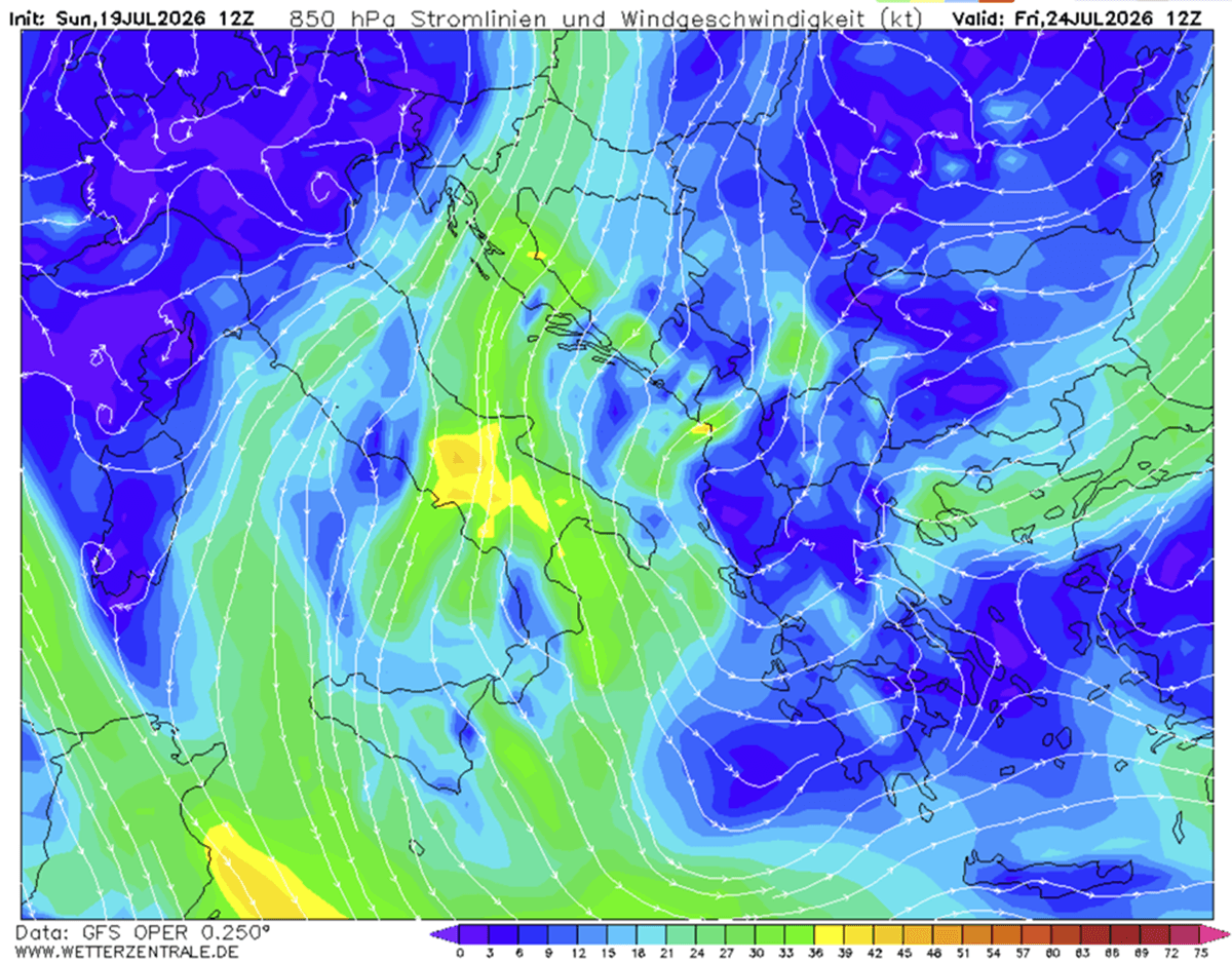
- Atmospheric Instability: The collision between the retreating tropical air mass and the incoming polar flow is creating a high-energy environment. This is triggering scattered, intense thunderstorms, particularly across the southern Balkans, Greece, and the Ionian Sea.
- The Wildfire Paradox: While the drop in temperature is beneficial, the accompanying dry, gusty winds are maintaining high wildfire risks in regions where the soil remains parched from the preceding weeks of extreme drought.
Chronology of the Shift
The transformation is not instantaneous but rather a progressive atmospheric march that is reshaping the European map over the course of several days.
Early Week: The Northern Invasion
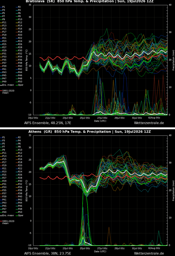
The process began with the strengthening of the Atlantic ridge, which acted as a catalyst, forcing the cold front to push across Northern and Central Europe. By Monday and Tuesday, nations such as Poland, the Czech Republic, and Slovakia began to notice a marked decrease in humidity and a rapid decline in afternoon peaks.
Mid-Week: The Central and Eastern Entrenchment
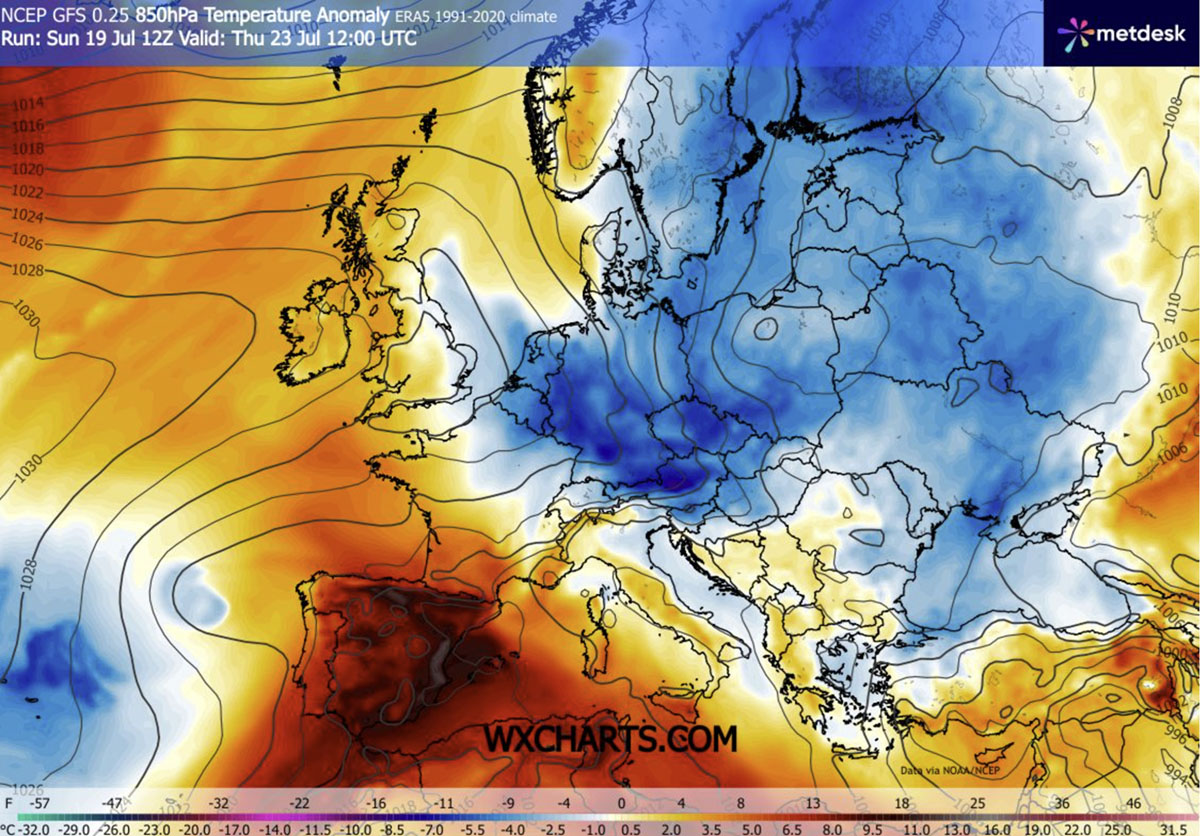
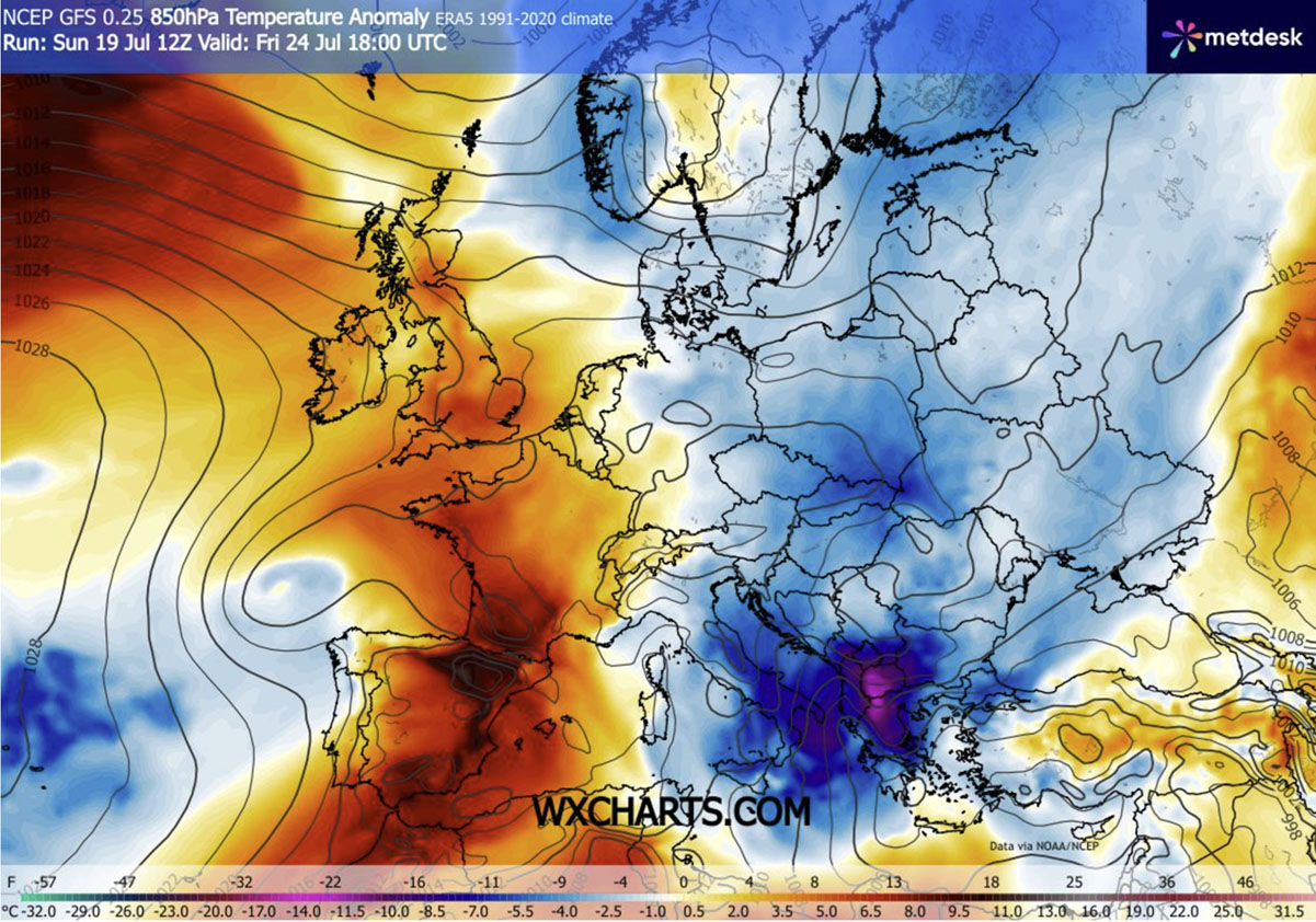
Wednesday and Thursday serve as the critical transition period for the Balkan Peninsula and Hungary. The 850mbar temperature anomalies show a massive influx of cooler air, with significant cooling recorded in northern Italy, Austria, and the northern Balkans. Residents in these areas are experiencing the most dramatic contrast, as the "tropical nights"—where temperatures fail to drop below 20°C—are finally being replaced by refreshing morning temperatures in the low-to-mid 10s.
Late Week: Southern Expansion
By Friday and Saturday, the core of the cold wave reaches its southern extent. The southern Balkans, Greece, and parts of Italy will experience the most impressive anomalies, with temperatures projected to be 10–12°C below normal for this time of year. This represents a significant shift for a region currently in the peak of the tourist season, where travelers who have been stifled by heat are finally finding relief.
Supporting Data and Meteorological Analysis
The transition is being meticulously tracked by atmospheric modeling. The shift from a zonal flow to a more "meridional" flow—where air moves primarily from north to south rather than west to east—is the primary engine of this change.
The Role of Geopotential Falls
As geopotential heights fall over Eastern Europe, the surface pressure is responding accordingly. The "western block" is effectively squeezing the atmosphere, creating a channel for air masses originating in the far north to descend directly toward the Mediterranean.
Wind Dynamics
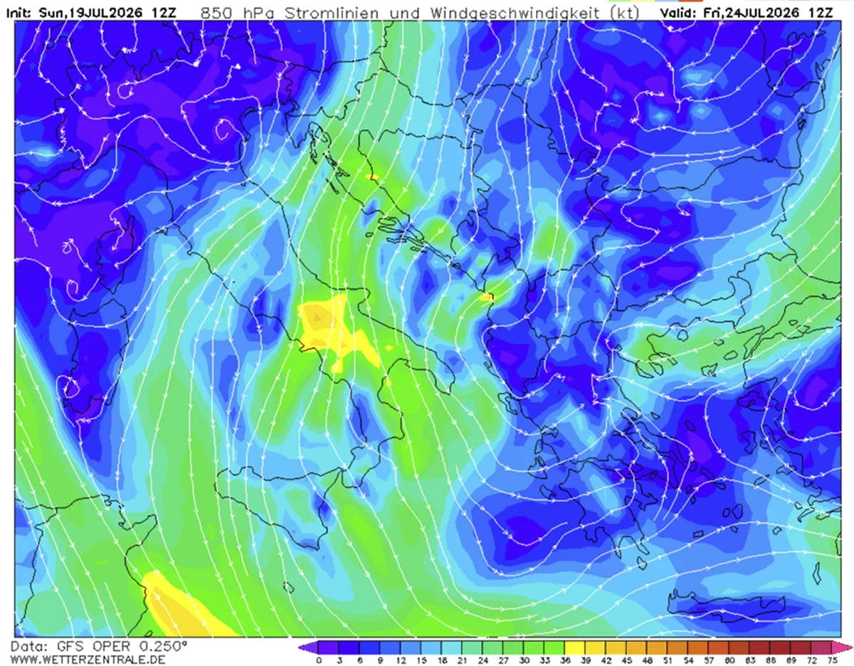
The pressure gradient between the high-pressure system over the Atlantic and the deepening trough over the East is driving increased wind speeds from Wednesday through Saturday. While these winds are essential for bringing in the cooler, drier air, they are also a double-edged sword. In the absence of sustained, widespread precipitation, these dry, breezy conditions are keeping the forest fire danger index at critical levels across the southern Balkans and the Black Sea region.
Precipitation and CAPE (Convective Available Potential Energy)
Meteorological models indicate that the collision of air masses is creating high-instability zones. As the cold air meets the residual heat trapped in the Ionian Sea and the southern Mediterranean, there is significant potential for severe, convective thunderstorm activity. These storms are expected to produce localized, heavy downpours, which may provide some minor agricultural drought relief, though they are unlikely to be sufficient to reverse the long-term hydrological deficit.
Official Responses and Public Health Implications
Public health authorities across Central and Eastern Europe have been on high alert for weeks due to the, at times, lethal heat. With this shift, the focus of emergency management is transitioning from heat-stroke mitigation to storm safety and infrastructure monitoring.
Infrastructure Relief
During the height of the heatwave, municipal infrastructure—including rail lines and power grids—was under severe strain. The current cooling trend is allowing for a "reset" period, where thermal expansion issues in transport networks and the extreme demand on electrical grids for air conditioning are finally stabilizing.
Cautionary Warnings
Despite the relief, government weather agencies have maintained high-level warnings for several reasons:
- Sudden Temperature Shock: While beneficial, the rapid decline in temperatures can be a shock to the vulnerable, particularly the elderly.
- Wildfire Vigilance: Emergency services remain on high alert. The combination of dry vegetation and the forecasted windy conditions means that a single spark could still lead to rapid fire propagation.
- Severe Weather Alerts: Localized flooding, although rare, remains a risk in the event of slow-moving, high-precipitation thunderstorms during the latter half of the week.
Implications: A Temporary Pause or a Lasting Change?
For millions of citizens, this week serves as a "vital pause." The relentless nature of the July heatwave had created a cumulative stress effect on both the population and the environment. This break provides a psychological and physical recovery period.
However, climatologists note that the atmosphere remains in a state of flux. While the Eastern half of Europe finds respite, the Iberian Peninsula continues to bake, with temperatures in Spain and Portugal holding steady in the 40s. This juxtaposition highlights the current state of the European climate, where extreme heat is becoming a regionalized but persistent feature.
Looking Ahead
As the weekend approaches, the cold wave is expected to settle into a pattern that will keep temperatures near or slightly below average for the remainder of the week. This configuration is, in part, a consequence of the persistent Atlantic blocking, which shows few signs of breaking down in the immediate short term.
For the average European resident, the immediate future holds a return to more traditional summer weather. It is a reminder of the variability of the continent’s climate and the importance of resilience in the face of increasingly volatile weather patterns. As the week concludes, the focus will shift to assessing the damage from the heatwave and preparing for the next evolution of the summer season. For now, however, the continent can breathe a sigh of relief as the mercury retreats to more manageable levels, allowing for a return to normalcy in daily life.
Stay tuned for further analysis as we monitor the extreme heat continuing to grip the Iberian Peninsula and the ongoing developments in the Atlantic weather patterns.