The Trollheimen Mountains of central Norway represent one of the most ecologically and historically diverse landscapes in the Nordic region. Situated in the critical transition zone between marine coastal influence and high-alpine environments, this range is a tapestry of ancient woodlands, crystalline glacial lakes, and jagged, snow-dusted peaks. Yet, despite its profound beauty, Trollheimen remains an "under-the-radar" gem, often overshadowed by more famous destinations like Jotunheimen or the Lofoten Islands.

For the intrepid hiker, the region offers a unique intersection of natural wonder and human heritage. From Stone Age settlements to Iron Age burial sites and the quintessentially Norwegian turf-roofed farmhouses that dot the valleys, the region feels like a living museum. Its name, translating to "Home of the Trolls," was a 19th-century branding effort intended to pique tourist interest—a marketing move that, while perhaps failing to achieve global household recognition, succeeded in preserving a sense of wild, mythical isolation.

Main Facts: The Trollheimen Triangle at a Glance
The "Trollheimen Triangle" is a premier trekking route that encapsulates the essence of the region in a manageable, circular format. Ideal for those seeking a rugged Nordic experience without the technical intensity of major mountaineering expeditions, the route is a masterclass in classic Scandinavian hiking.

- Total Distance: 58 kilometers (36 miles)
- Duration: 2–3 days
- Difficulty: Moderate (demanding terrain, subject to rapid weather shifts)
- Total Elevation Gain: 2,720 meters (8,924 feet)
- Start/Finish: Gjevilvasshytta mountain hut
- Accessibility: A 30-minute drive from the regional transit hub of Oppdal.
Chronology: Navigating the Triangle
The trek is typically completed in a counter-clockwise direction, starting and finishing at the historic Gjevilvasshytta, a mountain refuge dating back to 1819.

Stage One: The Ascent to Jøldalshytta
The first leg spans 21 kilometers (13 miles) and typically requires five to seven hours of active hiking. Departing from the historic structures of Gjevilvasshytta, the path climbs through the fragrant birch forests of Gjørdøldalen Valley. Within five kilometers, the hiker breaks through the tree line, entering the expansive, windswept high fells.

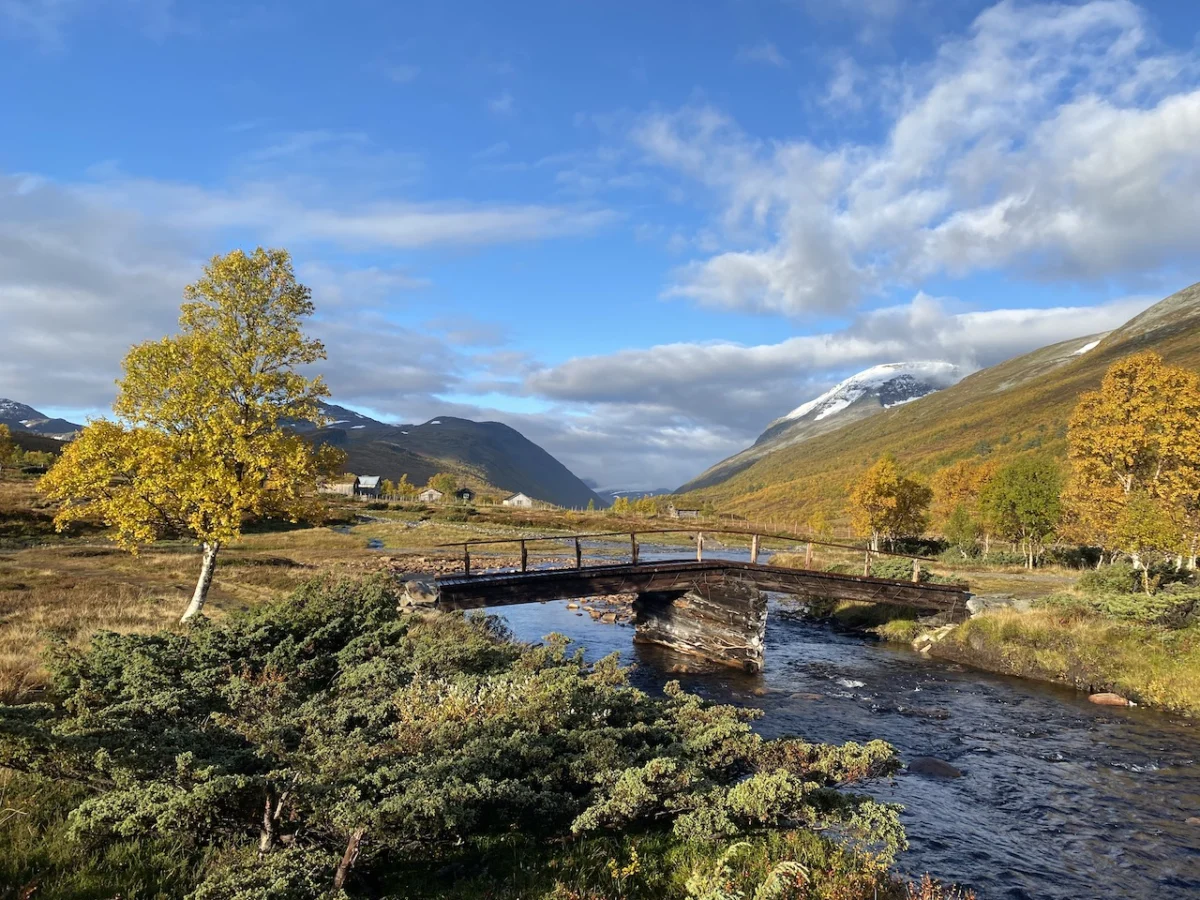
The route traverses a wide saddle beneath the Høghøa Peak (1,308 m), eventually descending into the marshy, lake-strewn Høghødalen Valley. A critical landmark is the footbridge over the Minnilla River at the 11-kilometer mark. From here, the trail crests near Skrikhøa Peak (1,061 m), offering panoramic vistas of the Gammelsæterdalen Valley before dropping down to the tranquil Jøldalshytta, which sits nestled beside the serene Jølvatnet Lake.

Stage Two: The Valley Floor and the Svartå River
The second stage toward Trollheimshytta presents a choice of routes. In optimal weather, many trekkers opt for the high-altitude traverses over Geithøtta (1,316 m) or the formidable Trollhetta (1,616 m). However, given the region’s notorious propensity for sudden, heavy precipitation, a low-level alternative is available.

This 16-kilometer (9.9-mile) path follows the Svartå River. It is a journey through a storybook landscape: lush, rain-fed meadows, rustic turf-roofed cottages, and dense, colorful fall foliage. The destination, Trollheimshytta, serves as the literal and figurative heart of "troll country," providing a vital refuge for weary hikers.

Stage Three: The Final Ascent and Return
The final 21-kilometer leg is widely considered the most physically demanding. After crossing the Slettå River, the trail initiates a steep, 700-meter vertical gain over a mere three kilometers. This leads to the summit of Skallen Peak (1,226 m). Beyond the peak lies the Mellomfjellet plateau—a rocky, tarn-peppered expanse that feels entirely removed from the sheltered valleys below.

After skirting the eastern shore of Fossådalsvatnet Lake, the trail reaches the Riarskaret Pass (1,307 m). This is the highest point of the stage. The subsequent descent through the treeless expanse leads back into the expansive Gjørdøldalen Valley, eventually tracing the Gravbekke River and offering final, sweeping views of Gjevillvatnet Lake before closing the loop at the trailhead.

Supporting Data and Logistical Realities
Hiking in the Trollheimen region is not merely a physical challenge; it is a lesson in preparedness. The "moderate" difficulty rating belies the reality of the Norwegian climate. Even in the height of summer, temperatures can drop to near freezing, and gale-force winds are common above the tree line.

Hikers must account for:

- Hydration and Nutrition: While the water in mountain streams is generally pristine, carrying calorie-dense food is essential for the high-elevation sections where energy expenditure is at its peak.
- Navigation: GPS and physical maps are mandatory. Trail markers (the classic red "T") are generally excellent, but fog can descend within minutes, obscuring visibility and complicating navigation across the rocky plateaus.
- Accommodation: The Norwegian Trekking Association (DNT) manages the huts in the region. Most are staffed or self-service, but it is critical to verify opening dates, as many close for the season by late September.
Official Perspectives: The Role of the DNT
The Norwegian Trekking Association (Den Norske Turistforening) maintains the vast network of trails in Trollheimen. According to regional representatives, the "Triangle" is one of the most effective ways to introduce international visitors to the concept of friluftsliv—the Norwegian philosophy of open-air living. The DNT emphasizes that the preservation of these trails is a collaborative effort between local landowners and the trekking community. They strongly advise that hikers adhere to the "Leave No Trace" principle, as the delicate alpine tundra is highly susceptible to erosion from off-trail traffic.

Implications: A Sustainable Future for Trollheimen
The relative obscurity of Trollheimen is both its greatest strength and its most significant challenge. As global tourism trends shift toward "slow travel" and remote wilderness experiences, the region is seeing a modest uptick in international interest.

The implication for the future is clear: sustainability must remain at the forefront. Unlike the overcrowded trails of Western Europe, Trollheimen offers a sense of solitude that is becoming increasingly rare. However, this solitude is fragile. The infrastructure—the bridges over the Minnilla and Slettå rivers, the maintenance of the huts like Gjevilvasshytta—requires consistent funding and voluntary support.

For the hiker, the Trollheimen Triangle is more than a trail; it is an invitation to engage with a landscape that has remained largely unchanged for millennia. It is a reminder of the raw, unfiltered beauty of the North, where the weather dictates the pace, the mountains command respect, and the "trolls" of old seem just behind the next ridge, watching as you navigate the path home.

Disclosure: This article contains affiliate links, which means the publisher receives a small commission if you purchase an item after clicking. This supports the ongoing effort to document and share information about the world’s most iconic, yet often overlooked, hiking trails.