After a relentless, record-shattering siege of extreme heat that has gripped the European continent for weeks, a significant atmospheric transformation is underway. A massive, high-amplitude weather shift is sweeping across Central and Eastern Europe, finally providing a long-awaited "cold refreshment" to regions that have been reeling from urban heat islands, tropical nights, and dangerous heat stress.
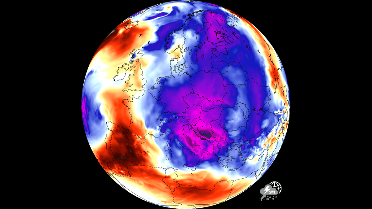
As the calendar turns toward the final days of July 2026, the meteorological narrative across the continent is splitting in two: while the southwestern fringes of Europe remain trapped in a furnace-like state, the eastern half is experiencing a profound temperature reversal that is bringing much-needed relief to millions of residents and travelers alike.
Main Facts: The Anatomy of a Weather Pivot
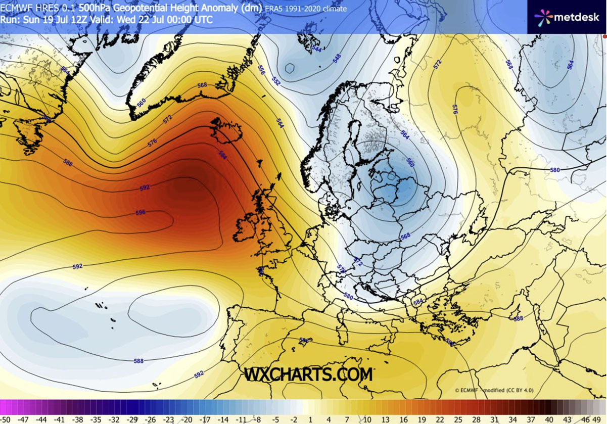
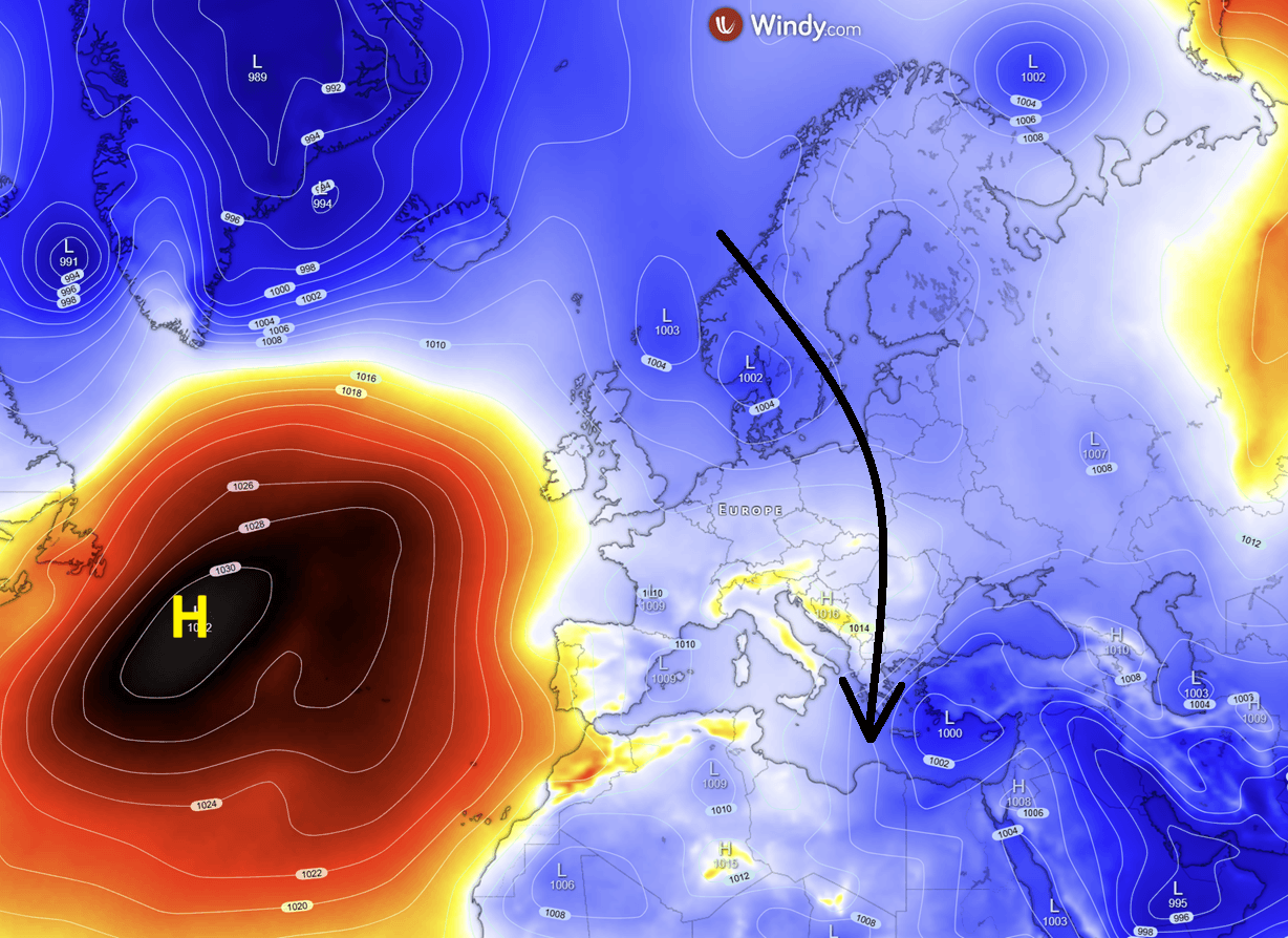
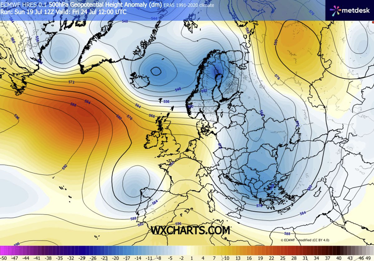
The driving force behind this abrupt change is a complex reorganization of the upper-level flow. A robust upper-level ridge has established itself over the Atlantic, effectively acting as a blockade. This configuration has allowed a deep, dynamic low-pressure system to carve a path southward from the high latitudes. By channeling cooler, more unstable polar air masses directly into the heart of the continent, the system is forcing a collapse of the heat domes that have dominated the landscape.
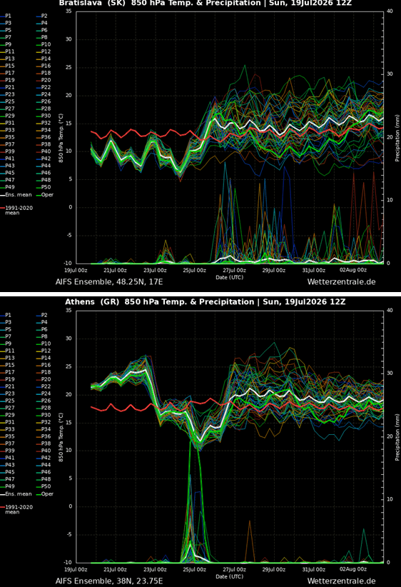
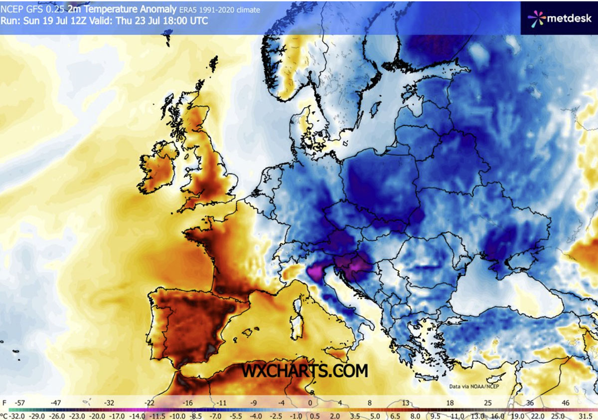
For nations such as Hungary, Poland, Romania, and the Balkan Peninsula, the transition marks an end to an exhausting endurance test. Daytime temperatures, which previously pushed well beyond uncomfortable thresholds, are now plummeting toward seasonal averages—staying firmly below the 30°C (86°F) mark. This cooling is not merely a surface-level phenomenon; it is a deep-seated atmospheric change that is finally allowing overheated residential buildings and critical infrastructure to dissipate trapped thermal energy.
Chronology of the Cold Front’s Progression
The transition is unfolding in distinct phases, as the cold wave pushes from the northern reaches toward the Mediterranean basin.
The Mid-Week Onset (Wednesday–Thursday)
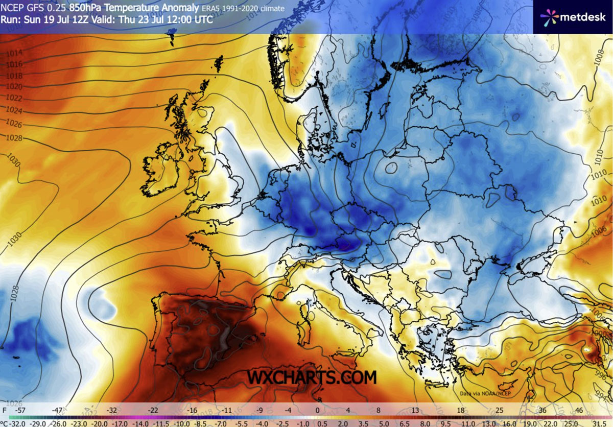
By mid-week, the leading edge of the cold front moved through Central Europe. On Thursday, the most significant temperature anomalies—ranging between 4°C and 8°C below the seasonal norm—were recorded across northern Italy, Slovenia, Croatia, Austria, Czechia, Slovakia, and Poland. The arrival of this air mass was characterized not only by the mercury drop but by brisk, refreshing winds that swept away the stagnant, humid air that had settled over these regions during the previous fortnight.
The Weekend Deep-Freeze (Friday–Sunday)
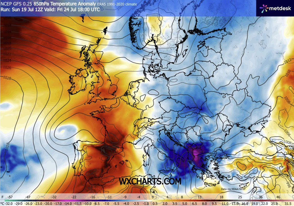
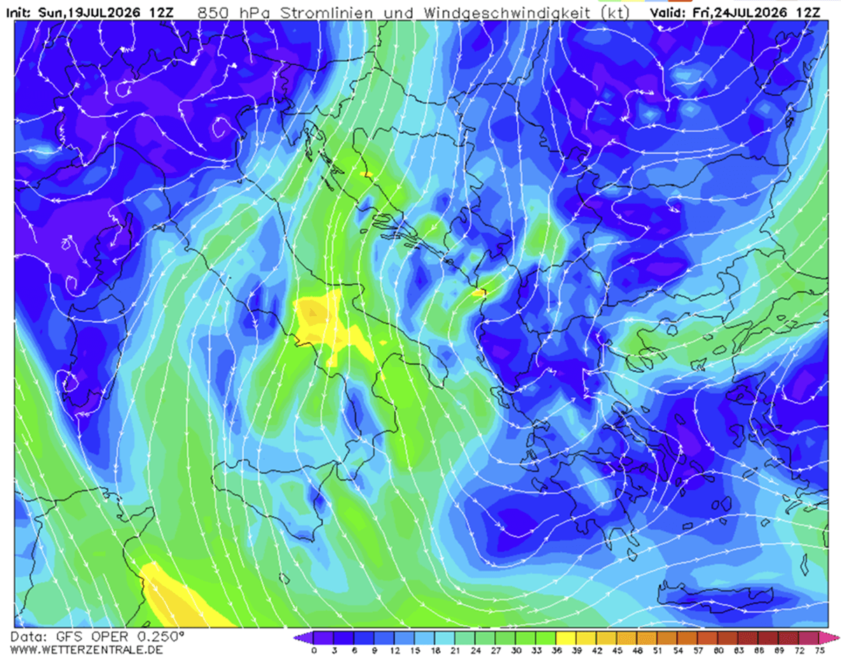
The most intense phase of the cold wave is slated for Friday and Saturday. As the trough deepens and tracks further into the southern Balkans, its core will bring a dramatic temperature anomaly of 10°C to 12°C below the July average. For the southern Balkans, southern Italy, and Greece, this represents a stark, almost jarring departure from the stifling heat that defined the early part of the week.
Long-Term Persistence
Due to the persistent "blocking" nature of the Atlantic high-pressure system, this eastern cold wave is not expected to be a fleeting event. Meteorological models indicate that the cooling trend will hold its grip through the coming weekend, providing a sustained, vital pause before the broader summer weather patterns undergo their next evolution.
Supporting Data and Atmospheric Dynamics
The shift in the European weather pattern is substantiated by a clear, measurable set of atmospheric metrics that underscore the severity of the transition.
Geopotential Heights and Surface Pressure
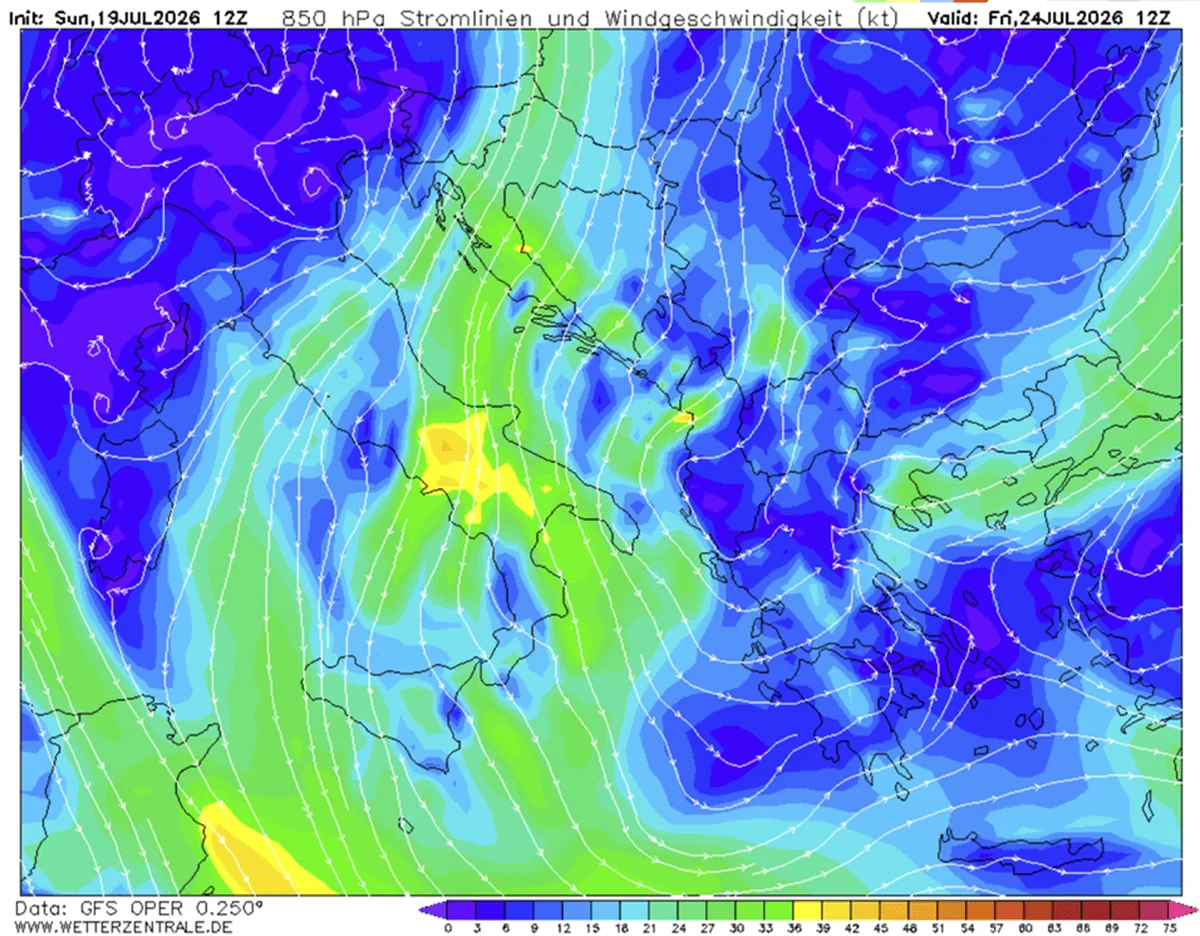
The surface pressure landscape is responding rapidly to the geopotential falls observed in the east. This shift is resulting in a more "meridional" flow—a north-to-south movement of air—which is essentially transporting cold air from the far north, dragging it around the western block and directly into the Mediterranean.
Nighttime Relief
One of the most critical aspects of this cooling trend is the drop in nighttime lows. For weeks, urban centers struggled with "tropical nights," where temperatures failed to drop below 20°C, preventing the natural cooling of building materials. From mid-week through the coming weekend, many regions across Central and Eastern Europe will see morning temperatures dip into the low to mid-10s Celsius. In regions where cloud cover is absent and winds remain calm, clear nights will offer a perfect environment for radiative cooling, providing residents with their first comfortable sleep in nearly a month.
The Instability Factor
The interaction between the incoming cold air and the lingering, extreme heat—particularly over the Ionian Sea and the southern Balkans—is triggering high levels of atmospheric instability. The resulting convective activity is expected to produce severe thunderstorms. While these storms will bring heavy downpours that could offer modest drought relief, experts warn that the precipitation is unlikely to be sufficient to neutralize the deep-rooted wildfire risks accumulated during the recent heatwaves.
Implications for Public Safety and Infrastructure
While the cool-down is largely viewed as a blessing, it brings its own set of challenges that authorities and the public must navigate.
The Wildfire Paradox
Despite the lower temperatures, the fire risk remains categorized as "extremely high." The cold front is bringing not just cool air, but also significantly drier air. The combination of strong, gusty winds and arid conditions creates a dangerous environment for potential wildfire ignition. Emergency services across the Balkan region remain on high alert, as the cooling of the air does not immediately equate to the rehydration of the parched landscape.
Energy and Urban Cooling
The drop in temperature provides a necessary reprieve for the energy grid. During the peak of the heatwave, power systems across the continent were pushed to the brink as residential and commercial air conditioning demand skyrocketed. The current temperature drop will allow for a significant reduction in energy load, providing a "recovery window" for critical infrastructure that has been running at maximum capacity.
Tourist Considerations
For the millions of tourists currently vacationing in the Mediterranean and the Balkans, the shift is a mixed bag. While the extreme heat of the previous week was dangerous for outdoor activities, the upcoming period of strong winds and potential thunderstorms will necessitate caution. Travelers are advised to monitor local weather warnings, particularly regarding marine conditions and potential flash flooding in mountainous regions where thunderstorms are expected to develop rapidly.
A Tale of Two Continents: The Iberian Exception
It is important to note that this cold wave is not a panacea for the entire continent. The atmospheric block is effectively partitioning Europe. While the east and central regions enjoy a respite, the Iberian Peninsula is currently shielded from this cooling influence. Spain and Portugal remain locked in an intense, persistent heatwave, with temperatures projected to hover in the 40s°C throughout the week. This stark disparity illustrates the volatile nature of modern European weather, where a continent can simultaneously experience near-autumnal conditions in the east and extreme, life-threatening heat in the west.
Conclusion: A Vital Pause
For the millions of people across Central and Eastern Europe, this week represents a crucial turning point. The transition from extreme heat to seasonable, or even unseasonably cool, conditions offers more than just physical comfort—it provides a vital psychological break.
The persistent, high-amplitude patterns observed this July serve as a reminder of the increasing complexity of continental weather systems. As the region moves through this period of refreshment, the focus for both meteorologists and public officials remains on the transitionary weather—specifically the severe thunderstorm risks and the persistent, high-stakes wildfire threat. This period of "cold refreshment" is a fleeting, albeit necessary, interlude in an increasingly unpredictable summer season. As the air masses continue to settle, the continent waits to see how the next phase of the 2026 summer will unfold, with all eyes now turning toward the persistent heat anomalies still dominating the southwestern horizon.