After enduring a grueling, persistent, and historically significant stretch of extreme heat that dominated headlines and stressed infrastructure throughout July 2026, the European continent is finally witnessing a profound atmospheric metamorphosis. A major shift in the upper-level weather pattern is ushering in a long-awaited period of cooling for the eastern half of the continent, providing a vital, albeit temporary, respite for millions of residents and travelers alike.
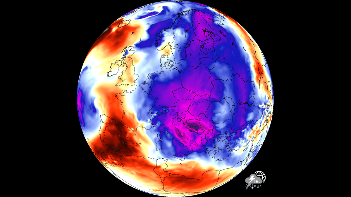
For countries across Central Europe, the Balkan Peninsula, and stretching toward the Eastern Mediterranean, the transition marks the end of a punishing cycle defined by urban heat islands, relentless tropical nights, and widespread heat stress. As a deep, cold-core low-pressure system descends from the north, the sweltering conditions that defined the past fortnight are being dismantled, replaced by a refreshing, seasonable air mass.
The Mechanics of the Shift: From Ridge to Trough
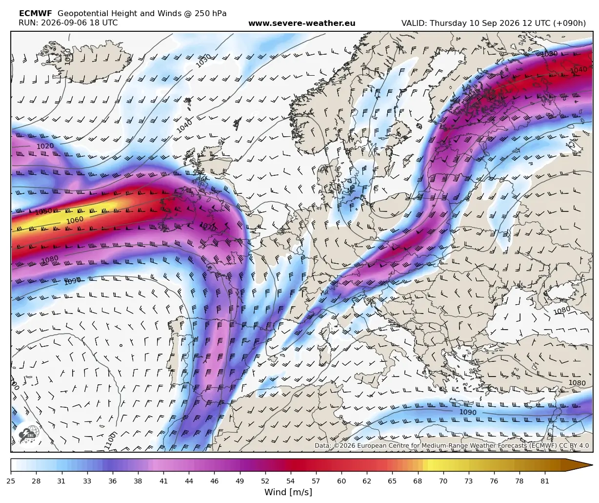
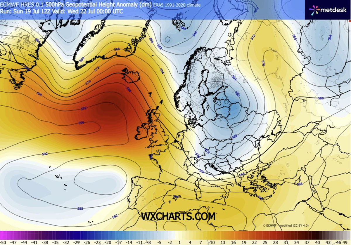
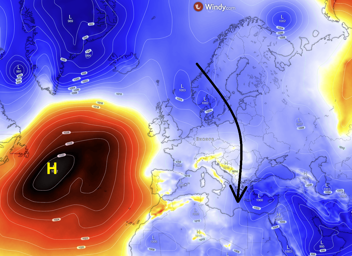
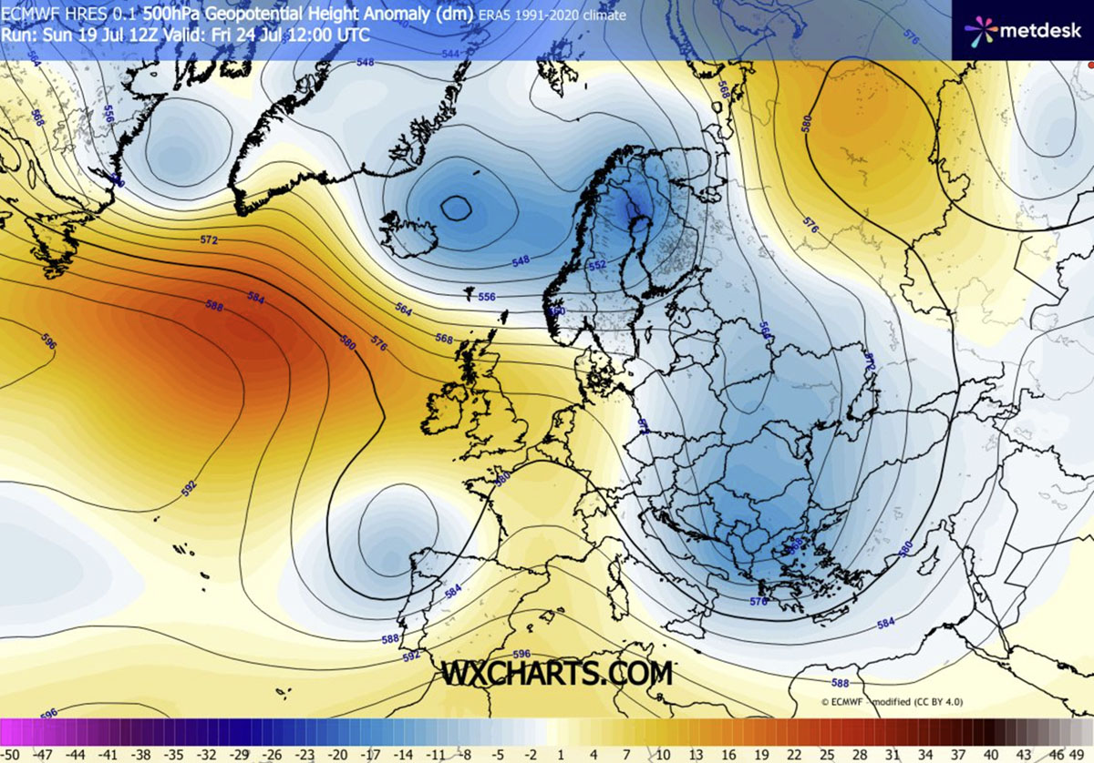
The driving force behind this meteorological flip is a significant realignment of the jet stream. Meteorologists have observed the strengthening of an upper-level high-pressure ridge over the Atlantic, which has acted as a catalyst for a massive, cold-air outbreak originating in the high latitudes of the north. This dynamic flow is effectively pushing a cold-wave southward, allowing cooler, more unstable air to displace the stagnant heat that has been trapped over the continent.
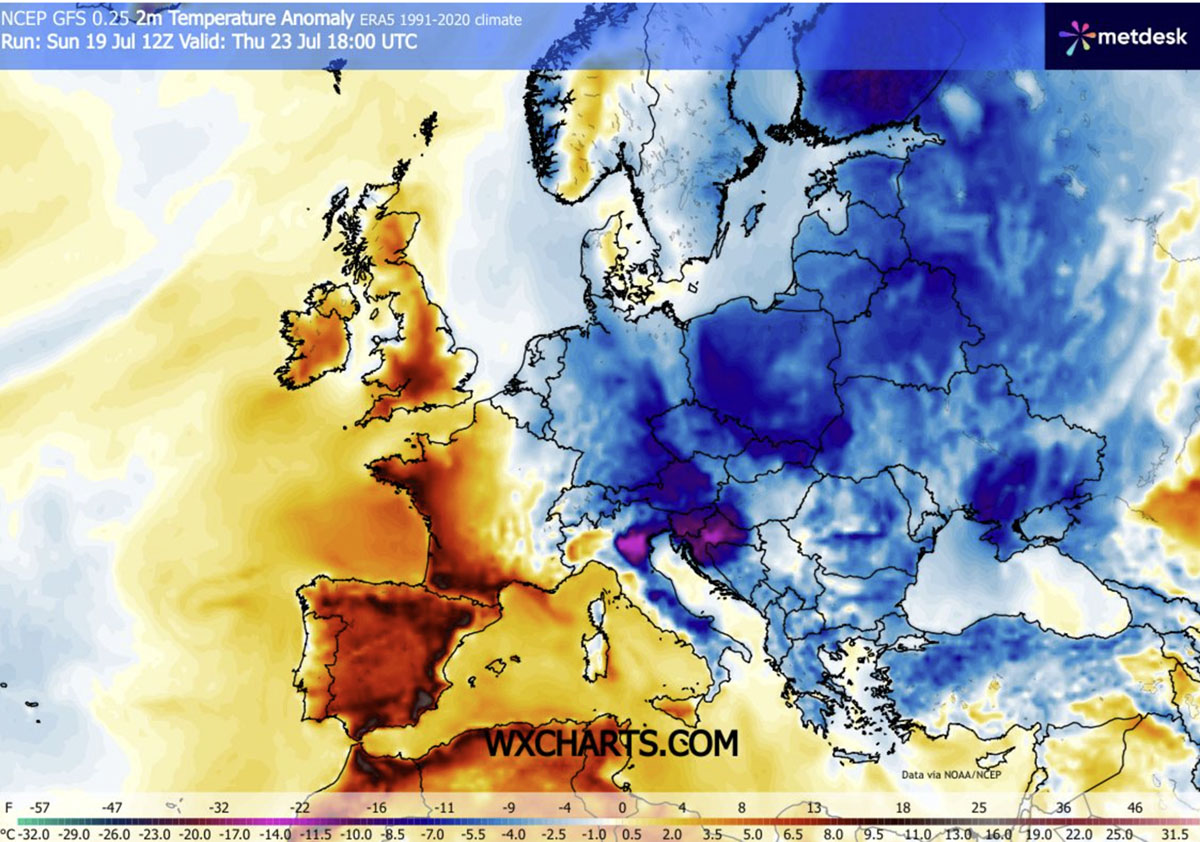
By mid-week, this cooling trend began to manifest as a tangible drop in temperatures, with mercury levels across the region plummeting 4°C to 8°C below the seasonal average. This shift is expected to persist through the weekend, as the trough deepens and the meridional flow continues to funnel arctic-influenced air into the heart of Europe.
Chronology: A Week of Meteorological Transformation
The trajectory of this cold wave has been methodical and widespread.
- Mid-Week (Tuesday–Wednesday): The leading edge of the cold front began its sweep across Central Europe, marking the end of peak heat in countries such as Poland, Slovakia, and Czechia. Residents in these areas experienced a sharp, welcome transition as daytime highs retreated from the 30s into the comfortable low-to-mid 20s.
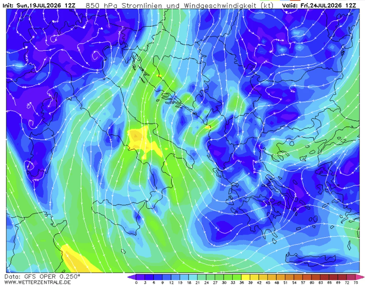
- Late Week (Thursday–Friday): The cold-core system pushed further south, exerting its influence on the northern Balkans and Italy. Thursday marked the peak of the cooling anomaly for these regions, with temperatures significantly lower than those observed just 72 hours prior. Wind speeds also increased, acting as a natural cooling mechanism and aiding in the ventilation of heat-saturated urban environments.
- The Weekend Outlook (Saturday–Sunday): The trough is projected to settle over the southern Balkans, Greece, and the Ionian Sea. By this point, the temperature anomaly will be at its most extreme relative to seasonal norms—potentially 10°C to 12°C below average in the lowest atmospheric layers. This will provide a significant relief for tourists in the Mediterranean, who had previously been contending with record-breaking heat.
Supporting Data: Understanding the Thermal Anomaly
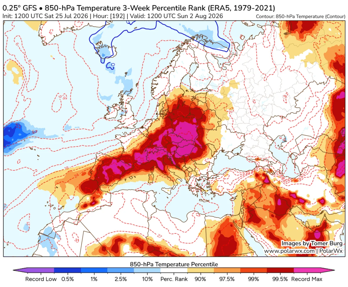
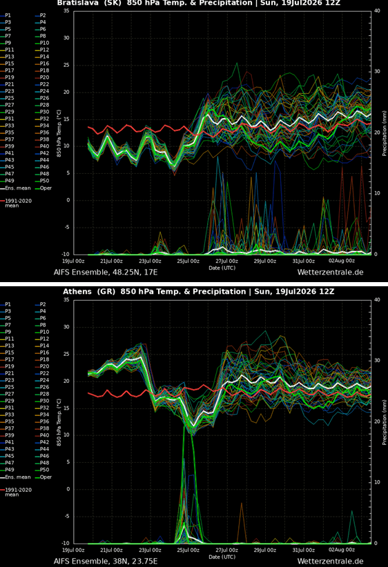
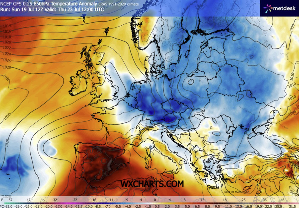
The severity of the recent heatwave, followed by this abrupt cooldown, is well-documented in current atmospheric modeling. According to 850mbar temperature anomaly maps, the cold air mass is not merely a surface phenomenon; it represents a deep, layered intrusion of arctic air.
While Central Europe is experiencing moderate relief, the most impressive deviations are occurring in the south. In regions that were recently experiencing peak temperatures in the high 30s or even 40s, the upcoming weekend will see a shift toward more moderate, manageable conditions. Morning and nighttime temperatures, which previously struggled to drop below 25°C, are now expected to settle into the low-to-mid 10s, allowing buildings, homes, and critical infrastructure to shed the cumulative thermal load of the past two weeks.
However, it is crucial to note the spatial divide. While the eastern half of the continent enjoys this refreshment, the Iberian Peninsula remains under the influence of a persistent, stagnant heat dome. Spain and Portugal continue to face extreme temperatures reaching into the 40s, serving as a stark reminder of the fragmented nature of Europe’s current climate state.
The Instability Factor: Thunderstorms and Precipitation
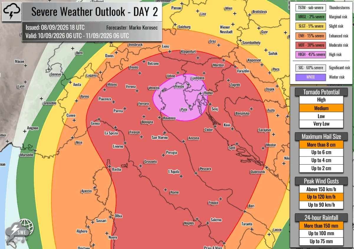
While the cooling is undoubtedly positive, it brings with it the inherent volatility of clashing air masses. As the cold, dense air pushes into the remnants of the tropical heat lingering over the southern Balkans and the Mediterranean, the resulting atmospheric instability will trigger localized, potentially severe, thunderstorms.
Meteorologists are monitoring the region for heavy downpours, which are expected from Wednesday through Friday. While these events will provide localized relief from the drought conditions that intensified during the recent heatwave, they are unlikely to fully mitigate the wildfire risks that have been exacerbated by weeks of dry, scorching weather. The combination of strong winds and dry soil—even with the influx of cooler air—means that fire danger remains high, requiring continued vigilance from local authorities and emergency management services.
Official Responses and Public Safety Implications
Public health and infrastructure agencies across the region have been on high alert throughout the month. In nations like Hungary, Romania, and Bulgaria, where heat-related health warnings had reached critical levels, the shift is being treated as a period of recovery. Municipalities are encouraging residents to utilize the cooler nights to ventilate overheated buildings and clear heat-trapping debris, while acknowledging that the risk of heat exhaustion for vulnerable populations has finally begun to subside.
However, emergency management services are shifting their focus toward the risks associated with the transition itself. The sudden increase in wind speeds, combined with the potential for sudden, intense, and short-lived thunderstorms, necessitates a change in public safety messaging. Travelers, particularly those in the Mediterranean, are advised to monitor local weather alerts, as the instability associated with the cold front can result in rapid, localized flooding and wind-related hazards.
Long-term Implications: A Pause, Not a Conclusion
For millions across the eastern and central regions, this refreshing break offers a vital "breathing room" in a summer that has been defined by climatic extremes. Yet, climate scientists warn that this shift is part of a broader, more volatile pattern. The persistent upper-level blocking over the Atlantic, which facilitated this cold wave, is a recurring theme in recent seasons.
The current relief is temporary. As the trough moves further east, the atmosphere will continue to evolve, and the potential for a return to higher temperatures remains high. The juxtaposition of this week’s cool, windy conditions against the backdrop of the ongoing heat in the Iberian Peninsula highlights the complex, interconnected nature of Europe’s weather.
As the continent looks toward the remainder of the summer, this week serves as a critical case study in resilience. The ability of urban infrastructure to recover during these cooling windows is becoming an increasingly important metric for city planners and public health officials tasked with adapting to an era of shifting weather extremes. For now, however, the primary sentiment across the Balkans and Central Europe is one of relief—a momentary, necessary pause before the next phase of the summer cycle takes hold.
As we continue to monitor the evolving weather patterns, our next report will delve deeper into the sustained, extreme heat affecting the western reaches of the continent and what the latest long-range models suggest for the remainder of the month. Stay tuned to our continued coverage as we track these significant atmospheric developments.