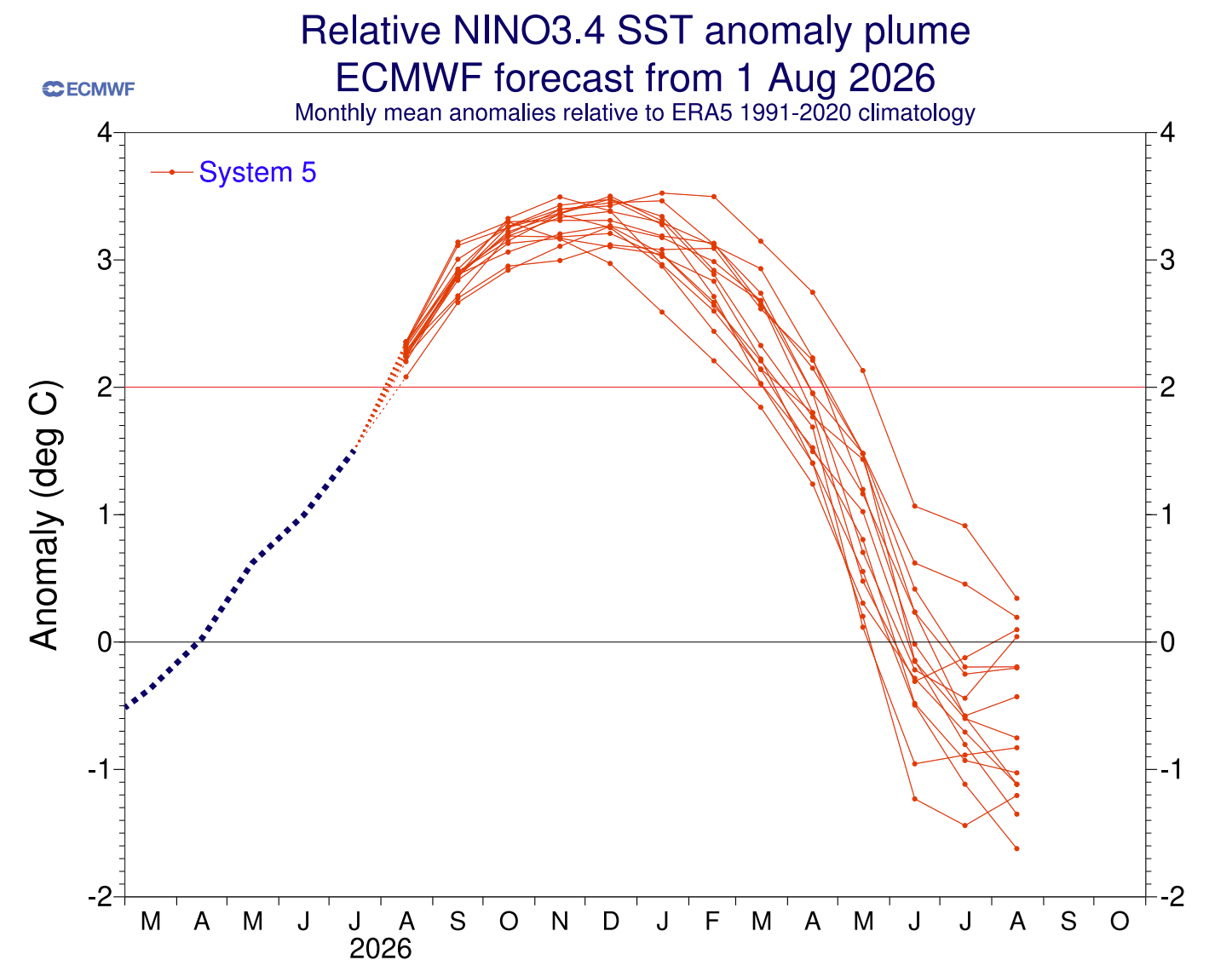
As autumn leaves begin to turn in September 2026, meteorologists and climate modelers are turning their attention to the Pacific Ocean, where a climate phenomenon of massive proportions is currently unfolding. A developing "Super El Niño"—an event characterized by sustained ocean surface temperature anomalies exceeding 2°C—is set to become the primary driver of global weather patterns for the upcoming winter season.
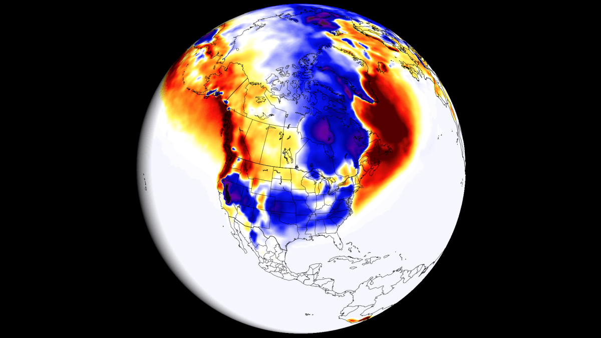
This rare and powerful climatic event is already fundamentally altering the jet stream, creating a ripple effect that promises to deliver starkly different winter realities across North America and Europe. From the snowy peaks of the American Southwest to the milder, rain-drenched lowlands of Europe, the 2026/2027 winter forecast is defined by extreme contrasts.
Main Facts: The Anatomy of a Super El Niño
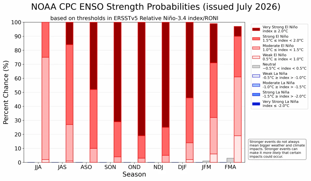
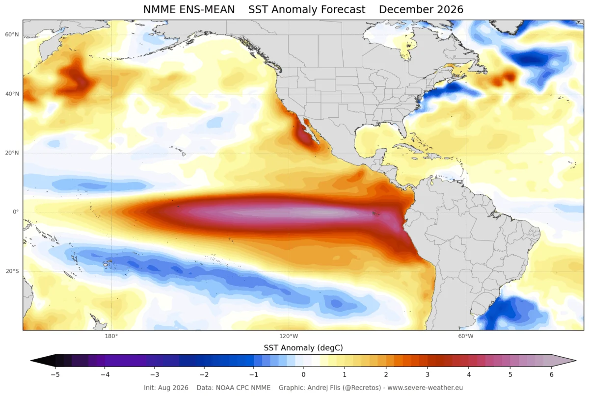
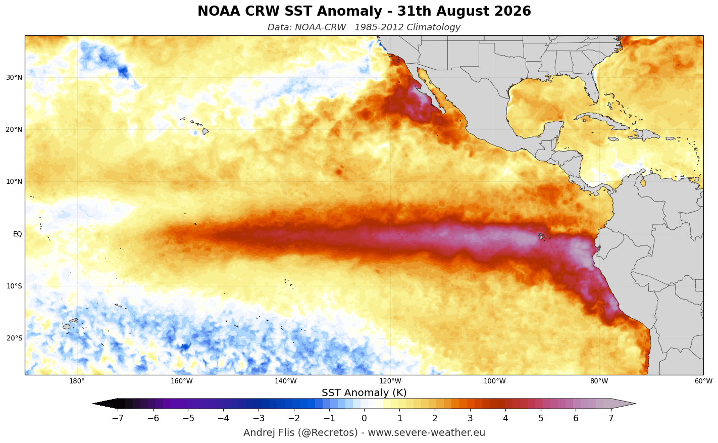
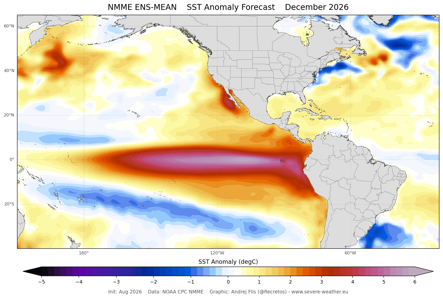
The term "Super El Niño" is not used lightly in meteorological circles. It is reserved for only the most intense episodes of the El Niño-Southern Oscillation (ENSO) cycle. Data from the National Oceanic and Atmospheric Administration (NOAA) indicates that the current event has already breached the 2°C anomaly threshold, with some regions in the eastern tropical Pacific showing temperatures more than 6°C (10.8°F) above historical norms.
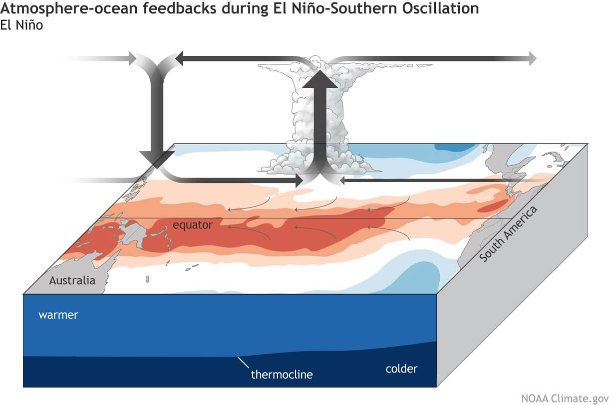
At its core, this event is driven by a powerful downwelling Kelvin Wave—a massive pulse of warm subsurface water migrating from the western Pacific toward the Americas. This wave, which has been monitored over the last three months, reaches depths of up to 250 meters (800 feet) and carries temperatures roughly 10°C (18°F) above average. As this energy surfaces near the South American coast, it disrupts the standard Walker Circulation, effectively shifting the global "atmospheric bridge" and forcing the jet stream into a configuration that dictates precipitation and snowfall on a continental scale.
Chronology of Development: From Subsurface to Surface
The transition of this climate driver has been rapid and well-documented. By late summer 2026, the subsurface Pacific was already showing classic signs of a major event, with a distinct thermocline tilt indicating that warm waters were being pushed eastward by persistent westerly wind bursts.
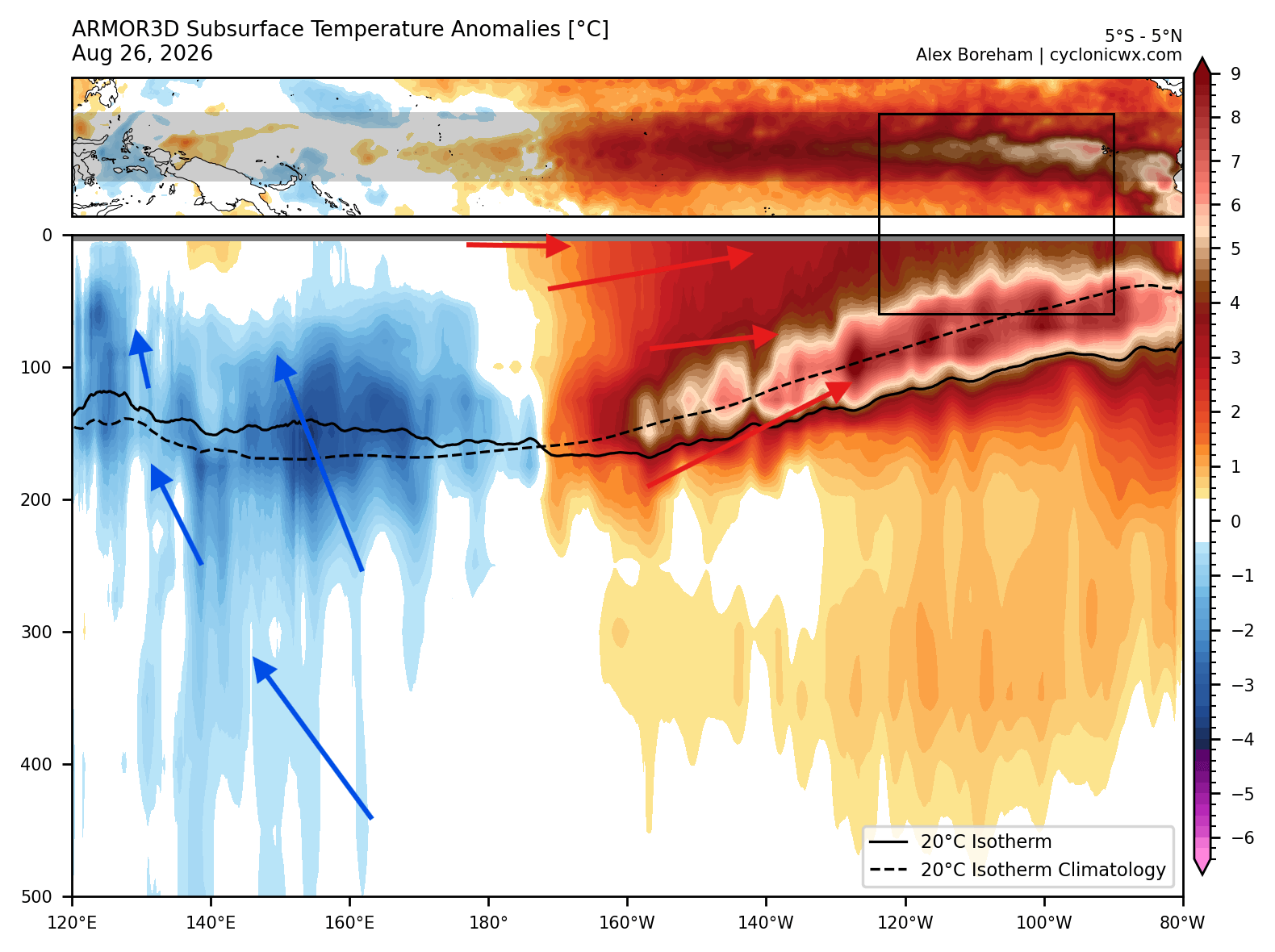
As we move into the final quarter of 2026, the event is projected to reach its peak intensity in December. Historical analysis of previous Super El Niño winters—most notably the events of 1982/1983, 1997/1998, and 2015/2016—provides a blueprint for what to expect. While no two winters are identical, the atmospheric response to such high ocean temperatures is remarkably consistent: a strengthened subtropical jet stream and a weakened polar jet stream.
Supporting Data: The Model Consensus
To forecast the winter ahead, meteorologists rely on the North American Multi-Model Ensemble (NMME) and the European Centre for Medium-Range Weather Forecasts (ECMWF). The current consensus among these high-resolution systems suggests that the 2026/2027 winter will be an outlier in the historical record.
North American Trends
In the United States and Canada, the primary effect of the Super El Niño is the "split-flow" pattern. By pushing the Pacific jet stream across the southern United States, the system invites frequent, moisture-laden storms into the region.
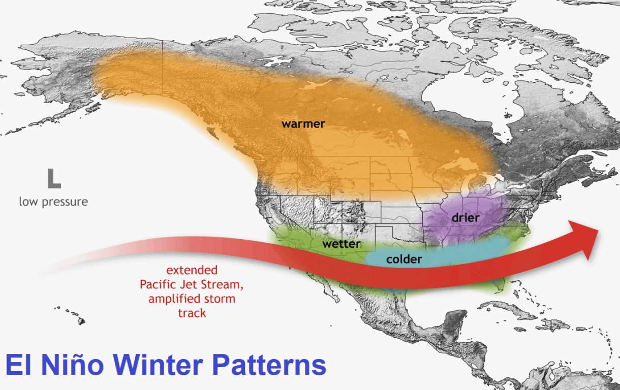
- The Southwest and Rockies: California’s Sierra Nevada, Utah, and the Central to Southern Rockies (Arizona, Colorado, New Mexico) are trending toward above-normal snowfall.
- The Southern and Central U.S.: The Plains and the Ohio Valley are expected to see increased snowfall potential as the subtropical jet interacts with colder air masses, particularly from January through February.
- The Northern Deficit: Conversely, the Pacific Northwest, the Great Lakes, and much of southern Canada are expected to face a significant snow deficit. The high-pressure ridge typically associated with strong El Niño events will likely act as a shield, deflecting storm tracks to the south and allowing milder air to persist in these northern latitudes.
The European Outlook
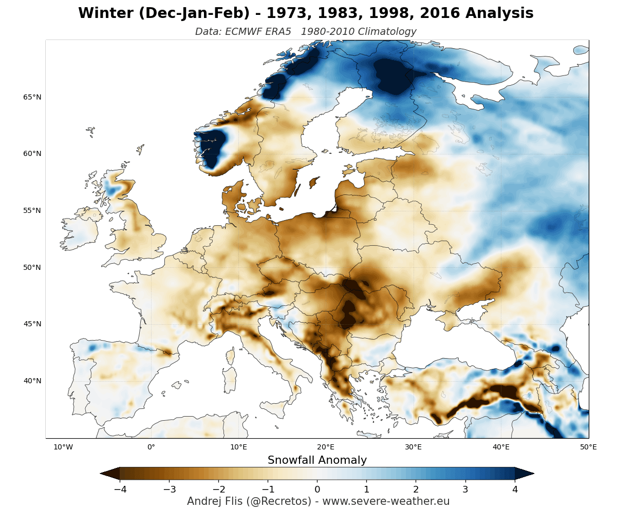
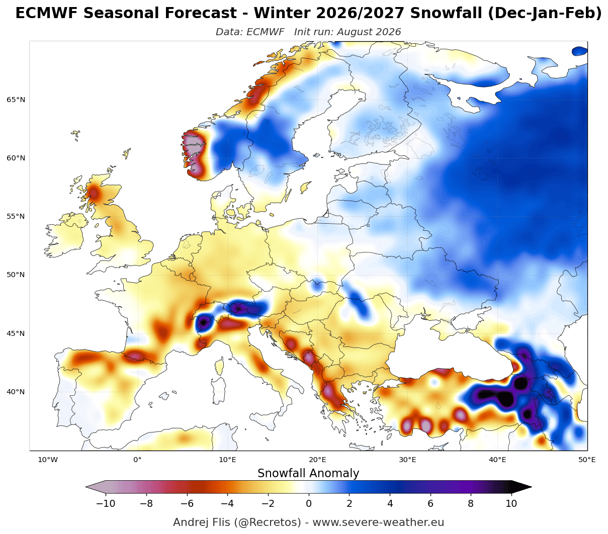
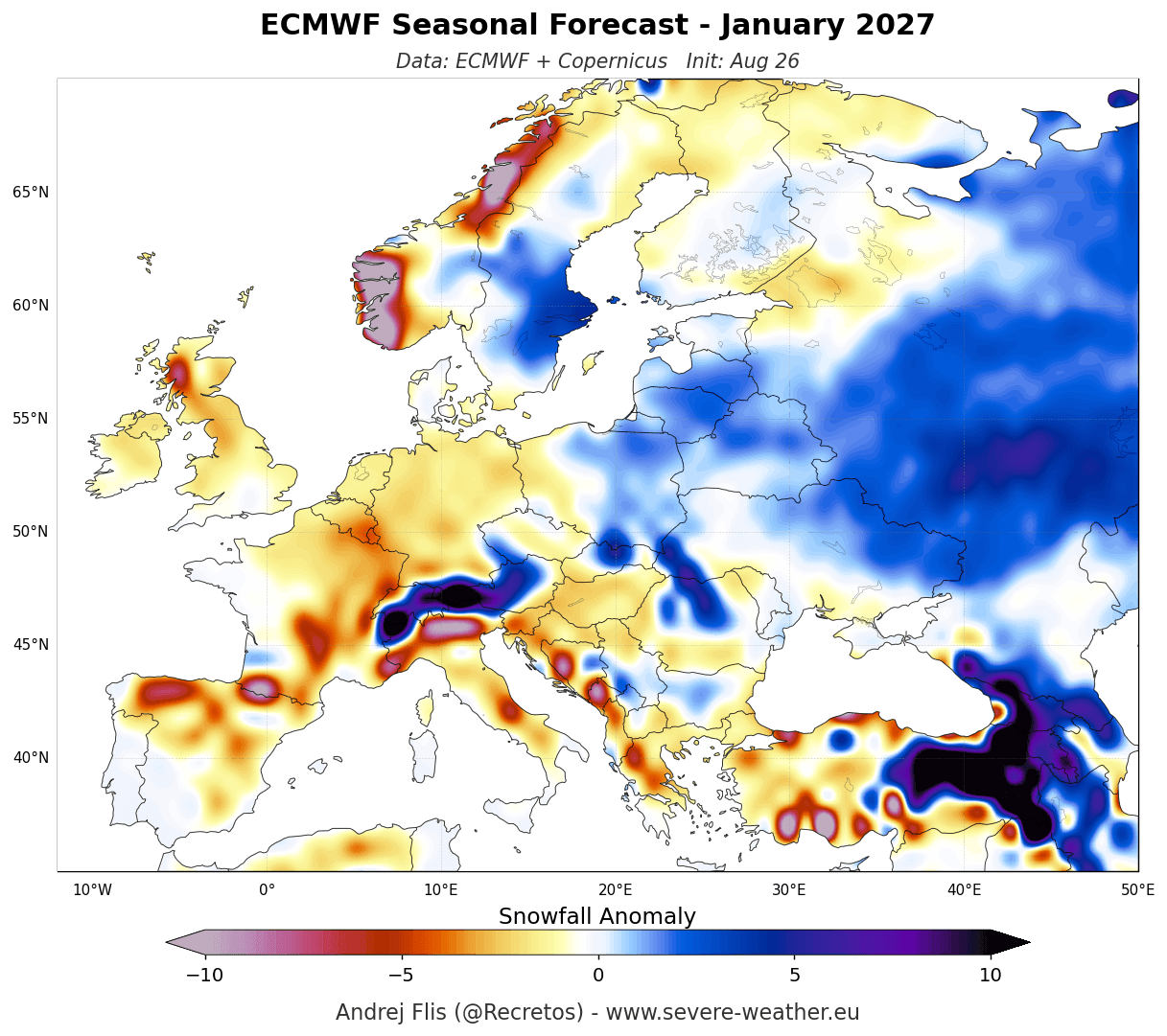
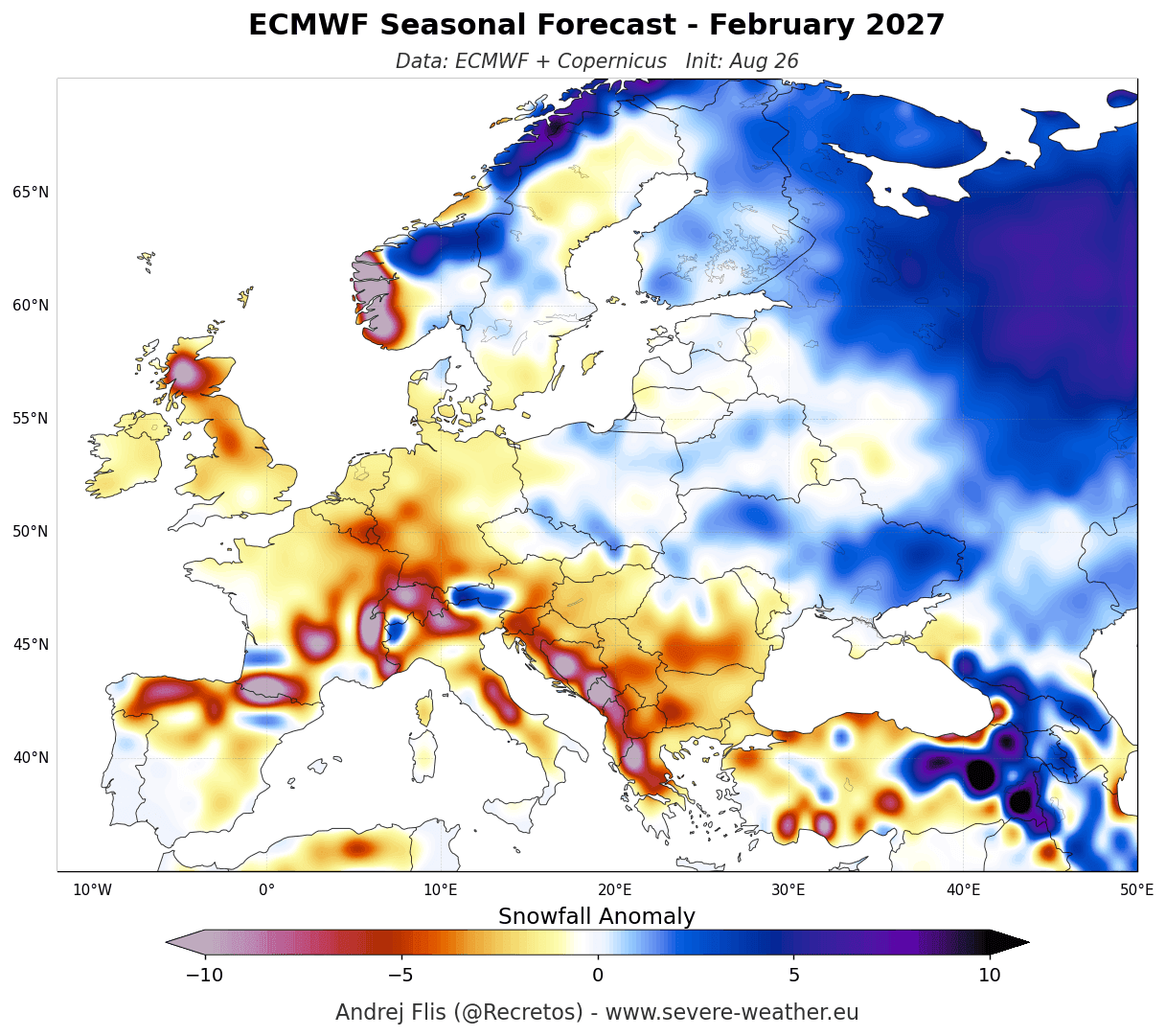
For Europe, the news is less promising for snow enthusiasts. The models from both the ECMWF and the UKMO (United Kingdom Met Office) indicate a persistent, high-pressure ridge dominating the continent. This setup encourages a mild, westerly flow from the Atlantic.
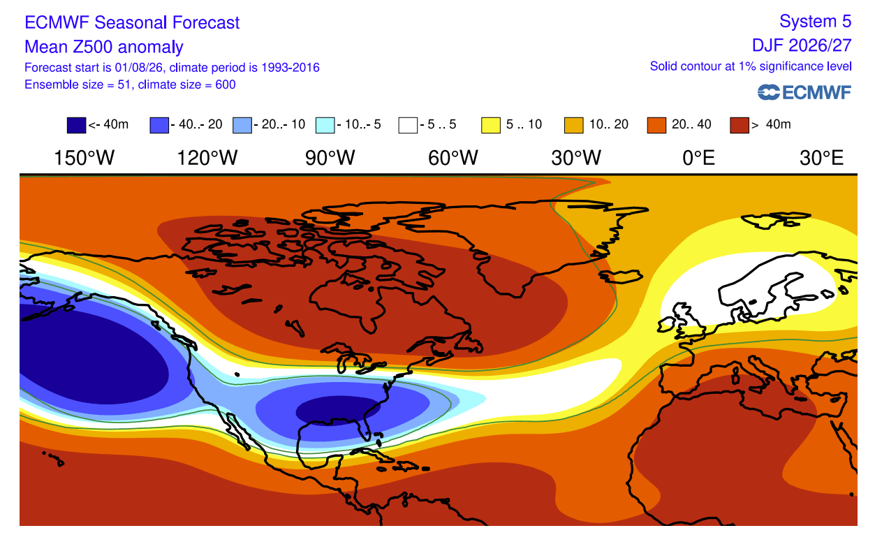
- Lowland Deficits: Most of Western, Central, and Southern Europe are forecast to experience below-normal snowfall.
- Elevation Factor: Higher altitudes, particularly in the Alps above 1,800–2,000 meters, remain the best bets for consistent snowpack, as these regions are better insulated from the mild surface temperatures driving the thaw in lower-lying areas.
Official Perspectives and Meteorological Implications
Climate scientists emphasize that while these seasonal models provide a high-level view of expected trends, they are not deterministic predictions. A "below-normal" forecast does not imply a total lack of snow; rather, it suggests that the total accumulated snowfall will likely fail to meet the 30-year statistical average.
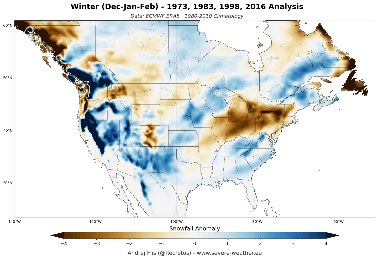
The implications for agriculture, water management, and energy consumption are significant. For example, the expected above-average snowfall in the Southern Rockies and Sierra Nevada is crucial for regional water security, as these mountain snowpacks act as a natural reservoir that feeds into the water systems of the American West during the spring melt. Conversely, the expected lack of snow in the Pacific Northwest and the Great Lakes could pose challenges for regional winter tourism and alter soil moisture levels for the upcoming spring planting season.
Furthermore, the "mid-to-late winter" surge indicated in the models for the Southern and Eastern U.S. suggests that while December may start slowly, January and February could see an uptick in severe, high-impact winter storms. This shift is a hallmark of the strengthened subtropical jet stream, which is highly efficient at pulling moisture from the Pacific and dumping it across the southern tier of the country.
A Season of Atmospheric Extremes
The Winter of 2026/2027 will be defined by the reach of the Super El Niño. As we look at the seasonal accumulation forecasts, the contrast is stark. The United States is likely to experience a "shifted" winter—where the traditional snow-belts of the north are bypassed in favor of a wetter, more active storm track across the south and central regions.
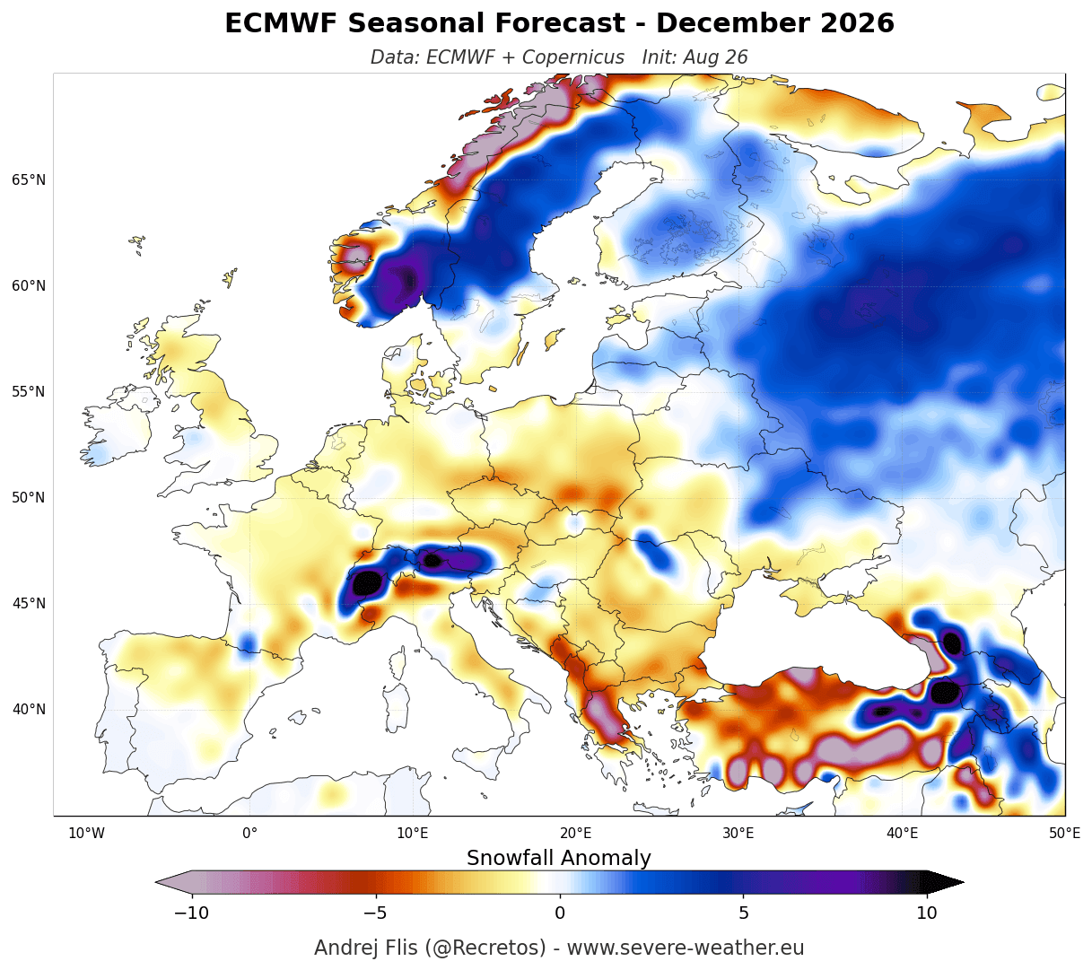
In Europe, the pattern appears more static, with the Atlantic flow acting as a buffer against the deep, continental freezes that typically bring widespread snow.
For the general public, the takeaway is clear: stay informed, monitor local meteorological updates, and prepare for a winter that will likely defy traditional expectations. Whether you are in the high-snow-potential zones of the American Southwest or the milder, rain-focused regions of Europe, the 2026/2027 season is poised to be a landmark event in contemporary climatology, reminding us once again of the profound influence our oceans hold over the atmosphere.
As the peak of the Super El Niño approaches, the global weather community will continue to refine these models, providing the data necessary to navigate what promises to be one of the most volatile and interesting winters in recent memory. For those looking to track the evolution of these patterns, the coming months of November and December will be critical, as they will confirm whether the predicted shift in the jet stream is locking into place as anticipated.