Executive Summary: A Summer of Fire and Ash
In the heart of the Italian Carnia region, the summer of 2026 will be remembered for the harrowing ten-day siege of Monte Amariana. A catastrophic wildfire, fueled by record-breaking temperatures and exacerbated by rugged, inaccessible limestone topography, scorched over 600 hectares of pristine forest. The blaze, which threatened the historic municipality of Tolmezzo and necessitated emergency evacuations in the hamlet of Pissebus, stands as one of the most significant environmental crises to strike Friuli-Venezia Giulia in recent memory.
The fire was finally subdued following a Herculean effort by an international aerial task force and a fortuitous shift in weather patterns that brought long-awaited precipitation to the drought-stricken valley. As the smoke clears and the charred landscape is monitored for residual heat, authorities are beginning to piece together the sequence of events that pushed the region to its breaking point.

The Chronology of the Inferno
Ignition and Escalation (August 7 – August 14)
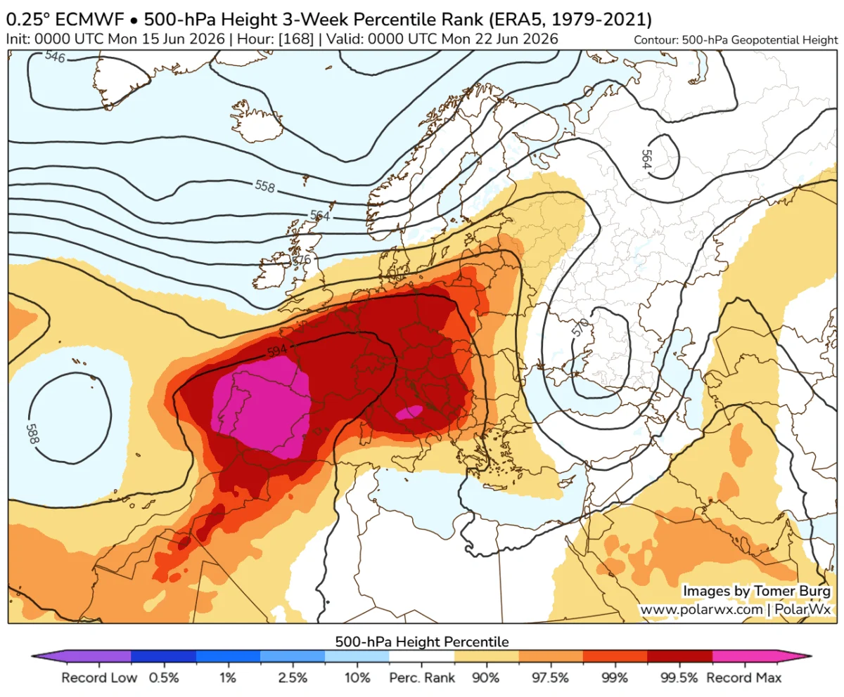
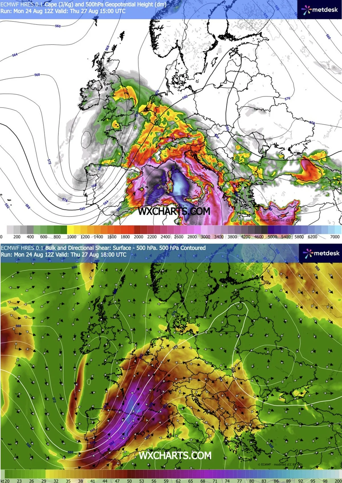
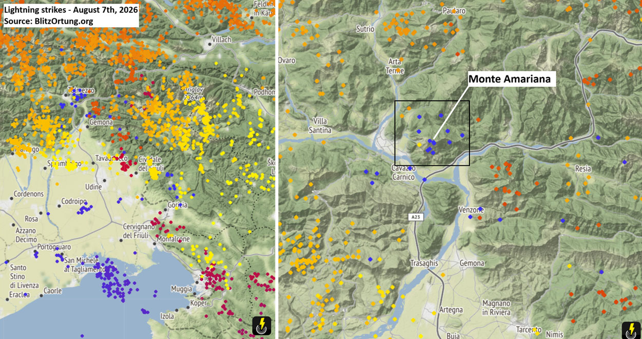
The catastrophe began in the aftermath of a volatile atmospheric setup. Early August saw a relentless "heat dome" settle over Europe, baking the Italian Alps and drying out the forest fuel beds—primarily Pinus nigra and dense brushwood—to a dangerous degree. On August 7, a passing frontal wave brought atmospheric instability, triggering lightning strikes across the upper Cuel Feltron, a steep spur of Monte Amariana.
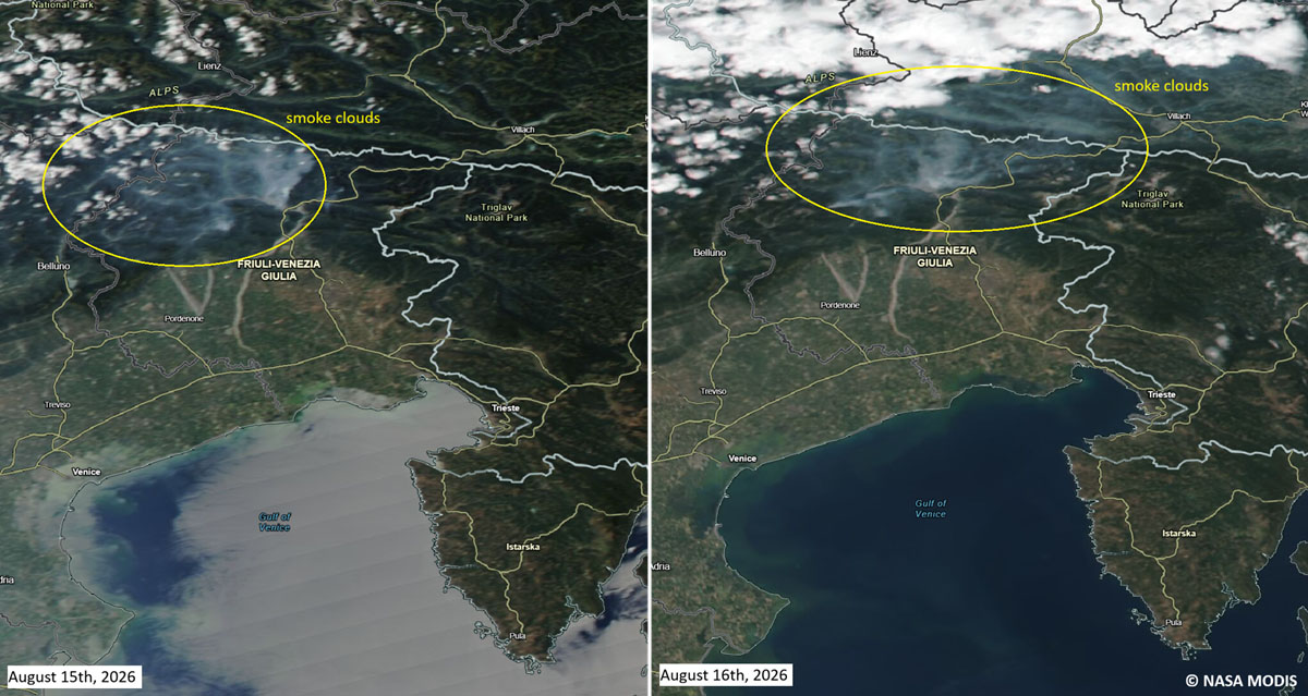
For several days, the fire smoldered in the high-altitude, inaccessible crags. However, the situation reached a critical inflection point on August 15—Ferragosto, Italy’s national holiday. Gusty, unpredictable downslope winds fanned the embers, pushing the blaze across the Rio Confine ridge. The fire surged toward Monte Amarianute with explosive speed, creating a chimney effect through the vertical limestone corridors that defied conventional containment strategies.
The Peak of the Crisis (August 15 – August 19)
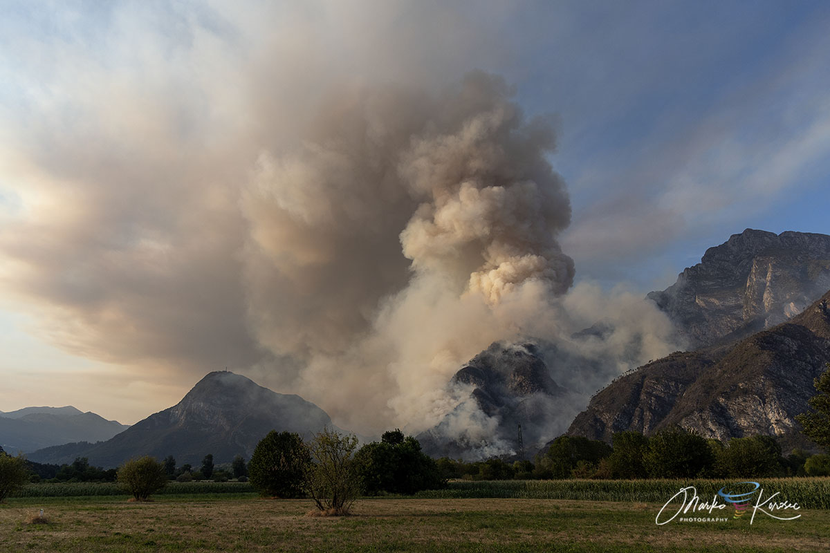
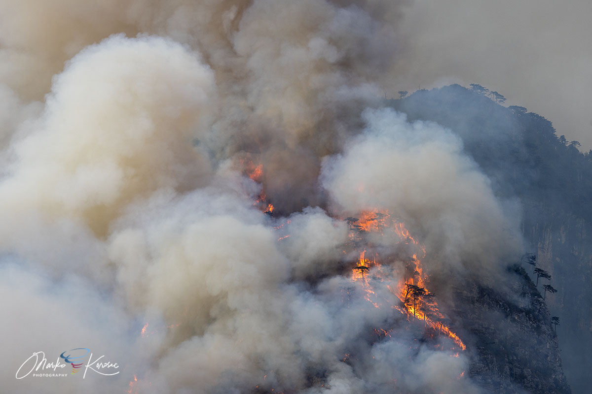
By mid-August, the fire had evolved into a multi-front monster. The flames crept within 50 meters of residential properties in the Pissebus sector of Tolmezzo, forcing local authorities to issue immediate evacuation orders. The intensity of the heat was so profound that it generated pyrocumulus clouds—thunderhead-like formations born of fire-driven convection—towering over the mountain.
Ground access was rendered nearly impossible by the vertical karst topography, leaving the defense of the valley floor and the residential districts entirely to aerial units and specialized mountain fire brigades.
Geographical Profile: The Fortress of Rock
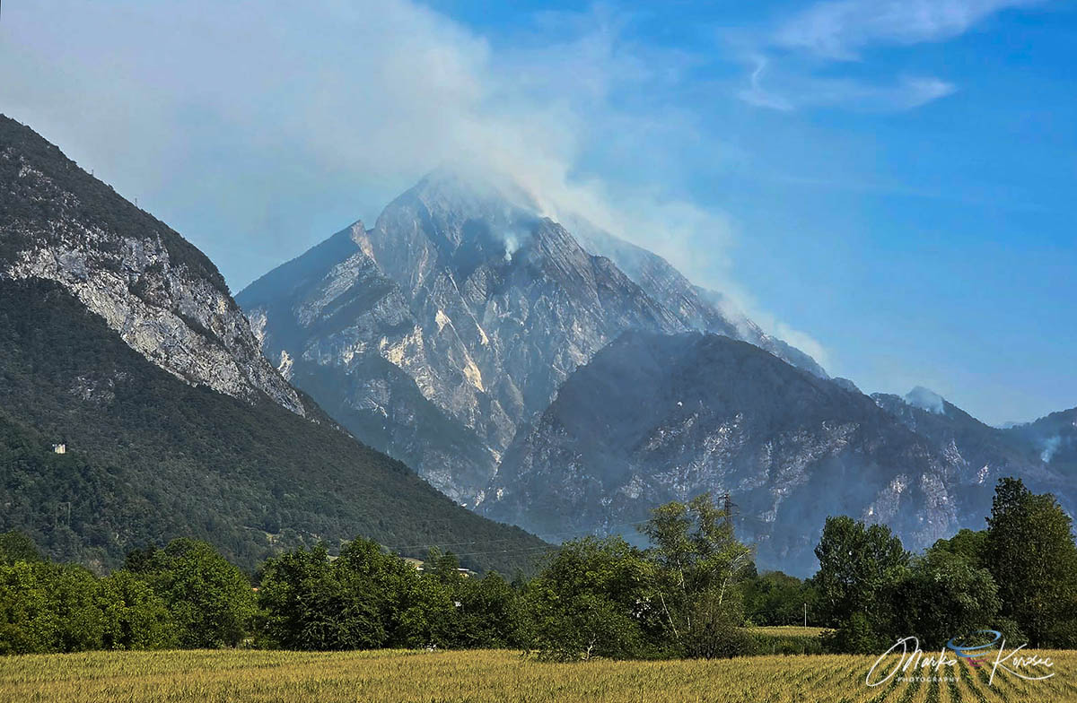
Monte Amariana (1,905 meters) is a distinctive, pyramid-shaped limestone peak that dominates the skyline of the Eastern Tolmezzo Alps. Its geography proved to be both a strategic hurdle and a primary driver of the fire’s behavior.
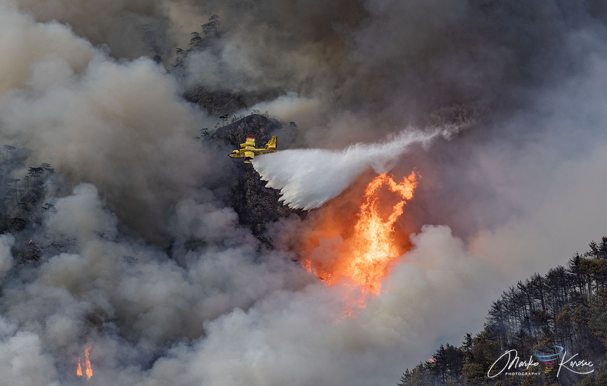
The mountain’s geology is characterized by near-vertical limestone cliffs, which act as natural ventilation shafts. When these are combined with the volatile, resin-rich Pinus nigra (Black Pine), the resulting fire spread is rapid and erratic. The terrain prevented the use of heavy machinery or standard firebreaks, forcing the Corpo Forestale Regionale and Vigili del Fuoco (Fire Brigade) to rely on long-range, high-precision water drops.
Mobilization of the International Aerial Task Force
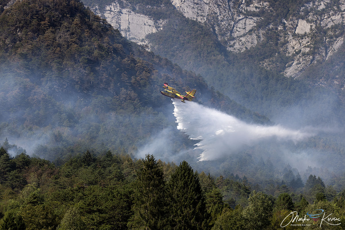
The scale of the fire required a mobilization of assets rarely seen in the region. To protect the threatened population centers of Tolmezzo and Amaro, Italy activated a multi-national aerial defense system.
Aerial Operations
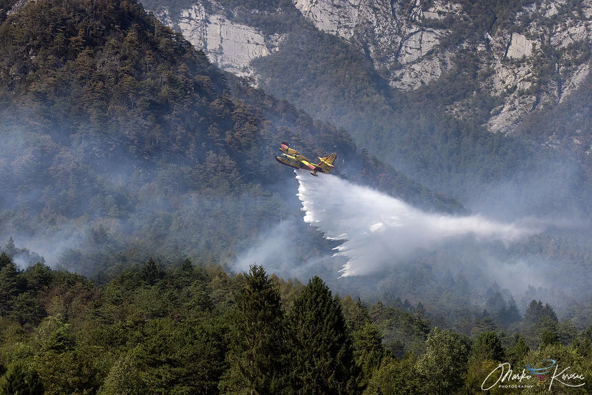
- Canadair Fleet: Italian Canadair water bombers performed hundreds of low-altitude sorties, skimming the surface of nearby water bodies to drop massive volumes of water directly onto the leading flame fronts.
- Slovenian Support: Demonstrating regional solidarity, Slovenian Air Tractor water bombers were integrated into the Italian command structure. These agile aircraft were instrumental in hitting smaller, high-altitude hot spots that larger planes could not safely reach.
- Regional Helicopters: Local helicopter units were tasked with precision drops and the constant transport of ground crew personnel to strategic ridgelines.
Ground Operations
While the sky was filled with aircraft, ground teams faced their own set of dangers. Firefighters navigated treacherous slopes, often working through the night to establish defensive lines near Pissebus and Illegio. High and medium-voltage power lines traversing the area were deactivated to ensure the safety of both the aerial crews and the firefighters on the ground.
Environmental and Meteorological Context
The Drought Factor
The wildfire did not happen in a vacuum. Regional meteorological data for the summer of 2026 highlights a severe rainfall deficit across the Friuli-Venezia Giulia region. Prolonged periods of heat, coupled with low soil moisture, created a "tinderbox" scenario. By the time the lightning strikes occurred, the forest floor was primed for rapid ignition.
The Turning Point: Atmospheric Relief
The final victory over the fire was achieved not by human intervention alone, but by a dramatic shift in the weather. Between August 20 and August 22, a significant frontal system swept through northeastern Italy. The storm brought intense downpours, with rainfall accumulations reaching between 150 mm and 200 mm within a 72-hour period. This deluge acted as the final extinguisher, saturating the smoldering debris and effectively ending the threat.
Post-Event Analysis and Future Implications
Thermal Monitoring
With the active flames suppressed, the mission has shifted from containment to mop-up and monitoring. Thermal drones, equipped with high-resolution infrared cameras, are currently sweeping the 600-hectare burn zone. These devices identify "hotspots"—pockets of heat trapped deep within the limestone cracks or beneath thick layers of ash—that could potentially reignite if temperatures were to spike again.
Ecological Impact
The loss of 600 hectares of forest is a significant blow to the local ecosystem. The Pinus nigra stands on Monte Amariana provide vital soil stabilization for the mountain’s steep slopes. In the coming months, geologists and environmental scientists will monitor the area for landslide risks, as the loss of vegetation and root structures can lead to increased erosion during the autumn and winter rain cycles.
Lessons Learned
The Monte Amariana wildfire serves as a stark reminder of the changing nature of European summers. The combination of intense "heat domes" and the increasing frequency of dry thunderstorms (lightning without significant rain) is testing the limits of traditional firefighting capabilities.
The successful coordination between Italian and Slovenian teams highlights the importance of cross-border emergency management protocols. As the climate continues to shift, experts suggest that regional authorities in Friuli-Venezia Giulia will need to invest further in high-altitude firefighting technology, including enhanced thermal mapping and faster-response aerial fleets, to defend the unique and vulnerable Alpine landscapes of the region.
Conclusion
The ten-day siege of Monte Amariana was a test of endurance for the people of Carnia and a display of bravery by those who fought to protect the mountain’s hamlets. While the landscape remains scarred, the containment of the blaze marks a successful conclusion to a summer that threatened to overwhelm the region’s resources. As the forest begins the long process of natural regeneration, the memory of the "Fire of Ferragosto" will undoubtedly inform future disaster preparedness strategies across the Italian Alps.
Data and imagery for this report were sourced from regional fire coordination centers, with supplementary meteorological analysis provided by PivotalWeather and WXcharts.