The Trollheimen Mountains of central Norway represent one of the most ecologically and historically significant landscapes in Scandinavia. A transition zone where the rugged marine influence of the coast meets the stark, silent majesty of alpine wilderness, Trollheimen—literally translated as "Home of the Trolls"—is a region defined by contrast. It is a land of ancient, wind-gnarled woodlands, crystal-clear glacial lakes, and serrated granite peaks that have served as the backdrop for human activity for thousands of years.

Despite its grandeur, Trollheimen remains an under-the-radar treasure for the international hiking community. While seasoned Norwegian trekkers know its secrets, the region offers a level of solitude and raw beauty that is increasingly difficult to find elsewhere in Europe. For the modern adventurer, the "Trollheimen Triangle" offers the perfect introduction to this mythical landscape, blending challenging physical endeavor with deep historical immersion.

Main Facts: The Anatomy of the Triangle
The Trollheimen Triangle is a classic circuit that encapsulates the very essence of the Norwegian mountain experience. For those looking to traverse the heart of the range, the logistics are straightforward but demand respect for the region’s volatile climate.

- Distance: 58 km (36 mi)
- Duration: 2–3 days
- Difficulty: Moderate (requires navigation skills and stamina)
- Total Elevation Gain: 2,720 m (8,924 ft)
- Start/Finish Point: Gjevilvasshytta mountain hut
The route is anchored by the historic Gjevilvasshytta, a mountain lodge dating back to 1819. From here, the trail forms a loop connecting the major mountain huts of the region, providing hikers with a structured way to experience the high fells, lush river valleys, and sweeping plateaus that define the "Home of the Trolls."

A Historical and Environmental Tapestry
Trollheimen is more than just a collection of trails; it is a living museum. Archaeological evidence found throughout the region points to human presence dating back to the Stone Age. Hikers frequently encounter remnants of Iron Age burial sites and traditional, turf-roofed farmhouses that have been preserved for generations.

The name "Trollheimen" itself is a product of late 19th-century tourism marketing. Coined by early explorers and local enthusiasts, the moniker was designed to capture the imagination of a budding international tourist market. While the name leans into folklore, the landscape does little to dispel the myth. With its jagged peaks and mysterious, mist-shrouded valleys, it is easy to see why the local culture has long associated the region with the legendary creatures of Norse mythology.

Chronology: Navigating the Triangle
The journey through the Triangle is best understood as a three-stage progression, each offering a distinct micro-climate and topographical challenge.

Stage 1: The Ascent to Jøldalshytta
Starting from the Gjevilvasshytta hut, the trail immediately climbs away from the basin, winding through the dense birch forests of Gjørdøldalen Valley. Within five kilometers, the landscape shifts dramatically as you break the treeline. The route crosses a wide, windswept saddle beneath the Høghøa Peak (1,308 m).

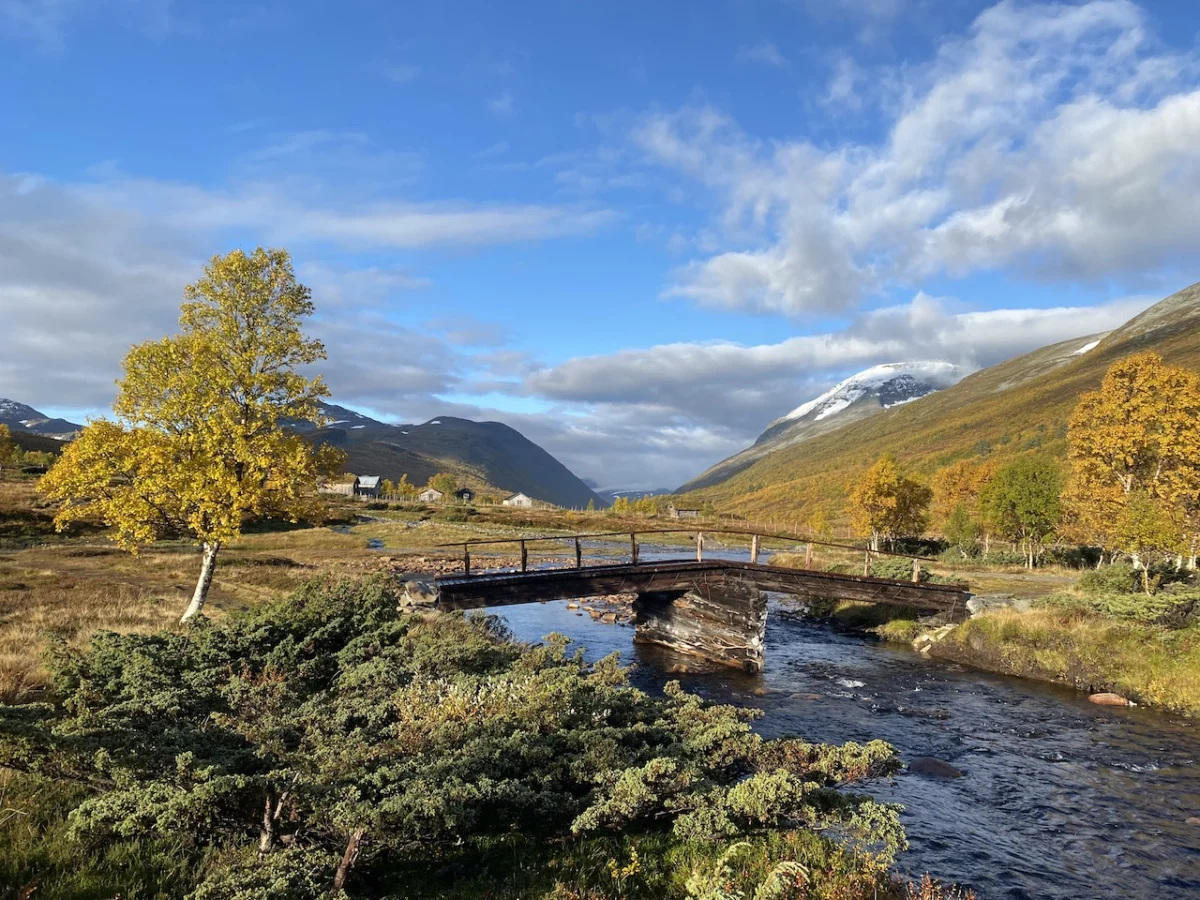
As you push toward the 11 km mark, the path descends into the marshy, lake-dotted Høghødalen Valley. A pivotal moment for many hikers is the crossing of the Minnilla River via a sturdy footbridge, a necessary transition before navigating the rolling fells toward Skrikhøa Peak (1,061 m). The stage concludes with a long, gradual descent toward Jøldalshytta, which sits in a picturesque position overlooking the vast Jølvatnet Lake.

Stage 2: Traversing the Heart of the Range
The second leg, moving toward Trollheimshytta, offers hikers a choice of three distinct paths. For those blessed with clear weather, the high traverses over the ridges of Geithøtta (1,316 m) or the formidable Trollhetta (1,616 m) provide unparalleled views.

However, Trollheimen is famous for its sudden weather shifts. In the event of heavy rain or high winds, the low-level route following the Svartå River is the preferred, and arguably more scenic, option. This valley walk is a lesson in tranquility, characterized by ancient bridges, lush meadows, and the charming, weathered architecture of mountain pastures. It is a rare opportunity to witness the "softer" side of the range, where the flora is at its most vibrant during the fall season.

Stage 3: The Final Challenge
The final 21 km stage is the most demanding. After departing Trollheimshytta, the route crosses the Slettå River before beginning a punishing climb. Over the next three kilometers, the trail gains 700 meters, zig-zagging through rocky terraces until it tops out at Skallen Peak (1,226 m).

From Skallen, the path continues across the Mellomfjellet plateau—a stark, lunar-like landscape of tarns and grey rock. The journey culminates at the Riarskaret Pass (1,307 m), the highest point of the stage. The final descent, past the shimmering waters of Kamtjønnin Lake, leads back into the Gjørdøldalen Valley, effectively closing the loop and returning the hiker to the civilized comforts of the trailhead.

Supporting Data and Logistical Insights
Successful completion of the Trollheimen Triangle relies heavily on preparation. The Norwegian Trekking Association (DNT) maintains a network of huts that are essential for long-distance hikers.

- Accommodation: The huts are equipped with bedding, cooking facilities, and in some cases, food supplies. Reservations are highly recommended during the peak season (July through August).
- Navigation: While trails are generally well-marked with the iconic red "T" symbol, the high plateaus can become disorienting in white-out conditions. A physical map and compass are mandatory, regardless of GPS availability.
- Gear: The rule of thumb for this region is the "three-layer system." Waterproof shells are non-negotiable, as the weather can change from sunshine to a freezing gale in under an hour.
Implications for Sustainable Tourism
Trollheimen stands as a testament to the success of Norway’s "Right to Roam" (allemannsretten) philosophy. This cultural right allows for public access to the countryside, provided that the environment is respected. However, as the region gains more attention, the challenge lies in balancing increased visitation with the preservation of sensitive alpine flora and fauna.

Local conservation boards have emphasized that hikers must stay on marked paths to prevent soil erosion and disturbance to local reindeer herds. The "Leave No Trace" ethos is not merely a suggestion here; it is the cornerstone of maintaining the pristine nature of the Trollheimen range for future generations.

Official Perspectives and Expert Advice
Regional park authorities and veteran guides consistently stress the importance of humility in the face of the mountains. A common refrain among those who manage the Gjevilvasshytta area is that "the mountain decides the schedule."

"Hikers who arrive with a rigid itinerary are often the ones who find themselves in trouble," says one local trail warden. "The beauty of Trollheimen is in its unpredictability. Whether it’s the sudden, dramatic shifts in the fog or the way the light hits the valley floor after a storm, the region demands that you remain present and adaptable."

For those seeking to document their journey or learn more about the technicalities of the trail, the resource Wanderlust Nordics: Exploring Trails in Scandinavia (2023) provides comprehensive GPS data and tactical breakdowns of the terrain.

Conclusion: A Call to the Wild
The Trollheimen Triangle is not just a hike; it is an immersion into a landscape that feels fundamentally unchanged by the frenetic pace of modern life. Whether you are navigating the steep slopes of Skallen or enjoying a quiet morning by the shores of Gjevilvatnet, the region offers a profound sense of scale.

It is a place where history and geography collide, where every bridge, every stone, and every valley floor holds a story. For the traveler willing to brave the elements and respect the power of the high fells, Trollheimen offers an experience that is as enduring as the mountains themselves. As the fall foliage turns the valleys into a tapestry of gold and crimson, there are few places on Earth where one feels more connected to the ancient, wild heart of the natural world.