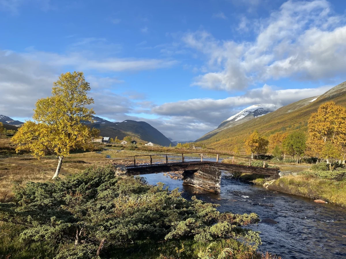
The Trollheimen Mountains of central Norway represent one of the most ecologically diverse and culturally rich landscapes in Scandinavia. Known as the "Home of the Trolls," this mountain range serves as a critical transition zone between marine and alpine environments. Here, jagged, snow-dusted granite peaks give way to ancient birch woodlands, while crystalline glacial lakes are fed by rivers winding through lush, verdant valleys.

Despite its profound natural beauty and deep historical significance—spanning from Stone Age hunting grounds and Iron Age burial sites to the quintessential turf-roofed farmhouses that dot the lower slopes—Trollheimen remains a well-kept secret to many international hikers. While the region’s moniker was popularized in the late 19th century as a clever marketing tactic to lure adventurous Victorian-era tourists, the name has stuck, perfectly capturing the mystical, rugged spirit of these highlands.

Main Facts: The Trollheimen Triangle
The Trollheimen Triangle is the quintessential circuit for those looking to experience the diversity of the Norwegian wilderness without committing to a multi-week expedition. This 58-kilometer (36-mile) loop is designed to be completed in two to three days, offering a moderate challenge for fit hikers.

- Distance: 58 km (36 mi)
- Duration: 2–3 days
- Difficulty: Moderate
- Total Elevation Gain: 2,720 meters (8,924 ft)
- Start/Finish Point: Gjevilvasshytta mountain hut
- Primary Season: Mid-July through mid-September
The trail offers a blend of physical challenge and pastoral comfort. By utilizing the network of well-maintained mountain huts managed by the Norwegian Trekking Association (DNT), hikers can balance long days on the trail with the warmth of a fire and a communal meal.

Chronology: A Journey Through Time and Terrain
The trek begins and concludes at the historic Gjevilvasshytta mountain hut, established in 1819. Situated just a 30-minute drive from the regional hub of Oppdal, the hut acts as the perfect gateway to the mountains.

Stage One: Entering the Fells
Walking in a counter-clockwise direction, the first 21-kilometer (13-mile) stage leads to Jøldalshytta Hut. The path ascends through the fragrant birch forests of Gjørrdøldalen Valley. After roughly five kilometers, the landscape shifts dramatically as the trail climbs above the treeline. The route crosses a wide, windswept saddle, passing beneath the imposing Høghøa Peak (1,308 m). The descent into the Høghødalen Valley reveals a mosaic of marshes and alpine tarns. At the 11-kilometer mark, hikers cross the Minnilla River—a key navigational waypoint—before continuing over rolling fells toward the shelter of Jøldalshytta, which sits majestically overlooking Jølvatnet Lake.

Stage Two: The Valley of Legends
The second stage, connecting Jøldalshytta to Trollheimshytta, provides the trekker with a choice of routes. In clear conditions, the high-altitude traverses over Geithøtta (1,316 m) or the formidable Trollhetta (1,616 m) are highly recommended for their panoramic views. However, during the unpredictable weather cycles common to the Nordic autumn, the 16-kilometer (9.9-mile) low-level route along the Svartå River is a magnificent alternative. This valley walk is a lesson in tranquility, passing storybook bridges, luxuriant meadows, and traditional, turf-roofed cottages that seem to have grown out of the earth itself.

Stage Three: The Final Ascent
The final 21-kilometer stretch is arguably the most strenuous. Leaving Trollheimshytta, the trail crosses the Slettå River and immediately begins a steep, technical climb. Over the course of three kilometers, the trail gains 700 meters (2,297 ft) in elevation, zigzagging through rocky terraces to reach the summit of Skallen Peak (1,226 m). On a clear day, the views of the Svartåmoen Nature Reserve are unparalleled. Descending from Skallen, the trail traverses the tarn-peppered plateau of Mellomfjellet before arriving at the shores of Fossådalsvatnet Lake. The final push involves a steep climb to the Riarskaret Pass (1,307 m) before the long, gentle descent back into the Gjørrdøldalen Valley and toward the Gjevilvasshytta trailhead.

Supporting Data and Logistics
For those planning to replicate this journey, logistical preparation is paramount. The Norwegian climate is famously volatile; even in the height of summer, hikers must be prepared for snow, sleet, and high winds.

- Navigation: While the trails are marked with the traditional red "T" synonymous with DNT paths, carrying a 1:50,000 scale topographic map (such as the Turkart series) is essential.
- Communication: Cell service is intermittent. A satellite messenger (like a Garmin inReach) is highly recommended for remote safety.
- Water: The water in the Trollheimen streams is, for the most part, pristine and drinkable. However, always exercise caution near grazing areas where livestock may be present.
- The DNT Hut System: The huts range from full-service (offering meals and bedding) to self-service (requiring guests to cook and clean). It is vital to check the operational status of these huts, as they close during off-peak shoulder seasons.
Official Perspectives and Conservation
The Norwegian government and regional authorities place a high priority on the preservation of the Trollheimen landscape. As a designated area of natural and historical importance, visitors are encouraged to follow the "Leave No Trace" principles strictly. The presence of Stone Age settlements and Iron Age burial sites means that archaeological sensitivity is required; hikers should never disturb stone structures or artifacts found near the trail.

Local conservationists emphasize that the "Home of the Trolls" is not merely a playground for tourists but a fragile ecosystem. The migration patterns of reindeer in the region are closely monitored, and hikers are often asked to keep to marked trails to avoid disrupting these herds.

Implications for the Modern Hiker
The Trollheimen Triangle represents a shift in modern adventure travel. In an era where "bucket-list" hiking destinations are increasingly overrun with tourists, Trollheimen offers an alternative: an authentic, quiet, and deeply meditative experience.

The primary implication for those who undertake this journey is the necessity of self-reliance. Unlike the more commercialized trails in Central Europe or the United States, Trollheimen requires the hiker to engage with the elements. There is a profound psychological shift that occurs when one stops "conquering" a trail and begins to move in rhythm with the weather and the terrain.

Whether it is the "pitter-patter" of rain against a tent at night or the sudden, fleeting golden light of a Norwegian autumn afternoon, the Trollheimen Triangle is a reminder of the raw, unfiltered majesty of the natural world. It is a destination that demands respect, rewards preparation, and leaves every traveler with a deeper understanding of the wilder, more ancient parts of our planet.

As the author noted during their 2022 expedition, there is no greater luxury than a hot meal and a warm, dry sleeping bag after a long day in the mountains. In the Home of the Trolls, the trail provides everything one needs—provided one is willing to accept the challenge of the climb.