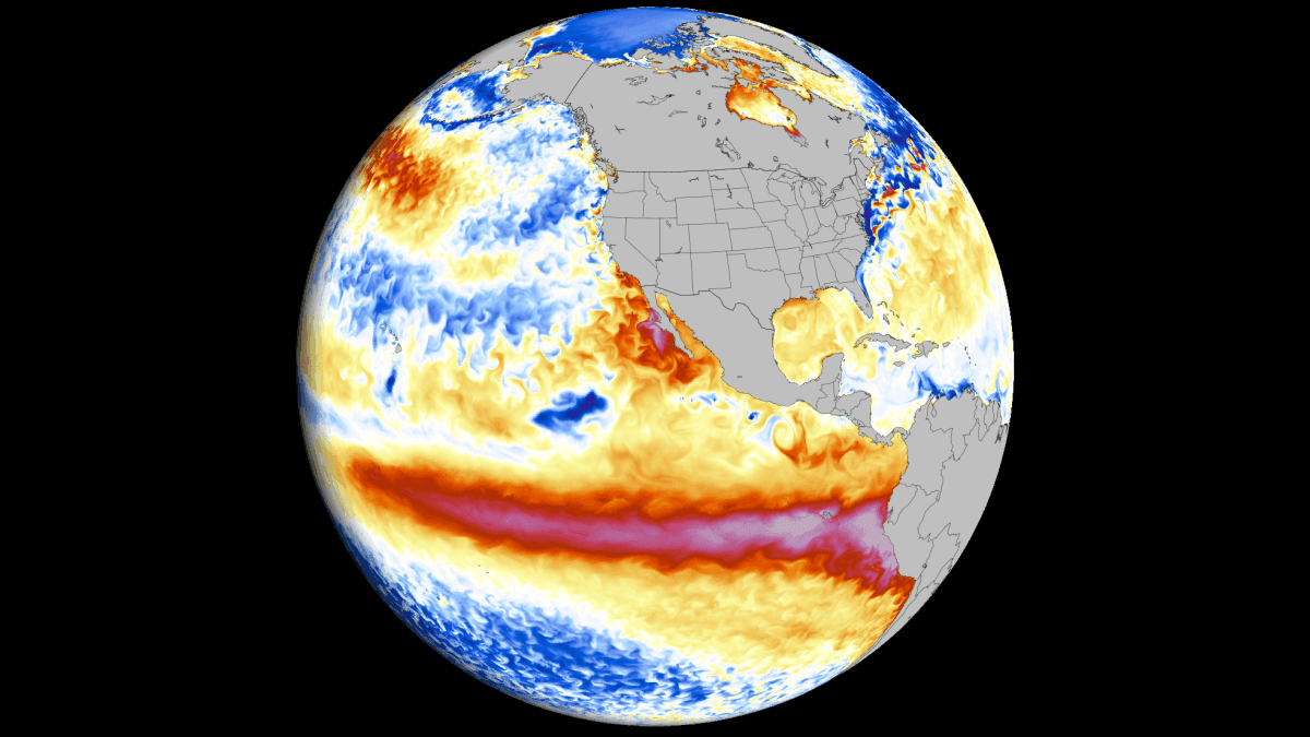
As the global meteorological community turns its eyes toward the equatorial Pacific, a singular, massive phenomenon is dominating the discourse: the 2026 Super El Niño. Recent oceanic and atmospheric data confirm that this event is not merely a standard oscillation, but a historic intensification that is rapidly evolving into one of the most powerful El Niño events recorded in over a century. With the transition into the Winter 2026/2027 season, this Super El Niño is effectively hijacking global circulation, setting the stage for significant weather anomalies across North America, Europe, and Asia.
The Anatomy of a Super Event
El Niño is defined by an anomalous warming of the central and eastern tropical Pacific, driven by shifts in trade winds and atmospheric pressure. While "moderate" El Niño events are common, the term "Super El Niño" is reserved for rare, extreme occurrences—typically manifesting once a decade or less—where oceanic warming exceeds specific, high-intensity thresholds.
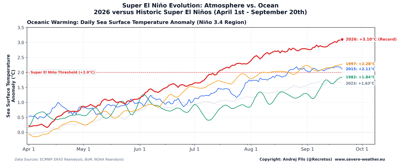
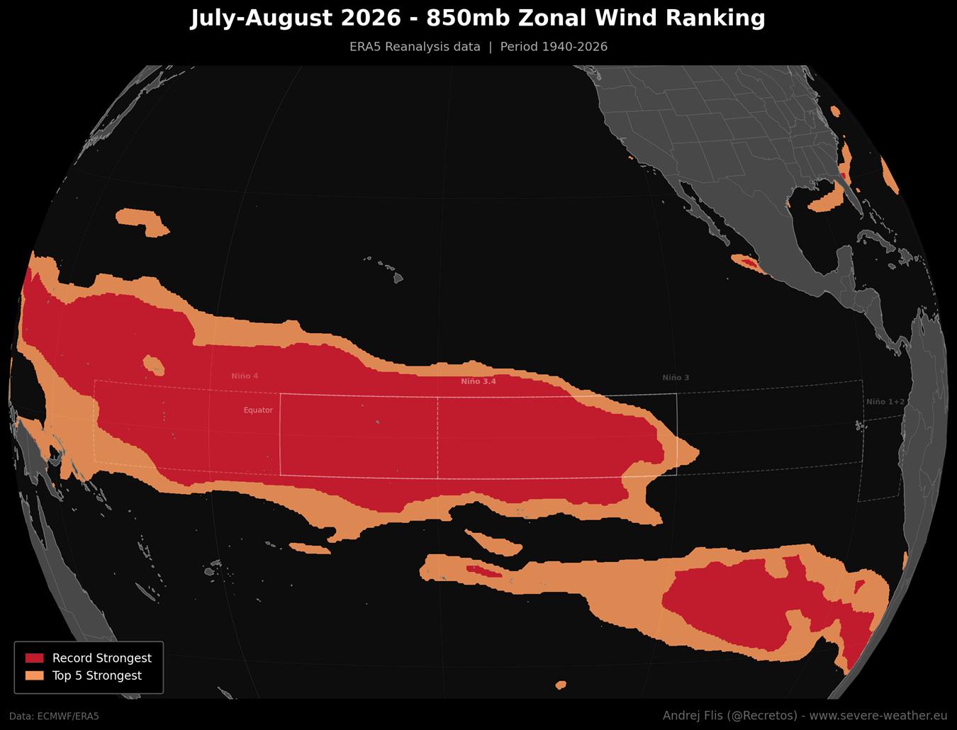
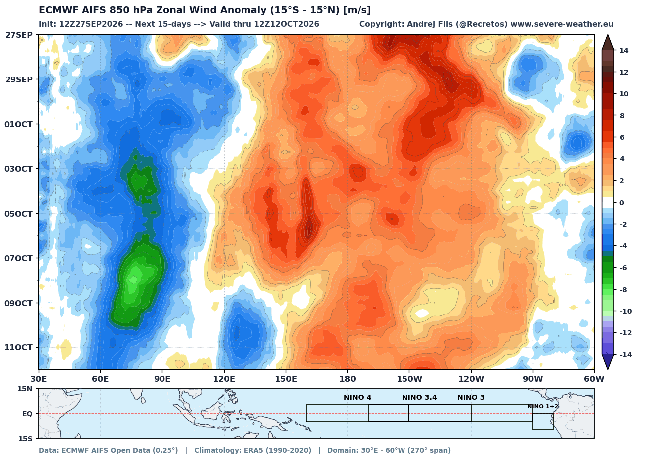
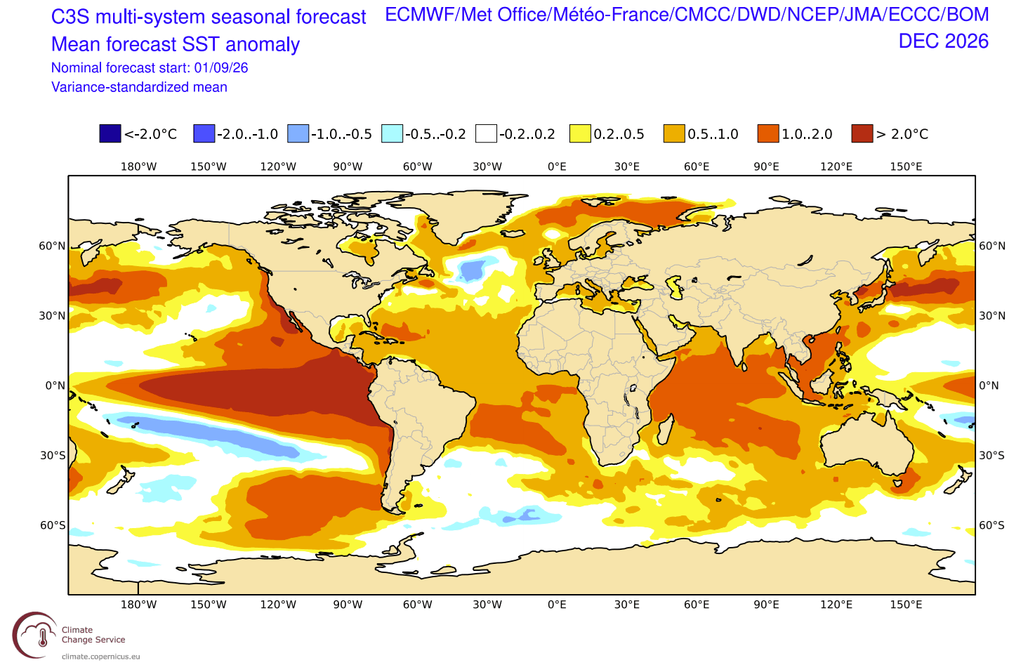
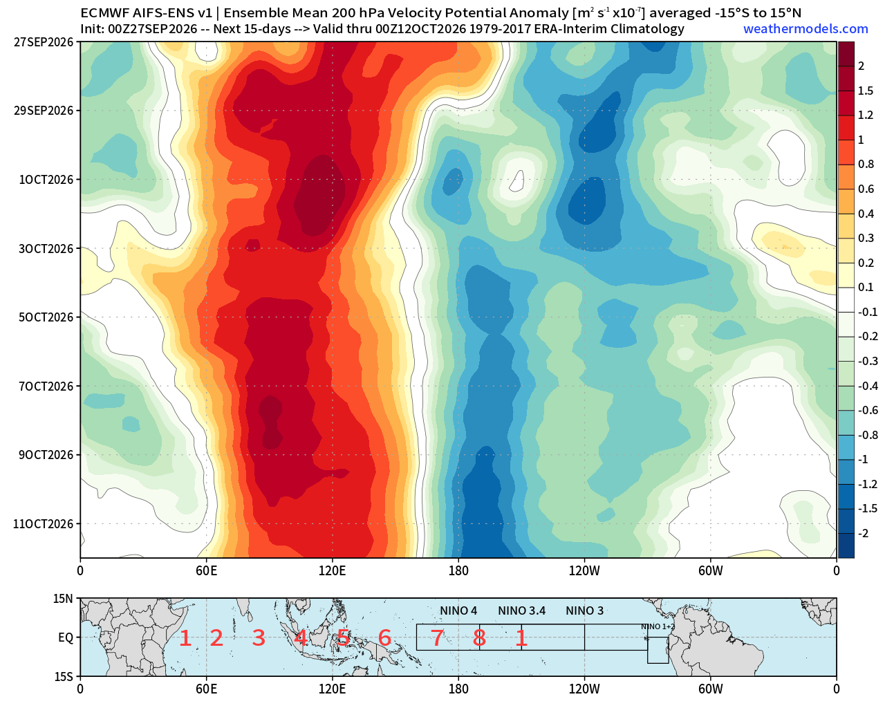
The 2026 event is currently in a state of rapid acceleration. Atmospheric data from the European Centre for Medium-Range Weather Forecasts (ECMWF) and NOAA confirm that the event has bypassed initial expectations, fueled by a collapse of the Pacific trade winds and a series of record-breaking westerly wind bursts. This atmospheric "smoking gun" has effectively paralyzed the normal thermal balance of the Pacific, creating a feedback loop that continues to amplify the warming.
Chronology of Intensification: From Summer to Winter
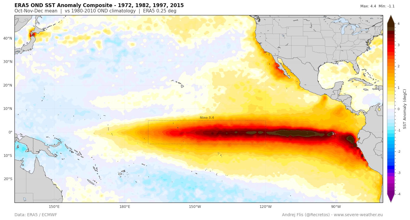
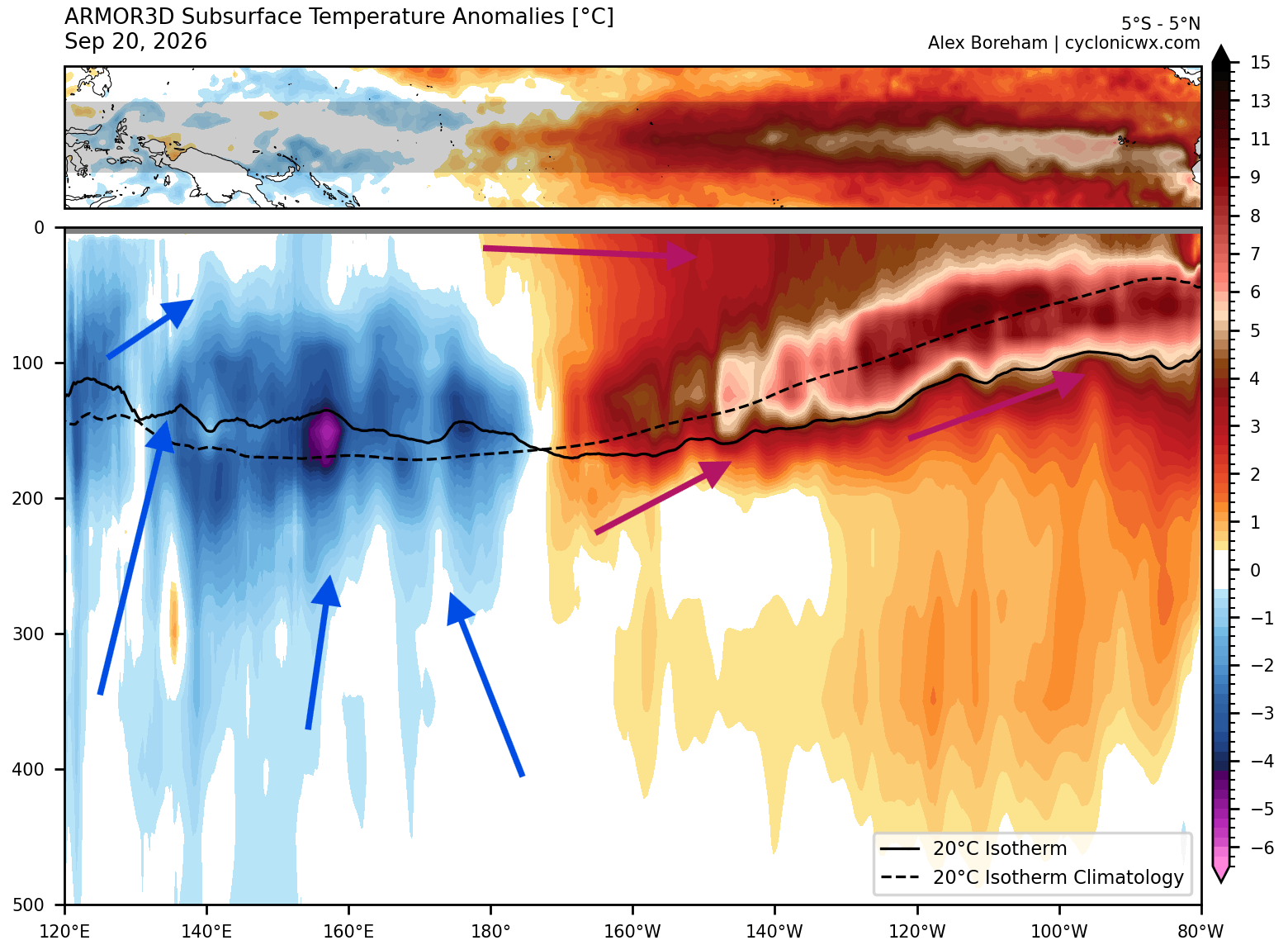
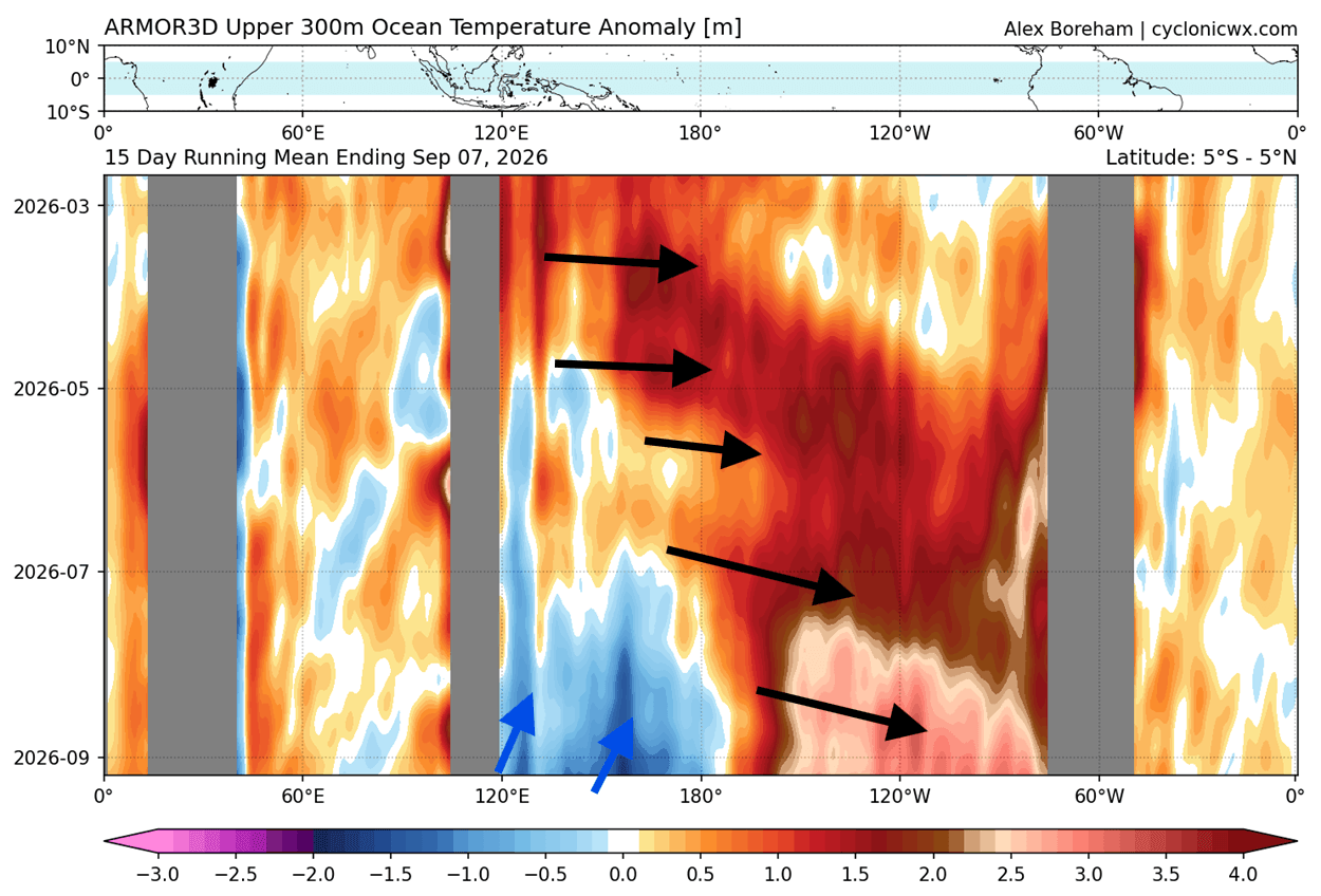
The development of the 2026 event has been nothing short of aggressive. Since the early summer months, meteorologists tracked the emergence of deep-seated subsurface anomalies. The engine of this current event is a powerful downwelling Kelvin Wave. As these waves move eastward along the equator, they push warm, subsurface water toward the surface of the eastern Pacific, where anomalies have already reached temperatures exceeding 6°C (11°F) above the historical norm.
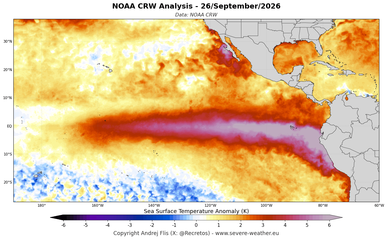
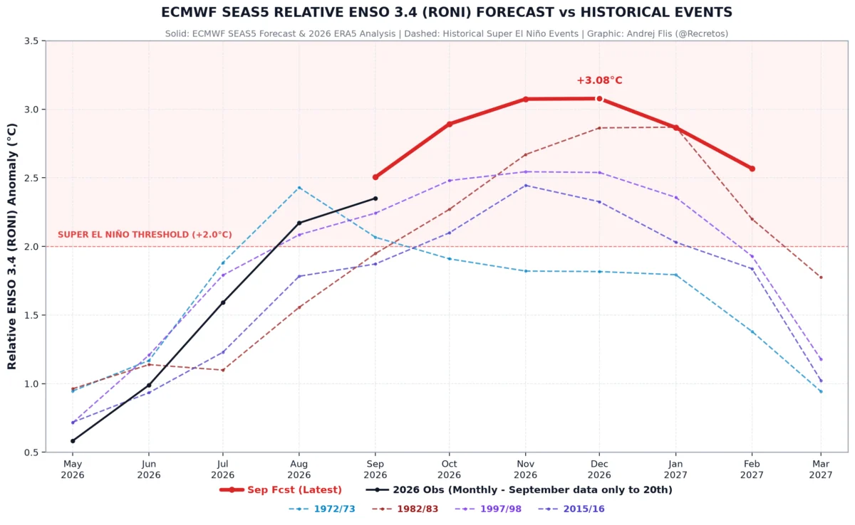
By late September, the Multivariate ENSO Index (MEI)—a composite metric used to measure the coupling between the ocean and the atmosphere—hit a record-high value of +2.5 for the July-August period. This is the highest level recorded since the index’s inception in 1979, signaling that the coupling between the warming ocean and the overlying atmosphere is locked in a high-intensity state. With the event projected to peak in November and December, we are currently in the most critical phase of its development, as the "standing wave" of global circulation begins to solidify.
Supporting Data: The Science of the "Engine"
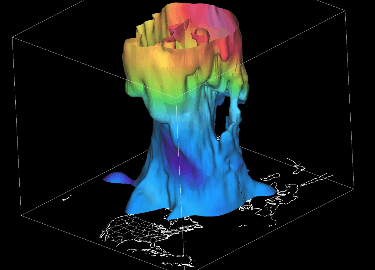
The sheer force of this Super El Niño is best illustrated by the subsurface thermal profiles. While surface sea temperatures grab the headlines, the true power lies in the upper 200 meters of the ocean. Recent scans show a massive warm core—a Kelvin Wave—stretching across the Pacific. Unlike previous events, this wave is deeper and warmer, suggesting that the event has significant "inertia" that will carry its impacts deep into the spring of 2027.
The westerly wind bursts recorded throughout August and September were the strongest in an 86-year dataset. These winds effectively "pile up" the warm water in the eastern Pacific, preventing the normal upwelling of colder, nutrient-rich water. This has created a stark thermal gradient, with the eastern Pacific acting as a massive heat reservoir that is now forcing the jet stream to restructure itself.
Global Atmospheric Implications
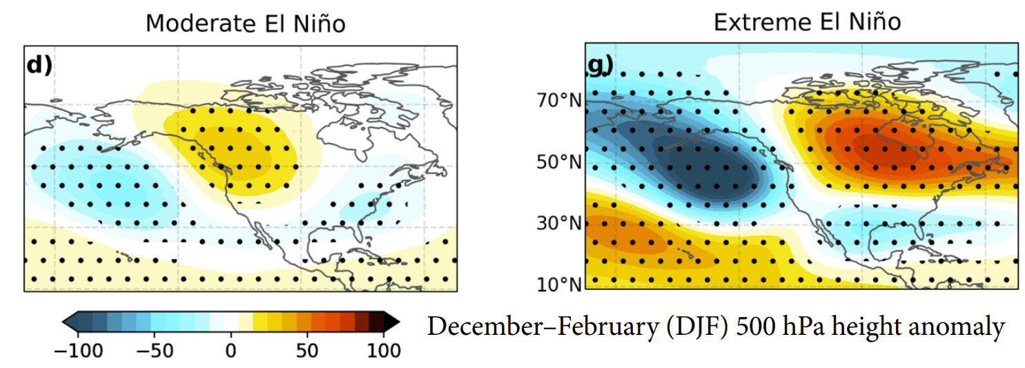
The primary way a Super El Niño impacts the world is by shifting the Walker Cell—a global circulation pattern of rising and sinking air. Normally, this cell is dynamic; however, the extreme heat of the 2026 event is anchoring this cell in place.
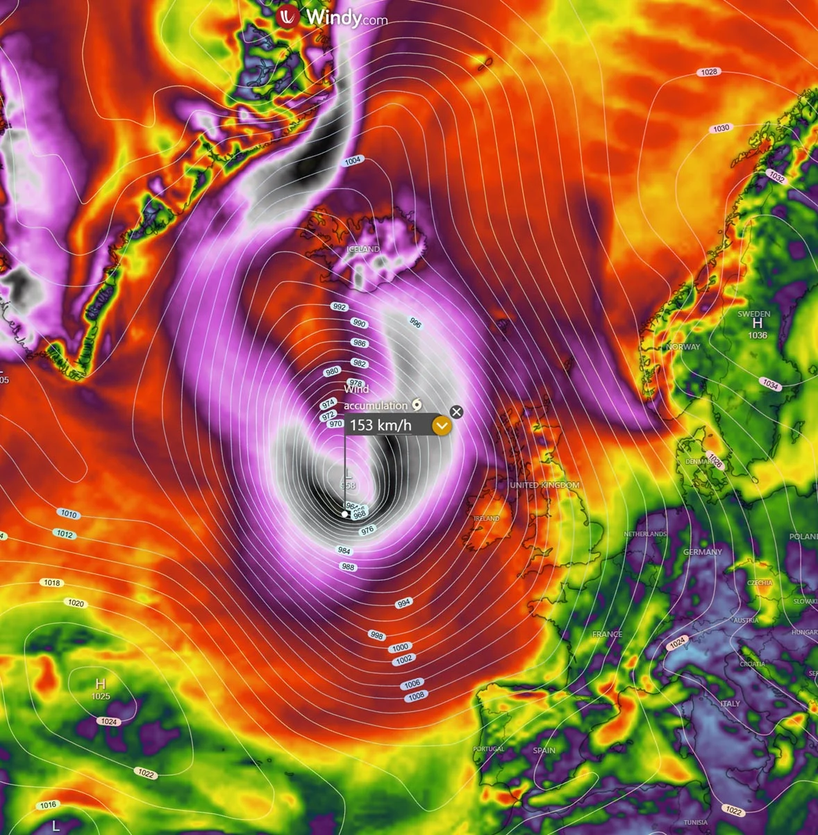
This results in an atmospheric standing wave that dictates weather patterns thousands of miles away. For North America, this typically manifests as a deep, persistent trough in the North Pacific, which in turn forces a high-pressure ridge to build over Canada and the northern United States. This "atmospheric highway" effectively deflects the polar jet stream, leading to warmer-than-average winters in the northern regions while simultaneously creating a pipeline for moisture and storm systems across the southern United States.
Regional Impacts
- United States and Canada: The northern tier of North America can expect milder, drier winters as the ridge blocks traditional cold-air outbreaks. Conversely, the southern U.S. should brace for an active storm track, bringing increased precipitation and potential flooding risks.
- Europe: The downstream effects of this Pacific-centric event often result in a dominant westerly flow, which typically drives warmer, wetter conditions across much of the European continent.
- Asia: The disruption to the Walker Cell often leads to altered monsoon patterns and shifts in tropical rainfall, with potential for drought in some regions and increased flood risk in others.
Official Projections and Future Outlook
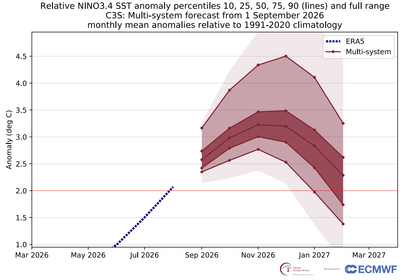
Climate modeling agencies, including the ECMWF and NOAA, are in rare consensus: the 2026/2027 event is projected to peak at or above +3°C (5.4°F) in the critical Niño 3.4 region. No event in the last 70 years has consistently sustained such high anomalies on a monthly basis.
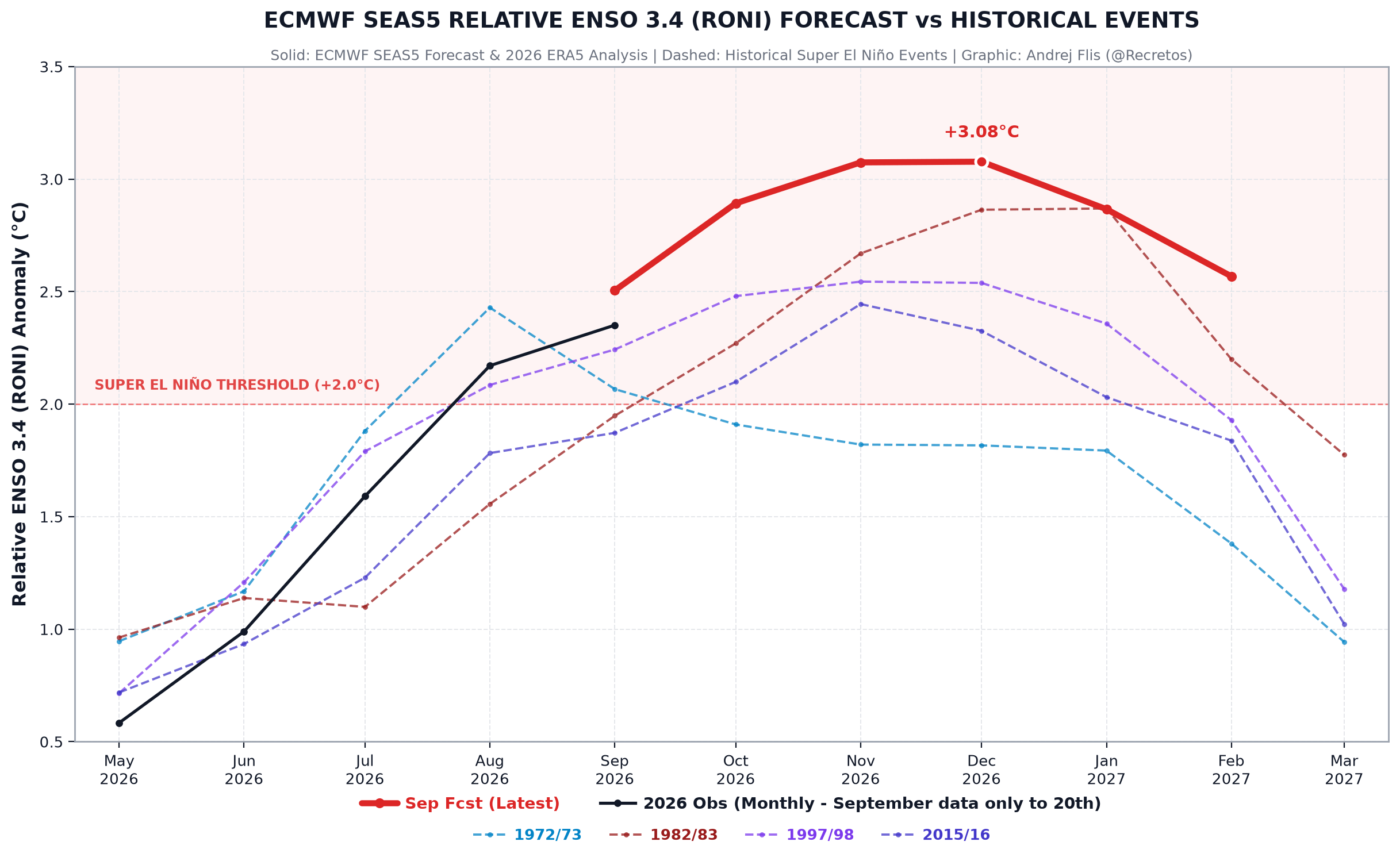
As we move toward the peak of the winter season, the scientific community is keeping a close watch on the "decay phase." While the event is expected to reach its zenith in December, the lingering effects of such a massive ocean-heat content anomaly will likely influence global weather through the first quarter of 2027.
Preparing for a Volatile Season
The implications of a Super El Niño extend beyond mere temperature fluctuations. The shift in pressure patterns impacts everything from energy demand and agricultural output to infrastructure stress. Because we are entering "uncharted waters" with this specific intensity, policymakers and emergency management agencies are advised to treat the coming months as a period of heightened volatility.
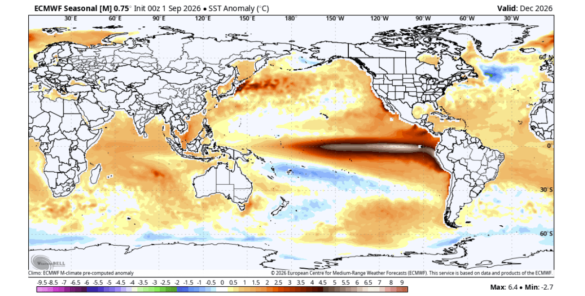
The "Winter 2026/2027 Forecast Explorer" is now available to provide granular detail on these shifts. By utilizing high-resolution atmospheric models, users can track how these pressure anomalies will translate into local snowfall, temperature, and precipitation patterns. Whether it is the projected moisture surge in the American South or the potential for a mid-winter shift in the North Atlantic, the data suggests that this winter will be defined by the reach of the Pacific’s record-breaking warmth.
As we continue to monitor the development of the Kelvin Wave and the atmospheric response, the message from the data is clear: 2026 is a milestone year in climatology. The 2026 Super El Niño is not just a weather event; it is a fundamental reconfiguration of the global climate system for the coming season. Residents in affected regions are encouraged to remain updated on evolving forecasts, as the atmospheric response to this event will continue to fluctuate throughout the winter months.
For ongoing analysis and real-time mapping of the 2026/2027 Winter season, refer to the latest updates from the ECMWF and regional meteorological services. As the situation remains fluid, users are encouraged to monitor their local weather advisories for specific, short-term impact warnings.