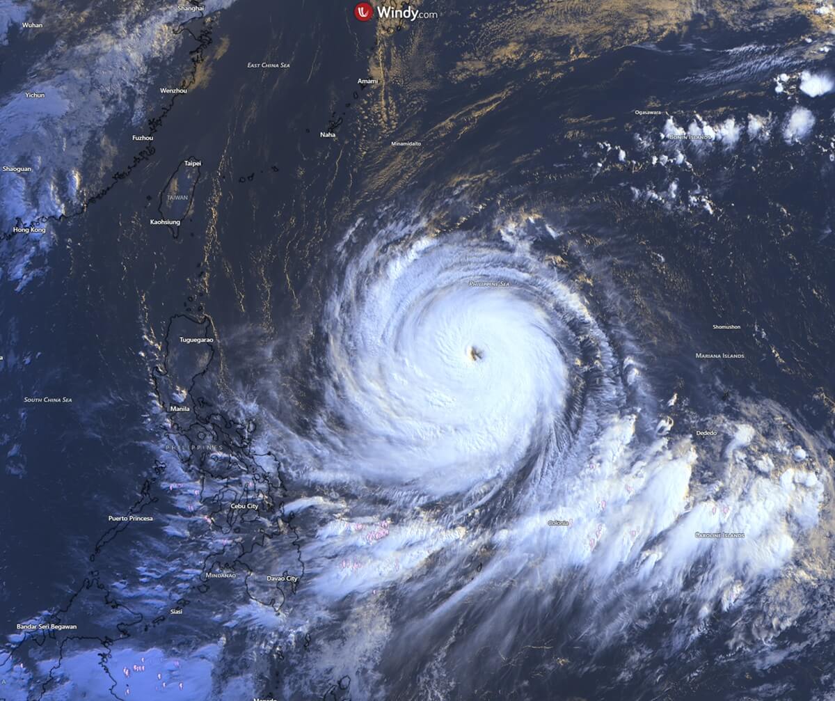
The Western Pacific has been thrust into a state of high alert as Super Typhoon Bavi, a storm of staggering proportions, continues its relentless march across the Philippine Sea. In a display of atmospheric volatility rarely seen in such a short window, Bavi evolved from a modest tropical system into a formidable Category 5-equivalent monster in under 48 hours. With sustained winds reaching a blistering 180 mph and a central pressure plummeting to 901 mbar, the storm has cemented its legacy as one of the most violent and rapidly intensifying cyclones of the current season.
The Anatomy of an Atmospheric Monster
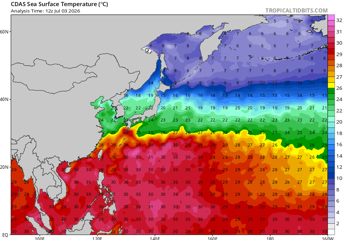
The rapid intensification of Super Typhoon Bavi is a direct result of "perfect storm" conditions within the Pacific basin. The storm thrived on exceptionally warm, deep oceanic temperatures—ranging from 29°C to 32°C—which acted as high-octane fuel for its convective engines. Coupled with an environment characterized by near-zero wind shear, the typhoon was able to establish a near-perfect atmospheric outflow, allowing for highly efficient upper-level ventilation.

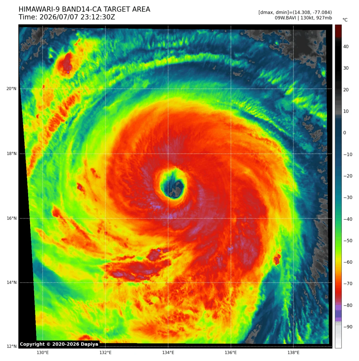
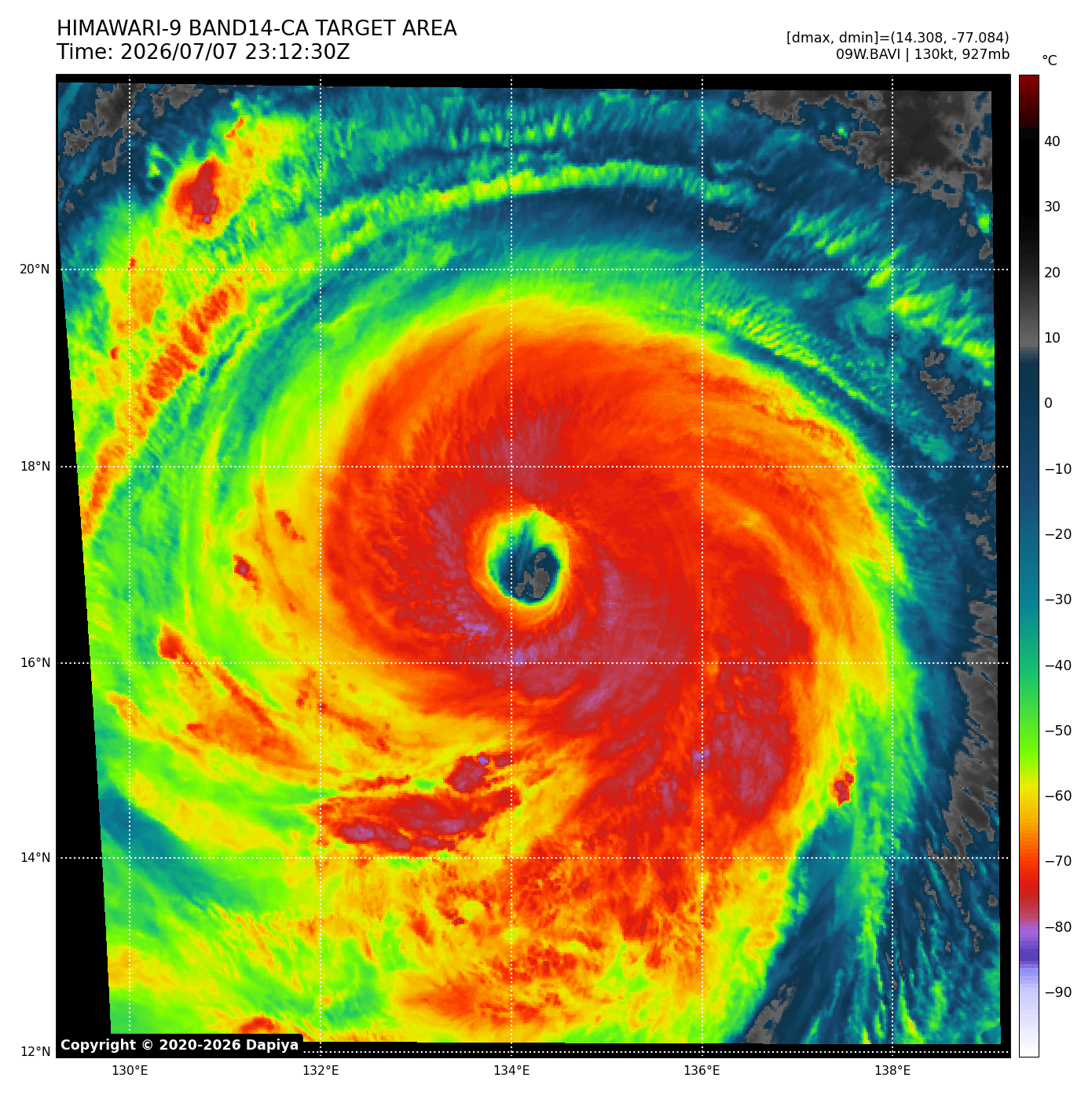
Meteorologists observing the storm’s "buzzsaw" rotation noted a classic, yet terrifying, eyewall replacement cycle. Rather than dissipating, the storm emerged from this cycle larger, more structurally sound, and possessing a significantly broader wind field than before. This expansion means that the area affected by catastrophic, hurricane-force winds is now much larger, exponentially increasing the potential for widespread structural damage across its projected path.
Chronology of Destruction: From Guam to the Horizon
The initial display of Bavi’s raw power occurred when its northern eyewall made a direct pass over the island of Rota in the Northern Mariana Islands. The impact was immediate and devastating, as the island was subjected to sustained hurricane-force winds and torrential, relentless rain. Guam, too, did not escape the storm’s reach; the island reported more than 20 inches of rainfall and wind gusts peaking at 85 mph.
The region, known historically as "Typhoon Alley," is no stranger to the fury of tropical cyclones. Islands in the Marianas chain, including Guam, have long lived under the shadow of these massive weather events. The memory of historic storms like Karen, Paka, and Pongsona remains etched in the local psyche. Following the catastrophic impact of Typhoon Karen in 1962, which leveled nearly all wooden structures on the island, Guam undertook a massive infrastructure overhaul. Today, the island is often referred to as a "concrete island," with building codes designed specifically to withstand the brutal winds that Bavi has now brought to the fore.
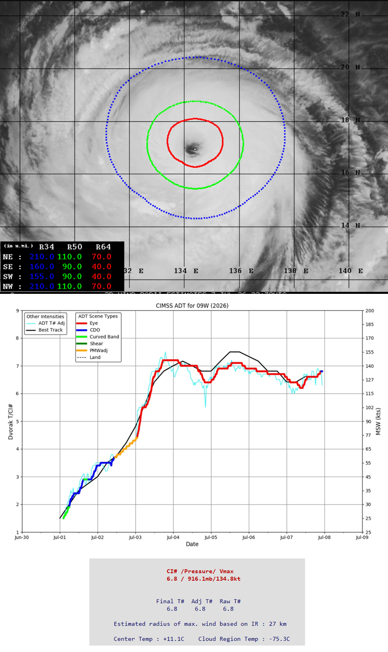
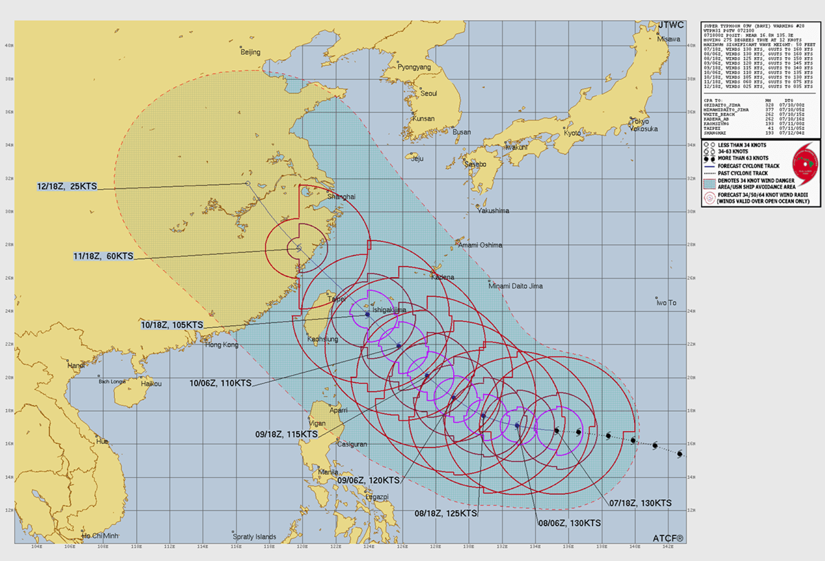
As of this writing, Bavi is tracking west-northwest through the Philippine Sea. The latest Advanced Dvorak automatic satellite analysis confirms that the typhoon maintains its violent strength. Its next major encounter is scheduled for northern Taiwan this coming Friday, where the storm is expected to arrive as a high-end Category 4 or low-end Category 5 system.
Meteorological Data: Why Bavi is Breaking Records
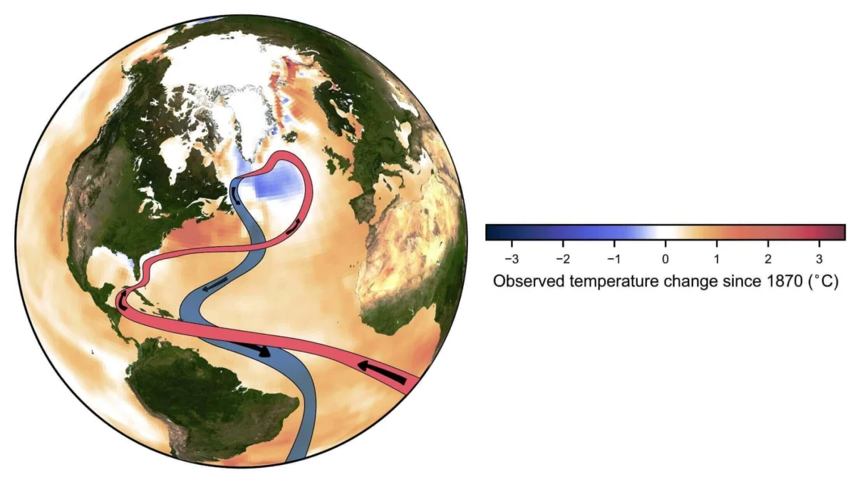
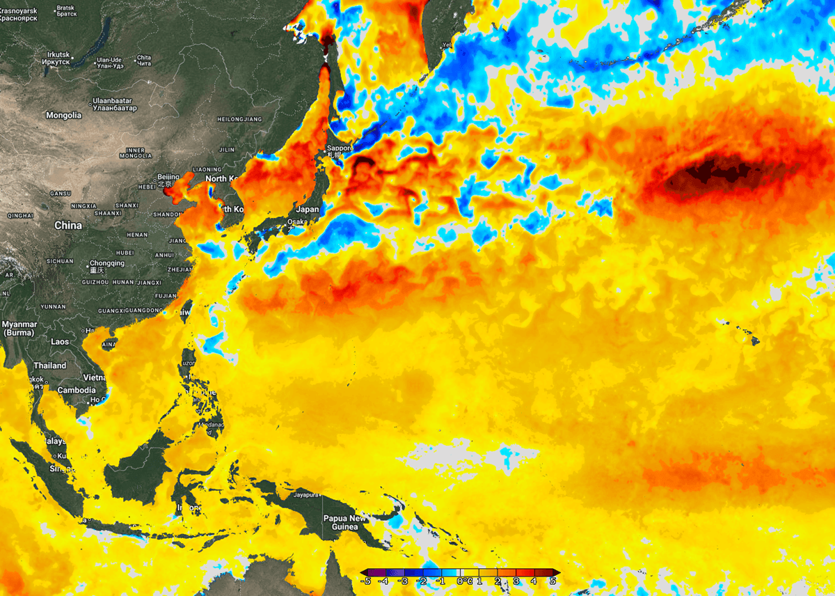
To understand the severity of Bavi, one must look at the anomalous conditions currently gripping the Western Pacific. Sea surface temperatures in the region are currently 2–3°C above the long-term average for mid-July. In some areas, particularly off the coasts of China, Taiwan, and Japan, these anomalies reach as high as 4°C.
These elevated temperatures lead to higher dew points and a surplus of near-surface energy. When a tropical system encounters this volatile air mass, it does not merely grow—it explodes. The infrared satellite imagery currently streaming from weather satellites provides a sobering view of Bavi’s size. The storm displays a symmetrical, expansive wind field where the most intense winds extend 60–70 miles from the core. Tropical-storm-force winds extend up to 110 miles from the eye, ensuring that the impact is not confined to a single point but will be felt across a massive swathe of the Pacific.
The Path Ahead: Implications for Taiwan and Beyond
As Bavi approaches the southern islands of Japan and northern Taiwan, the forecast models paint a harrowing picture. While the center of the storm may track slightly away from direct landfall on Taiwan, the peripheral effects will be catastrophic. The primary threat is not just wind, but water.
Meteorological models are projecting exceptional rainfall totals, with some areas of Taiwan’s mountainous terrain potentially receiving between 600 mm and 1,000 mm (up to 40 inches) of rain within a 48-hour period. Given the topography of the region, this volume of water is almost guaranteed to trigger massive flash floods and mudslides.
Furthermore, the storm’s immense size will push a catastrophic storm surge toward the coastlines of Japan’s southern archipelago and northern Taiwan. The combination of giant waves, surging seawater, and torrential downpours poses an existential threat to low-lying infrastructure. Following the impact on Friday, Bavi is expected to track toward the coast of China by Saturday. While the storm is predicted to begin a gradual weakening phase as it encounters cooler waters and increased wind shear, it is expected to remain a powerful, dangerous system until it makes final landfall.
A Legacy of Resilience and Preparation
The history of the Western Pacific is a testament to human resilience in the face of nature’s greatest fury. The transition of the Marianas from wooden settlements to reinforced concrete structures serves as a global blueprint for disaster mitigation. However, storms like Bavi remind us that even the most robust infrastructure is tested to its limits by the increasing intensity of modern typhoons.
The current advisory for the region is clear: residents in the path of the storm must prioritize safety over property. Official responses from regional authorities have focused on early evacuation, the securing of maritime vessels, and the activation of emergency flood defenses. In Taiwan and the southern Japanese islands, authorities are warning that the "wide wind field" of Bavi makes the exact point of the eye less relevant than the massive rain and wind bands that accompany the storm.
Conclusion: The New Normal?
Super Typhoon Bavi is more than just a singular event; it is a manifestation of the warming trends in our global oceans. The high-energy environment that allowed Bavi to jump from a tropical storm to a Category 5 monster in less than two days is a sobering indicator of how climate variables are altering the behavior of tropical cyclones.
As we look toward the remainder of the season, the scientific community remains focused on the interaction between these warmer waters and the intensification rates of future storms. For now, the eyes of the world are on the Western Pacific, waiting for Bavi to complete its path and praying for the safety of those in its wake. The storm serves as a stark reminder that while we can build better, stronger cities, the sheer kinetic energy of a super typhoon remains one of the most humbling forces on the planet.
Summary of Key Metrics:
- Maximum Sustained Winds: 180 mph (Category 5-equivalent)
- Central Pressure: 901 mbar
- Projected Rainfall (Taiwan): 600–1000 mm (40 inches)
- Primary Risks: Catastrophic wind damage, extreme flash flooding, storm surge, and landslides.
- Status: Maintaining intensity; weakening expected upon interaction with cooler coastal waters and increased wind shear.
Note: This report utilizes data provided by Windy, CyclonicWX, and Tropical Tidbits. Residents in affected areas are encouraged to monitor local meteorological agencies for real-time updates and evacuation orders.