As we transition into the latter half of 2026, the global meteorological community has turned its gaze toward the Pacific Ocean, where a formidable weather phenomenon is rapidly taking shape. A "Super El Niño"—an extreme manifestation of the El Niño-Southern Oscillation (ENSO)—is emerging as the primary driver for the upcoming Fall and Winter seasons. Meteorological data confirms that warm anomalies in the equatorial Pacific are intensifying at an unprecedented pace, setting the stage for a highly volatile and active global weather pattern.

This development is particularly significant because the autumn months typically serve as a period of atmospheric transition, often characterized by weaker, less organized seasonal systems. However, current long-range forecast trends suggest a departure from the norm. Instead, we are seeing a connected, amplifying evolution where the influence of this Super El Niño extends its reach earlier than historical precedents might suggest, promising to dictate the climate narrative through the 2026/2027 winter season.
Main Facts: A Global Driver in the Making
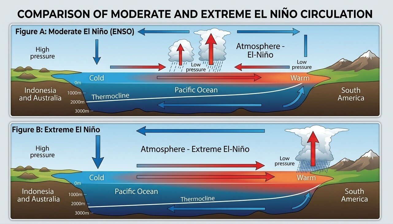
At the heart of this atmospheric shift is the El Niño-Southern Oscillation (ENSO). This oceanic and atmospheric coupling involves the fluctuation of sea surface temperatures in the equatorial Pacific. When this region enters a strong warm phase, it triggers a cascade of effects known as the "Walker Cell"—the pattern of upward and downward air motion across the tropics.
In a Super El Niño event, this circulation is dramatically altered. A significant pressure drop in the central and eastern tropical Pacific, paired with high-pressure zones over the western Pacific, creates a massive feedback loop. This loop filters into the mid-latitudes, dictating storm tracks, jet stream positioning, and temperature anomalies across the Northern Hemisphere. Current data indicates that this 2026 event is tracking to exceed the +2°C anomaly threshold, a key marker for "Super" classification, with some projections suggesting a peak anomaly that could challenge historical records.
Chronology of Development: From Early Anomalies to Seasonal Peak
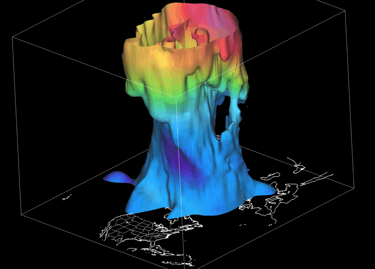
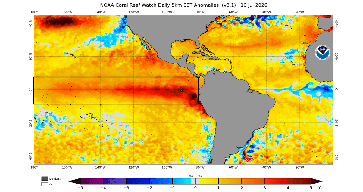
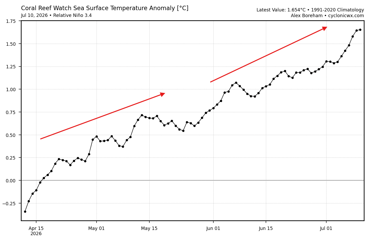
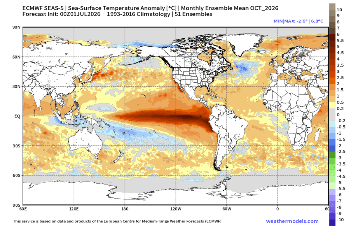
The progression of this El Niño has been nothing short of aggressive. Ocean analysis from the past 90 days reveals a consistent, rapid warming trend across the primary ENSO region. While initial signals were moderate, the onset of strong warm anomalies—some exceeding 3°C to 4°C above normal in eastern regions—has caught the attention of climate scientists.
The Trajectory Toward Winter
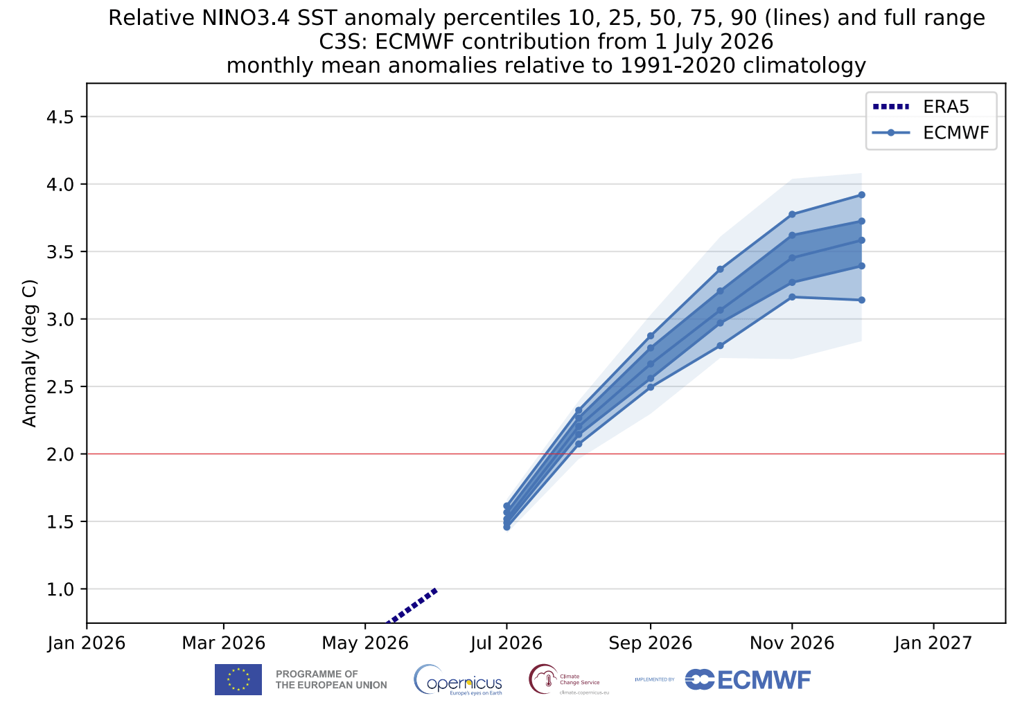
The current trajectory shows no signs of dissipation. If the latest ensemble forecasts from the European Centre for Medium-Range Weather Forecasts (ECMWF) hold, the event will likely reach its zenith during late Fall and early Winter. By October 2026, models indicate potential anomalies exceeding 6°C in certain sectors of the Pacific. This early-season intensification is unusual, suggesting that the "atmospheric bridge" between the tropical Pacific and the rest of the world is being constructed much faster than in previous cycles.
Supporting Data: Scientific Modeling and Consensus
To understand the scope of this phenomenon, we must rely on the integration of multiple high-fidelity models, including the ECMWF and the North American Multi-Model Ensemble (NMME).
Atmospheric Pressure Patterns
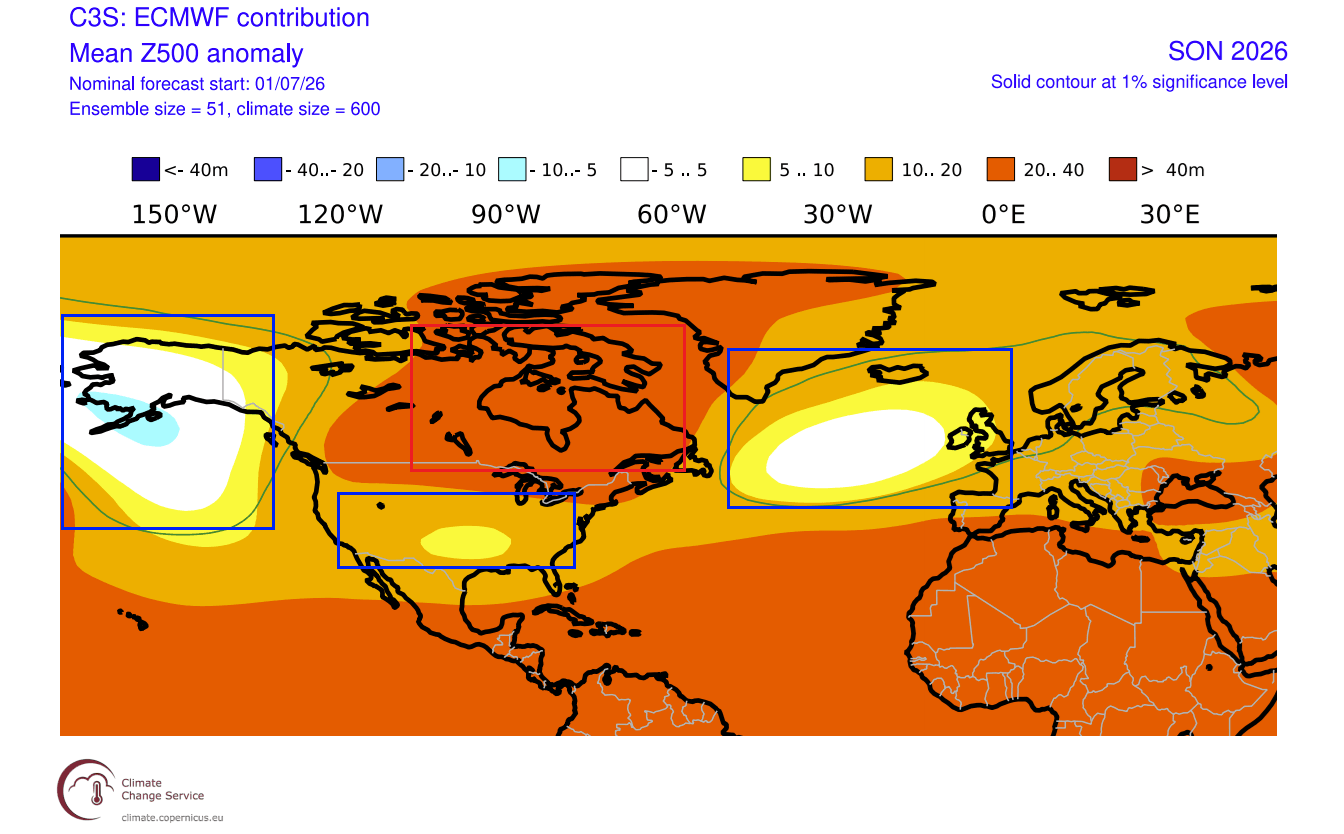
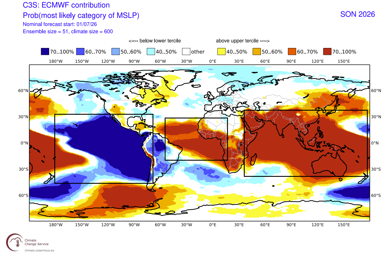
The pressure pattern forecast for the 2026 meteorological Fall is highly unusual. Rather than a standard transitional phase, the models show a fully realized El Niño response:
- High-Pressure Anomalies: A persistent ridge is forecast over Canada, which acts as a "block" in the atmosphere.
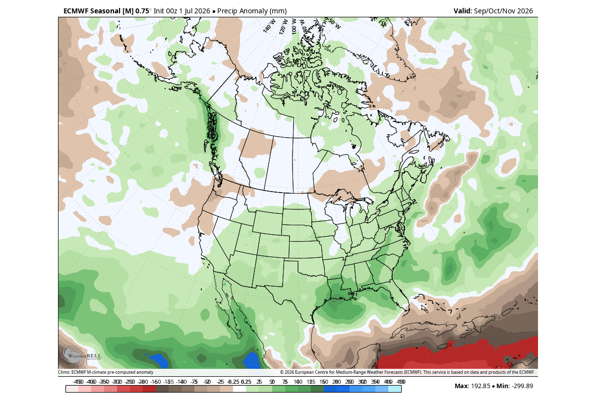
- Active Storm Tracks: A chain of low-pressure systems is projected to establish itself across the southern United States, fueled by an amplified, moisture-rich subtropical jet stream.
- Global Circulation: The presence of a broad low-pressure zone over the eastern tropical Pacific confirms that the atmosphere is already "locked in" to the El Niño cycle, demonstrating the classic Walker Cell configuration that dictates global weather outcomes.
Comparison with Past Events
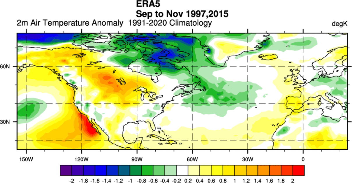
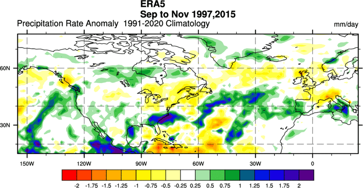
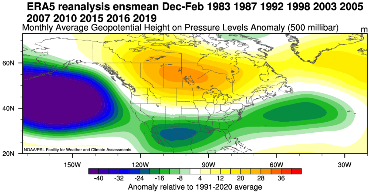
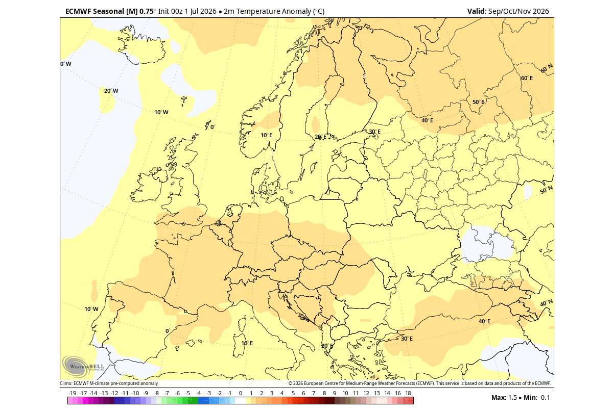
By analyzing the last two Super El Niño events, meteorologists can draw parallels for what lies ahead. Historically, these events result in above-normal temperatures across northern and central North America and parts of Europe, while the U.S. West Coast and Southeast often experience increased precipitation. The 2026 forecast mirrors these historical signatures but with an increased intensity that underscores the "Super" nature of the current cycle.
Official Responses and Probability Outlooks
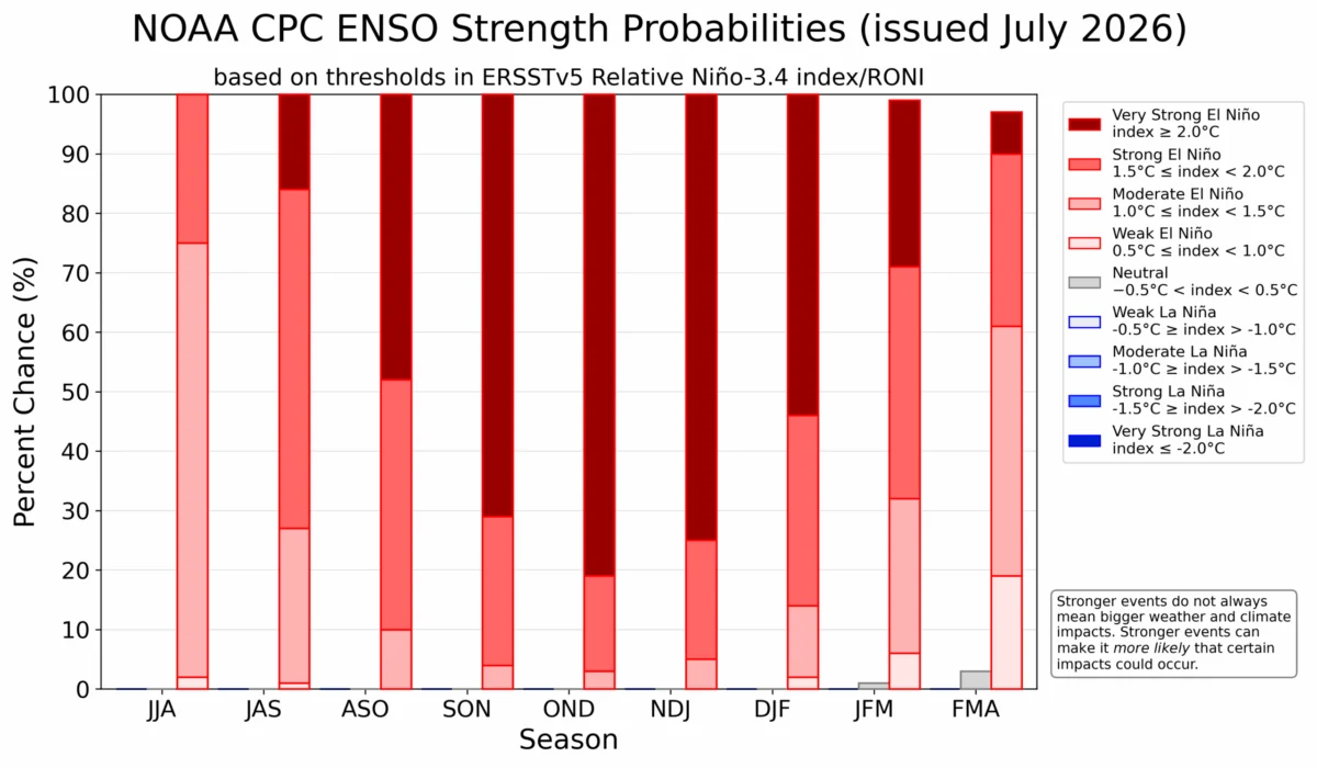
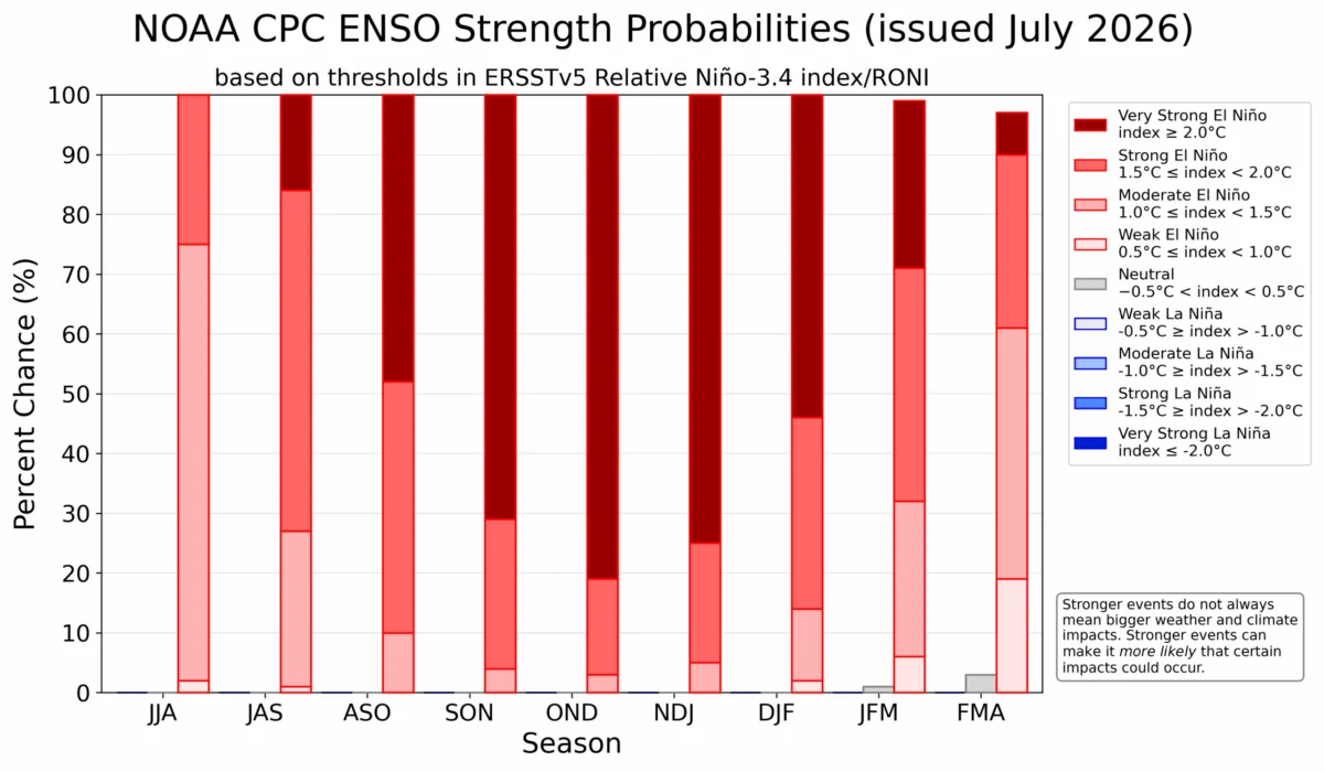
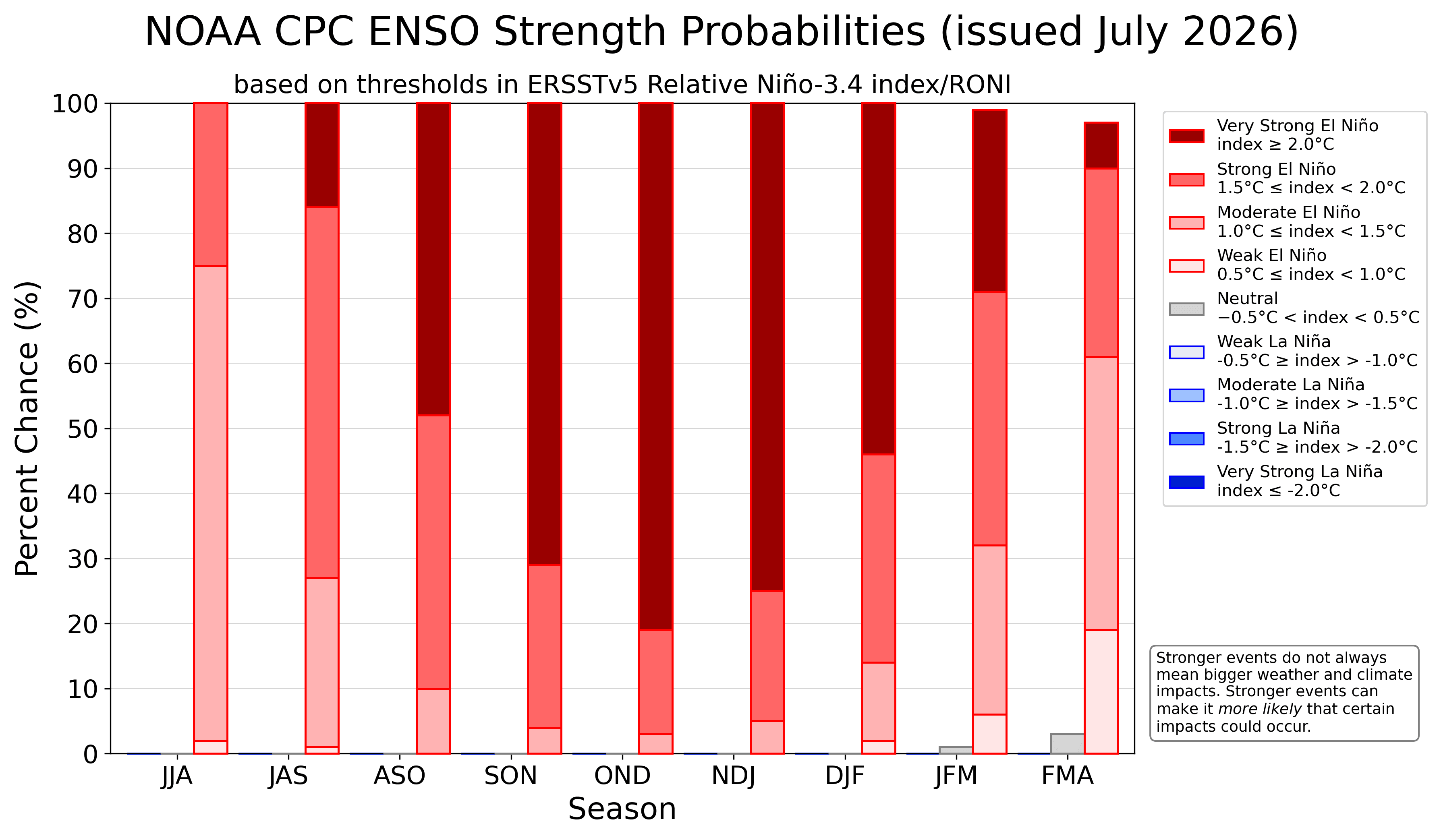
The National Oceanic and Atmospheric Administration’s Climate Prediction Center (NOAA CPC) has issued outlooks that confirm the overwhelming likelihood of this event ending in the extreme category. The probability curves for a "Very Strong" El Niño are currently at their highest point for this time of year in several decades.
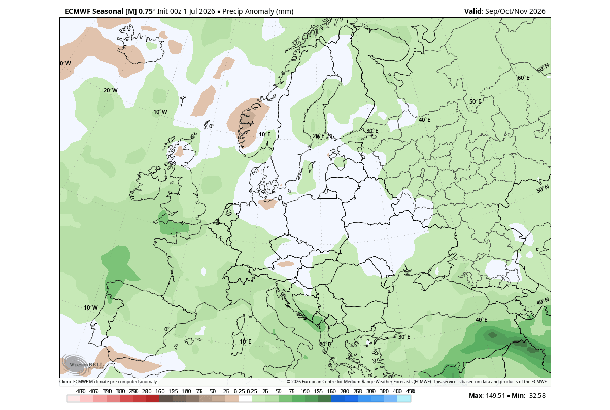
International meteorological agencies are using these forecasts to brief policymakers on the potential for increased flood risks in the southern U.S. and Europe, as well as the necessity for energy grid preparedness in regions likely to face temperature extremes. The consensus among the scientific community is that the forcing from this Super El Niño is so strong that it is effectively overriding the usual seasonal "noise," creating a predictable, albeit intense, winter outlook.
Implications: A Winter of Extremes
The implications of this Super El Niño for the 2026/2027 season are profound, extending from the stratosphere down to the surface level.
The Polar Vortex Connection
One of the most critical factors to watch is the interaction between the Super El Niño and the Polar Vortex. The Polar Vortex, a massive cyclonic structure in the stratosphere, is susceptible to disruption when tropical forcing is strong. Historical data shows that El Niño winters have a higher statistical probability of producing Stratospheric Warming Events (SSW).
An SSW can cause the Polar Vortex to weaken or collapse. When this happens, the "containment" of polar air fails, allowing frigid, arctic temperatures to spill into the mid-latitudes—specifically Canada, the northern and eastern United States, and Europe. Therefore, while El Niño often brings warmer temperatures to northern regions, it simultaneously creates the atmospheric instability required for sudden, severe cold outbreaks in mid-winter.
Regional Weather Impacts
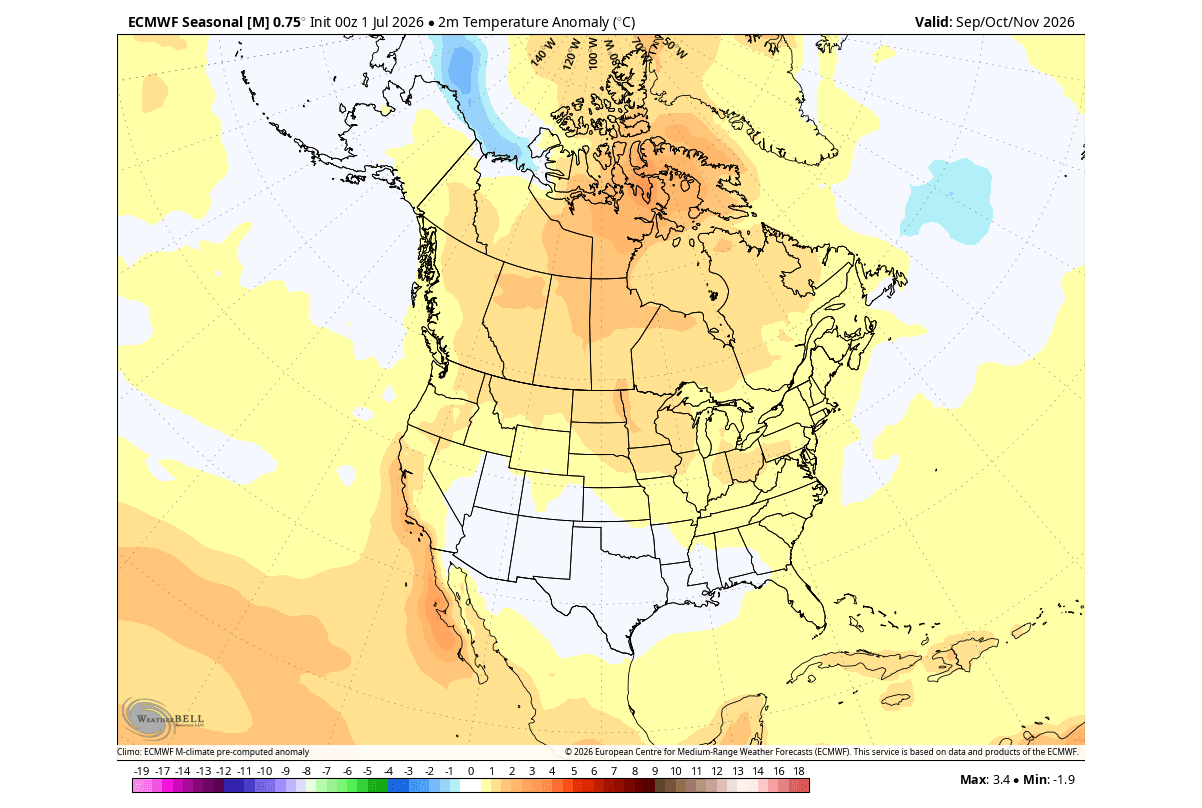
- North America: The forecast points toward a split-personality winter. The northern tier can expect warmer-than-normal conditions due to the Canadian high-pressure ridge. Conversely, the southern and central United States should prepare for a "supercharged" winter characterized by frequent, moisture-heavy storm systems. This increases the risk of flooding and severe weather events.
- Europe: The continent is expected to be under the influence of a persistent westerly flow. This "Atlantic pump" will likely drive mild, moist, and windy conditions across much of Western and Central Europe. While this may limit extreme cold, it increases the likelihood of high-precipitation events and storm surges.
Conclusion: Preparing for the Unprecedented
As we move toward the peak of the 2026/2027 season, the message from the global climate community is clear: this is not a typical year. The combination of a record-setting Super El Niño and the potential for a volatile Polar Vortex suggests that the coming months will be defined by sharp temperature contrasts, active storm tracks, and significant atmospheric amplification.
For those in high-risk areas, the early arrival of these winter-like pressure patterns is a warning. The atmosphere is currently behaving as though it is already in the depths of winter, with the "engine" of the Super El Niño driving global circulation at full capacity. As the season progresses, monitoring the stability of the Polar Vortex will be the final piece of the puzzle in determining whether this winter will be remembered for its warmth, its storms, or its sudden, brutal cold snaps.
For now, the data confirms a locked-in trend: the Super El Niño of 2026/2027 is a historic event, and its impacts on our global weather system are only just beginning to unfold.