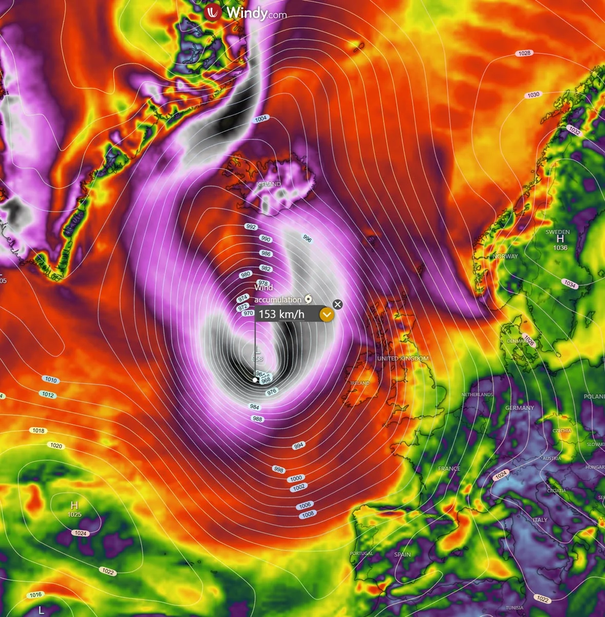
As the Northern Hemisphere transitions from the mild warmth of late summer into the cooling trends of autumn, atmospheric scientists are turning their gaze toward the stratosphere. Recent data indicates that a new Polar Vortex is currently forming over the North Pole. While this seasonal engine is showing a robust start—exhibiting rapid stratospheric cooling and a significant pressure drop—long-range forecasts suggest a highly volatile trajectory for the upcoming 2026/2027 winter season.
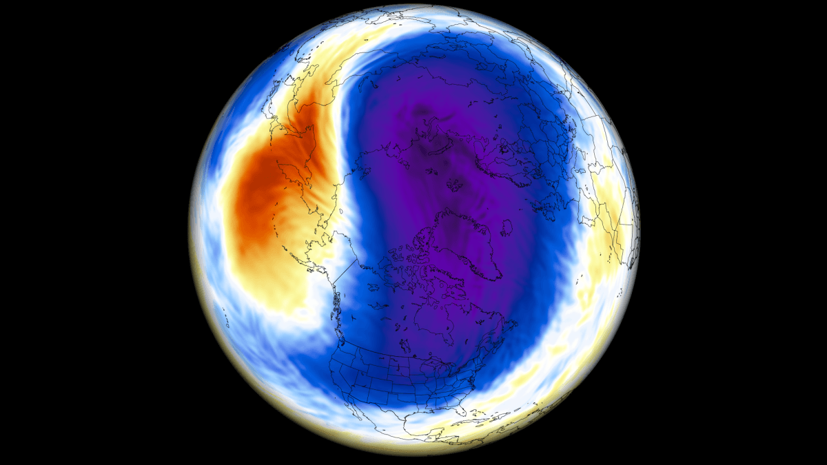
The current meteorological consensus points toward a mid-winter slowdown of the Polar Vortex, characterized by weakening winds and rising stratospheric pressure. Complicating this already complex system is the development of a powerful "Super El Niño" in the tropical Pacific, a climate phenomenon historically linked to major disruptions in polar circulation. This article examines the developmental stages of the upcoming Polar Vortex, the potential for a mid-winter collapse, and the profound implications for weather patterns across the United States, Canada, and Europe.
Understanding the Engine of Winter Circulation
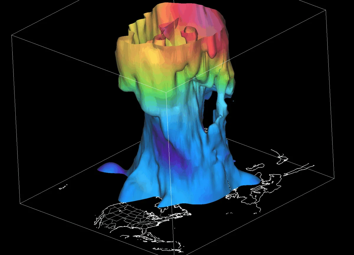
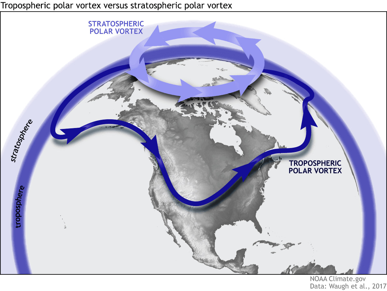
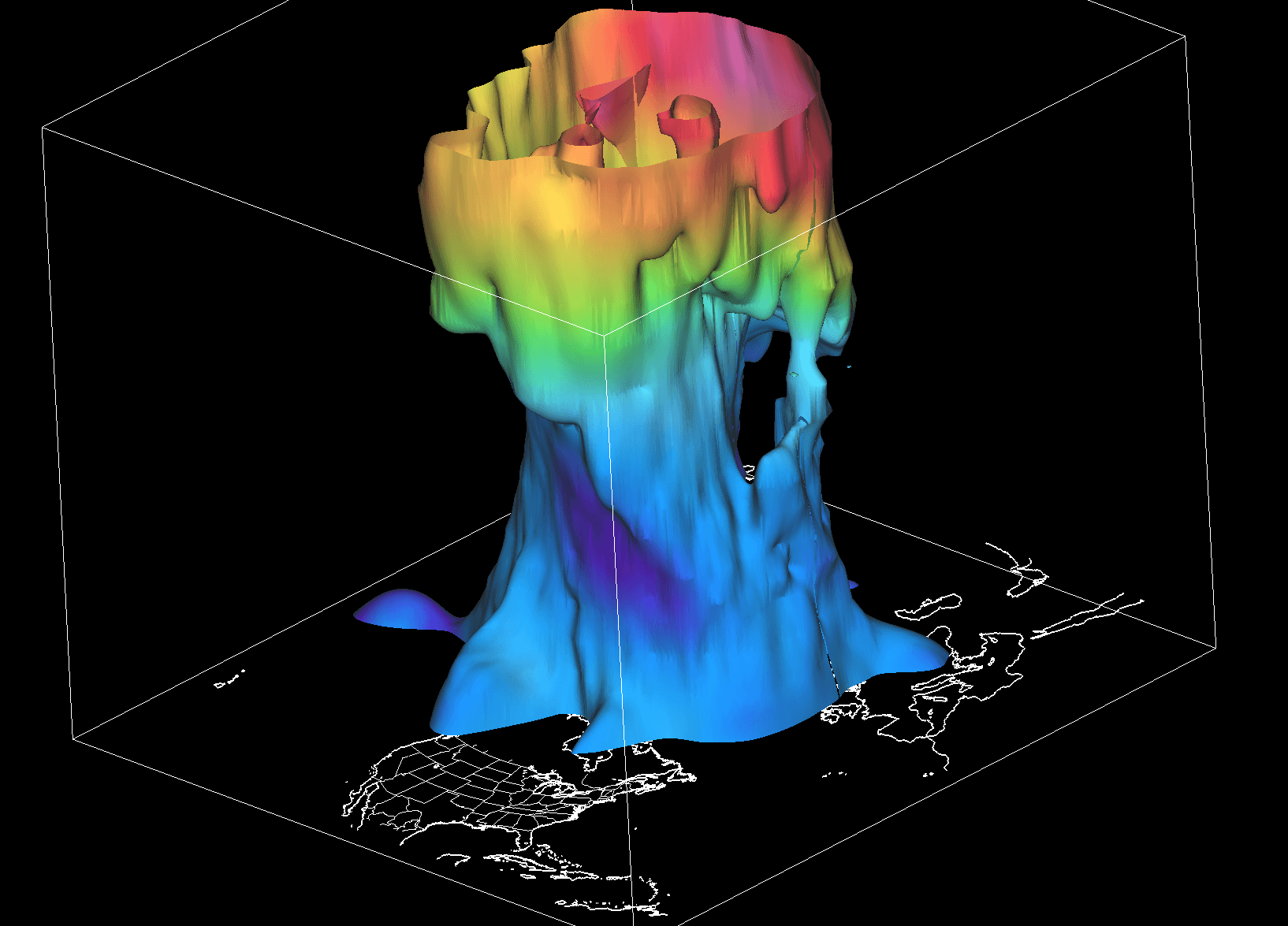
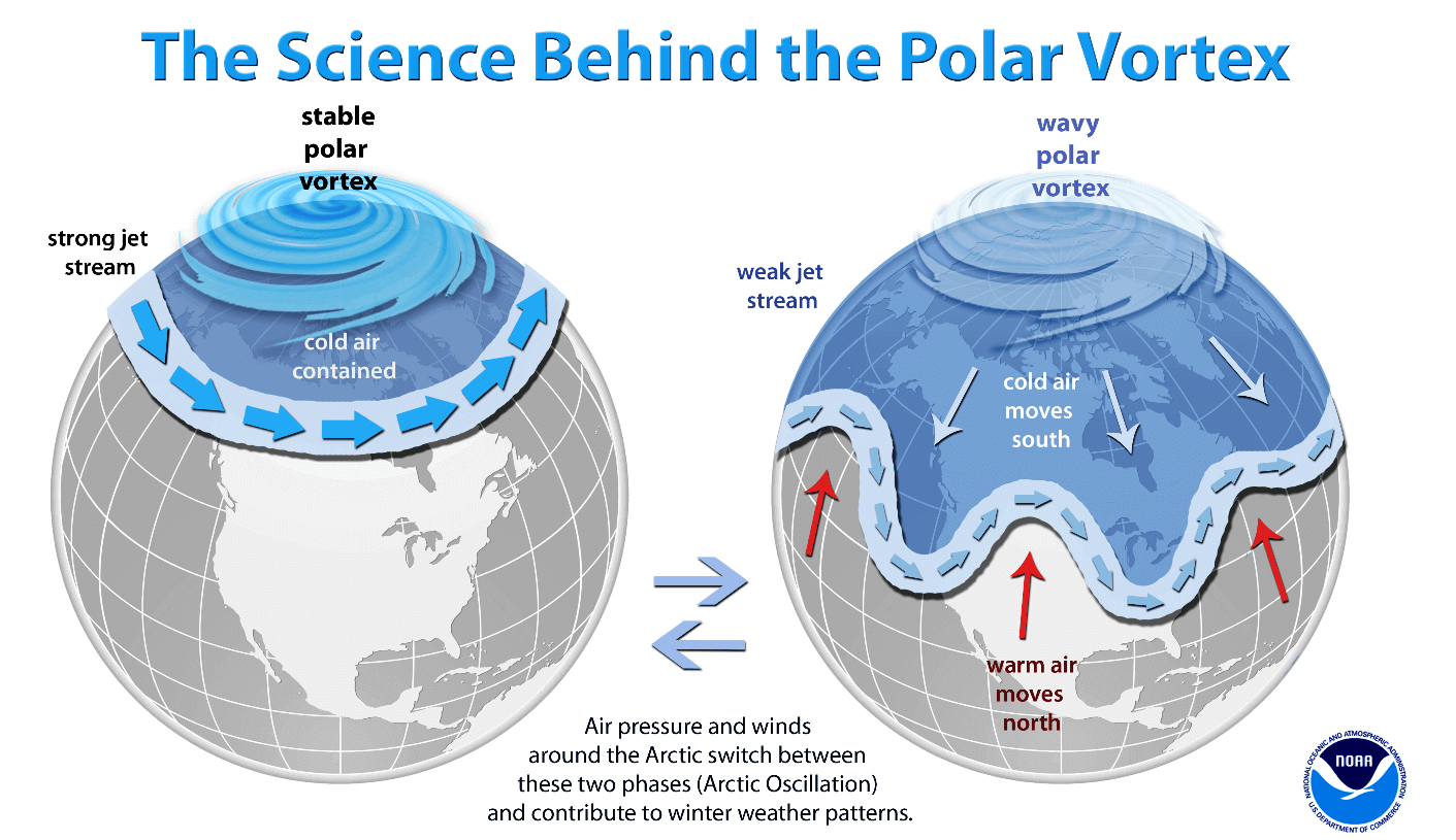
To grasp the potential volatility of the coming months, one must first understand the architecture of the Polar Vortex. It is not merely a single storm, but a vast, high-altitude cyclonic circulation that encircles the polar regions, extending from the surface up to the stratosphere—over 50 kilometers (30 miles) above the Earth.
The vortex is bifurcated into two distinct layers: the stratospheric vortex and the tropospheric vortex. The stratospheric layer, existing at higher altitudes, is generally more symmetrical and stable. Its primary function is to act as a containment vessel, locking frigid Arctic air within the polar circle. Conversely, the tropospheric vortex—the layer closest to the ground—is highly susceptible to interference from surface-level topography, such as mountain ranges and large-scale pressure systems. These obstacles induce "wave-like" distortions in the flow, often causing the vortex to wobble and extend "cold arms" toward lower latitudes, leading to the severe Arctic outbreaks frequently seen in North America and Europe.
Chronology: From Autumn Genesis to Mid-Winter Volatility
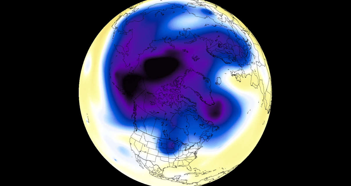
The formation of the Polar Vortex is a seasonal ritual. As sunlight wanes in the Arctic throughout August and September, the stratosphere experiences rapid cooling. This temperature gradient between the poles and the tropics generates a pressure deficit, which naturally pulls air into a cyclonic, spinning motion.
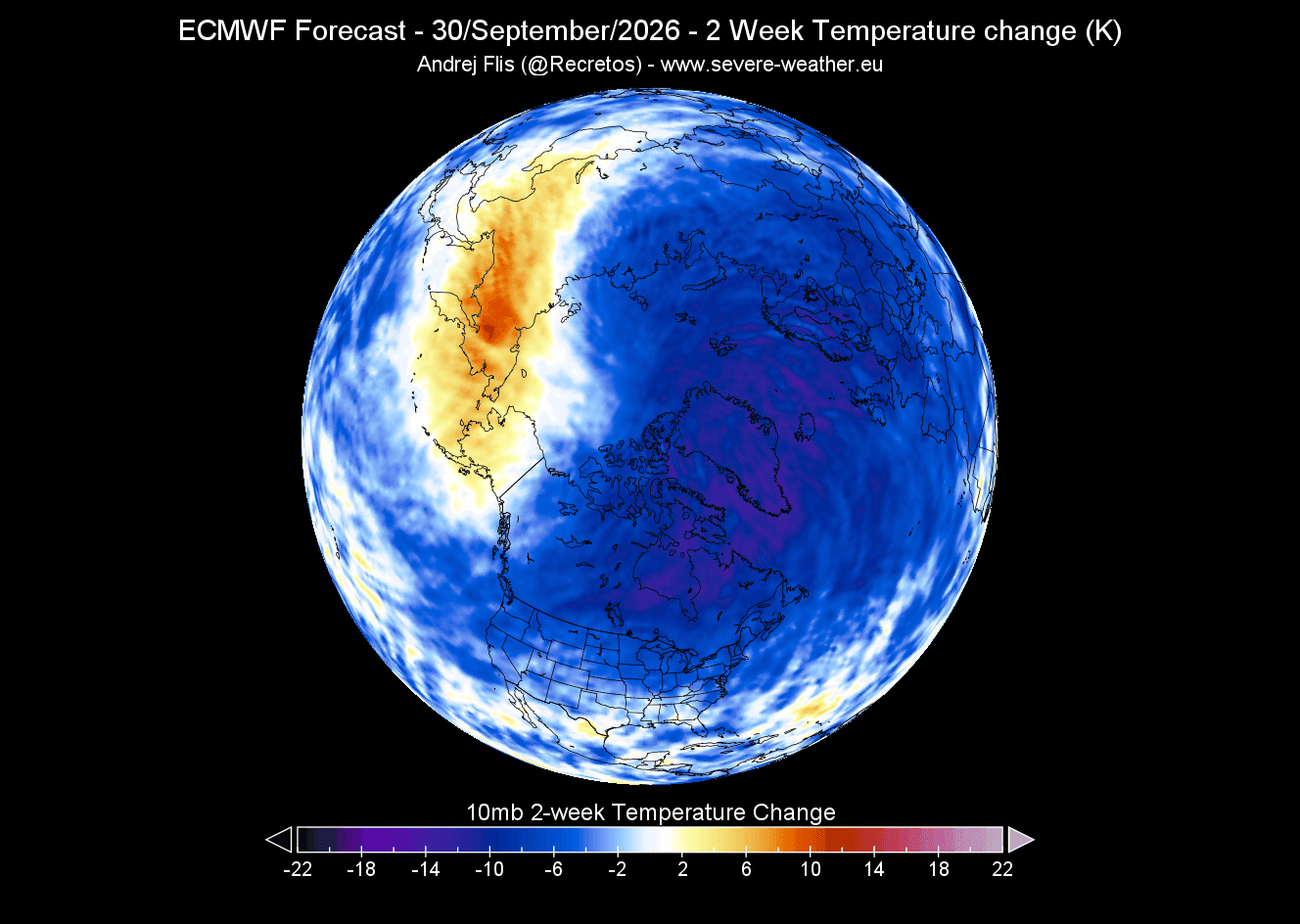
The Current Status (September 2026)
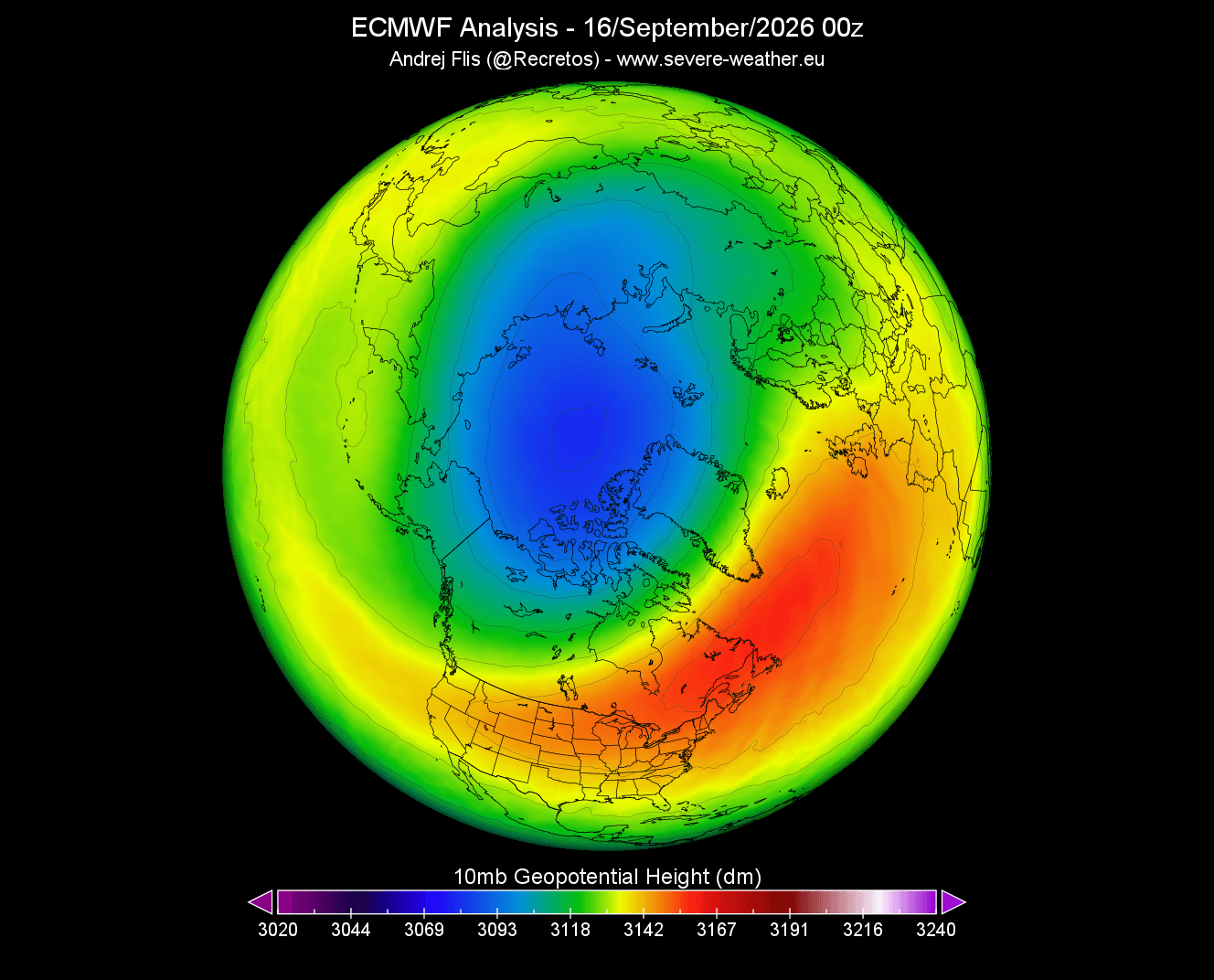
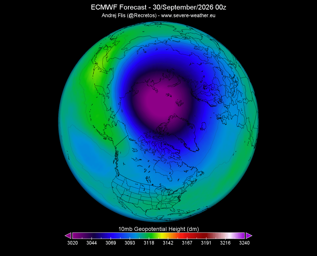
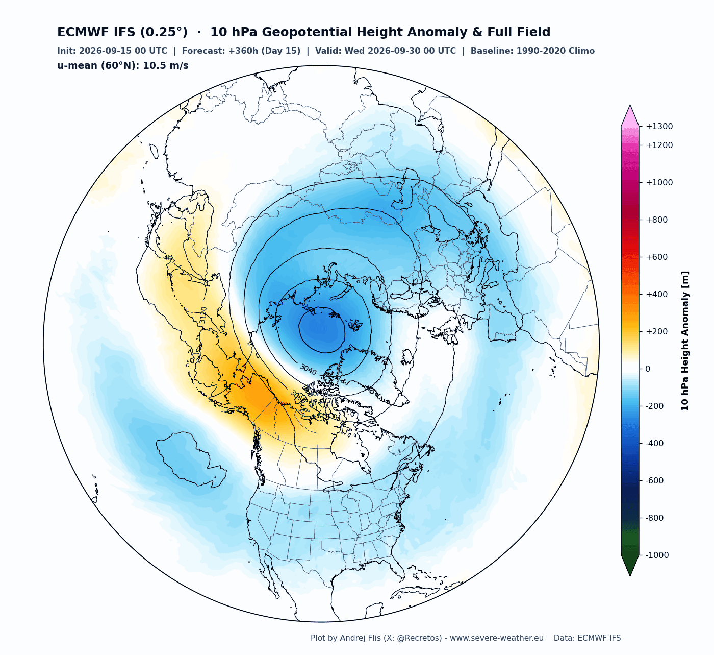
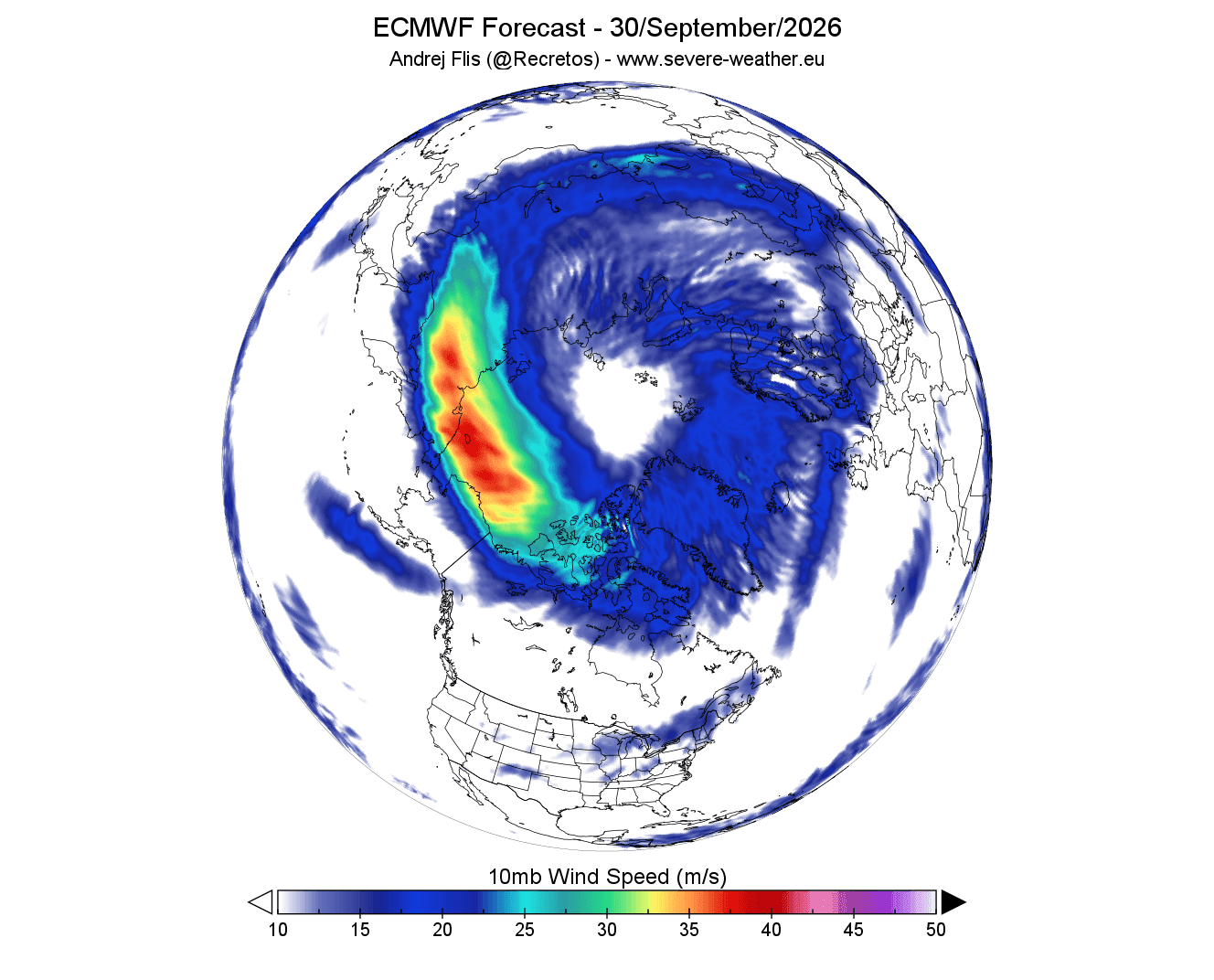
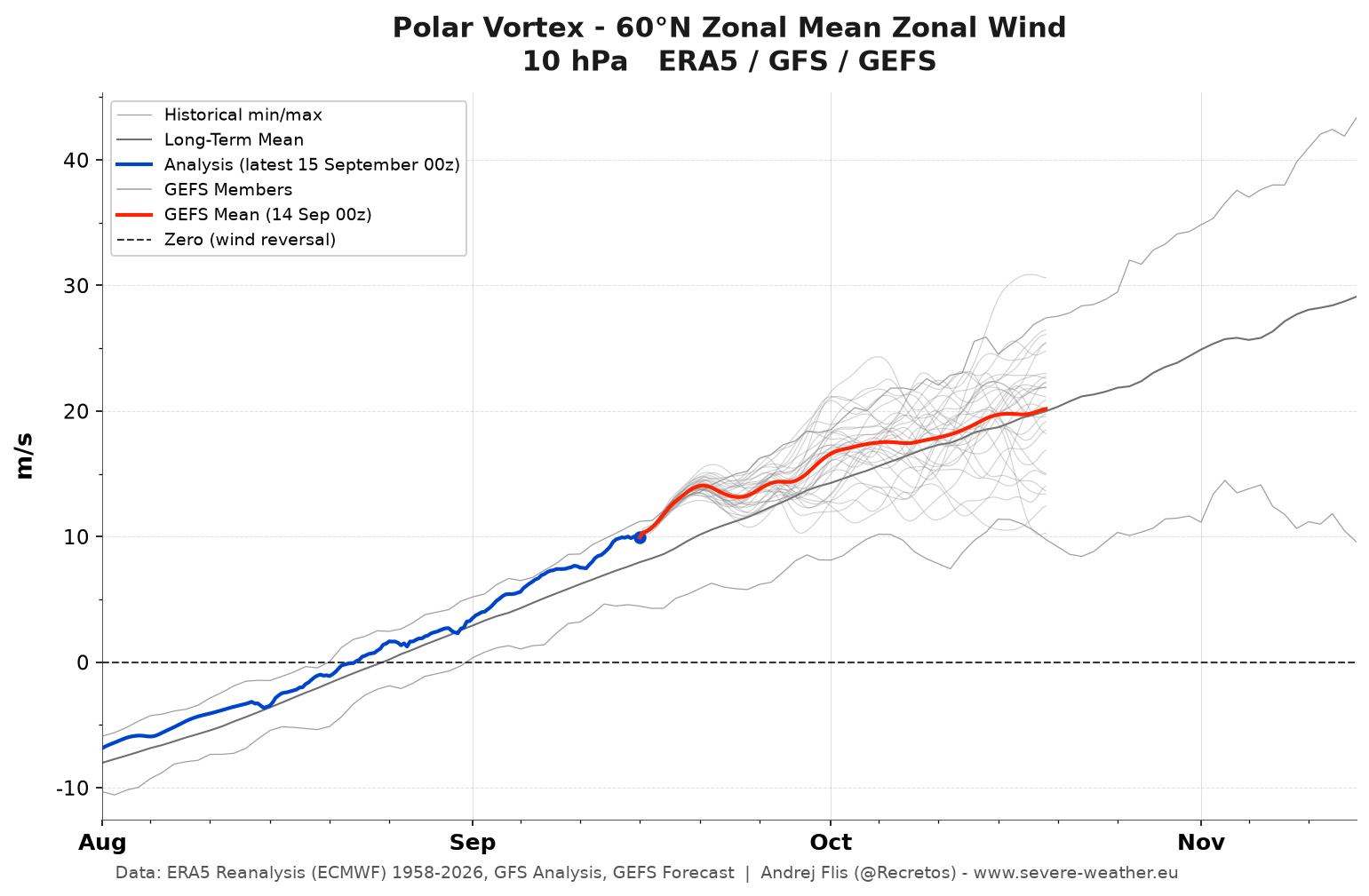
Latest observations at the 10mb level (approximately 30km altitude) confirm that a cold core is currently organizing over the North Pole. Geopotential height analysis shows a well-defined, closed-low center, signaling that the vortex is successfully "organizing" for the season. Early models suggest that the vortex core is slightly stronger than the long-term average for late September, displaying a textbook circular flow.
The Forecasted Shift (January/February 2027)
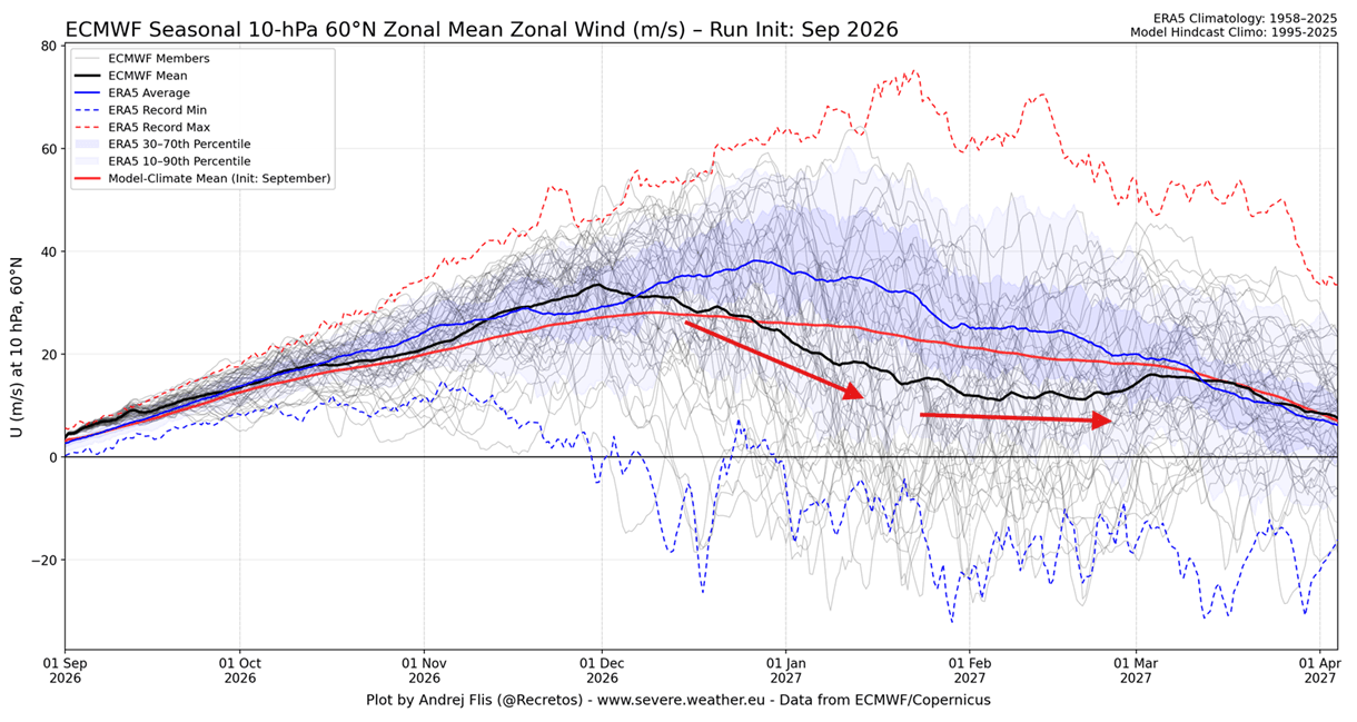
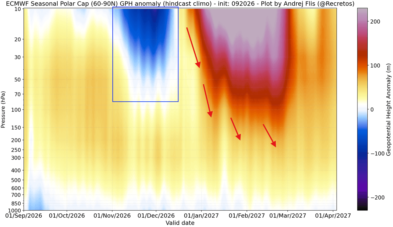
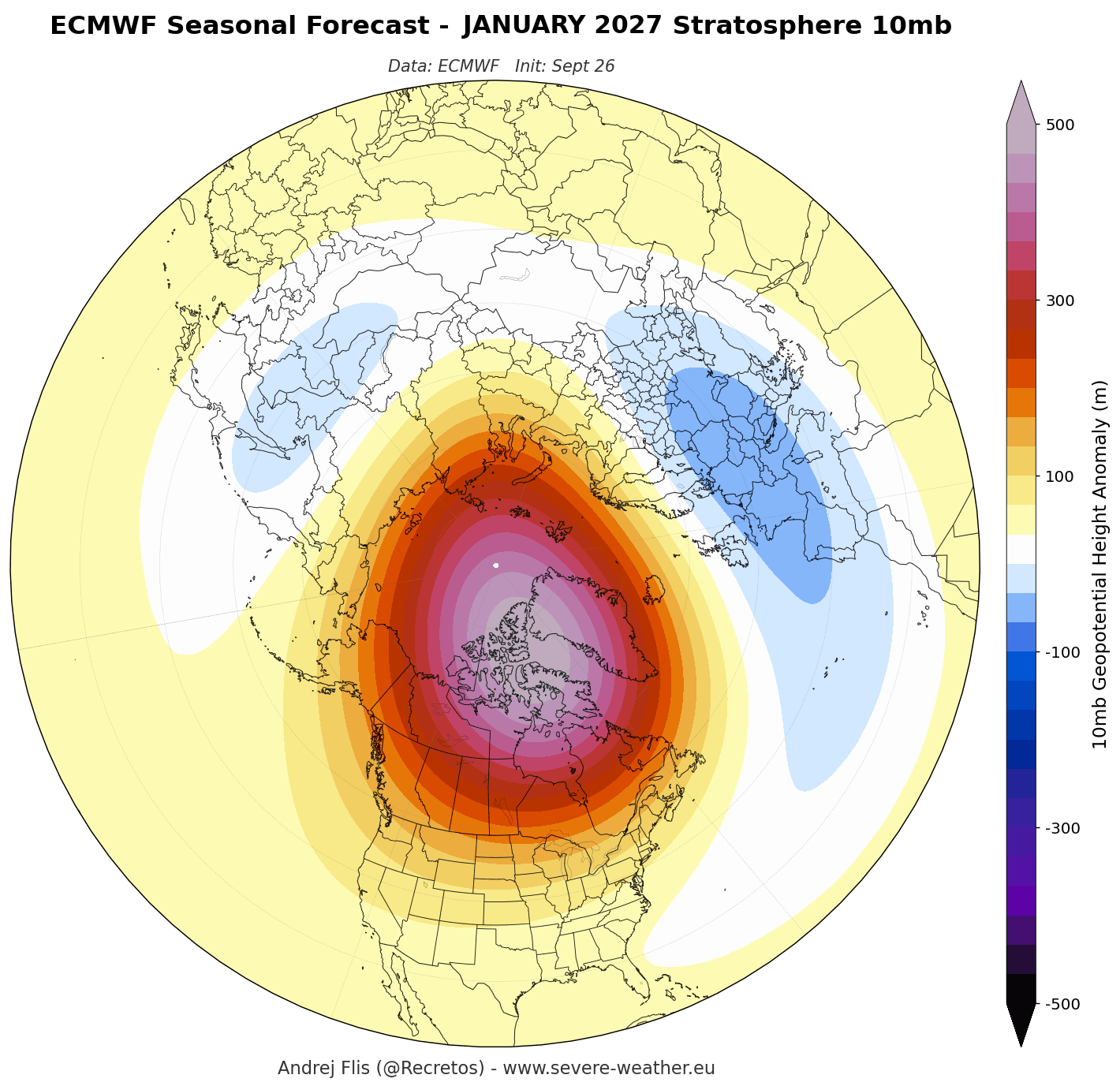
While the current outlook is stable, seasonal climate models from the European Centre for Medium-Range Weather Forecasts (ECMWF) and the United Kingdom Meteorological Office (UKMO) show a dramatic departure from the norm by mid-winter. The models indicate a clear deceleration trend beginning in early January 2027. The forecast lines for stratospheric zonal winds consistently dip below long-term averages, signaling a significant "power drop" in the vortex. This trend suggests that the atmospheric stability we observe in the autumn will likely be compromised by the time winter reaches its peak.
Supporting Data: The Role of the Super El Niño
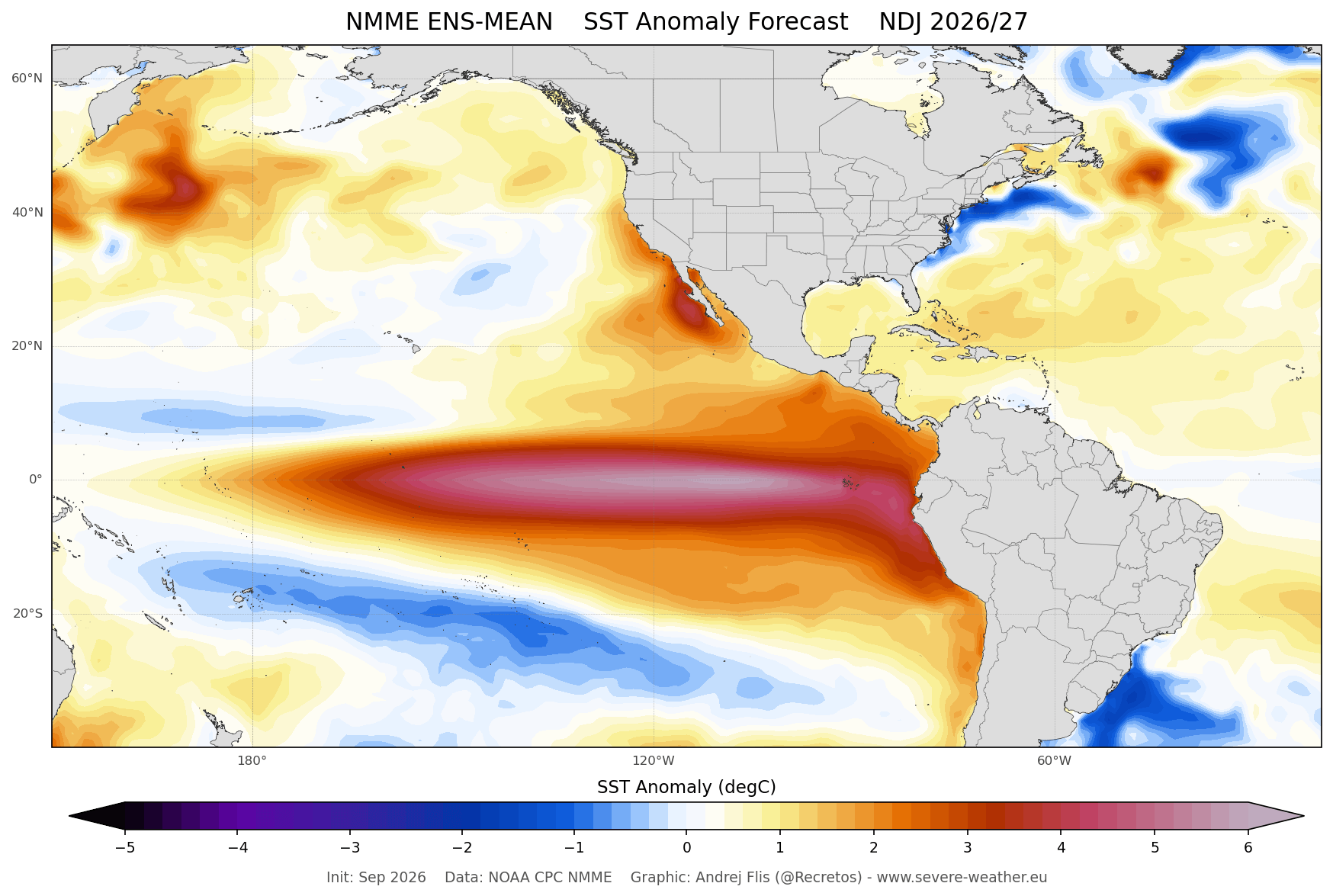
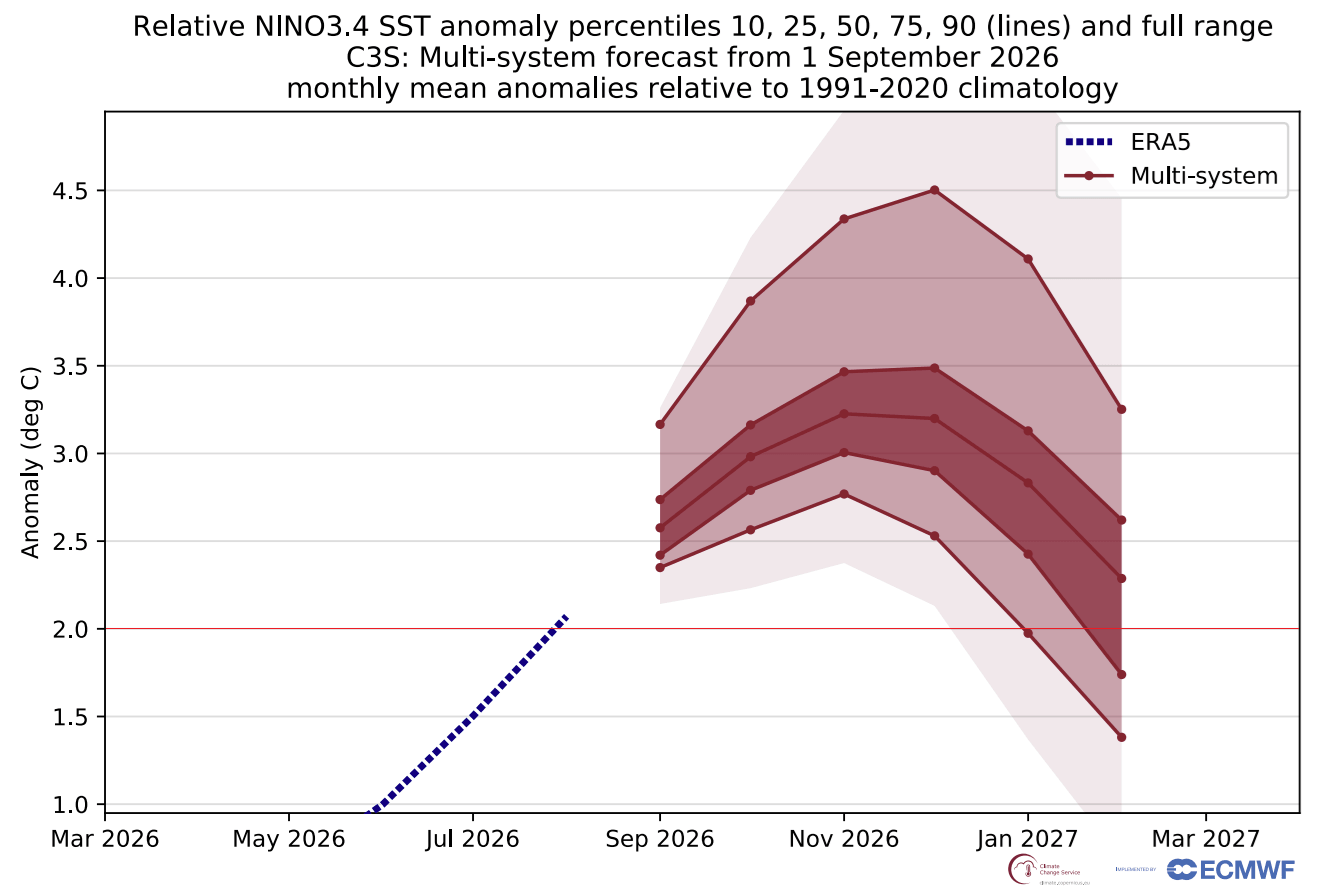
A critical factor influencing this year’s forecast is the emergence of a "Super El Niño." Current ocean temperature data from the National Multi-Model Ensemble (NMME) confirms a massive area of warm surface anomalies in the tropical Pacific, with peak departures exceeding 2 degrees Celsius above normal.
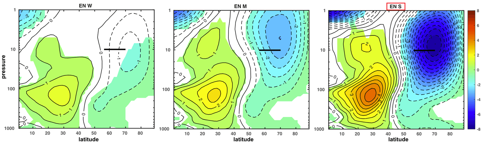
Historical data confirms that such strong El Niño events are not mere spectators in global weather; they act as drivers of planetary-scale atmospheric waves. These waves propagate vertically from the troposphere into the stratosphere, frequently disrupting the integrity of the Polar Vortex. Simulations show that when a strong El Niño interacts with the winter stratosphere, it can induce significant deceleration. This suggests that the "Super" nature of this year’s event may be the primary catalyst for the predicted mid-winter weakening of the vortex, potentially pushing it toward a state of instability or even a structural collapse.
Sudden Stratospheric Warming (SSW): The Threat of Collapse
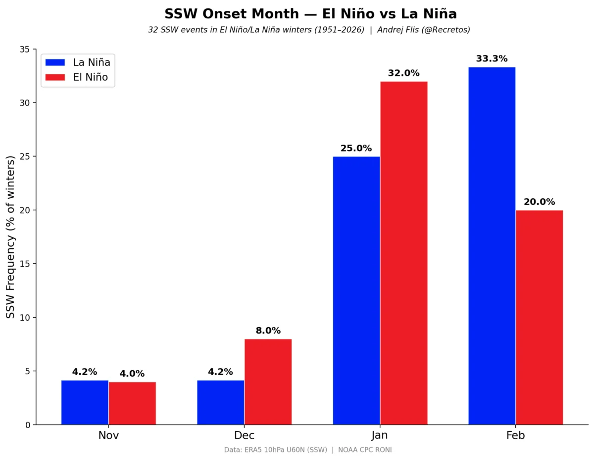
The most severe manifestation of a vortex disruption is the Sudden Stratospheric Warming (SSW) event. In an SSW, temperatures in the stratosphere can surge by several tens of degrees Celsius within a matter of days. This rapid heating destroys the vortex’s integrity, often causing the polar jet stream to buckle.
Types of Disruption
- Displacement Events: The vortex is pushed off-center, leading to a southward shift of Arctic air that can persist for weeks.
- Split Events: The vortex is torn into two or more distinct cores. This is historically more impactful, as it allows deep Arctic air to spill simultaneously into North America and Eurasia.
The scientific consensus is that an SSW event acts as a "top-down" trigger. Once the stratospheric flow is disrupted, the high-pressure anomaly cascades downward through the atmosphere. Research based on 34 historical SSW events indicates that within 10 to 30 days post-collapse, the surface weather across the United States and Europe typically turns significantly colder than the seasonal norm.
Implications for North America and Europe
The potential for a weakened or collapsed Polar Vortex has direct consequences for winter survival and infrastructure.
United States and Canada
If the forecast of a mid-winter disruption holds, we can anticipate a "Polar Express" pattern. This involves the breakdown of the stable, circular flow, allowing the massive reservoirs of Arctic air to flood southward. Historically, this has resulted in the notorious deep-freeze events seen in 2016 and early 2026, where temperatures plummeted to record-breaking lows across the central and eastern United States. Infrastructure, agriculture, and energy grids in these regions should remain on high alert for late-January or February cold-air outbreaks.
Europe
For Europe, the impact of a vortex disruption is equally significant. A weakened vortex often shifts the storm track, which can lead to prolonged periods of bitter cold originating from the Siberian plains. In conjunction with the humidity from the Atlantic, this often results in extreme snowfall events, even in regions that are traditionally considered temperate.
Scientific Outlook and Monitoring
It is important to emphasize that while the trend toward a weaker vortex is clearly visible in long-range ensemble data, the precise timing and location of a potential "collapse" are subject to change. Meteorologists rely on 3D structure analysis and continuous monitoring of planetary wave activity to refine these predictions as the season progresses.
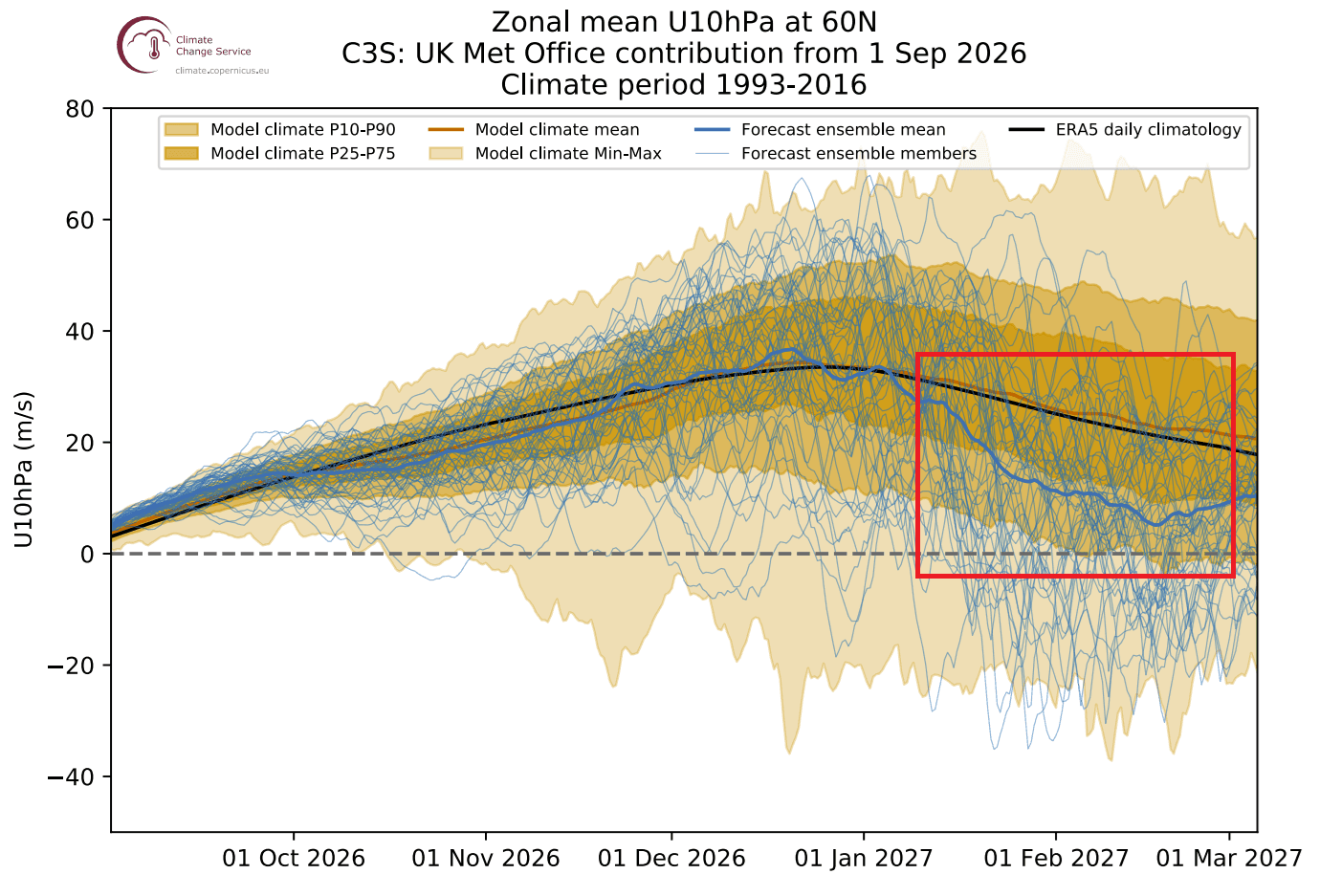
The combination of a strong start to the season and the external pressure from a Super El Niño creates a "tinderbox" scenario. The current atmospheric configuration is primed for a winter that will likely be defined by high volatility. While the early winter months may remain relatively mild due to a strong initial vortex, the transition into January and February appears increasingly susceptible to major disruptions.
Conclusion: Preparing for Volatility
For the 2026/2027 season, the message from the scientific community is one of vigilant readiness. The "Super El Niño" provides a compelling signal for a turbulent mid-winter period. Citizens, energy providers, and emergency management agencies in the United States, Canada, and Europe should monitor the latest stratospheric data as we move into the late autumn months.
Whether we witness a full-scale Sudden Stratospheric Warming event or a series of smaller, yet impactful, vortex disruptions, the atmospheric dynamics suggest that the winter of 2026/2027 will be anything but standard. As the vortex matures, the interplay between the Pacific ocean temperatures and the stratospheric winds will remain the most critical metric for determining the severity of the upcoming winter weather patterns.
For real-time updates and ongoing analysis of the 2026/2027 winter patterns, continue to follow long-range meteorological reports and climate data archives as they develop.