As autumn settles across the Northern Hemisphere, meteorologists are turning their gaze toward the stratosphere, where a familiar but volatile seasonal engine is beginning to churn: the Polar Vortex. Recent atmospheric data indicates that while this year’s vortex is organizing with notable strength, early long-range forecasts are signaling a significant mid-winter shift. With the potential for a "Super El Niño" to reshape global circulation, the coming months—and particularly January and February 2027—could see dramatic disruptions that threaten to bring severe winter weather to the United States, Canada, and Europe.
The Engine of Winter: Understanding the Polar Vortex
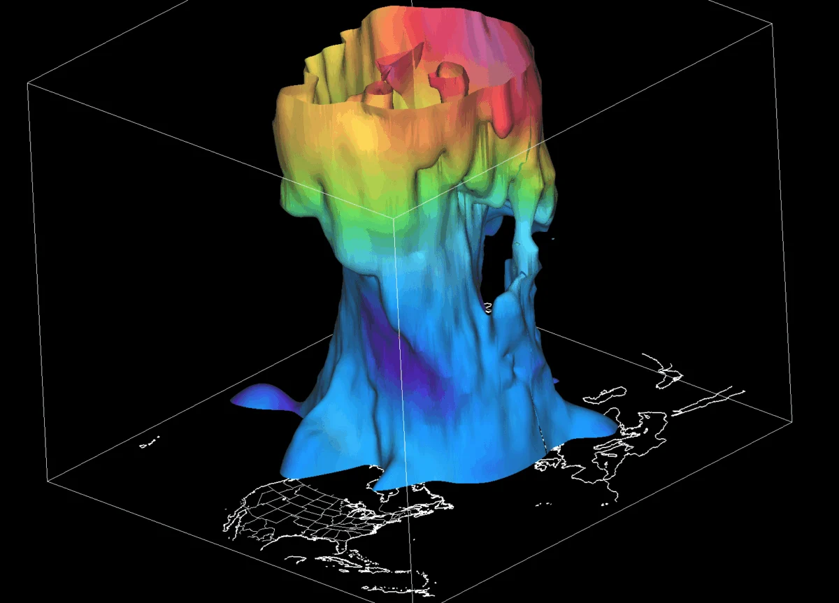
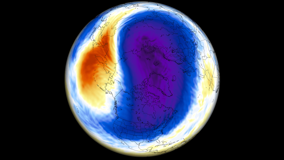
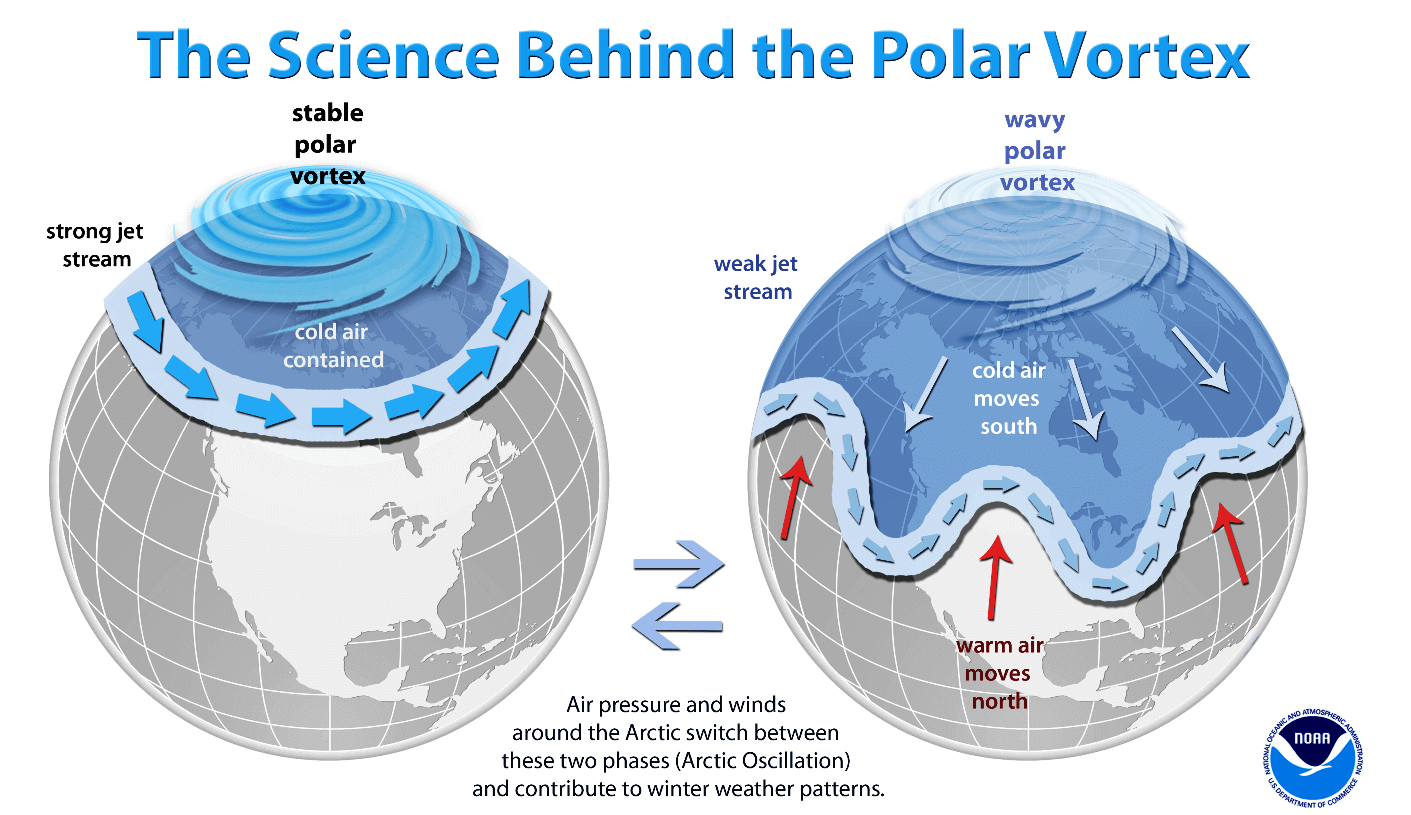
To understand the stakes for the upcoming season, one must first grasp the nature of the Polar Vortex. It is not a single storm, but a vast, persistent, and large-scale cyclone that encircles the North Pole. It functions as a "spinning wall" of air, extending from the surface up to the stratosphere, roughly 50 kilometers (30 miles) above the Earth.
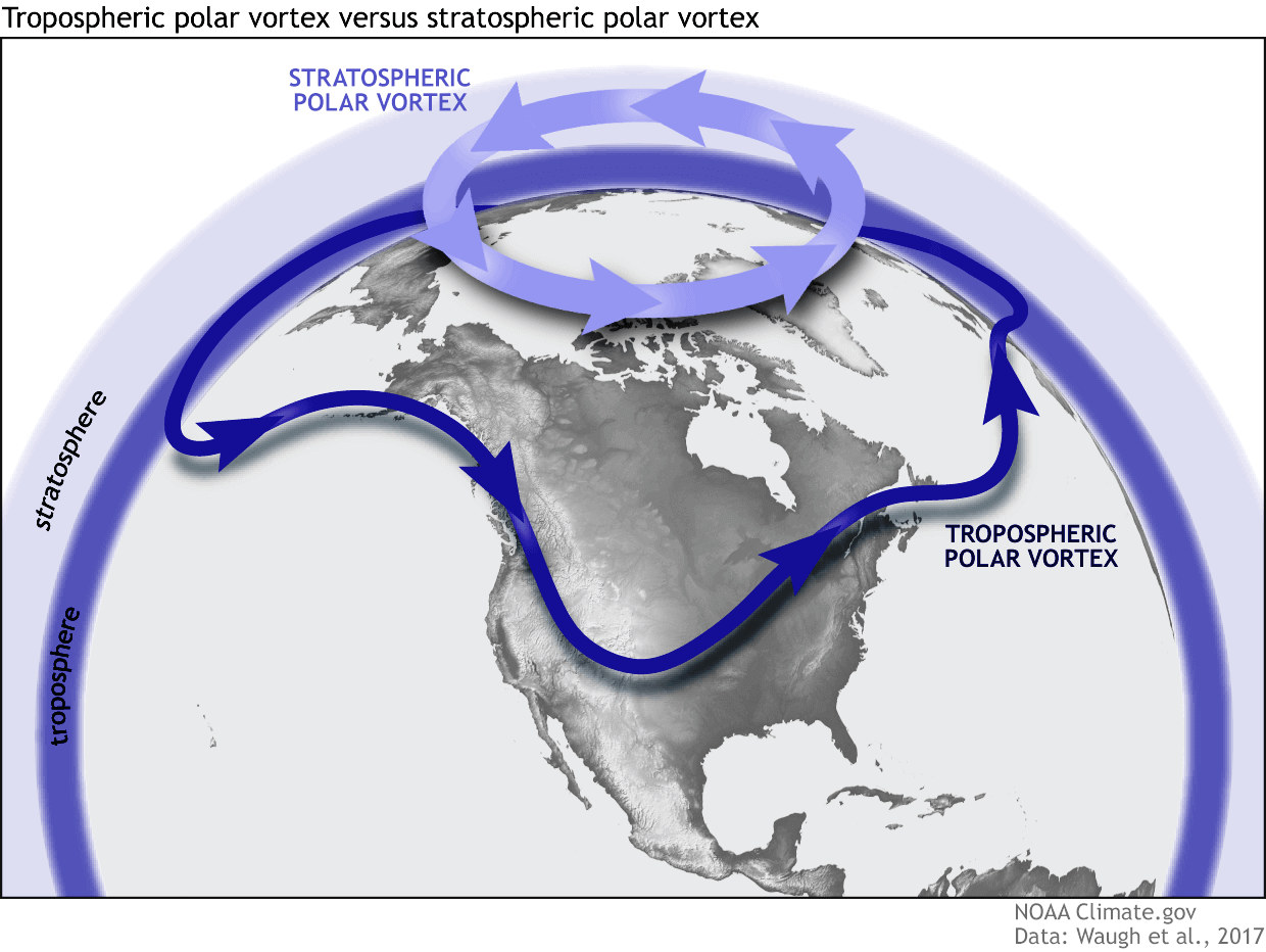
The vortex is essentially a gatekeeper. When it is robust and symmetrical, it acts as a containment vessel, trapping frigid Arctic air within the polar circle. This keeps mid-latitude regions, such as the central United States and Western Europe, relatively shielded from the most extreme deep-freeze events. However, the vortex is not monolithic; it is divided into a stable, symmetrical upper layer in the stratosphere and a more chaotic, "wobbly" lower layer in the troposphere. The lower layer is frequently deformed by mountainous terrain and major pressure systems, which can cause "cold arms" of polar air to extend into lower latitudes.
Chronology of Development: From Fall to Mid-Winter
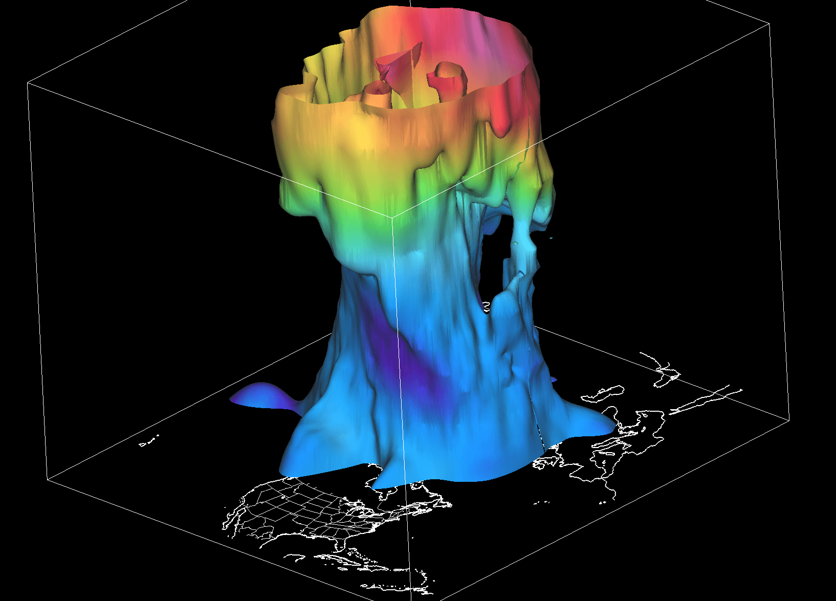
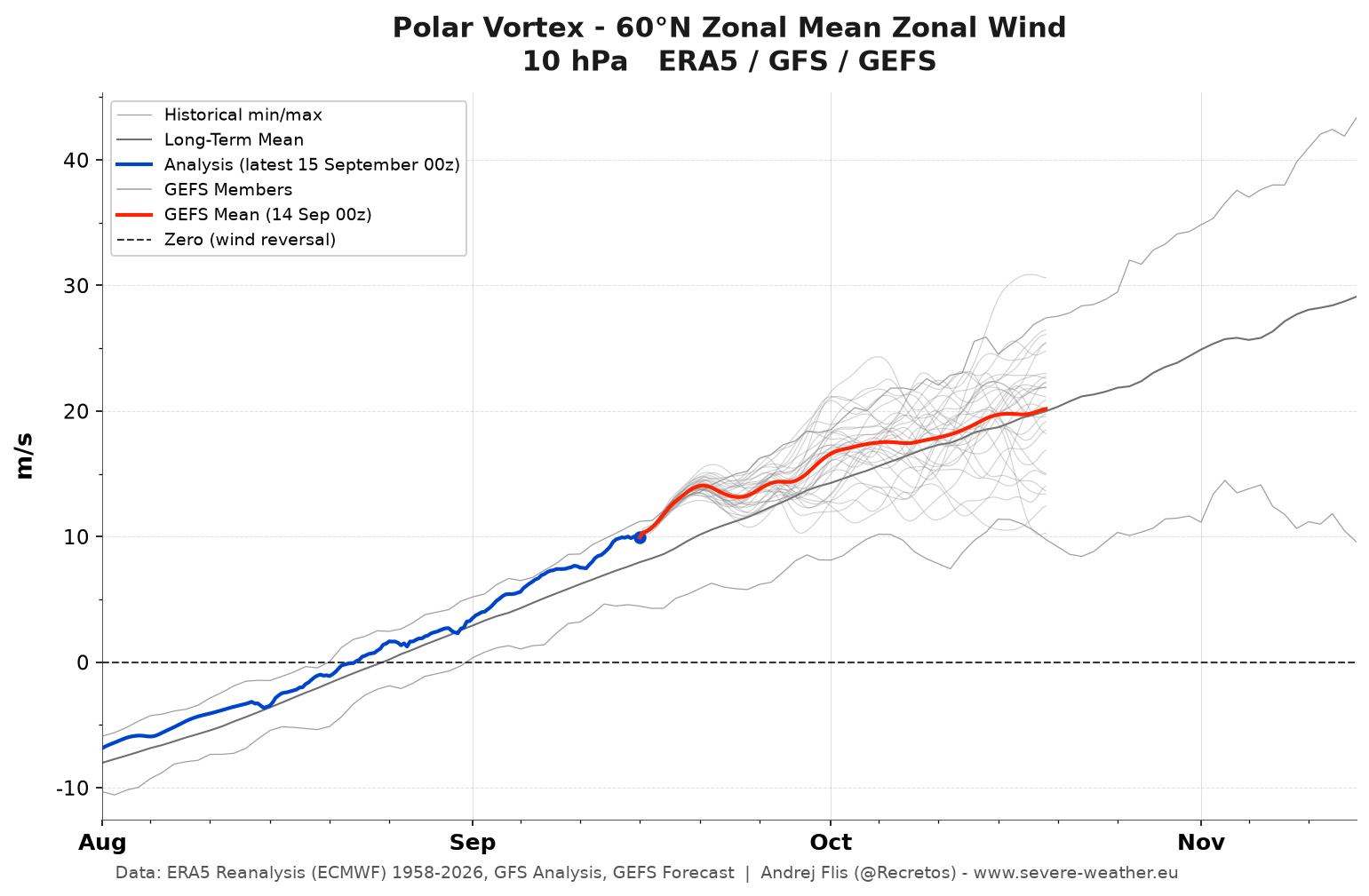
The formation of the Polar Vortex is a rhythmic, seasonal process. As sunlight wanes in the Arctic throughout August and September, temperatures in the stratosphere plummet. This thermal gradient—the difference between the freezing pole and the warmer southern latitudes—causes air pressure to drop, fueling the development of the cyclonic circulation we identify as the Polar Vortex.
The Early Season (September – October 2026)
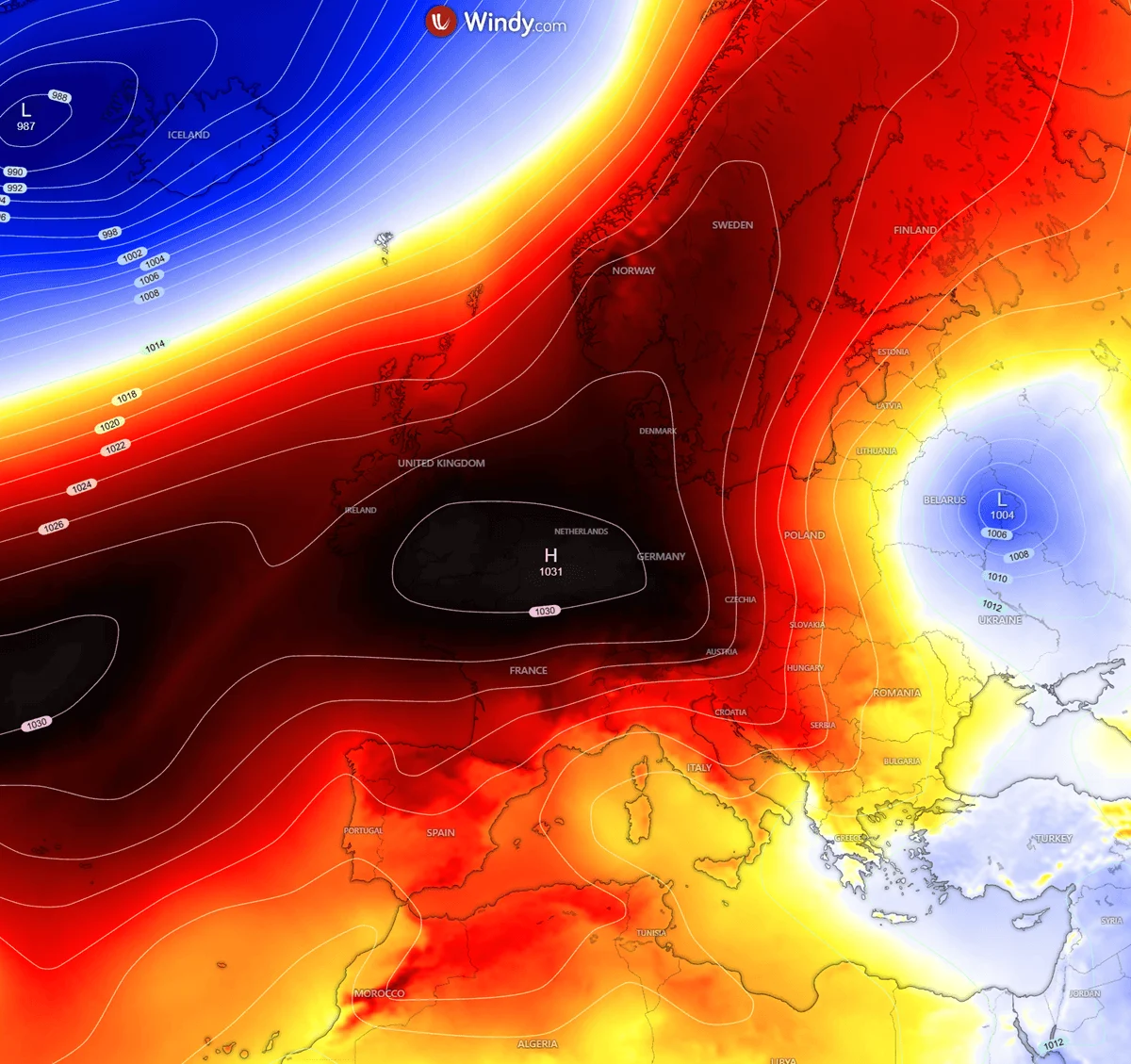
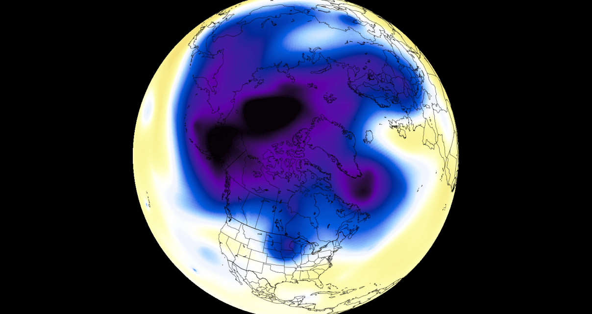
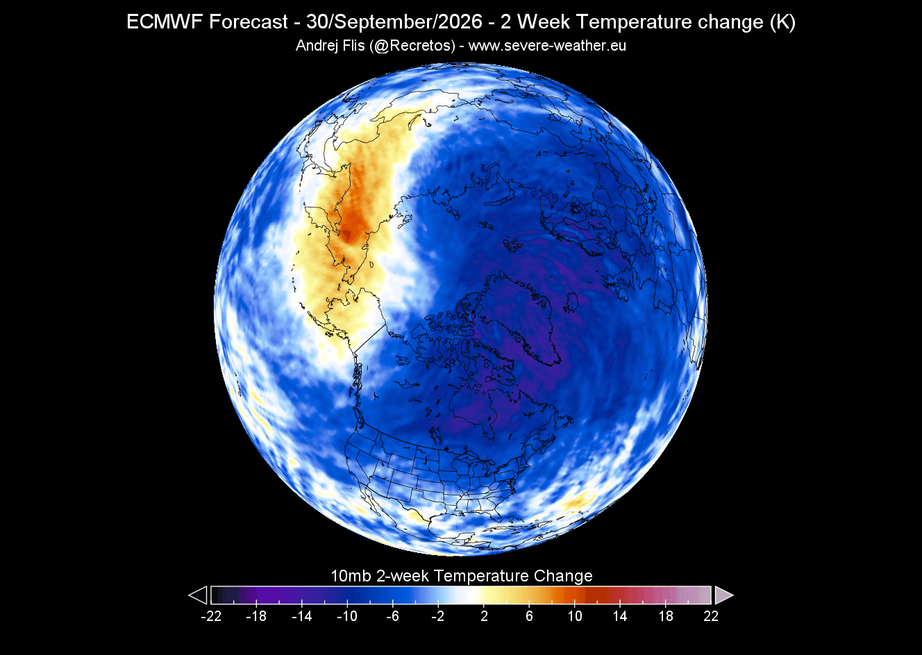
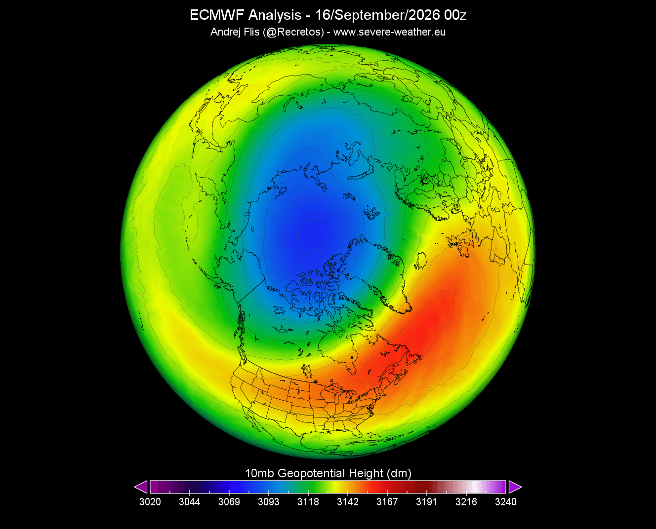
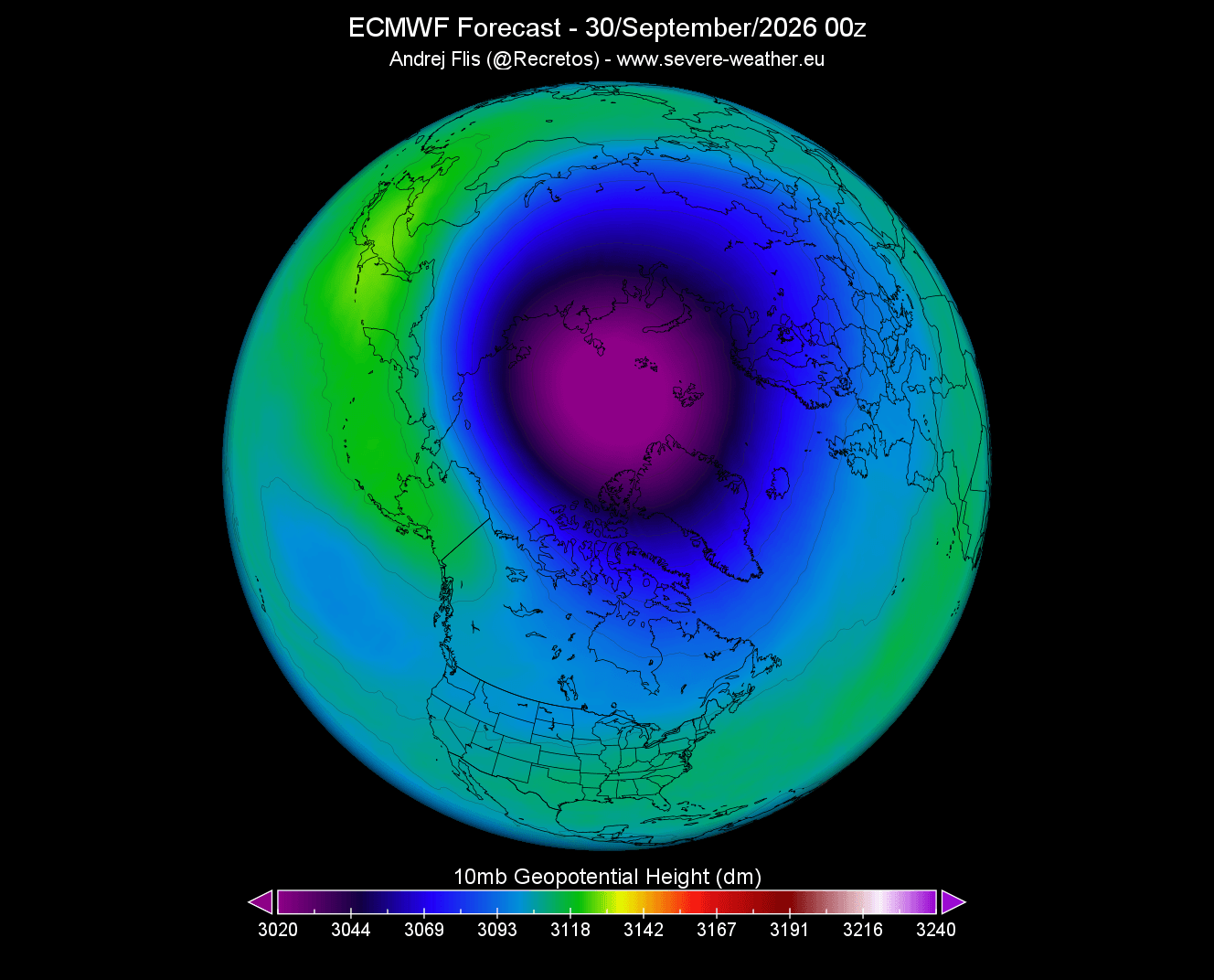
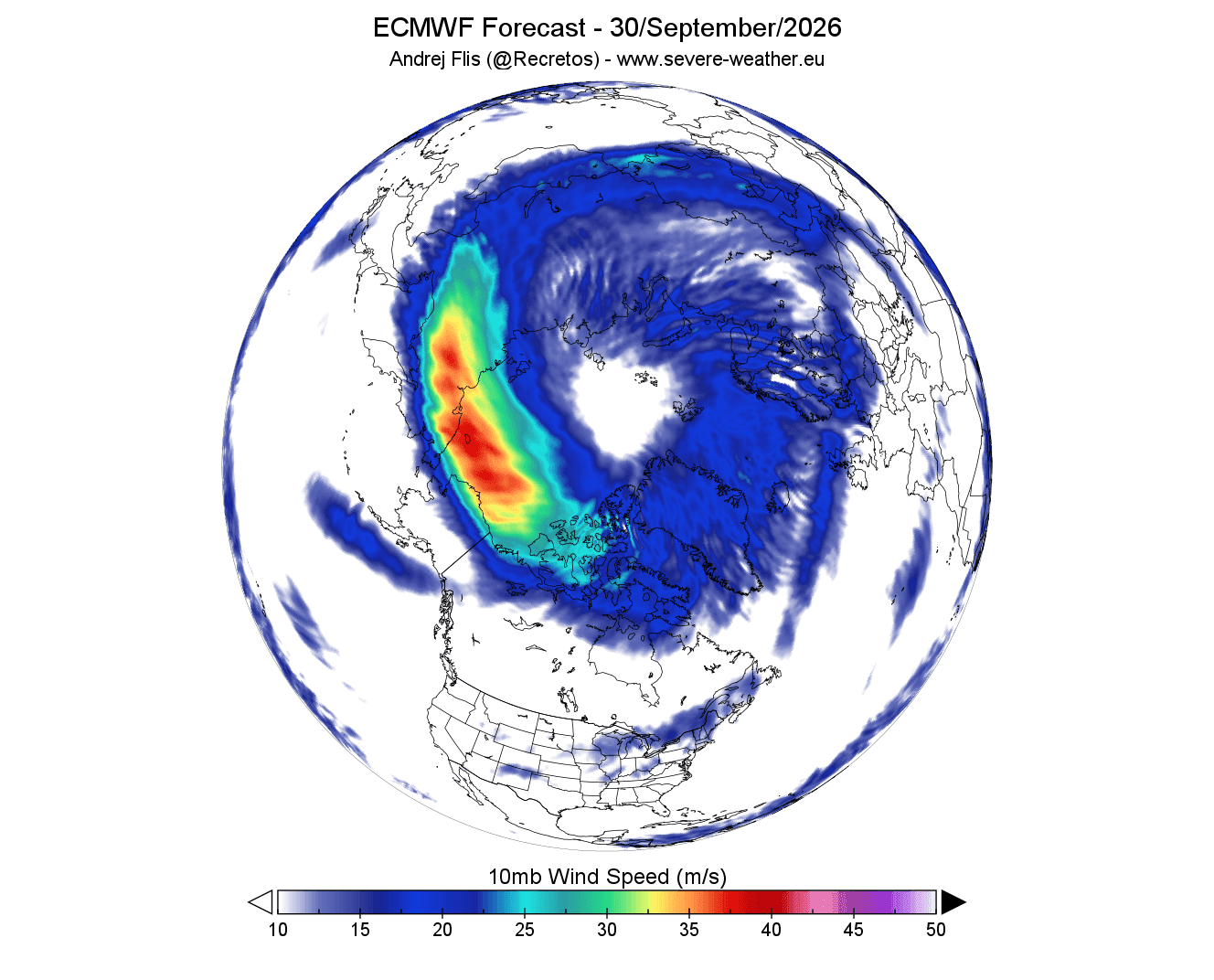
Current data from the European Centre for Medium-Range Weather Forecasts (ECMWF) shows that the Polar Vortex is currently strengthening, with a well-defined cold core emerging over the North Pole. Wind speeds at the 10mb level (approximately 30 km altitude) are exhibiting a classic "donut-shaped" wind stream, characteristic of a healthy, organizing vortex. By all early metrics, the 2026/2027 season is starting from a position of relative stability.
The Mid-Winter Transition (January – February 2027)
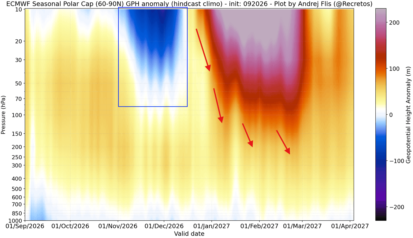
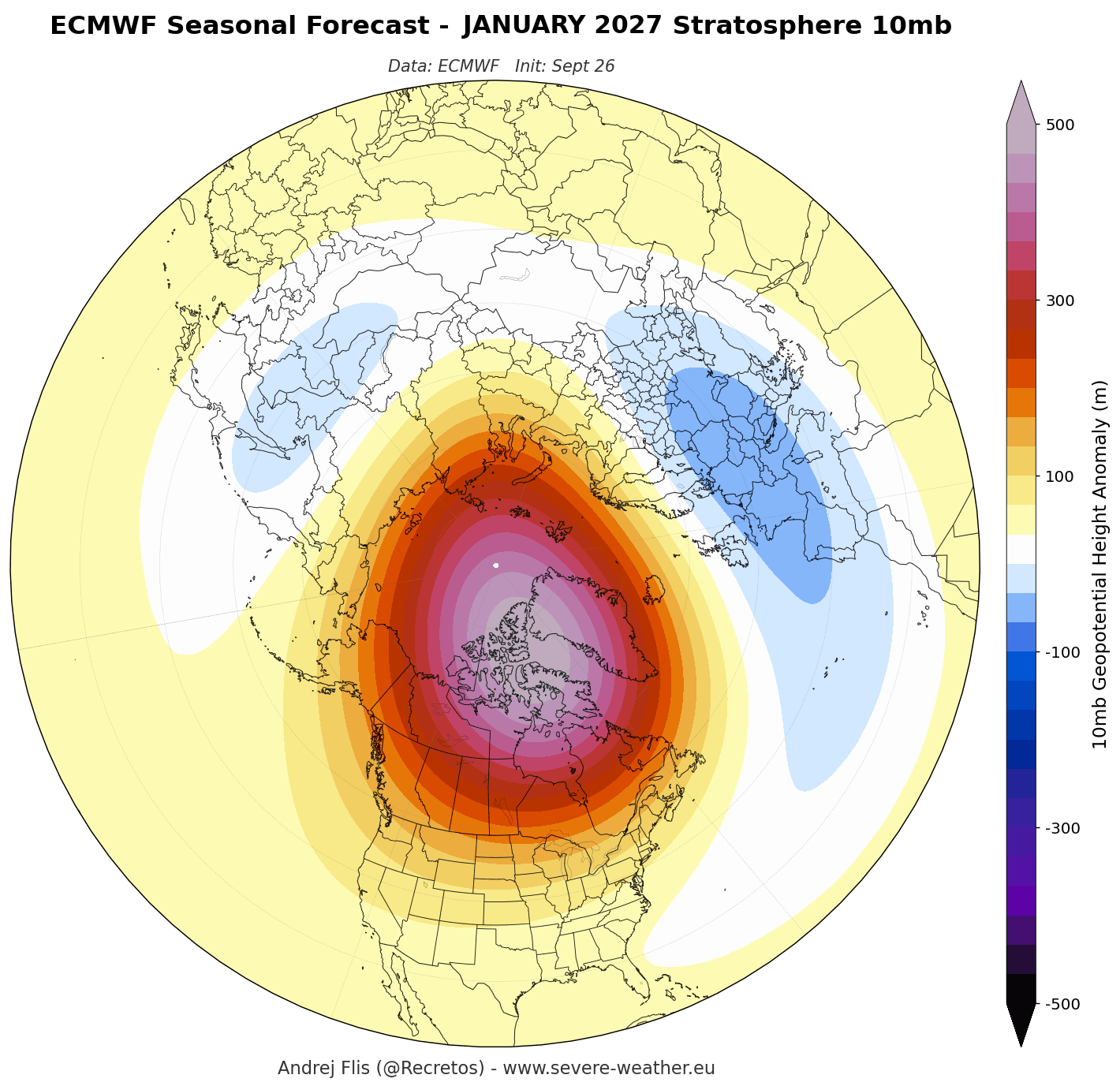
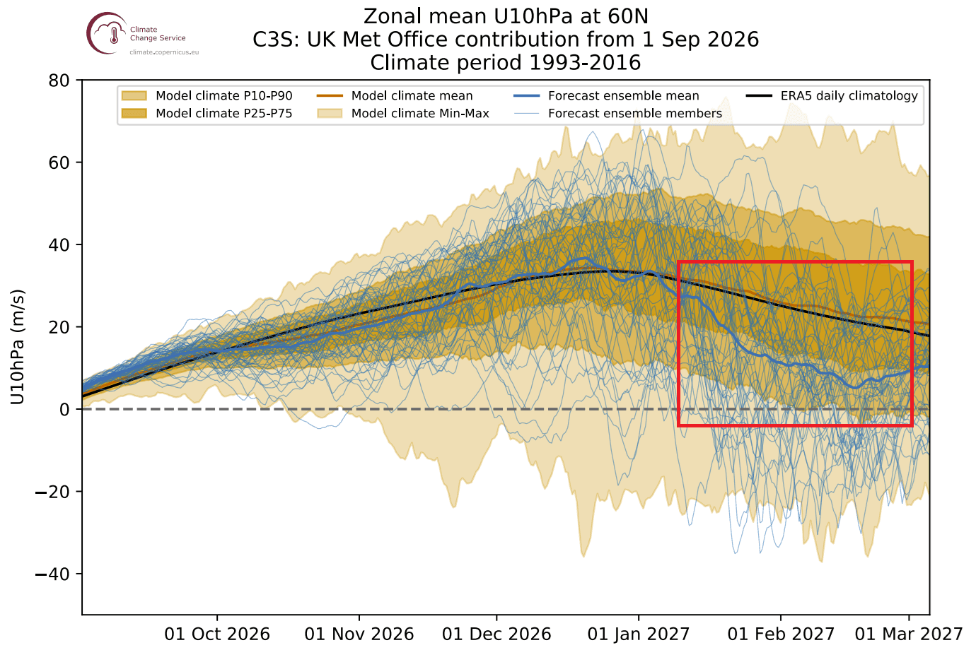
However, the narrative shifts as we look toward the heart of winter. Seasonal models, including both the ECMWF and the UKMO (United Kingdom Met Office), are currently showing a consistent "disruption signal." Forecasts suggest a deceleration of stratospheric winds by early 2027. This is not merely a minor fluctuation; the models show a distinct trend toward a rise in pressure in the stratosphere, which is a precursor to a potential weakening of the vortex.
Supporting Data: The "Super El Niño" Influence
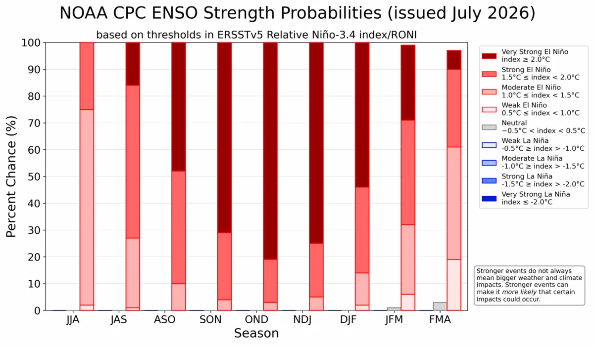
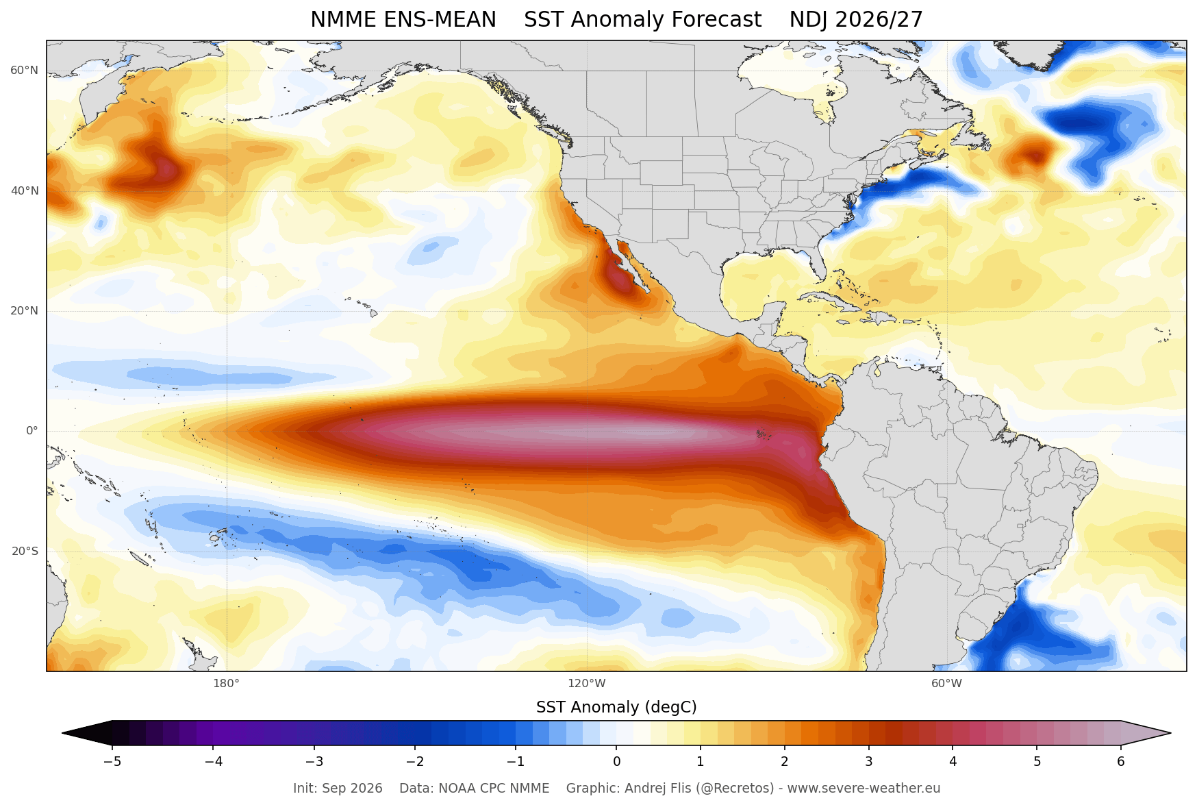
One of the most critical variables in this year’s forecast is the development of a strong El Niño event in the tropical Pacific. Current ocean temperature anomalies are already exceeding the threshold for a "Super El Niño," a phenomenon that has historically influenced global weather patterns by altering the way energy is transferred through the atmosphere.
The Teleconnection Mechanism
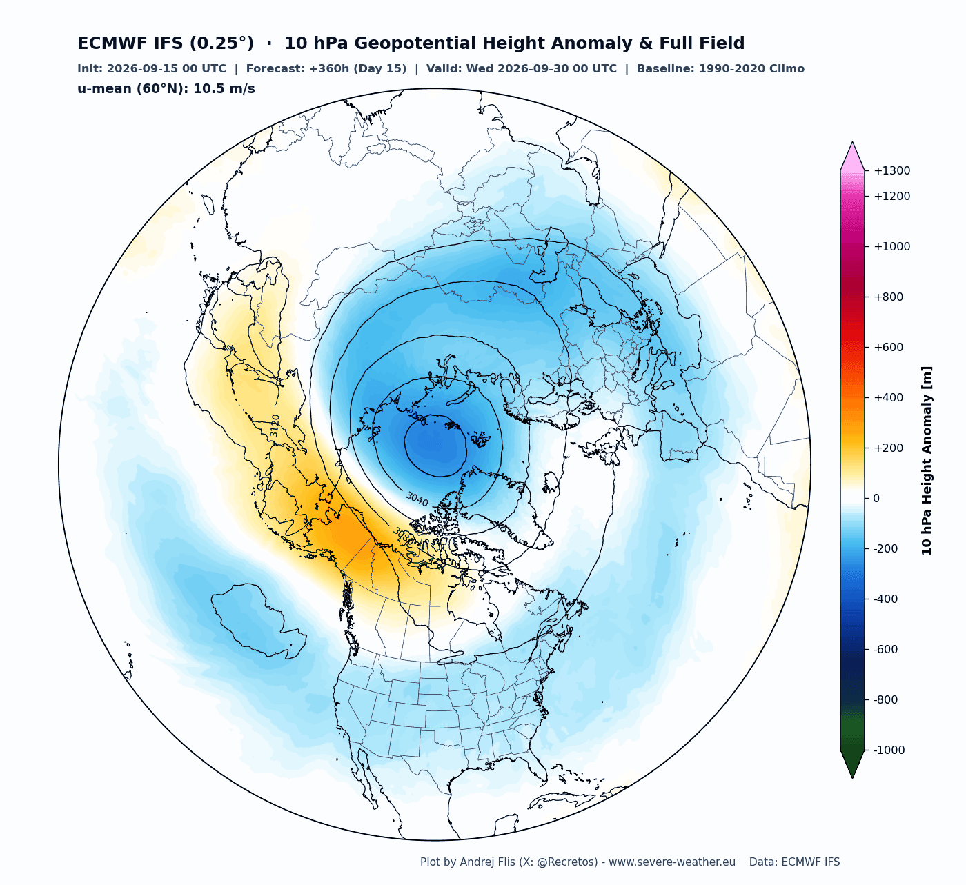
Scientific studies have demonstrated a clear correlation between strong El Niño events and stratospheric deceleration. The mechanism involves planetary-scale pressure waves. An El Niño-induced shift in tropical Pacific sea surface temperatures can lead to the formation of a high-pressure anomaly over the Aleutian Islands and parts of Canada. This "wave energy" propagates upward into the stratosphere, where it can strike the Polar Vortex, forcing it to distort, shift, or even collapse.
The data provided by the National Multi-Model Ensemble (NMME) confirms that the upcoming El Niño is expected to be one of the most intense in decades. By analyzing previous winters—such as the 2016 Super El Niño event—meteorologists can observe how this energy transfer leads to the stretching and splitting of the vortex, effectively opening the gates for "Polar Express" cold-air outbreaks into North America and Eurasia.
Implications for the United States, Canada, and Europe
The potential for a "Sudden Stratospheric Warming" (SSW) event is the primary concern for meteorologists. An SSW is a violent event where temperatures in the stratosphere spike by tens of degrees in just a few days, causing the Polar Vortex to weaken or reverse.
The Impact of a Collapse
When the vortex undergoes a full "split" or "displacement" event, the impacts on the surface are often profound:
- Cold-Air Outbreaks: With the vortex no longer able to "lock" cold air at the pole, the Arctic air mass spills southward. This often manifests as extreme, prolonged cold spells in the Eastern United States, Canada, and Northern/Central Europe.
- Shift in Jet Stream: A disrupted vortex leads to a wavy, sluggish jet stream. This can cause weather systems to stall, resulting in heavy, persistent snowfall or prolonged periods of freezing temperatures in regions that typically experience milder winters.
- Delayed Response: It is important to note that the surface response to a stratospheric disruption is not instantaneous. Typically, the weather impacts lag behind the stratospheric event by 10 to 30 days.
Analyzing Recent Historical Precedents
To gauge what might occur in 2027, we can look at the winter of 2026. Last January, a significant stratospheric disruption—though not a total collapse—compressed the Polar Vortex, forcing it into a stretched, elongated structure. This resulted in a series of severe cold-air outbreaks across the central and eastern United States.
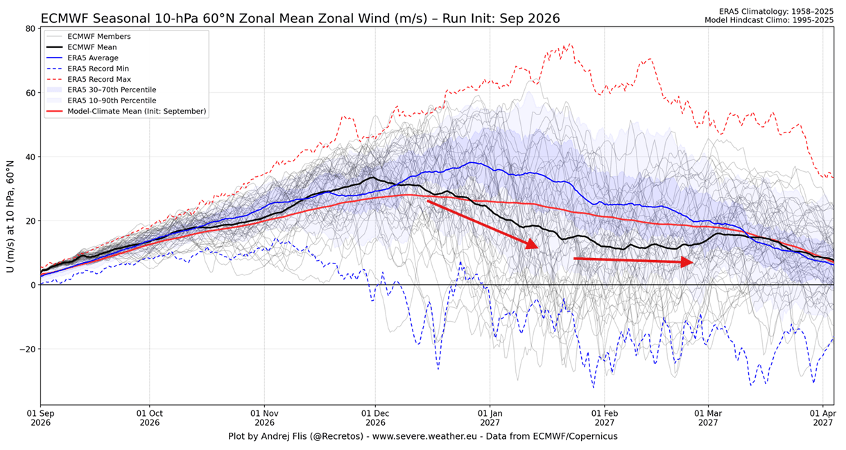
The models for 2027 suggest a similar, perhaps more pronounced, pattern. The "disruption signal" currently appearing in the seasonal ensembles is significant because it is appearing well in advance of the event. While no model can predict the exact day an SSW will occur three months out, the consistent agreement between the ECMWF and UKMO models provides a high degree of confidence that the atmosphere is primed for instability.
Official Meteorological Perspective
Meteorological agencies remain cautious. While the models highlight a risk, the complexity of atmospheric dynamics means that other factors, such as the Quasi-Biennial Oscillation (QBO) and current sea ice coverage, also play a role. However, the consensus among long-range forecasters is that the combination of a record-setting Super El Niño and the early-season stratospheric signals creates a "high-risk" scenario for the 2026/2027 winter season.
Conclusion: Staying Prepared
As we move deeper into the fall, the focus will remain on the 10mb pressure level. Any sign of a warming anomaly or a persistent high-pressure wave originating from the Pacific will be a major red flag.
For residents in North America and Europe, the implications are clear: while the winter may begin with a sense of stability, the middle of the season carries a heightened risk of volatile, extreme weather. Whether this manifests as an official "Polar Vortex collapse" or a series of significant "wobbles" in the vortex structure, the result is likely to be a winter characterized by dramatic, rapid shifts in temperature and increased snowfall potential for mid-latitude regions.
The upcoming season serves as a reminder of the delicate balance within our atmosphere. As the Polar Vortex begins its annual cycle, the scientific community will continue to track these developments, providing the necessary data to help populations prepare for the potential of a harsh and unpredictable winter.