As we look toward the winter season of 2026/2027, atmospheric scientists are beginning to observe a series of significant anomalies brewing high above the North Pole. Early-season modeling data is flashing warning signs of a potentially volatile Polar Vortex—a vast, swirling pool of frigid air that, when stable, keeps winter’s harshest elements locked away in the Arctic. However, current long-range indicators suggest that this season could be anything but stable, with a distinct "weakening signal" emerging for January 2027.
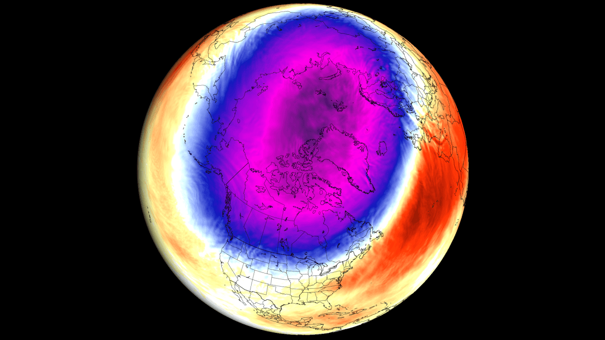
The convergence of three major global drivers—a looming "Super El Niño," specific stratospheric wind patterns, and record-low Arctic sea ice—is setting the stage for a highly dynamic winter. For residents across the United States, Canada, and Europe, this could mean an increased probability of sudden, high-impact cold air outbreaks.
Understanding the Polar Vortex: The Gatekeeper of Winter
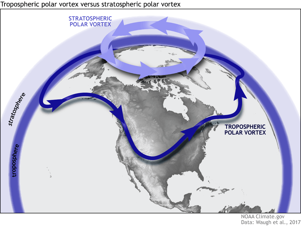
The Polar Vortex is not a singular storm, but rather a massive, persistent, large-scale cyclone located near the Earth’s poles. It is divided into two distinct layers: the lower troposphere and the higher stratosphere. When the vortex is "strong" and healthy, it acts as a rigid, circular barrier, keeping the bitterest Arctic air contained at the North Pole and allowing for relatively milder winters in the mid-latitudes.
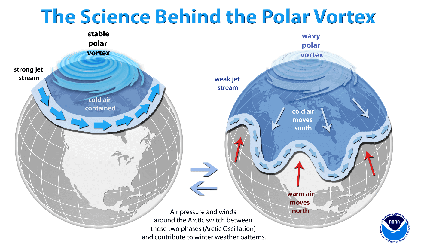
When the vortex is "disrupted" or weakened—often by energy waves propagating upward from the lower atmosphere—its circulation becomes distorted. It can stretch, wobble, or even split into multiple smaller vortices. When this occurs, the "polar walls" break down, allowing frigid, high-latitude air to spill southward into the United States, Canada, and Europe. This phenomenon is often the precursor to the extreme "Polar Express" weather events that dominate headlines during the winter months.
Chronology of Emerging Signals
The anticipation of a disrupted winter in 2026/2027 is not based on guesswork, but on a chronological progression of atmospheric data points collected over the last several months:
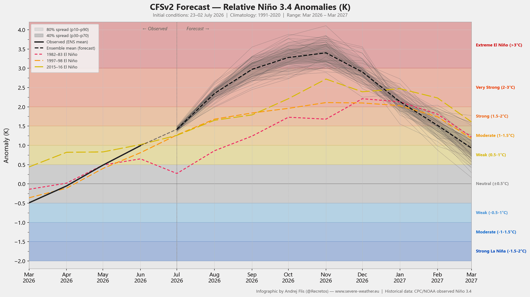
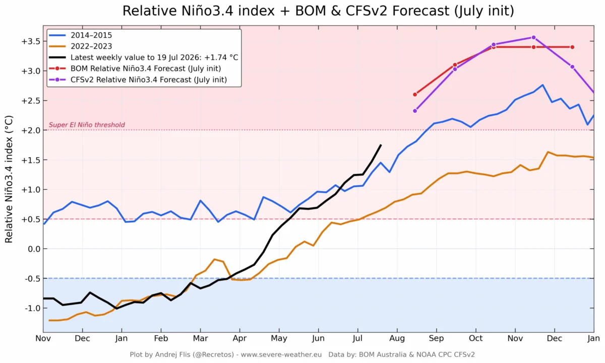
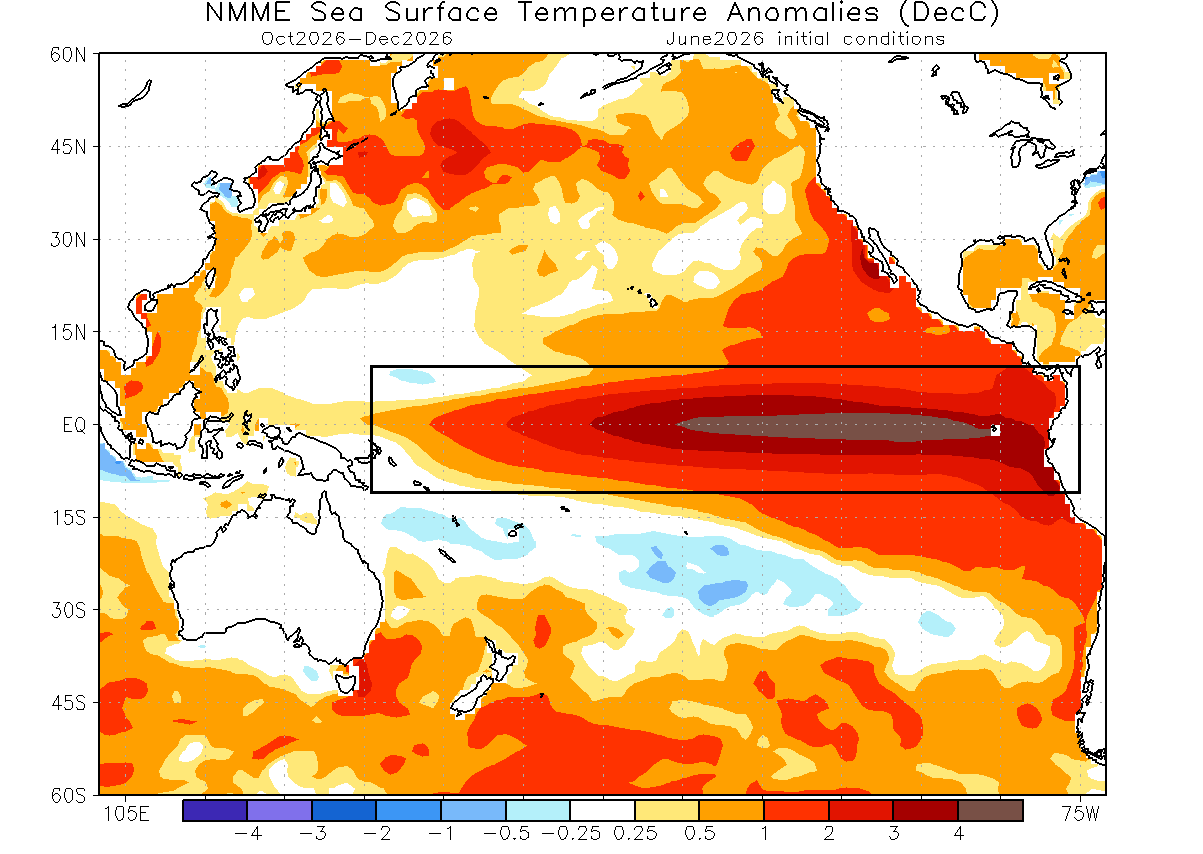
- Summer/Fall 2026: Development of the Super El Niño becomes evident, with ocean surface temperature anomalies exceeding 4°C above the seasonal norm.
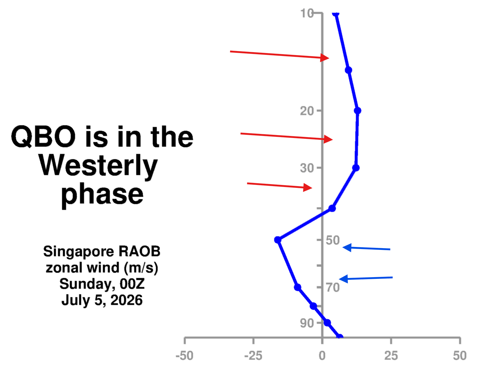
- Late Autumn 2026: Monitoring of the Quasi-Biennial Oscillation (QBO) confirms a westerly wind phase, which interacts with the El Niño-driven wave energy.
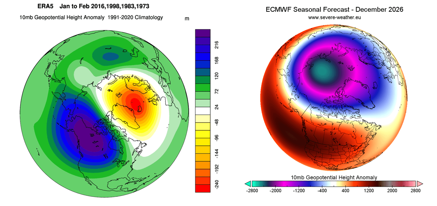
- December 2026: Early seasonal modeling begins to show a displacement of the Polar Vortex core, with building high-pressure anomalies in the stratosphere.
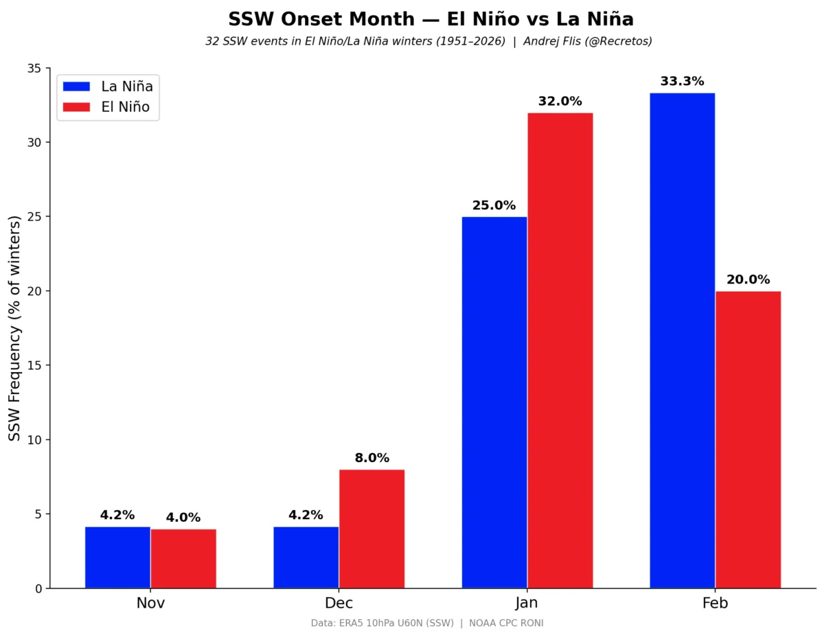
- January 2027 (Forecasted): The critical window where the "weakening signal" reaches its peak intensity, potentially leading to a Sudden Stratospheric Warming (SSW) event.
Supporting Data: The Trinity of Atmospheric Drivers
Three primary global forces are currently converging to influence the state of the Polar Vortex for the upcoming season.
1. The Super El Niño Effect
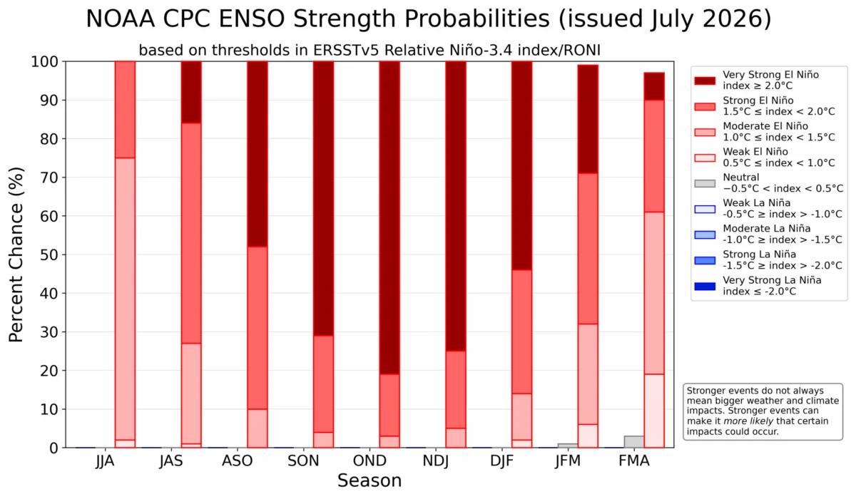
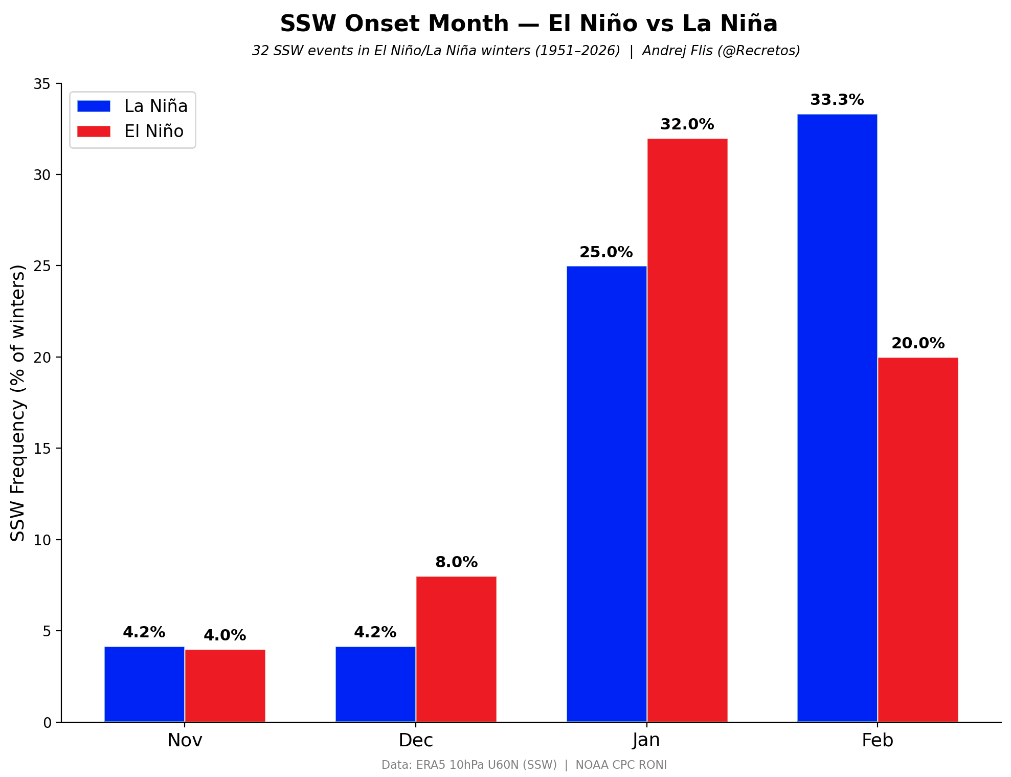
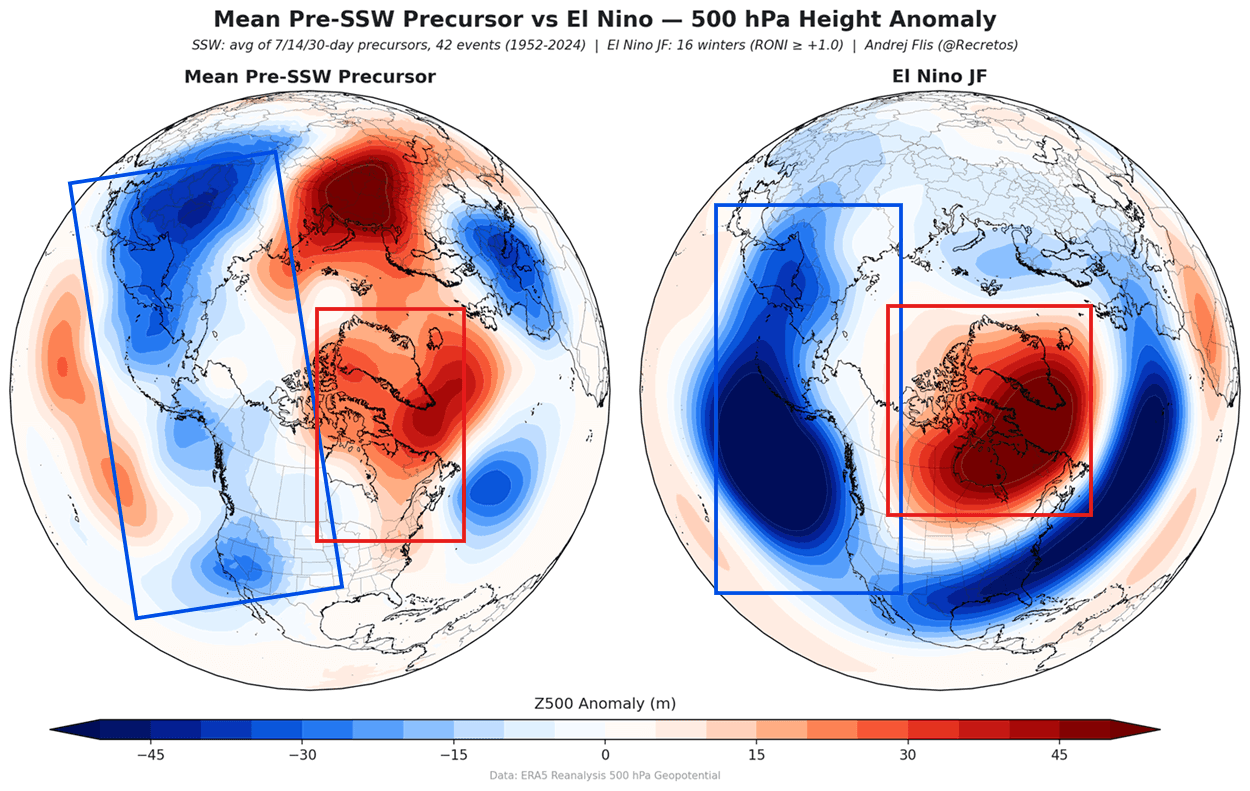
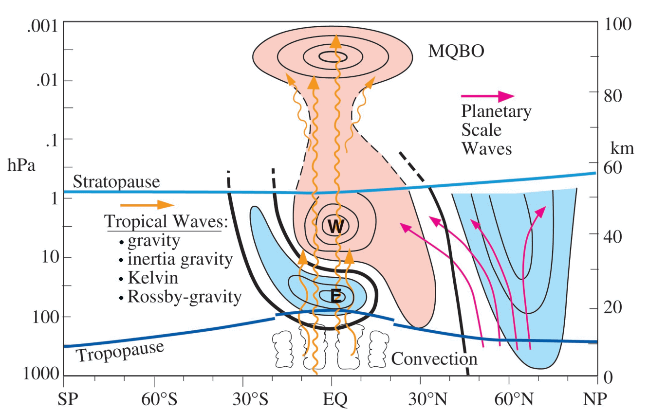
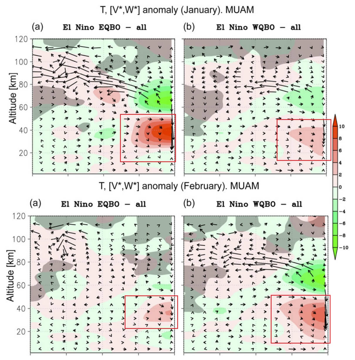
The El Niño Southern Oscillation (ENSO) is a cycle of fluctuating sea surface temperatures in the equatorial Pacific. The current forecast points toward a "Super El Niño" event, one of the strongest in decades. Historically, strong El Niño years are statistically correlated with a higher frequency of Polar Vortex disruptions. The mechanism is simple: the warmer waters in the Pacific alter global pressure patterns, creating "planetary waves" that travel vertically into the stratosphere. This energy disrupts the vortex, frequently leading to a collapse or significant displacement in mid-winter.
2. The Quasi-Biennial Oscillation (QBO)
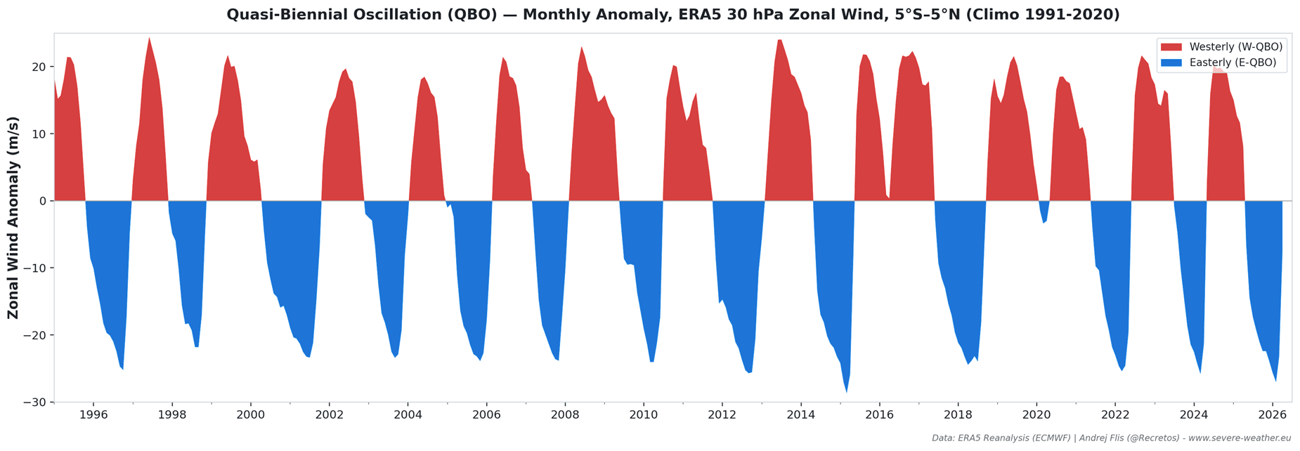
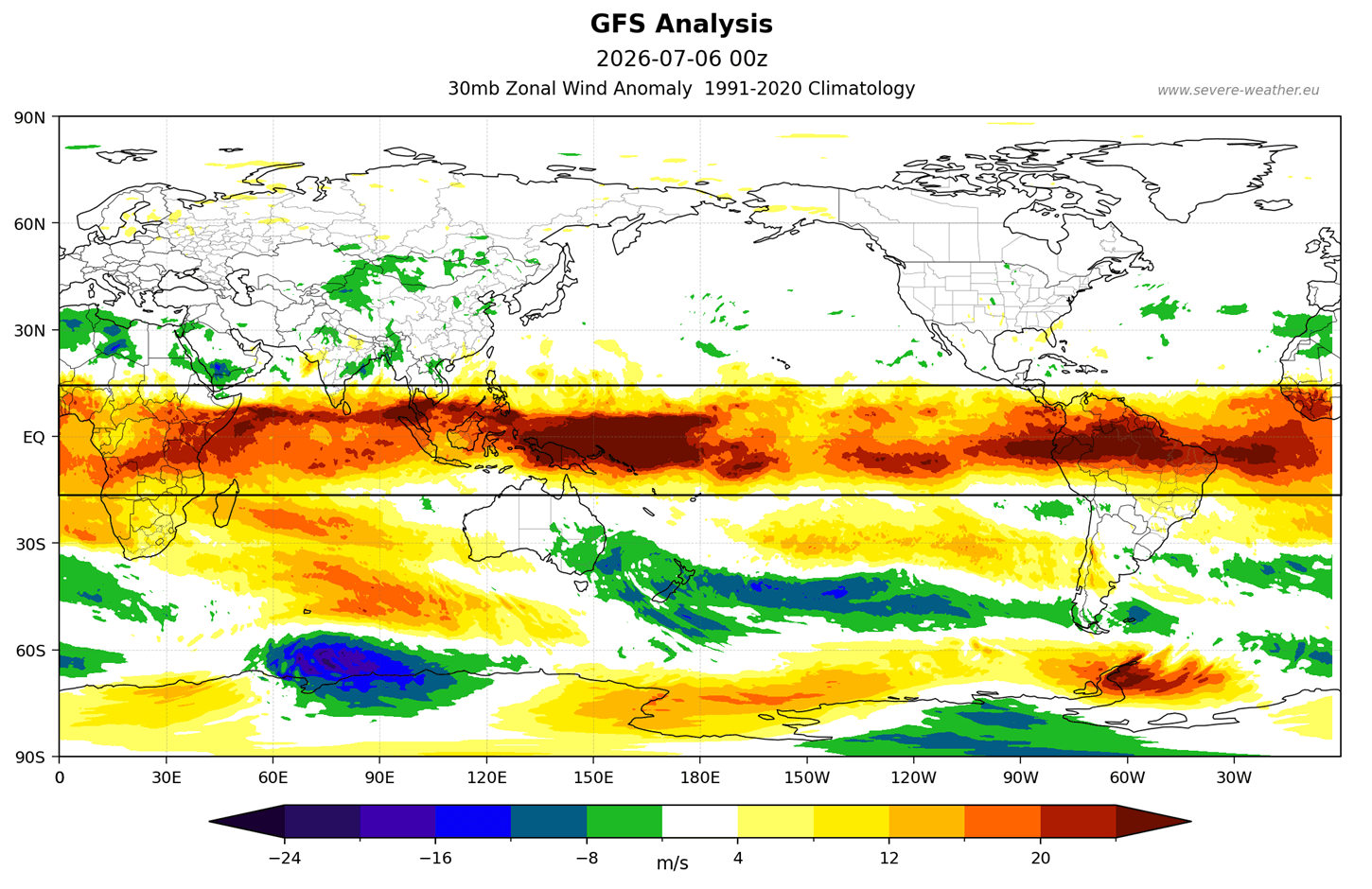
The QBO is the "heartbeat of the atmosphere," a regular oscillation of equatorial stratospheric winds. Currently, we are tracking an active westerly (west) QBO phase. While a west QBO typically helps stabilize the Polar Vortex, its influence is being overridden by the immense energy injection from the Super El Niño. The interplay between these two forces creates a complex, "tug-of-war" scenario: the vortex may start the season appearing strong, but the accumulated stress from Pacific wave energy creates a high likelihood of a late-season collapse.
3. Arctic Sea Ice Anomalies
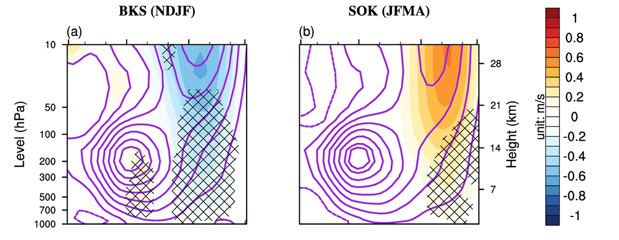
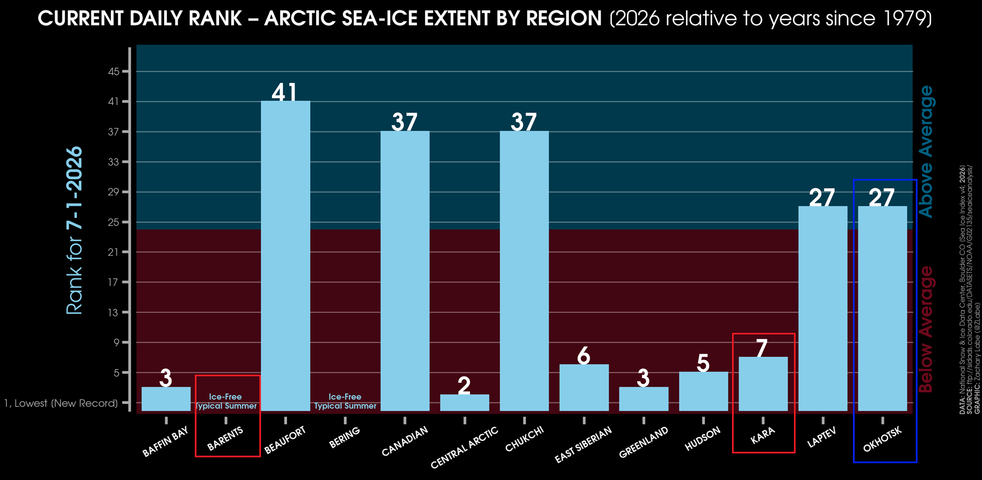
The state of the Arctic ice cap is a direct indicator of thermal balance. Data from researchers, including Dr. Zachary Labe, confirms that the Barents and Kara Sea regions are currently experiencing significant ice deficits. This "ice-free" state reduces the heat capacity of the region, which alters the temperature gradients that normally keep the vortex symmetric. A low-ice Arctic is a known catalyst for a weaker, more prone-to-disruption Polar Vortex, as it facilitates the release of energy into the stratosphere.
Official Meteorological Perspective
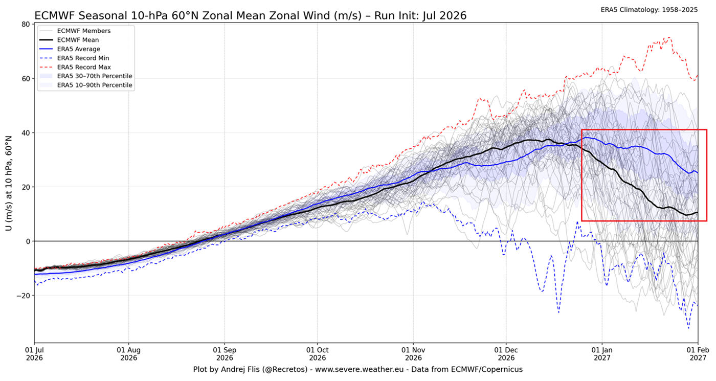
Meteorological agencies, including the NOAA and the European Centre for Medium-Range Weather Forecasts (ECMWF), utilize ensemble forecasting to predict these complex interactions. The latest seasonal forecast from the ECMWF suggests that the Polar Vortex wind speeds—the primary metric for its health—will drop well below the long-term average as we move into January 2027.
While an official "prediction" of a disaster is never given, the scientific consensus is clear: the background conditions for a major disruption are currently met. Experts note that even a "minor" disruption in the stratosphere can have profound "trickle-down" effects on the tropospheric jet stream, leading to prolonged cold snaps and increased snowfall for the mid-latitudes.
Implications: What This Means for Winter 2026/2027
The implications of a disrupted Polar Vortex are significant for the general public and infrastructure managers alike.
The "Polar Express" Pattern
If the vortex splits or collapses, the most common outcome is the "Polar Express" pattern. This involves a direct southward transport of air from the high Arctic into the central and eastern United States, southern Canada, and northern Europe. Historically, these events are characterized by:
- Rapid Temperature Drops: Sudden plunges into sub-zero temperatures, often occurring over just a few hours.
- Increased Snowfall: The clash between descending Arctic air and moisture-rich air from the Atlantic or Pacific often results in massive snowstorms, or "bomb cyclones," that can paralyze infrastructure.
- Prolonged Winter Severity: Unlike a standard cold front that passes in a day, a disrupted vortex can "park" its cold air over a region for weeks at a time, creating sustained heating demands and potential strain on power grids.
A Note on Regional Variability
It is critical to note that a "disrupted vortex" does not mean the entire Northern Hemisphere will freeze simultaneously. Because the vortex is a fluid, global system, its disruption usually causes a "see-saw" effect. While the Eastern United States or Northern Europe may face brutal, record-breaking cold, other regions (such as the Pacific Northwest or parts of East Asia) may experience unseasonably warm, dry conditions due to the altered position of the jet stream.
Conclusion: Staying Informed
As we approach the winter of 2026/2027, the data suggests we are entering a high-risk period for atmospheric instability. The confluence of a Super El Niño, a specific QBO wind phase, and record-low Arctic ice creates a "perfect storm" of variables that favor a weaker Polar Vortex.
Residents in vulnerable regions are encouraged to monitor seasonal weather updates throughout the autumn. While the exact timing and severity of these events remain subject to the chaotic nature of the atmosphere, the early signals are unambiguous. By understanding the science behind these global drivers, the public can better prepare for the potential for a more volatile, colder, and snowier winter season than in recent years.
For ongoing analysis of the 2026/2027 winter season, continue to monitor official national weather service reports and long-range atmospheric research updates.