In a rare meteorological convergence, the tropical Atlantic has developed a cooling phenomenon known as an "Atlantic Niña," unfolding simultaneously with a robust, developing "Super El Niño" in the Pacific Ocean. While these two phenomena exist on opposite sides of the globe, they are currently acting in tandem to create a formidable "atmospheric shield" over the United States, effectively dampening the conditions necessary for tropical cyclone development.
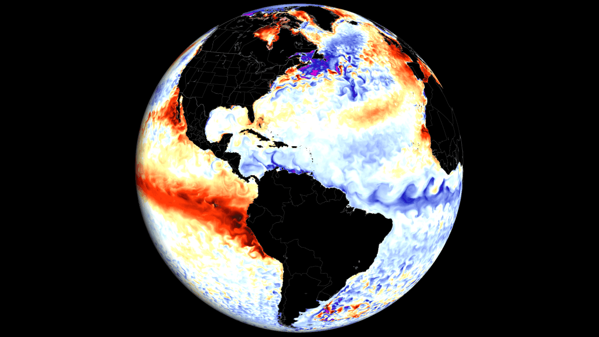
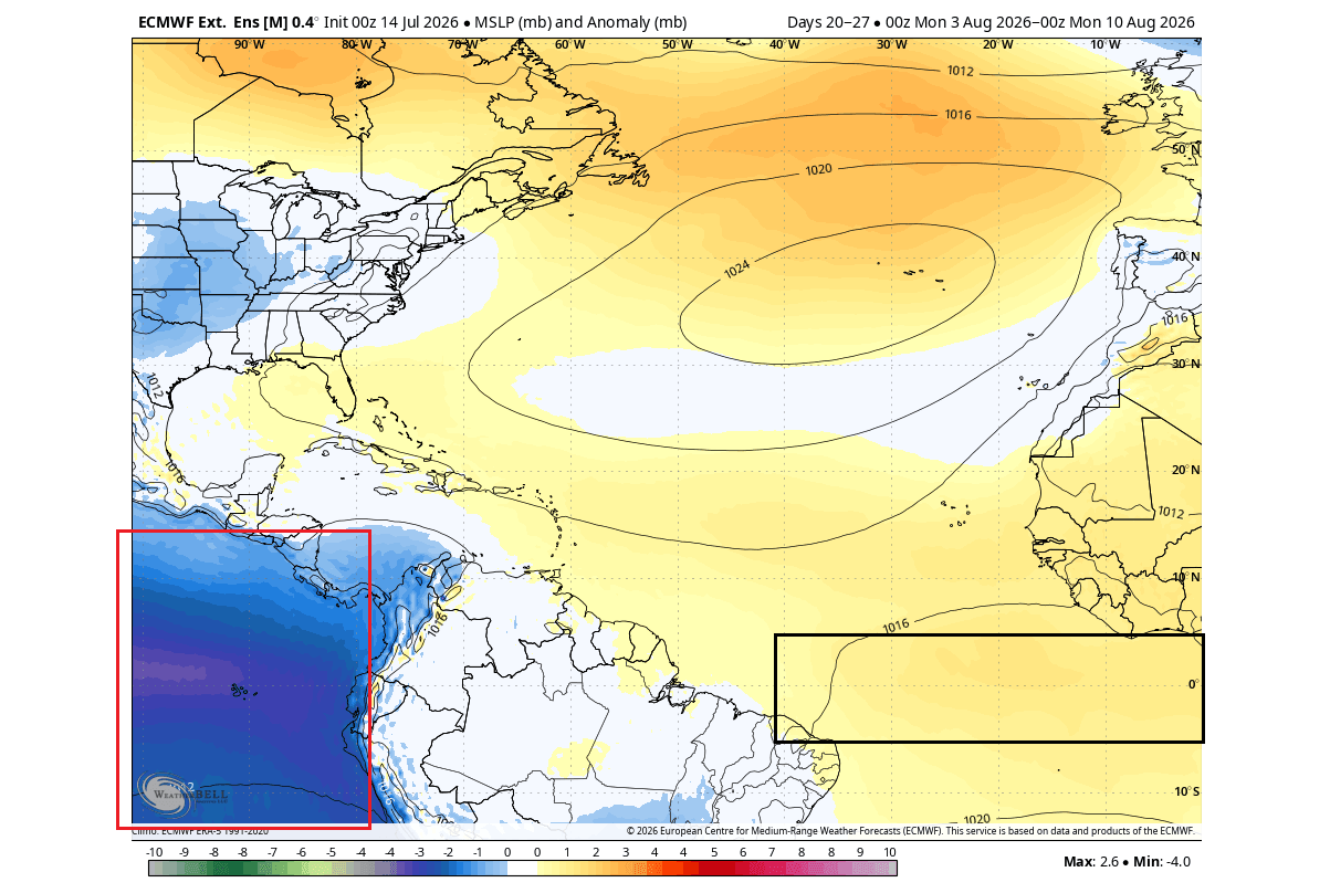
As we enter the peak of the hurricane season, this dual-ocean anomaly is generating high pressure, increased wind shear, and sinking air across the Atlantic’s primary tropical development regions. For meteorologists and emergency management officials, this setup suggests a significantly suppressed hurricane risk for the 2026 season. However, as history has repeatedly shown, even the most hostile environments cannot guarantee absolute safety from tropical threats.
The Mechanics of a Global Atmospheric Shift
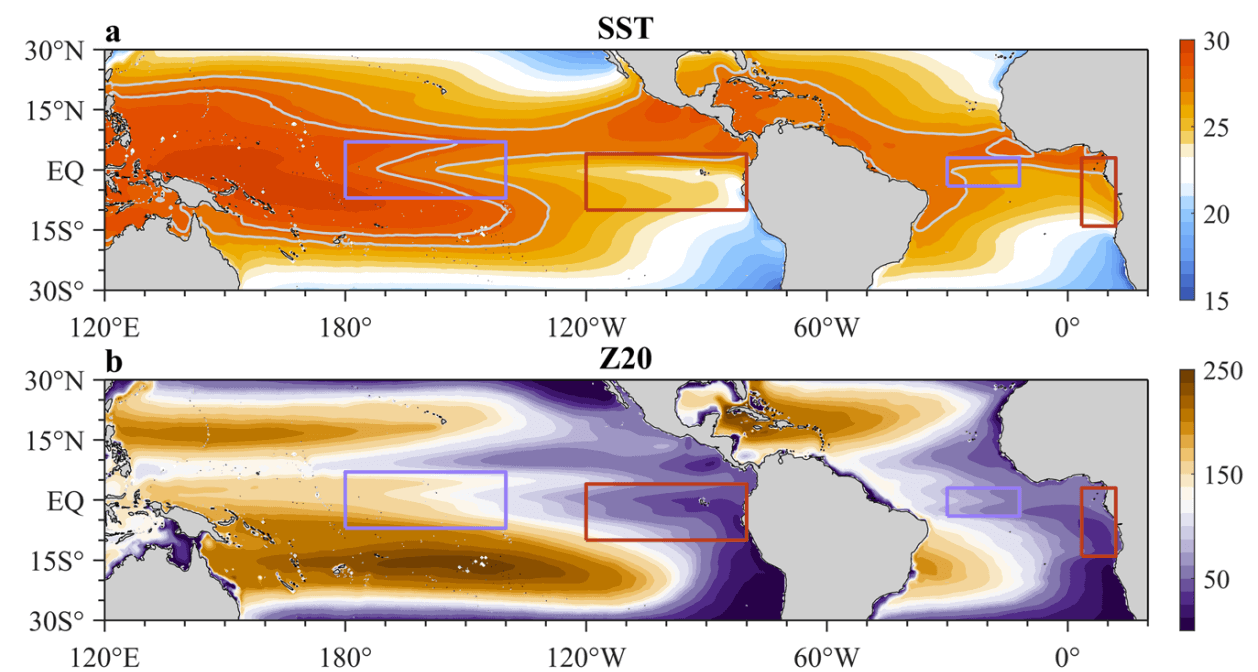
Oceanic temperatures are the primary engine of our global weather system. While local variations often dictate regional weather, massive anomalies like the El Niño Southern Oscillation (ENSO) have a profound, cascading impact on atmospheric circulation patterns worldwide.
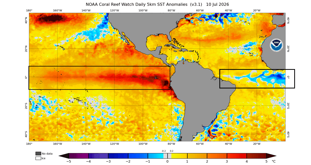
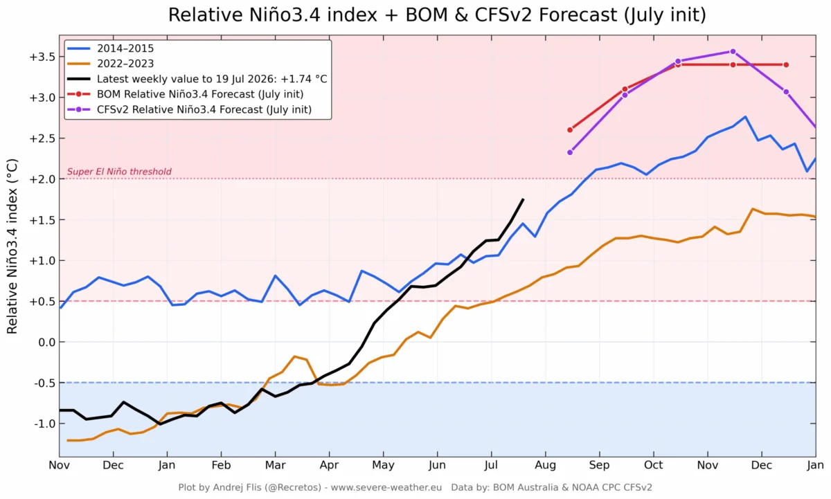
The current state of our oceans is dominated by two primary signals. In the Pacific, the rapid onset of a Super El Niño—characterized by sea-surface temperature anomalies peaking at 3–4 degrees Celsius above normal—is fundamentally altering the position of the jet stream. Simultaneously, the Atlantic has developed an Atlantic Niña, a cooling trend in the tropical Atlantic that typically acts as a suppressant for cyclonic activity.
These anomalies are governed largely by the trade winds. When these easterly winds strengthen, they trigger "upwelling," pulling colder water from the depths to the surface, which leads to the cooling observed in the Atlantic Niña. Conversely, when trade winds weaken in the Pacific, warmer water pools, fueling the development of El Niño. Because these winds dictate the temperature of the surface, these ocean anomalies serve as a critical diagnostic tool for forecasters to predict the state of the atmosphere months in advance.
Chronology of a Developing Anomaly
The Atlantic Niña is a relatively rare event. Historical data spanning the last 40 years reveals that if the current cooling trend persists—with seasonal anomalies dropping below the -0.5-degree threshold—this will be only the sixth occurrence of such an event in four decades.
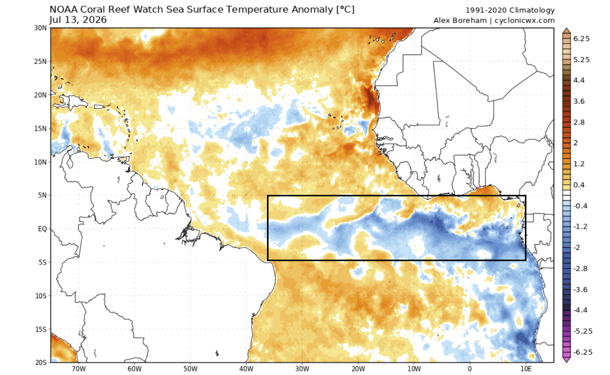
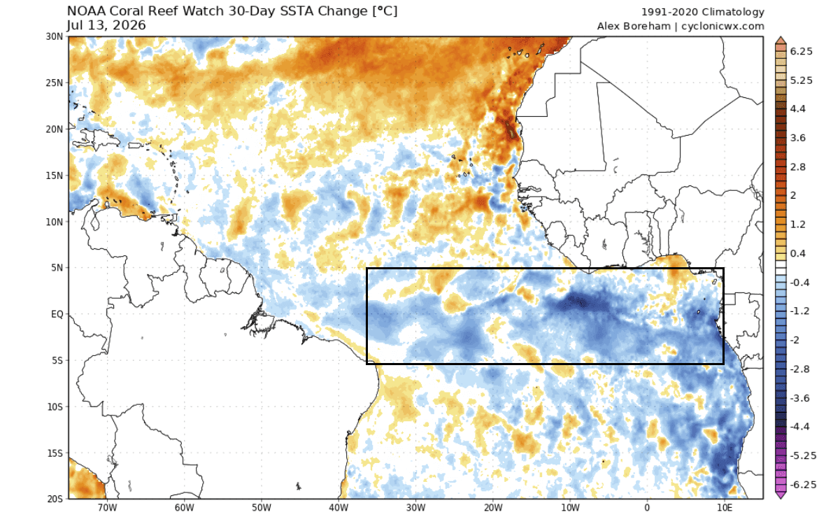
June–July 2026: Initial monitoring by the National Oceanic and Atmospheric Administration (NOAA) Coral Reef Watch (CRW) identified the early signs of cooling in the equatorial Atlantic. This cooling intensified throughout July, with temperatures in critical regions dropping 1–3 degrees Celsius below the long-term average.
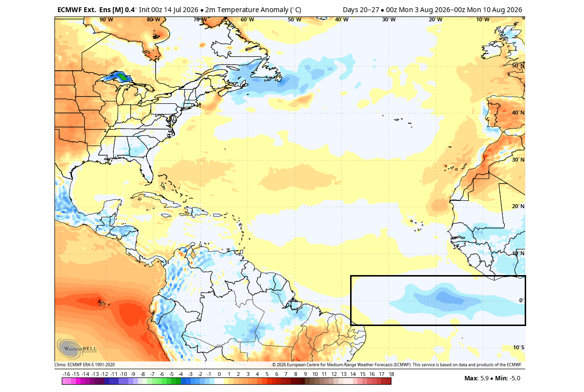
August 2026: As the season transitions into its most active phase, the European Centre for Medium-Range Weather Forecasts (ECMWF) extended-range models indicate that the Atlantic Niña is not merely a transient spike, but a sustained feature. Concurrently, the Pacific Super El Niño has reached a critical threshold, effectively locking in the global atmospheric pressure difference that favors a "hostile" Atlantic environment.
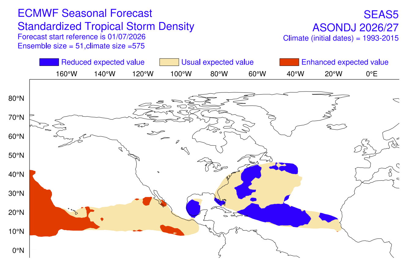
September–October 2026: Meteorological models project that this atmospheric configuration will persist through the peak of the season. The primary focus remains on the "Main Development Region" (MDR), the nursery area for most major hurricanes, where current forecasts show a consistent suppression of convective activity.
Supporting Data: Why the Atlantic is Under Siege
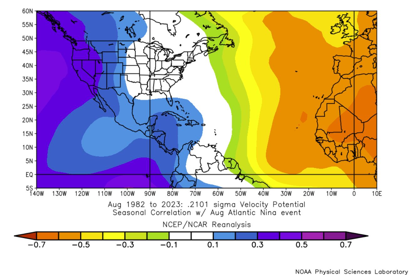
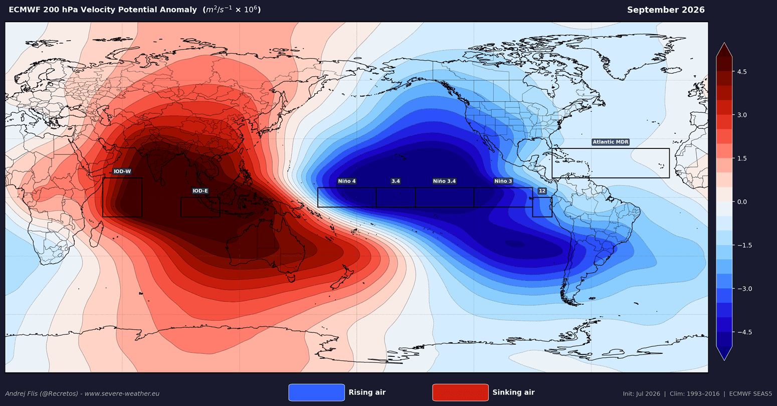
The scientific consensus regarding the current season is driven by the "Velocity Potential"—a metric that describes where air is rising and sinking in the atmosphere.
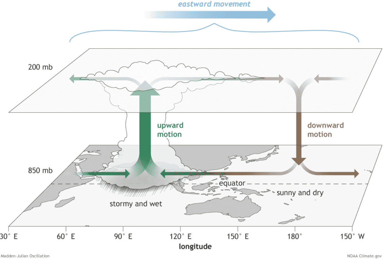
Rising air, associated with low pressure, typically fosters cloud formation and tropical storm intensification. Sinking air, however, creates stability, suppressing the development of clouds and rain. During this 2026 season, the Atlantic MDR is dominated by sinking air—a byproduct of the Atlantic Niña and the global atmospheric response to the Pacific Super El Niño.
Key Atmospheric Inhibitors:
- Increased Wind Shear: The large-scale circulation patterns associated with El Niño create a strong "shearing" effect in the upper atmosphere. This prevents nascent storms from developing the vertical structure required to become major hurricanes.
- Sinking Air (Subsidence): The high-pressure anomalies currently sitting over the Atlantic act as a lid, preventing the upward transport of moisture.
- Drier Mid-Levels: Humidity analysis shows that the middle layers of the atmosphere are significantly drier than average, making it difficult for convective cells to sustain themselves.
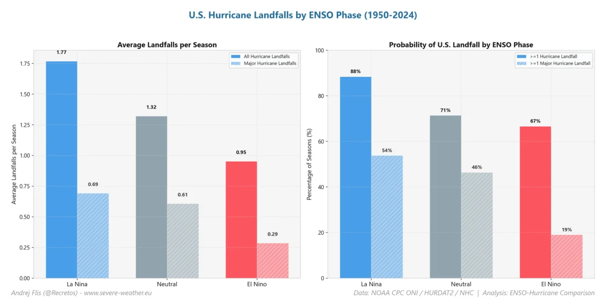
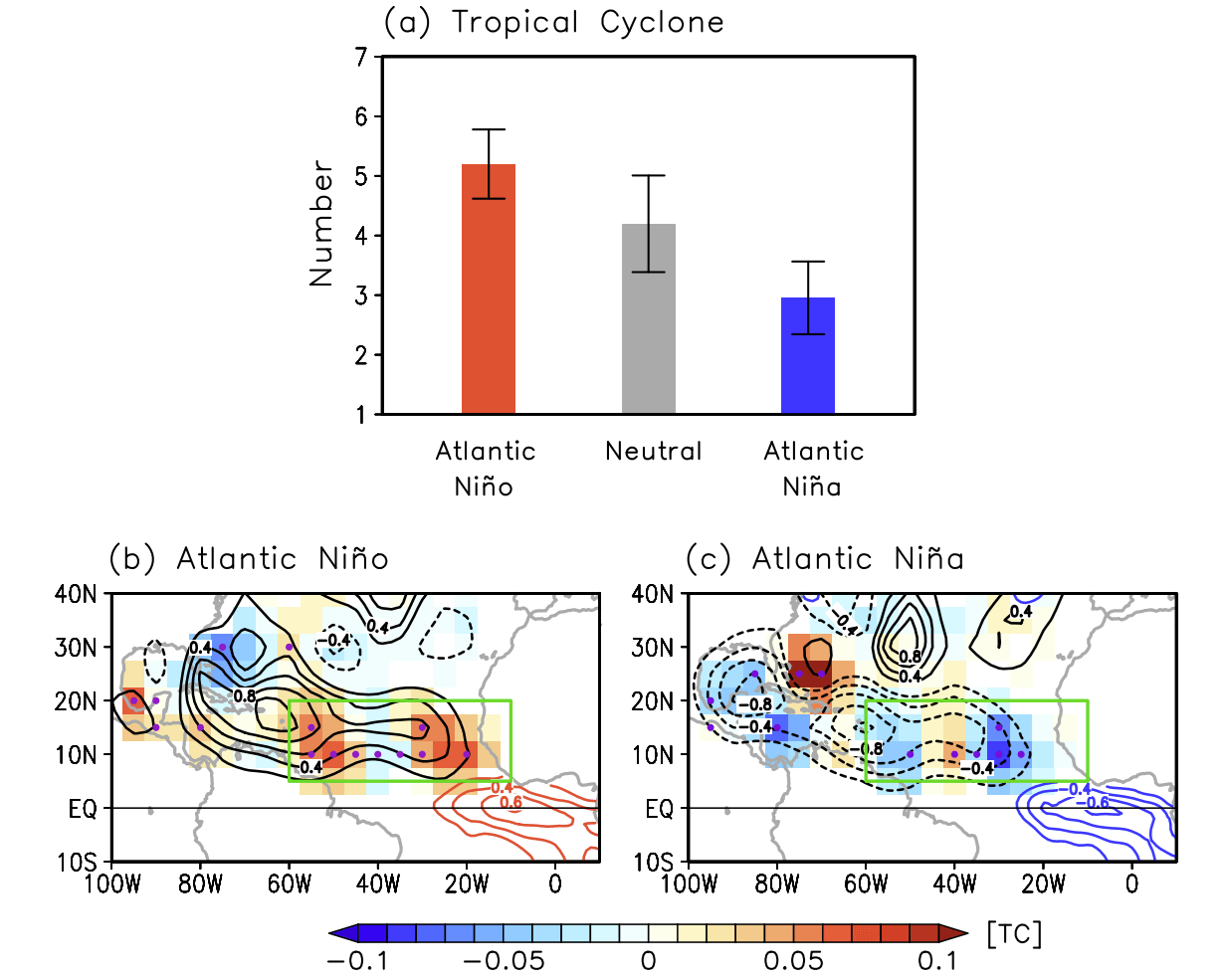
Historical data reinforces this: in years with similar ocean anomalies, the number of tropical cyclones in the Atlantic has dropped by as much as 50% compared to neutral or La Niña years. Furthermore, the Accumulated Cyclone Energy (ACE) index—a measure used by meteorologists to express the energy used by a tropical system over its lifetime—is forecast to remain well below the historical average for 2026.
Official Outlooks and the Reality of Risk
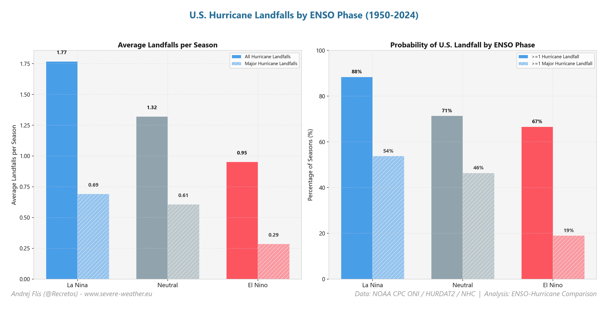
The Colorado State University (CSU) tropical research team, led by Dr. Philip Klotzbach, has issued updated outlooks reflecting these ocean conditions. The data is clear: every coastal county from the Texas border to the Canadian Maritimes is currently facing a below-normal threat of hurricane landfall.
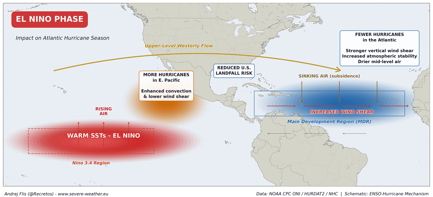
However, official bodies like the National Hurricane Center (NHC) are quick to provide a vital caveat. An "atmospheric shield" is not an impenetrable wall. The 1992 hurricane season remains the definitive case study in this regard; despite being an El Niño-suppressed year with very low overall activity, it produced Hurricane Andrew, a devastating Category 5 storm that leveled parts of South Florida.
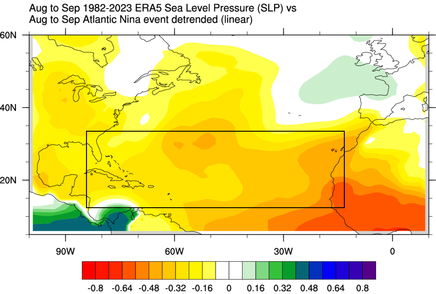
Therefore, while the statistical probability of a landfall is lower, the risk never reaches zero. Emergency management agencies emphasize that citizens should not interpret a "quiet" forecast as an excuse to forgo disaster preparedness.
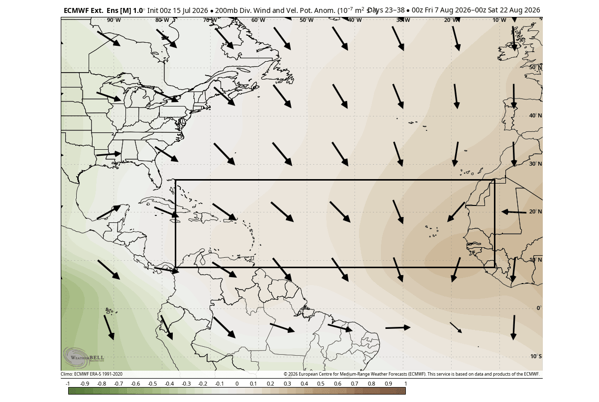
Implications for the Upcoming Winter
The connection between a quiet hurricane season and the subsequent winter is a subject of intense study. Climate researchers are observing that the same global atmospheric forcing that suppresses hurricane development in late summer often sets the stage for the following winter’s circulation patterns.
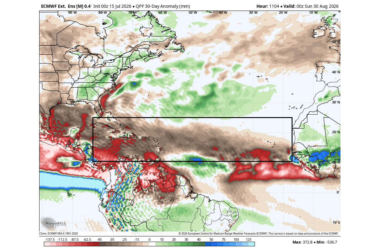
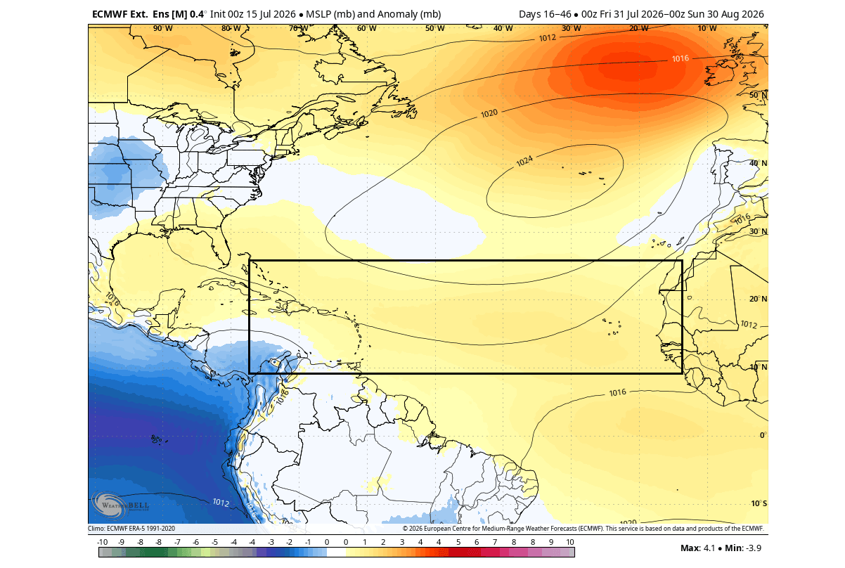
Preliminary modeling for the 2026/2027 winter suggests a potential correlation between a suppressed hurricane season and a weakened Polar Vortex. When the Polar Vortex weakens, the jet stream becomes more erratic, often allowing frigid Arctic air to spill into the mid-latitudes of the United States and Europe.
The Winter 2026/2027 Outlook:
- Stratospheric Warming: Early data indicates that the conditions contributing to a quiet hurricane season may correlate with a warmer stratosphere in late 2026. This often precedes a disruption of the stratospheric polar vortex.
- Temperature Anomalies: If the current patterns hold, the U.S. may see a winter characterized by volatile cold outbreaks. Unlike a standard "warm" El Niño winter, the interaction between the Pacific anomaly and the potential breakdown of the Polar Vortex could lead to sharper, more severe winter weather events.
- Jet Stream Behavior: The expected jet stream configuration for late 2026 suggests a high-pressure zone over Canada and Europe, which, when coupled with the potential for a weakened vortex, creates a high-probability scenario for cold air intrusion in the lower 48 states.
Conclusion: Watching the Global System
The 2026 hurricane season serves as a masterclass in global atmospheric interconnectedness. The ocean is not merely a passive body of water but an active participant in determining the weather we experience on land. The emergence of the Atlantic Niña alongside a Super El Niño has effectively tilted the scales in favor of a quieter tropical season, providing a much-needed reprieve for vulnerable coastal regions.
However, the science of meteorology is one of probabilities, not certainties. As the season progresses through the coming months, the focus remains on monitoring the "atmospheric shield." Furthermore, the lingering impacts of these ocean anomalies will likely dictate the narrative of the 2026/2027 winter. Whether this year concludes as a historically quiet season or one defined by rare outliers remains to be seen, but one thing is certain: the interplay between the Pacific and Atlantic oceans will continue to be the primary driver of global weather patterns, demanding our close and constant attention.
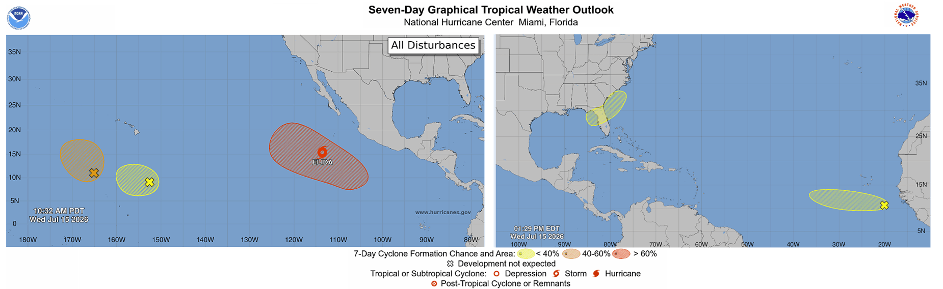
For the public, the message remains consistent: use this period of lower risk to ensure personal safety plans are in place, for even in the quietest years, the atmosphere retains the capacity to surprise.