The tropical Pacific Ocean is currently the stage for a meteorological event of historic proportions. A "Super El Niño"—a rare, extreme manifestation of the El Niño-Southern Oscillation (ENSO)—is strengthening at a rate that has surprised even the most seasoned long-range forecasters. With ocean temperatures surging and atmospheric circulation patterns shifting in lockstep, the 2026/2027 event is not merely a seasonal variation; it is a global climate driver poised to redefine weather expectations for the coming winter.

The Anatomy of a Super El Niño
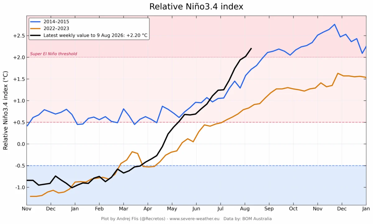
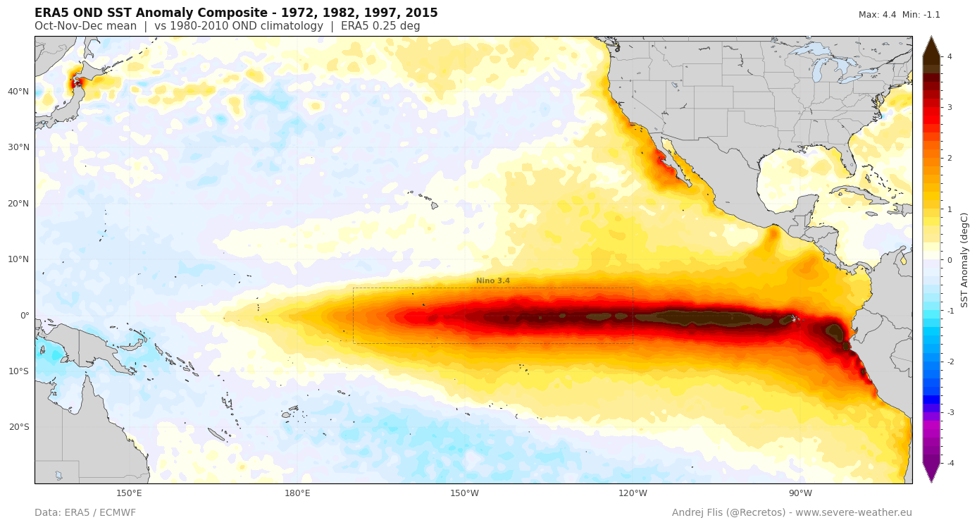
At its core, El Niño is a warming of the central and eastern tropical Pacific waters. However, when this warming reaches specific thresholds—often exceeding 2°C above the long-term average—it earns the designation of a "Super" event. These occurrences are decadal in frequency and possess the power to alter the jet stream, change precipitation patterns across continents, and disrupt agricultural cycles globally.
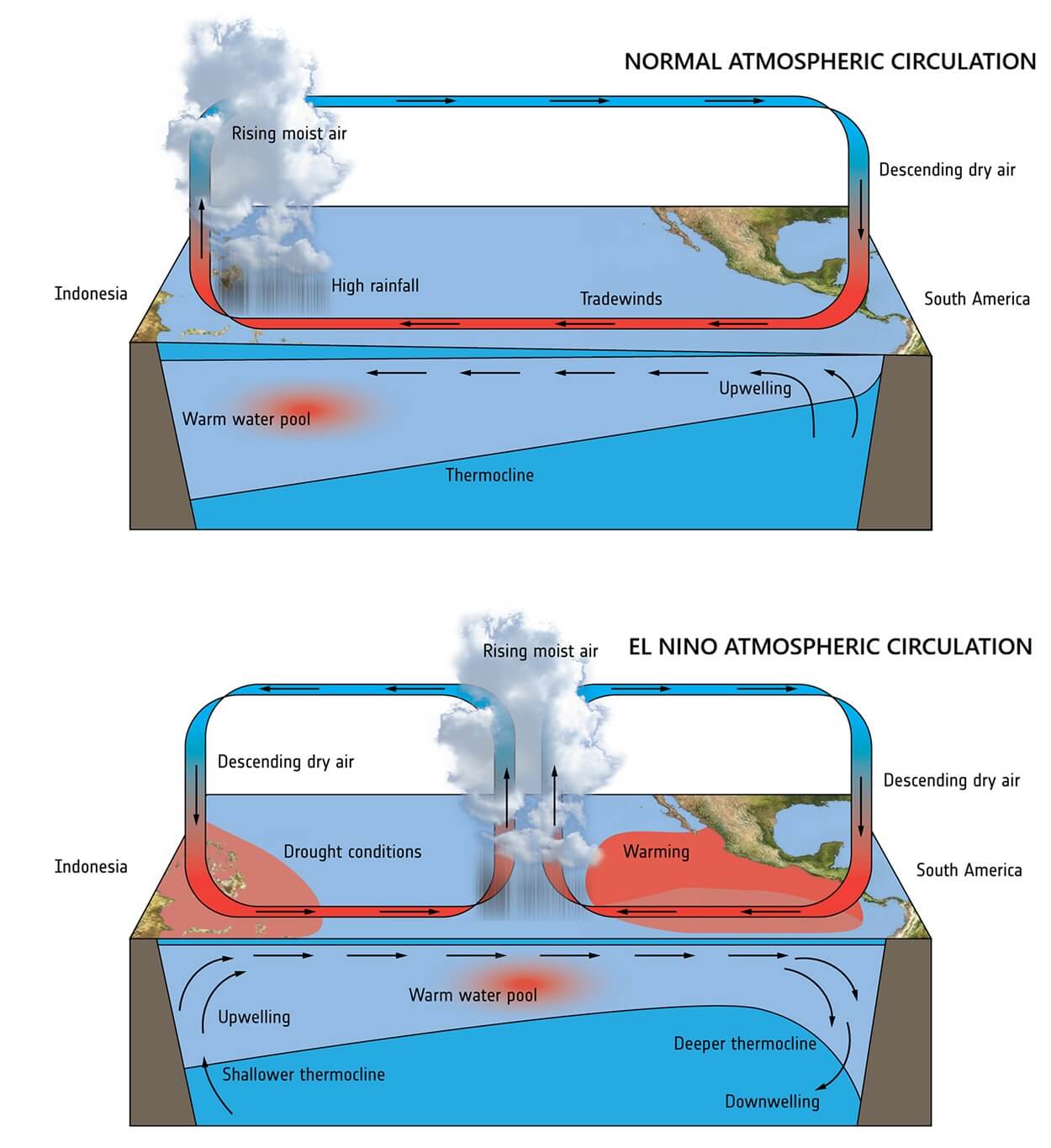
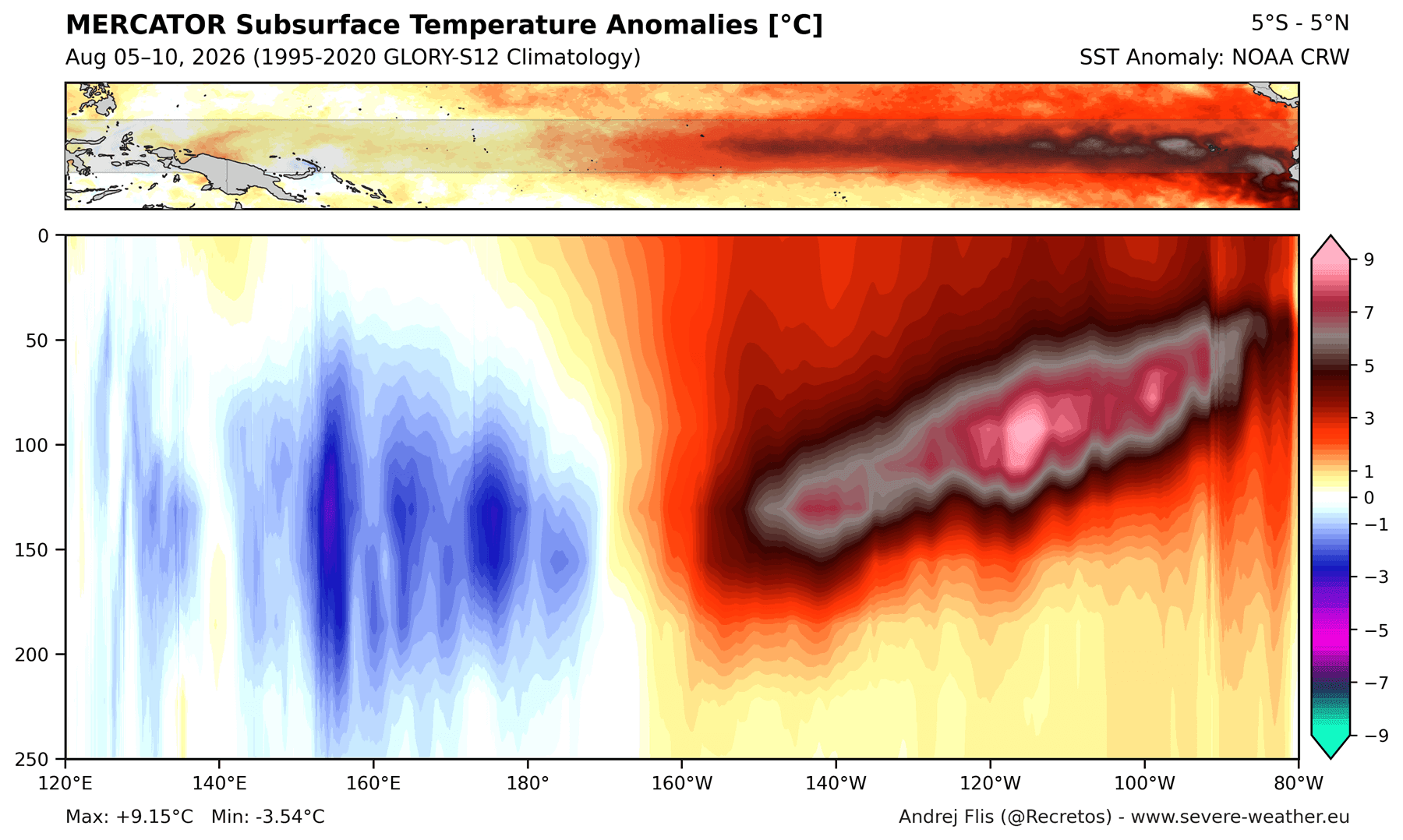
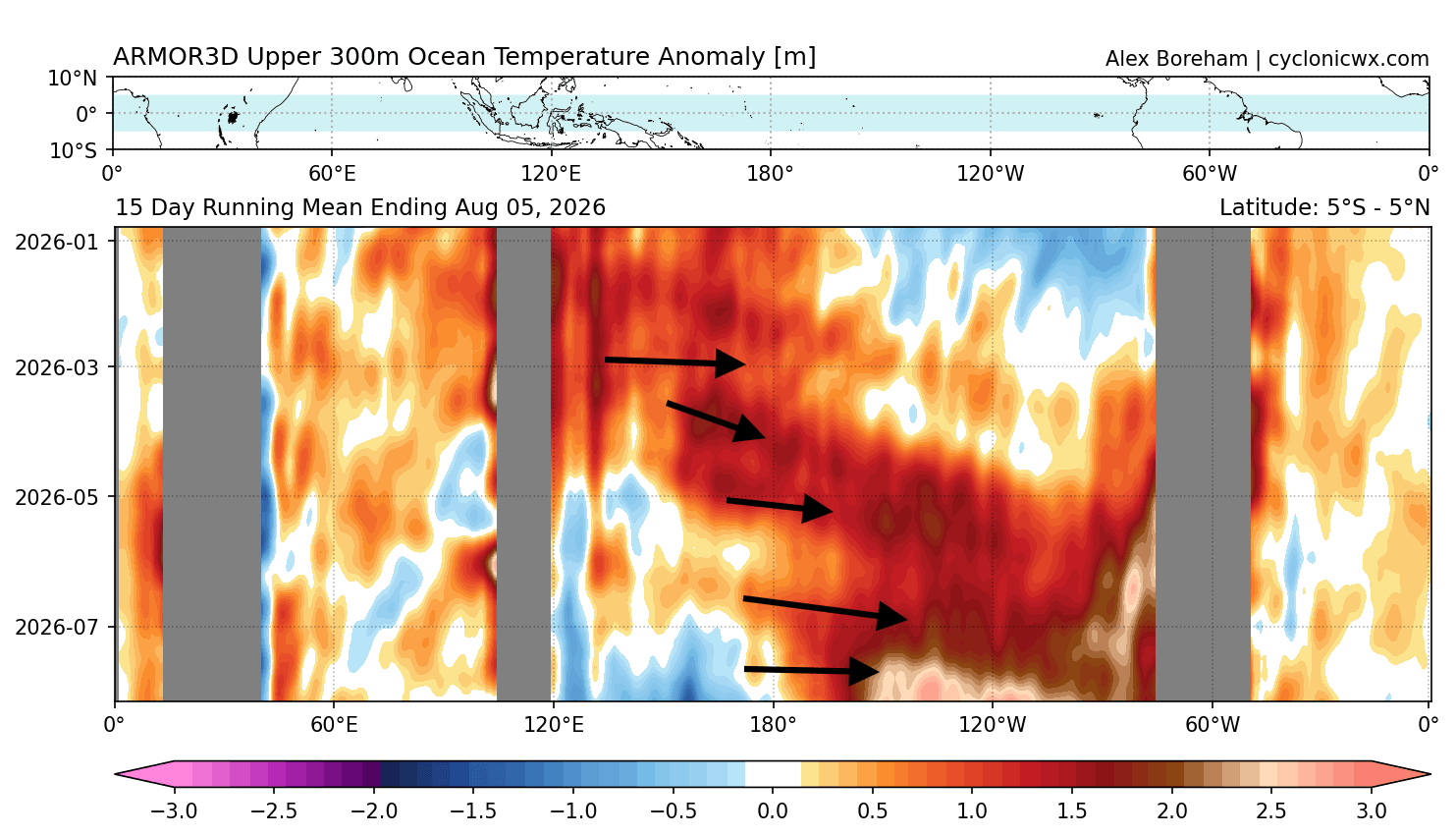
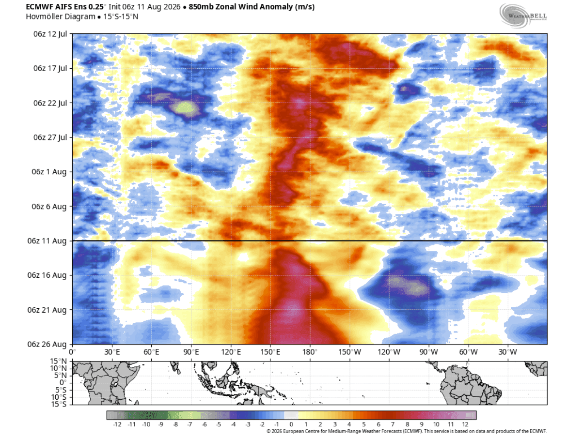
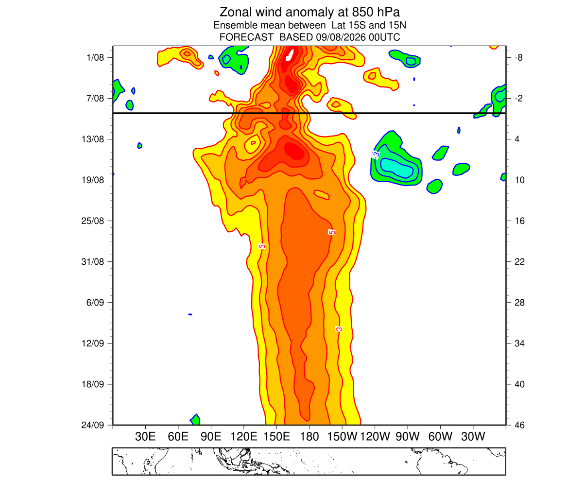
The current 2026 event is distinguished by its aggressive development. Unlike moderate El Niño events that evolve gradually, this episode has been accelerated by an unusually strong combination of westerly wind anomalies and a massive subsurface Kelvin Wave. These physical mechanisms are pumping vast amounts of heat from the deep ocean to the surface, creating a feedback loop that maintains the El Niño’s intensity.
Chronology of Rapid Development: From Spring to Autumn
The trajectory of the 2026 Super El Niño has been nothing short of extraordinary.
- Spring 2026: Initial signs of sustained Pacific warming appeared, with early models identifying a shift toward an El Niño phase.
- June–July 2026: The atmosphere began to synchronize with the ocean. During this period, the Multivariate ENSO Index (MEI) surged to a record-high value of +2.4, the highest for this time of year since the index’s inception in 1979.
- Mid-August 2026: Recent data indicates that the "engine" of the event—the Kelvin Wave—is currently producing subsurface temperature anomalies exceeding 9°C (16°F) above normal. This heat is rising toward the surface, ensuring that the El Niño will remain potent well into the winter months.
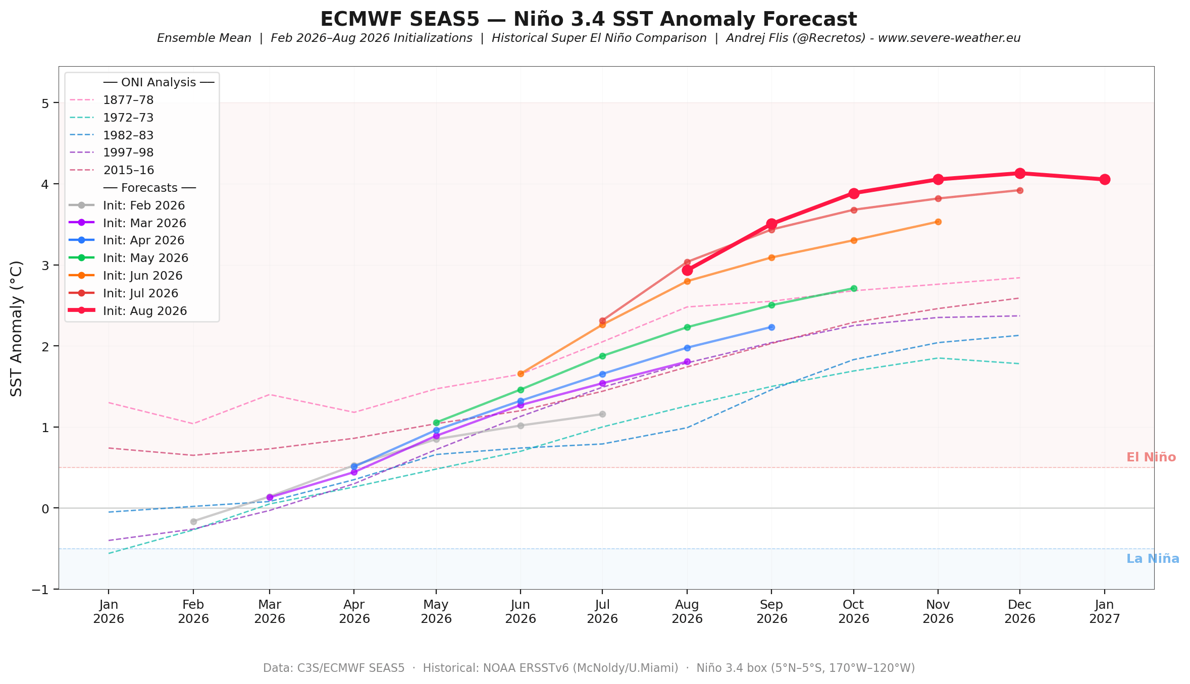
- Current Status: Forecasts are consistently being revised upward. Each new run from the European Centre for Medium-Range Weather Forecasts (ECMWF) and the National Oceanic and Atmospheric Administration (NOAA) Multi-Model Ensemble (NMME) shows a stronger peak, with many scenarios pushing the anomaly beyond the +3°C threshold.
Supporting Data: Why This Event is Unique
The scientific community relies on a suite of data to track this phenomenon. The most telling indicator is the "Walker Cell," the atmospheric circulation pattern in the tropics. Under normal conditions, this cell facilitates specific rising and sinking air patterns. Under the current Super El Niño, these patterns have locked into a stationary "standing wave."
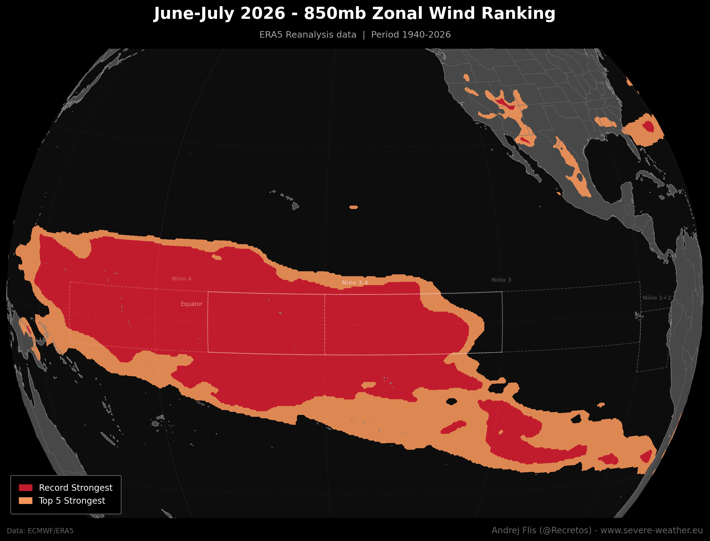
Furthermore, the zonal wind analysis provides a stark reality check. The westerly wind bursts recorded over the past two months in the western and central equatorial Pacific are the strongest observed in 86 years of historical data. This collapse of the trade winds allows warm water to pool in the east, effectively acting as a massive heat battery that powers the global climate anomaly.
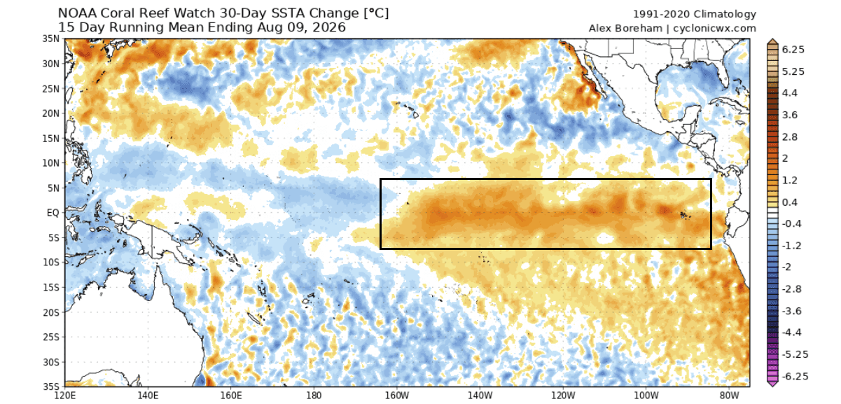
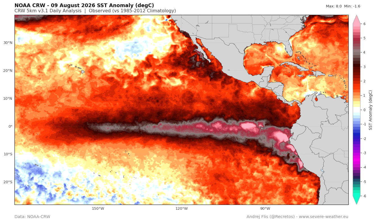
Surface temperature maps currently show a massive expanse of the Pacific, covering over 10% of the global ocean, experiencing significant heat anomalies. As this heat reaches the surface, it provides the thermal energy necessary to sustain the event through the Northern Hemisphere’s winter.
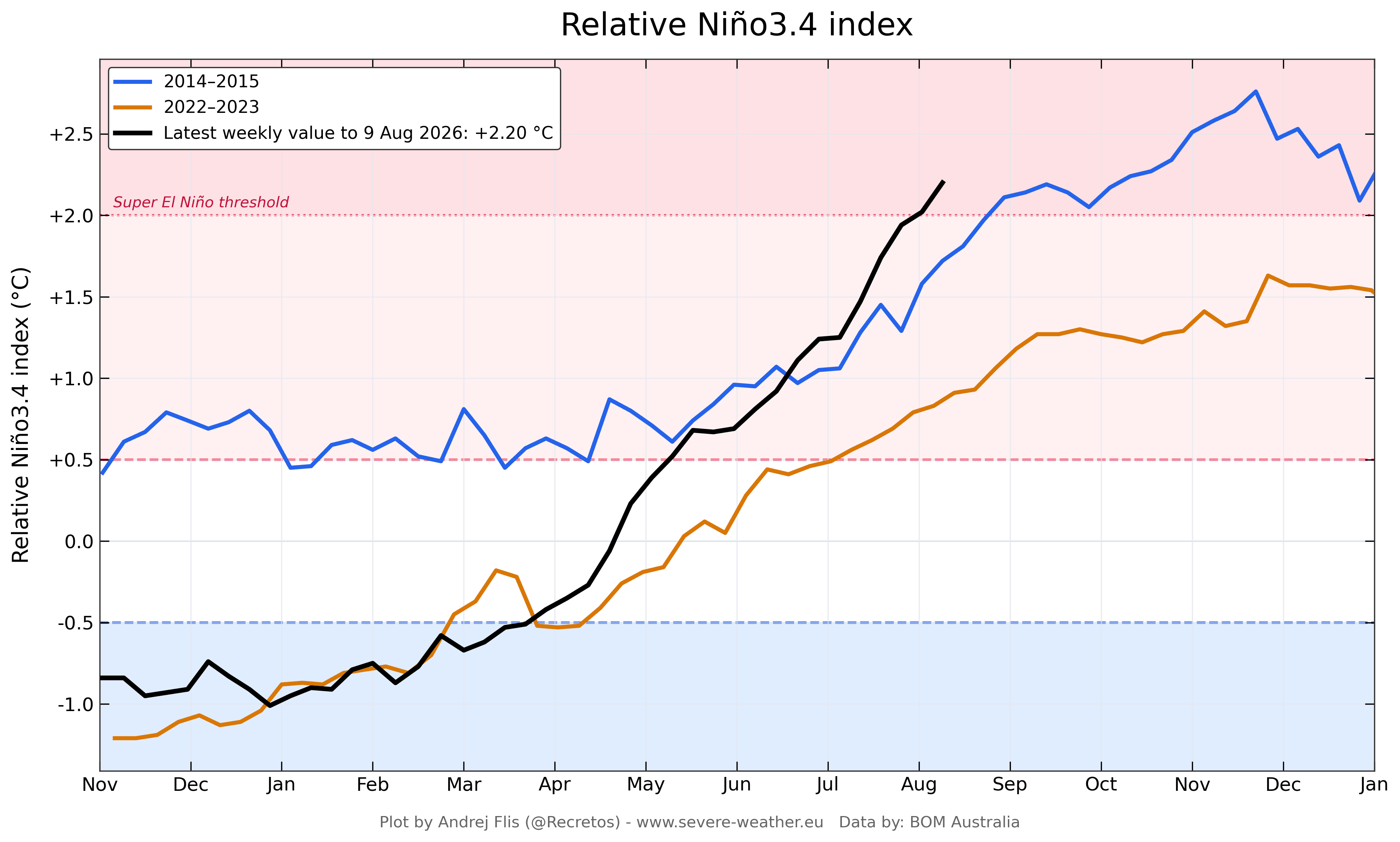
Official Projections and Model Consistency
Seasonal models often struggle to simulate individual westerly wind bursts, which is why early predictions for this event were initially conservative. However, as the atmosphere has responded, the models have caught up.
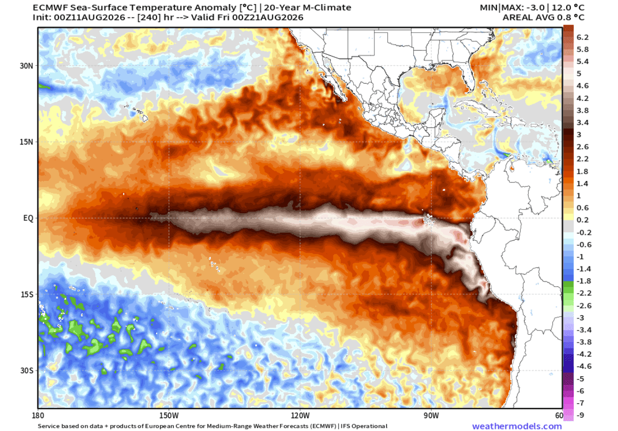
The latest ECMWF forecast for the November–December 2026 period shows peak anomalies hitting +7°C in certain eastern regions. While this is an localized extreme, the broader trend confirms that we are entering "uncharted territory." Institutional forecasts from climate centers across the globe now agree on one thing: this is a high-amplitude event that will dominate global circulation patterns for the next six months.
Implications for North America and Europe
The impacts of this Super El Niño will vary by region, but the "atmospheric highway" created by the jet stream will be the primary mechanism for weather distribution.
The United States and Canada
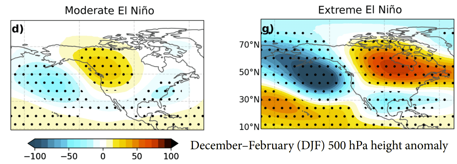
In North America, the typical El Niño signature involves a stronger, more active Pacific jet stream.
- Fall 2026: We are seeing early signs of this shift. High-pressure anomalies are developing over Canada, while a persistent low-pressure storm track is forming across the southern United States.
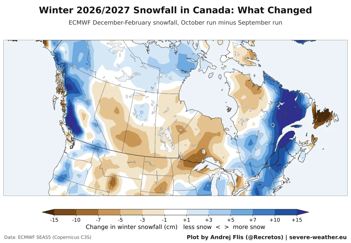
- Winter 2026/2027: Forecasts point toward an amplified pattern. The northern tier of the U.S. and Canada can expect warmer-than-average conditions due to a persistent ridge. Conversely, the southern U.S. will likely face a wetter, cooler, and stormier winter.
- The February Outlook: Mid-to-late winter could see the pattern go into "overdrive." Current models suggest a deep pressure wave shifting eastward, which may create a favorable setup for significant snowstorms across the Central, Eastern, and Northeastern United States.
Europe’s Milder Outlook
Europe’s weather is influenced by the "downstream" effect of the North Atlantic. The current forecast suggests that the intensified Pacific jet stream will manifest in Europe as a persistent low-pressure system near the UK and Ireland. This is expected to usher in a milder, wetter winter for much of the continent, driven by sustained westerly and southwesterly flows. While some northern and central regions may see snowfall, the overall trend is one of warmth compared to historical averages.
Navigating the Uncertainty
While the data points toward a highly amplified winter, it is essential to remember that long-range forecasting is a probabilistic science. The transition from a "strong" to a "super" event brings with it a degree of volatility that models are still calibrating.
The coming months will be critical. The persistence of the standing wave in the tropical Pacific will dictate whether this event remains at its current high-energy level or fluctuates. For residents in the southern United States, this may mean preparing for an increased frequency of extreme precipitation events. For those in the Northeast, the potential for high-impact winter storms—contingent on the availability of cold air—remains a primary concern.
As the 2026/2027 season progresses, meteorologists and climate scientists will continue to monitor the subsurface heat content and the persistence of the westerly wind bursts. The Super El Niño is not just a scientific curiosity; it is a profound reminder of the interconnected nature of our global atmosphere. With the event now firmly established, the world must prepare for a winter that will likely be remembered for its intensity and its deviation from standard climatological norms.