As the final week of August 2026 unfolds, Europe finds itself gripped by the sixth—and arguably one of the most stubborn—heatwaves of the season. A massive, persistent "Heat Dome" has anchored itself over the Central Mediterranean and Southern Europe, setting the stage for a period of extreme thermal stress. This meteorological phenomenon, characterized by a blocking high-pressure system, is expected to drive surface temperatures to dangerous levels, testing the resilience of infrastructure, energy grids, and public health systems across the continent.
Main Facts: The Anatomy of a Thermal Siege
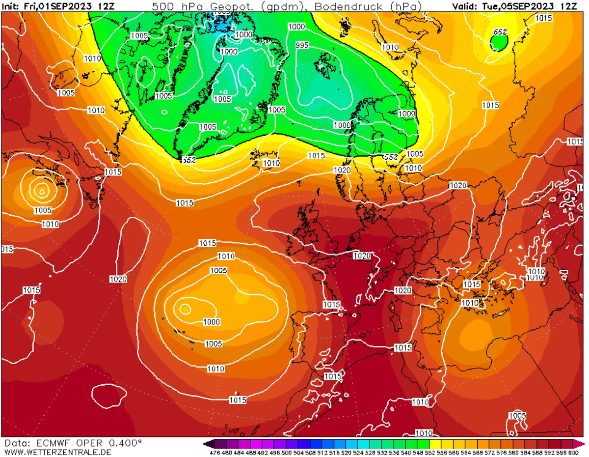
The atmospheric engine driving this event is a robust, stagnant high-pressure ridge originating from North Africa. Meteorologically, a "heat dome" functions much like a lid on a boiling pot. As the high-pressure system parks over a region, it forces warm air to sink toward the surface. This sinking air undergoes adiabatic compression, significantly raising temperatures in the lower troposphere.
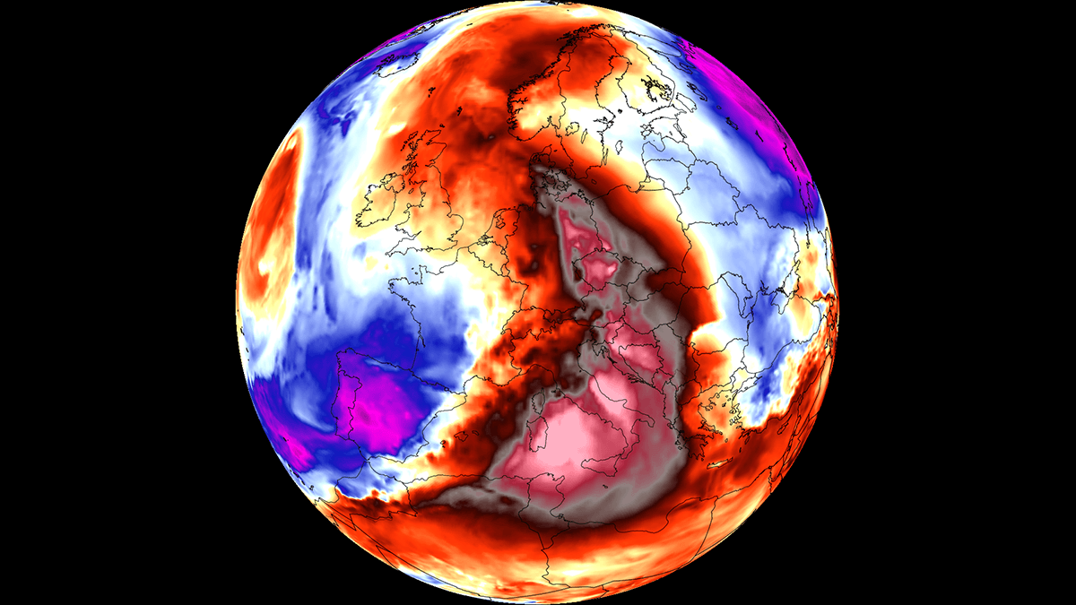
In low-lying river basins and plains across Italy, the Balkans, and parts of Central Europe, peak afternoon temperatures are projected to climb between 38°C and 43°C. Compounding this heat is a lack of atmospheric moisture and the presence of dry continental winds, which are actively accelerating soil moisture loss, further exacerbating the risk of wildfires in already parched regions.
The intensity of this heatwave is particularly concerning due to its duration and the absence of nocturnal relief. Major urban corridors, which act as "heat islands" by absorbing and re-radiating solar energy, are forecast to experience overnight lows that refuse to dip below 22°C to 26°C. These "tropical nights" are a critical factor in heat-related morbidity, as they prevent the human body from undergoing the necessary physiological recovery required to cope with high daytime temperatures.
Chronology of the Heatwave
The progression of this thermal event is dictated by the movement of the upper-level ridge.
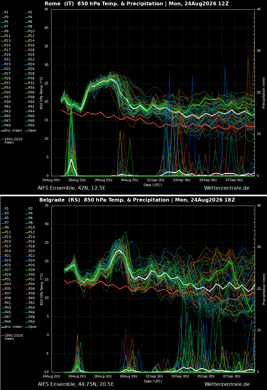
- Mid-Week (Tuesday–Wednesday): The high-pressure system continues its expansion from North Africa into the Mediterranean. Initial temperature spikes are noted across Southern Italy and the southern Balkan Peninsula.
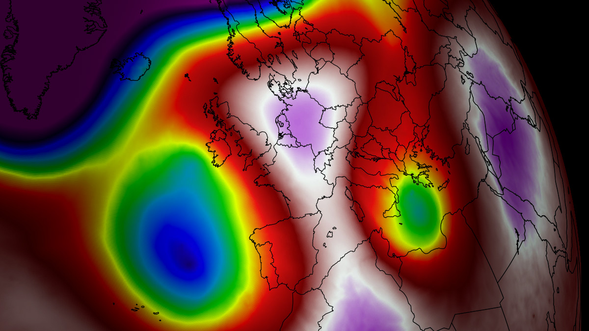
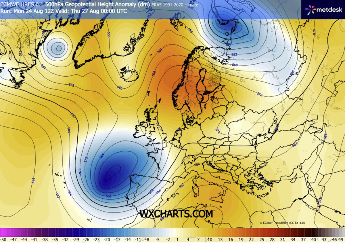
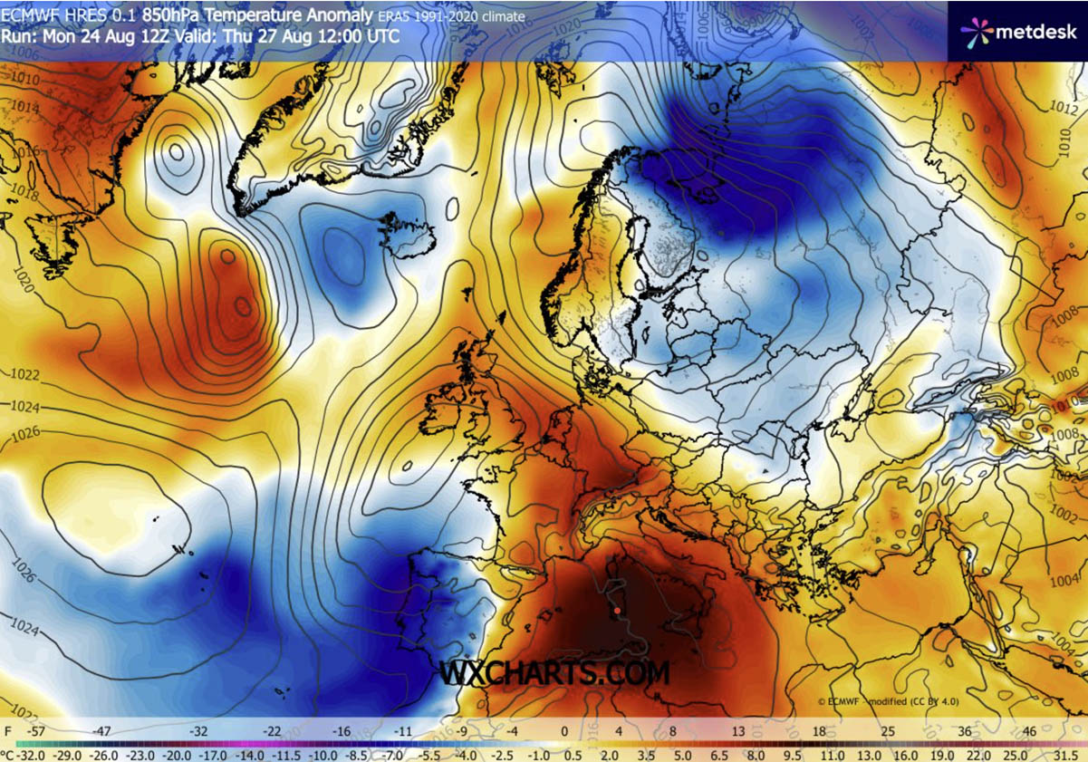
- Thursday (The Peak): The ridge reaches its maximum intensity. The most extreme temperature anomalies—projected to be 12°C to 16°C above the seasonal average—are concentrated across Italy and the central Balkans. Concurrently, a deep, cold-core upper-level wave over the Bay of Biscay creates a high-pressure gradient, pushing hot air northward into Germany and the Alpine regions.
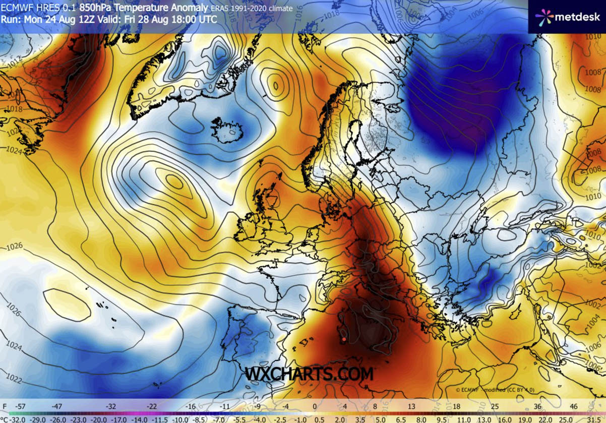
- Friday and Saturday: The heat dome begins an eastward migration. While western regions may see a slight reprieve as Atlantic maritime air moves in, the Balkan Peninsula, western Ukraine, and Poland will experience their most intense heat.
- Sunday and Beyond: The dome is expected to elongate and gradually weaken, though the underlying meteorological trends suggest a lingering warmth that may persist into the first week of September.
Supporting Data: Meteorological Modeling and Anomalies
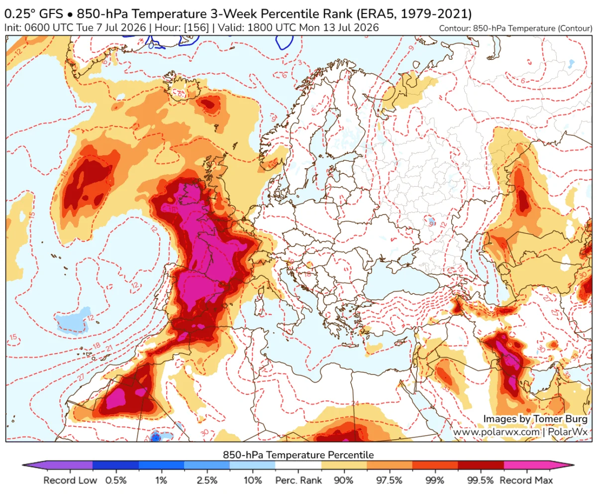
Data from high-resolution forecast models, including those from PivotalWeather and WXcharts, indicate that the 850 hPa temperature anomalies—a standard metric for measuring the heat content of an air mass—are tracking at record levels for this time of year.
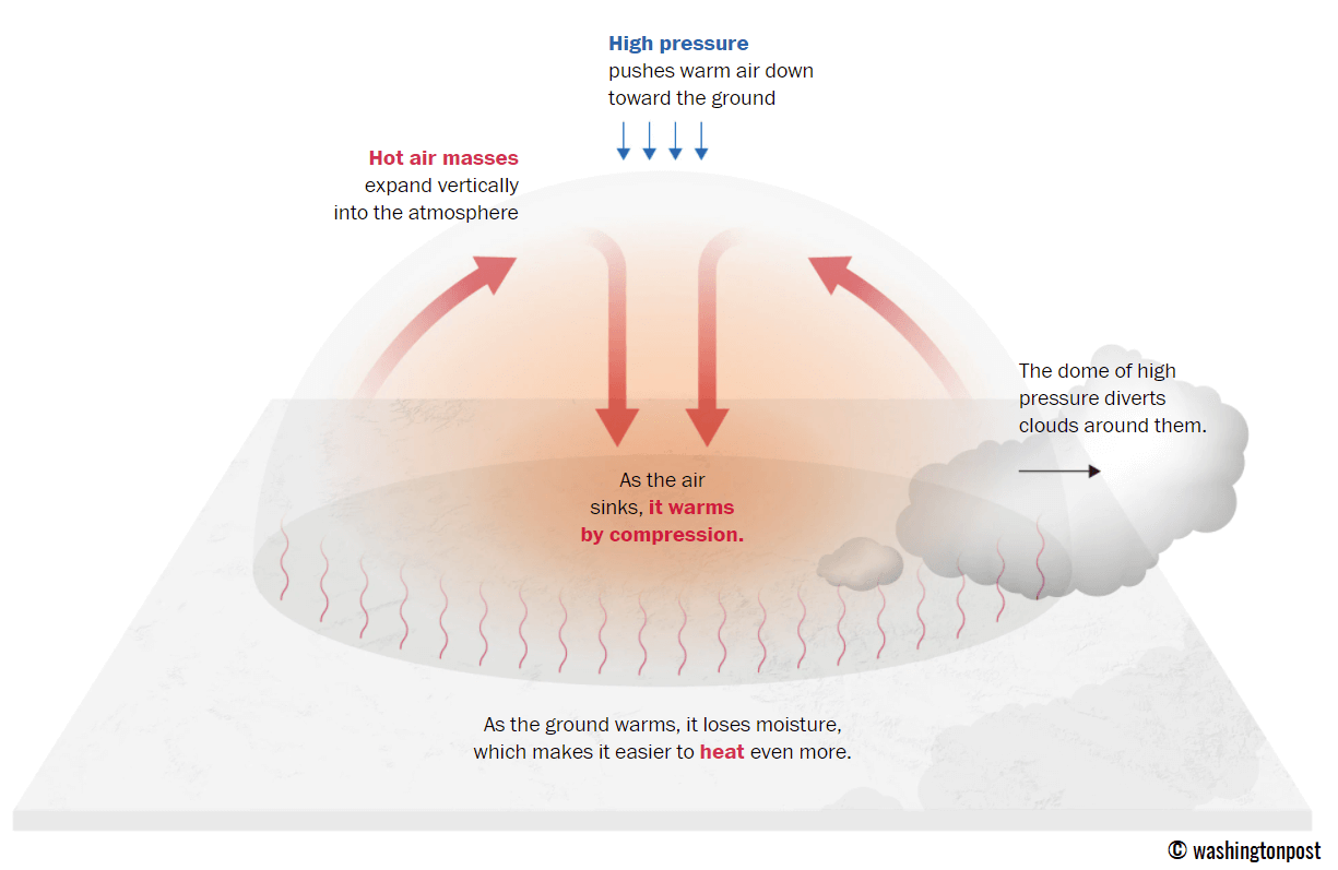
The "heat dome" is not merely a surface phenomenon; it is a deep-layer atmospheric structure. The 2-meter temperature anomalies across the affected regions are significantly higher than the long-term climatological averages for late August. For instance, while typical temperatures for the end of summer in the Pannonian plains might hover in the high 20s or low 30s, the current forecast models suggest sustained readings well into the low 40s.
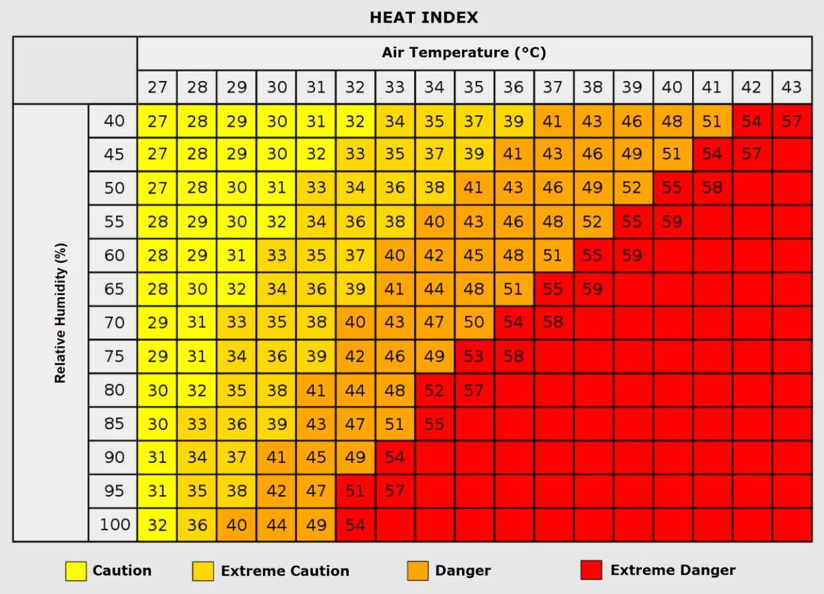
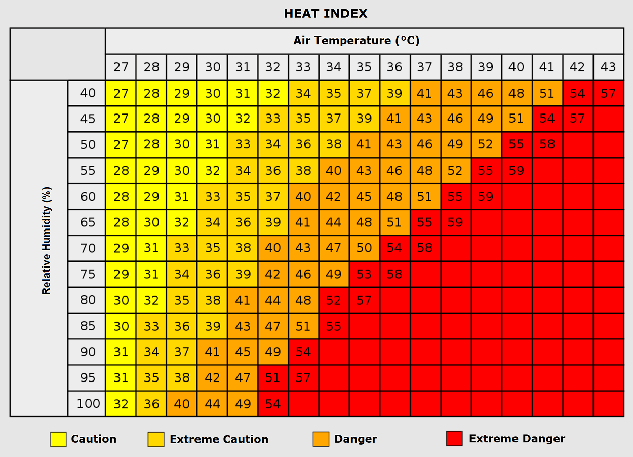
Furthermore, the "Heat Index"—the perceived temperature—is being pushed to dangerous levels by the combination of residual humidity and direct solar radiation. Even in areas where the ambient temperature is "only" 35°C, high humidity levels can create a perceived feel of nearly 50°C, a threshold that significantly increases the likelihood of heatstroke, cardiac distress, and respiratory failure in the general population.
The Intersection of Severe Weather: A Double Threat
While the heat dome dominates the Mediterranean and Central Europe, a separate, highly volatile meteorological event is unfolding over Western Europe. On Thursday, the pressure gradient between the stagnant Mediterranean heat dome and a deep Atlantic trough over France will create a "clash of air masses."
This setup is providing the perfect conditions for a potentially explosive severe thunderstorm outbreak. Forecasters are tracking high to extreme instability, with CAPE (Convective Available Potential Energy) values ranging from 3,000 to 5,000 J/kg. When these values overlap with the intense vertical wind shear generated by the southwesterly jet stream, the result is often the development of organized supercell thunderstorms.
These storms possess the capability to produce:
- Giant Hail: Large enough to cause structural damage to vehicles and crops.
- Tornadoes: Driven by the intense low-level shear.
- Severe Downbursts: Capable of toppling trees and power lines.
- Torrential Rainfall: Leading to flash flooding in areas where the ground is baked hard by the heat.
Implications for Public Health and Energy Infrastructure
The implications of this six-day heat siege are multi-faceted.
Public Health Risks
The most vulnerable populations—the elderly, children, and those with pre-existing cardiovascular or respiratory conditions—are at the highest risk. The cumulative effect of consecutive "tropical nights" is particularly hazardous. During these periods, mortality rates historically spike because the body cannot recover from the daytime thermal load. Outdoor workers, including those in agriculture and construction, face an elevated risk of heat exhaustion and heatstroke. Health authorities are urging residents to avoid prolonged exposure, maintain hydration, and seek climate-controlled environments during peak afternoon hours.
Energy Grid Strain
The extreme temperatures are placing an unprecedented strain on European energy grids. As residents and businesses crank up air conditioning systems to combat the heat, electricity demand has skyrocketed. This surge in demand creates a precarious balance for grid operators, who must manage the load while simultaneously ensuring that power plants—many of which rely on water cooling—are not compromised by the elevated ambient temperatures or low river water levels.
Urban Planning and Social Equity
The event has reignited discussions regarding urban heat islands. Residents living in densely populated, concrete-heavy environments often experience temperatures significantly higher than those in suburban or rural areas. Furthermore, the lack of energy-efficient housing for low-income populations remains a critical issue, as these homes often lack adequate insulation, trapping heat and turning living spaces into ovens.
Conclusion and Future Outlook
As of late August 2026, the European continent is firmly in the grip of an intense, atmospheric blocking event. The combination of sustained, record-breaking heat and the threat of severe, violent thunderstorms on the periphery of the heat dome demonstrates the dynamic and often hazardous nature of our current climate cycle.
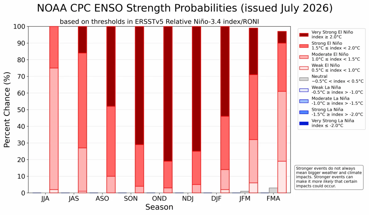
While the heat dome is projected to shift eastward and dissipate by early next week, the pattern remains dynamic. Long-term forecasting models indicate that the "split-flow" patterns, influenced by broader global phenomena like the current Super El Niño, may continue to produce extreme weather variations into the autumn.
As meteorologists continue to monitor the progression of this dome and the impending storm systems, the lesson remains clear: Europe’s summer weather is becoming increasingly volatile, demanding both heightened public awareness and a more robust approach to climate-resilient infrastructure. Residents across the affected regions are encouraged to monitor local meteorological alerts, follow guidance from civil protection agencies, and prioritize safety during this period of extreme thermal stress.