The global climate system is currently undergoing a dramatic transformation as a "Super" El Niño event rapidly develops across the tropical Pacific. Current oceanographic analysis and predictive modeling indicate that this event is not merely a standard oscillation, but a potent climate driver poised to reach, or potentially exceed, record-breaking intensities. As we transition from the late summer of 2026 into the upcoming fall and winter, the atmospheric consequences of this phenomenon are already becoming visible, creating a "bridge" of circulation that is fundamentally altering weather patterns across North America, Canada, and Europe.
Main Facts: The Anatomy of a Super El Niño
An El Niño event is defined by the anomalous warming of sea surface temperatures (SSTs) in the equatorial Pacific. When these temperatures rise more than 2 degrees Celsius above the norm, the event is categorized as "Super" or "Extreme."
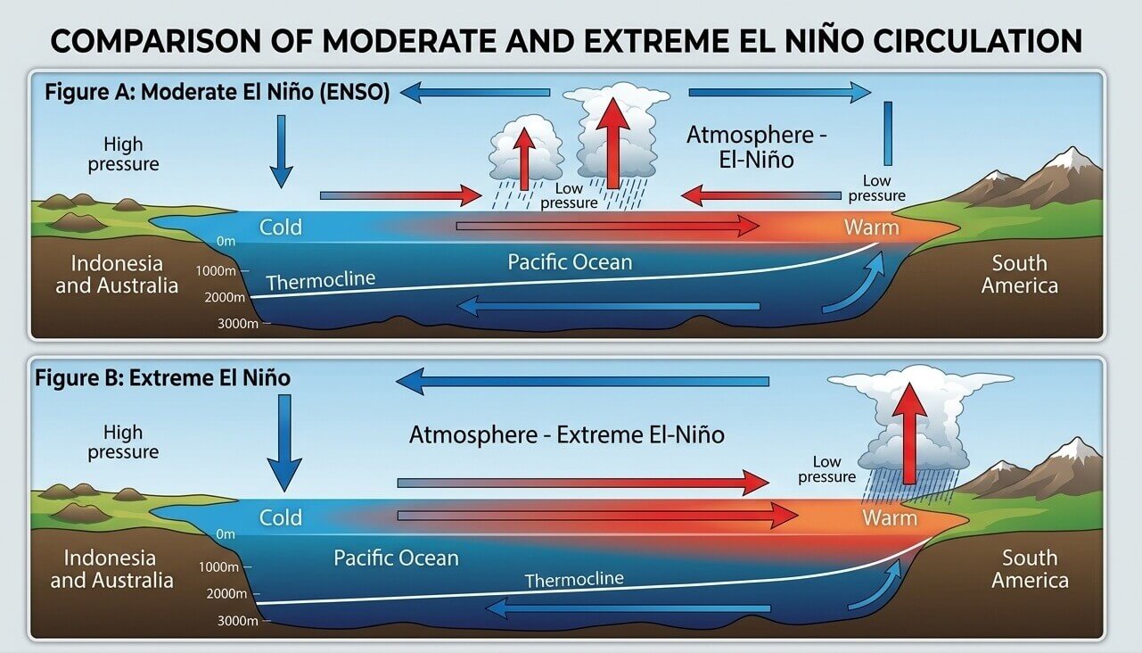
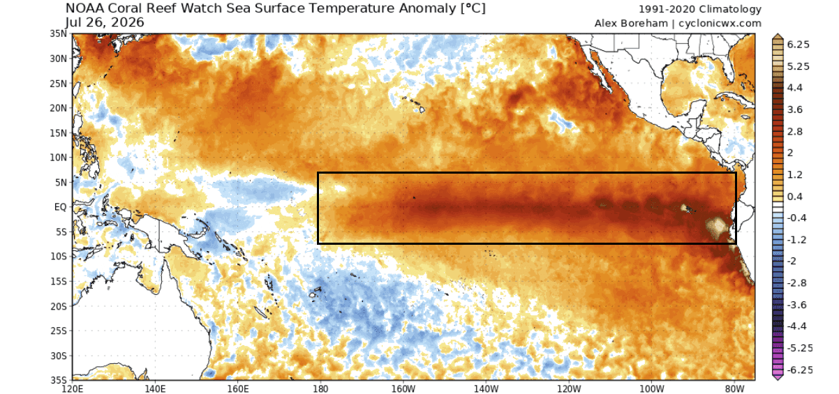
The current 2026 event is distinguished by its aggressive trajectory. Unlike moderate El Niño events that evolve slowly, this system has shown an unprecedented acceleration in its subsurface thermal expansion—a process driven by powerful Kelvin Waves. These waves transport heat from the deep ocean to the surface, effectively creating a feedback loop that sustains the warm anomaly. As of August 2026, peak anomalies in key ENSO (El Niño-Southern Oscillation) regions are already reaching +5 degrees above historical averages, signaling a shift in global pressure systems that is expected to peak in late fall and early winter.
Chronology of Development: From July Signals to Winter Forecasts
The progression of this Super El Niño can be mapped through a series of distinct atmospheric phases:
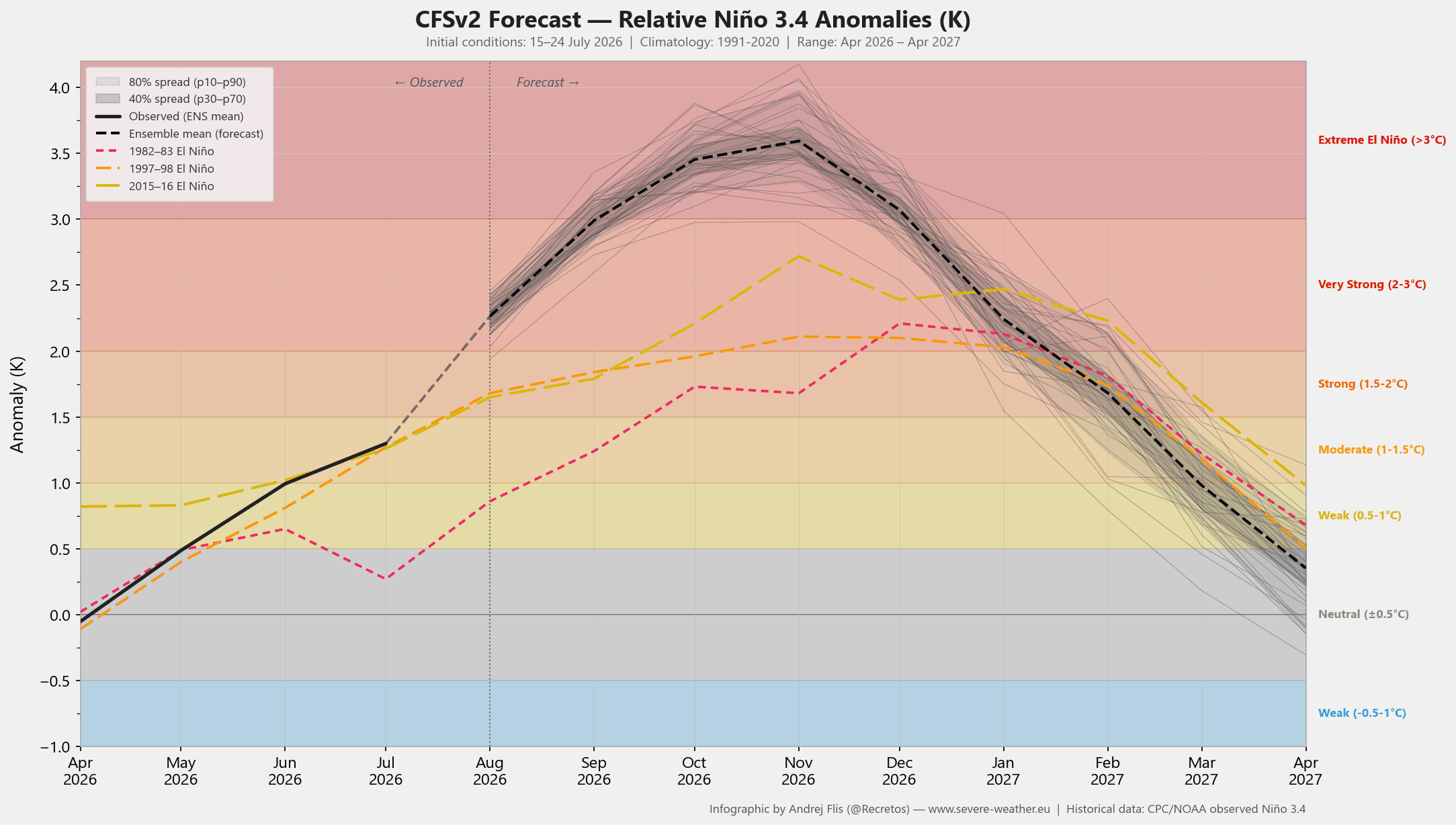
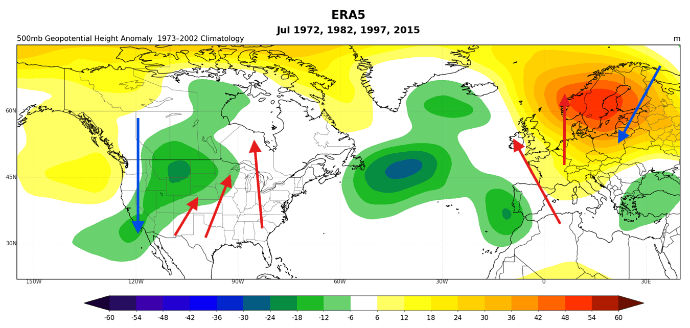
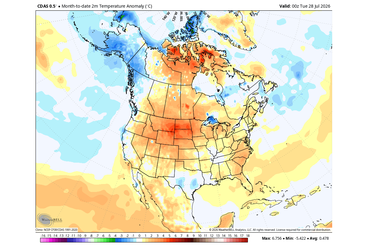
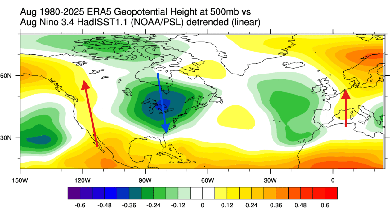
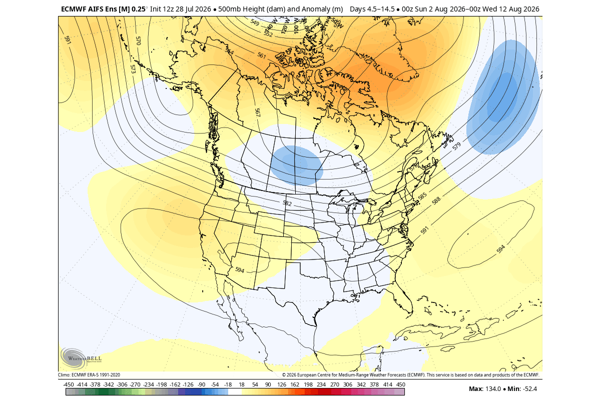
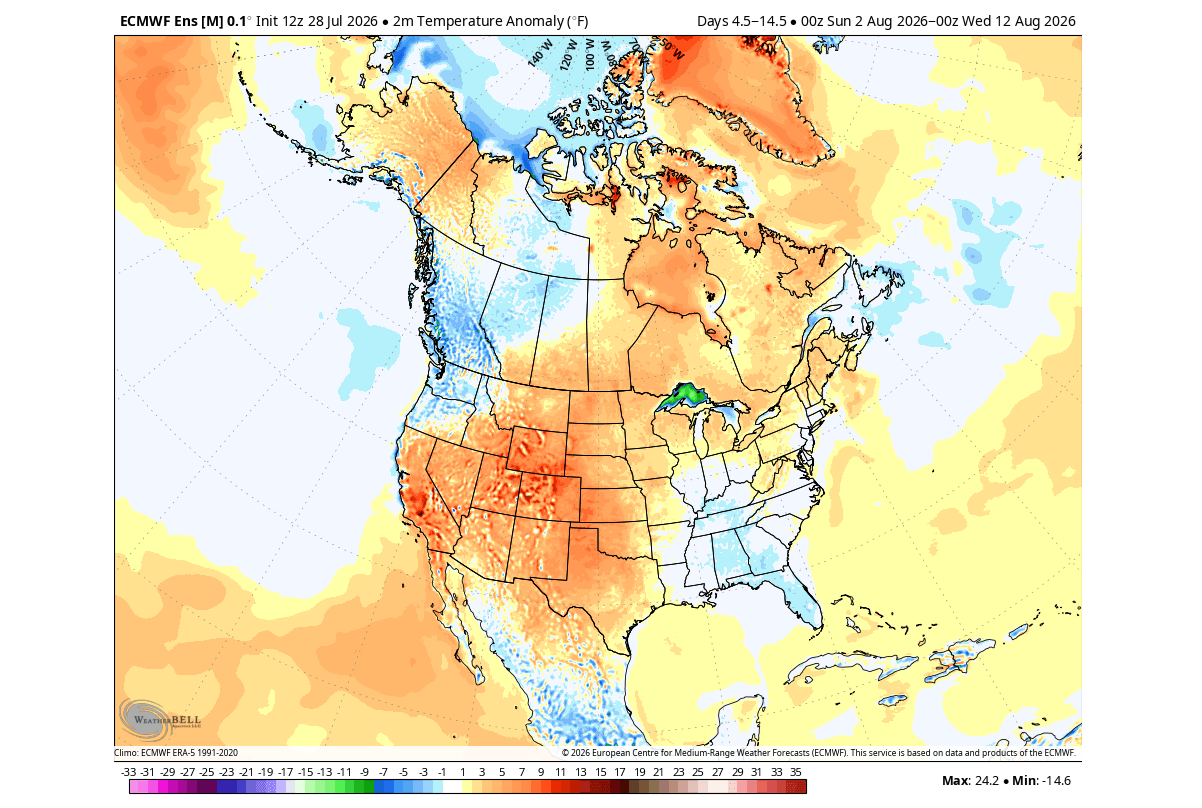
- July 2026 (The Emergence): July served as a proof-of-concept for climate models. Pressure patterns across North America and Canada shifted to mirror historical "Super" events. Specifically, a low-pressure area developed further west, allowing a high-pressure ridge to anchor over the central and eastern U.S. and Canada, fueling significant heat anomalies.
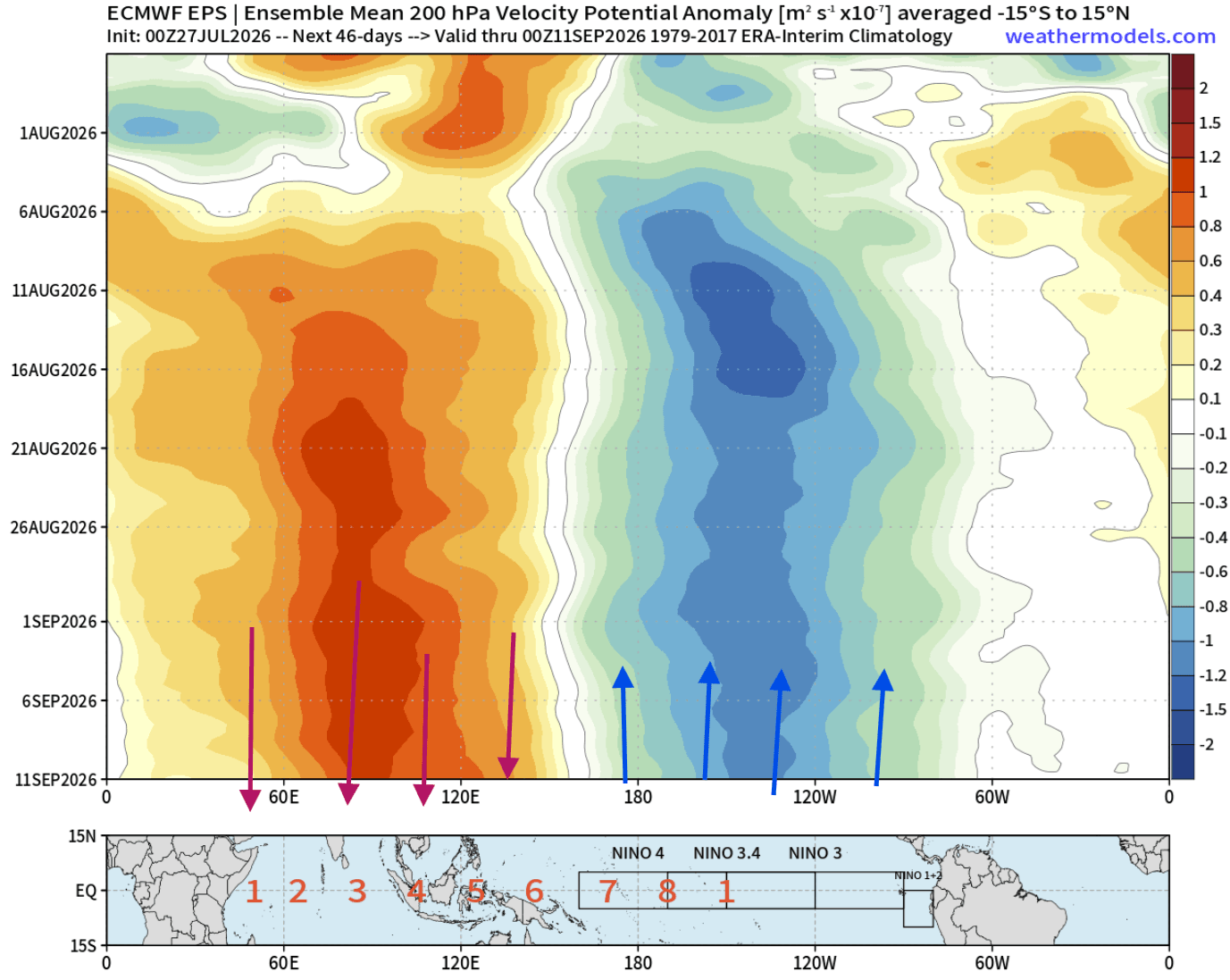
- August 2026 (The Locking Phase): We are currently observing the "Atmospheric Standing Wave." The persistent area of rising air over the central and eastern Pacific is now effectively locked in place. This "forced" atmospheric state is currently dictating weather trends for the remainder of the month, with models indicating a transition toward a trough-dominated pattern in the eastern United States.
- Fall 2026 (The Amplification): As the seasons turn, the subtropical jet stream is expected to intensify. This creates a "conveyor belt" of moisture and low-pressure systems, setting the stage for an active autumn across the southern United States.
- Winter 2026/2027 (The Peak): By the winter months, the split-flow pattern is projected to reach its zenith. A strong high-pressure block over Canada will likely suppress arctic outbreaks in the north, while the southern U.S. experiences more frequent, moisture-heavy storm tracks.
Supporting Data and Meteorological Analysis
The scientific consensus is supported by high-resolution data from organizations like the NCEP (National Centers for Environmental Prediction) and the ECMWF (European Centre for Medium-Range Weather Forecasts).
The Walker Cell Modification
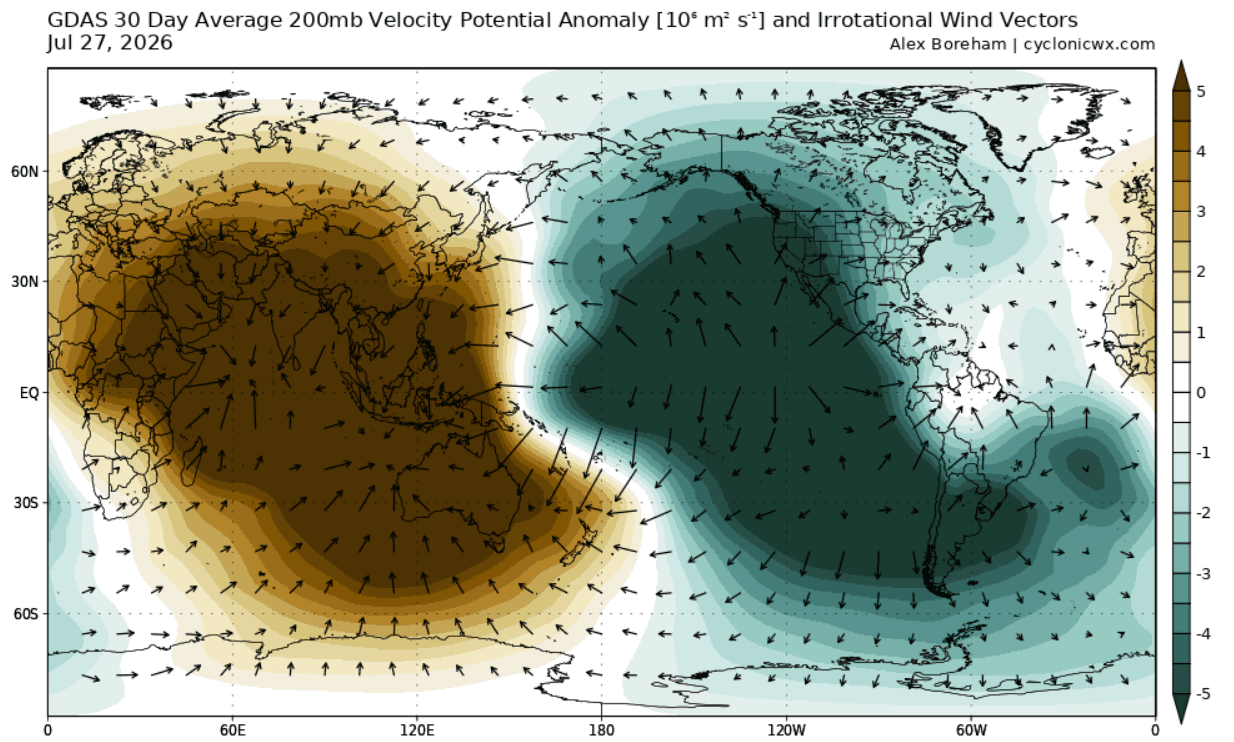
The "Walker Cell"—the atmospheric engine that governs tropical circulation—is currently experiencing a significant disruption. The GDAS (Global Data Assimilation System) analysis shows a dramatic shift: strong rising air motion in the central/eastern Pacific (the "teal" zones) and sinking air in the Indian Ocean. This modification of the Walker Cell is the definitive signature of a Super El Niño, indicating that the atmospheric bridge is fully operational and capable of influencing mid-latitude weather hundreds of miles away.
Velocity Potential and Jet Stream Dynamics
At the 200mb level (approximately 12km in altitude), we can observe the "velocity potential," which maps rising and sinking air. The data confirms that the Pacific is "forcing" the atmosphere. When the jet stream interacts with this forced heat, it bends. In previous events, this bending created the classic "storm track" seen in winter forecasts. Because this 2026 event is an Eastern Pacific (EP) type, the atmospheric response is expected to be more aggressive, leading to more volatile temperature swings than those seen in weaker, Central Pacific-centered events.
Official Responses and Modeling Trends
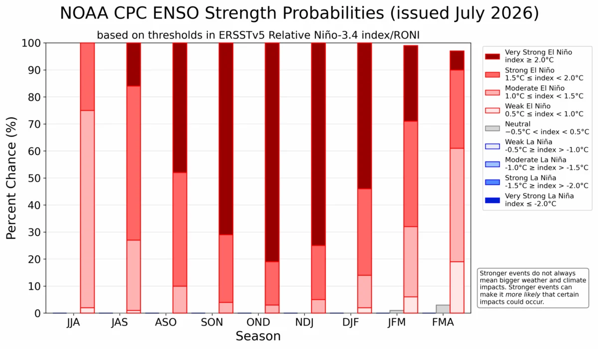
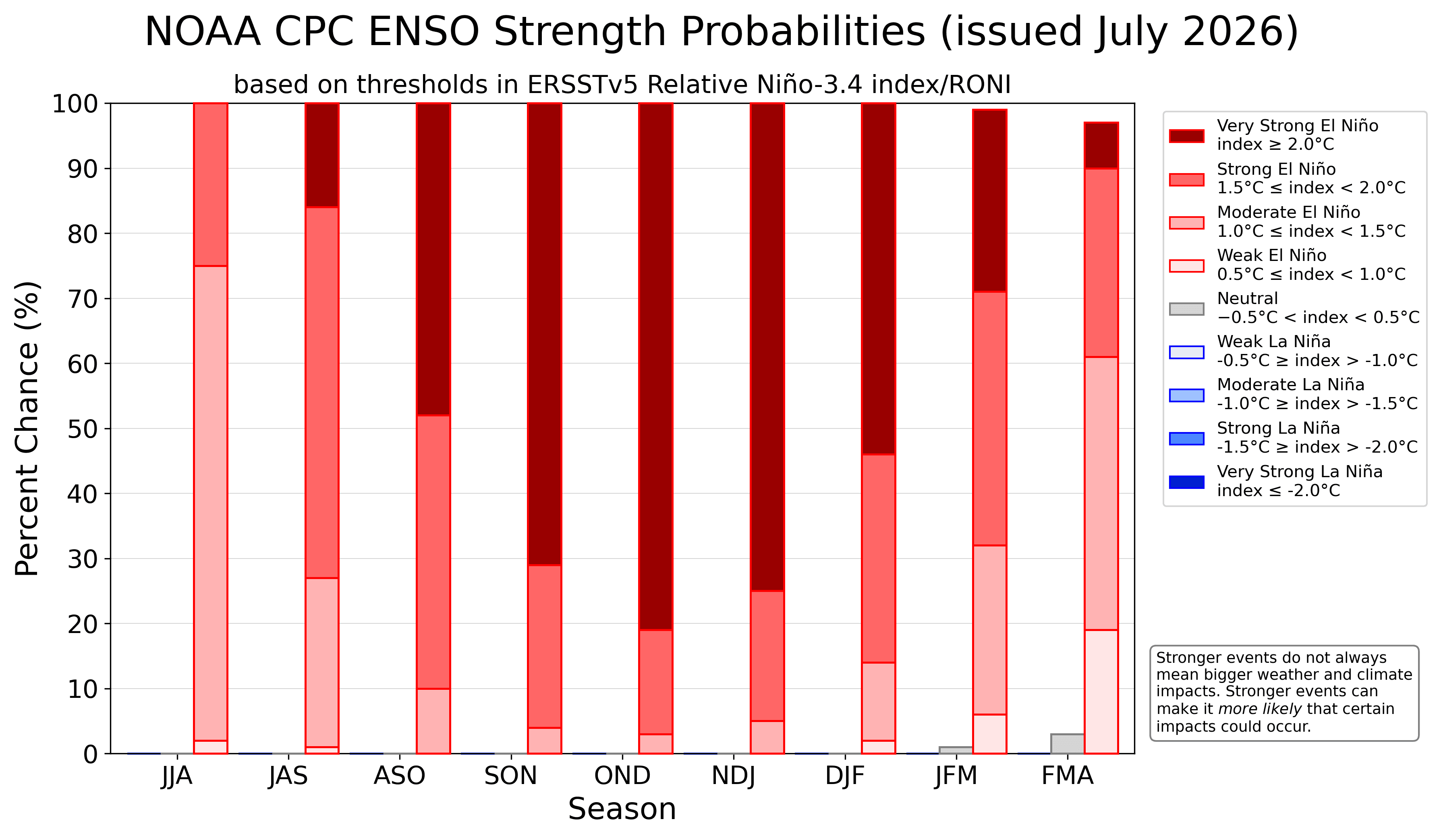
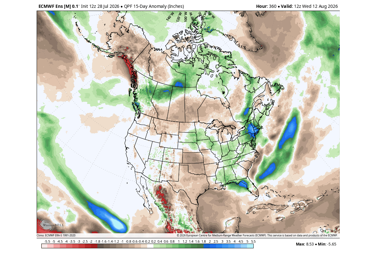
While official agencies like NOAA (National Oceanic and Atmospheric Administration) and the CPC (Climate Prediction Center) maintain rigorous oversight, the current ensemble forecasts are striking. The NOAA CPC strength probability outlook shows a high concentration of model runs landing in the "Extreme" category.
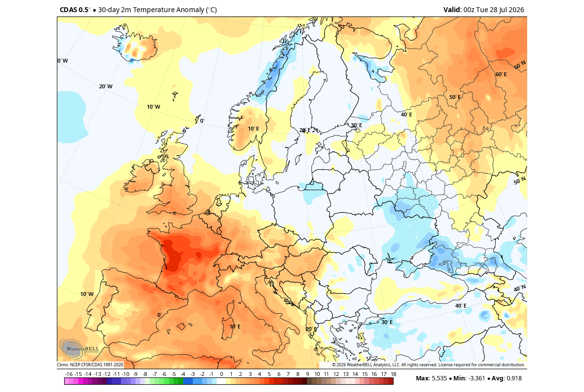
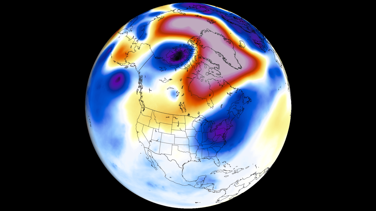
Current operational runs from the ECMWF indicate that the pressure anomalies are not just localized but are creating a teleconnection—a long-distance link—with the North Atlantic. This explains why European weather is also showing signs of disruption, with a persistent low-pressure zone resisting the typical seasonal norms. While Europe generally lags behind in direct El Niño impacts, the sheer scale of this 2026 event means the continent will likely experience unusual shifts in moisture and temperature as the jet stream becomes increasingly meridional (north-south oriented).
Implications for Global Weather
The implications of a Super El Niño are profound, affecting everything from energy consumption to agricultural yields and disaster preparedness.
North America: The Split-Flow Impact
The most critical takeaway for the North American continent is the "split-flow" pattern. By pushing the Pacific jet stream toward the southern U.S., the atmosphere creates a divide.
- The Northern Tier: Expect a milder-than-average winter. The high-pressure ridge over Canada will likely block cold Arctic air from descending as frequently as it does during neutral years.
- The Southern Tier: Residents should prepare for an active, wet, and potentially stormy winter. The moisture-rich jet stream will likely track across the southern U.S., increasing the risk of heavy precipitation and significant winter storm events.
Europe: A Change in the Atlantic Flow
For Europe, the implications are more complex. The current forecasts suggest that the Atlantic low-pressure zone will continue to influence the continent throughout the fall. This will likely result in a warmer-than-average autumn, driven by a southwesterly flow that brings moist air from the Atlantic into the central and western parts of the continent. However, as winter approaches, the potential for "blocking" high-pressure systems remains a wild card that could lead to erratic temperature patterns.
Disaster Readiness and Long-Term Outlook
Because this event is tracking toward record intensity, the standard seasonal averages are no longer reliable benchmarks. Emergency management agencies and municipal planners should account for a high-variability winter. The "atmospheric highway" created by this Super El Niño means that storms could potentially be more intense and frequent than in the recent decade.
Conclusion: A New Climate Standard
The 2026/2027 Super El Niño is a stark reminder of the Pacific Ocean’s role as the heartbeat of the global climate. As the atmospheric standing wave continues to lock into place, we are witnessing the formation of a winter weather pattern that is likely to define the next six months. From the cooling footprints expected in the Southern Plains to the shifting heat domes in Europe, the global response is being orchestrated by the massive thermal release in the equatorial Pacific.
As we move deeper into this event, the scientific community remains vigilant. Fresh data will continue to be processed, and as the atmospheric bridge strengthens, the precision of our seasonal forecasts will improve. Residents in the path of these shifting jet streams are encouraged to monitor updates closely, as the transition from late summer to the peak of winter promises to be one of the most meteorologically active periods in recent history. The 2026/2027 season will not just be a test of our climate models, but a demonstration of the power of the Pacific in shaping the life and environment of the Northern Hemisphere.