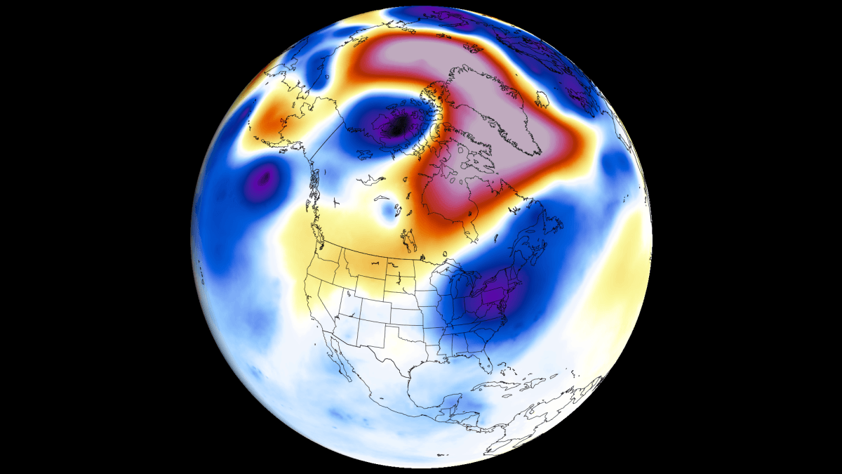
The global climate system is currently bracing for a profound transformation as a powerful Super El Niño event rapidly accelerates across the tropical Pacific. Current oceanographic analysis and advanced forecast modeling indicate that this climate phenomenon is not merely developing but is on a trajectory toward record-breaking intensity. As the event matures, it is actively reshaping global pressure systems, wind patterns, and jet stream dynamics, setting the stage for a dramatic winter season across North America and Europe.
Main Facts: The Anatomy of a Super El Niño
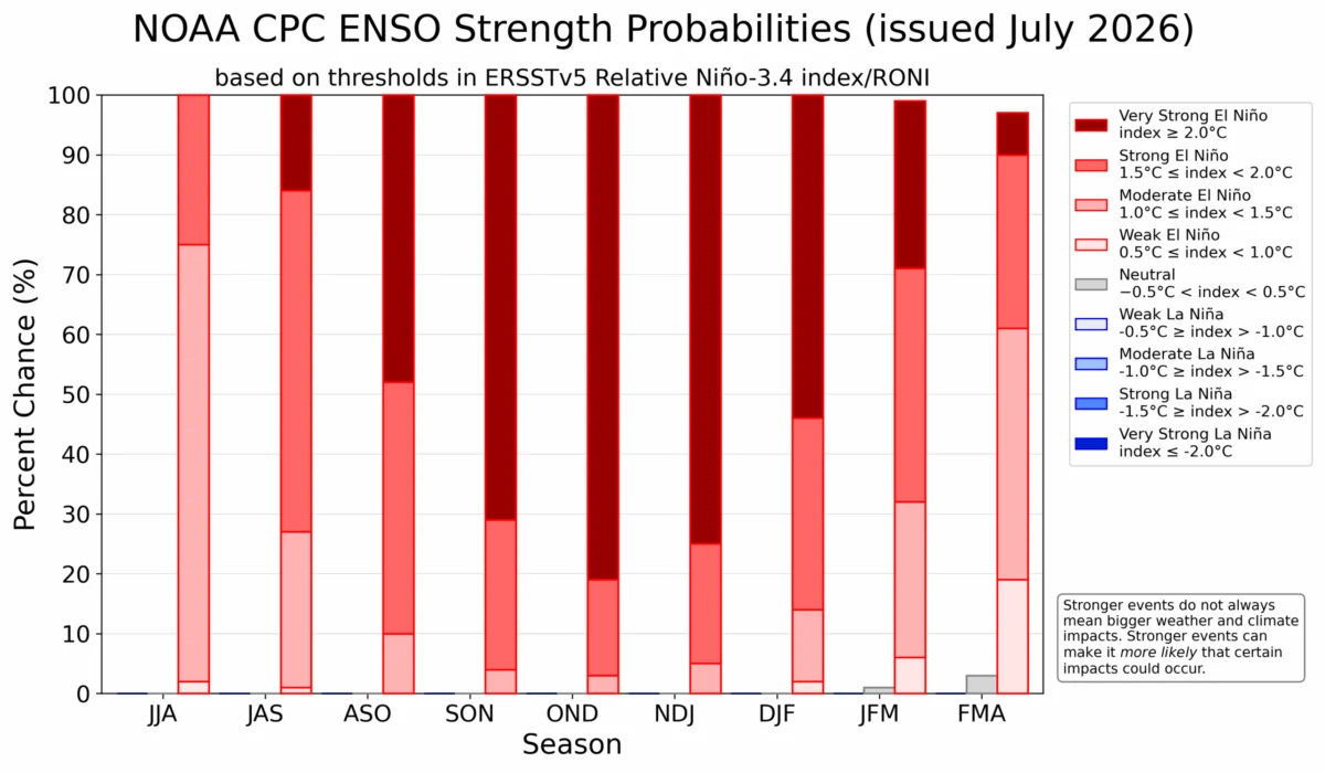
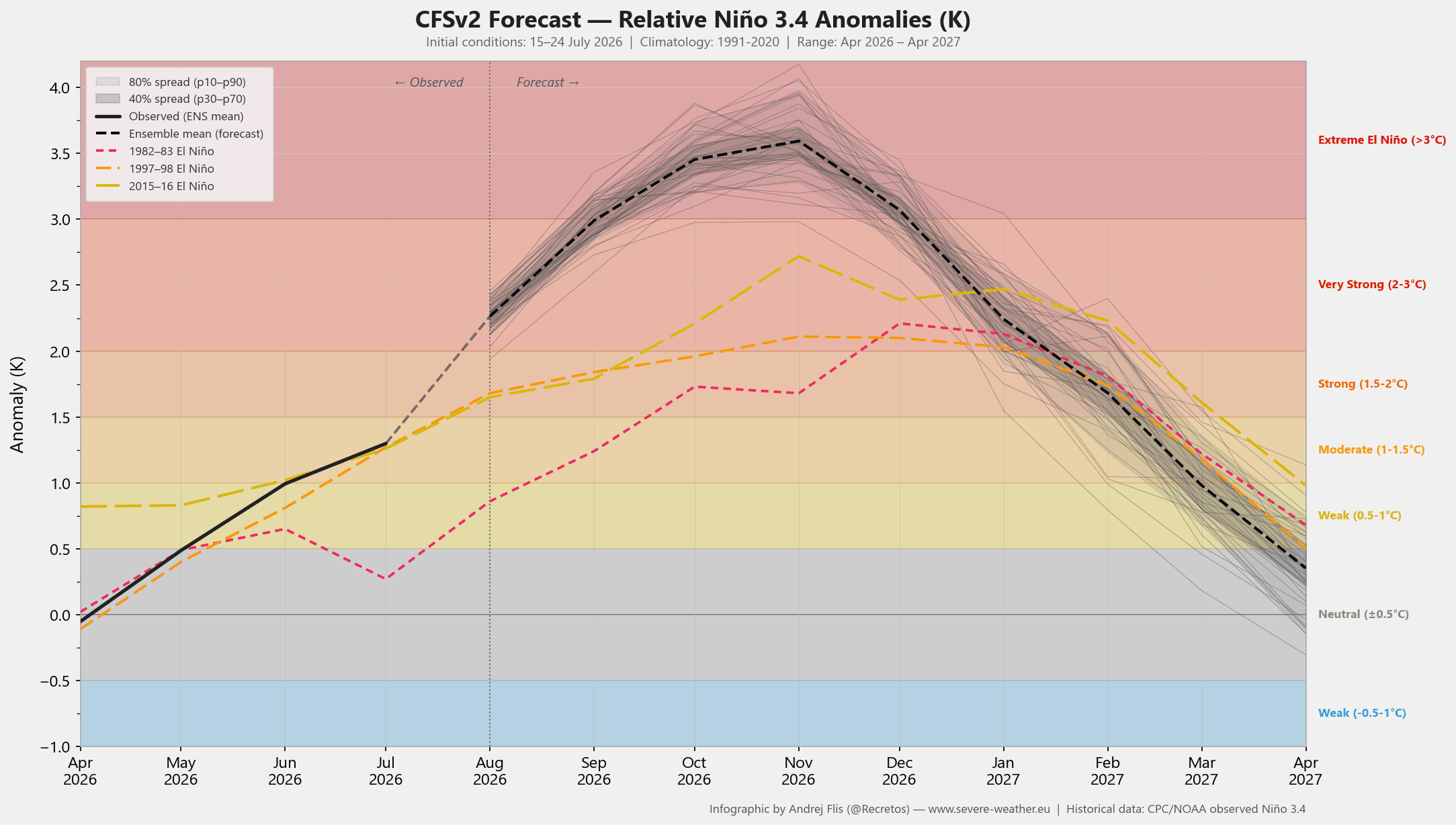
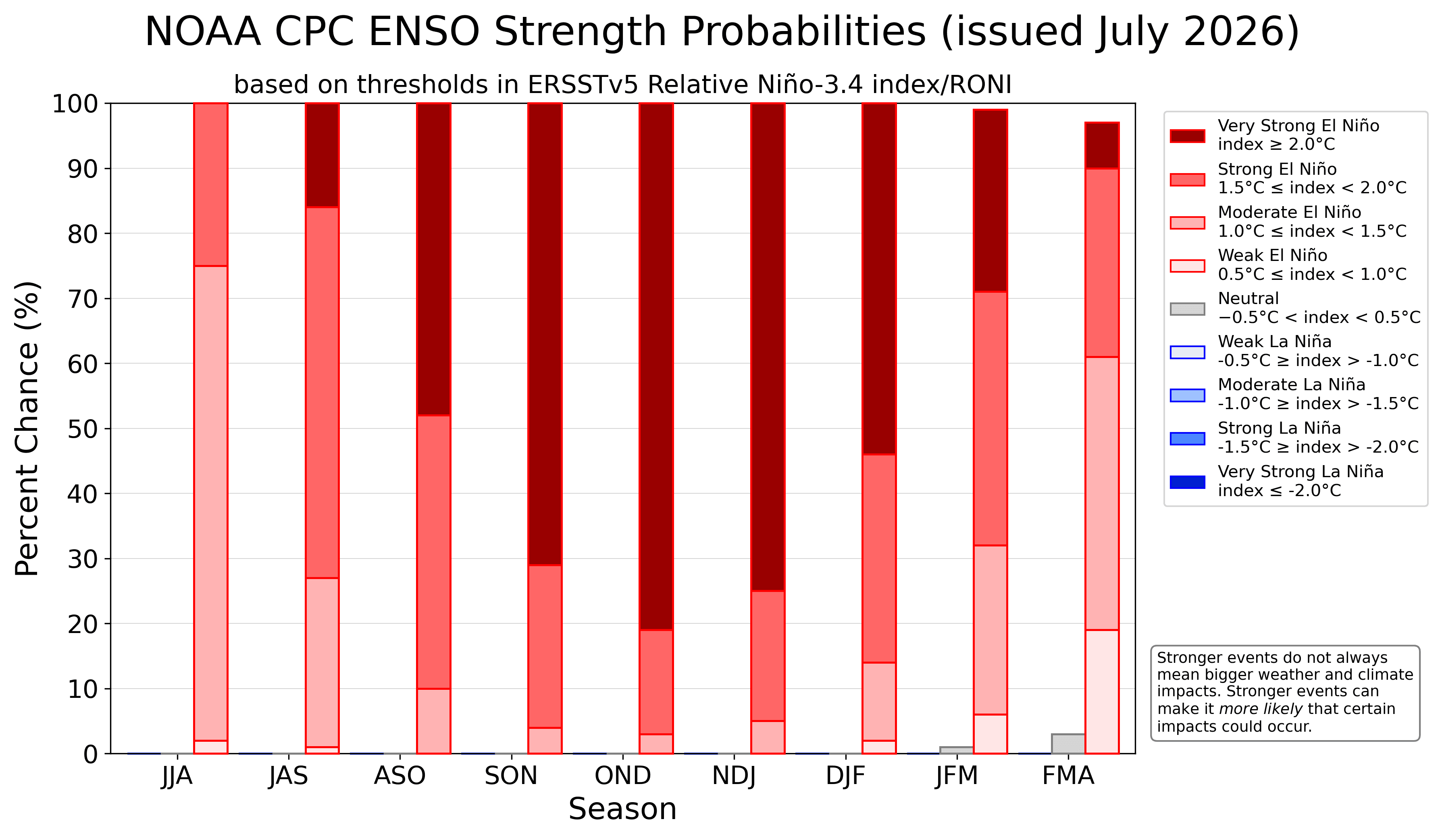
A Super El Niño is characterized by a significant, sustained rise in equatorial Pacific sea-surface temperatures. When these anomalies exceed the +2.0°C threshold, the event enters the "Super" category. The 2026/2027 event is currently showing anomalies that suggest it could surpass even the most intense historical benchmarks.
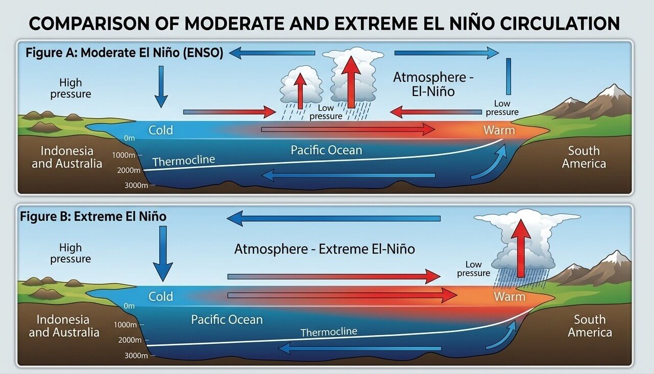
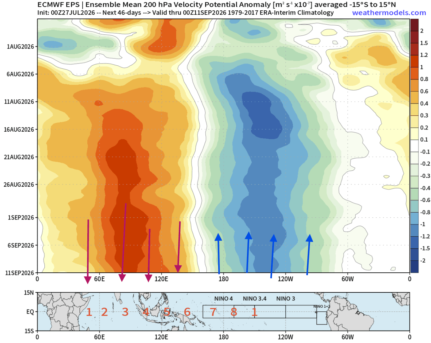
This phenomenon works through the "Atmospheric Bridge." As the ocean warms, it alters the Walker Circulation—a massive loop of atmospheric air movement. During a Super El Niño, a deep drop in surface pressure occurs over the central and eastern tropical Pacific, while a high-pressure zone dominates the western Pacific. This shift acts as a global thermostat, "forcing" the jet stream to reconfigure, which in turn dictates the placement of storms, heat domes, and cold outbreaks across the Northern Hemisphere.
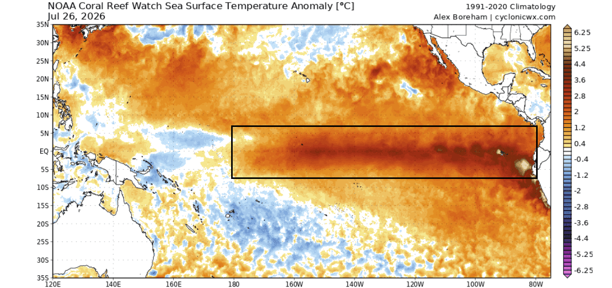
Chronology of Development
The transition into this climate extreme has been remarkably swift.
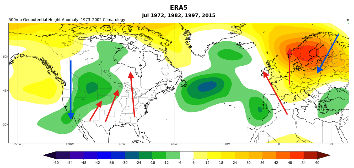
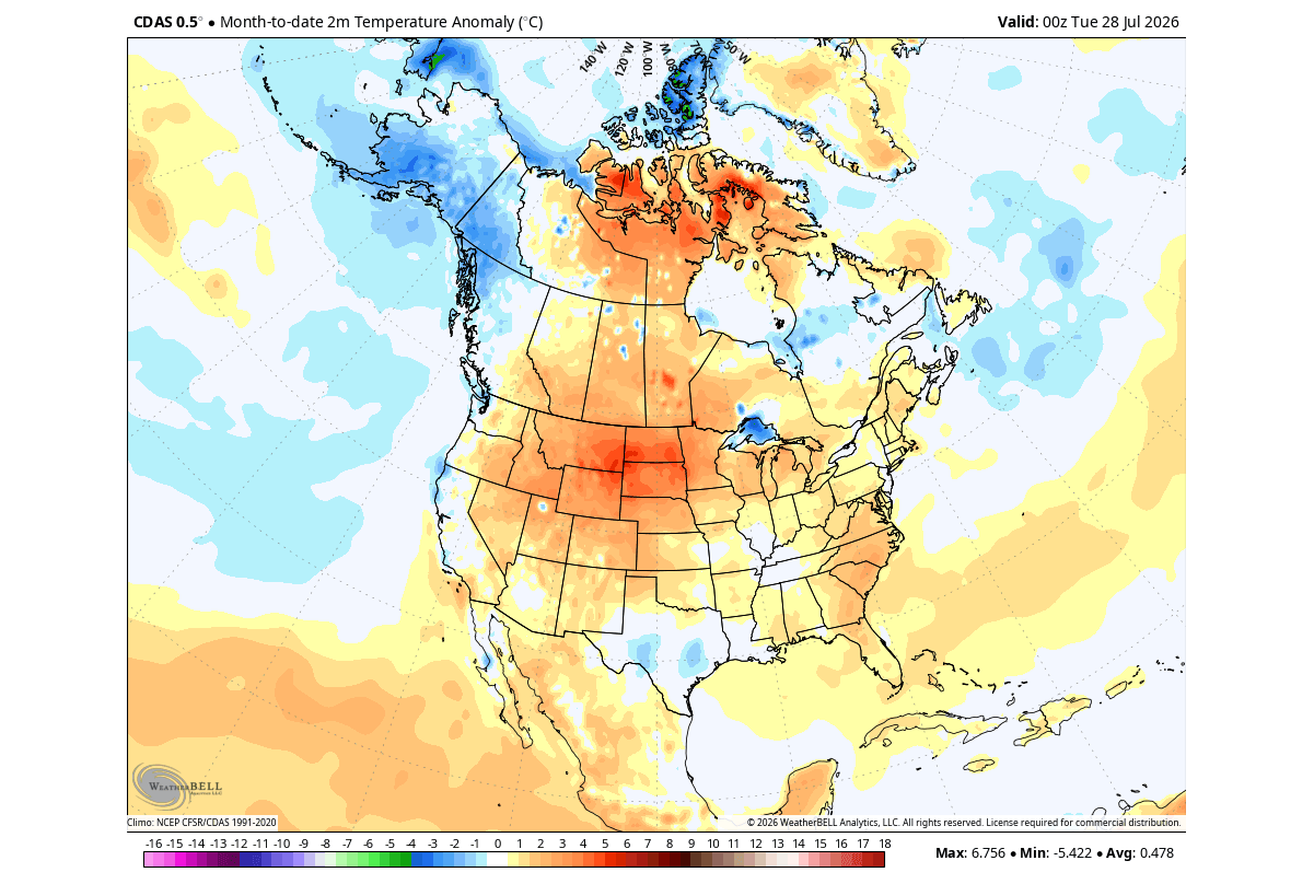
- July 2026: Initial atmospheric signatures began to align with historical Super El Niño patterns. Pressure and temperature anomalies across North America started mirroring the structural responses observed during the extreme events of the past.
- August 2026: The "Pacific Forcing" phase initiated, with subsurface Kelvin Waves—massive pulses of warm water moving from the western to the eastern Pacific—surfacing to cement the temperature anomalies.
- Late Summer to Fall 2026: Meteorologists observe an "atmospheric standing wave." The tropical Pacific is now effectively locking the atmosphere into a specific configuration, ensuring that the jet stream remains consistently influenced by the El Niño signal.
- Winter 2026/2027: The model consensus points to a peak in late fall and early winter, where the amplified split-flow pattern will reach its maximum impact, dictating weather outcomes through the end of the year and into early 2027.
Supporting Data and Technical Analysis
The confidence in this forecast is rooted in multi-model ensemble data. The NCEP CFSv2 model has been consistently trending toward extreme anomalies, with several projections exceeding the +3.0°C mark in the primary ENSO (El Niño-Southern Oscillation) regions.
The Role of Kelvin Waves
Super El Niño events are not spontaneous; they are fueled by subsurface dynamics. Westerly wind bursts in the tropical Pacific trigger Kelvin Waves—underwater thermal pulses that migrate eastward. These waves are the "fuel" that sustains the surface warming. Current data shows these waves are stronger than those seen in previous moderate events, confirming that the current trajectory is one of extreme intensity rather than a standard seasonal fluctuation.
Velocity Potential and Circulation
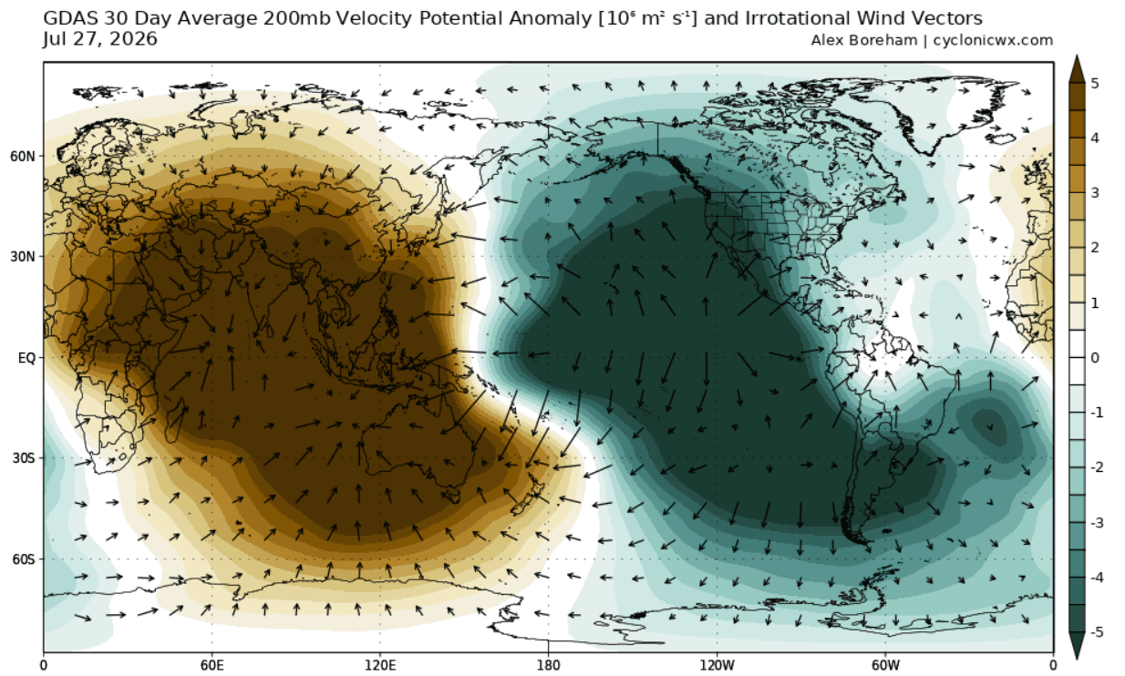
Using the Velocity Potential at the 200mb level (the upper atmosphere), researchers have identified a "highly modified Walker cell." Observations from July and early August show intense rising air motion over the central and eastern Pacific—a clear indicator of the massive energy transfer occurring between the ocean and the atmosphere. This energy is being exported globally, essentially "locking" the jet stream into a pattern that favors specific storm tracks over North America.
Official Responses and Scientific Consensus
Leading meteorological agencies, including the NOAA Climate Prediction Center (CPC), have updated their probability outlooks to reflect a high likelihood of an "Extreme" category event. While individual models vary, the ensemble support is overwhelming: the 2026/2027 event is projected to be among the strongest in recorded history.
Scientific studies comparing "Central Pacific" versus "Eastern Pacific" El Niño events suggest that the location of the heat is critical. Because this event is primarily an Eastern Pacific event with extreme magnitude, the downstream "ripple effect" is expected to be more aggressive, leading to a more volatile jet stream than what is observed in moderate events.
Implications for North America and Europe
North America: The Split-Flow Pattern
As we move into the heart of autumn and winter, the most significant implication for North America is the development of a split-flow jet stream.
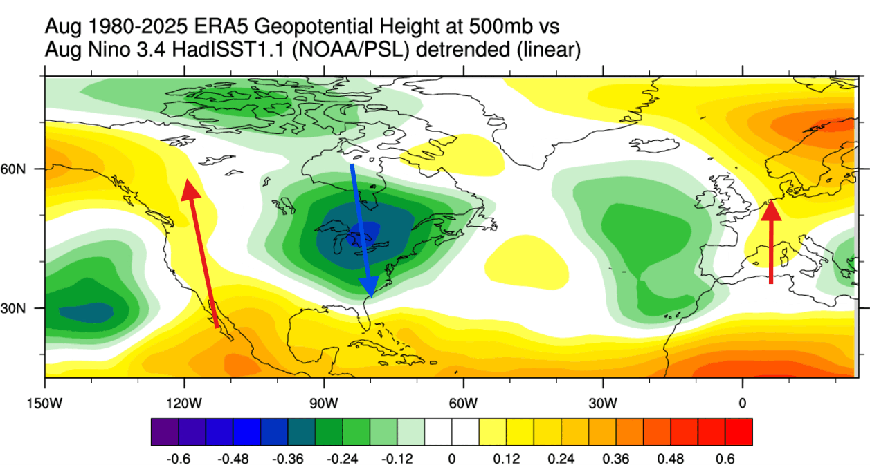
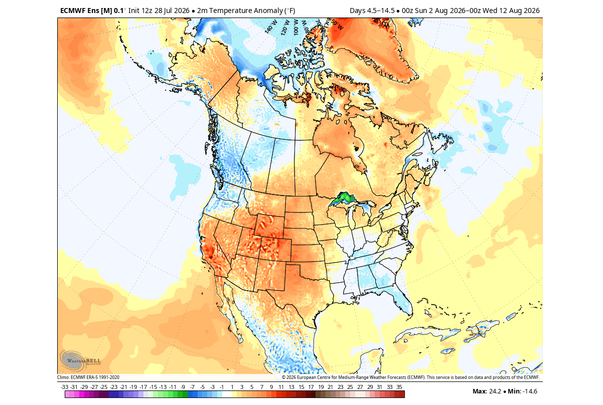
- Northern Tier: A persistent high-pressure ridge is expected to build over Canada and the northern United States. This will act as a buffer, frequently suppressing Arctic air mass outbreaks and leading to milder-than-average winter temperatures in these regions.
- Southern Tier: The Pacific jet stream, energized by the Super El Niño, will be displaced southward. This "atmospheric highway" will bring increased moisture and frequent storm systems to the southern United States, the Central Plains, and the interior Mid-Atlantic.
- Snowfall Impacts: While the north may see reduced seasonal snowfall, the southern and central regions are likely to face an active, potentially severe storm season. The interplay between the southern jet and colder air intrusions will create high-impact precipitation events.
Europe: A Delayed Response
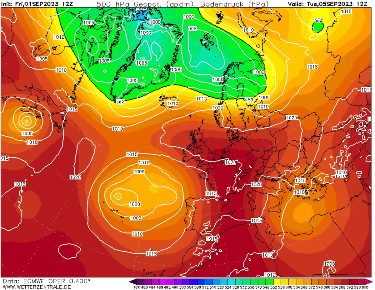
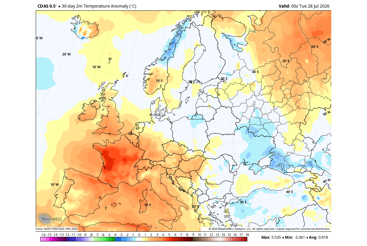
Europe’s weather is influenced by El Niño through a more indirect, lagged pathway. Initial trends for August have shown a resistance to typical El Niño forcing, with high-pressure anomalies behaving unpredictably. However, as the atmospheric bridge strengthens toward winter, the projected pattern suggests an Atlantic-driven, moisture-rich flow. This will likely result in a warmer-than-normal autumn for much of the continent, with increased precipitation potential as the westerly flow from the Atlantic brings moisture into the central and western European regions.
Conclusion: A Winter of Extremes
The 2026/2027 Super El Niño is a definitive driver of global weather. By forcing the atmosphere into a stationary wave pattern, the Pacific Ocean is effectively dictating the climate for the coming months.
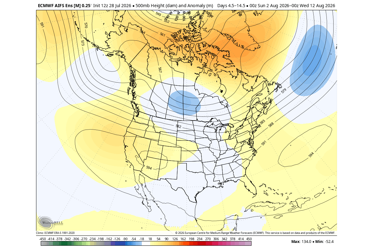
For the United States and Canada, the message is clear: expect a winter defined by regional contrasts. The north will likely enjoy a reprieve from deep freezes, while the south and central regions must prepare for an active, storm-prone winter. In Europe, the influence will manifest as a shift in precipitation patterns and temperature anomalies that will likely intensify as the Pacific signal reaches its peak.
As this event continues to evolve, stakeholders in agriculture, energy, and emergency management should prepare for the heightened volatility associated with record-strength ENSO events. The atmosphere is currently in the process of a major "recalibration," and the effects of this Super El Niño will be felt long after the final winter storms of 2027 dissipate. Continuous monitoring of weekly ensemble forecasts remains essential for navigating the complex atmospheric shifts ahead.