An unforgiving atmospheric furnace is descending upon the Iberian Peninsula this week, as a formidable "heat dome" anchors itself over Southwestern Europe. Meteorologists are tracking a dangerous, potentially record-shattering thermal event that is expected to push temperatures into the staggering 45°C to 47°C range. As a massive ridge of high pressure traps a superheated air mass directly over Spain and Portugal, communities are bracing for what could be one of the most intense and hazardous early-summer thermal anomalies in recent history.
The Anatomy of the Crisis: A Sahara-Fed Heat Dome
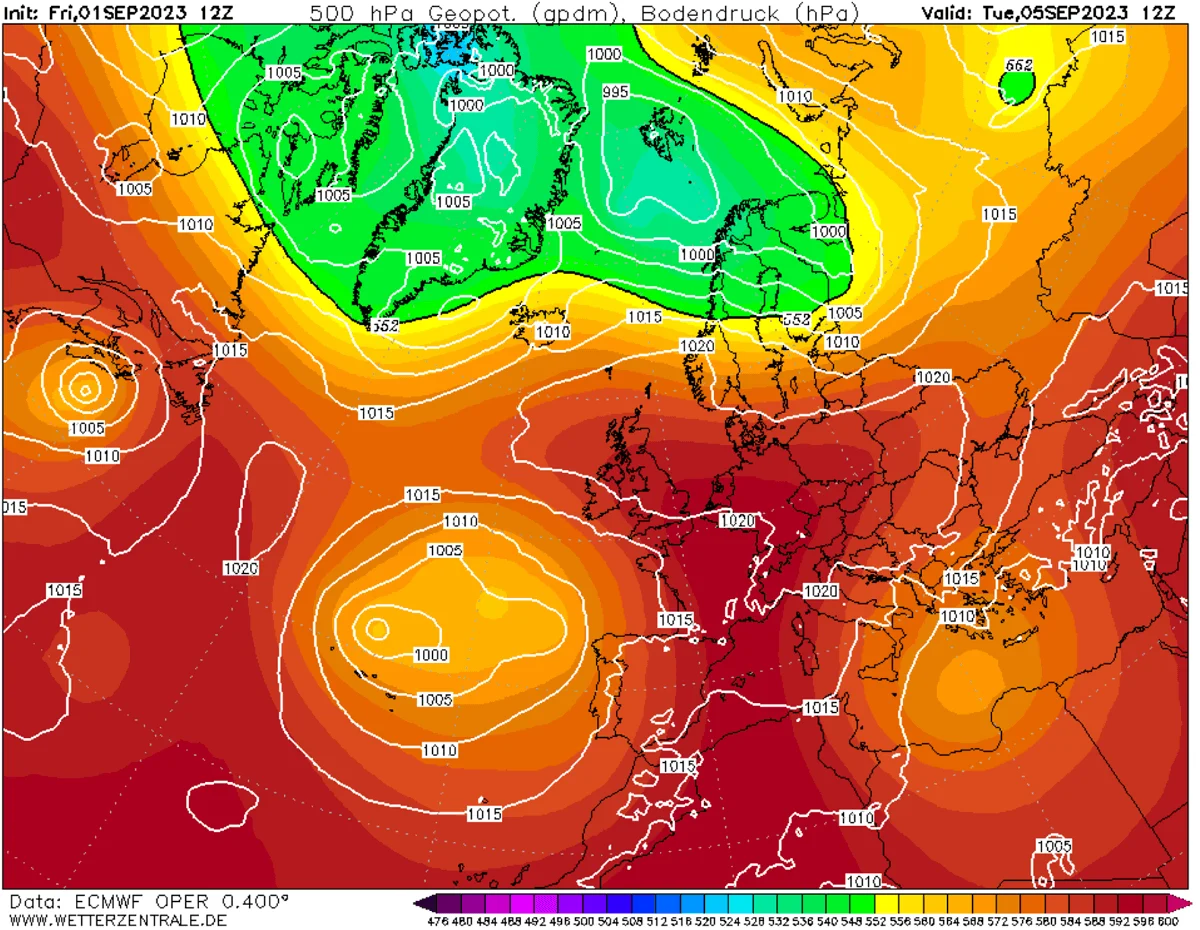
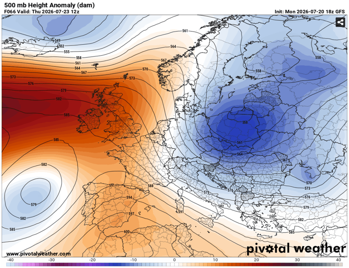
The current weather phenomenon is far more than a typical seasonal warm-up. It represents a massive surge of superheated air, drawn directly from the heart of the Sahara Desert. The primary driver is a robust atmospheric blocking pattern featuring an expansive upper-level ridge—a classic heat dome. This structure is further reinforced by a cut-off low-pressure system positioned to the west, creating a "synoptic engine" that pumps hot, arid air across the Iberian landscape.

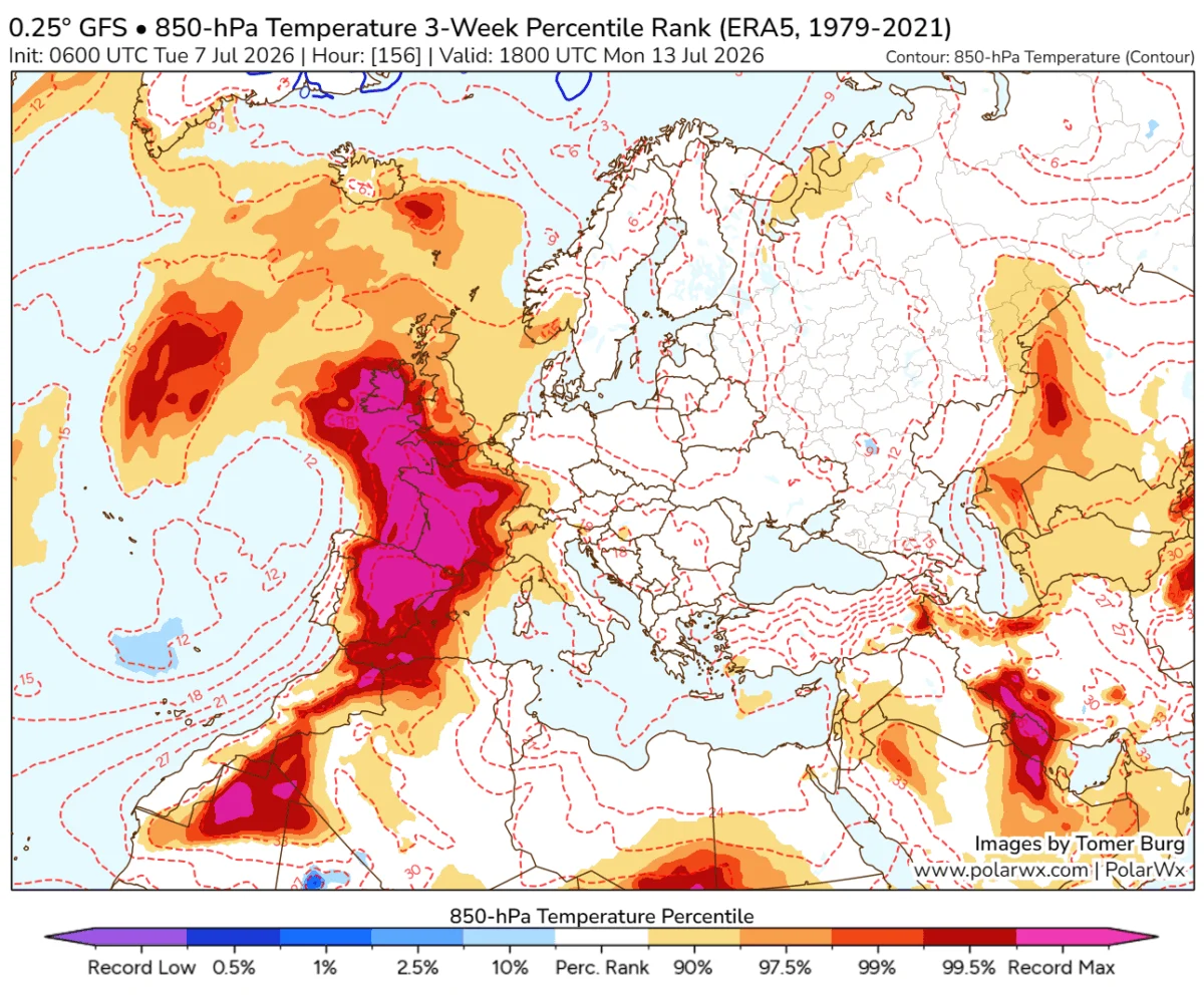
At the 850 mbar level, temperatures are expected to reach an astonishing 30°C to 31°C. To put this in perspective, this is 10°C to 15°C above the seasonal norm for late July. When this superheated air mass encounters the complex topography of the peninsula, the results are amplified by localized terrain dynamics. As winds sweep across the interior plateaus and mountain ranges, they undergo "foehn" effects—a process of rapid descent and compression. This adiabatic warming strips the air of any remaining moisture and supercharges the heat, particularly in the Guadalquivir and Ebro valleys, as well as the provinces of Murcia and Castilla-La Mancha.
Chronology of the Heatwave
The progression of this event is expected to be swift and punishing, with little respite for residents, particularly at night.
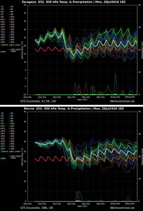
- Mid-Week Escalation (Wednesday): Global forecast models, including the GFS and the regional ARPEGE, indicate a rapid intensification. By Wednesday, central Spain and the southern lowlands will see temperatures climbing into the 42°C to 44°C range. The remainder of the peninsula will experience a "milder" but still dangerous 34°C to 40°C.
- The Peak (Thursday): Thursday is projected to be the most critical day. The heat dome reaches maximum intensity, with central Spain entering the low 40s, while the southern and eastern lowlands—specifically Murcia, Alicante, and Valencia—could see peaks hitting 44°C to 46°C. Some localized valleys are at high risk of touching the 47°C mark. The Ebro Valley is also expected to reach critical levels of 43°C to 44°C.
- The Final Stretch (Friday): While western regions will begin to see a shift as more humid air from the Atlantic filters in, providing a marginal degree of relief, the eastern and southern regions will remain trapped under the dome. Friday will likely mark the last day of this specific heatwave, with temperatures once again challenging the 45°C threshold before a gradual cooling trend begins.
Supporting Data and Historical Context
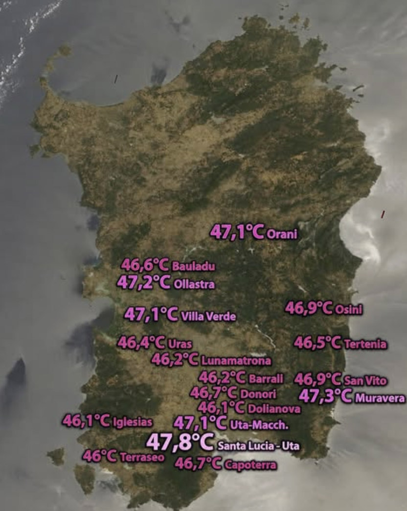
The threat posed by this heatwave is underscored by the region’s volatile climate history. Spain’s official record holder stands at 47.6°C, recorded at La Rambla in the Córdoba countryside. Nearby stations, such as Montoro (47.4°C) and Córdoba Airport (46.9°C), highlight the extreme sensitivity of these basins to Saharan air incursions.
To understand the severity of this event, one must look at the European record: 48.8°C, recorded in Syracuse, Sicily, in August 2021. With the current forecast calling for 47°C in parts of Murcia and the Ebro Valley, the Iberian Peninsula is dangerously close to challenging not just its own regional records, but the continent-wide ceiling.
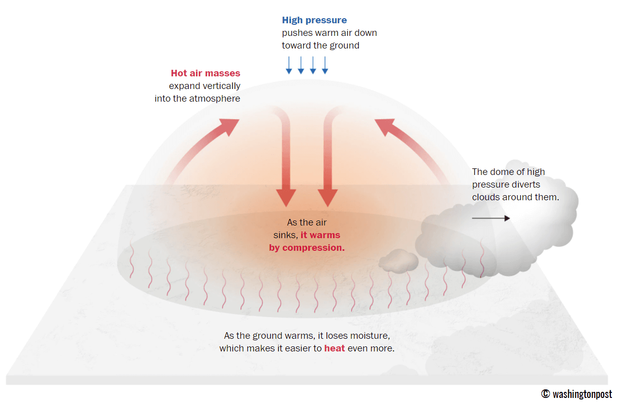
The Castilla-La Mancha region provides further sobering data from the historic 2021 heatwave, where stations like Talavera de la Reina reached 45.5°C and Almadén hit 45.4°C. These figures serve as a benchmark for the extreme conditions that infrastructure and emergency services are currently preparing to face.
Understanding the "Heat Dome" Mechanism
The "heat dome" is a meteorological phenomenon where a persistent, broad area of high pressure sits over a region, acting like a lid on a pot. By trapping warm air at all levels of the atmosphere and preventing the rise of cooler air or the development of convective rain clouds, it creates a feedback loop of heating.
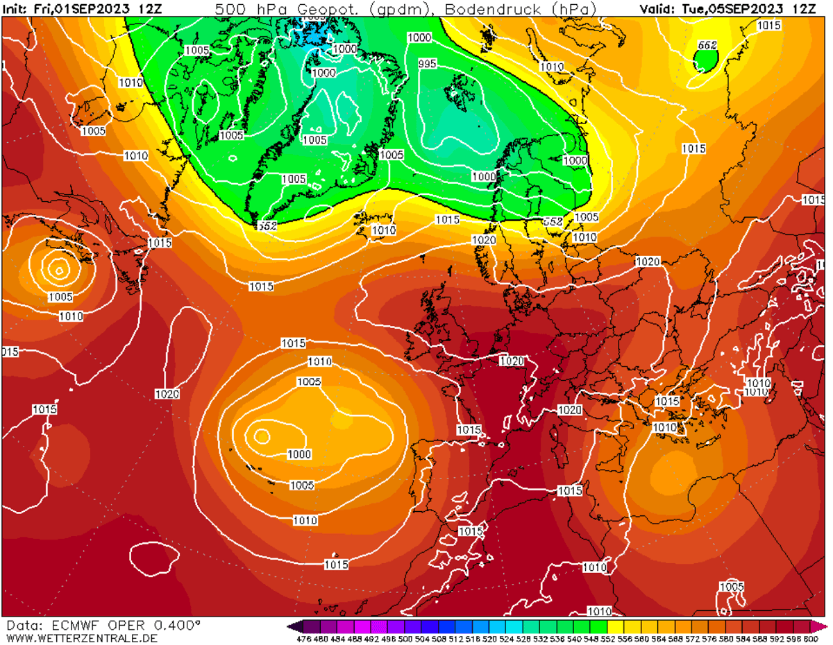
As the air sinks toward the surface, it compresses and warms further. Because this dome is currently locked in place by a high-pressure ridge, it is exceptionally stable, meaning the heat will not dissipate overnight. Residents can expect "tropical nights," where temperatures refuse to dip below 25°C, effectively denying the human body the physiological recovery time it needs after a day of exposure to extreme heat.
Official Responses and Public Safety
Public health authorities in Spain and Portugal have issued high-level alerts, urging citizens to avoid outdoor activities during the peak hours of 12:00 PM to 6:00 PM. The implications for public health are severe:
- Vulnerable Populations: The elderly, children, and those with pre-existing cardiovascular or respiratory conditions are at the highest risk for heat exhaustion and heat stroke.
- Labor and Infrastructure: Construction workers, agricultural laborers, and transport staff face significant occupational hazards. Governments are being urged to mandate flexible working hours to avoid the hottest parts of the day.
- Urban Heat Islands: Cities, with their abundance of concrete, asphalt, and heat-trapping building materials, will act as radiators, keeping urban centers significantly hotter than rural surroundings, especially at night.
- Energy Demands: The strain on the power grid is expected to reach a breaking point as residential and industrial air conditioning demand spikes simultaneously.
Broader Implications: The Fire Risk
Perhaps the most immediate and dangerous consequence of this heatwave is the explosive wildfire risk. The combination of triple-digit temperatures, extremely low relative humidity, and persistent, gusty winds creates an "atmospheric tinderbox."
Forestry services across the Iberian Peninsula are on high alert. The dryness of the vegetation, compounded by the ongoing drought conditions that have plagued the Mediterranean for months, means that any ignition—whether caused by human activity or lightning—could spiral into a large-scale, uncontrollable conflagration. Firefighting crews are currently prepositioning resources to address potential fire fronts in high-risk zones, such as the wooded interiors of Castilla-La Mancha and the dry, scrub-covered hills of the southeast.
Conclusion
The upcoming days represent a stern test for the Iberian Peninsula. As the heat dome parks itself over the region, the focus shifts from normal summer activity to survival and mitigation. With the mercury poised to climb toward historic peaks, the resilience of the region’s infrastructure, its emergency services, and its most vulnerable populations will be pushed to the limit.
Meteorologists and civil protection agencies continue to monitor the synoptic evolution of the ridge. While this specific heatwave is expected to wane by the weekend, the broader trend of record-breaking heat events in Southwestern Europe remains a subject of intense scientific scrutiny. For now, the message to residents is clear: prioritize hydration, seek shade, and stay informed through official local channels as the peninsula enters the heart of this atmospheric furnace.