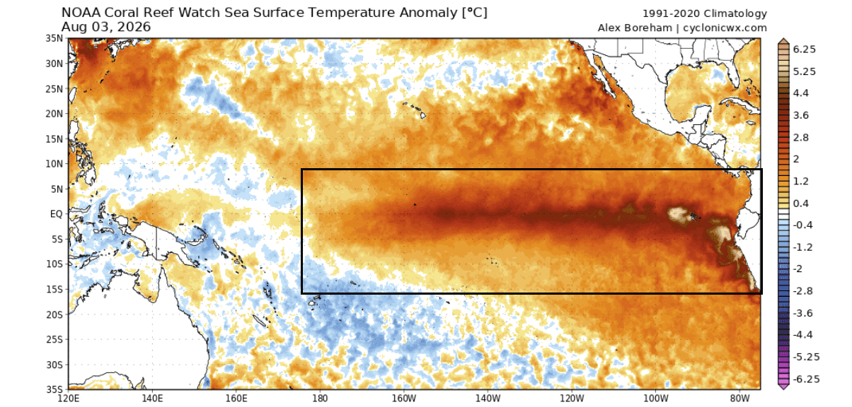
As we move into the latter half of 2026, the global climate system is bracing for a meteorological phenomenon of significant magnitude. A rare, high-intensity "Super El Niño" is currently surging across the tropical Pacific, while simultaneously, a positive Indian Ocean Dipole (IOD) is taking root in the Indian Ocean. Together, these two powerful oceanic anomalies are forming a synchronized "dual-ocean" atmospheric engine that meteorologists expect to dictate the weather patterns of the Northern Hemisphere for the upcoming 2026/2027 winter season.

Main Facts: A Synchronized Global Engine
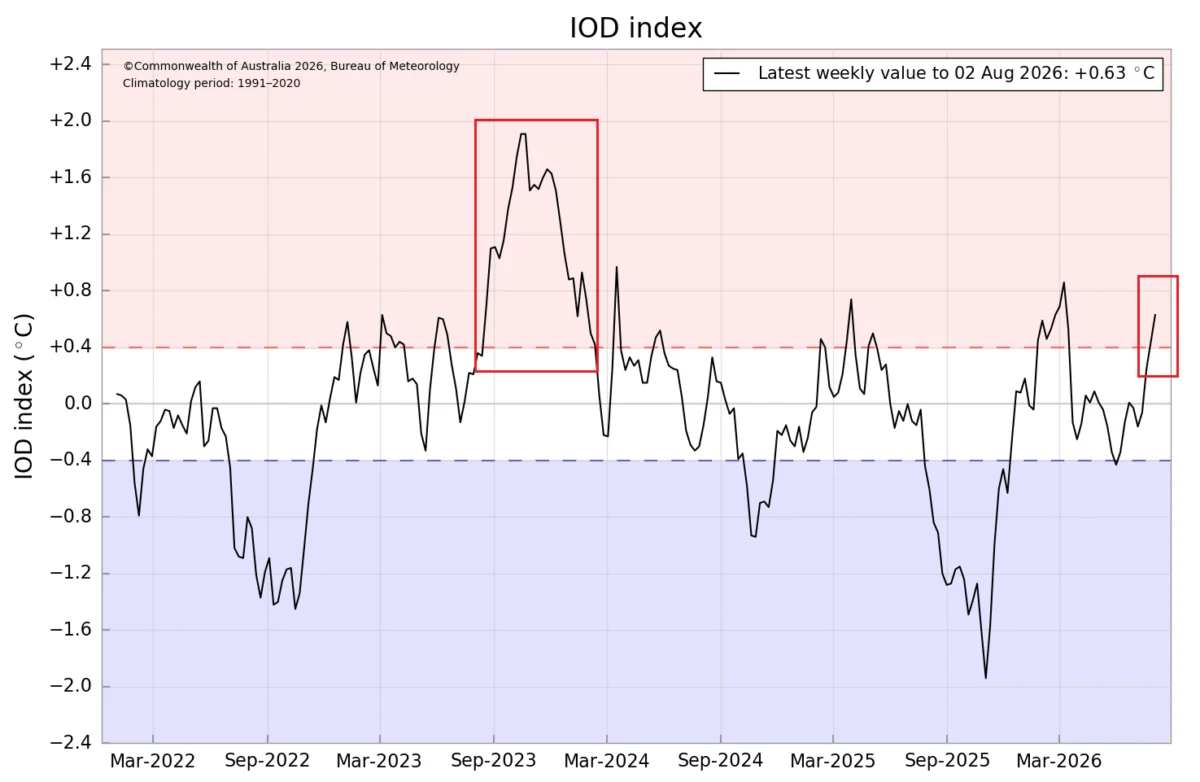
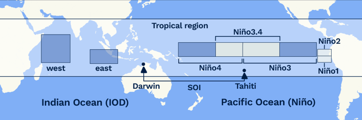
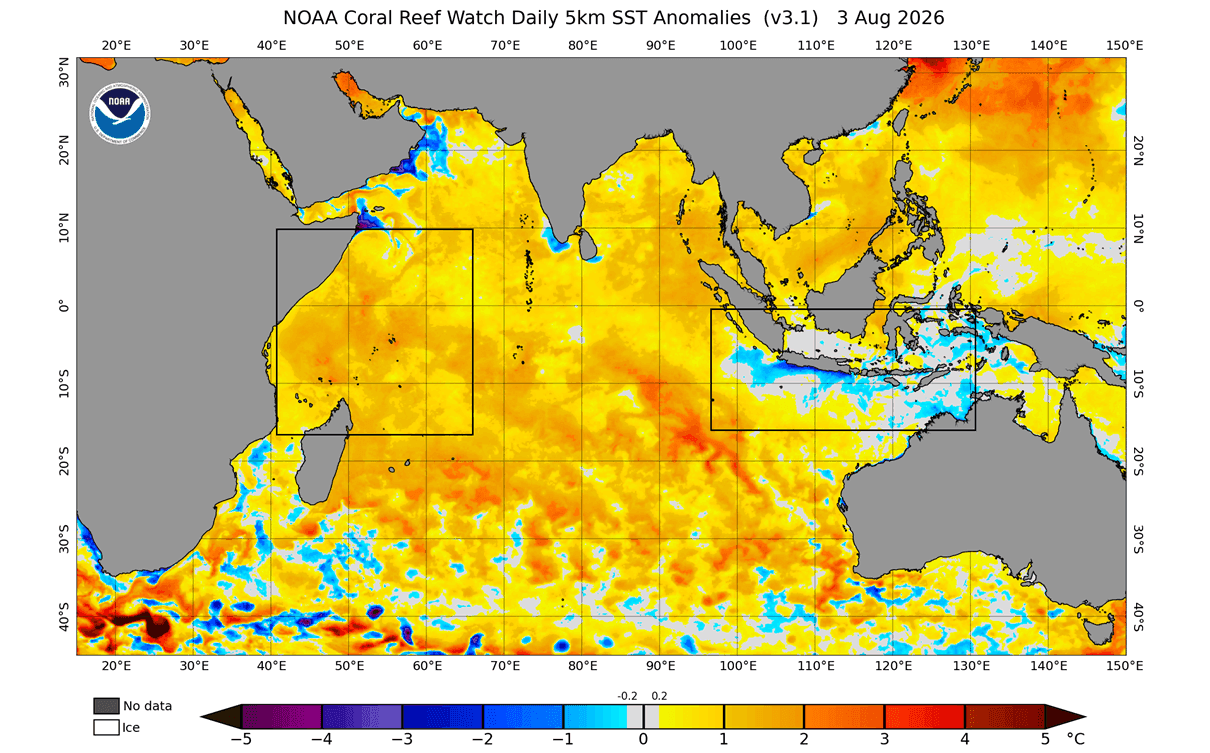
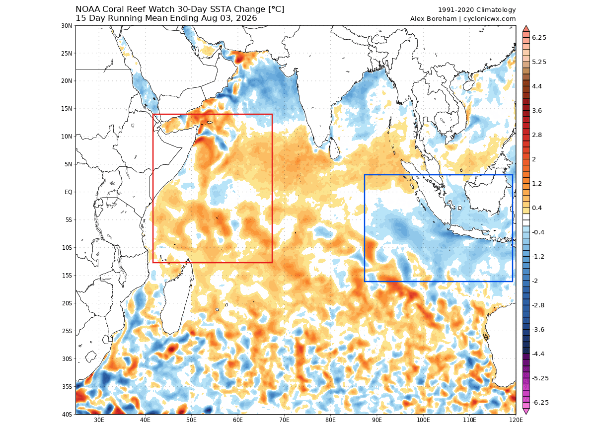
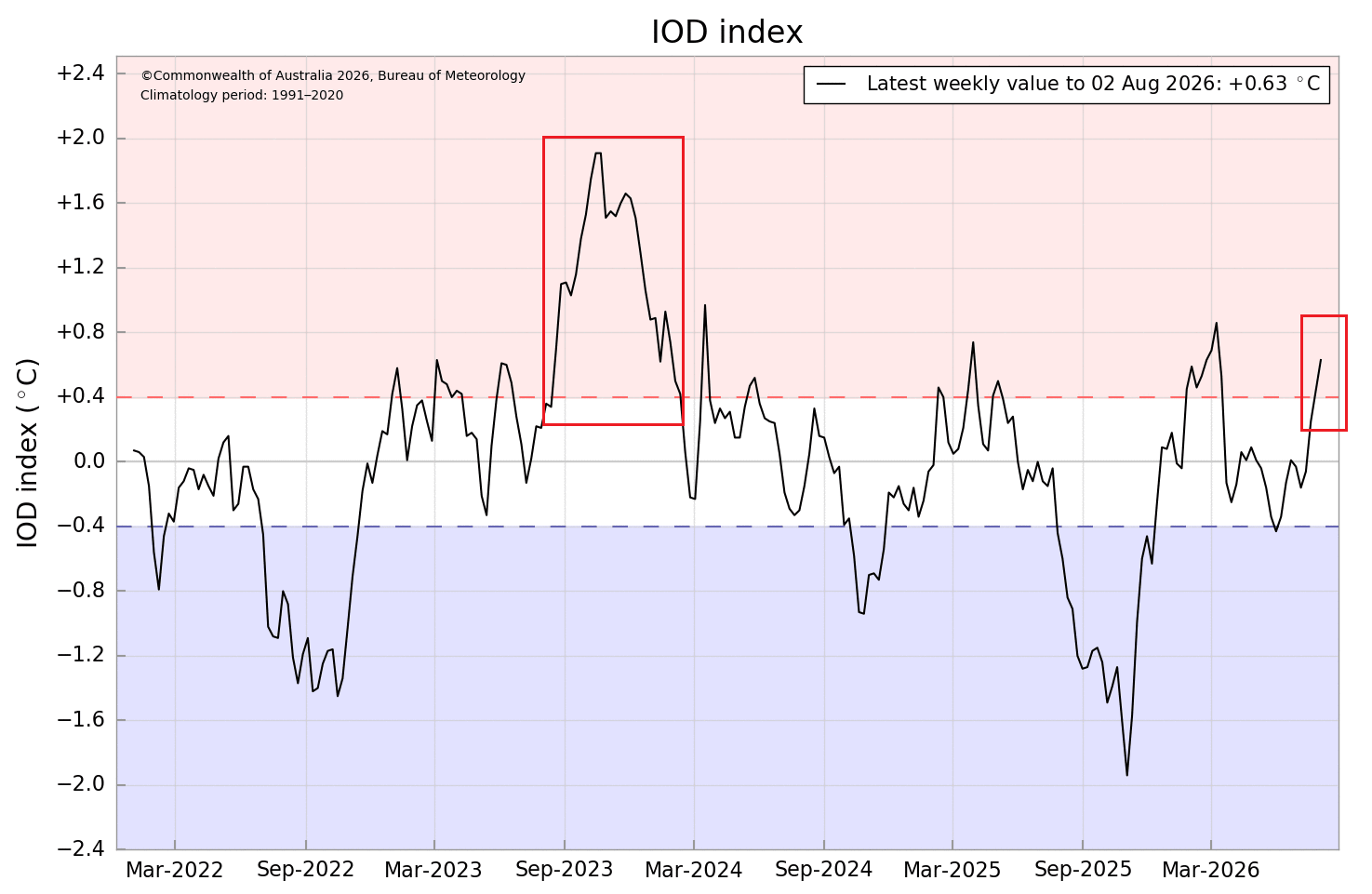
The climate is governed by the exchange of energy between the oceans and the atmosphere. Currently, the Pacific Ocean is exhibiting signs of an extreme El Niño event, with sea surface temperatures in the eastern regions spiking to anomalies of +4°C to +5°C. Simultaneously, the Indian Ocean has entered a positive IOD phase—a "dipole" characterized by warmer waters in the west and cooler waters in the east.
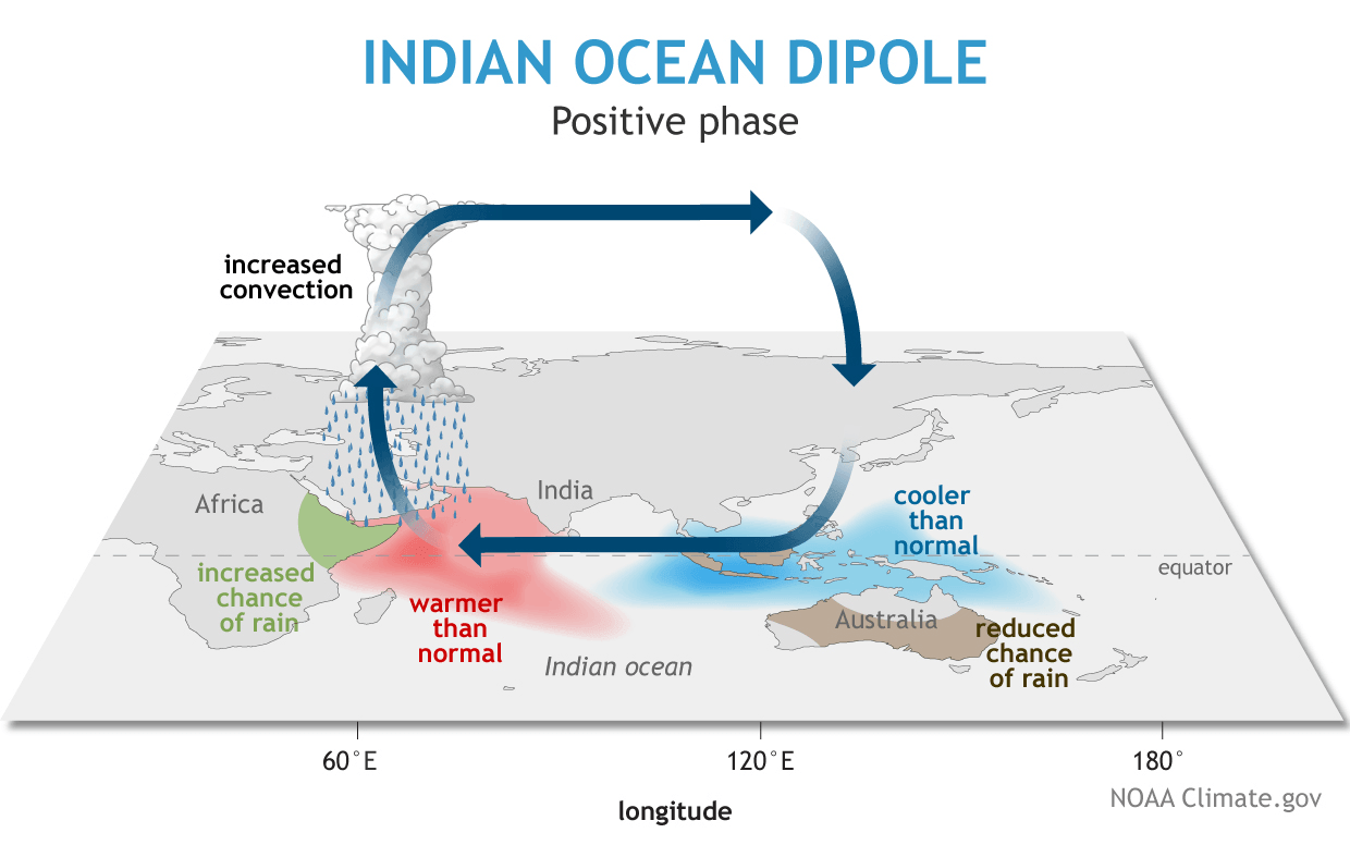
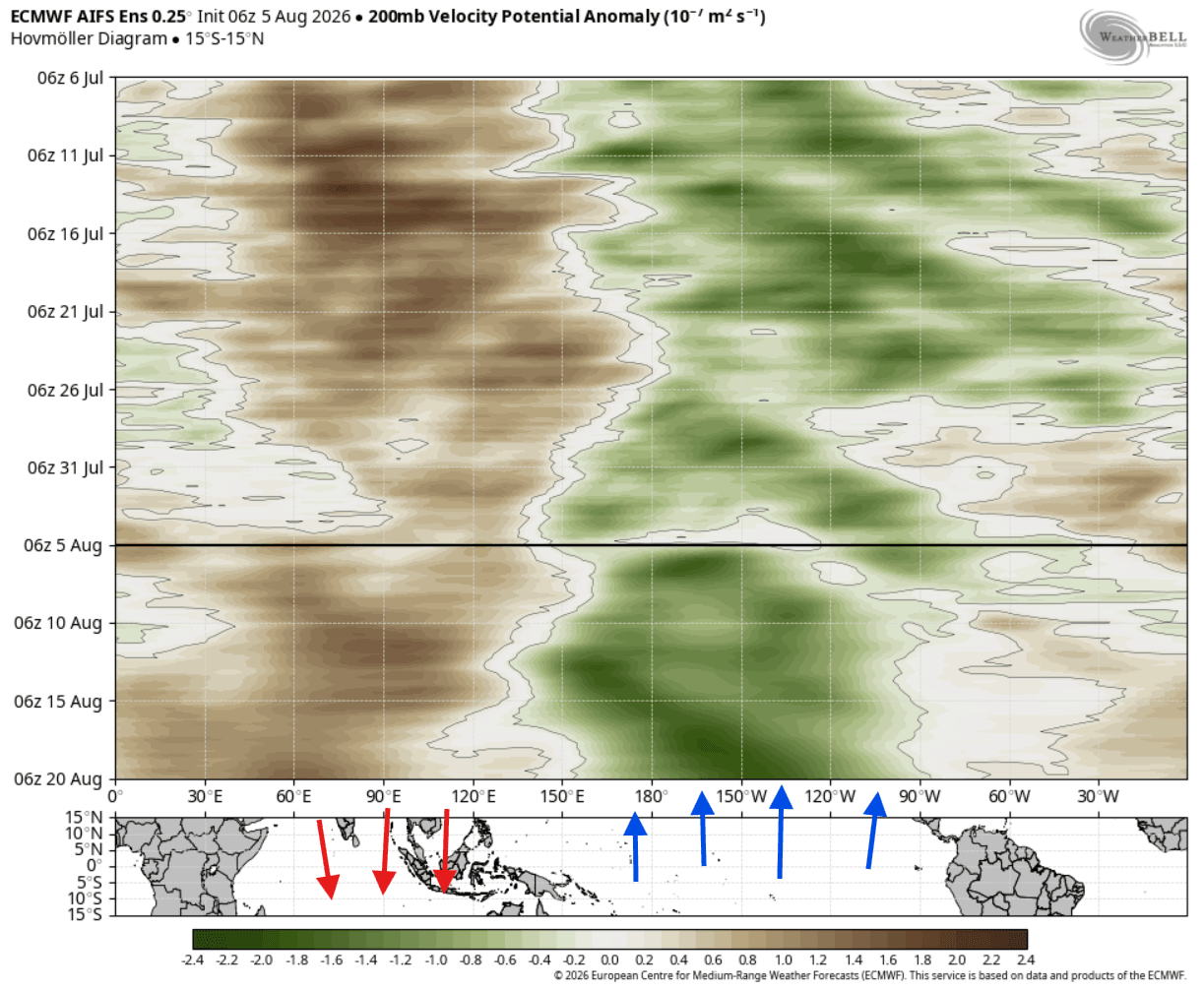
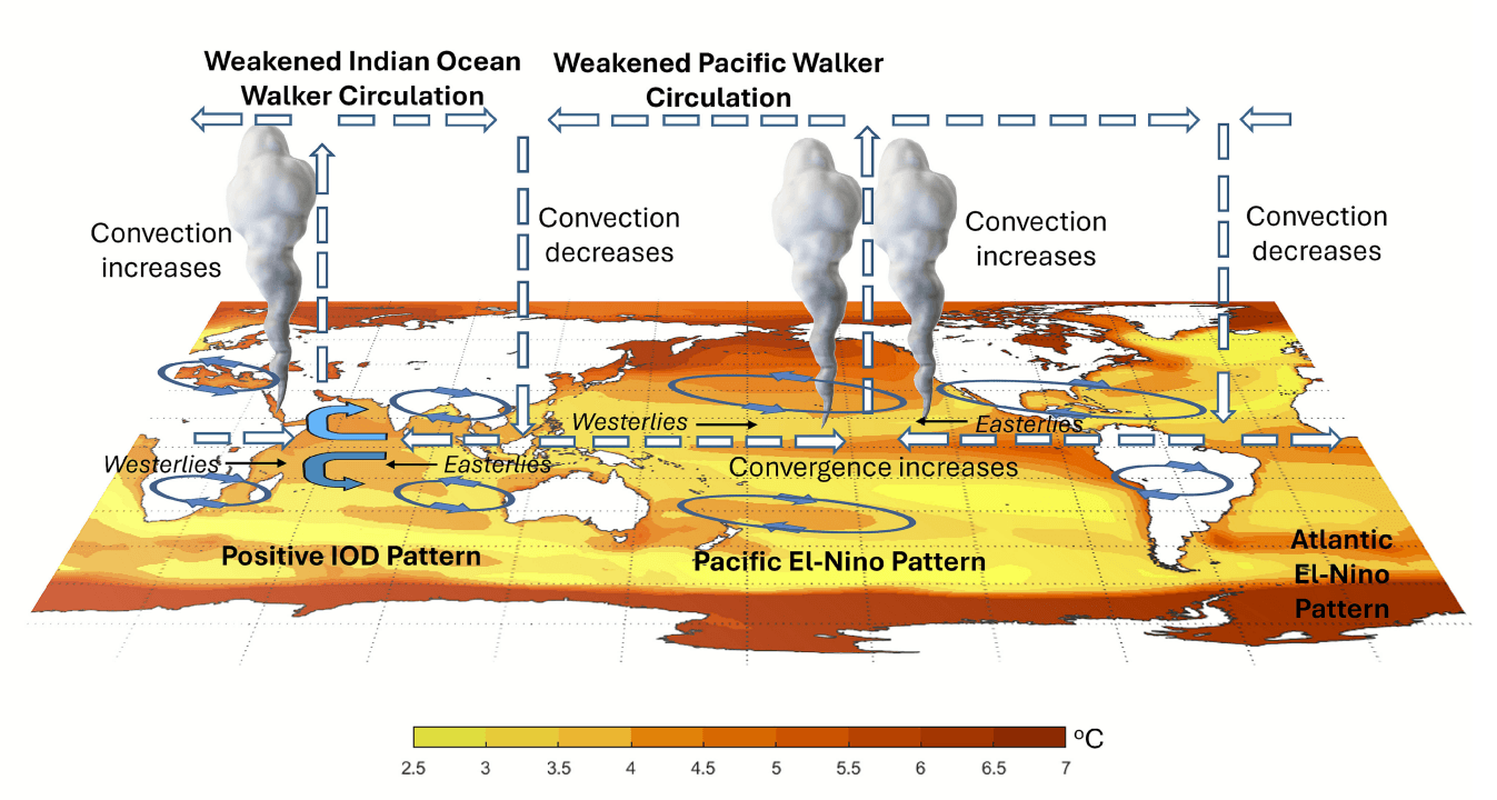
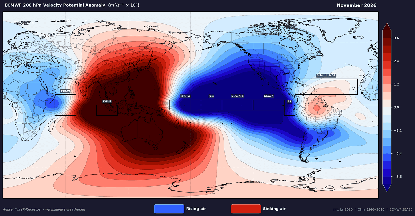
When these two events occur concurrently, they create a massive shift in global tropical forcing. The result is a fundamental restructuring of the Walker Circulation, which determines how air rises and sinks across the tropics. This is not merely a localized shift; it is a global domino effect that alters the jet stream, dictates storm tracks, and fundamentally changes the temperature and precipitation distribution across North America, Europe, and beyond.
Chronology of Development: From August Onwards
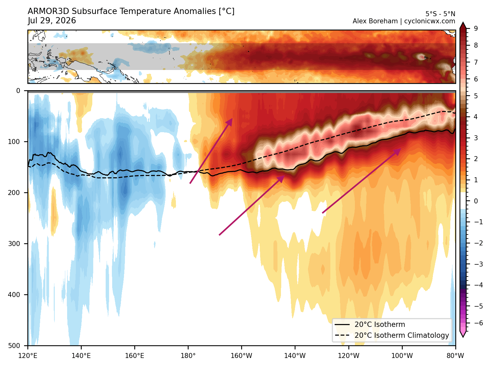
The emergence of this dual-anomaly setup began in earnest mid-summer. By August 2026, oceanographic sensors and satellite data confirmed that the subsurface "Kelvin Wave"—the deep-ocean engine of an El Niño—had gained significant momentum, reaching anomalies of over 8°C in the top 500 meters of the Pacific.
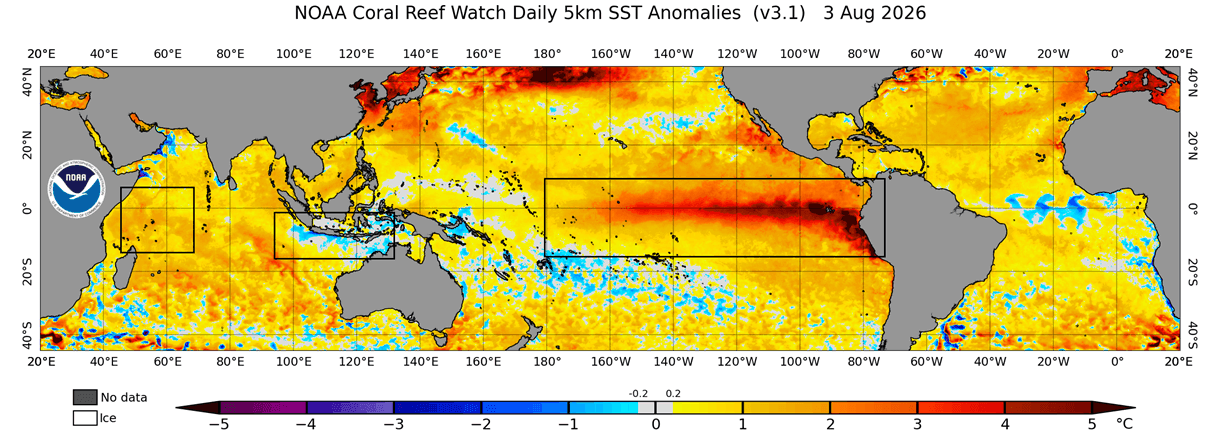
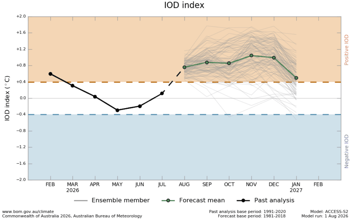
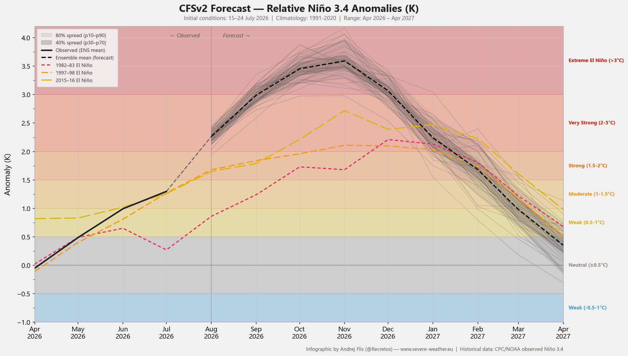
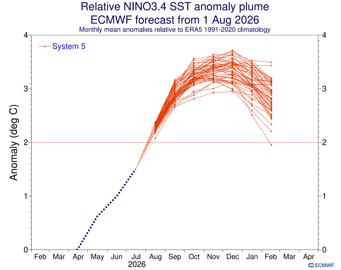
As these waves rise to the surface, they solidify the El Niño’s presence. Forecasts from the European Centre for Medium-Range Weather Forecasts (ECMWF) and the NCEP CFSv2 model indicate that this event will not only persist through the Autumn but will intensify as we approach the winter solstice. The positive IOD, currently in its nascent phase, is projected to reach its peak intensity in October and November, effectively locking the global atmospheric circulation into a "Super El Niño" configuration just as the Northern Hemisphere winter begins.
Supporting Data: The Physics of the Atmosphere
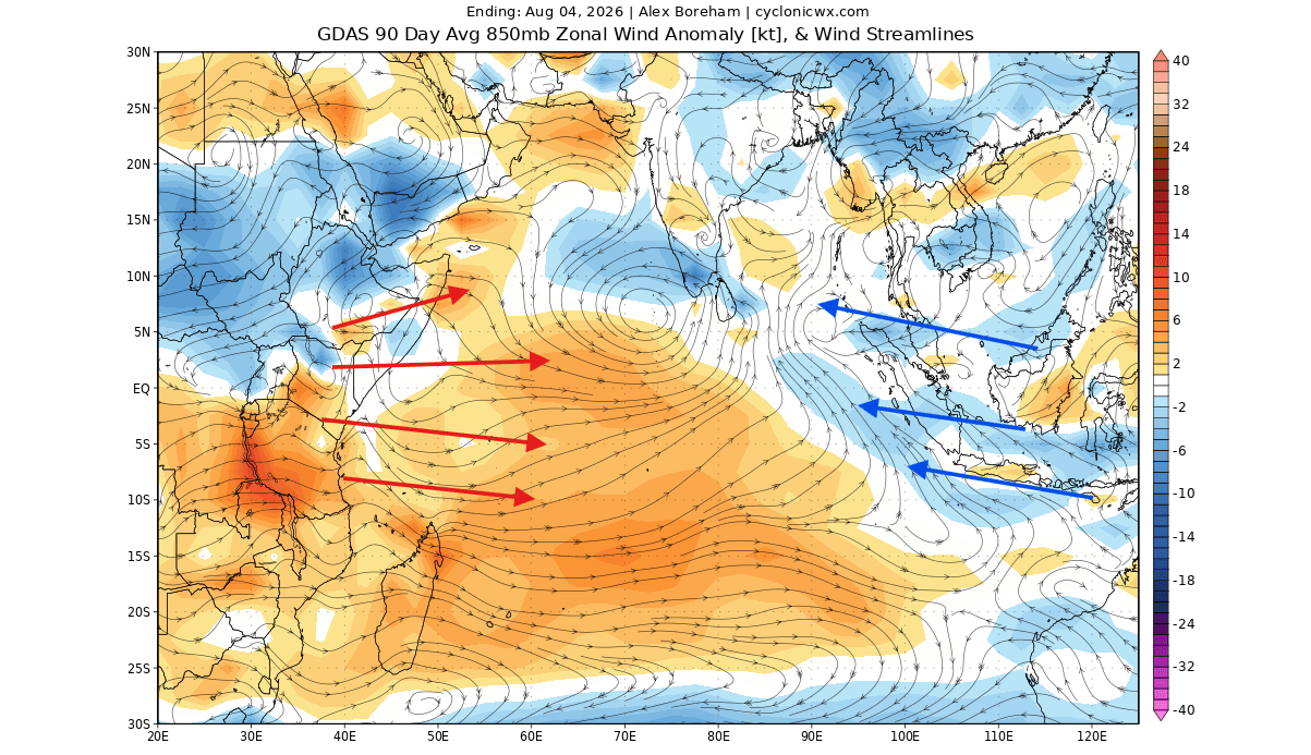
The connection between these anomalies is rooted in atmospheric pressure and trade wind dynamics. In a normal year, easterly trade winds maintain the status quo. However, the current weakening of these trades across the Indian and Pacific Oceans has allowed the sea surface temperatures to deviate drastically from the norm.
The Atmospheric Standing Wave
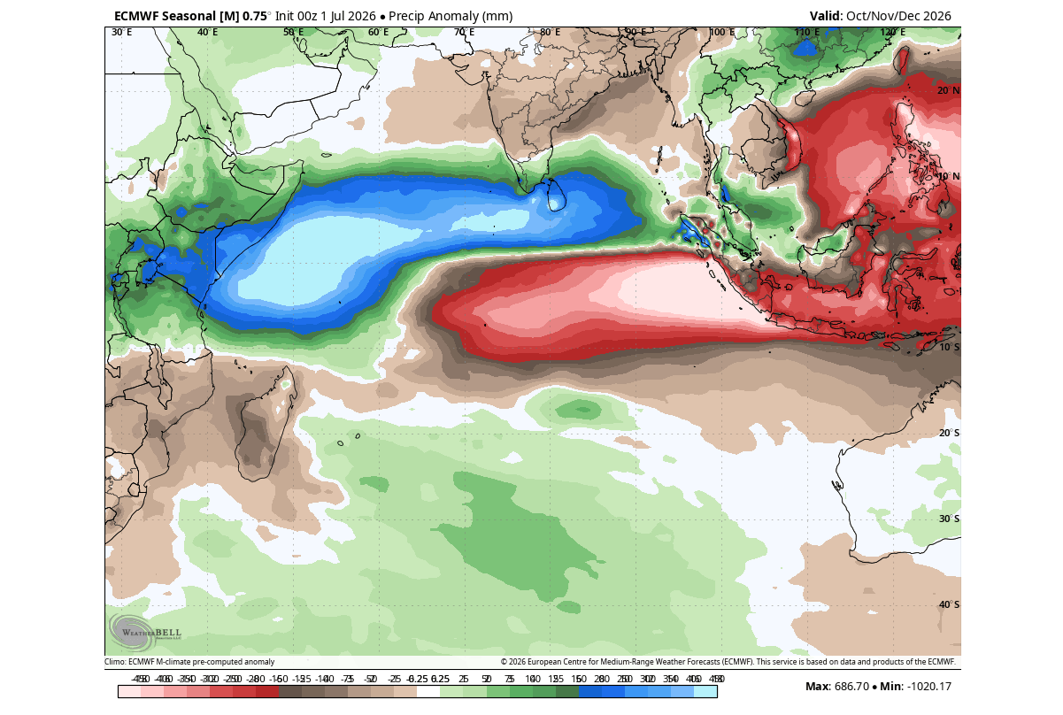
The primary indicator of this influence is the "atmospheric standing wave." Ensemble analyses from the ECMWF show a persistent, massive zone of rising air over the central Pacific, coupled with a powerful sinking zone over the Indian Ocean. This configuration creates a "bridge" between the two oceans. Research indicates that this "dual-forcing" creates a more aggressive Rossby wave train than either phenomenon could produce in isolation.
While a lone IOD might cause only minor fluctuations in the jet stream, the combined energy of the Super El Niño and the positive IOD creates a planetary-scale highway for storm systems. This setup effectively "bends" the jet stream, creating a high-amplitude wave pattern that forces cold air southward and directs moisture-laden storms into specific corridors.
Implications for North America
For the United States and Canada, the 2026/2027 winter is shaping up to be a story of "split-flow." Historical data combined with current model projections suggest a distinct divide across the continent.
Temperature and Pressure Extremes
The forecast models show a persistent high-pressure ridge forming over Canada and the northern United States. This "blocking high" will likely result in a milder-than-average winter for these northern latitudes. However, this high pressure acts as a barrier, forcing the Pacific jet stream to dip sharply into the southern and eastern United States.
For residents of the southern plains, the Gulf Coast, and the Southeast, this indicates a period of persistent, stormy, and potentially colder-than-normal conditions. As the jet stream channels moisture from the Pacific directly into these regions, the collision between southern moisture and periodic cold-air outbreaks from the north will likely result in increased winter storm activity.
The Snowfall Outlook
The snowfall forecast is inherently tied to this southern storm track. Because the primary storm corridor is projected to shift further south than in a typical winter, northern regions may experience lower-than-average snowfall totals. Conversely, the Central Plains, the Mid-Atlantic, and the interior Northeast are at a higher risk for significant winter storm events, as these areas sit at the intersection of the moisture-rich southern jet and the cold air trapped by the northern ridge.
Implications for Europe
Europe’s relationship with tropical anomalies is indirect but profound. In a Super El Niño year with a positive IOD, the North Atlantic circulation is often disrupted. The forecast models indicate an amplified low-pressure system over northwestern Europe, which will likely drive a stronger-than-average westerly flow from the Atlantic.
This "westerly engine" will likely bring a milder, wetter winter to much of the European continent. While temperatures will largely remain above normal, the increase in moisture transport will lead to higher-than-average precipitation. Snowfall will be limited primarily to higher elevations and the northern/northeastern fringes of the continent, as the dominant westerly winds tend to push mild Atlantic air deep into the interior.
Official Projections and Scientific Consensus
The scientific community is monitoring this event with extreme caution. The magnitude of the current subsurface anomalies suggests that we are witnessing one of the strongest El Niño events in recorded history. Because the atmosphere is currently "locked" into this pattern, the predictability for the upcoming winter is higher than usual.
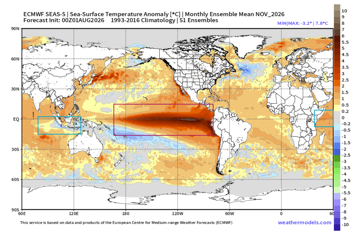
Official reports from the National Oceanic and Atmospheric Administration (NOAA) and international climate centers emphasize that while models are currently aligned, the interplay between the IOD and El Niño is complex. The "Super" designation is reserved for events that reach extreme thresholds—often exceeding a +3°C anomaly—and the current data suggests we are well on our way to crossing that threshold.
Conclusion: A Season of High Impact
The winter of 2026/2027 will likely be defined by the "Great Confluence" of the Pacific and Indian Oceans. By linking their atmospheric signatures, these two anomalies are effectively overriding standard seasonal trends. For those in the path of the southern storm tracks in the United States, or those expecting a mild, wet winter in Europe, the coming months will serve as a stark reminder of how deeply connected our global climate truly is.
Meteorologists will continue to refine these forecasts as we move through the autumn. For the public, the message is clear: the climate system is in an active, high-energy state. Staying informed through official channels and monitoring regional weather updates will be critical as the full force of this dual-ocean driver begins to manifest in the coming months.
Disclaimer: This report is based on current long-range climate models and historical correlation analysis. Weather patterns are subject to rapid change; always refer to your local National Weather Service office for localized, short-term safety alerts and forecasts.