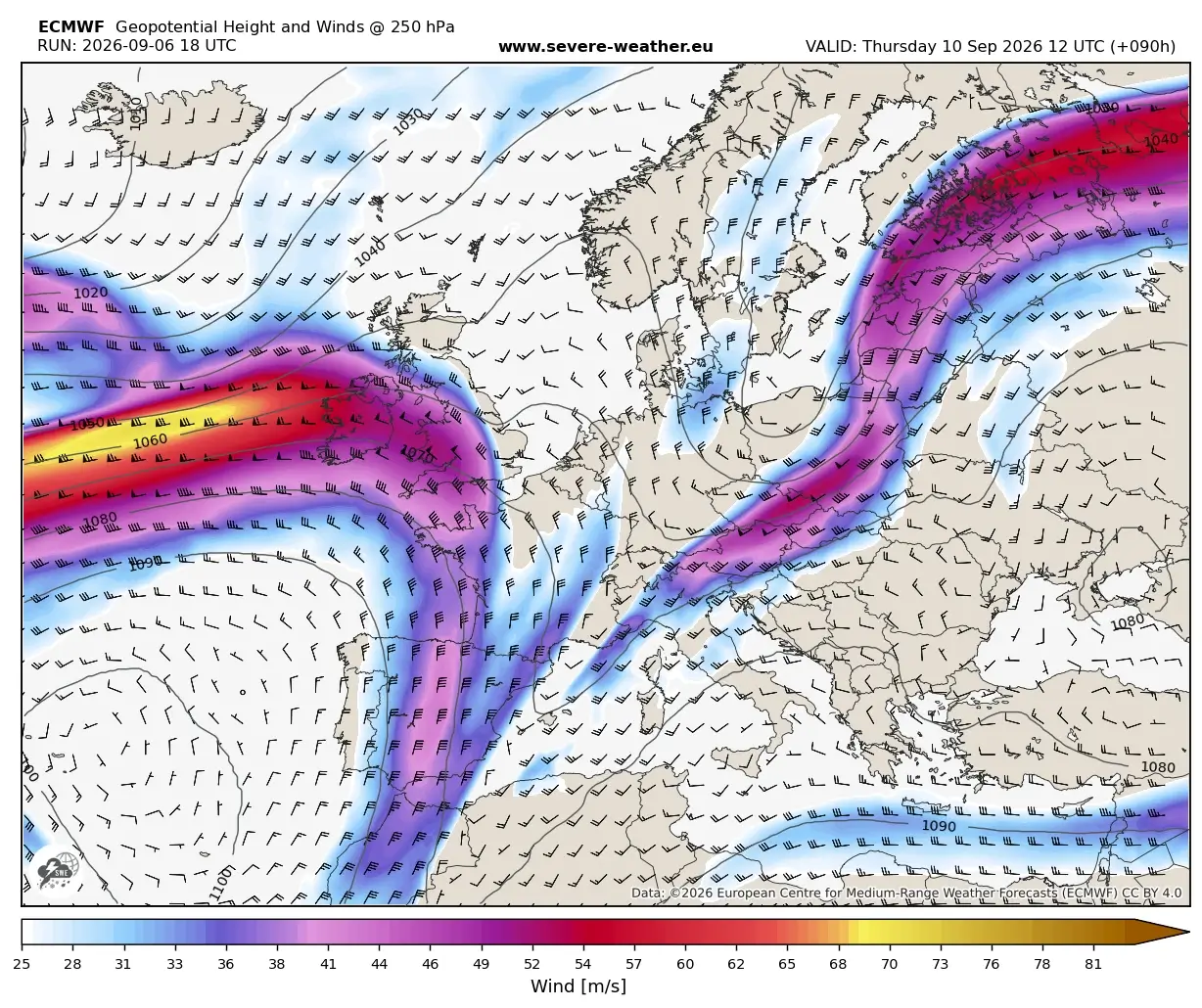
A dramatic meteorological shift is currently underway across the European continent, signaling the definitive end of the prolonged, record-breaking "Heat Dome" that has dominated the early days of September 2026. A powerful, high-amplitude upper-level trough, surging from the North Atlantic, is driving a vigorous cold front into the heart of Western and Central Europe. This atmospheric collision—where polar-origin air meets an entrenched, record-warm air mass—is triggering a widespread and volatile severe weather outbreak stretching from the Alps to the Western Balkans.
For millions of residents who have endured weeks of oppressive heat, the transition is both a relief and a hazard. The clash of air masses is producing extreme convective instability, resulting in a dangerous cocktail of giant hail, damaging winds, and catastrophic flash flooding. As the front pushes eastward, it is carving a path of thermal collapse, with temperatures in many regions plummeting by as much as 20°C in less than 24 hours.
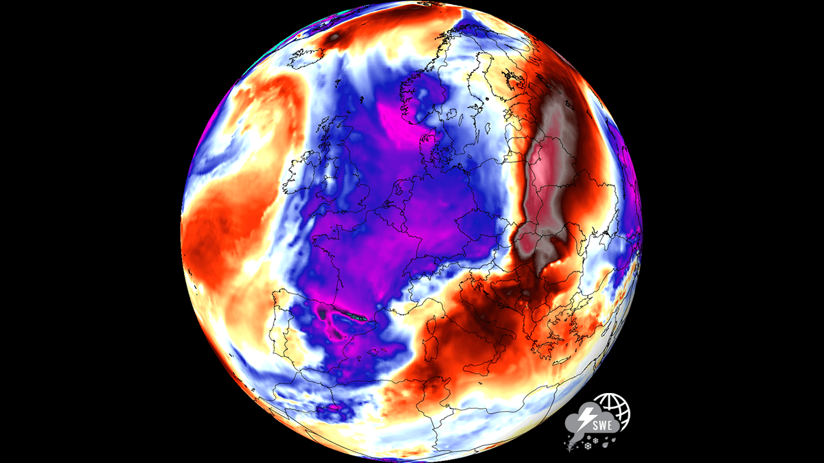
Chronology of the Meteorological Transition
The transition from a stable, sweltering heat-locked pattern to an active, autumnal regime began in earnest between Monday night and Tuesday.
Tuesday: The Initial Breach
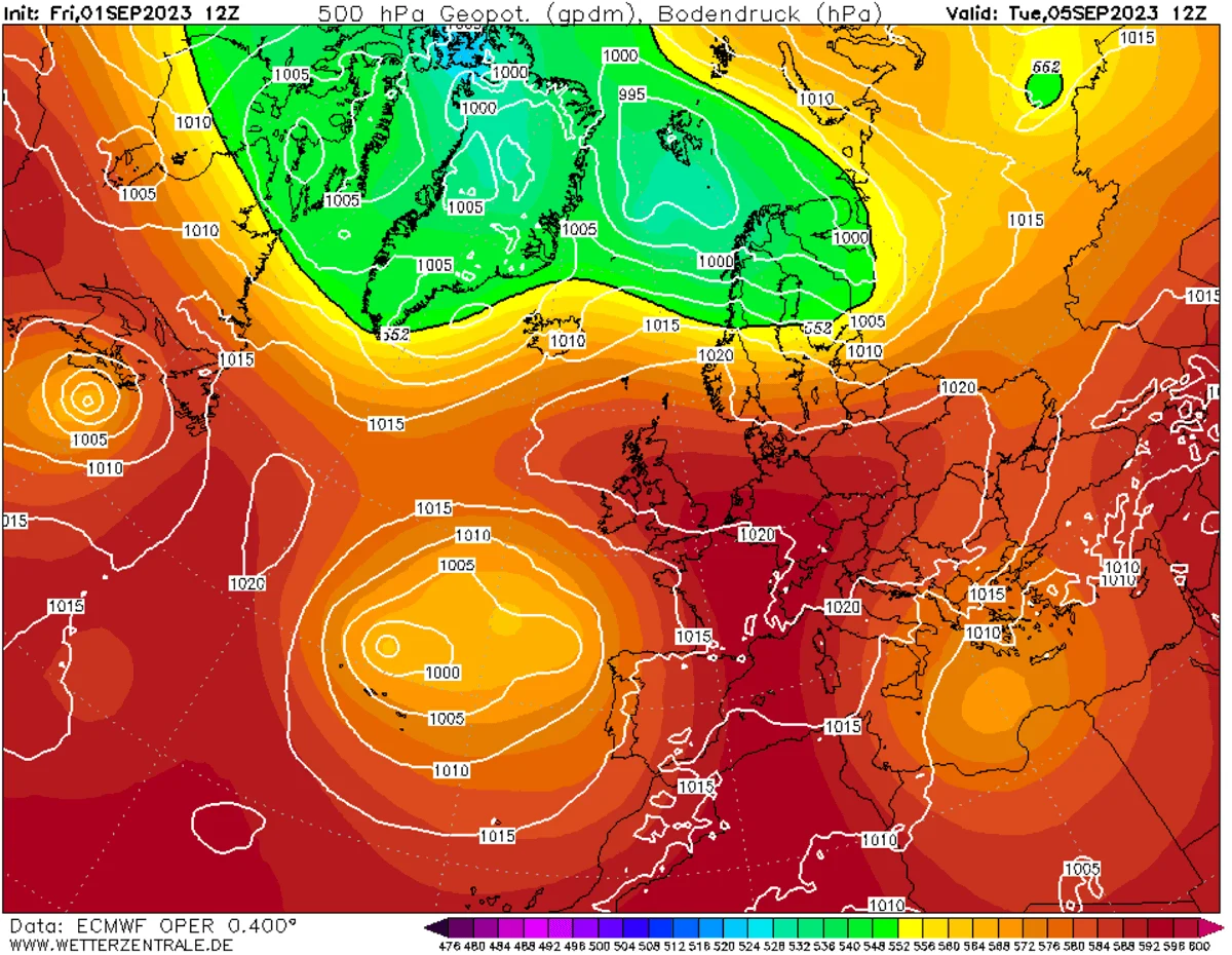
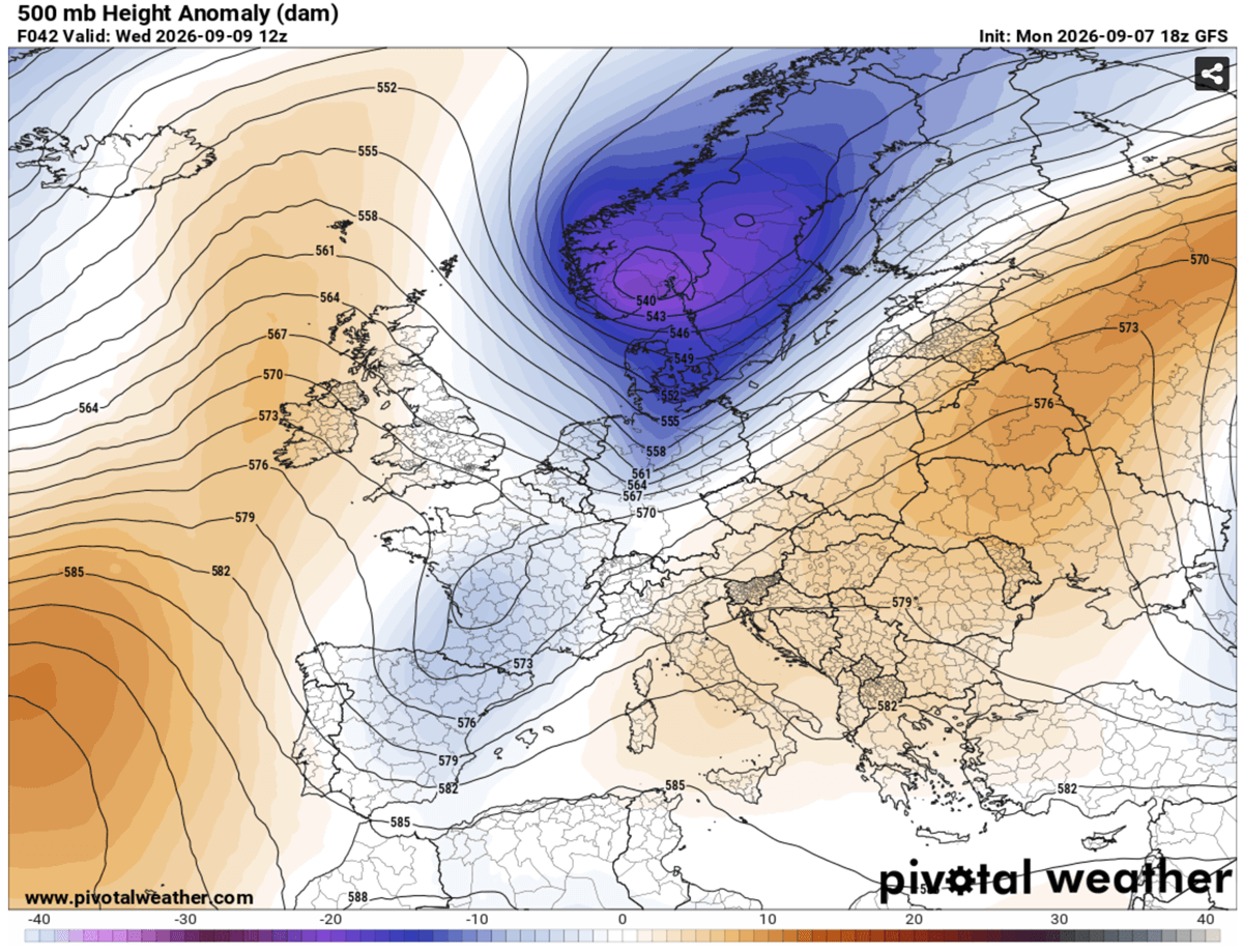
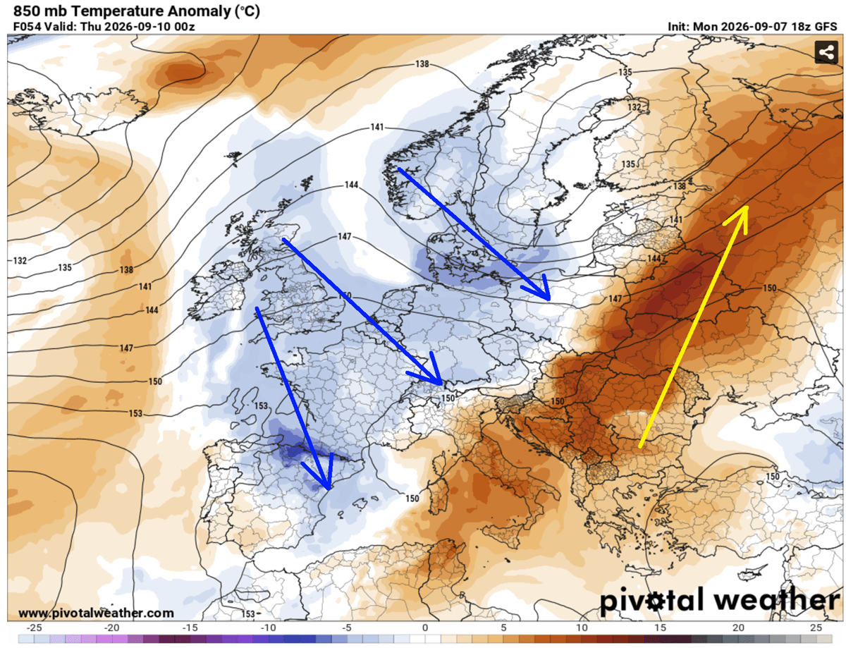
As the deep upper-level low consolidated over the North Atlantic and pushed toward Scandinavia, the western edge of the European Heat Dome began to fracture. Meteorologists identified the frontal boundary extending from a deep surface low near the Azores, moving steadily eastward. While the eastern reaches of the continent remained under the influence of record-breaking heat, Western Europe began to see the first signs of cooling as the high-pressure ridge, which had trapped heat for weeks, finally buckled under the weight of incoming upper-level forcing.
Wednesday: The Peak of Instability
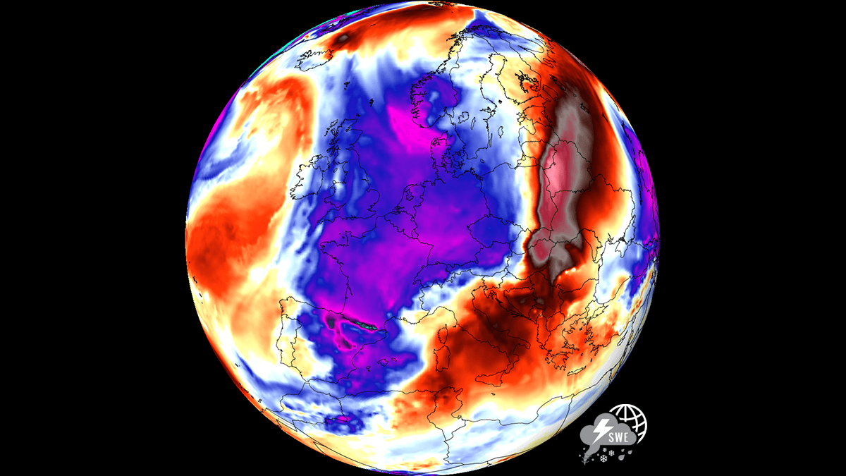
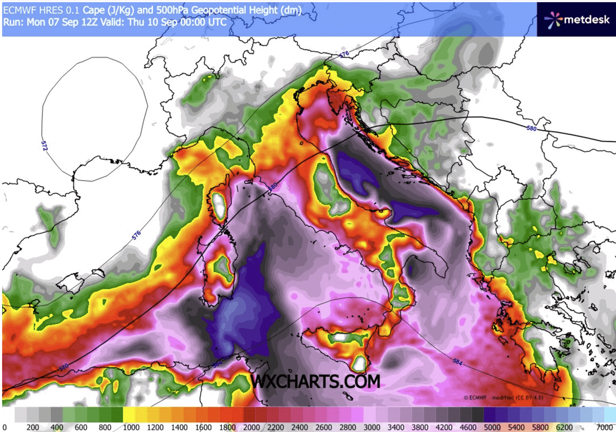
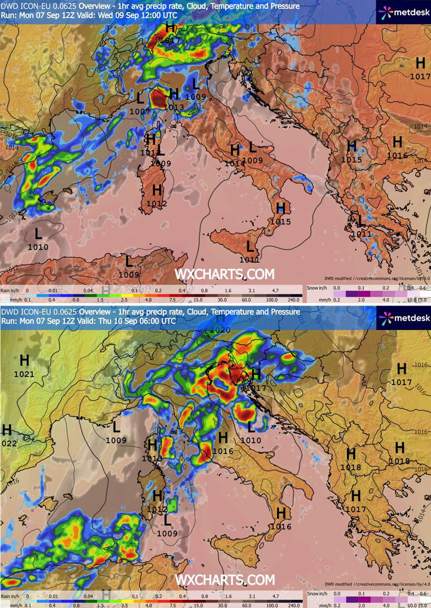
By Wednesday, the core of the cold front moved directly into the Alpine region and the Mediterranean basin. This phase marks the most dangerous period of the transition. The interaction between the advancing cold front and the moisture-laden air—warmed further by the historic Mediterranean marine heatwave—created an environment of extreme instability. With CAPE (Convective Available Potential Energy) values surging between 3,000 and 4,000 J/kg, the atmosphere became primed for violent convective development.
From Eastern France and Switzerland to the Balearic Islands and Northern Italy, the midday hours saw the rapid development of supercell and multicell thunderstorm clusters. These storms, fueled by immense moisture, began producing localized tornadoes, large-to-giant hail, and torrential rainfall.
Thursday: Eastward Progression
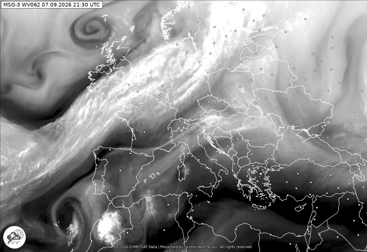
As the front tracks further east-southeast on Thursday, the focus of the severe weather shifts toward the Adriatic Sea, Slovenia, Croatia, and the broader Western Balkans. The development of a secondary surface low over the Northern Mediterranean is expected to slow the frontal movement, allowing it to intensify. This "stalling" effect poses a major threat for training-cell storms—where multiple heavy downpours pass over the same geographical area—significantly increasing the risk of flash flooding and landslides in mountainous regions.
Supporting Meteorological Data
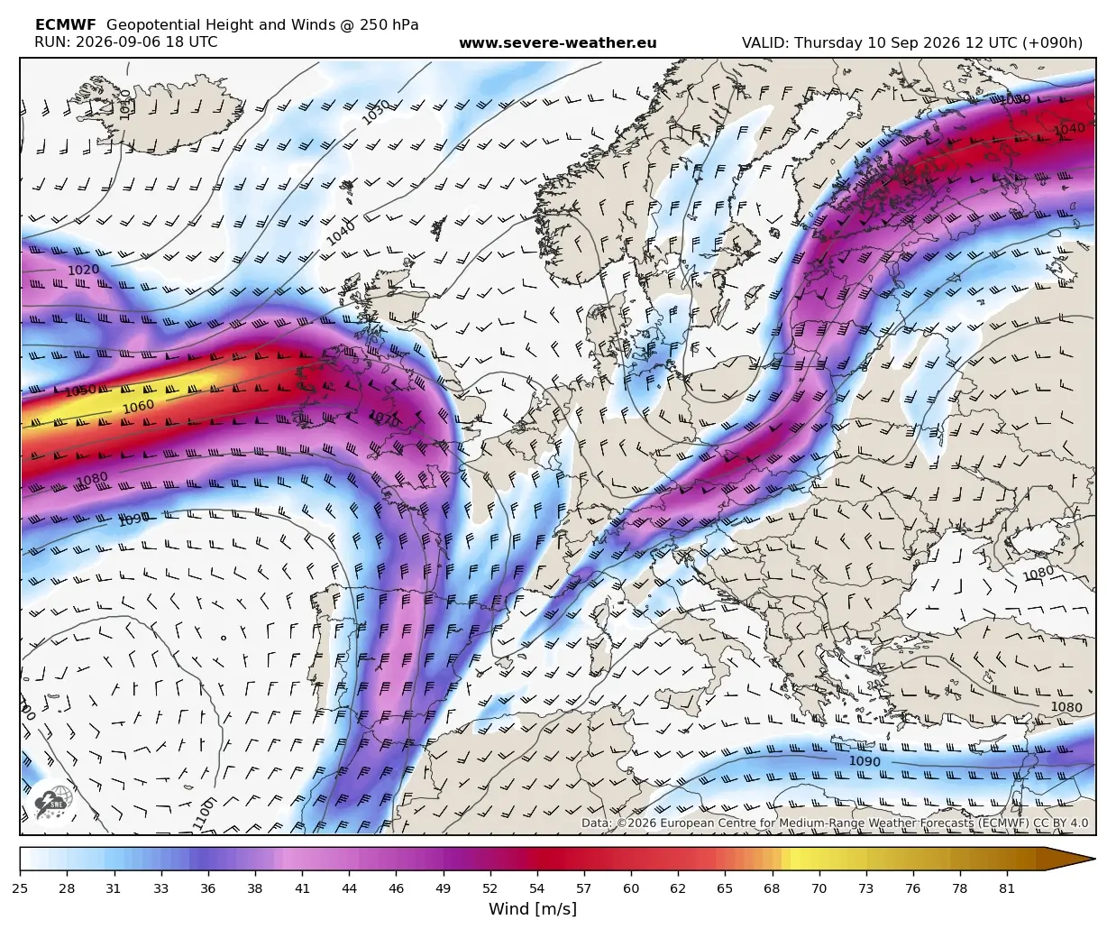
The intensity of this "Summer-Killer" event is supported by comprehensive atmospheric modeling. Data from the European meteorological community, corroborated by WXcharts and PivotalWeather, highlights several critical factors:
The Thermal Collapse
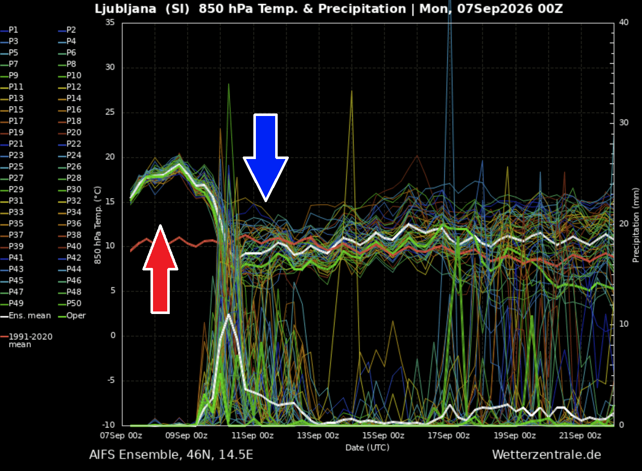
Perhaps the most striking aspect of this event is the magnitude of the temperature drop. Meteograms for regions like Ljubljana, Slovenia, illustrate a collapse in 850 mbar temperatures from roughly 18–20°C (10°C above long-term averages) to significantly colder levels within a 24-hour window. This is not merely a seasonal cooling; it is a total reset of the regional thermodynamic profile.
Moisture and Instability
The Mediterranean marine heatwave has acted as an energy reservoir. Because the sea surface temperatures remain unseasonably high, the moisture content of the air flowing into the front is exceptionally high. When combined with the strong vertical wind shear produced by the advancing trough, the potential for rotating storms—and by extension, tornadic activity—reaches its annual peak for this sector.
Precipitation Projections
Hydrological models indicate that certain coastal zones, particularly along the Ligurian Bay, the North Adriatic, and the Tuscan coast, could see rainfall accumulations reaching 150–200 mm in just 48 hours. These figures are well above the threshold for localized flash flooding, necessitating high-alert status for civil protection agencies in Italy, Slovenia, and Croatia.
Implications for Public Safety and Infrastructure
The rapid nature of this weather shift carries significant implications for both public safety and infrastructure management.
Flash Flooding and Landslides
The primary concern for civil authorities is the potential for rapid inundation. In the Alps and the Balkans, the terrain often exacerbates the impact of sudden, heavy rainfall. Narrow valleys can funnel water, turning dry creek beds into destructive torrents in minutes. Authorities are urging residents to monitor local flood warnings and to avoid travel in low-lying areas during the peak of the convective activity on Wednesday and Thursday.
The "Autumnal" Shift
Beyond the immediate severe weather, the agricultural sector faces a abrupt change. The rapid drop in temperatures, while alleviating the heat stress on crops that persisted through August and early September, may be accompanied by high winds that could cause lodging in unharvested fields. Conversely, the arrival of the first heavy snowfall at higher Alpine elevations—dropping below traditional snow lines—marks a premature transition toward winter conditions, which may impact late-season tourism and mountain pass transit.
Energy Grid and Urban Impacts
The collapse of the Heat Dome will, in the long term, reduce the extreme strain on Europe’s power grids caused by air conditioning demand. However, the immediate severe weather brings the threat of localized power outages caused by wind-damaged power lines and lightning strikes. Emergency services across the region have been placed on standby to address these potential disruptions.
Official Responses and Advisories
While this event is a standard, albeit intense, meteorological pattern change, the severity of the associated storms has prompted heightened vigilance.
- National Weather Services: Agencies in Italy, Switzerland, and Austria have issued "Orange" and "Red" alerts for severe thunderstorms. These warnings emphasize the risk of wind damage and flooding, specifically targeting the late afternoon and overnight hours of Wednesday.
- Marine Safety: Given the high moisture and instability over the Mediterranean, maritime authorities have issued warnings for the Balearic and Adriatic regions, citing the potential for sudden gale-force winds and high seas associated with passing supercells.
- Public Awareness: Civil defense organizations are circulating guidelines on "lightning safety" and "flood preparedness," advising citizens to clear drainage systems near their homes and to secure outdoor equipment that could become projectiles in high winds.
Conclusion: A Turning Point for the Season
The current "Summer-Killer" pattern serves as a stark reminder of the volatility inherent in the transition between seasons, particularly in an era of warmer-than-average marine conditions. As the upper-level trough clears the continent by the end of the weekend, it will leave behind a landscape fundamentally transformed.
The heat, which defined the first half of September, will be a memory, replaced by a crisp, autumn-like atmosphere. While the immediate risk of severe weather will subside as the cold front moves into Eastern Europe and western Russia by Friday, the lessons learned from this transition—regarding the rapid escalation of convective risk in a warming climate—will remain a subject of analysis for meteorologists throughout the coming winter season.
Residents are encouraged to continue monitoring official updates as the frontal system completes its passage. With the atmospheric energy now being flushed out, Europe enters the second half of September with a much more dynamic, and potentially unpredictable, weather outlook. Stay tuned for further developments as this pattern stabilizes and the long-term impacts of this transition become clearer.