Jotunheimen, Norway’s crown jewel of national parks, is perhaps the only place on earth where a name so perfectly captures the visceral scale of the landscape. Translating to "Home of the Giants," this 1,151-square-kilometer wilderness is a rugged, glaciated expanse that serves as the high-altitude heart of Scandinavia. With 23 of Norway’s highest peaks piercing the horizon and a complex web of glaciers feeding turquoise alpine lakes, the park is a magnet for those who measure their lives in elevation gain and miles traveled.
In late September 2022, I embarked on a three-day, 80-kilometer loop through this legendary terrain. This journey was not merely a hike; it was a rigorous exploration of one of Europe’s most formidable high-altitude environments. The following report serves as both a chronicle of that expedition and a comprehensive guide for those looking to traverse the land where myth and geography collide.

Main Facts and Logistics
The Jotunheimen Loop is a moderate-to-challenging circuit that requires a high degree of self-sufficiency and respect for the rapidly shifting Nordic weather.

- Total Distance: 80 km (49.7 miles)
- Total Elevation Gain: 3,941 meters (12,930 feet)
- Duration: 3 days
- Starting Point: Gjendesheim Mountain Hut
- Best Season: Mid-July to late September
- Wildlife: Reindeer, moose, wolverines, lynx, and roe deer.
The park’s infrastructure is anchored by the DNT (Den Norske Turistforening) hut system. These lodges provide a crucial safety net for hikers, offering warm shelter, local culinary traditions—such as reindeer and elk stews—and a community of like-minded adventurers. However, for those seeking true immersion, the park is a premier destination for backcountry camping, provided one adheres to the principles of "Leave No Trace."

The Chronology of the Expedition
Day 1: The Gateway to the Giants
The journey begins at Gjendesheim, where the iconic ferry carries hikers across the deep, emerald waters of Lake Gjende. Disembarking at the remote Gjendebu Hut, the oldest in the DNT system (established in 1871), the trail shifts from the low-lying birch forests into the raw, glacial atmosphere of the Storådalen Valley.

The ascent is marked by the presence of the 60-meter Hellerfossen waterfall, a thundering reminder of the seasonal melt that shapes this landscape. As the trail winds past Langvatnet—the "Long Lake"—the transition from valley floor to high-altitude plateau is abrupt. By the time I reached the privately-owned Leirvassbu Hut, the scale of the surrounding peaks felt oppressive in the best possible way. Dining on local mountain fare here is a ritual; the food is as hardy as the terrain, sourced directly from the surrounding valleys.

Day 2: The U-Shaped Majesty of Visdalen
Leaving Leirvassbu, the trek enters the Visdalen Valley. This section is a geological masterclass in glacial erosion. The valley floor, draped in late-season wildflowers, is flanked by imposing peaks such as Store Bukkeholstinden and Styggehøe. The walking here is gradual, offering a reprieve for the legs before the climb toward Spiterstulen.

Spiterstulen serves as the logistical base camp for those attempting Galdhøpiggen, Scandinavia’s highest peak at 2,469 meters. While my own summit of Galdhøpiggen occurred on a previous expedition, the energy at Spiterstulen remains infectious. It is a hub of international mountaineering, where the "alpine congregation" mentioned earlier—hikers from Chile, England, and the Netherlands—converge to swap gear tips and share the camaraderie of the trail.

Day 3: The Knife-Edge Finale
The final leg between Spiterstulen and Glitterheim, crossing the Skautflye Plateau, is perhaps the most visually rewarding. The landscape is a stark, boulder-strewn tundra that feels more like the surface of another planet than a European mountain range. Crossing the Velsglupen pass and descending into the Veodalen Valley, I encountered a herd of reindeer, a silent, majestic reminder of the park’s ecological importance.

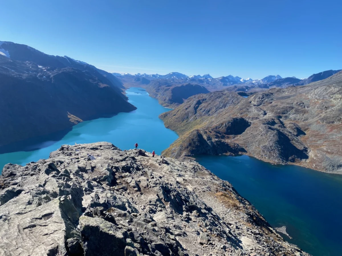
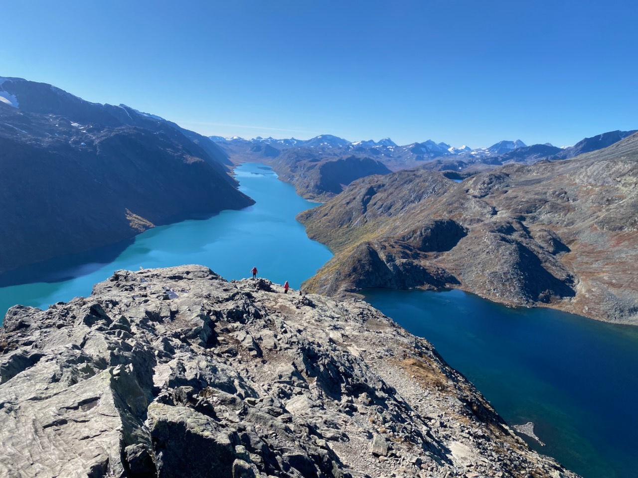
The grand finale is the Besseggen Ridge. This is not merely a trail; it is a cultural icon. The ridge, which separates the turquoise waters of Lake Gjende from the deep blue of Bessvatnet, is a narrow, rocky spine that requires careful footwork. It is the stuff of Norwegian legend, immortalized by Henrik Ibsen in his 1867 masterpiece, Peer Gynt. Walking the ridge, one can almost hear the echoes of Ibsen’s protagonist describing the "four-mile-long" edge that "stretches sharp before you like a scythe."

Supporting Data and Technical Insights
The Jotunheimen Loop requires meticulous planning. Navigation is simplified by the DNT’s excellent marking system—red-painted "T" symbols and strategically placed stone cairns—but these should never replace a reliable GPS and physical map.

- Weather Dynamics: Even in late September, snow is common. The Jotunheimen microclimate is notoriously unpredictable; temperatures can plummet from a comfortable 15°C to below freezing within an hour.
- Gear Requirements: A lightweight, high-performance shelter is essential. During my trip, the MLD Duomid proved invaluable against the gusting winds of the high plateau. Layering systems should focus on merino wool bases, high-loft down insulation, and a robust hardshell jacket.
- Emergency Infrastructure: As noted at the Spiterstulen emergency hut, the facilities are world-class, often including gas cookers and charging points. These are vital for maintaining communication and safety equipment.
Official Responses and Conservation Efforts
The Norwegian government, through the National Park authorities, manages Jotunheimen with a strict focus on preserving the delicate tundra ecosystem. Conservation efforts center on managing the impact of the thousands of hikers who visit the Besseggen Ridge annually.

Authorities emphasize that the "Right to Roam" (Allemannsretten) comes with the "duty to respect." Hikers are explicitly instructed to avoid walking on the fragile lichen cover of the plateaus and to pack out all waste, including organic matter, which decomposes at a glacial pace in the alpine environment. Monitoring of reindeer migration corridors is a top priority, and hikers are often advised to keep a respectful distance to avoid causing unnecessary stress to the herds during their autumnal movements.

Implications for the Future of Nordic Trekking
The popularity of trails like the Jotunheimen Loop has significant implications for sustainable tourism. As digital platforms and social media continue to highlight the "Instagrammable" beauty of the Besseggen Ridge, the pressure on these trails grows.

The long-term health of the park depends on the education of the "new wave" of hikers—many of whom are venturing into the wilderness for the first time. The culture of the mountain hut—where experienced veterans pass on the values of the trail to novices—is a critical component of this education. By maintaining the tradition of communal dining and shared responsibility, the DNT system ensures that the spirit of the "Land of the Giants" remains intact.

For those planning to visit, the advice is simple: Go with humility. Whether you are a seasoned mountaineer or a newcomer seeking to understand the allure of the high north, Jotunheimen demands your full attention. It is a place that strips away the noise of modern life and replaces it with the sound of wind over stone and the sight of water that has been held in glaciers for millennia.

Note: For a more granular breakdown of the specific gear used during this trek, readers are encouraged to review my documentation on the Greenland Arctic Circle Trail, which shares a similar requirement for high-latitude equipment. This trip was conducted in preparation for the book "Wanderlust Nordics," a collaborative project with Gestalten Publishing, detailing the most spectacular trails across the Scandinavian region.