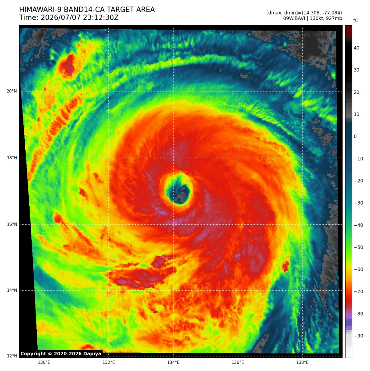
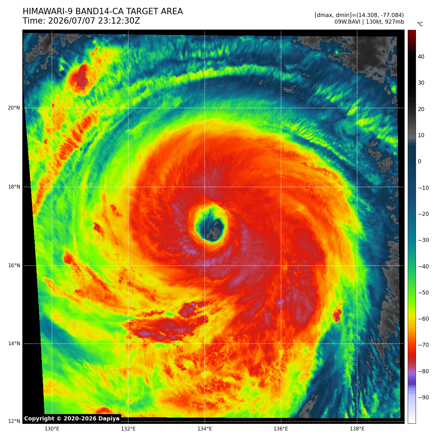
The Western Pacific has once again demonstrated the raw, unbridled power of nature with the emergence of Super Typhoon Bavi. In a display of rapid intensification that has left meteorologists stunned, Bavi evolved from a modest 60-mph tropical system into a colossal Category 5-equivalent monster in under 48 hours. With sustained winds reaching a terrifying 180 mph and a central pressure plummeting to 901 mbar, Bavi has firmly cemented its legacy as one of the most violent and rapidly intensifying tropical cyclones of the current season. As it barrels across the Philippine Sea, the region remains on high alert, bracing for a series of catastrophic impacts.
The Anatomy of an Atmospheric Monster
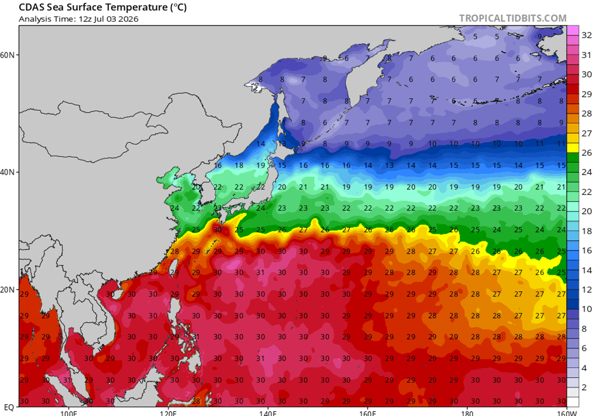
The rapid genesis of Super Typhoon Bavi is not an accident of nature but a result of a "perfect storm" of atmospheric conditions. The storm has been fueled by deep, exceptionally warm oceanic waters, with surface temperatures ranging between 29°C and 32°C. These thermal anomalies, sitting 2–3°C above the seasonal average, act as a massive battery for the cyclone, providing the high dew points and latent heat energy required for explosive convective activity.

Furthermore, the storm benefited from an environment characterized by near-zero wind shear, which allowed its structure to remain vertical and coherent. This lack of interference enabled a classic "eyewall replacement cycle"—a phenomenon where a storm’s internal eye collapses and reforms—to produce a larger, more structured, and ultimately more dangerous wind field. The resulting "buzzsaw" rotation is now capable of exerting unprecedented pressure on any landmass in its path.
Chronology: From Formation to Catastrophe
The initial signs of Bavi’s development were relatively innocuous, but by the time it began its trek toward the Northern Mariana Islands, the shift in intensity was stark. The storm’s northern eyewall made a direct pass over the island of Rota, where it unleashed hurricane-force winds and torrential rains that decimated local infrastructure.
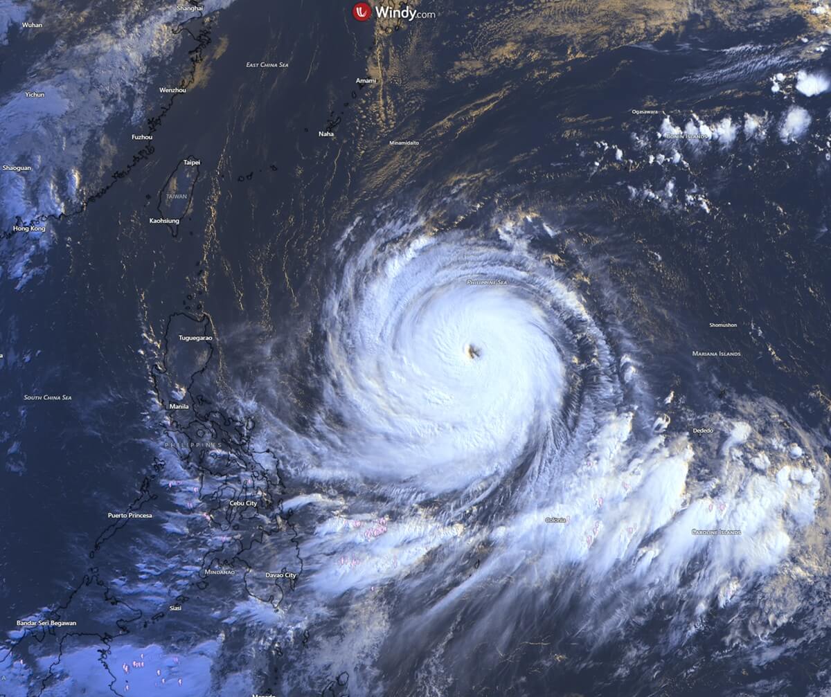
Guam, long accustomed to the threats of "Typhoon Alley," also felt the sting of Bavi’s reach. While the eye did not make a direct landfall on the main island, the outer bands deposited over 20 inches of rain and produced wind gusts exceeding 85 mph. This event served as a grim reminder of why Guam transitioned into a "concrete island" following the historical devastation caused by past storms like Typhoon Karen in 1962.
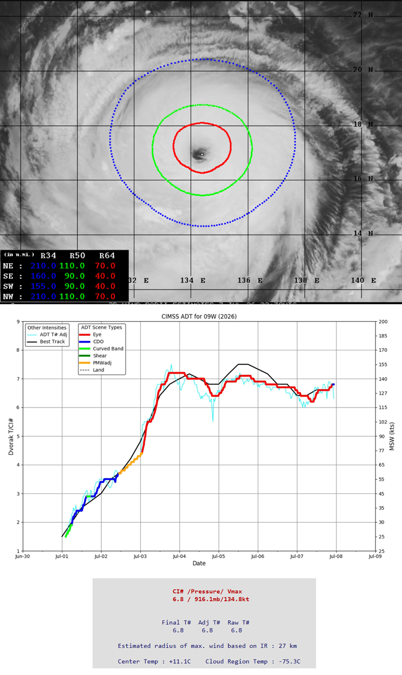
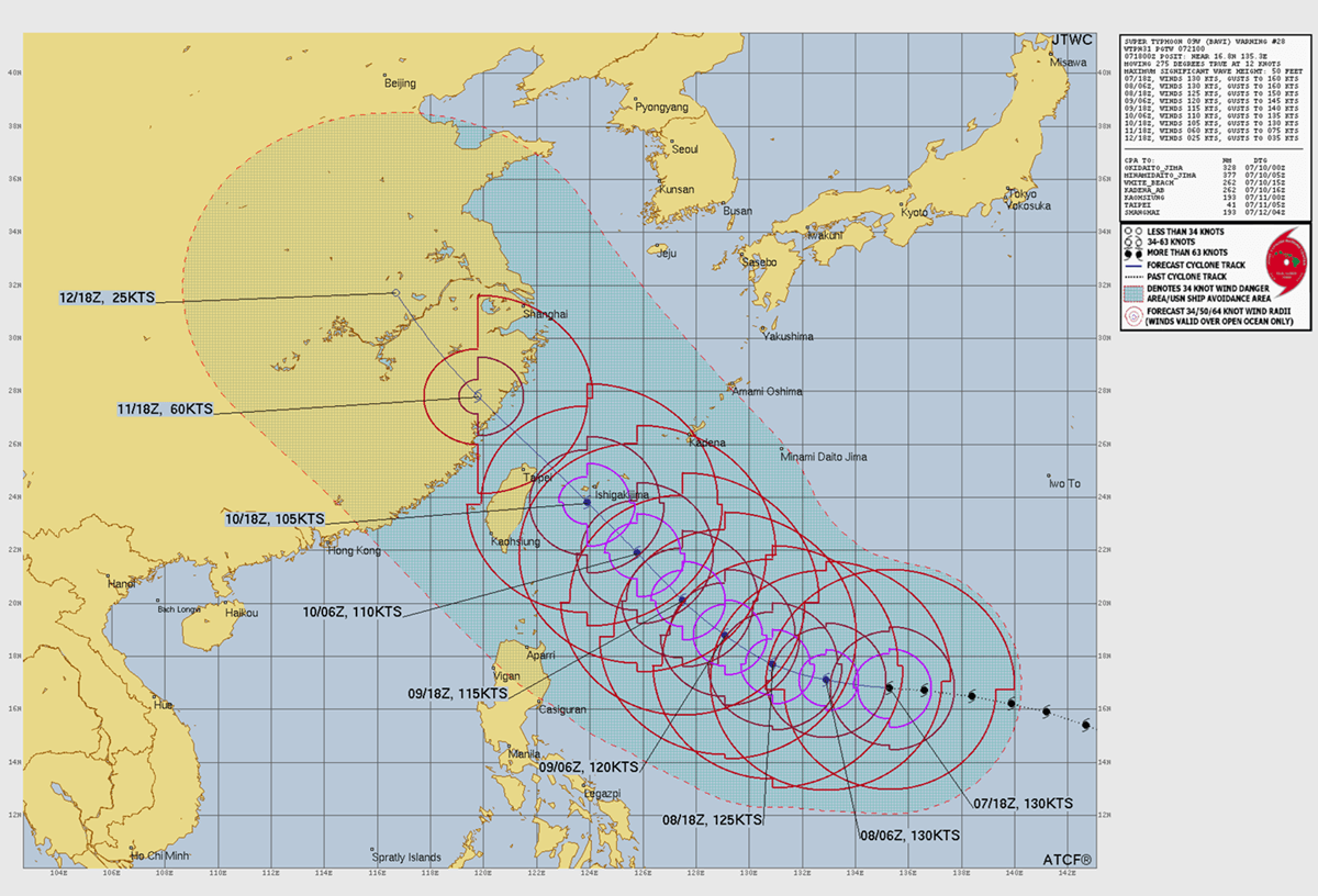
As of this report, Bavi is tracking west-northwest, maintaining its status as a violent, symmetrical cyclone. Advanced Dvorak automatic satellite analysis—a methodology used to estimate intensity based on cloud patterns—consistently places Bavi at the highest tiers of the Saffir-Simpson scale. Projections indicate that the storm will maintain high-end Category 4 to 5 intensity as it approaches the southern Japanese archipelago and northern Taiwan this coming Friday.
Supporting Data: The Physics of the Storm
To understand the scale of Bavi, one must look at the satellite telemetry. The core of the storm currently exhibits a central pressure of 916 mbar, with hurricane-force winds extending 60 to 70 miles from the center in every quadrant. Tropical-storm-force winds, which are still powerful enough to cause significant structural damage, extend up to 110 miles from the massive, well-defined eye.
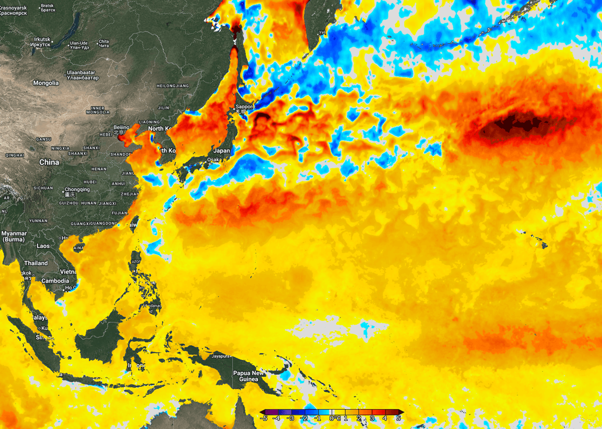
The sea-surface temperature anomalies are perhaps the most concerning metric. Along the coasts of China, Taiwan, and Japan, temperatures are currently tracking 4°C above the long-term average. As Bavi tracks toward these areas, it is essentially moving through a "heated corridor" of ocean water that will sustain its intensity far longer than a typical storm would.
Meteorological models are currently tracking a massive rainfall event. In the mountainous terrain of northern Taiwan, total precipitation is expected to range between 600 mm and 1,000 mm (approximately 24 to 40 inches) over a 48-hour period. Given the topography of the region, this volume of water presents an immediate and life-threatening risk of landslides and catastrophic flash flooding.
Official Responses and Public Safety Directives
Regional disaster management agencies in Taiwan, Japan, and the Philippines have initiated emergency protocols. In Taiwan, officials are urging citizens to clear drainage systems, secure heavy outdoor objects, and finalize emergency supplies. The Central Weather Bureau has begun issuing maritime and land warnings, emphasizing that even if the eye of the storm avoids a direct landfall, the periphery of the storm carries enough kinetic energy to cause widespread destruction.
In Japan, the focus remains on the islands of Ishigaki and Miyakojima. Local authorities have advised residents to prepare for power outages and to move to designated storm shelters well before the onset of the most intense winds on Friday. The maritime industry has also been significantly impacted, with shipping lanes in the Philippine Sea effectively closed and major ports preparing to cease operations to prevent damage to cargo vessels and harbor infrastructure.
The Long-Term Implications of Super-Charged Storms
The emergence of Bavi raises broader questions about the future of Pacific weather patterns. When tropical systems reach this level of intensity, they do more than just destroy buildings; they fundamentally alter landscapes. The history of the Marianas—specifically the transition from wooden housing to reinforced concrete—is a testament to the adaptive measures required to survive such high-frequency, high-intensity events.
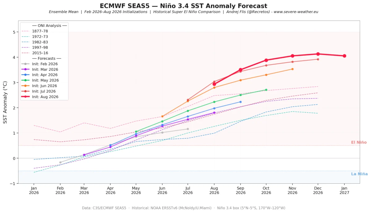
However, as sea temperatures continue to rise, the "return period" for such storms is shrinking. Scientific consensus suggests that the combination of warmer oceans and altered atmospheric circulation patterns is leading to more frequent "rapid intensification" events, where storms skip the gradual growth phases and jump straight to major hurricane status. This creates a narrowing window for warning and evacuation, forcing governments to move toward more proactive, tech-driven disaster mitigation strategies.
Preparing for the Inevitable: A Summary of Hazards
As Super Typhoon Bavi approaches its final, high-impact phase, residents in the path of the storm should be cognizant of the four primary hazards:
- Destructive Wind Fields: With winds capable of exceeding 250 km/h, structural failure of non-reinforced buildings is a near certainty. Even well-built structures are at risk of roof failure and projectile damage.
- Catastrophic Storm Surge: The extreme low pressure at the center of the storm will act like a vacuum, pulling ocean water toward the coast. When combined with high tides, coastal flooding could inundate low-lying areas, causing saltwater damage to infrastructure that may take years to remediate.
- Extreme Rainfall and Flooding: As noted, the potential for 1,000 mm of rain is significant. This amount of water is enough to overwhelm natural river channels and urban drainage systems, leading to deep, fast-moving flash floods.
- Landslides: In mountainous regions like northern Taiwan, the saturation of the soil will lead to slope instability. Areas previously unaffected by landslides may become vulnerable, necessitating the evacuation of rural and highland communities.
Conclusion: A Tense Wait
The coming 48 hours will be critical. While Bavi is expected to undergo a gradual weakening phase as it encounters cooler waters and increased vertical wind shear near the Chinese mainland, it will remain a "dangerous" system throughout its lifespan. The combination of its massive size and the high-energy environment of the Western Pacific ensures that its impact will be felt far beyond the eye’s path.
As the world watches the satellite imagery provided by organizations such as Windy and Tropical Tidbits, the focus remains on the safety of the millions in the storm’s trajectory. Bavi serves as a stark, powerful, and undeniable reminder of the planet’s atmospheric volatility and the necessity of continued vigilance in an era of shifting climate norms. For those in the path of this monster, the time for preparation has passed; the time for endurance and safety has begun.