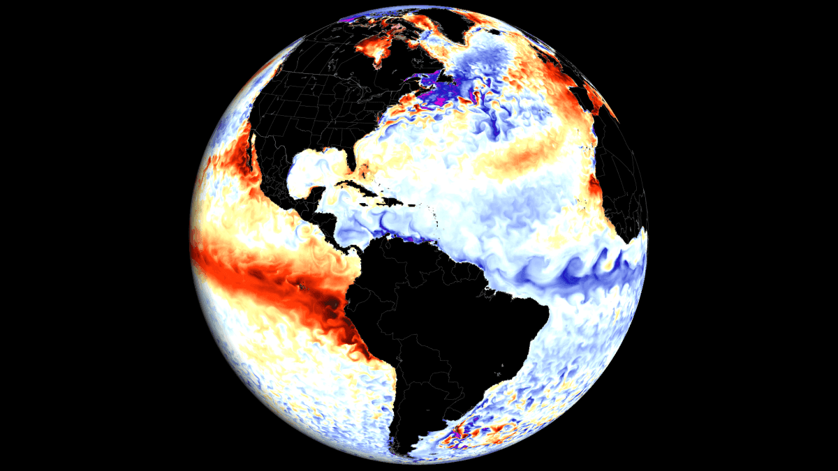
In a rare meteorological convergence, the tropical oceans are currently hosting two of the most significant climate anomalies in recent memory: a potent "Super El Niño" in the Pacific and a developing, rare Atlantic Niña. While these phenomena are geographically separated by an entire continent, they are working in concert to create a formidable "atmospheric shield" across the Atlantic Basin. This synergy is currently reconfiguring global circulation patterns, casting a long shadow over the 2026 Atlantic hurricane season and offering, perhaps, early clues about the volatile winter weather expected for 2026/2027.
Main Facts: The Convergence of Extremes
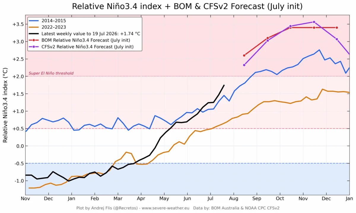
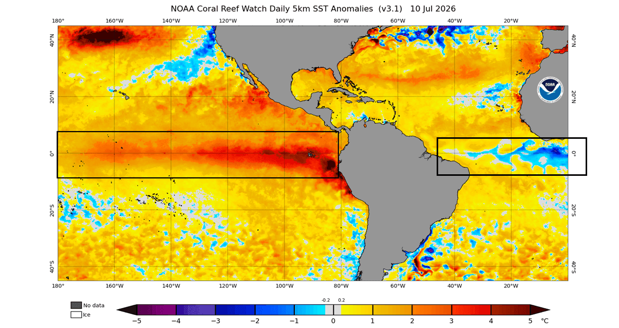
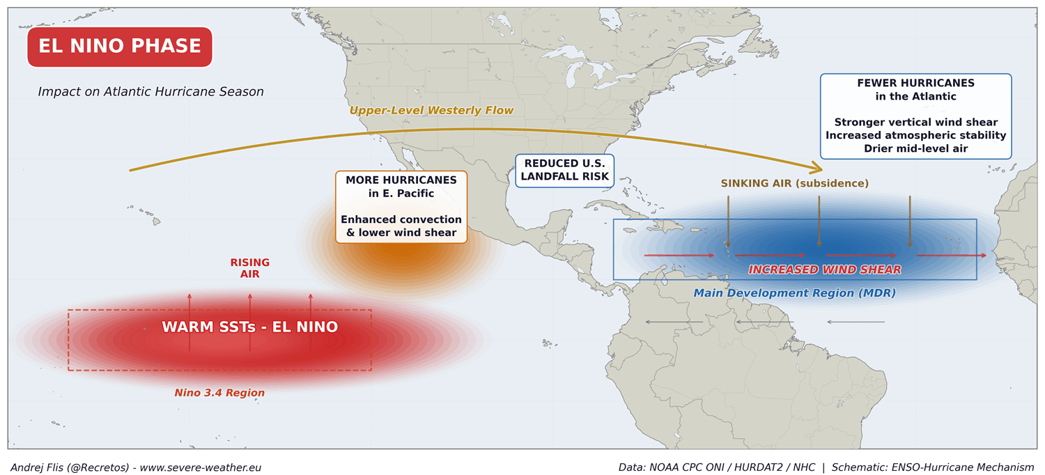
The current state of the global climate system is defined by a striking dichotomy. In the Pacific, the rapid onset of a Super El Niño—characterized by surface temperatures 3 to 4 degrees Celsius above the norm—is driving massive shifts in atmospheric pressure and wind patterns. Simultaneously, the tropical Atlantic has transitioned into an Atlantic Niña state.
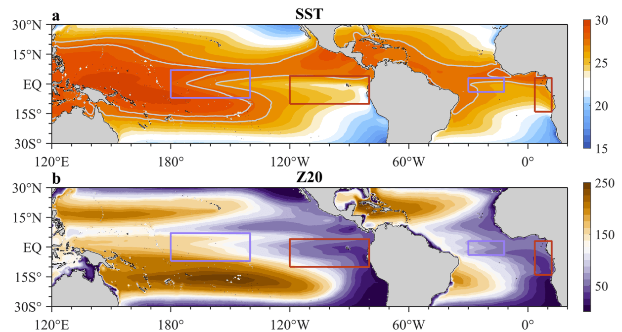
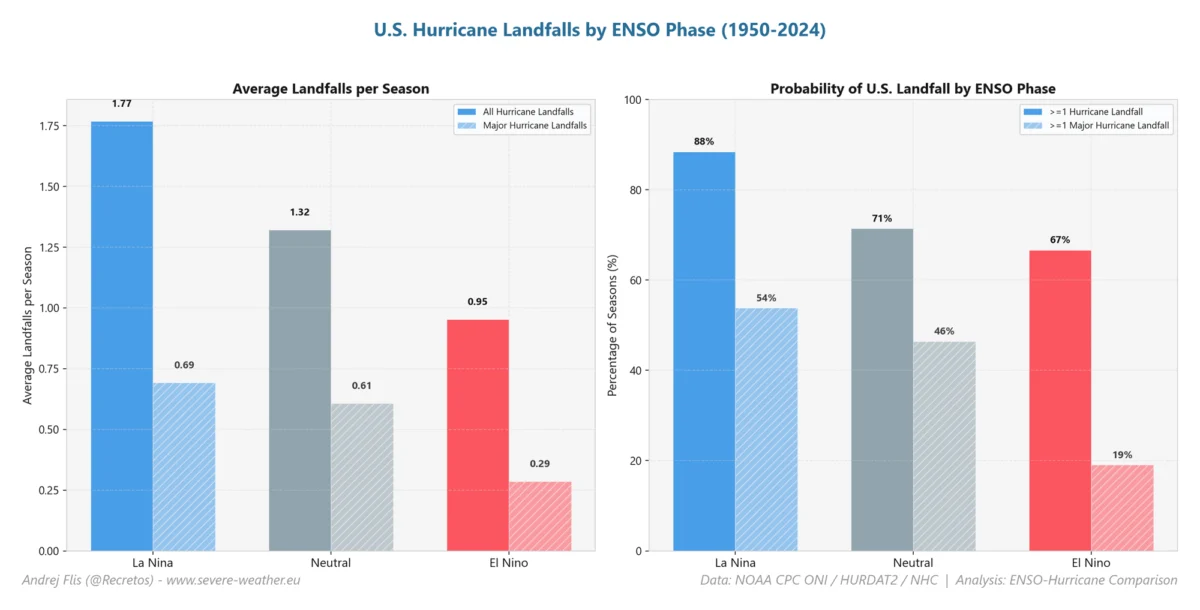
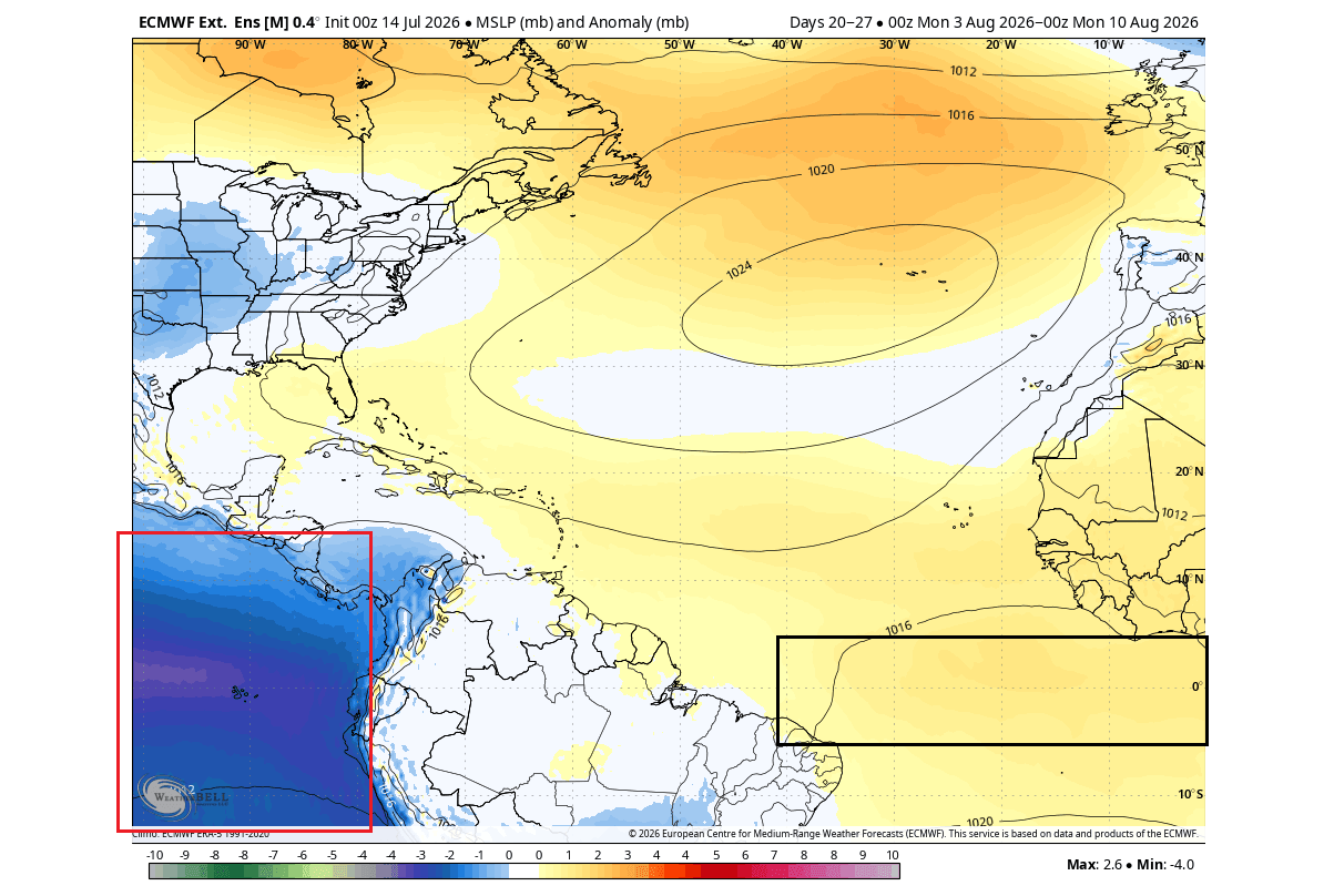
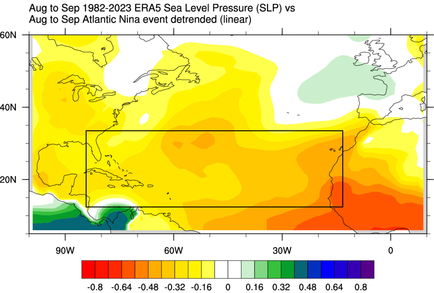
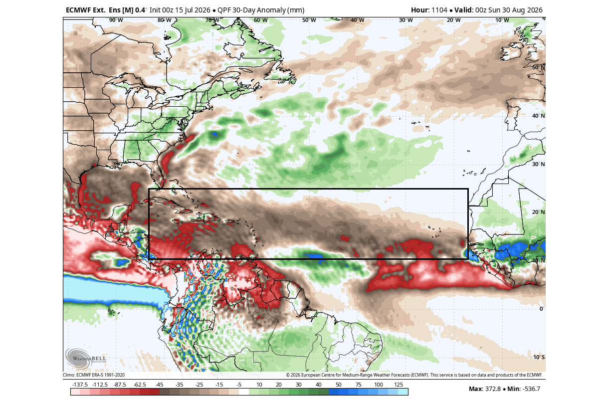
Historically, these two events serve as antagonistic forces for hurricane development. An Atlantic Niña generally creates conditions hostile to tropical cyclone formation by increasing vertical wind shear and promoting sinking air motions. When coupled with the far-reaching influence of a Pacific Super El Niño, the two anomalies create a "double-suppression" effect. Meteorological data indicates that this setup is pushing the atmosphere toward a state of higher pressure, reduced rainfall, and enhanced stability in the "Main Development Region" (MDR)—the nursery where the most dangerous Atlantic hurricanes typically originate.
Chronology: The Emergence of the 2026 Anomaly
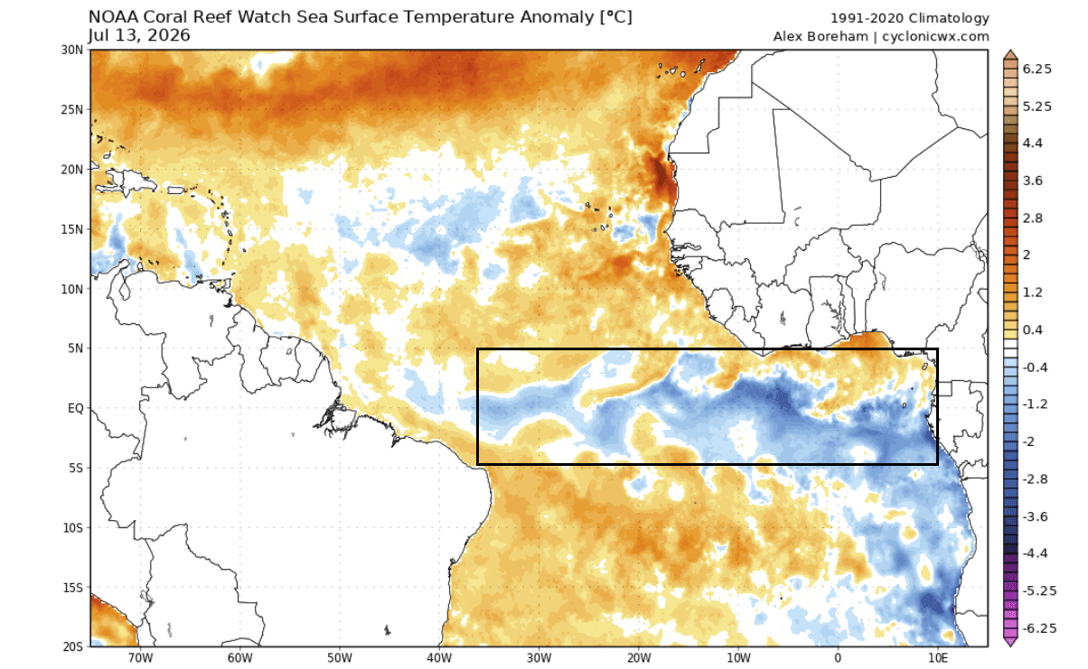
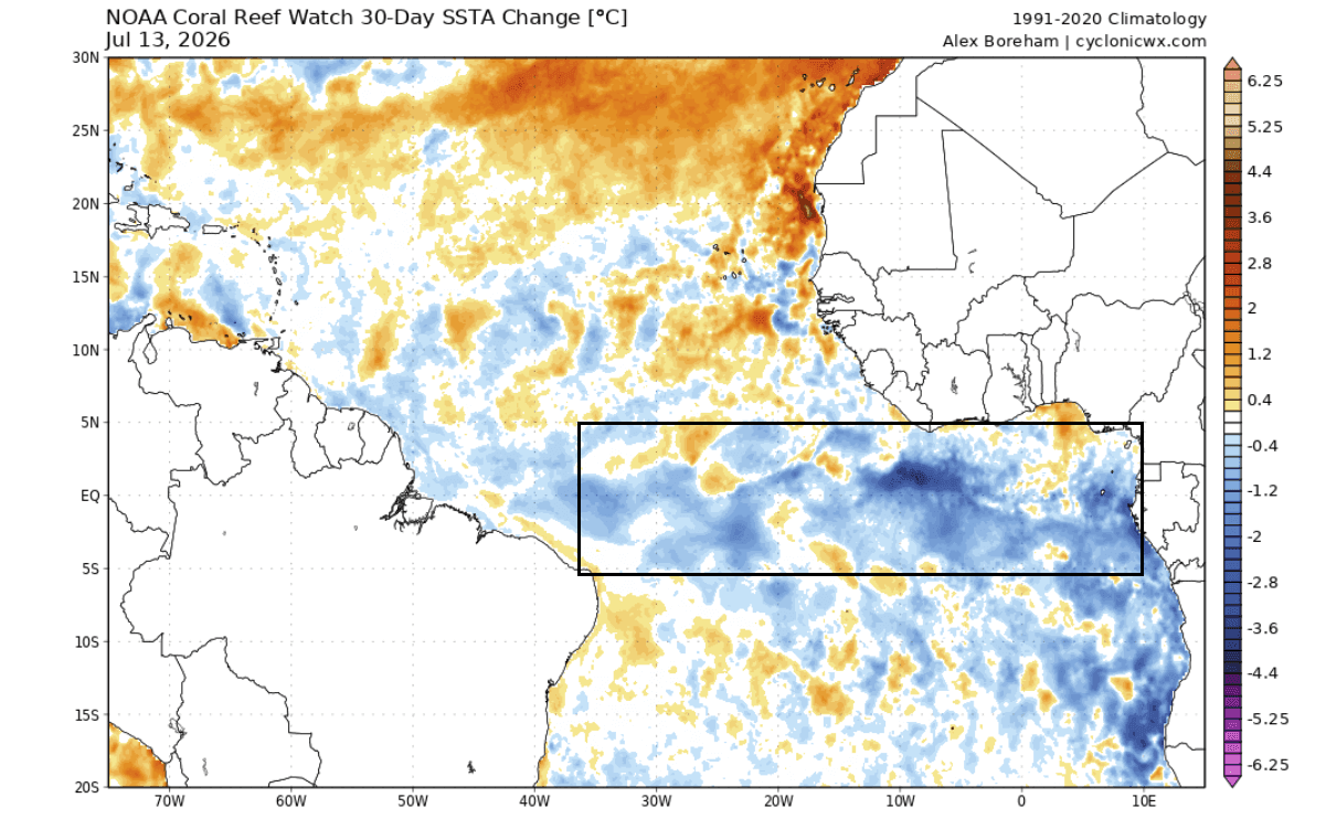
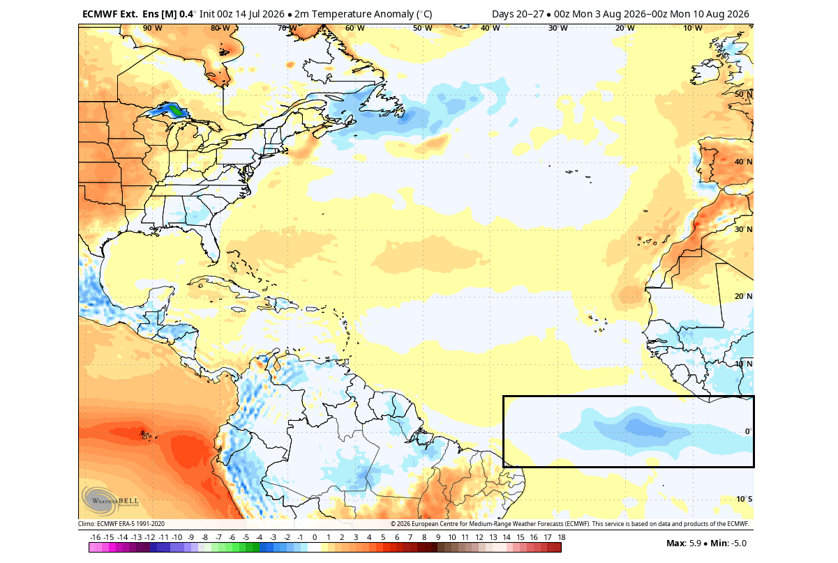
The development of this unique climate state began in early summer 2026. Ocean temperature monitoring by the National Oceanic and Atmospheric Administration (NOAA) Coral Reef Watch (CRW) first identified a cooling trend in the tropical Atlantic that met the criteria for an Atlantic Niña event. By mid-July, the cooling had intensified, with temperatures in the equatorial Atlantic dropping 1 to 3 degrees Celsius below historical averages.
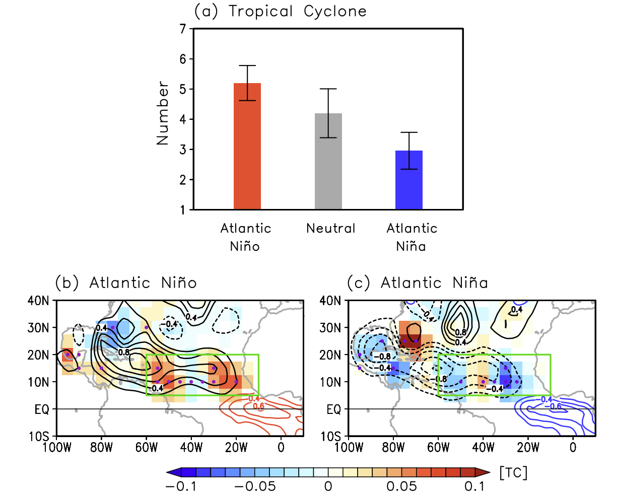
This is not a common occurrence. If the cooling persists throughout the season, as forecast models currently suggest, the 2026 event will be recorded as only the sixth such Atlantic Niña in over 40 years of reliable satellite and buoy data. The timeline of this cooling aligns precisely with the strengthening of the Pacific Super El Niño. As the trade winds—the easterly currents that girdle the equator—have intensified, they have triggered a massive upwelling of colder water in the Atlantic, while simultaneously allowing warm water to pile up in the Pacific, fueling the El Niño feedback loop.
Supporting Data: The Mechanics of Suppression
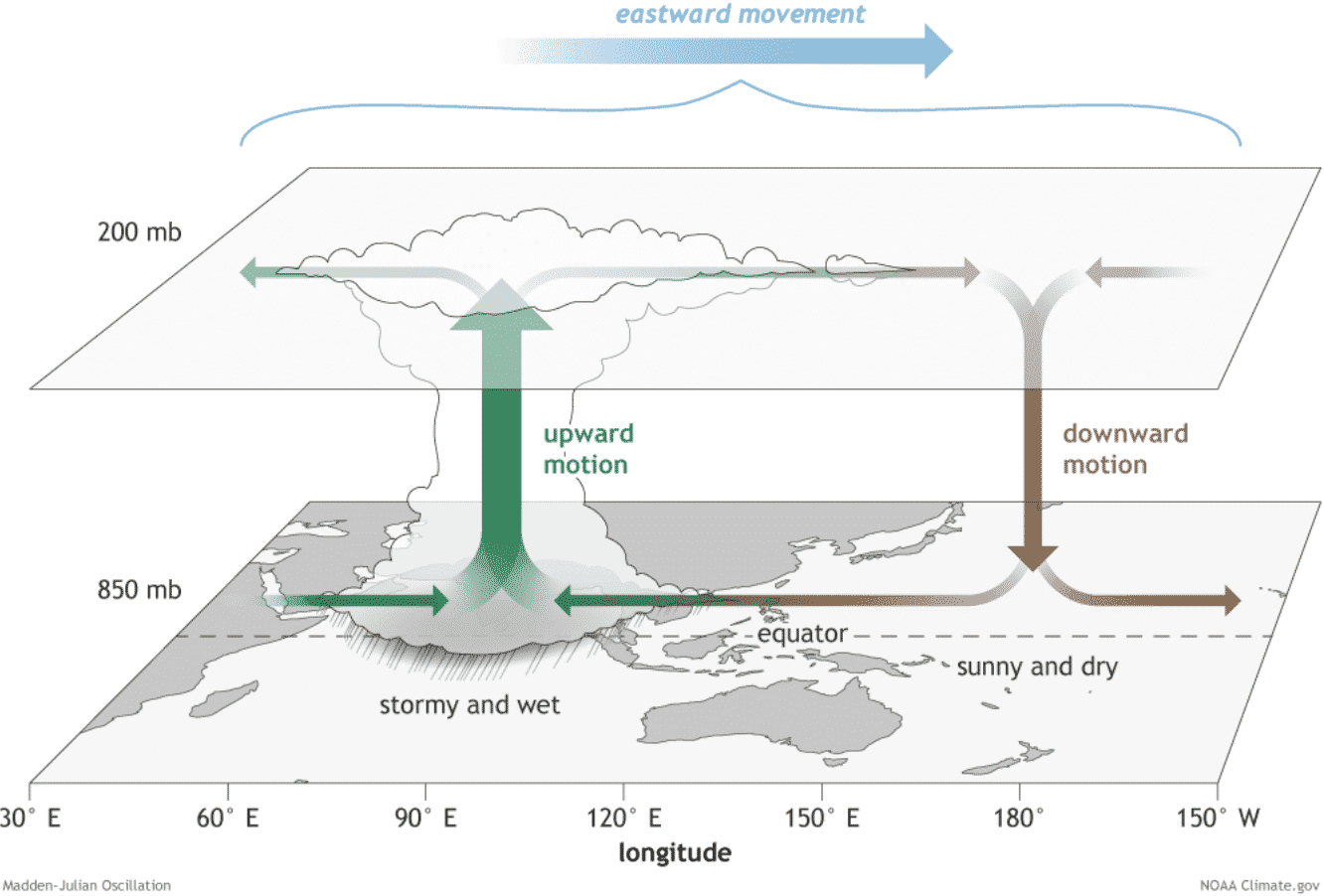
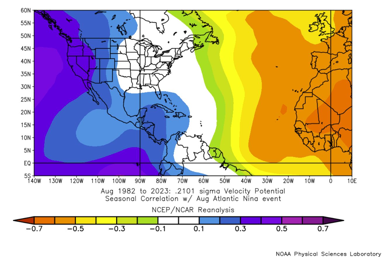
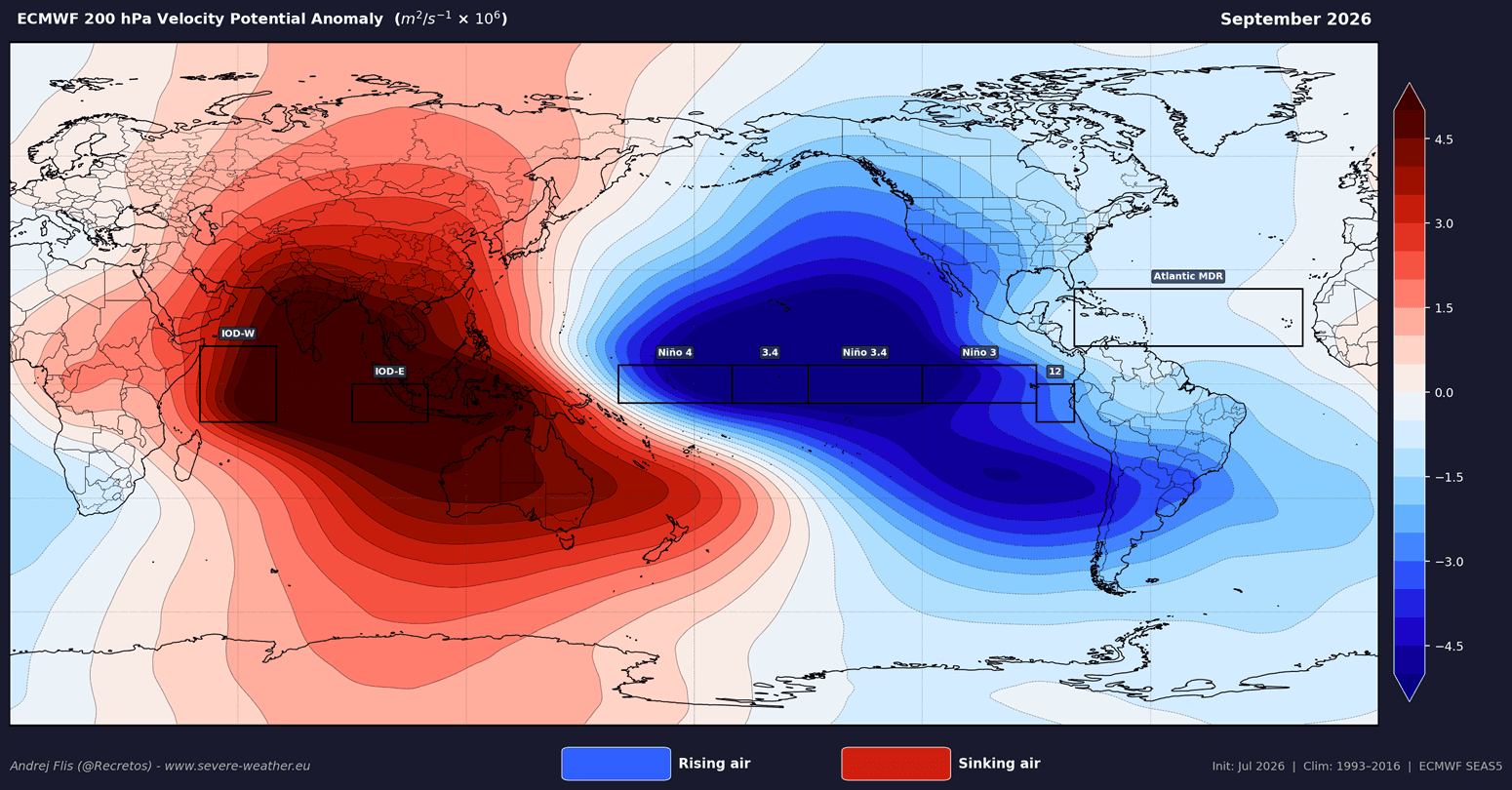
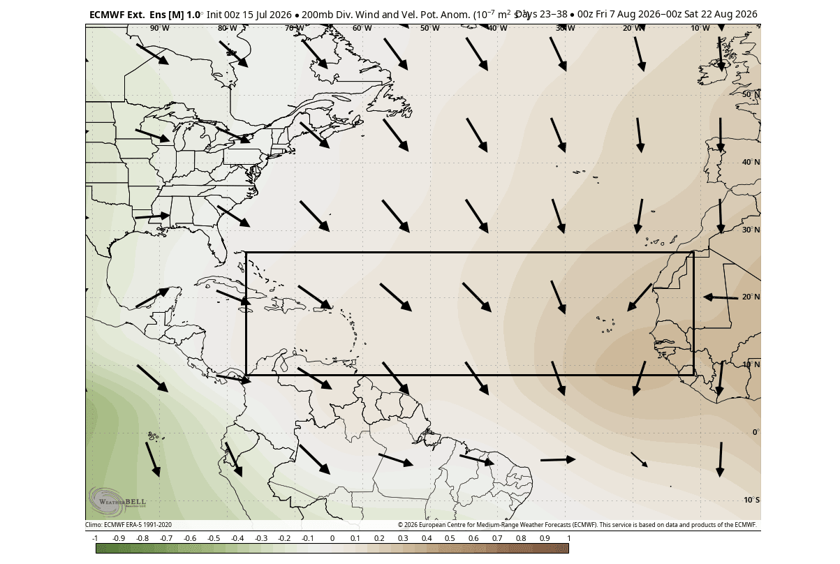
To understand why this "atmospheric shield" is so effective, one must look at the "Velocity Potential"—a metric used by meteorologists to track where air rises (convection) and sinks (subsidence).
In a typical, active hurricane season, the tropical Atlantic experiences "rising motion," which facilitates the cloud formation and low-pressure centers required for tropical depressions to intensify into hurricanes. However, the current velocity potential analysis from the European Centre for Medium-Range Weather Forecasts (ECMWF) shows a massive, persistent zone of sinking air across the Atlantic MDR.
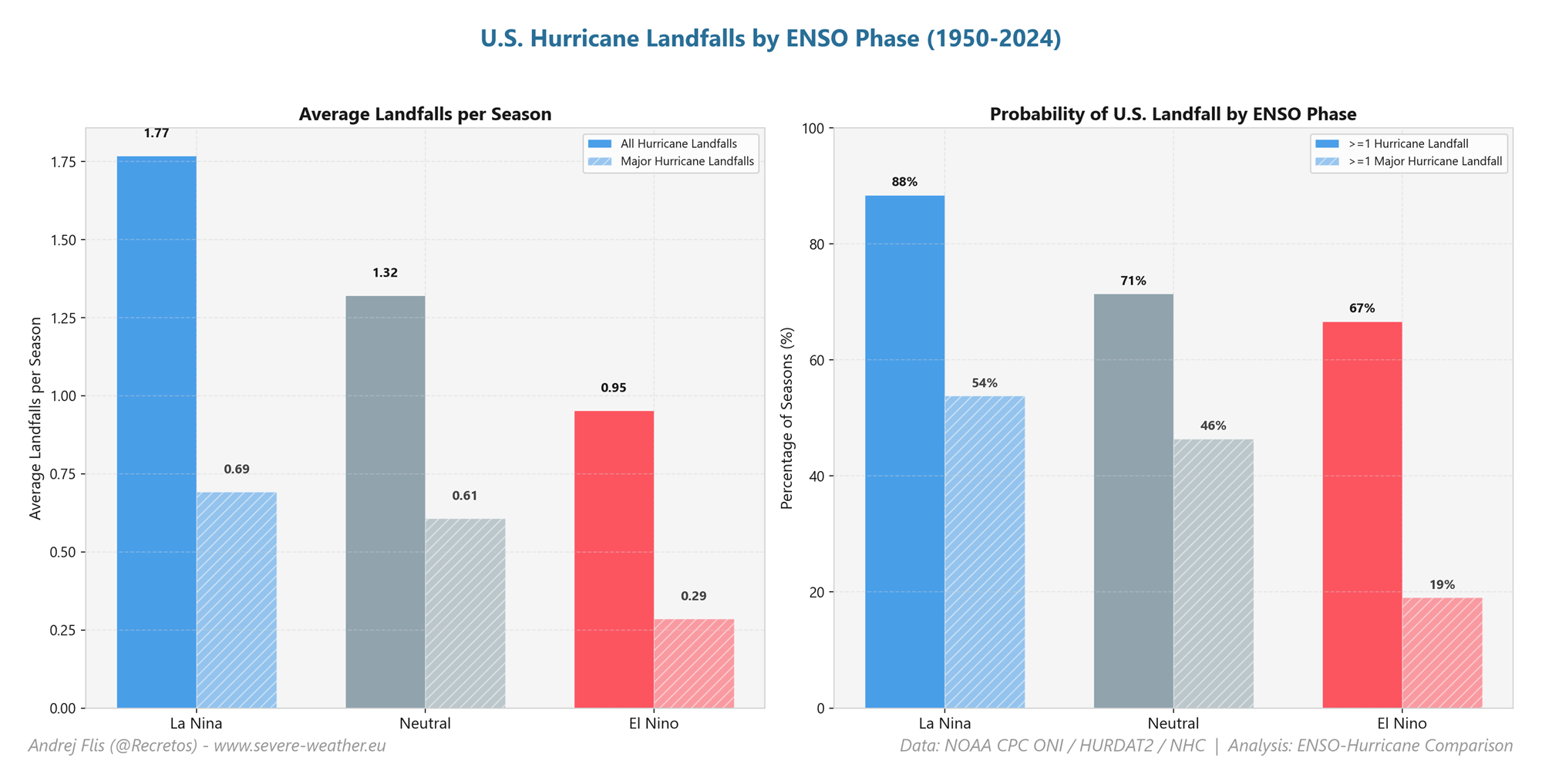
Sinking air acts as a "lid" on the ocean surface, preventing the vertical development of thunderstorms. Furthermore, the Pacific Super El Niño generates significant wind shear across the Atlantic—a phenomenon where wind speeds change direction and velocity with height. This shear effectively "decapitates" developing tropical storms, preventing them from organizing into major hurricanes. Data from the last four decades suggests that during years featuring this specific combination of anomalies, the number of Atlantic tropical cyclones is roughly 50% lower than in neutral years, significantly reducing the probability of landfall along the United States coastline.
Official Perspectives and Risk Assessment
While the meteorological data points toward a suppressed season, experts caution against complacency. The Colorado State University (CSU) tropical research team, led by Dr. Philip Klotzbach, has updated their 2026 outlook to reflect this "atmospheric shield." Their analysis confirms that every coastal region from the Gulf of Mexico to the Canadian Maritimes faces a below-normal threat of hurricane landfall.
However, historical precedent serves as a sobering reminder. The 1992 season, which was similarly suppressed by strong environmental headwinds, still produced Hurricane Andrew—a catastrophic Category 5 storm that devastated South Florida. "The seasonal outlook provides a probability, not a guarantee," notes a representative from the National Hurricane Center (NHC). "A quiet season simply means there are fewer opportunities for a storm to form; it does not mean the risk is zero."
The official stance remains that while the large-scale drivers are unfavorable for a high volume of storms, the atmospheric "background noise" can still occasionally allow for a high-intensity, localized event.
Implications: A Glimpse into Winter 2026/2027
Perhaps the most fascinating aspect of the current 2026 climate pattern is its potential to serve as a bellwether for the upcoming winter. The "Accumulated Cyclone Energy" (ACE) index—a metric used to measure the total intensity and duration of the hurricane season—is forecast to be among the lowest in recent history.
Research into teleconnections suggests that a quiet hurricane season, when driven by a strong Pacific El Niño, often correlates with specific winter outcomes. A suppressed tropical season is frequently associated with a weakened or "disrupted" Polar Vortex. As the stratospheric circulation becomes warmer and more unstable, the jet stream—the high-altitude river of air that steers weather systems—becomes increasingly wavy.
This "waviness" prevents the Polar Vortex from effectively bottling up cold Arctic air at the pole. Consequently, the frigid air is prone to "spilling out" into the mid-latitudes, including the United States and Canada. While it is too early for precise regional snowfall forecasts, the current ocean-atmosphere coupling suggests that the 2026/2027 winter could be characterized by high-impact, short-duration cold snaps and significant atmospheric volatility.
Conclusion: The Global Weather System in Motion
The 2026 season is a testament to the interconnected nature of our planet’s climate. The same easterly trade winds that cool the Atlantic to protect the U.S. from hurricanes are simultaneously stoking the fires of a Super El Niño in the Pacific.
As we move deeper into the peak of the hurricane season, the focus remains on the "atmospheric shield" provided by these anomalies. While the risk of widespread tropical activity is diminished, the secondary implications—specifically the shifting patterns of the jet stream and the potential for a weakened Polar Vortex—suggest that the challenges of 2026 will not end when the tropical season closes in late November. The global atmosphere is currently in a state of adjustment, and the signals we see today in the tropical oceans will likely resonate throughout the winter months, shaping the climate experience for millions across North America.
For now, the combination of a rare Atlantic Niña and a robust Pacific Super El Niño provides a temporary, but significant, buffer for coastal communities. Monitoring these oceanic anomalies remains the most effective tool we have for anticipating not just the immediate hurricane threat, but the broader seasonal trends that lie ahead.