As the Northern Hemisphere transitions through the summer of 2026, meteorologists are closely monitoring a convergence of massive atmospheric and oceanic drivers. Data from the tropical stratosphere and the Pacific Ocean suggest that the upcoming 2026/2027 winter season will be shaped by a "global trinity"—a rare synchronization of a record-breaking Super El Niño, the Quasi-Biennial Oscillation (QBO), and the volatile state of the Polar Vortex.
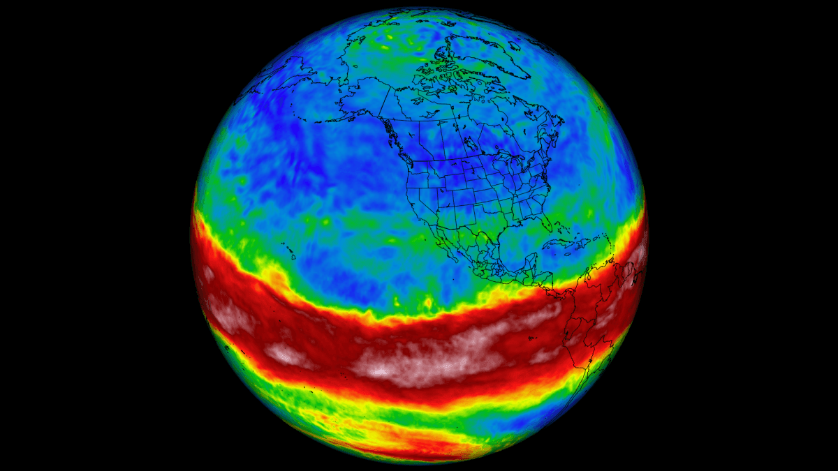
This combination of forces is already setting the stage for significant weather anomalies across the United States, Canada, and Europe. For climate researchers and the public alike, these drivers serve as the "heartbeat" of global weather, dictating the jet stream’s path and the distribution of extreme cold and snowfall long before the first snowflake hits the ground.
The Global Trinity: Understanding the Drivers
The complexity of the upcoming winter is rooted in the interaction of three distinct, yet interconnected, systems.
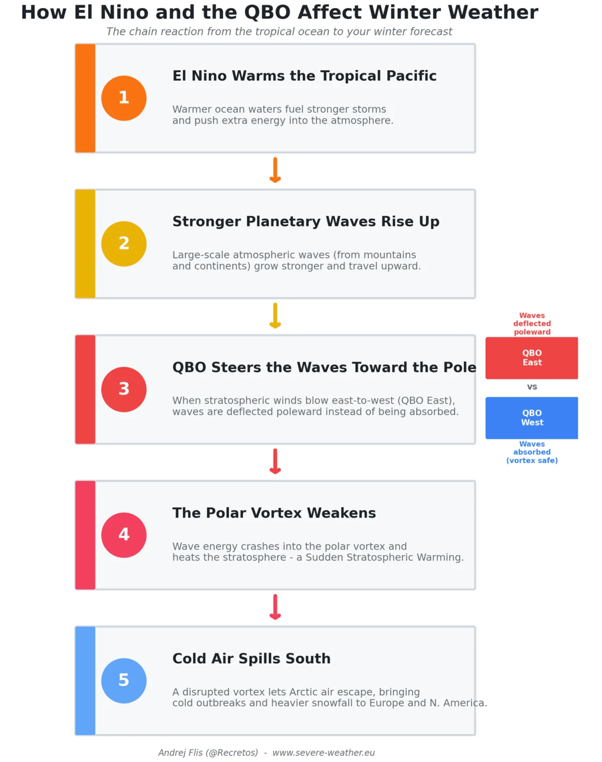
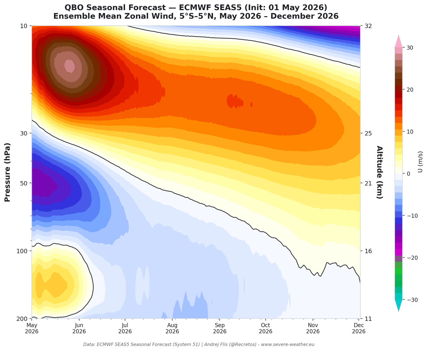
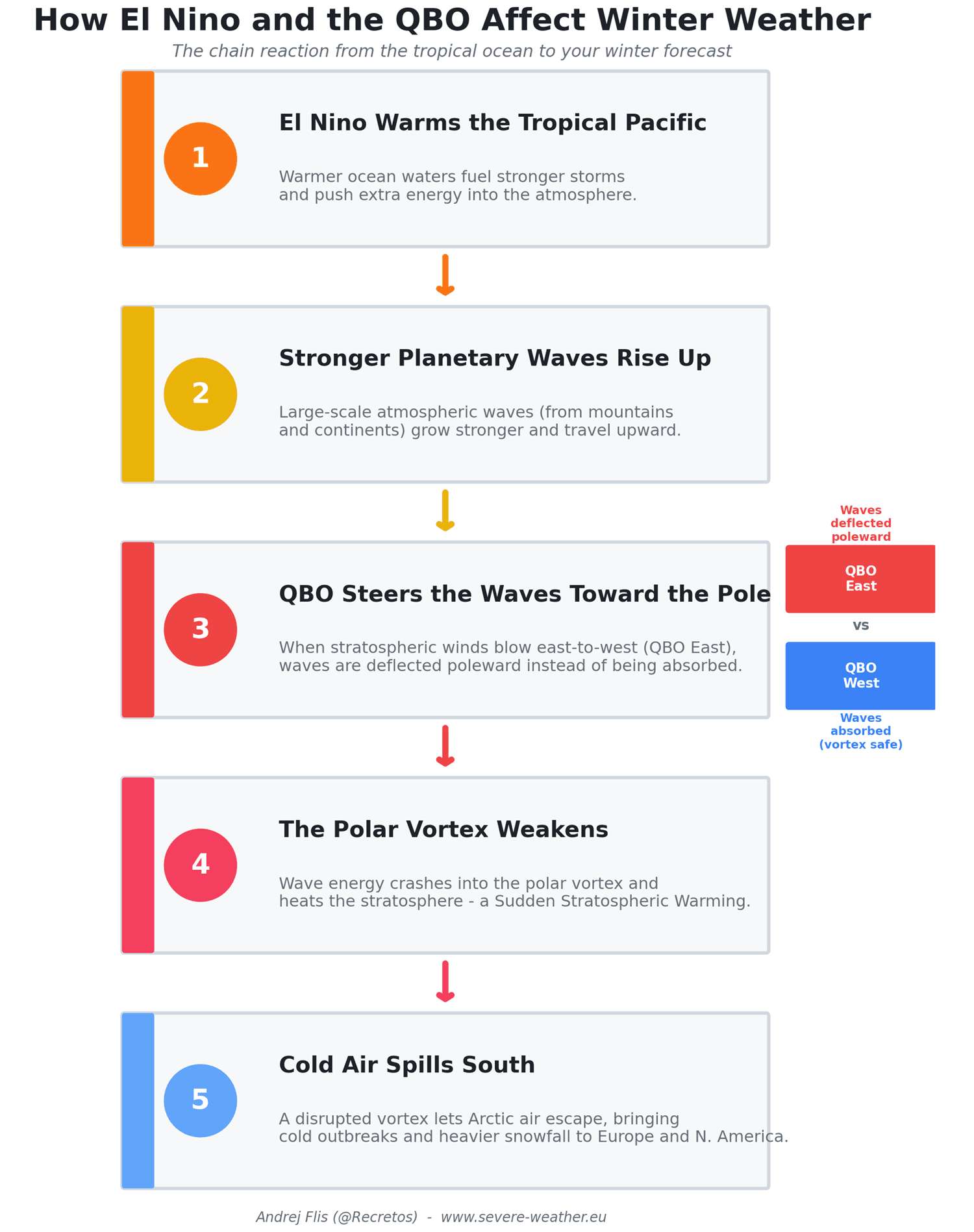
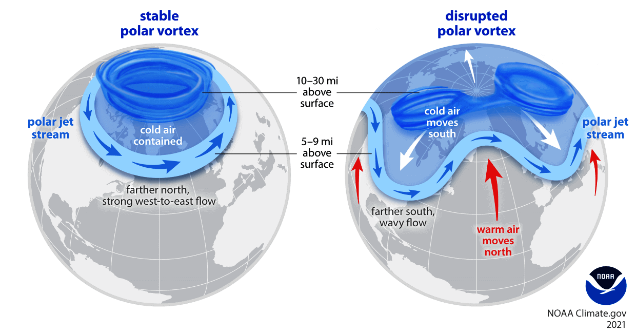
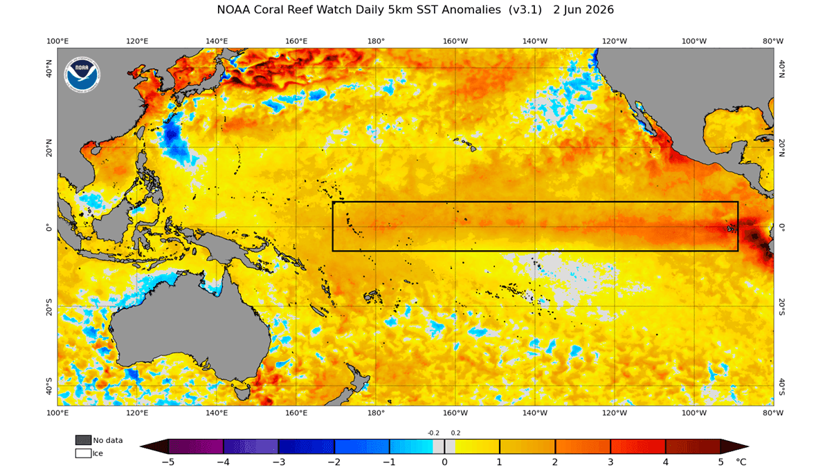
First, the Super El Niño in the tropical Pacific is rapidly intensifying. As ocean temperatures in the ENSO region soar, they fuel powerful atmospheric waves that propagate upward into the atmosphere. Second, the Quasi-Biennial Oscillation (QBO) is undergoing a major phase shift. This stratospheric "traffic controller" alternates between westerly and easterly wind patterns; currently, a strong westerly phase is descending, which will influence how planetary waves interact with the polar regions. Finally, the Polar Vortex acts as the final arbiter. When weakened by the other two factors, the vortex loses its ability to contain Arctic air, leading to the severe cold outbreaks that often characterize high-impact winter events.
Chronology of Atmospheric Development
The progression toward this unique winter began earlier this year, and current observations provide a clear timeline of these developing anomalies:
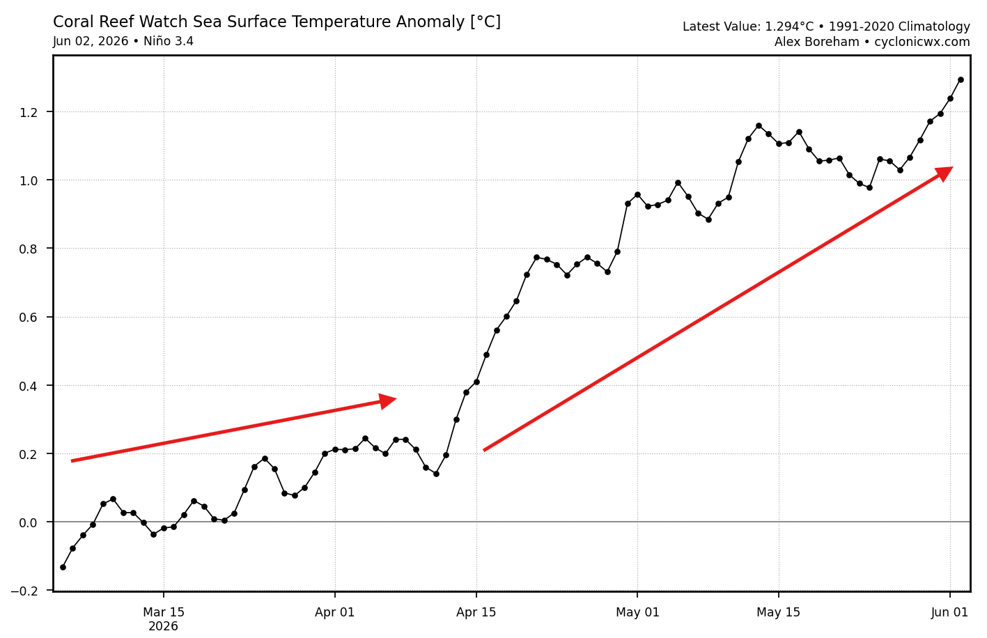
- March–May 2026: Initial temperature anomalies in the tropical Pacific began to rise, signaling the early onset of an El Niño event.
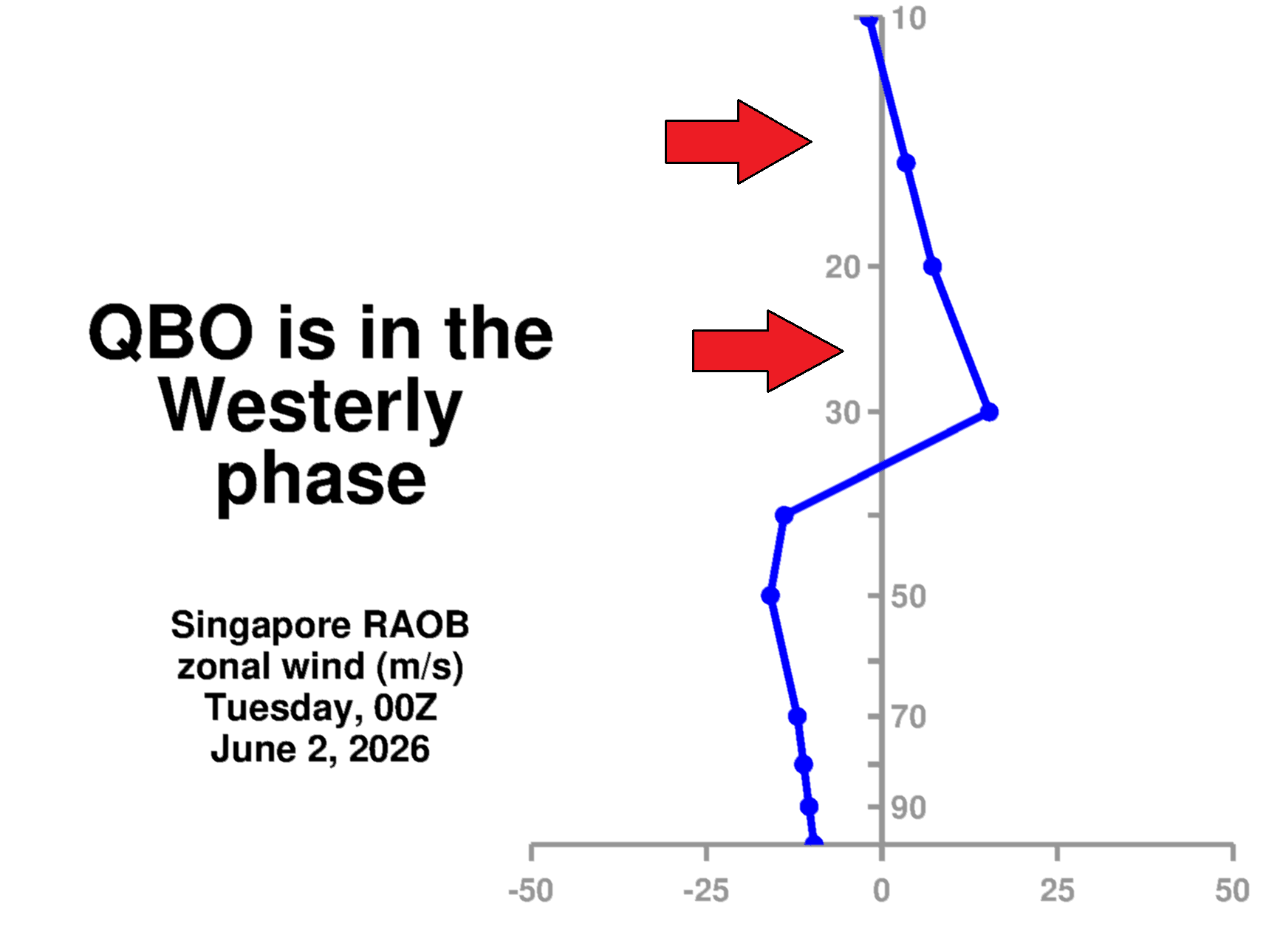
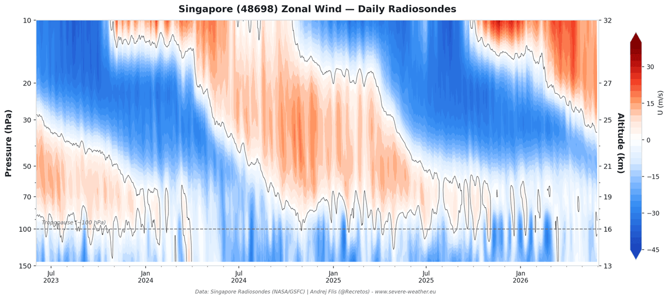
- June 2026: NASA radiosonde analysis from Singapore confirmed a westerly wind shift at the 15–30mb level. This confirmed that the West QBO phase is descending through the tropical stratosphere, set to peak just as the winter season approaches.
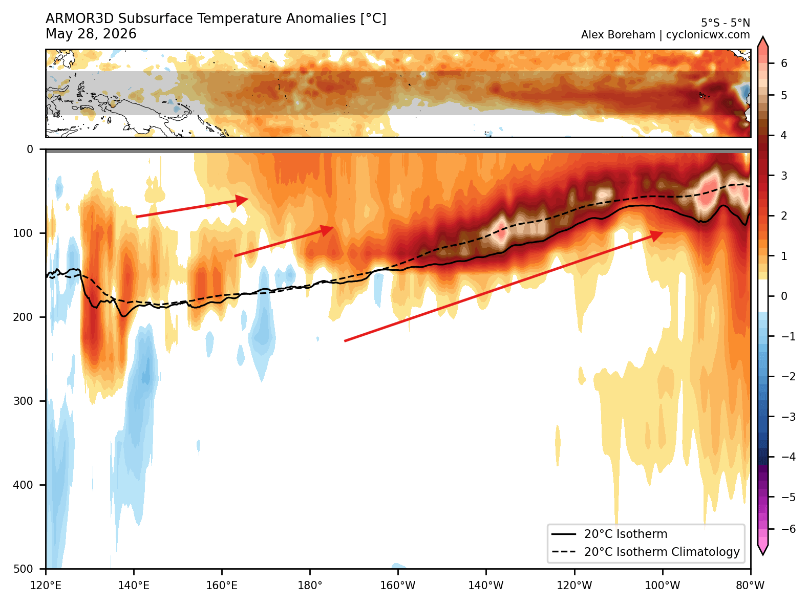
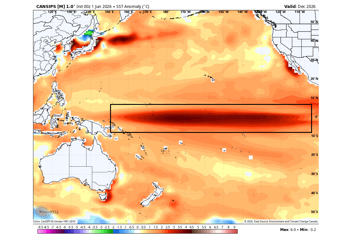
- July 2026: Subsurface Kelvin waves—massive bodies of warm water—have reached temperatures nearly 8°C above normal. This "core" of the El Niño is now rising to the surface, confirming the potential for a "Super" event.
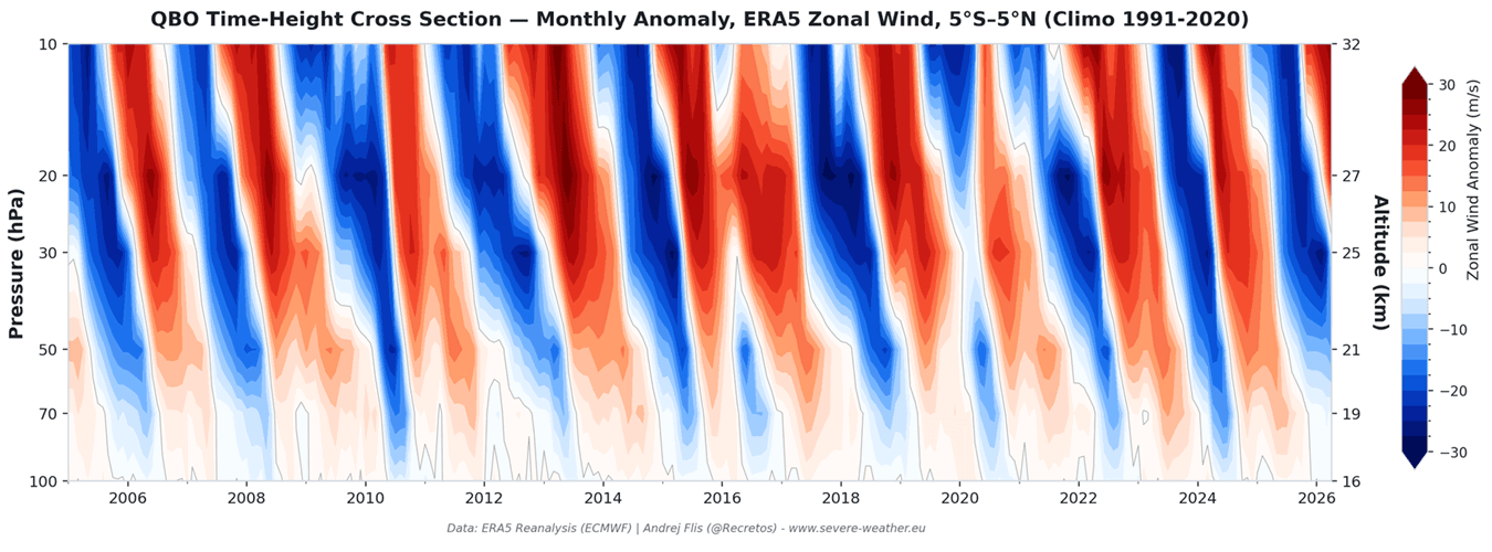
- Fall 2026 (Projected): The West QBO will stabilize between 30–50mb, creating a rigid atmospheric environment that will interact with the El Niño-driven tropical wave energy.
- Winter 2026/2027 (Projected): The peak of the interaction between these systems will likely disrupt the Polar Vortex, forcing the jet stream to adopt a highly meridional (wavy) pattern, shifting typical snow and cold zones.
Supporting Data: The Physics of the Shift
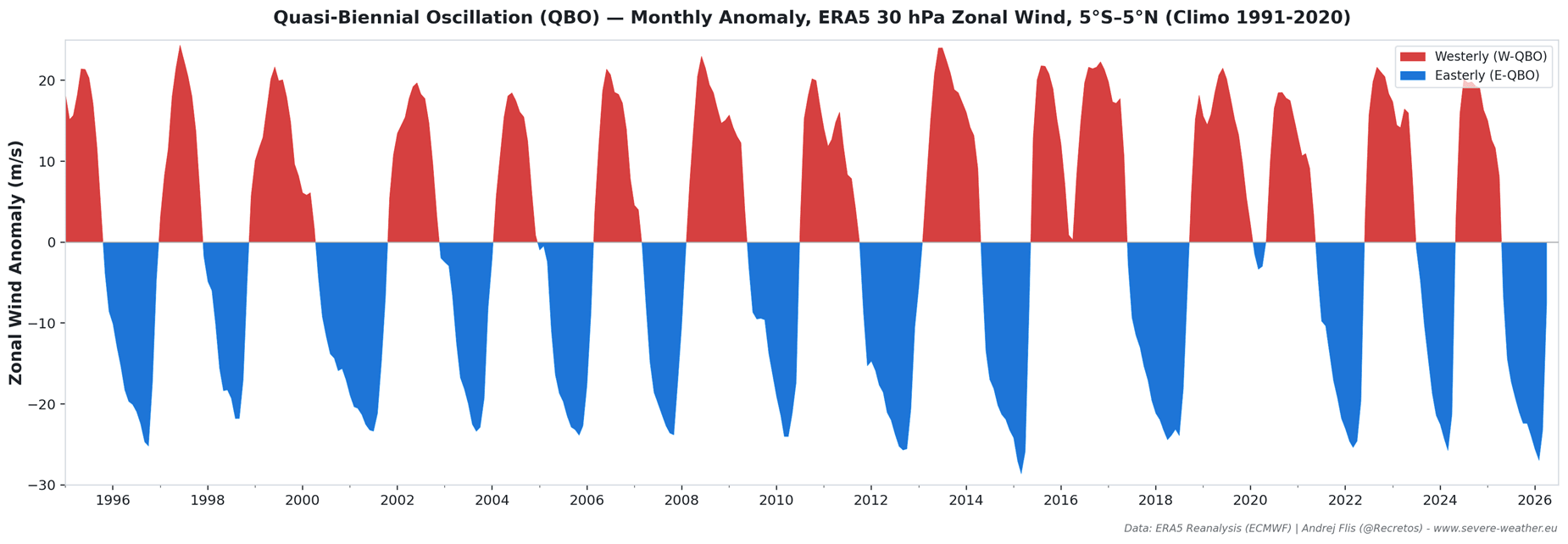
The QBO is often referred to as the "heartbeat of the atmosphere" due to its remarkably regular 17-month cycle. By analyzing zonal wind anomalies over the last 30 years, researchers can see how the stratosphere responds to these oscillations.
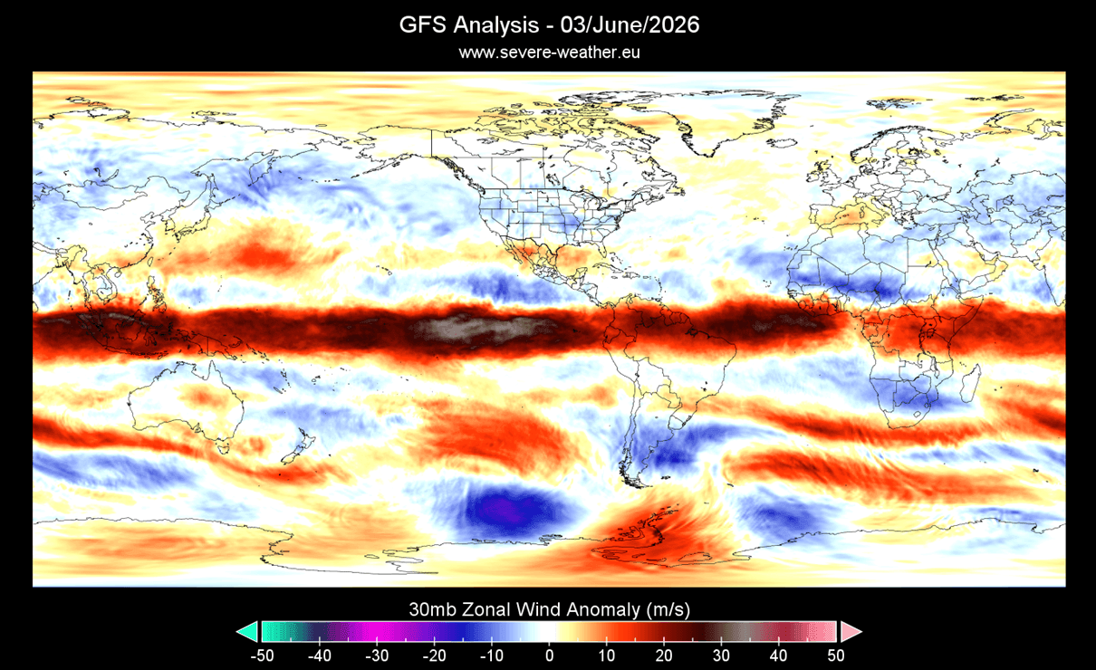
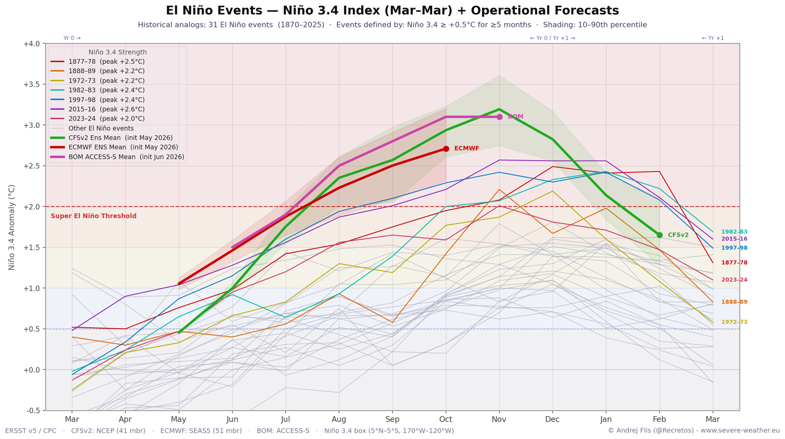
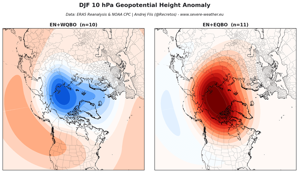
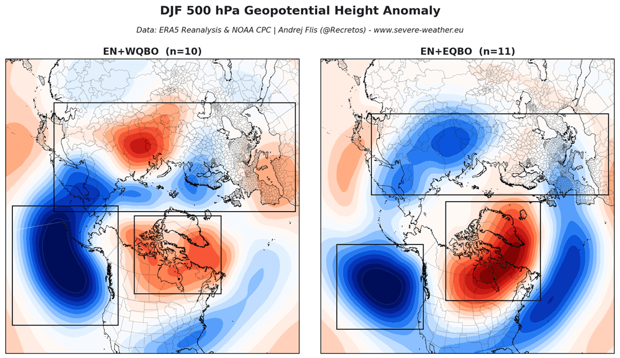
The latest data from the European Centre for Medium-Range Weather Forecasts (ECMWF) and the Canadian CanSIPS model provides a consensus: we are looking at a Super El Niño event that may rival the strongest on record. When compared to historical data—such as the 2015/2016 season—the current model forecasts show striking similarities. The coincidence of a West QBO phase during a Super El Niño year provides a distinct "signature" in the pressure anomalies, typically resulting in a more amplified, wavy jet stream.
The Role of Kelvin Waves
The "engine" of this El Niño is the Kelvin wave. Driven by westerly wind bursts in the Pacific, these waves push warmer subsurface waters eastward. As they surface, they alter the global atmospheric circulation. Current satellite and buoy data show these warm anomalies are not merely temporary spikes; they are deep, sustained, and trending toward historic levels.
Implications for Global Weather Patterns
North American Impact: A Tale of Two Regions
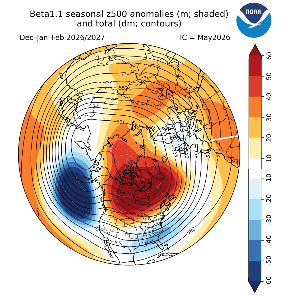
For North America, the West QBO + Super El Niño configuration suggests a divided winter. Historical reanalysis of similar years indicates that the Pacific jet stream will be highly active, often bringing mild, above-normal temperatures to the Western U.S., the Northern Plains, and Canada.
Conversely, the central and southern United States may face a higher frequency of moisture-laden storm systems. The 2015/2016 winter serves as a case study: that season saw heavy snowfall in the Southern Rockies and the Mid-Atlantic, while the Pacific Northwest experienced a significant snow deficit. If the current trend holds, we can expect a "storm track" that favors the southern and central corridors, potentially leaving the Northeast and New England with less consistent snow cover than in a neutral year.
European Outlook: The Atlantic Influence
Europe’s winter is dictated by its proximity to the Atlantic. Under a West QBO phase, the atmospheric pressure pattern tends to favor a low-pressure environment over Northern Europe. This often results in a more robust westerly flow, bringing milder temperatures to the continent. However, the exact positioning of the jet stream remains sensitive to the state of the Polar Vortex. While the West QBO generally suppresses the likelihood of deep-freeze events compared to an East QBO winter, the potential for "block" high-pressure systems remains, which could force short-lived, intense cold snaps into the UK and Scandinavia.
Official Perspectives and Model Consensus
Meteorological agencies worldwide, including NOAA and the Australian Bureau of Meteorology (BOM), are aligned in their assessment. While long-range seasonal forecasting is inherently probabilistic, the high degree of agreement between these disparate modeling systems is noteworthy.
The consensus is that the atmosphere is currently in a state of "high predictability" regarding its major drivers. Unlike years where the drivers are weak or conflicting, the current "Global Trinity" provides a clear roadmap for the coming months.
"We are witnessing a synchronized development," noted analysts at the most recent climate briefing. "When the QBO, ENSO, and the stratospheric circulation move in tandem, the resulting weather patterns tend to be more persistent and extreme."
Summary of Expected Trends
As we look toward the winter of 2026/2027, the following key takeaways emerge for stakeholders, agriculture, and emergency management:
- Increased Storminess: The southern tier of the United States and the central Plains should prepare for increased storm frequency and associated precipitation.
- Temperature Divergence: A significant temperature split between the "warm" north (Canada/Pacific Northwest) and the "dynamic" south/central regions is expected.
- Snowfall Variability: Traditional northern snowbelts may face a drier winter, while non-traditional areas—particularly in the Southern and Central U.S.—should be prepared for heavy, albeit episodic, snowfall.
- Polar Vortex Monitoring: Because the West QBO influences how waves break in the stratosphere, the potential for a sudden stratospheric warming (SSW) event remains a critical "wildcard" that could trigger a late-season collapse of the Polar Vortex.
Conclusion: Preparing for a Dynamic Season
The winter of 2026/2027 is shaping up to be a defining season in the modern meteorological record. By understanding the interplay between the warming Pacific, the rhythmic shifting of stratospheric winds, and the fluctuating strength of the Polar Vortex, we gain a valuable window into what nature has in store.
While precise local forecasts are impossible at this range, the structural "scaffolding" of the upcoming winter is clearly visible. As the QBO continues its descent and the Super El Niño reaches maturity, the scientific community will continue to refine these projections. For now, the message is clear: the global atmosphere is shifting, and the coming winter will be a testament to the immense power of our planet’s interconnected systems.
Stay tuned for further updates as we continue to track these global drivers throughout the transition into autumn.