As the meteorological community monitors the evolving climate landscape for the latter half of 2026, one phenomenon has eclipsed all others in its potential for global disruption: the rapid development of a record-strength "Super El Niño." This event is not merely a localized warming of the Pacific Ocean; it is a profound driver of global atmospheric circulation, triggering a cascade of anomalies that are already manifesting in early fall and are projected to define the character of the 2026/2027 winter season across the Northern Hemisphere.

The Anatomy of a Super El Niño: Main Facts and Drivers
At the heart of the current climate forecast is a robust and deepening El Niño event. Meteorologists define an El Niño as a phase of the El Niño-Southern Oscillation (ENSO) characterized by warmer-than-average sea surface temperatures (SSTs) in the central and eastern tropical Pacific. However, the 2026 event is rapidly ascending to "Super" status—a classification reserved for the most extreme anomalies.
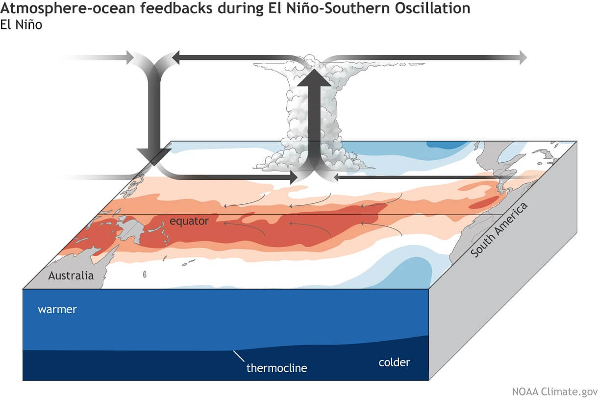
The fundamental driver of this event is the "ocean-atmosphere bridge." As warm water pools in the eastern Pacific, it alters the Walker Circulation. Rising air over the warmer ocean waters increases precipitation and decreases atmospheric pressure, while descending air over the western Pacific creates high-pressure zones. This redistribution of thermal energy effectively acts as a global conductor, shifting storm tracks, jet streams, and temperature gradients thousands of miles away from the equator.
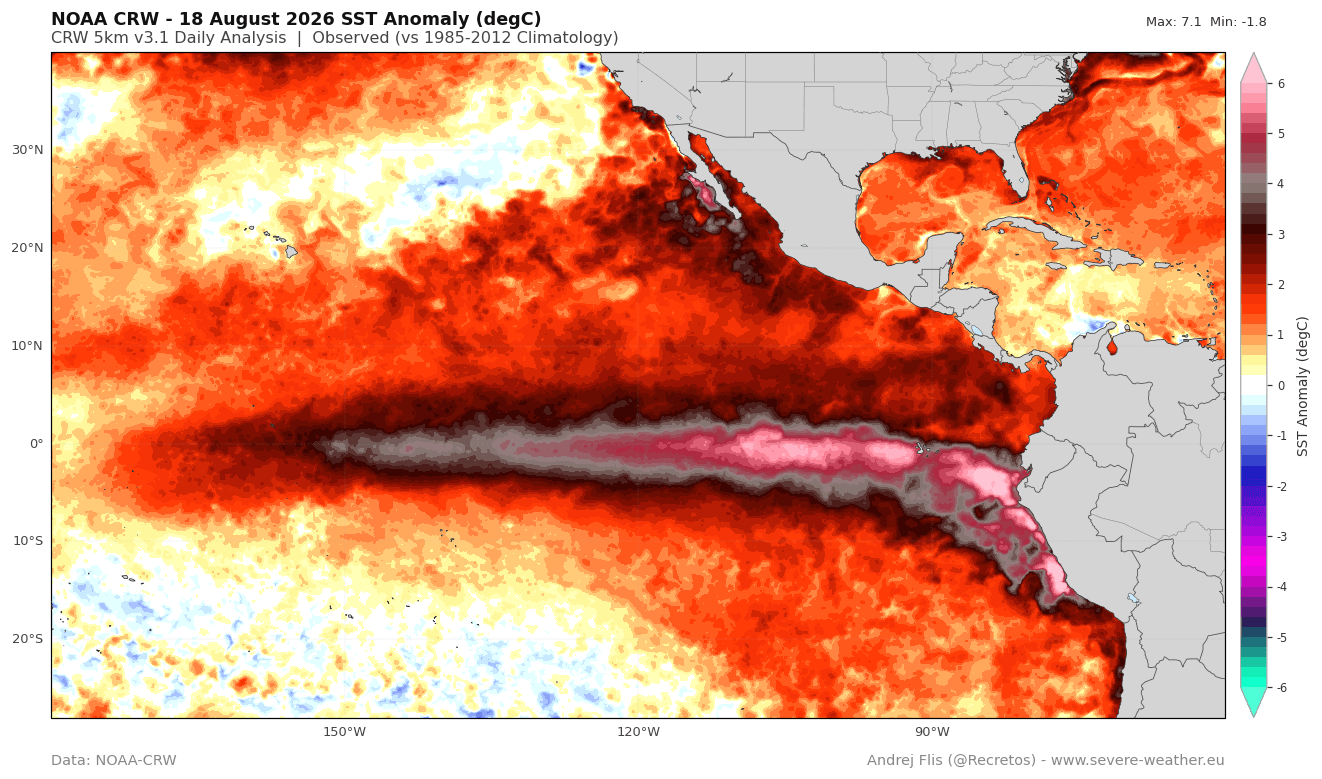
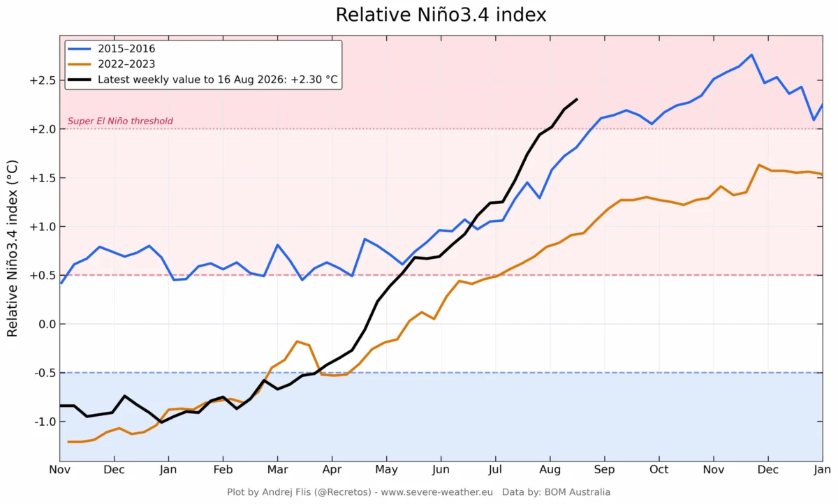
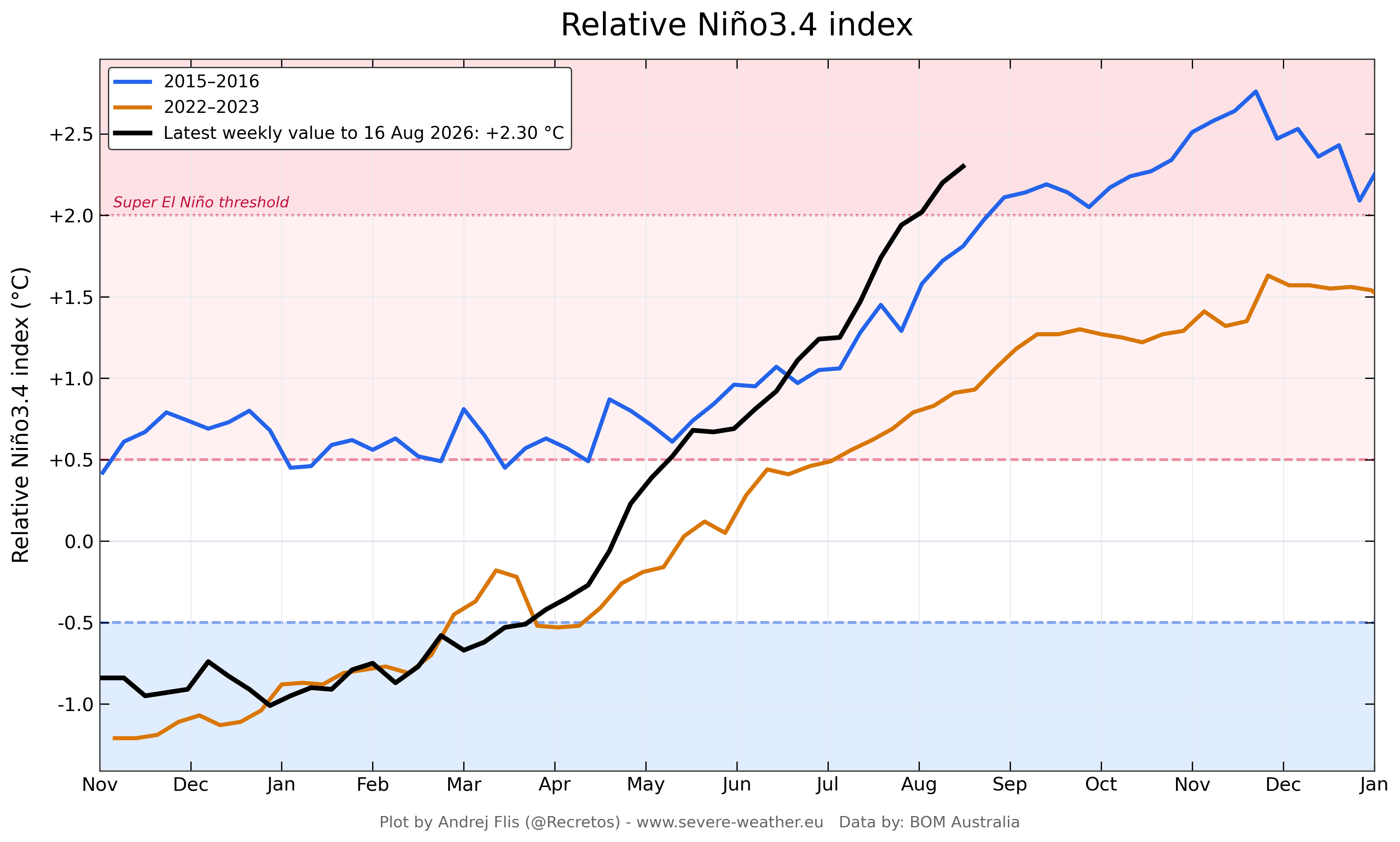
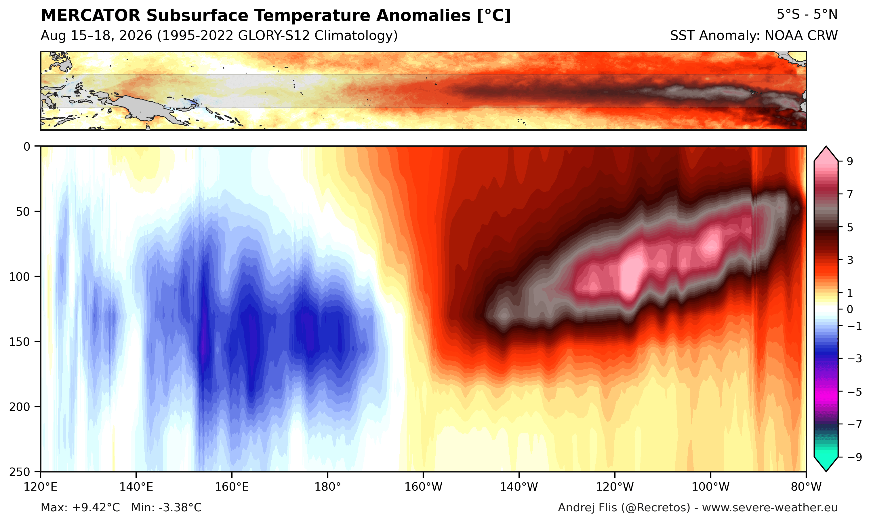
Recent data from the National Oceanic and Atmospheric Administration (NOAA) and the Australian Bureau of Meteorology (BOM) confirm that SST anomalies in the primary ENSO regions have already surpassed the +2°C threshold—the baseline for a Super El Niño. More concerning is the subsurface temperature data, which reveals a powerful Kelvin Wave—a massive pulse of warm water—traversing the tropical Pacific. With anomalies in the top 250 meters of the ocean exceeding 9°C (16°F) above normal, this deep-seated thermal energy ensures that the El Niño will remain energized well into the winter months.
Chronology: A Rapid Development and Early Onset
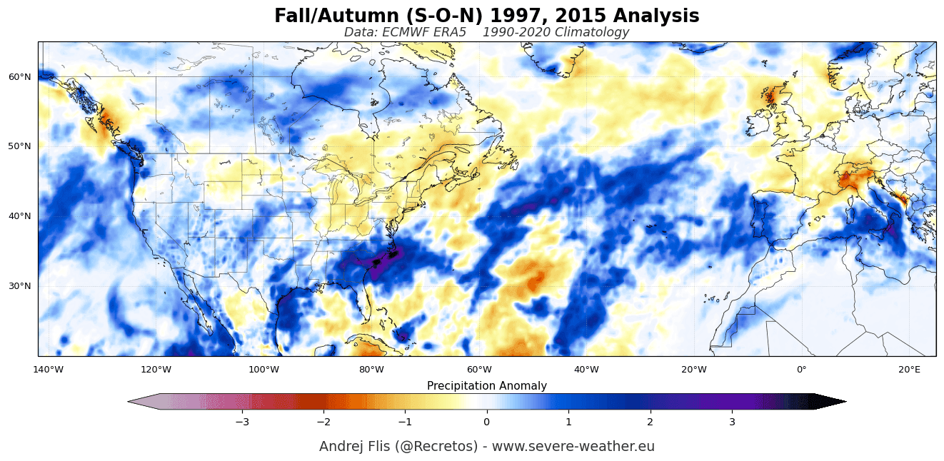
The speed of this year’s development has caught many models by surprise. Compared to the historic 2015/2016 Super El Niño, the 2026 event has reached critical thresholds months ahead of schedule. While the 2015 event did not hit its peak intensity until late autumn, the 2026 cycle achieved comparable benchmarks by August.
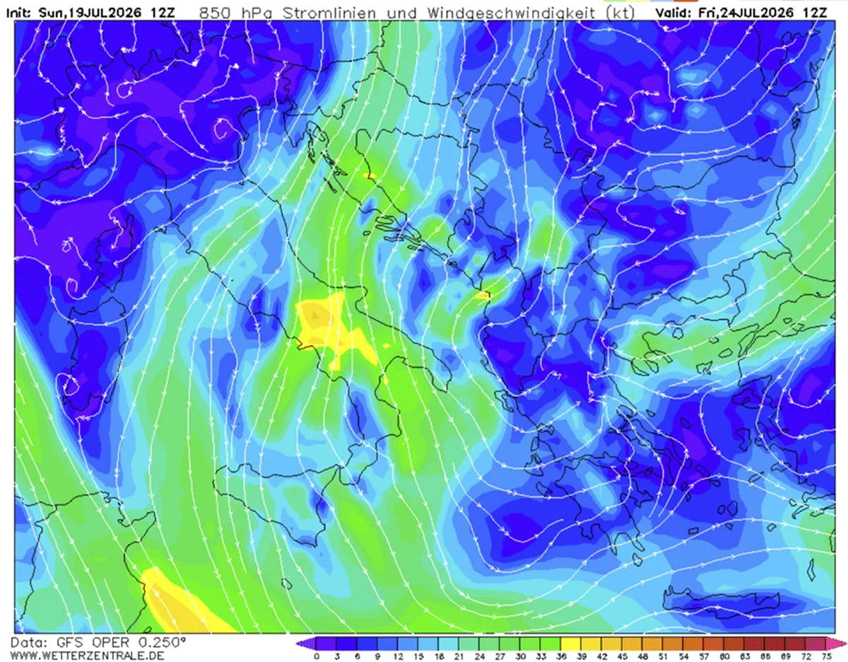
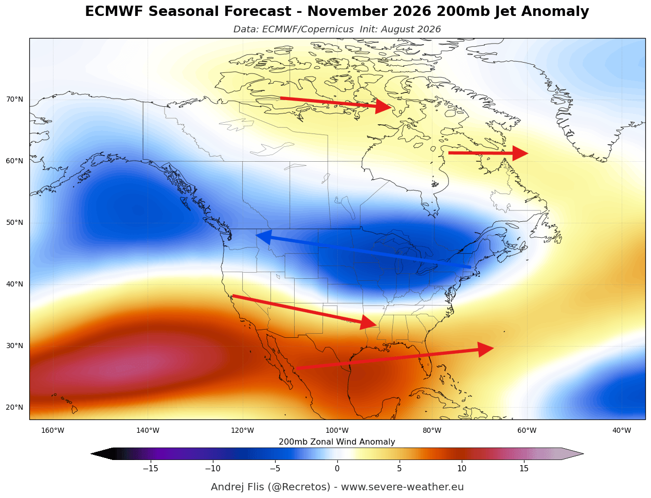
This accelerated development has resulted in an unusually evolved atmospheric response. Typically, the "winter-like" impacts of El Niño—such as the strengthening of the subtropical jet stream—are not fully realized until mid-winter. However, current modeling from the European Centre for Medium-Range Weather Forecasts (ECMWF) shows a "split-flow" pattern already emerging across North America. The polar jet stream is being displaced northward by a persistent high-pressure anomaly over Canada, while a secondary, vigorous southern jet stream is channeling moisture across the southern United States. This premature shift signals that the atmosphere is already responding to the profound forcing exerted by the Pacific’s warm core.
Supporting Data: Multi-Model Ensemble Projections
To assess the potential trajectory of this winter, meteorologists rely on the North American Multi-Model Ensemble (NMME). This system synthesizes data from various independent models, and the consensus is alarming. Consecutive runs since February have consistently trended toward higher anomaly values, with some models suggesting a peak intensity near +4°C in the main ENSO region.
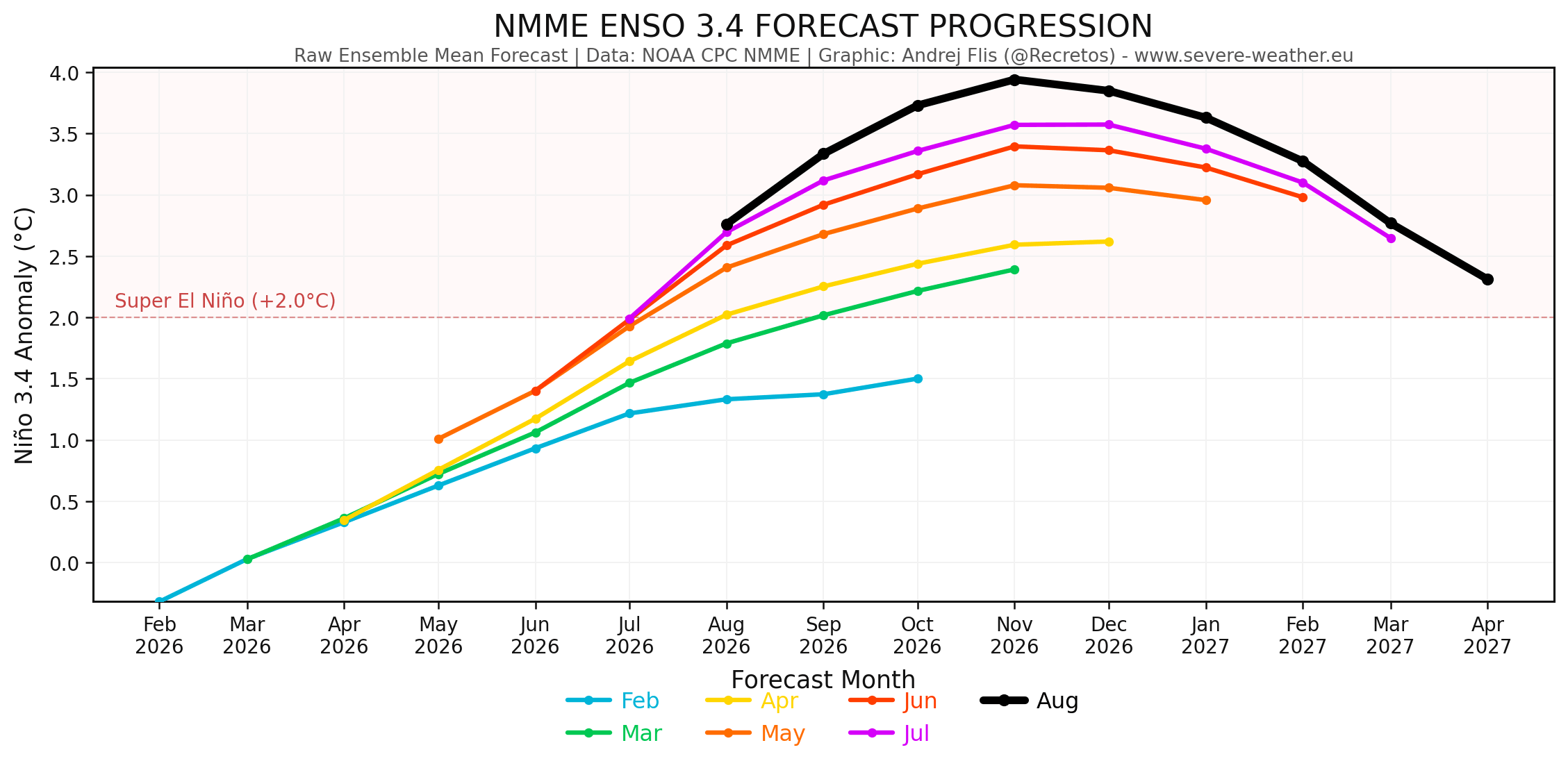
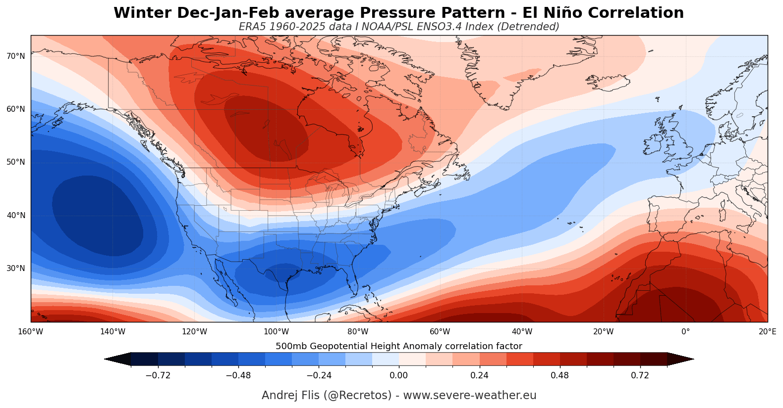
If these projections hold, 2026 will be categorized as an Eastern Pacific (EP) dominant event. Historically, EP events tend to generate a stronger pressure response in the North Pacific compared to Central Pacific events, which often results in more significant precipitation anomalies for the southern United States and parts of Europe.
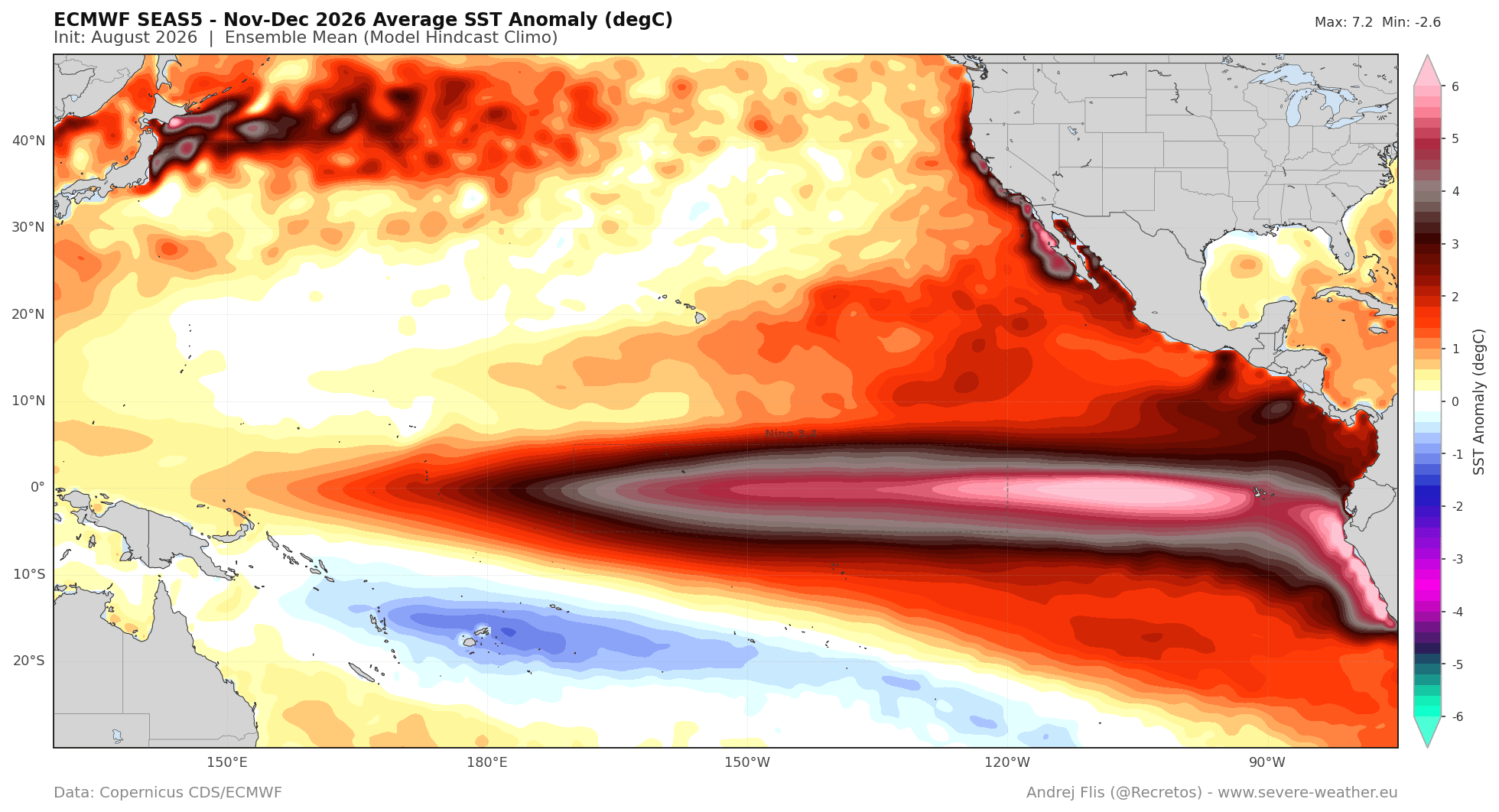
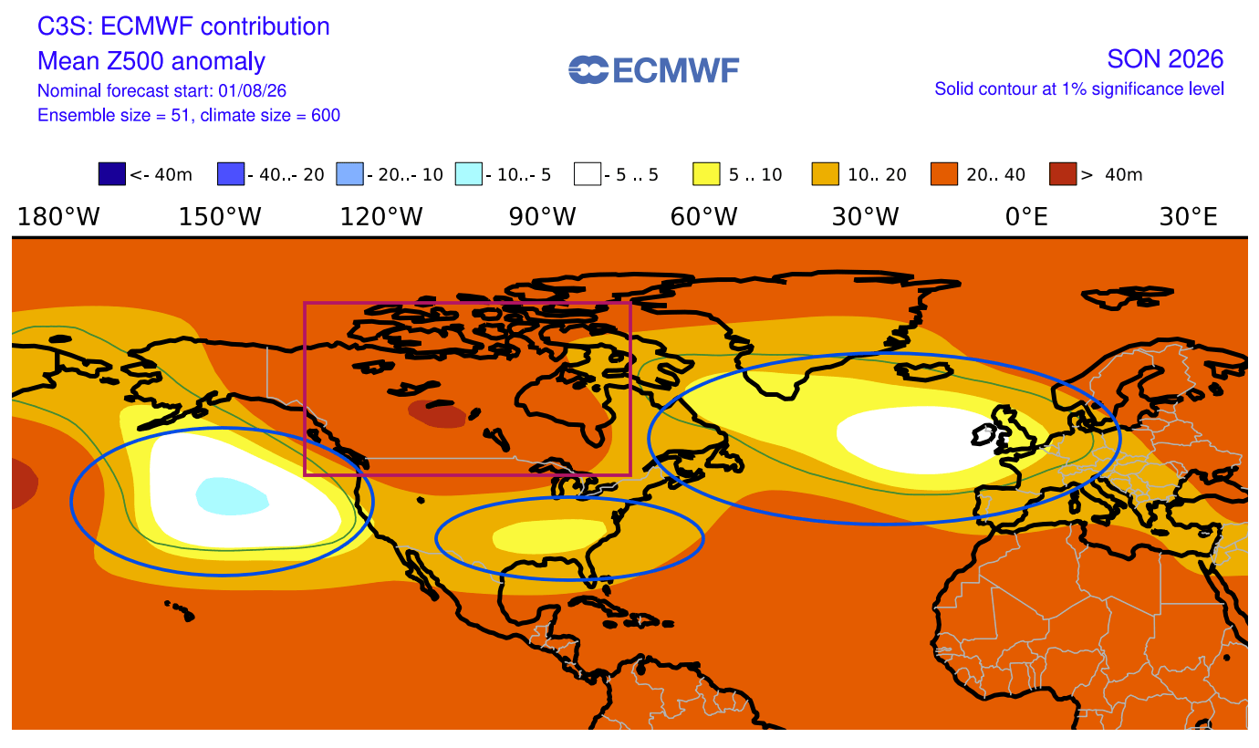
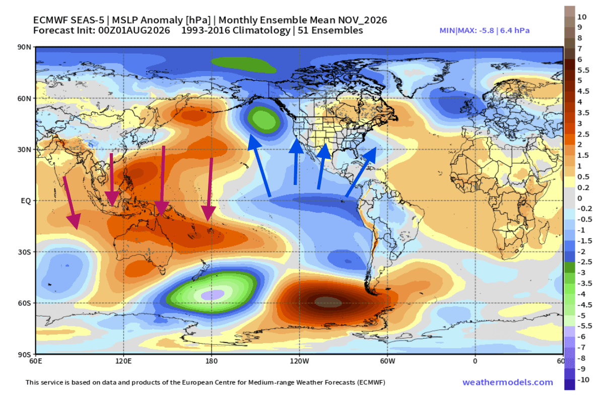
The ECMWF forecast for late 2026 reflects this by showing a profound high-pressure block over Canada, which serves as a pivot point for the rest of the hemisphere’s weather. By the time we reach December and January, the models show a persistent, "locked-in" pressure anomaly that effectively steers moisture-rich storms into the southern U.S. and milder, oceanic air into the heart of Europe.
Implications for North America and Europe
The implications for the coming winter are significant and geographically distinct:
North America
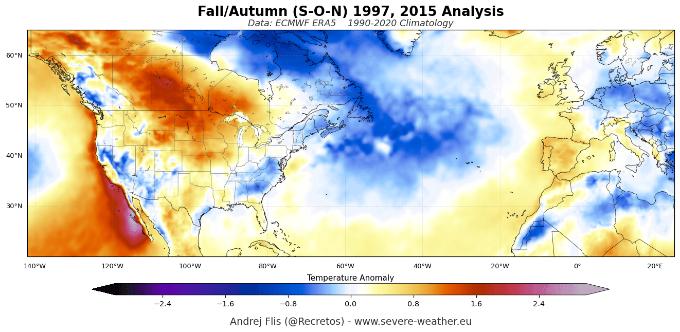
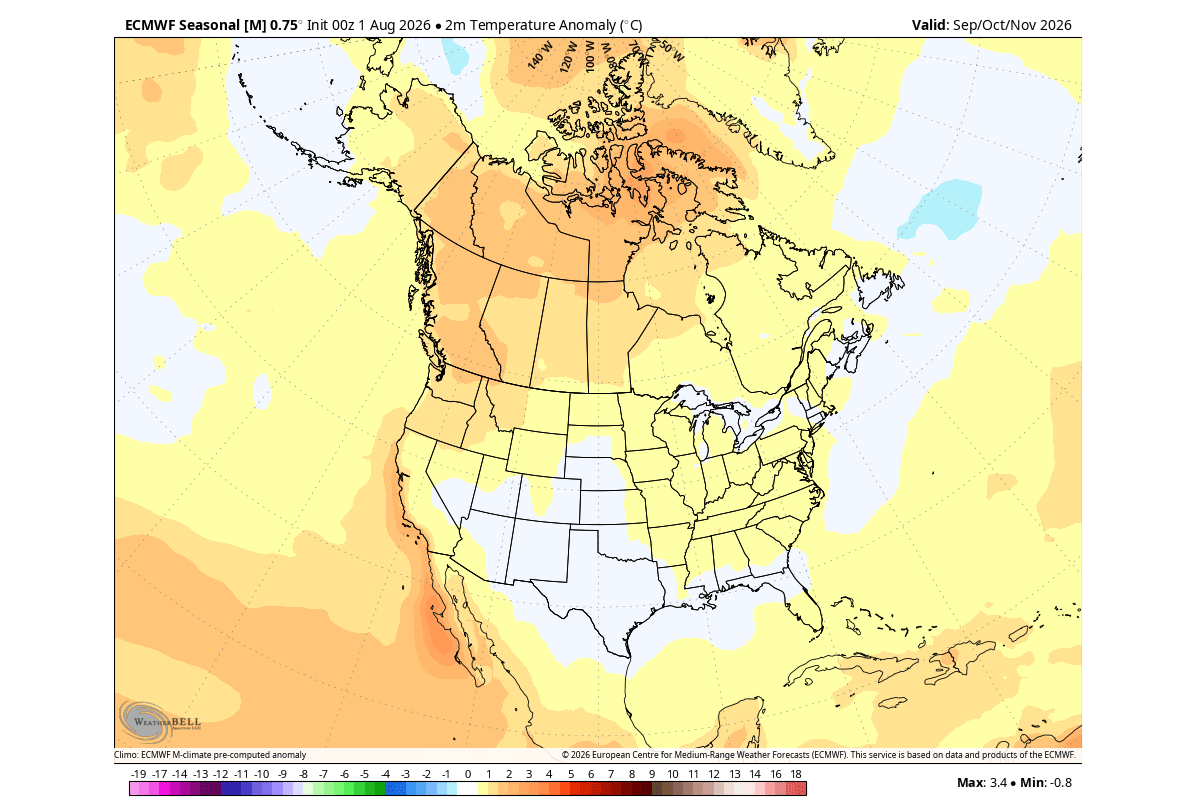
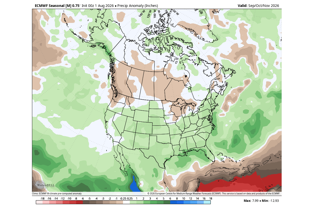
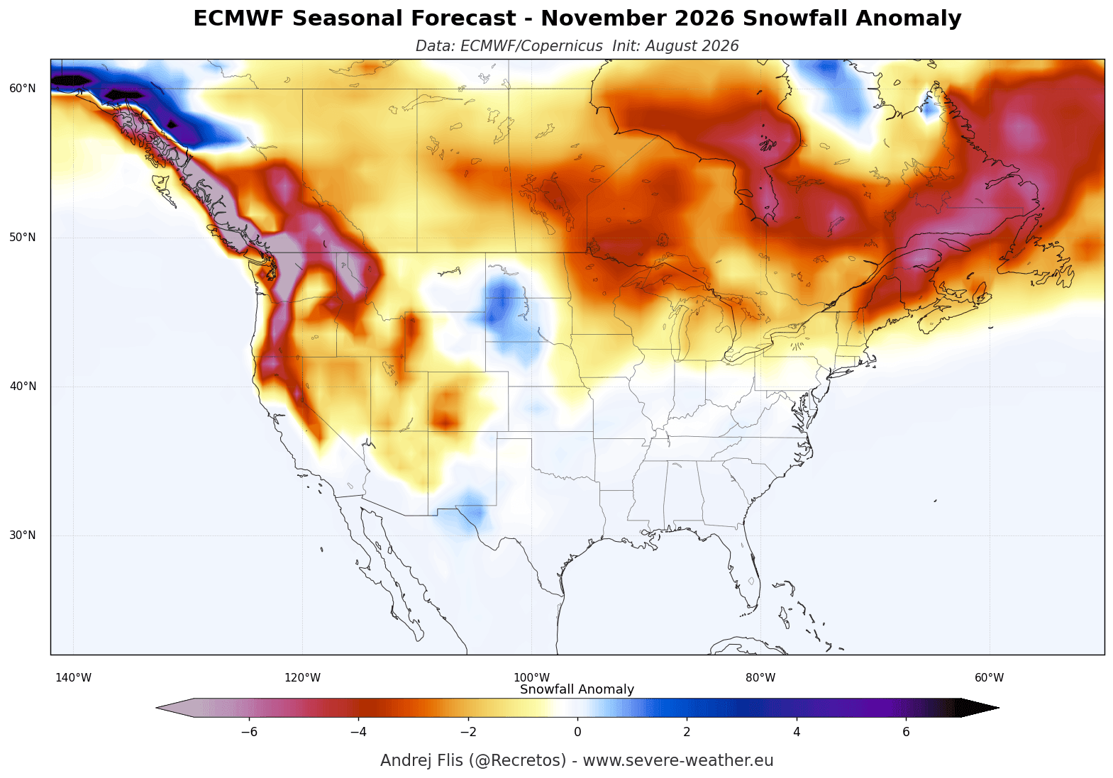
The forecast indicates a winter characterized by a sharp contrast. The "High-Pressure Block" over Canada and the northern United States will likely act as a shield, deflecting typical Arctic cold pulses and resulting in above-normal temperatures for the northern tier of the continent. Conversely, the amplified subtropical jet stream will serve as a conveyor belt for storms across the southern and central United States. While this brings much-needed moisture, it also increases the risk of flooding and severe weather outbreaks. Snowfall will be highly variable; while the overall trend for the northern U.S. may be warmer, the moisture from the southern jet stream, interacting with periodic cold-air intrusions, could produce heavy snowfall in elevated regions, such as the U.S. Plains and the mountainous regions of Texas.
Europe
The European outlook is heavily influenced by the North Atlantic pressure configuration. The expected low-pressure anomalies over the North Atlantic are set to drive a persistent westerly to southwesterly flow across the continent. This flow will likely bring a mild, wet winter to much of Western and Central Europe. While this reduces the likelihood of sustained deep-freeze conditions, it significantly increases the potential for heavy rainfall and storm-driven wind events. Snowfall will likely be restricted to higher altitudes, such as the Alps, where the influx of moisture may actually lead to above-average accumulation despite the milder ambient temperatures.
The Polar Vortex: A High-Stakes Variable
Perhaps the most critical wild card for the 2026/2027 season is the state of the Polar Vortex. The Polar Vortex is a massive cyclonic structure in the stratosphere that, under ideal conditions, keeps frigid Arctic air locked at the pole.
Current research into the relationship between Super El Niño events and stratospheric dynamics suggests that the energy released from the Pacific can propagate upward, disrupting the vortex. The latest ECMWF and UK Met Office (UKMO) forecasts are already flagging an unusual deceleration of stratospheric winds for the late December and January period.
A disrupted or "collapsed" Polar Vortex is the primary mechanism for extreme winter weather. If the vortex weakens, it can no longer contain the polar air, leading to a "spill" of extreme cold into the mid-latitudes. The combination of a Super El Niño and a potential mid-winter Polar Vortex collapse creates a high-probability scenario for significant weather volatility. While the seasonal average may lean toward milder conditions in some regions, the potential for short-term, high-impact cold snaps and major winter storms increases dramatically if the vortex is destabilized.
Official Outlooks and Scientific Consensus
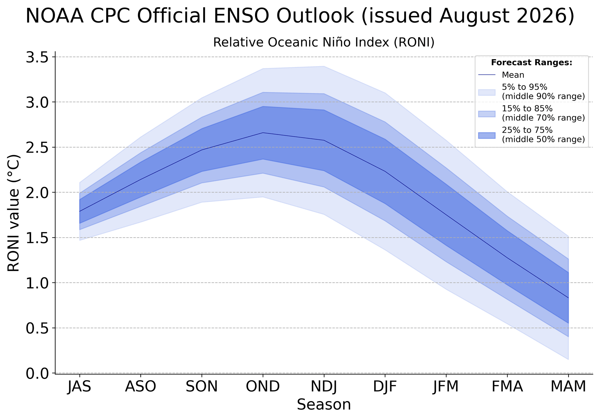
Governmental agencies, including NOAA and the Climate Prediction Center (CPC), have consistently upgraded their ENSO outlooks to reflect the rapid intensification of this event. The official consensus is that the +2°C threshold for a "Super" event is not only met but is expected to be sustained through the winter.
Scientific studies conducted on past Super El Niño events—such as those in 1982/1983 and 1997/1998—confirm that atmospheric responses to such events are rarely linear. Instead, they exhibit "threshold effects," where the atmosphere shifts rapidly into a new configuration once the ocean warming reaches a critical point. We are currently witnessing that shift in real-time.
As the 2026 winter season approaches, the message from the data is clear: the climate system is under significant stress from the Pacific-led thermal forcing. Whether it be the increased storm frequency in the southern U.S., the mild, damp conditions expected across Europe, or the volatile risks posed by a potentially fragile Polar Vortex, the 2026/2027 season is shaping up to be one of the most complex and closely watched periods in recent meteorological history. Residents and policy makers alike should prepare for a winter that defies historical norms, driven by the immense, far-reaching power of the 2026 Super El Niño.