In the rugged, windswept expanse of the Bolivian Altiplano, where the air is thin and the horizon stretches into infinity, lies one of the most pristine and overlooked trekking circuits in South America. While the 600-kilometer Altiplano Traverse—a journey famously documented for its transit across the Salar de Uyuni and the ascent of Volcán Licancabur—captures the imagination of high-altitude mountaineers, a smaller, more intimate route remains a hidden gem: The Five Lakes Loop.

Straddling the border between Bolivia and Chile, this overnighter offers a concentrated experience of the Andean highlands. It is a land of dormant volcanoes, crystalline glacial waters, and a silence so profound it commands respect. This guide serves as a detailed examination of the route, providing the necessary logistics for those looking to test their mettle in one of the world’s most demanding environments.

Main Facts: The Anatomy of a High-Altitude Trek
The Five Lakes Loop is not a journey for the uninitiated. It is a 47-kilometer (29-mile) trek that demands respect for both altitude and climate. Starting and finishing in the village of Sajama, Bolivia, the route traverses a landscape that fluctuates between 4,230 meters (13,879 ft) and a lung-straining 5,130 meters (16,831 ft).

Quick Stats
- Total Distance: 47 km (29 mi)
- Elevation Gain: 946 m (3,104 ft)
- Duration: 10 hours to two days
- Difficulty: Moderate
- Seasonality: June to September (Dry season)
Unlike many European or North American trails, this route is roughly 40% off-trail. However, the treeless, wide-open geography of the Altiplano makes navigation intuitive. The primary challenge is not finding the path, but managing the physiological toll of trekking at extreme elevations where oxygen saturation is significantly reduced.

Chronology: A Two-Day Expedition
Day 1: The Ascent to the High Lakes
The journey begins in the village of Sajama, an unassuming settlement at 4,230 meters that holds the distinction of being one of the highest permanently inhabited places on Earth. As one departs the village, the path leads toward the towering, snow-dusted massifs of the region.

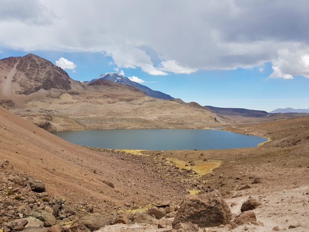
The initial leg of the trek is defined by the transition from the arid plains into the mountainous corridors of the Andes. The first significant landmark, Laguna Inca Ingenio, sets the tone for the journey—a mirror-like body of water framed by volcanic rock. By midday, the trail pushes toward Paso Casiri, where the views of the snow-capped peak of Nevado Sajama provide a constant, breathtaking backdrop.

As afternoon settles, the route reaches the area surrounding Laguna Chiar Khota. This is the heart of the trek. A planned side trip to the summit of Jisk’a Kunturini (5,475 m) is a common objective for those with the time, though weather conditions in this region are notoriously fickle. Even in the dry season, a sudden storm can roll in with little warning, forcing a tactical retreat to lower ground.

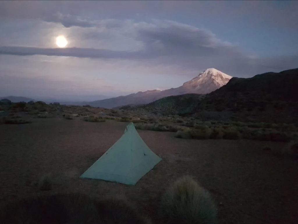
Camping at nearly 5,000 meters requires specialized equipment. As the sun dips behind the jagged horizon, temperatures plummet rapidly—often reaching -12°C (10°F). The experience of sleeping in the open Altiplano is transformative; the lack of light pollution renders the Milky Way in such vivid detail that it feels almost tactile.

Day 2: The Return to the Village
The second day involves a descent through the Quebrada Condoriri. The terrain shifts from the high-altitude tundra back toward the lower-lying valleys. The route takes trekkers past the final of the five lakes, including the striking Laguna Huayna Khota.
As the trail nears completion, the "civilization" of Sajama re-emerges. Returning to the village, one is often met with the sight of local life continuing unabated—rugged locals gathering for a game of football in the thin air, a stark reminder of the resilience required to thrive in this environment.

Supporting Data: Flora, Fauna, and Physics
The ecosystem of the Altiplano is fragile and fascinating. A highlight for many travelers is the encounter with Azorella compacta, locally known as llareta. This plant is a marvel of evolutionary adaptation; it looks like a moss-covered boulder, but it is actually a slow-growing, dense shrub that can live for thousands of years. It thrives between 3,200 and 5,000 meters, effectively functioning as a "living rock" in the harsh, high-UV environment.

For the trekker, hydration and nutrition are not merely matters of comfort but survival. Coca tea, a traditional remedy in the Andes, serves as a vital tool for managing mild altitude sickness and maintaining core body temperature during the frigid nights.

The Gear List
For a successful two-day traverse, the following is recommended:

- Shelter: A 4-season tent capable of withstanding high-velocity winds.
- Sleeping System: A sleeping bag rated to at least -15°C (5°F) and a high-R-value sleeping pad.
- Navigation: Offline GPS maps (e.g., Gaia GPS or AllTrails) as a backup, though the route is visually straightforward.
- Clothing: A robust layering system. Synthetic or merino wool base layers are essential, paired with a high-loft down jacket for camp.
- Footwear: Sturdy, broken-in trail runners or light boots with excellent traction for loose volcanic scree.
Official Perspectives and Local Impact
Local authorities and the communities within the Sajama National Park encourage independent tourism, provided that trekkers practice strict "Leave No Trace" principles. Because the environment is so slow to recover from human interference—due to the extreme cold and arid climate—the protection of these landscapes is a priority for the local indigenous populations.

The village of Sajama has developed a modest but welcoming infrastructure for hikers. Homestays and small lodges provide a critical economic boost to the region, and visitors are encouraged to hire local guides if they are unfamiliar with high-altitude safety protocols. A local guide can provide not only navigational assistance but also invaluable cultural context regarding the sacred significance of the peaks and lakes in Aymara tradition.

Implications: The Future of High-Altitude Tourism
The Five Lakes Loop represents a shift in how modern adventurers are interacting with the Andes. It is a move away from the "tourist trap" circuits toward more authentic, self-sufficient experiences. However, the rise in popularity of the Altiplano brings with it the risk of environmental degradation.

Sustainability Considerations
- Water Usage: The lakes are vital to local herds of llamas and alpacas. Hikers must ensure that they do not contaminate these water sources with soaps or waste.
- Cultural Respect: The mountains in the region are often considered Apu (deities). Visitors should behave with the appropriate level of reverence when passing through these areas.
- Climate Sensitivity: The retreat of glaciers in the Andes is a well-documented phenomenon. Trekkers today are witnessing a landscape that is changing in real-time. By documenting their journeys and participating in citizen-science platforms, hikers can contribute to a broader understanding of how these delicate ecosystems are responding to a warming planet.
Final Thoughts
The Five Lakes Loop is more than just a hike; it is an exercise in humility. To stand at 5,000 meters, surrounded by the silence of the Andes, is to be reminded of the scale of the natural world. Whether you are preparing for a larger traverse or seeking a short, high-intensity challenge, this route offers an unparalleled window into the heart of the Altiplano. For those who respect the mountain, the rewards are not found in the summiting of a peak, but in the quiet, bone-chilling clarity of the air and the enduring beauty of the five lakes.