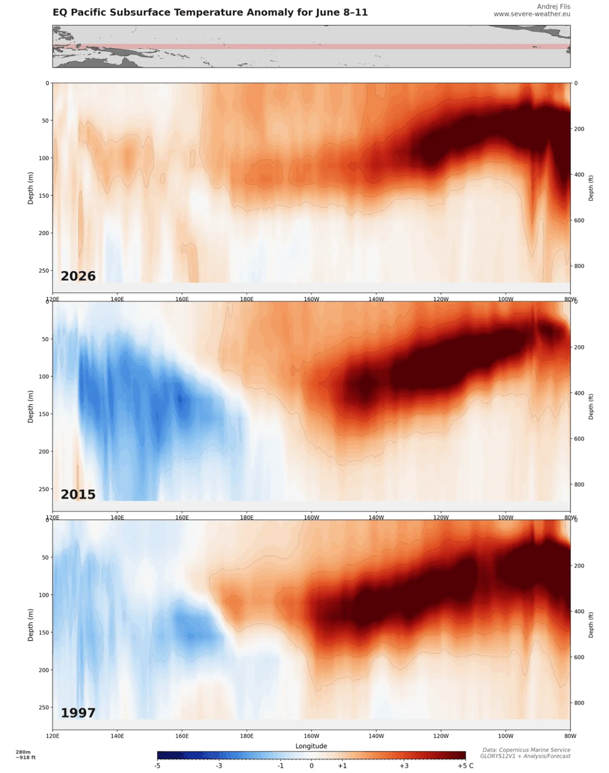
As the world transitions into the winter months of 2026/2027, meteorologists are closely monitoring a historic climatic event: the emergence of a "Super El Niño." This powerful atmospheric and oceanic phenomenon is already fundamentally altering the jet stream, creating a distinct divergence in snowfall expectations across North America and Europe. For residents, travel planners, and ski enthusiasts, the coming months promise a winter defined by stark regional contrasts rather than a uniform seasonal experience.
Main Facts: The Power of the Super El Niño
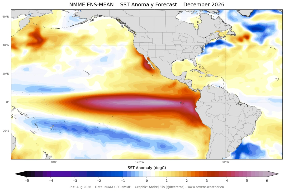
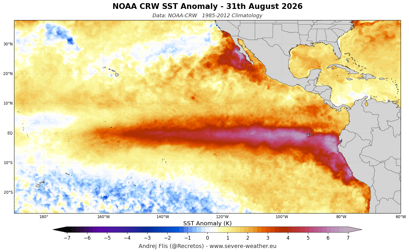
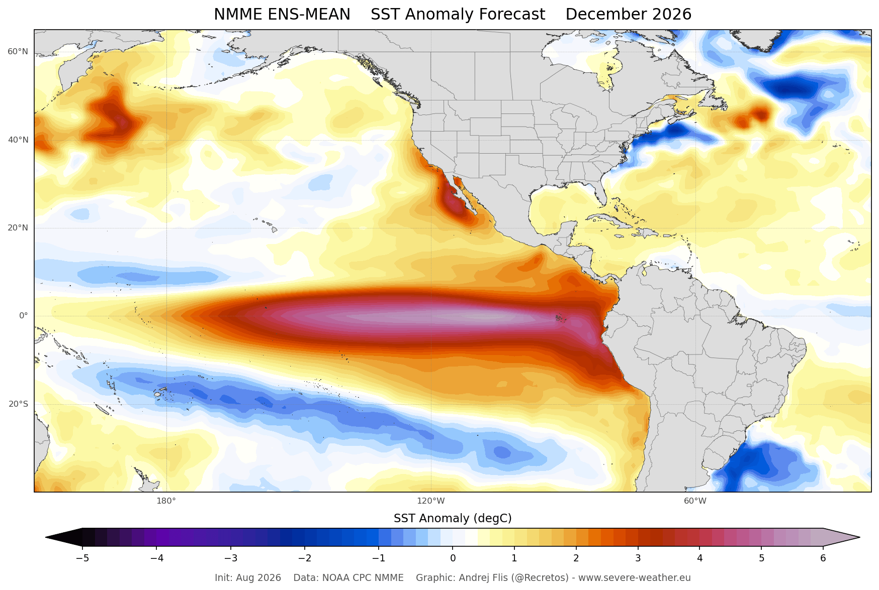
The term "Super El Niño" is reserved for the most extreme instances of the El Niño-Southern Oscillation (ENSO), characterized by tropical Pacific sea surface temperatures reaching or exceeding +2°C above the long-term average. The 2026 event has already surpassed this critical threshold, with some areas showing anomalies as high as +6°C (10.8°F).
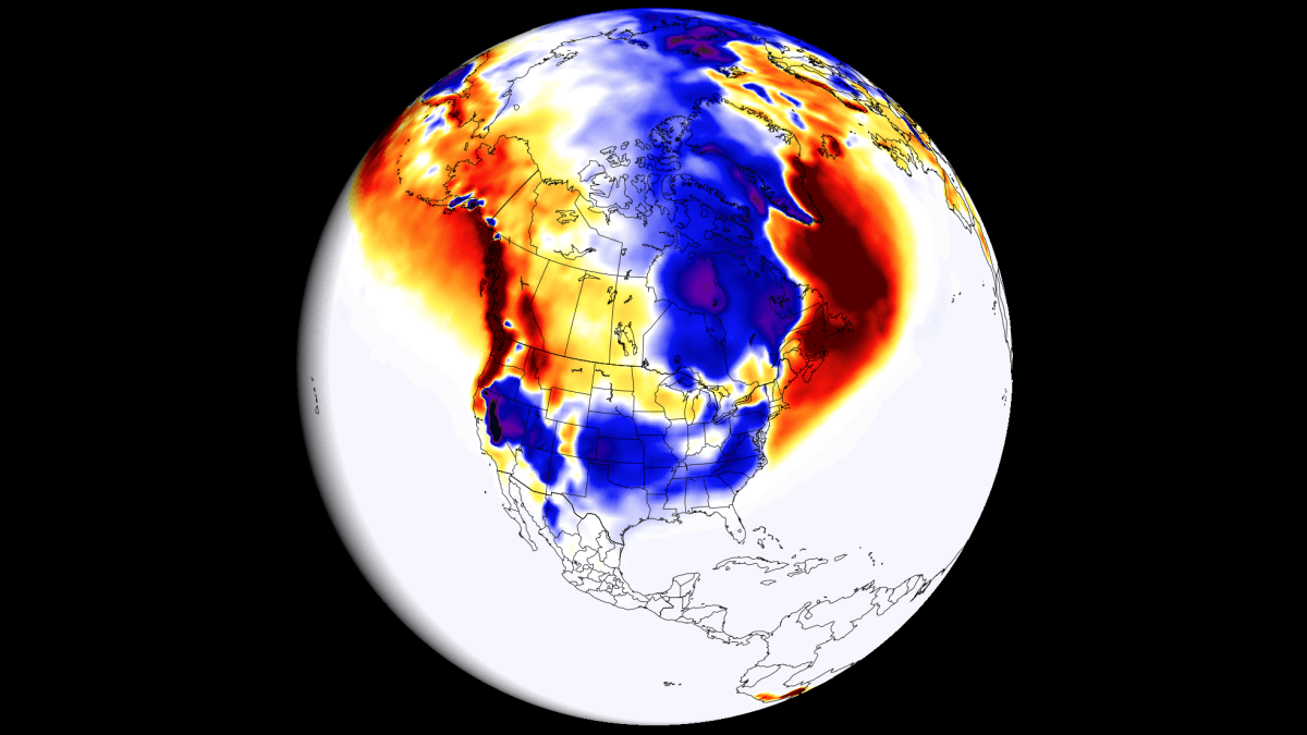
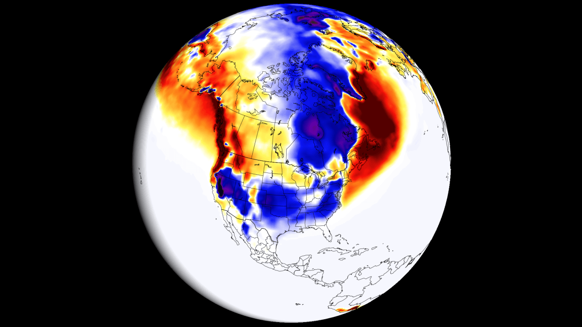
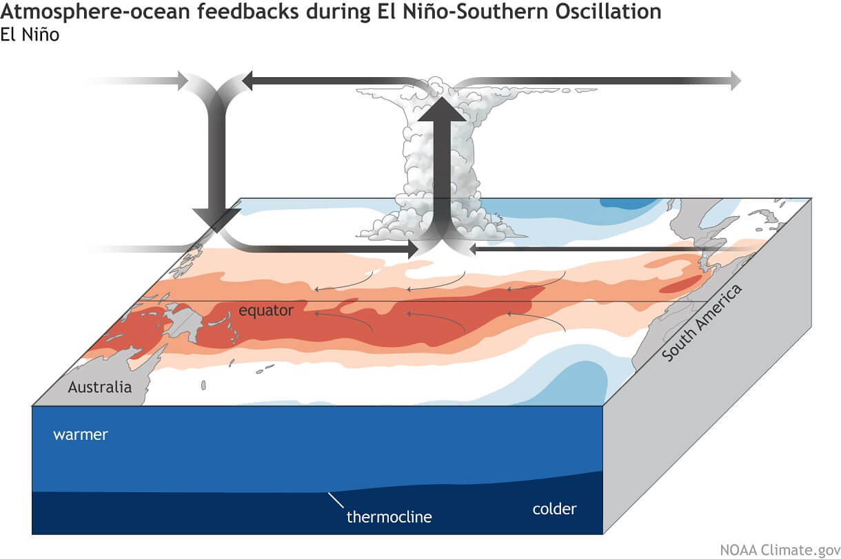
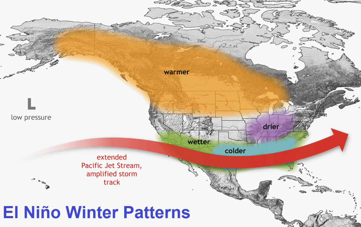
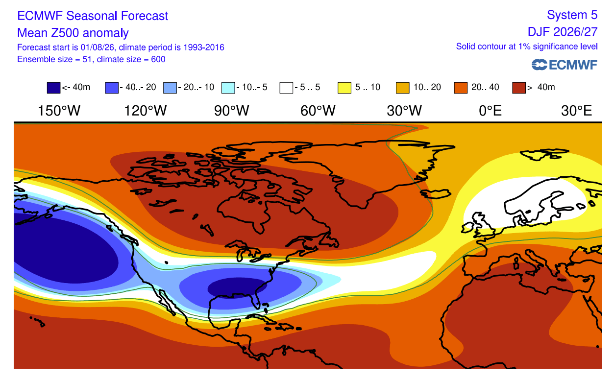
This massive influx of warm water into the eastern Pacific acts as a thermal engine, shifting the global "Walker Circulation." In simple terms, the rising air over the central and eastern Pacific alters the path of the jet stream—a high-altitude ribbon of air that guides storm systems across the Northern Hemisphere. During a Super El Niño, the Pacific jet stream typically strengthens and extends further into the southern United States, while a persistent high-pressure ridge often develops over Canada and northern Europe. This redistribution of pressure and energy is the primary driver of the anomalous winter weather patterns now forecast for the 2026/2027 season.
Chronology of Development
The current Super El Niño is not a sudden development; it is the result of months of subsurface ocean dynamics.
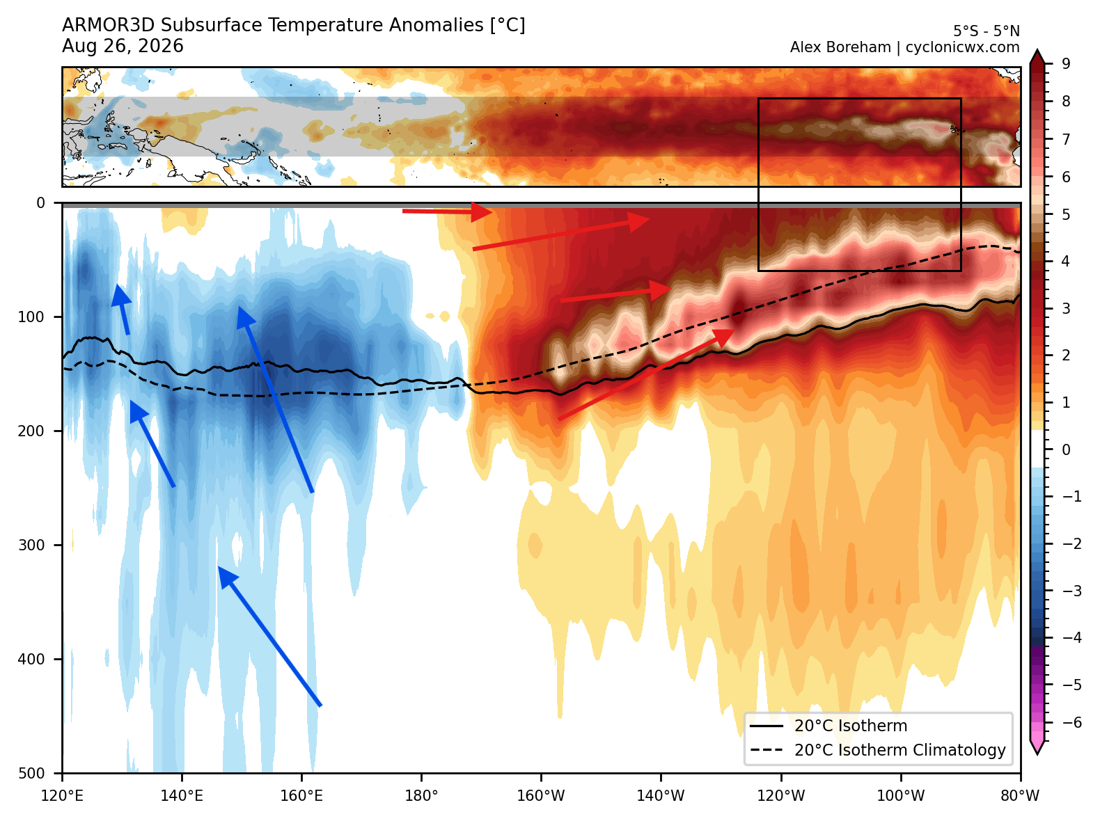
- Late Summer 2026: Subsurface analysis revealed a massive downwelling Kelvin Wave—a deep, warm water pulse—moving eastward across the Pacific. This wave acted as a "fuel tank," ensuring that the surface warming would remain sustained throughout the autumn.
- September–October 2026: The surface temperature anomalies became locked in, with NOAA-CRW data confirming that the event was gaining intensity rather than dissipating.
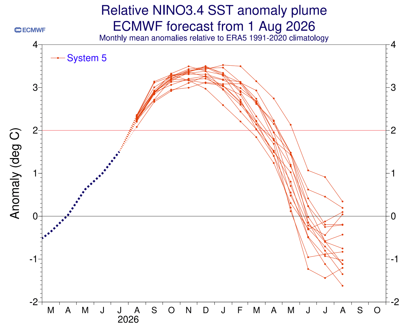
- December 2026 (Projected Peak): Leading climate models, including the European Centre for Medium-Range Weather Forecasts (ECMWF) and the North American Multi-Model Ensemble (NMME), indicate that the El Niño will hit its maximum intensity during the early winter months, ensuring its influence will be felt throughout the entire 2026/2027 season.
- January–February 2027: As the event begins its slow decline, the residual atmospheric shifts—specifically the "stuck" jet stream patterns—will dictate the final snowfall tallies for the mid-to-late winter period.
Supporting Data and Model Analysis
To build a reliable picture of the coming winter, meteorologists synthesize data from global models like the ECMWF and the UK Met Office (UKMO). These systems provide a probabilistic outlook based on millions of data points.
The North American Outlook
The forecast for North America is characterized by a "split-flow" reality. Because the Pacific jet stream is significantly strengthened, it will likely drive moisture into the southwestern and central United States.
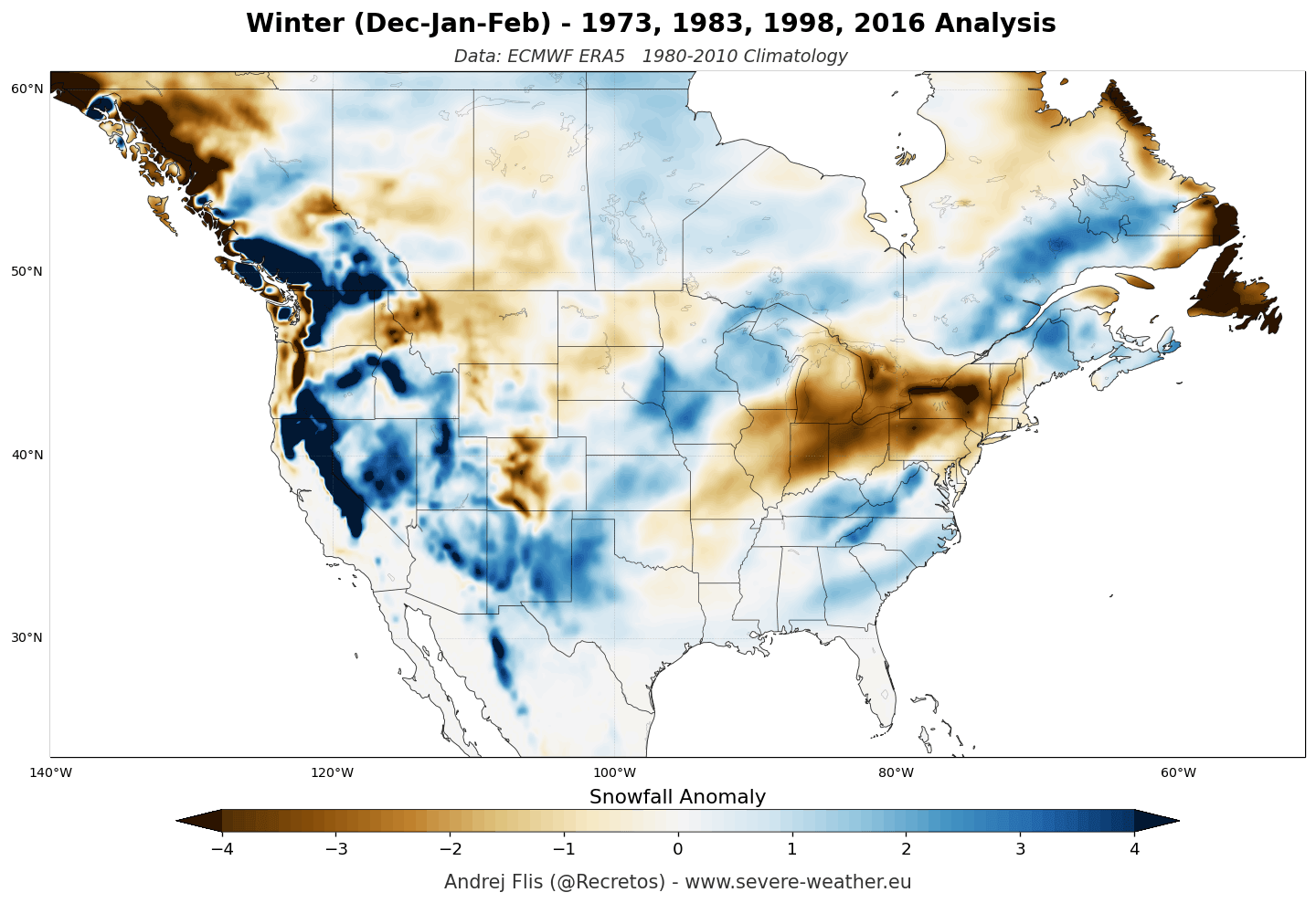
- Above-Average Snowfall: Areas including the Sierra Nevada, Utah, and the Central to Southern Rockies are poised for high snowfall potential. Additionally, the southern and central Plains and parts of the Mid-Atlantic may see increased winter precipitation.
- The Northern Deficit: Conversely, the northern United States and southern Canada face a persistent high-pressure barrier. This ridge effectively blocks cold, northern storm tracks, leading to below-normal snowfall for the Pacific Northwest, the Great Lakes, and New England.
The European Perspective
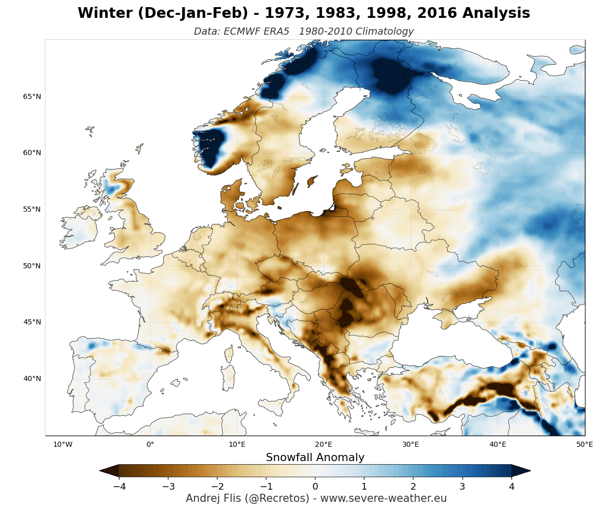
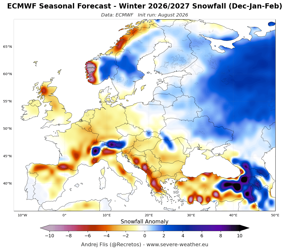
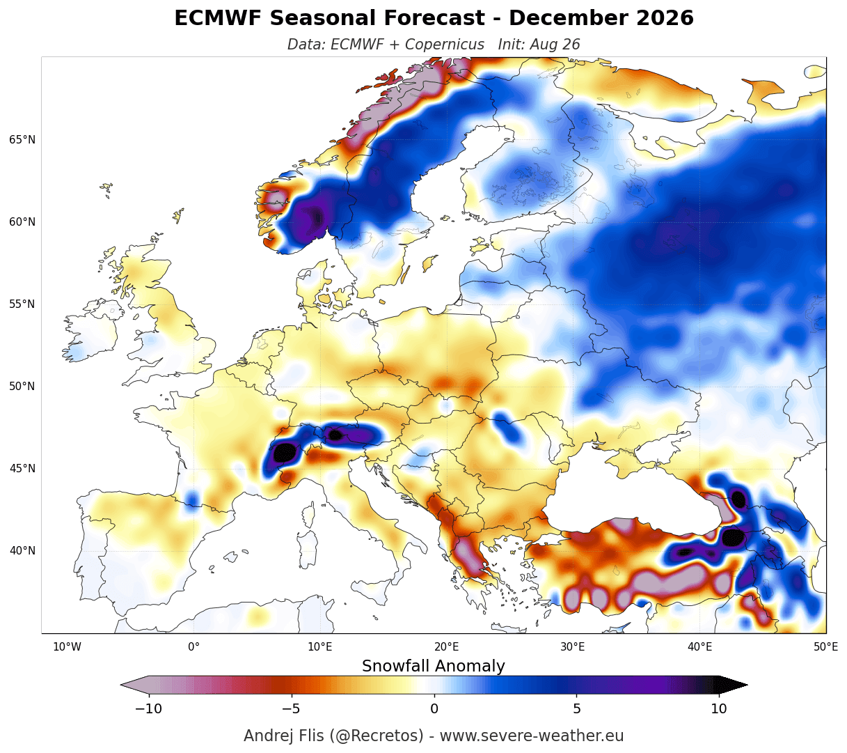
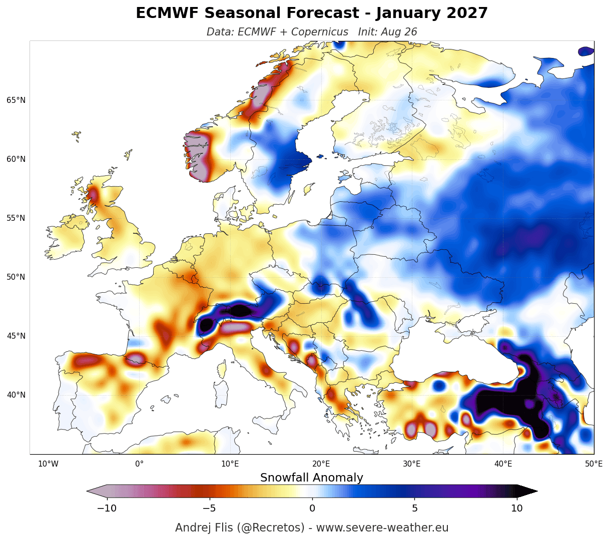
In contrast to the varied North American landscape, the outlook for Europe is relatively uniform in its scarcity of snow. Both the ECMWF and UKMO models predict a dominant mild, westerly flow originating from the Atlantic. This pattern brings warmer-than-average air into the continent, which often turns potential snow into rain for low-to-mid elevations. While high-altitude regions—specifically the Alps above 2,000 meters—may see healthy accumulations, the lowlands of central and western Europe are expected to endure a suppressed snow season.
Implications for Regions and Industries
The implications of this Super El Niño are far-reaching, touching on everything from municipal infrastructure to the multi-billion dollar winter tourism industry.
Winter Tourism and Skiing
Ski resorts in the American Southwest and the Rockies have reason for optimism, as the southern storm track is expected to deliver consistent, heavy snowfall. Conversely, resorts in the Pacific Northwest and the northeastern United States may face a challenging season, as the high-pressure ridge pushes moisture away from their slopes. In Europe, the "snow line" is expected to rise, putting pressure on lower-altitude resorts that rely on natural snowfall rather than artificial snow production.
Agriculture and Water Management
While snowfall is often associated with recreation, it is a critical water source. The increased snowpack in the Southern Rockies is a welcome sign for water managers in the American Southwest, as this "frozen reservoir" will provide essential runoff during the spring and summer of 2027. However, the lack of snow in the northern United States and parts of Europe could lead to concerns regarding soil moisture levels and early-season water availability for the 2027 growing season.
Infrastructure and Energy
The "mild and wet" pattern forecast for much of Europe and the northern United States could lead to reduced demand for heating fuel, which has historically been a significant economic factor during Super El Niño winters. However, the risk of "wet" winter storms in the southern United States—where infrastructure is less adapted to heavy snow and ice—could lead to localized power grid disruptions.
Official Responses and Meteorological Context
Meteorological agencies worldwide, including NOAA and the Copernicus Climate Change Service, continue to issue updates as the atmosphere responds to the warming Pacific. While these models are highly sophisticated, experts caution that "average" does not mean "certain."
"A Super El Niño creates a strong statistical bias toward certain weather patterns, but it does not dictate every single storm," notes climate researchers. "Local variables, such as the state of the Polar Vortex or North Atlantic Oscillation, can still produce localized cold snaps or blizzards that defy the broader seasonal trend."
Conclusion: A Winter of Extremes
The winter of 2026/2027 will be remembered as a textbook example of how a singular oceanic event can dictate global weather. For the southern United States, the Super El Niño promises a moisture-rich winter with high snow potential. For the northern tier and much of Europe, it signals a trend toward milder, less snowy conditions.
As we move deeper into the season, residents are encouraged to stay informed through local weather services. While the macro-trends provided by the ECMWF and UKMO offer a clear roadmap of what to expect, the inherent volatility of the atmosphere ensures that winter, even in a Super El Niño year, retains its capacity to surprise.
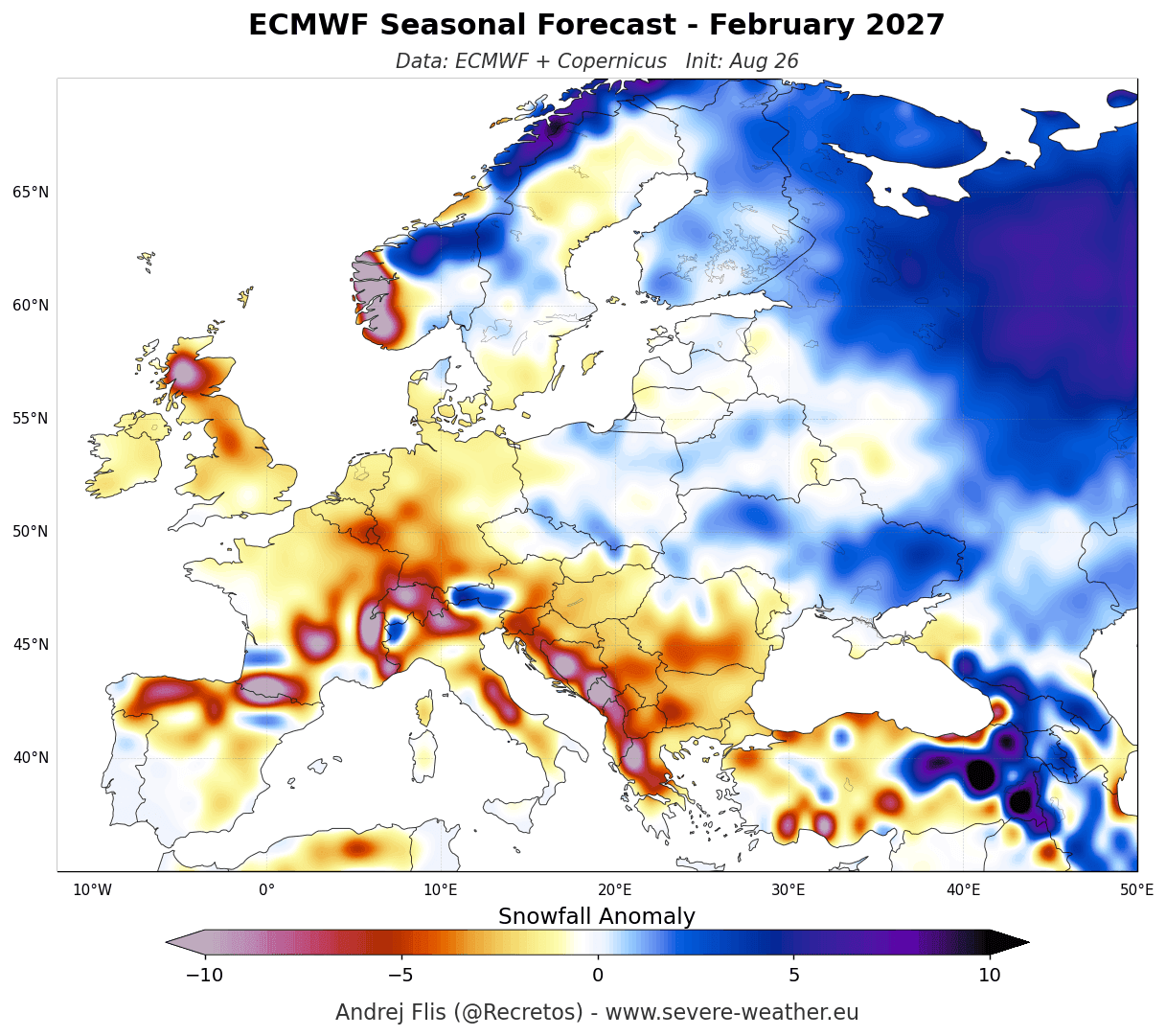
Summary Table: Regional Snowfall Expectations (2026/2027)
| Region | Snowfall Trend | Primary Driver |
|---|---|---|
| Southwestern U.S. | Above Average | Enhanced Southern Jet Stream |
| Central/Southern Rockies | Above Average | Direct Pacific Moisture Feed |
| Pacific Northwest | Below Average | High-Pressure Ridging |
| Northern U.S. / S. Canada | Below Average | Suppressed Storm Tracks |
| Central/Western Europe | Below Average | Persistent Mild Atlantic Flow |
| European Alps (>2000m) | Near Normal | Altitude-based cold retention |
This article is intended for informational purposes and reflects the current state of long-range climate forecasting. For specific regional alerts, please consult your national meteorological agency.