The tropical Pacific is currently the epicenter of a climatic transformation that threatens to reshape seasonal weather patterns across the Northern Hemisphere. A "Super El Niño"—an extreme manifestation of the El Niño-Southern Oscillation (ENSO)—is currently strengthening at a pace that has surprised even the most seasoned meteorologists. With ocean and atmospheric data now reflecting an acceleration in development, long-range forecasts have repeatedly pushed the event’s projected peak into historic territory, signaling a winter season that could be defined by extreme volatility.

The Mechanics of a Super El Niño
At its core, El Niño is a warming of the equatorial Pacific Ocean that disrupts global atmospheric circulation. However, a "Super" event is a different beast entirely. It is characterized by a profound breakdown of the Walker Cell—the system of rising and sinking air in the tropics—which effectively acts as the engine for global weather.
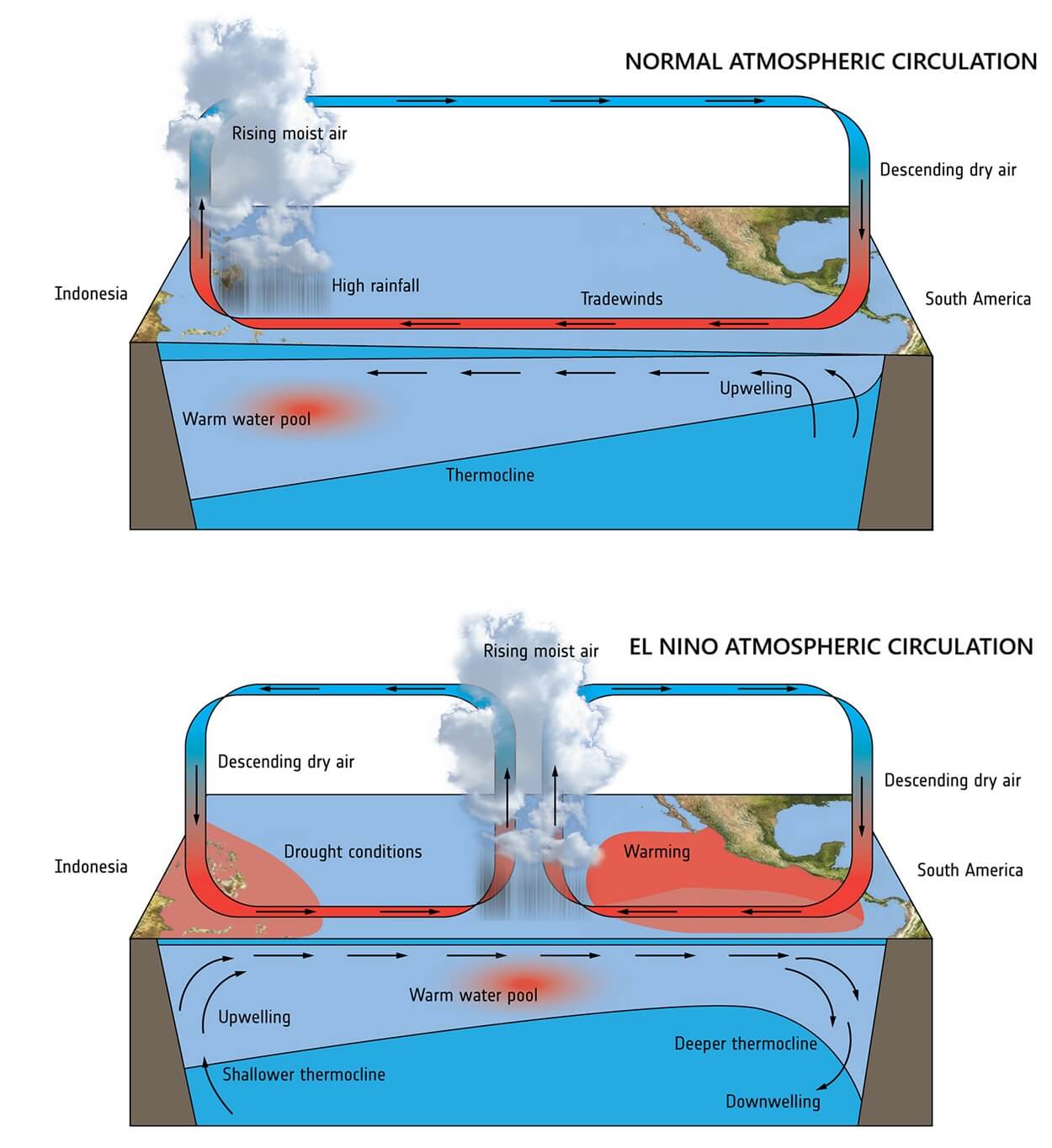
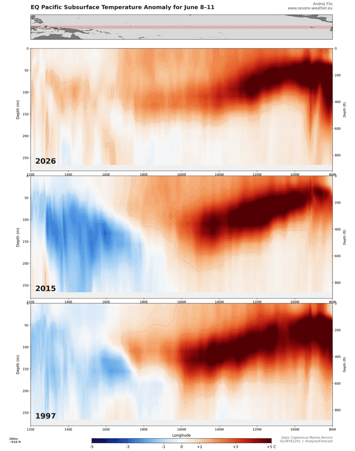
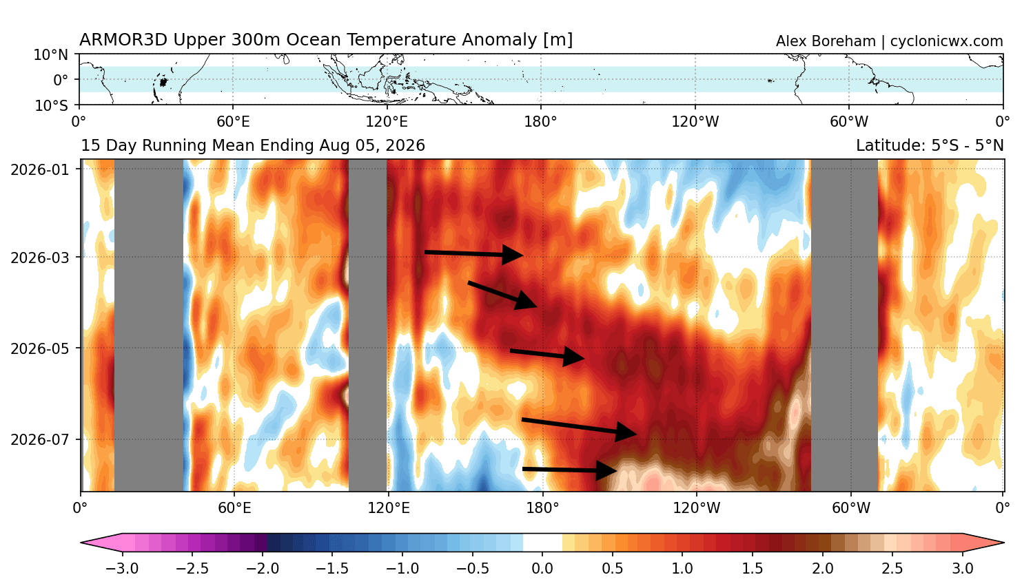
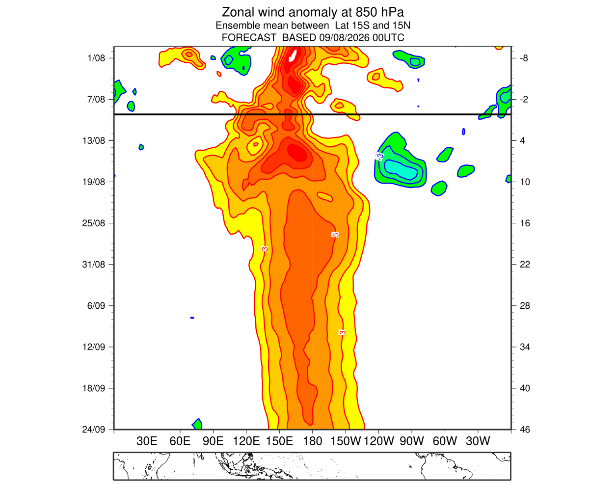
Under normal conditions, trade winds blow from east to west, pushing warm surface water toward the western Pacific. During a Super El Niño, these trade winds collapse or even reverse into "westerly wind bursts." This reversal allows the massive reservoir of warm subsurface water to surge eastward, flooding the eastern and central Pacific with heat. This energy, fueled by massive, deep-ocean Kelvin Waves, does not merely stay in the ocean; it forces the atmosphere into a "locked" configuration, creating a standing wave that dictates the position of the jet stream for months.
A Chronology of Rapid Development
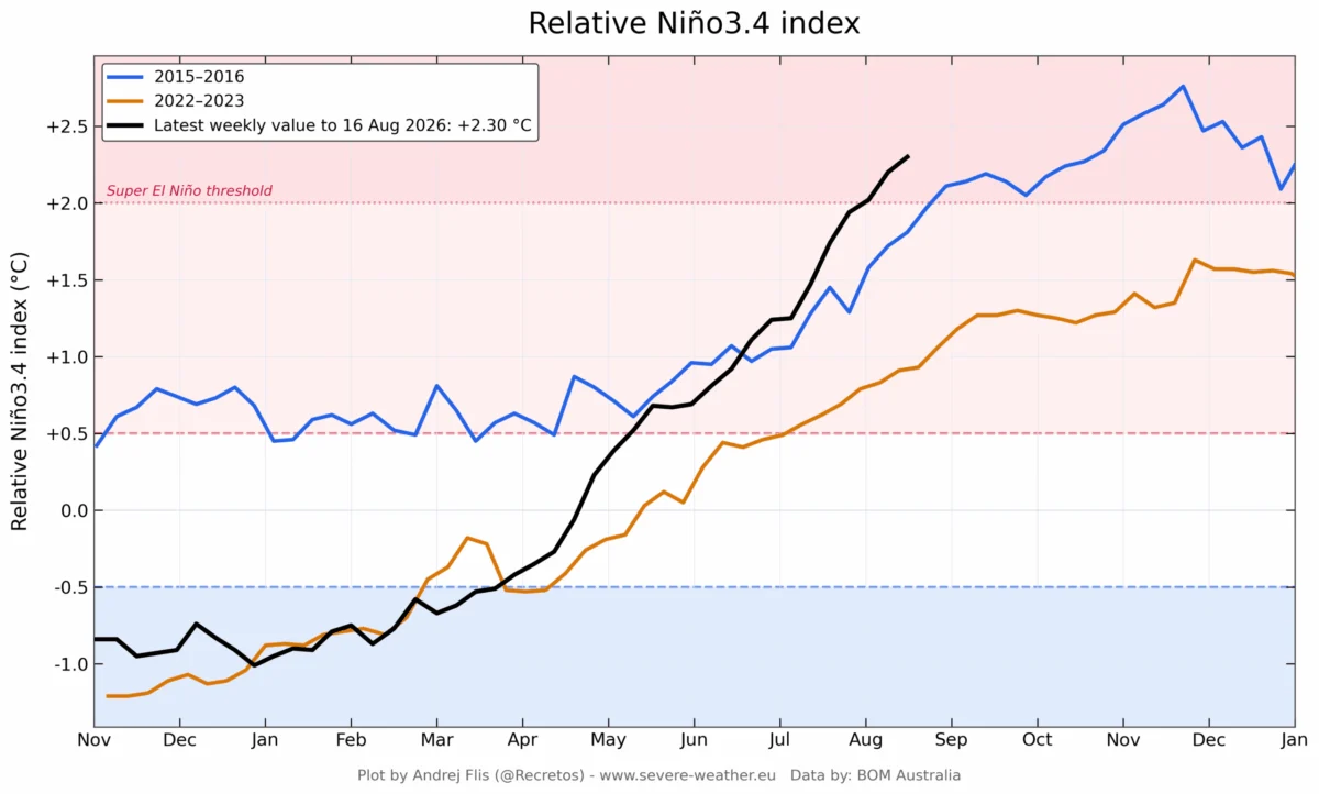
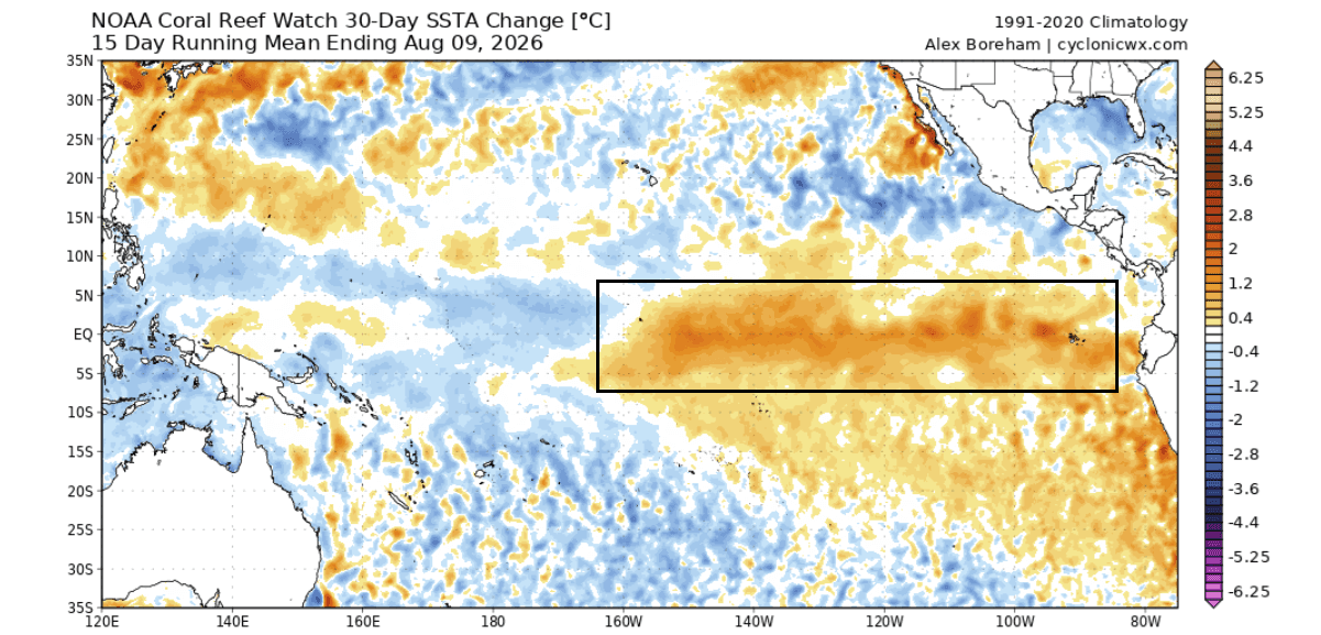
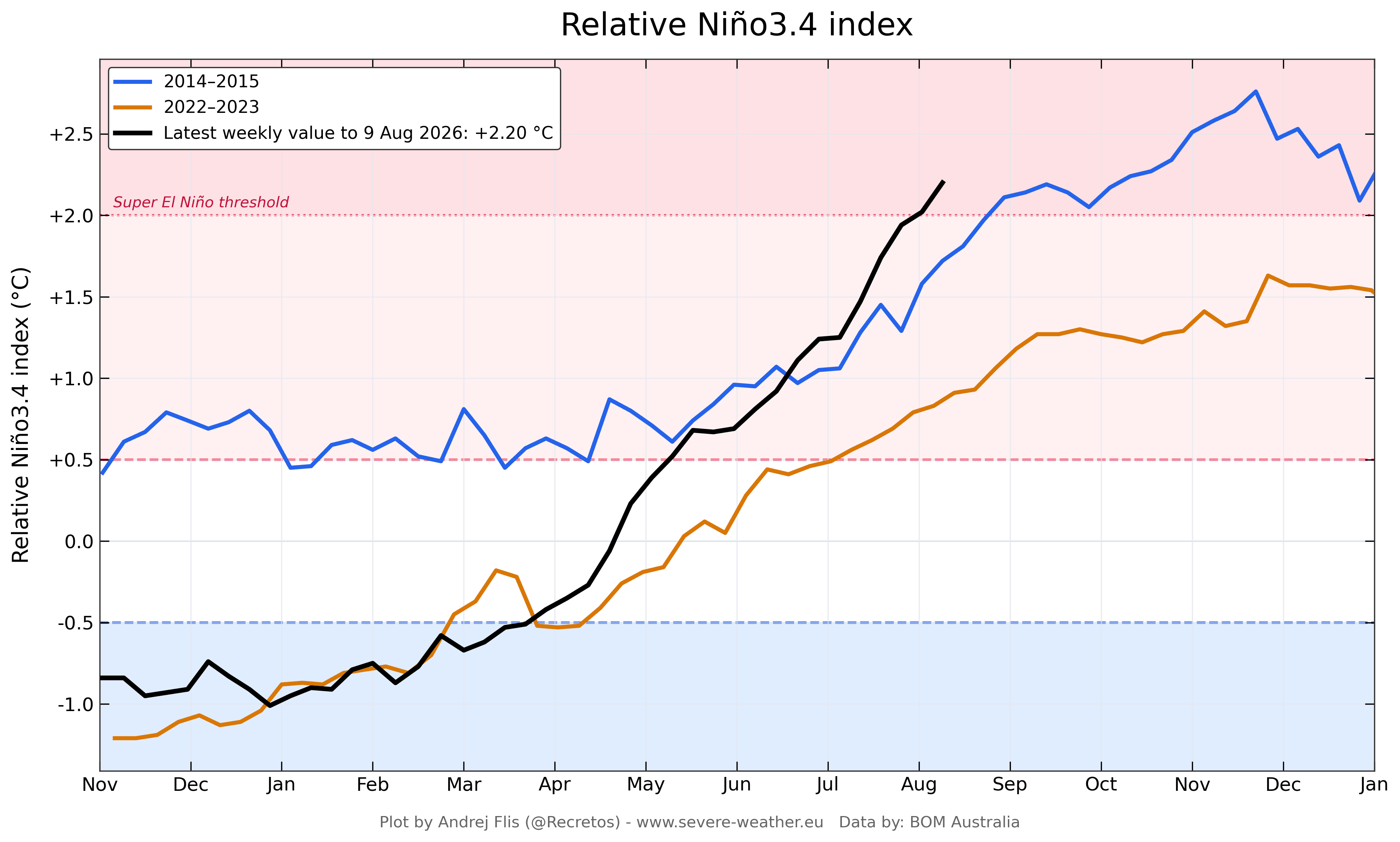
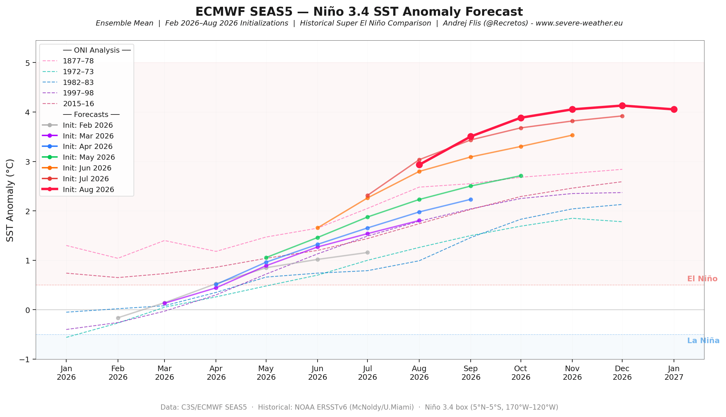
The current event began showing signs of its extreme potential as early as the spring of 2026. By mid-summer, the development cycle had already surpassed the 2015–2016 event—widely considered one of the most intense on record—in terms of both speed and magnitude.
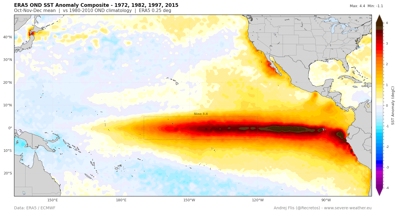
- Spring 2026: Initial subsurface warming signaled a departure from neutral conditions.
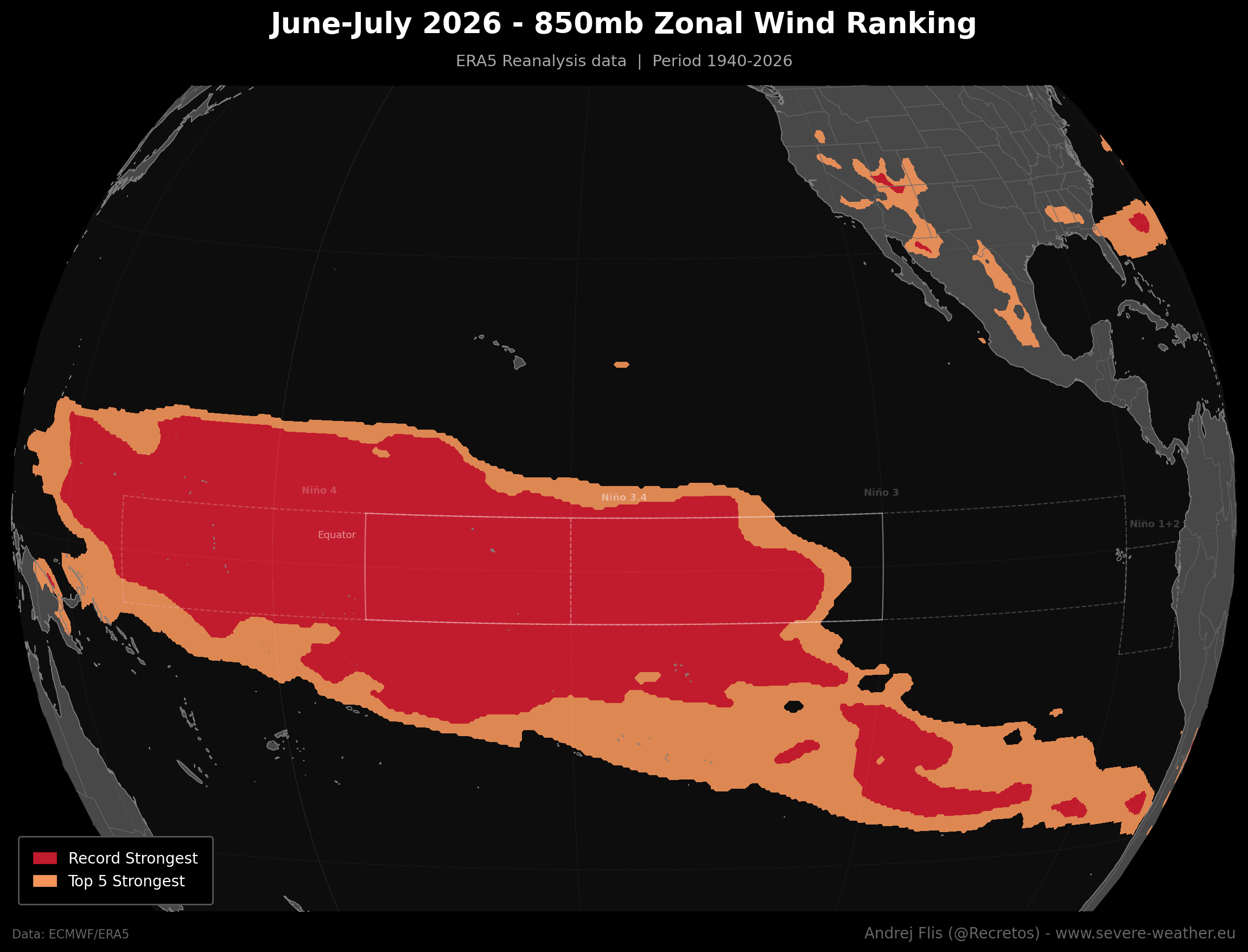
- June–July 2026: Record-breaking low-level westerly wind anomalies were recorded across an 86-year dataset. This sustained collapse of the trade winds provided the "fuel" necessary for the event to escalate rapidly.
- August 2026: NOAA’s Multivariate ENSO Index (MEI) surged to +2.4, the highest value recorded for the June-July period since the index’s inception in 1979.
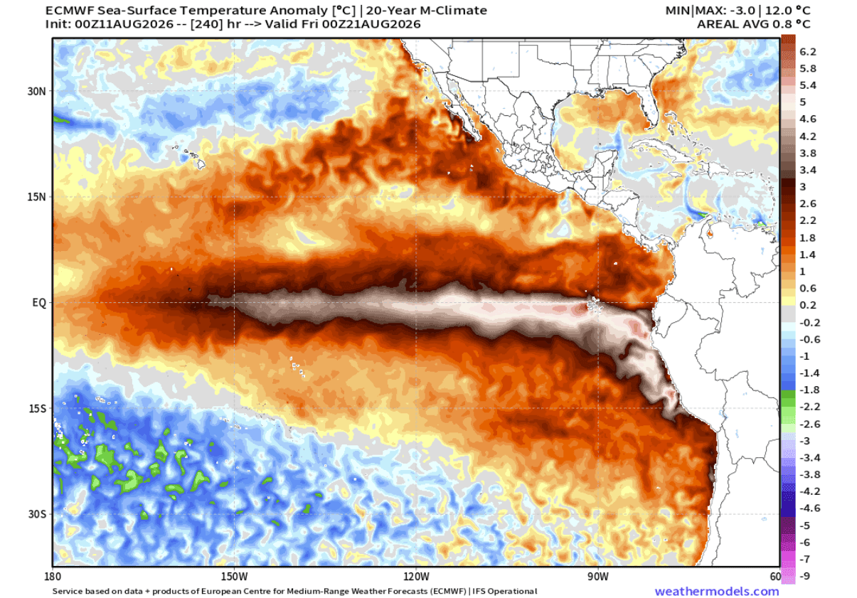
- Current Outlook: Forecast models, including the ECMWF and NMME, continue to trend upward with each new run, suggesting that the event will exceed the +3.0°C anomaly threshold, placing it in the highest echelon of historically documented El Niño events.
Data-Driven Insights: The Engine Beneath the Surface
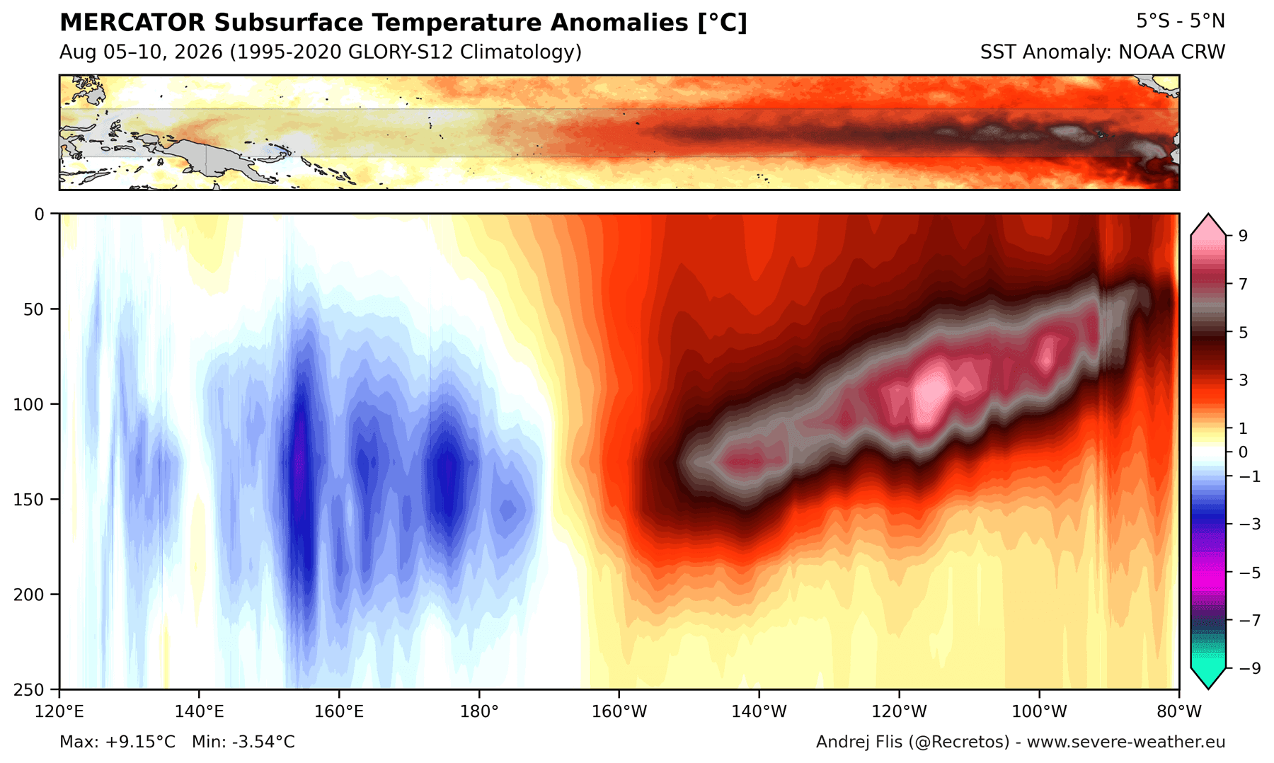
Surface sea temperatures are often the headline, but the true driver of this 2026/2027 event lies 800 feet below the surface. Subsurface temperature anomalies are currently peaking at over 9°C (16°F) above normal. These massive "Kelvin Waves" are essentially thermal conveyor belts, pushing warm water from the west to the east.
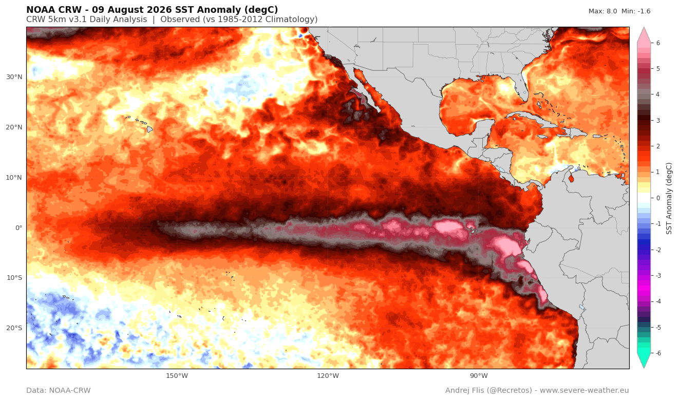
As this warm water rises to the surface, it provides a consistent, near-limitless supply of heat to the atmosphere. Meteorologists note that this is not a short-term fluctuation; the current ensemble forecasts indicate that these anomalies will persist through the late autumn, ensuring that the influence of the Super El Niño will remain a dominant factor throughout the 2026/2027 winter.
Global Atmospheric Forcing and Standing Waves
One of the most concerning aspects of this Super El Niño is its ability to force the atmosphere into a "stationary" state. Typically, atmospheric waves move around the globe, bringing transient weather systems. However, the sheer energy of this event is pinning the Walker Cell in place.
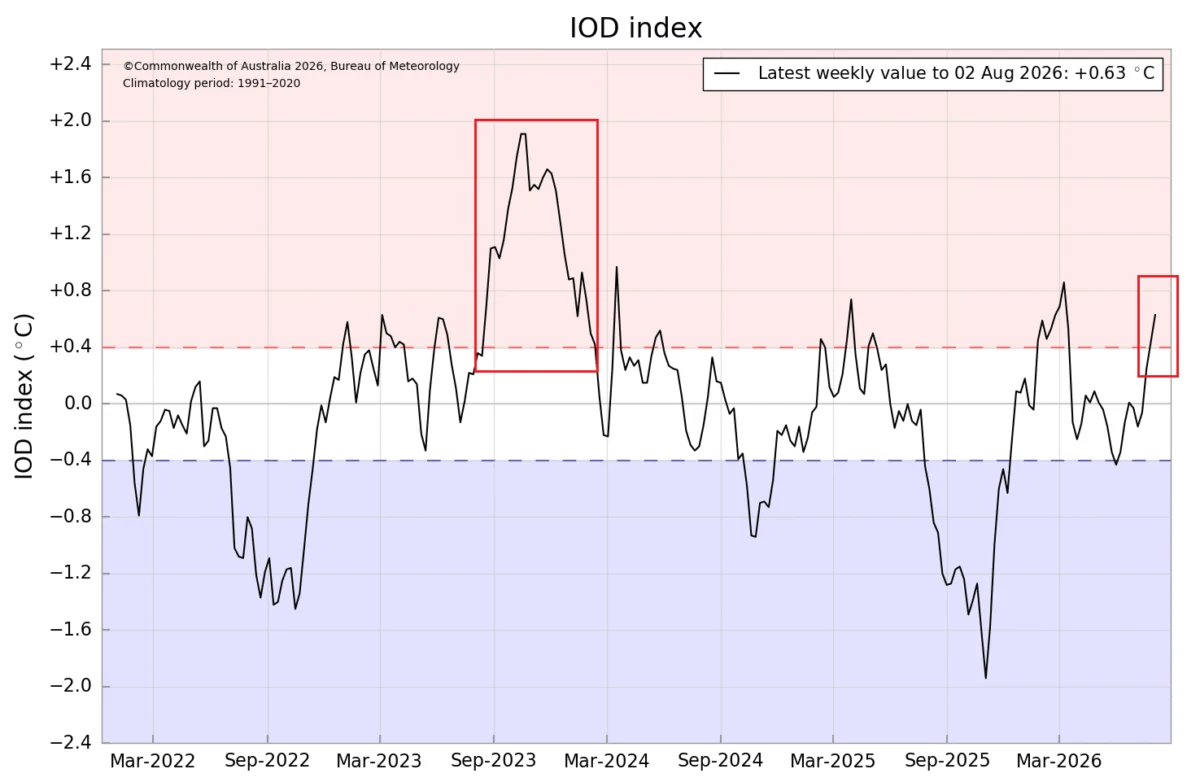
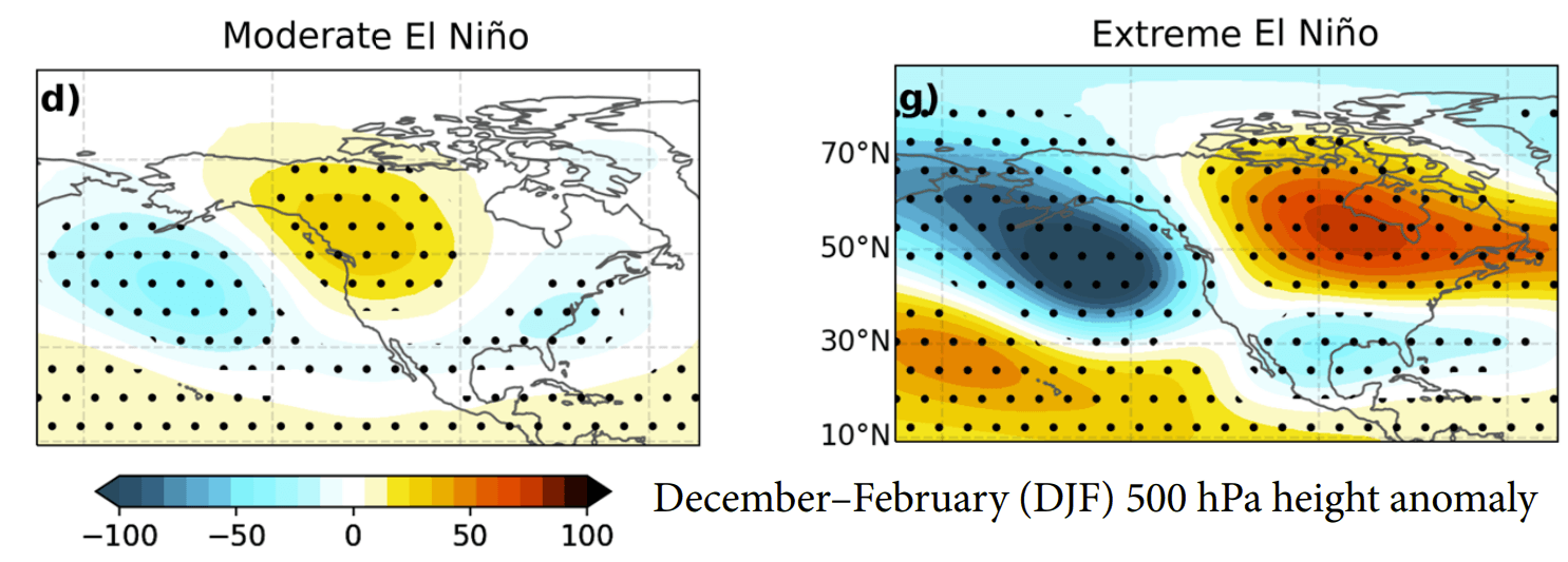
Analysis from the Global Data Assimilation System (GDAS) reveals that rising air is currently locked over the central and eastern Pacific, while sinking air remains anchored over the Indian Ocean. This fixed configuration creates a ripple effect, forcing the polar and subtropical jet streams into a highly amplified state. For North America and Europe, this means the typical "El Niño winter" pattern is not just a possibility—it is an inevitability that is already manifesting in late-summer pressure anomalies.
Implications for North America: Fall and Winter 2026/2027
The shift in the jet stream is already being felt, and the long-range seasonal forecasts for the coming months are painting a vivid picture of the challenges ahead.
The United States and Canada
The classic Super El Niño pattern for North America features a strong, persistent high-pressure ridge over Canada and the northern United States, which typically keeps those regions warmer than average. Conversely, the "atmospheric highway"—a powerful, active storm track—is being driven across the southern United States.
- Precipitation and Storm Tracks: The southern tier of the U.S., from the Gulf Coast to the Mid-Atlantic, should prepare for an active, moisture-laden winter. The jet stream will likely act as a funnel for Pacific storms, increasing the risk of heavy rainfall and, when coupled with periodic surges of cold air from the north, significant winter storm events.
- Temperature Extremes: While the north may see mild conditions, the collision of southern moisture and northern cold air in the mid-latitudes could lead to volatile, high-impact weather. The February 2027 outlook from the CFSv2 model even suggests the possibility of a "cold-core" shift, where deep pressure waves could bring anomalous cold into the central and eastern U.S., creating prime conditions for heavy snowfall.
The European Outlook
Downstream from the North American pattern, Europe faces a different set of impacts. The amplified pressure wave over the Atlantic is expected to force a strong westerly flow into the continent. For much of Europe, this translates to a milder, wetter winter. The Atlantic low-pressure systems will likely dominate, bringing warmer maritime air masses that limit snow potential in the central and southern regions. However, the north and northeast, along with high-altitude regions, may still experience significant winter precipitation as individual systems move inland.
Official Responses and Meteorological Vigilance
While agencies like NOAA and the ECMWF do not issue "disaster warnings" for seasonal phenomena, the diagnostic data they provide is being treated with the highest level of gravity by national emergency management agencies. The "Super" designation is not merely a statistical label; it represents an increased probability of extreme weather events, including flash flooding in the American Southeast and potential supply chain disruptions due to intense winter storms.
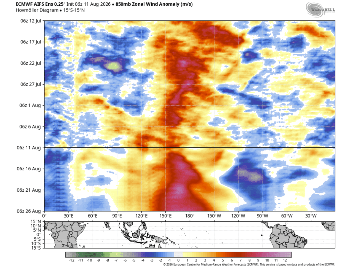
Meteorologists emphasize that while these long-range models are the best tools available, they are "probabilistic" in nature. The unpredictability of day-to-day westerly wind bursts means that the exact intensity of the winter impact can change. However, the "forcing" provided by the ocean is already locked in, meaning the stage for an extraordinary season is set.
Conclusion: Entering Uncharted Territory
As we move into the final months of 2026, the scientific community is keeping a close watch on the evolution of this event. We are effectively entering "uncharted territory" where the magnitude of the Pacific warming is pushing the limits of historical comparisons.
For the public, this means that the coming winter will likely defy standard seasonal expectations. Whether it is the potential for heavy snow in the U.S. interior or the unusually mild, wet winters expected in Europe, the 2026/2027 Super El Niño is serving as a stark reminder of the Pacific Ocean’s immense power to dictate the rhythm of life on land. As the atmospheric and oceanic systems continue to couple, the coming months will prove critical in determining the full extent of this historic climate event. Stay tuned to official weather updates, as the situation remains fluid and highly dynamic.